National Weather Service United States Department of Commerce

As we go through next week, temperatures are expected to be on the rise, well above normal. Widespread high temperatures above freezing are possible by the end of the week. Some areas could see low temperatures stay above freezing as well into next weekend. There is also a 40 to 50% chance of above normal precipitation - this could mean systems with mixed precipitation thanks to warm temperatures.
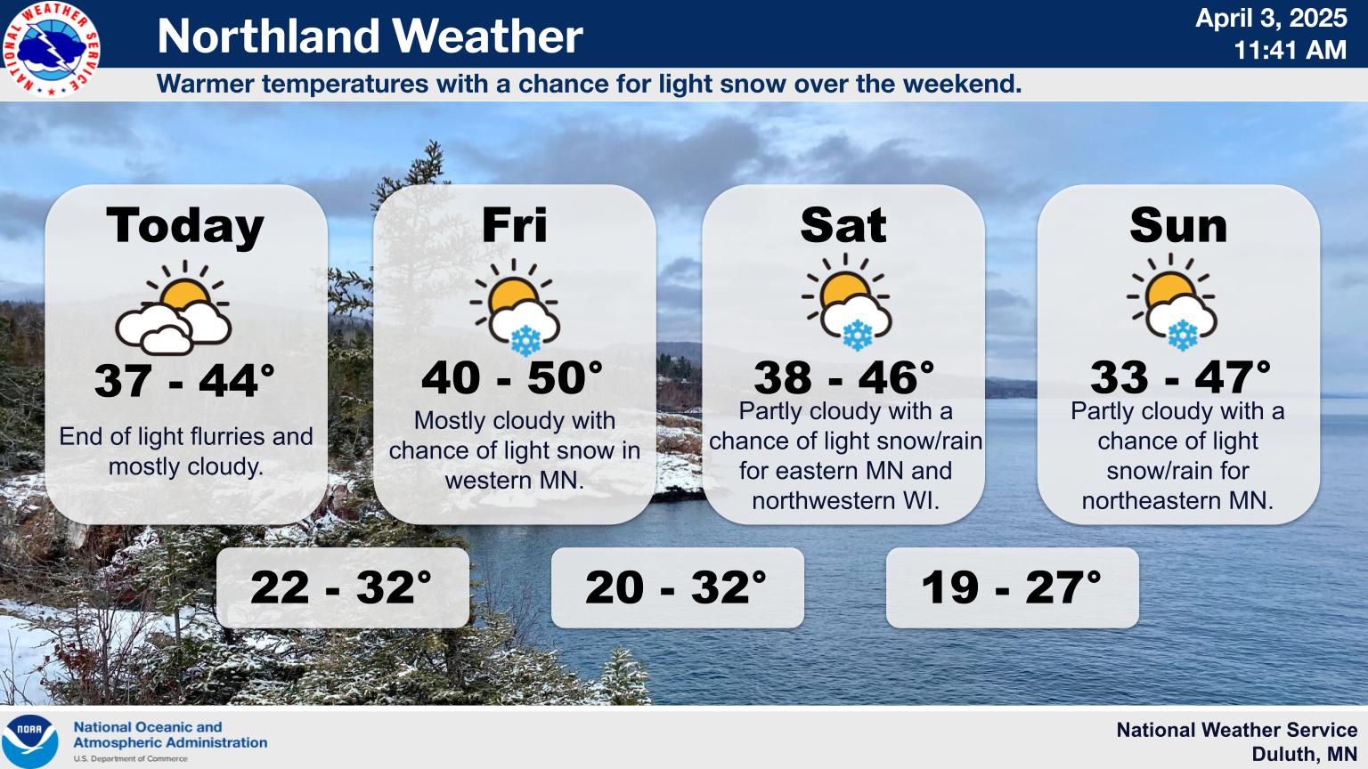
Today will see increasing cloud cover with scattered light snow showers, mainly in north-central Minnesota and near the North Shore. Accumulations today will be under an inch. Light snow continues tomorrow near the North Shore. A clipper system will bring a chance for light snow on Sunday night into Monday, with snow amounts being under 2 inches. Temperatures will be gradually increasing next week, reaching the upper 20s to mid 30s on Tuesday.
We want to take a moment to recognize that yesterday’s snowfall forecast was quite a bit less than our forecast going into the storm. This was due to a shift south in the low pressure track at the last minute, which placed heavy snowfall bands into southern Minnesota and brought in much more dry air across the Northland, eating away at a lot of potential morning accumulations. There was a fair amount of spread in model snowfall guidance up until the event, but our team of meteorologists had decided to lean into higher snowfall solutions, as we recognized the potential for heavy snow bands to lead to quick accumulations - something that did happen, only just south of the Twin Cities metro. We make sure to learn from every event at NWS Duluth, regardless of forecast accuracy, but we will definitely be collecting a lot of data on this one in order to do a thorough post-event review. The only constant in our line of work is change and trying our best to adapt. In recent years NWS Duluth winter storm warnings have had around 80% accuracy, but occasionally we miss the mark and we are committed to understanding why and doing better in the future.
Here is a look at the new snowfall analysis from Thursday's system. A good swath of the area saw 1 to 4 inches, with lesser amounts towards the International Border. You can see a map of 24 hour reports at https://www.weather.gov/source/crh/snowmap.html?sid=dlh