Duluth, MN
Weather Forecast Office
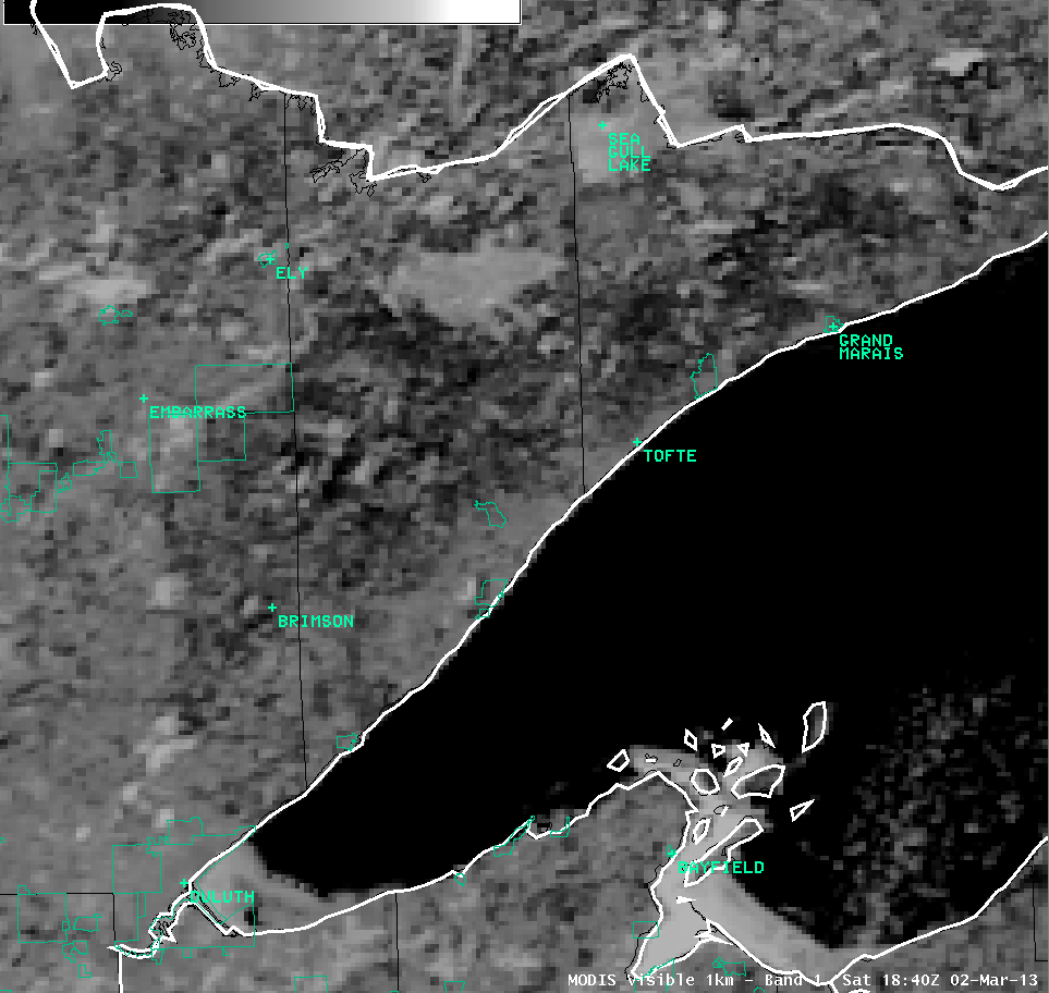
On Saturday's visible satellite loop the Pagami Creek Wildfire burn scar was easily recognizable within the snow field. In visibile satellite the earth is "seen" by the satellite, like a camera.
Most times a snow field is depicted as white on visible satellite. You can discern the difference between a snow field and clouds because snow fields are stationary and clouds move when the satellite pictures are animated. However, you may have noticed that on visible satellite the dense snow pack over northeastern Minnesota and northwestern is usally not seen on visible satellite, although it is there. That is because the vast forests of the northland "hides" or shields the snow pack and the satellite cannot see it.
But, the large Pagami Creek Fire destroyed 93,000 acres of forest in the Boundary Waters Canoe Area Wilderness of northeastern Minnesota in late summer and fall of 2011. Without those trees, the snow pack was easly seen on visible satellite photos today.
The animated satellite picture below shows the snow pack in the burn area. The yellow outline depicts the burn area.
Forecasts
Fire Weather
Great Lakes
Local Text Products
Winter Weather
Local Area Forecasts
Aviation
Marine
Rainy River Basin Page
Current Conditions
Current Observations
Public Information Statements
National Snowfall Map
NOHRSC Snow Analysis
Rain/Snow Reports
Winter Monitor
US Dept of Commerce
National Oceanic and Atmospheric Administration
National Weather Service
Duluth, MN
5027 Miller Trunk Highway
Duluth, MN 55811-1442
218-729-6697 - Duluth; 218-283-4615 - Intl Falls
Comments? Questions? Please Contact Us.

