
| Table of Contents |
| 1. Top Daily Snowfalls 2. Seasonal and Monthly Snow 3. Snowfall Averages 4. Earliest and Latest Snow 5. Consecutive Days With Snow 6. Frost and Freeze Info 7. Extreme Cold Temps 8. Miscellaneous Stats |
This web page is a collection of winter climate statistics and records. Simply scroll down the page to get started, or use the table of contents on the right to navigate.
** Please note this page is not always up to date. For any official inquiries please email nws.duluth@noaa.gov **
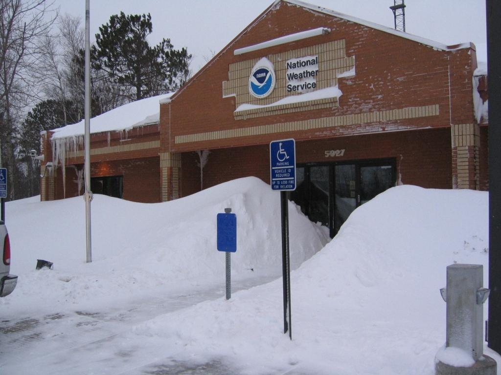
The National Weather Service office in Duluth, MN after a snowstorm in 2007.
| Rank | Duluth, Minnesota | International Falls, Minnesota | Brainerd, Minnesota |
| 1. |
24.1" November 1, 1991 |
14.1" January 10, 1975 |
24.0" March 5, 1985 |
| 2. |
23.2" December 6, 1950 |
13.9" April 25, 1950 |
15.0" April 12, 2008 |
| 3. |
18.2" January 26, 2004 |
13.7" December 14, 2008 |
12.0" February 12, 2013 |
| 4. |
18.0" March 13, 1917 |
13.1" March 10, 2009 |
12.0" January 5, 1997 |
| 5. |
17.2" March 17, 1965 |
13.0" March 4, 1966 |
12.0" January 18, 1996 |
Seasonal and Monthly Snow Records
(Snow Season defined as the sum of snow totals from July 1st to June 30th)
| Maximum Snow Season Snowfall | |||
| Rank | Duluth, Minnesota | International Falls, Minnesota | Brainerd, Minnesota |
| 1. |
135.4" 1995-1996 |
125.6" 2008-2009 |
80.6" 1996-1997 |
| 2. |
131.8" 1949-1950 |
116.0" 1995-1996 |
79.4" 1988-1989 |
| 3. |
131.0" 2013-2014 |
111.0" 1991-1992 |
75.3" 1968-1969 |
| 4. |
129.4" 2012-2013 |
104.7" 1988-1989 |
73.5" 2017-2018 |
| 5. |
128.2" 1996-1997 |
101.2" 2013-2014 |
71.3" 1970-1971 |
| Minimum Snow Season Snowfall | |||
| Rank | Duluth, Minnesota | International Falls, Minnesota | Brainerd, Minnesota |
| 1. |
36.5" 1980-1981 |
27.1" 1999-2000 |
12.6" 1975-1976 |
| 2. |
39.3" 1967-1968 |
28.7" 1962-1963 |
15.5" 1972-1973 |
| 3. |
40.6" 1976-1977 |
30.4" 1972-1973 |
15.8" 1986-1987 |
| 4. |
40.6" 1986-1987 |
32.8" 1957-1958 |
18.0" 1958-1959 |
| 5. |
44.5" 1958-1959 |
39.3" 2006-2007 |
22.1" 1957-1958 |
| Location | Highest Total Snowfall For the Month of... | |||||||||
| Sep | Oct | Nov | Dec | Jan | Feb | Mar | Apr | May | Jun | |
| Duluth, Minnesota |
2.4" (1991) |
14.0" (1933) |
50.1" (1991) |
44.3" (1950) |
46.8" (1969) |
36.4" (2019) |
48.2" (1917) |
50.8" (2013) |
8.1" (1954) |
- |
| International Falls, Minnesota |
2.0" (1912) |
10.5" (1917) |
29.7" (1965) |
43.9" (1992) |
43.0" (1975) |
32.3" (1992) |
31.5" (1951) |
23.5" (2008) |
13.4" (1954) |
0.3" (1969) |
| Brainerd, Minnesota | - |
3.5" (1992) |
28.5" (1983) |
29.1" (1968) |
33.0" (1950) |
25.4" (2001) |
35.5" (1965) |
22.8" (2008) |
1.0" (2017) |
- |
| Dates of... | Duluth, Minnesota | International Falls, Minnesota | Brainerd, Minnesota |
| Earliest Measureable Snow: | Sept. 18, 1991 | Sept. 14, 1964 | Oct. 10, 2018 |
| Latest Measureable Snow | May 28, 1965 | Jun. 2, 1969 | Apr. 30, 2017 |
| Average first Measureable Snow: | Oct. 24th | Oct. 20th | Nov. 10th |
| Average Last Measureable: | Apr. 26th | Apr. 25th | Mar. 31st |
| Average first 1 inch of Snow: | Nov. 4th | Nov. 1st | Nov. 14th |
| Average Last 1 inch: | Apr. 11th | Apr. 10th | Mar. 27th |
Consecutive Days With Measurable Snowfall
| Rank | Duluth, Minnesota | International Falls, Minnesota | Brainerd, Minnesota |
| 1 |
10 Days, 12/25/2016-01/03-2017 |
11 Days, 12/14-12/24 1974 |
5 Days, 12/03-12/07 2016 |
| 2 |
10 Days, 12/12-12/21 2008 |
10 Days, 11/29-12/08 2008 |
5 Days, 01/10-01/14 2011 |
| 3 |
10 Days, 02/25-03/06 1998 |
10 Days, 11/13-11/22 1955 |
5 Days, 01/22-01/26 2004 |
| 4 |
10 Days, 02/27-03/07 1976 |
10 Days, 12/05-12/14 1950 |
5 Days, 01/09-01/13 |
| 5 |
9 Days, four dates have tied |
9 Days, four dates have tied |
5 Days, 12/03-12/08 1950 |
Frost and Freeze Information (CAUTION under construction)
Frost (the formation of light ice crystals on the ground) occurs under light wind conditions with radiational cooling - that is, heat radiating away from the Earth's surface. Frost will form when temperatures at ground level fall to around 32 degrees. Because of different radiative properties, frost will often occur when the surface air temperature is still in the mid-30s. A freeze occurs when the air temperature measured at an observing site falls below 32 degrees. These temperature readings are taken at 2 meters above ground level, or about 6 feet.
Why does the fall frost occur much later at the Duluth harbor, as opposed to on top of the hill by the airport? Basically, Lake Superior heats up during the summer months and water has a high heat content. Therefore, it takes awhile to heat up, or cool down a large body of water. When it gets really cold in inland areas in the fall, the areas right along the water will stay warmer because Lake Superior hasn't cooled down yet.
Extreme Cold Temperatures (CAUTION under construction)
| Coldest Low Temperatures | |
| Duluth, Minnesota | International Falls, MN |
| 1. -41F, January 2, 1885 T2. -39F, February 2, 1996 T2. -39F, January 15, 1972 T4. -38F, four dates tied, January 17, 1982 most recent |
1. -55F, January 6, 1909 2. -54F, January 7, 1909 3. -50F, January 11, 1909 4. -48F, February 8, 1909 T5. -46F, January 21, 2011 and January 6, 1968 |
| Coldest High Temperatures | |
| Duluth, Minnesota | International Falls, MN |
| 1. -22F, January 9, 1982 T2. -21F, February 2, 1996 T2. -21F, January 18, 1994 T2. -21F, January 14, 1972 T5. -20F, four dates tied, January 19, 1985 most recent |
1. -29F, January 6,1909 T2. -28F, January 19, 1985 T2. -28F, January 14, 1972 4. -26F, January 27, 1966 T5. -25F, February 1, 1996 and January 16, 1982 |
| Consecutive Days Highs Below Zero | |
| Duluth, Minnesota | International Falls, MN |
| 1. 7 days, ended on January 19, 1994 2. 6 days, ended on January 23, 1963 T3. 5 days, 6 different streaks tied for 3rd place. |
1. 18 days, ended on December 31, 1924 2. 13 days, ended on January 15, 1912 3. 10 days, ended on December 17, 1919 T4. 9 days, ended on January 7, 1968 T4. 9 days, ended on January 26, 1963 |
| Consecutive Days Lows Below Zero | |
| Duluth, Minnesota | International Falls, MN |
|
1. 23 days ended on February 11, 2014 T2. 22 days, ended on January 31, 1963 |
1. 35 days, ended on January 22, 1977 2. 34 days, ended on February 4, 1950 3. 31 days, ended on February 13, 1959 T4. 30 days, ended on January 26, 1982 T4. 30 days, ended on January 28, 1924 |
Miscellaneous Climate Facts (CAUTION under construction)

