Duluth, MN
Weather Forecast Office
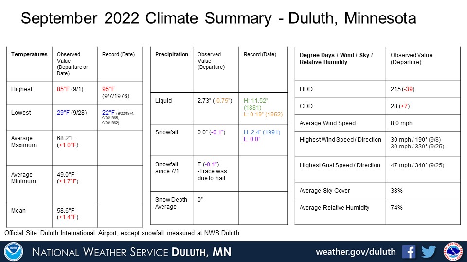
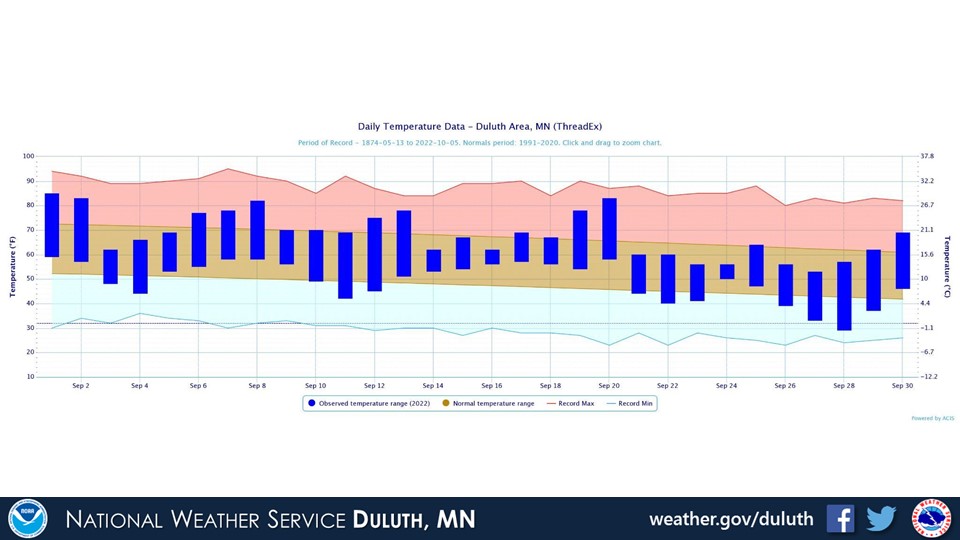
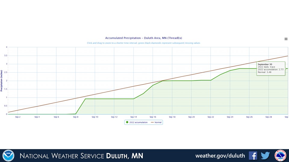
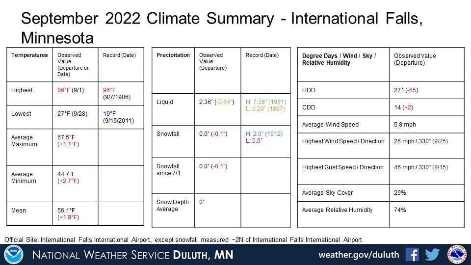
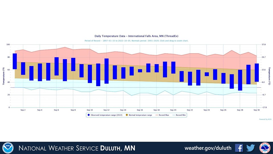
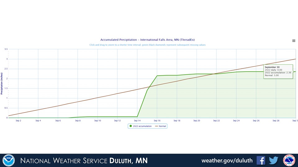
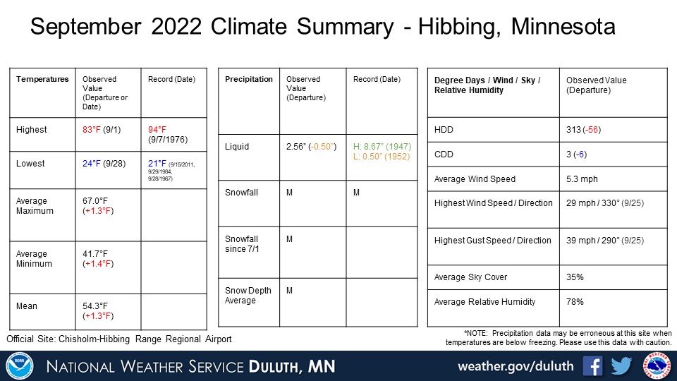
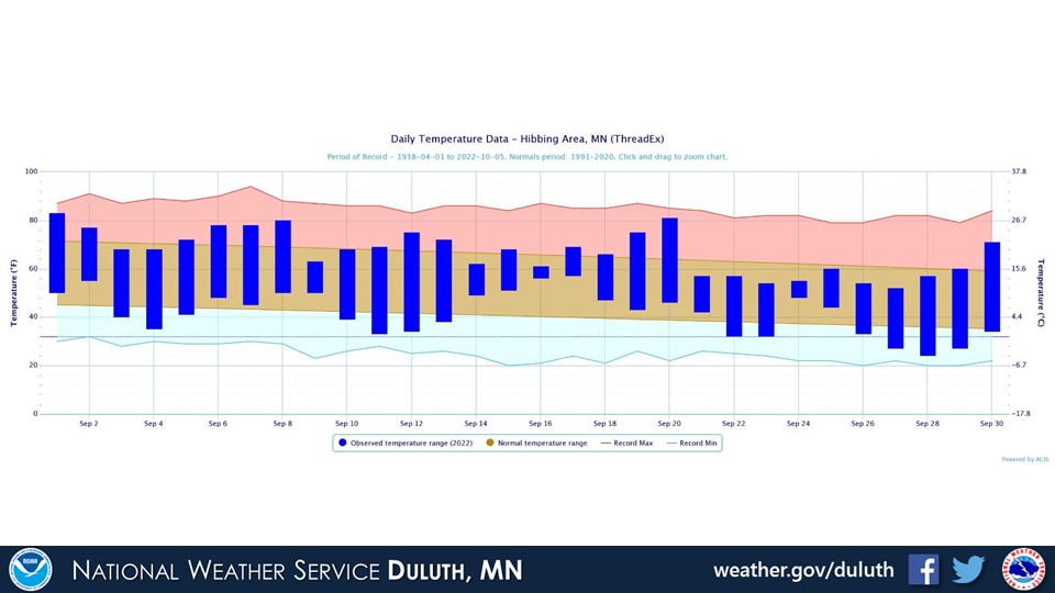
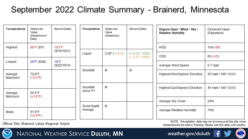
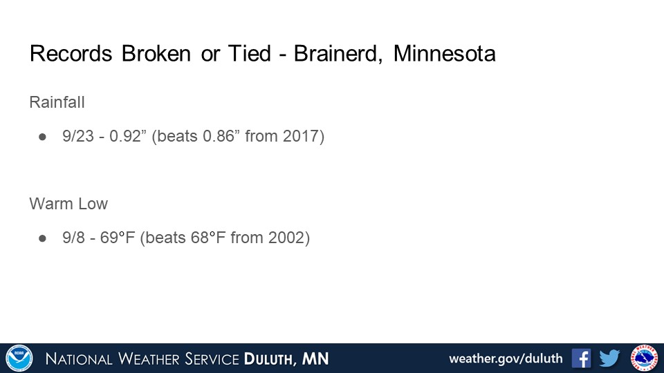
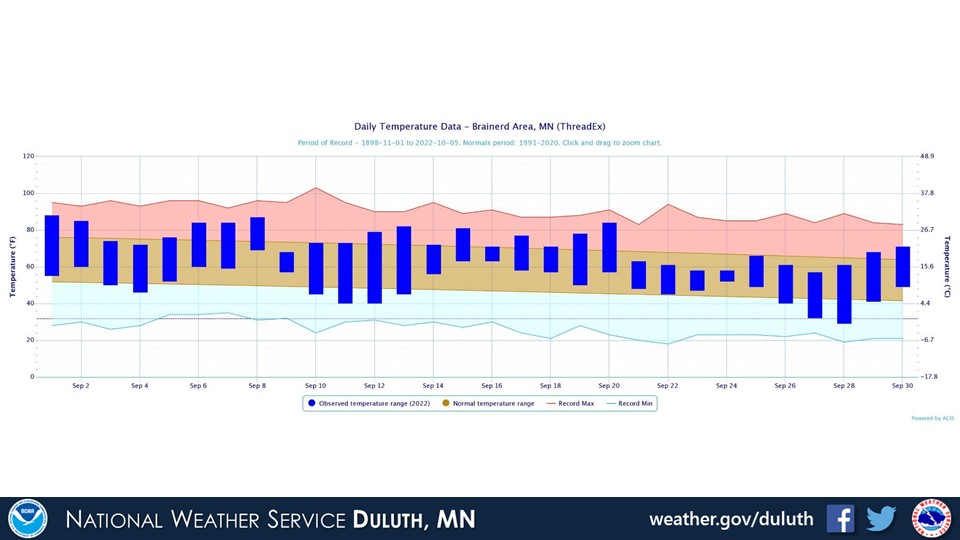
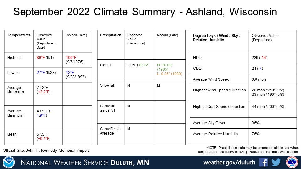
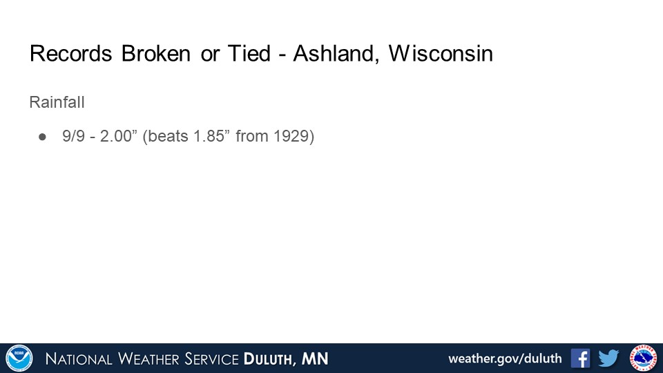
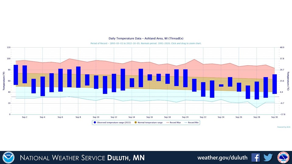
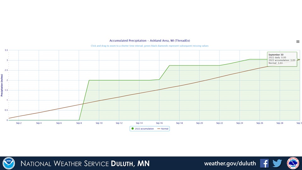
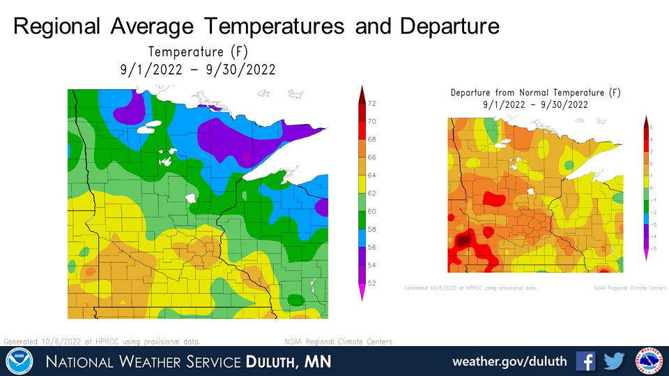
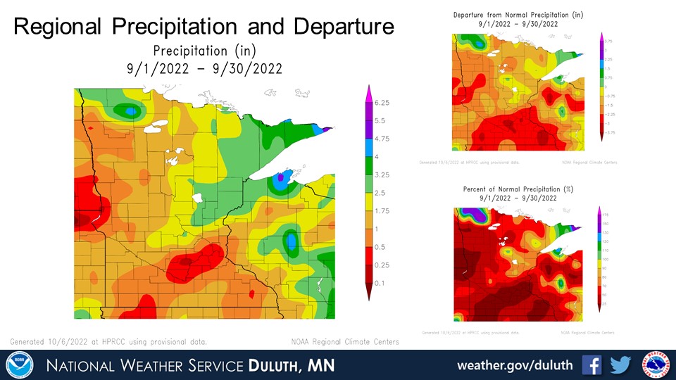
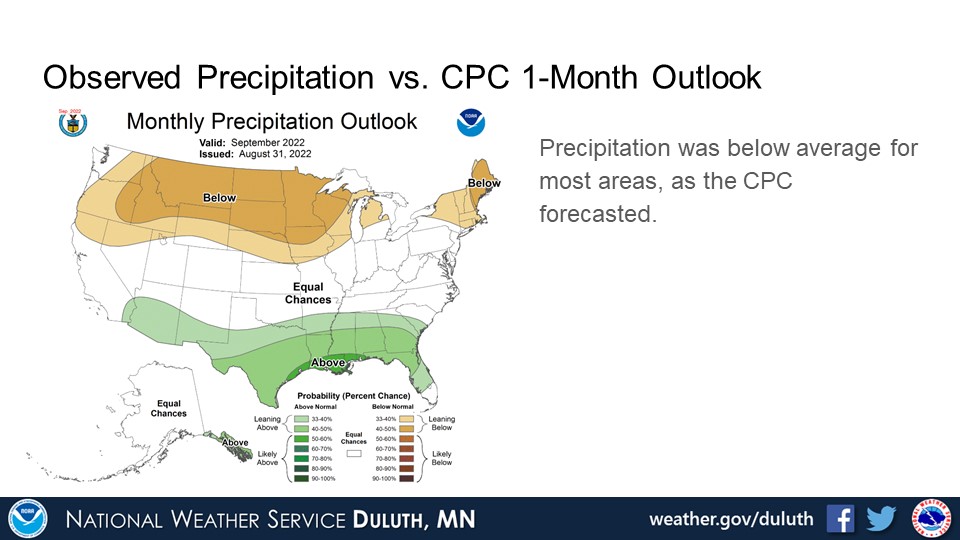
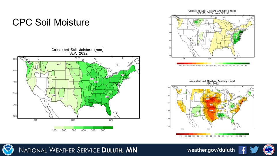
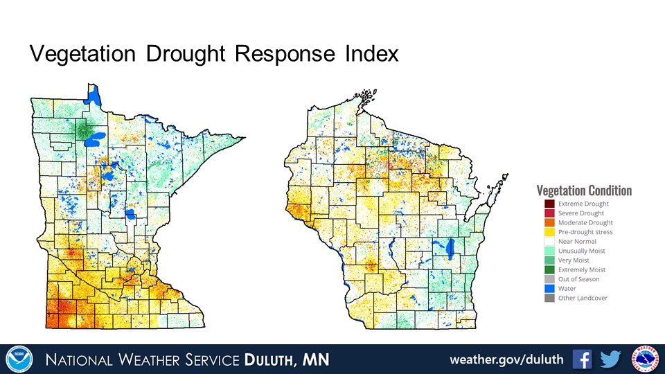
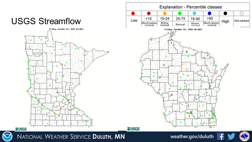
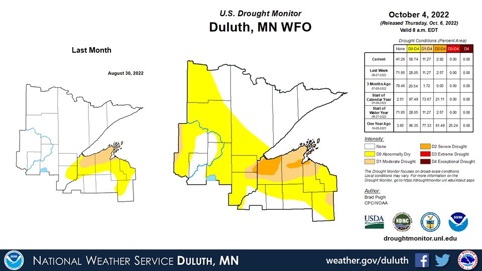
September featured pretty widespread warmer than average temperatures and below average rainfall. Few records were broken this month, though a record high low temperature was set at Brainerd and a couple daily rainfall records were set. The warm and dry conditions have resulted in expanded drought conditions, with pockets of moderate to extreme drought across portions of northwest Wisconsin along the South Shore, inching into Carlton and Pine counties. Abnormally dry conditions have spread into parts of northeast Minnesota as well. Many rivers and streams are running below normal across northwest Wisconsin.
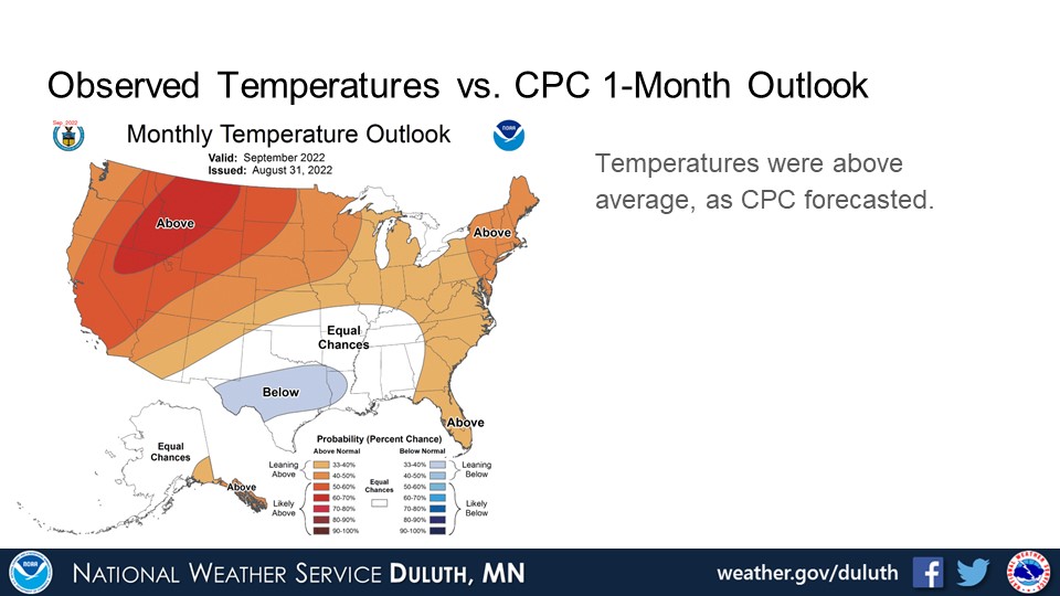
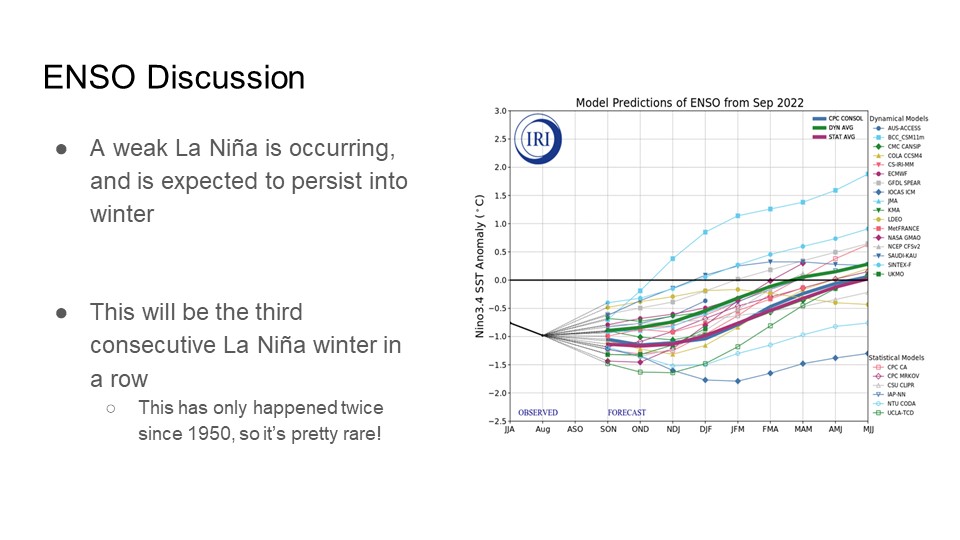
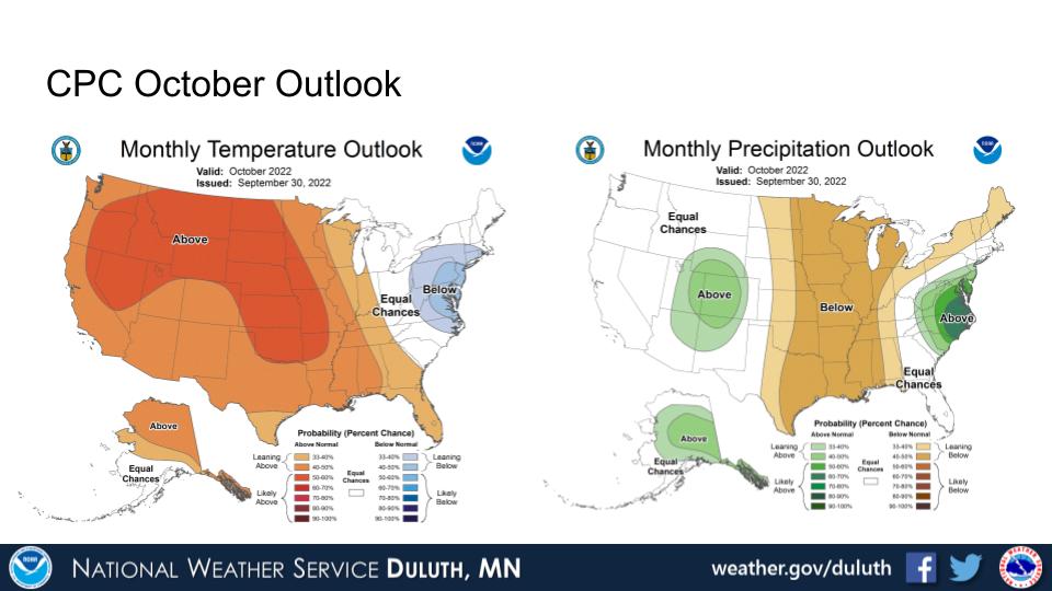
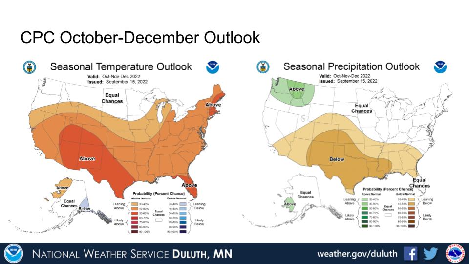
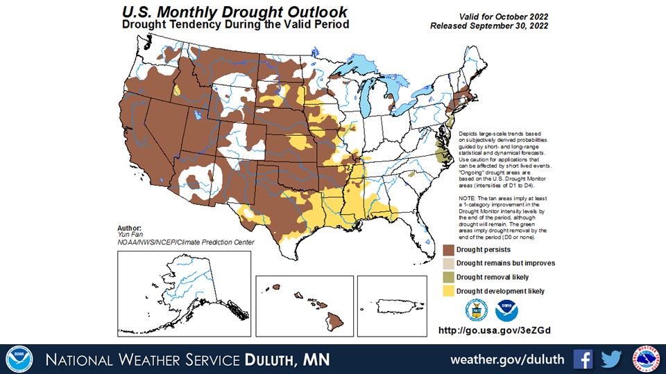
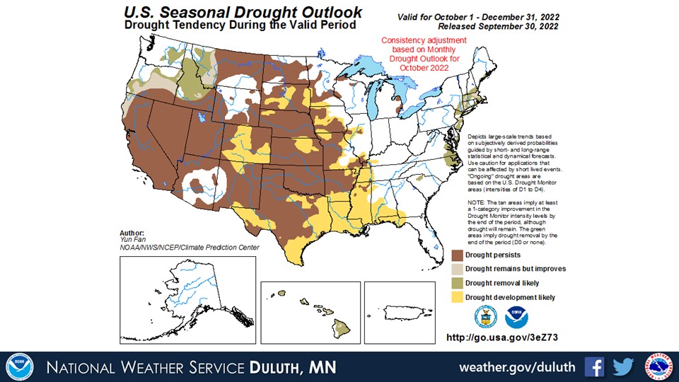
Above normal temperatures and below normal precipitation are likely to persist across the region through October, as is forecasted by the Climate Prediction Center. Chances are equal for above or below normal temperatures and precipitation through December. Areas that are currently experiencing drought will likely see conditions persist for the foreseeable future.
Duluth
International Falls
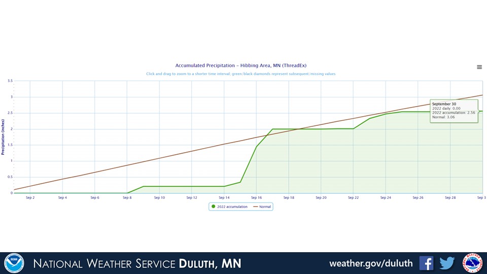
Hibbing
Brainerd
Ashland
Summary
Hydro
Outlook
 |
Media use of NWS Web News Stories is encouraged! Please acknowledge the NWS as the source of any news information accessed from this site. |
|
Forecasts
Fire Weather
Great Lakes
Local Text Products
Winter Weather
Local Area Forecasts
Aviation
Marine
Rainy River Basin Page
Current Conditions
Current Observations
Public Information Statements
National Snowfall Map
NOHRSC Snow Analysis
Rain/Snow Reports
Winter Monitor
US Dept of Commerce
National Oceanic and Atmospheric Administration
National Weather Service
Duluth, MN
5027 Miller Trunk Highway
Duluth, MN 55811-1442
218-729-6697 - Duluth; 218-283-4615 - Intl Falls
Comments? Questions? Please Contact Us.

