Duluth, MN
Weather Forecast Office
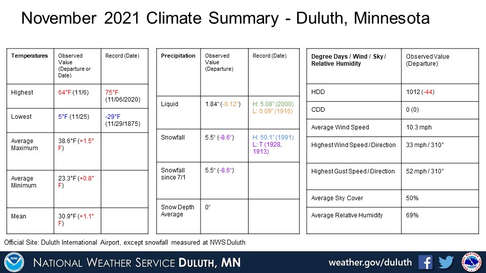
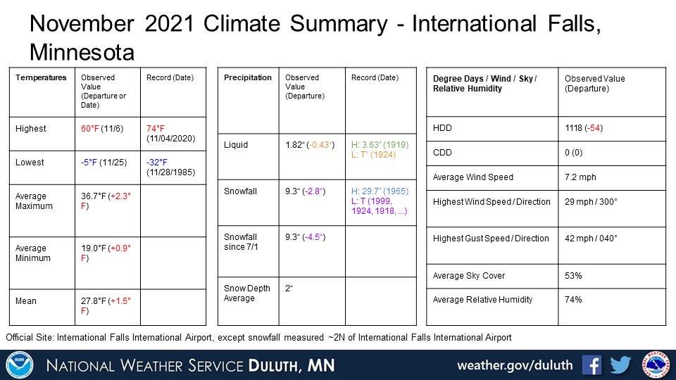
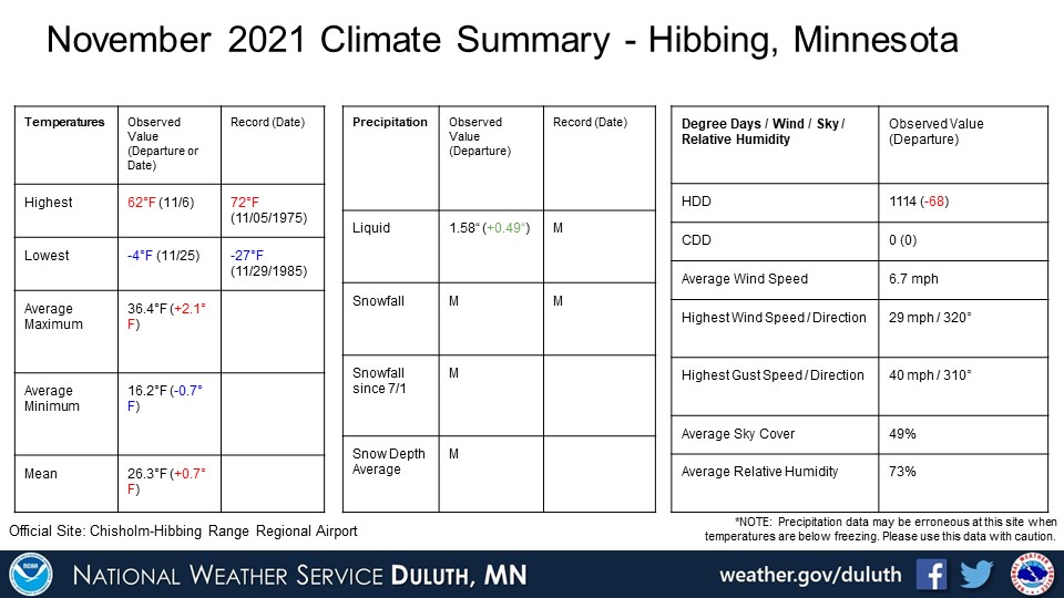
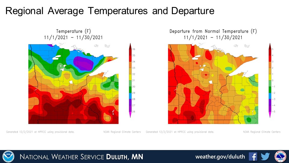
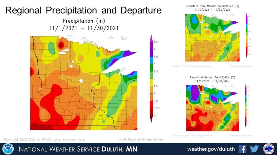
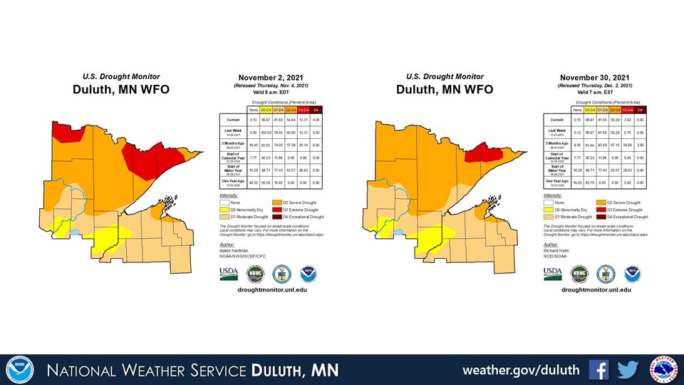
November 2021 was a bit warmer than average, and many places recorded around or even above normal precipitation, which is a notable change from previous months. This is due in large part to the storm that brought heavy snow and rain November 11 and 12 across northern Minnesota, with several reports of rain in excess of 3” along the North Shore. This has led to some improvement in drought conditions, but given that we are now in the cold season and overall precipitation amounts are less compared to summer, we still remain in severe drought for most of northeastern Minnesota, and even a patch of extreme drought for a portion of the Boundary Waters.
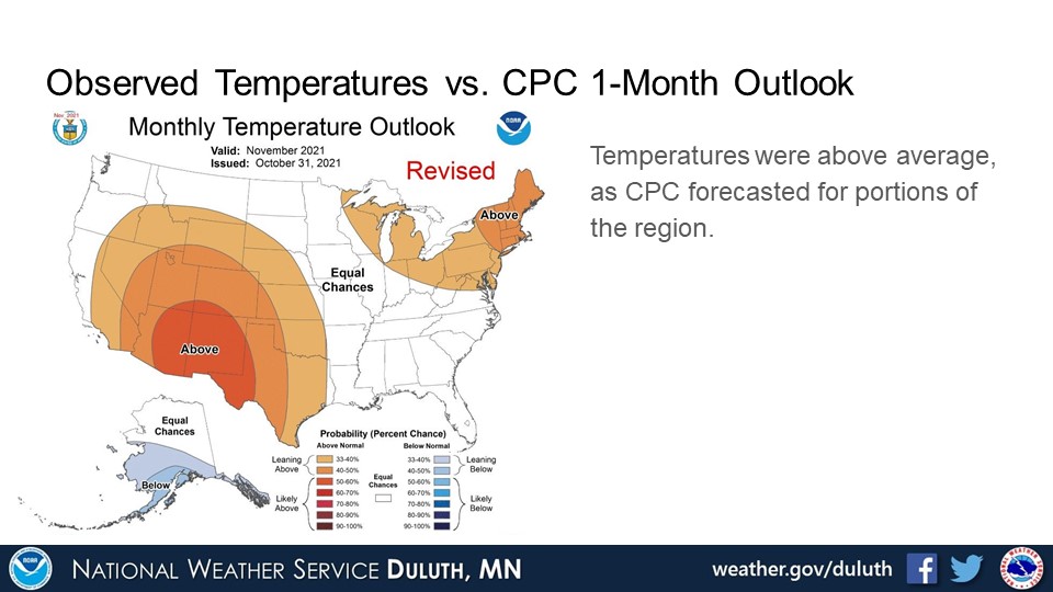
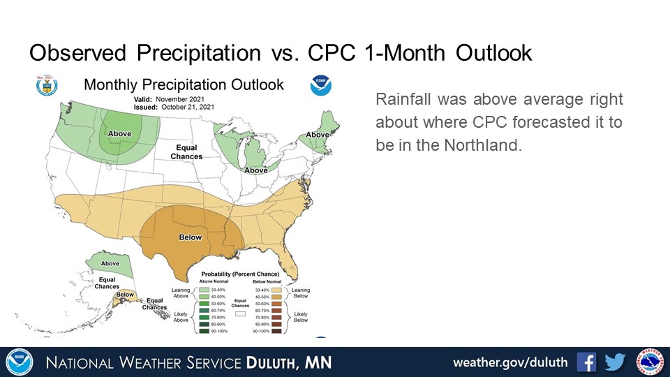
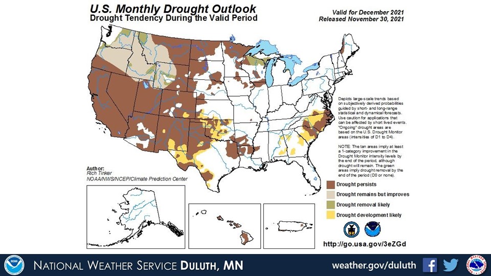
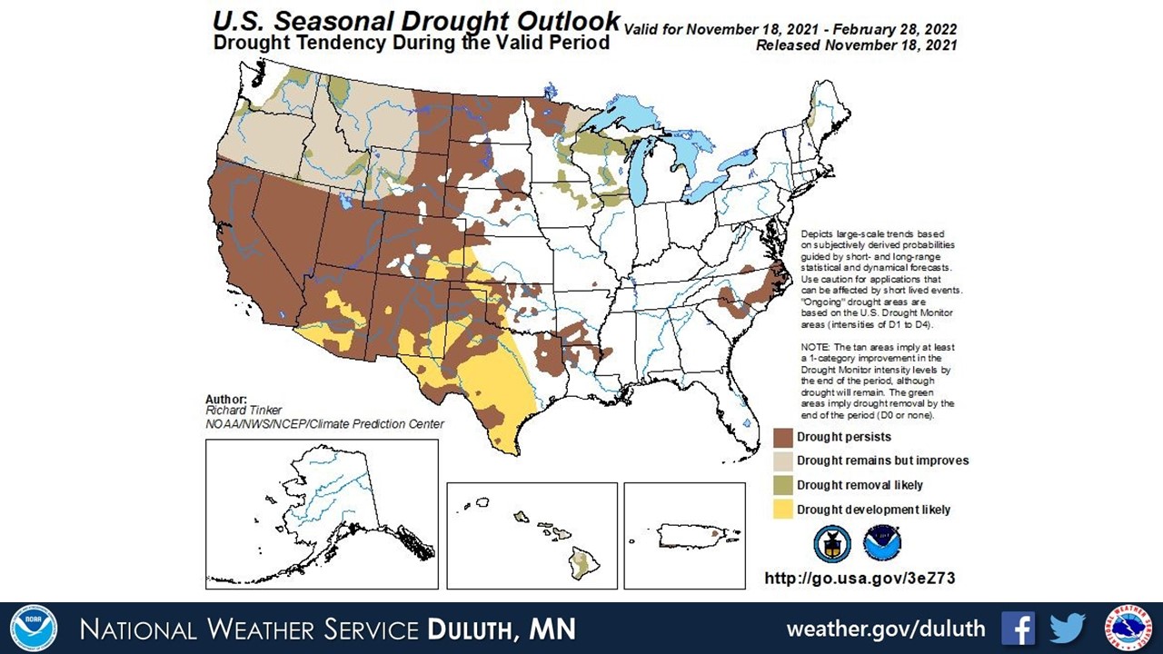
Looking ahead, the CPC predicts slightly above normal temperatures and precipitation for the region for December. Now that we are already one week into December, that prediction is holding up well with the first major snowstorm giving nearly everyone a good dumping of snow. Drought conditions are expected to persist across northeastern Minnesota, but improvement is possible in northwest Wisconsin per the CPC.
Duluth
International Falls
Hibbing
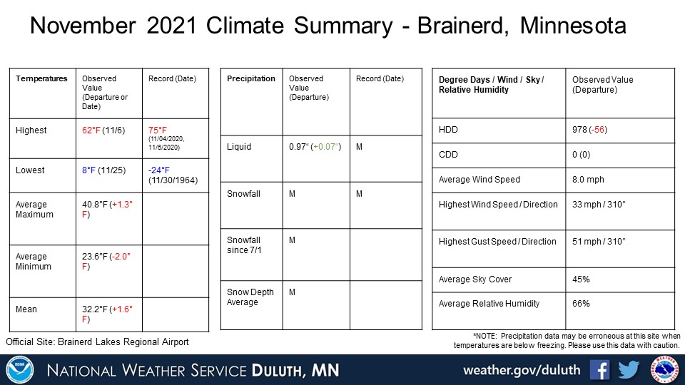
Brainerd
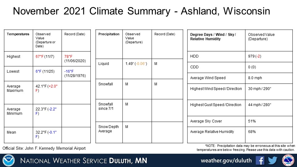
Ashland
Summary
 |
Media use of NWS Web News Stories is encouraged! Please acknowledge the NWS as the source of any news information accessed from this site. |
|
Forecasts
Fire Weather
Great Lakes
Local Text Products
Winter Weather
Local Area Forecasts
Aviation
Marine
Rainy River Basin Page
Current Conditions
Current Observations
Public Information Statements
National Snowfall Map
NOHRSC Snow Analysis
Rain/Snow Reports
Winter Monitor
US Dept of Commerce
National Oceanic and Atmospheric Administration
National Weather Service
Duluth, MN
5027 Miller Trunk Highway
Duluth, MN 55811-1442
218-729-6697 - Duluth; 218-283-4615 - Intl Falls
Comments? Questions? Please Contact Us.

