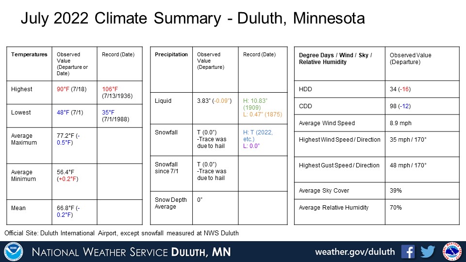
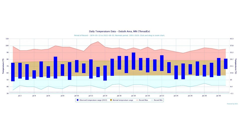
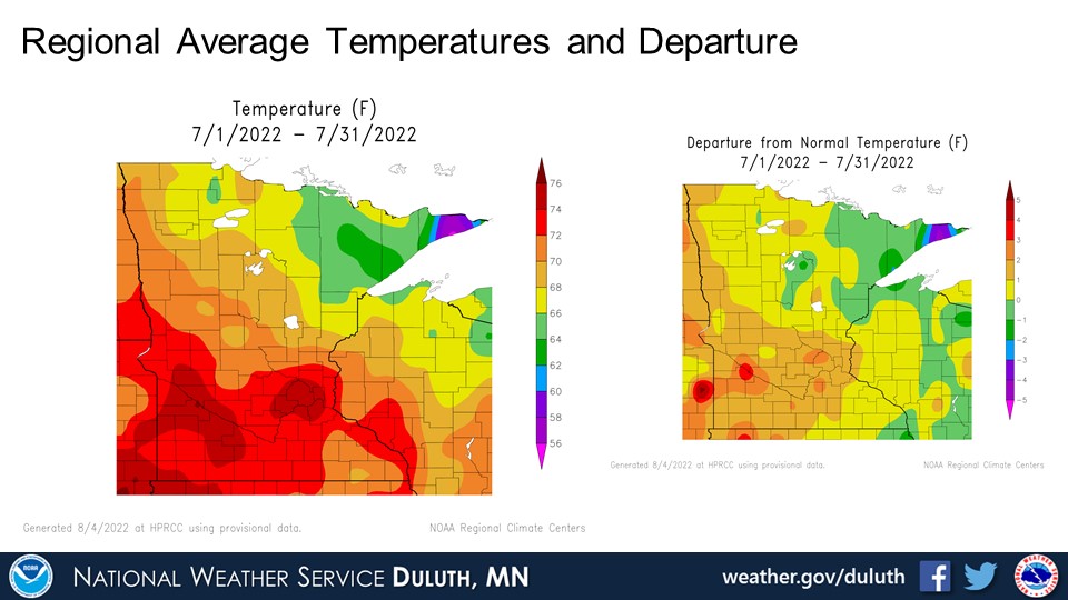
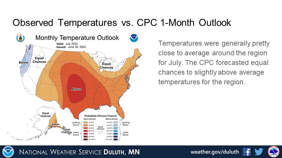
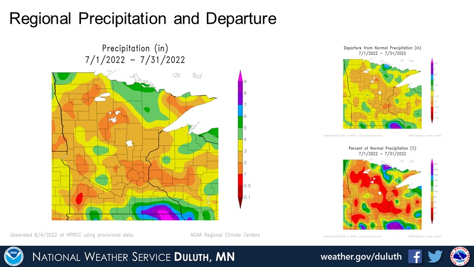
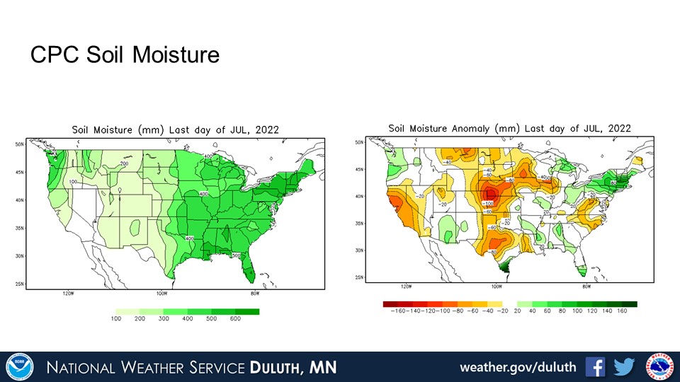
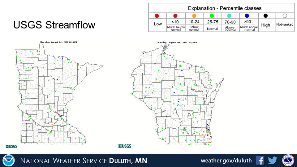
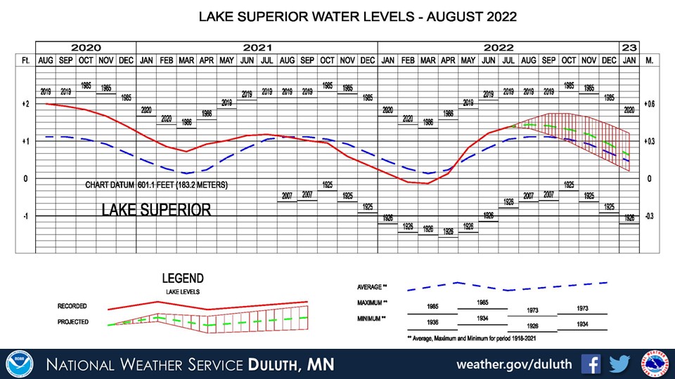
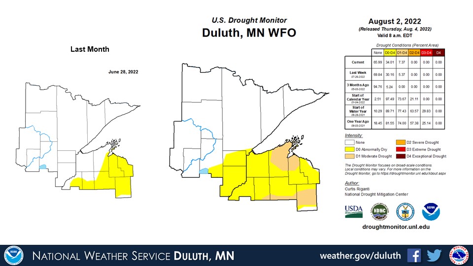
The weather was pretty variable across the region in July 2022 with no really notable heat waves or cold snaps. Average temperatures were within a degree of the 30 year normals. Rainfall varied with some sites seeing above average rainfall and other seeing below average rainfall. There have been some positive and negative effects to this in terms of the drought and hydro situations. Across northeast Minnesota, there were several areas, including International Falls and Hibbing, that received above average rainfall. This doesn’t help the Rainy River flooding situation, but that situation has been improving pretty steadily such that the higher rains just slowed it down a bit. The sliver of above normal rain is pretty small compared to those that saw below average rain, most notably east-central Minnesota into northwest Wisconsin. Abnormally dry conditions now cover all of northwest Wisconsin and bleed into east-central Minnesota with pockets of moderate drought. Recent rains over northwest Wisconsin in early August will likely put a bit of a dent in that, but not totally.
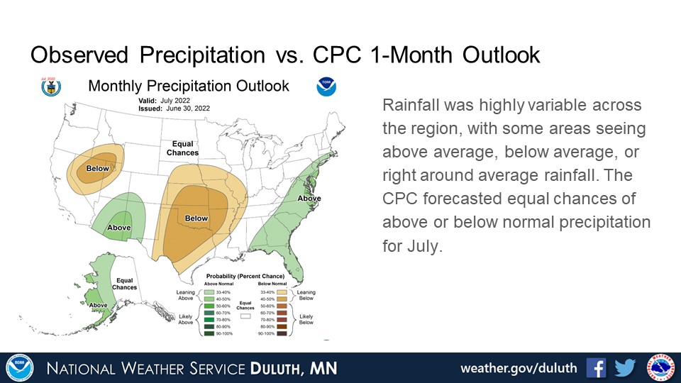
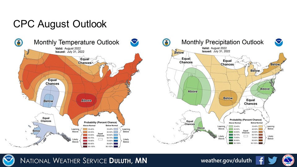
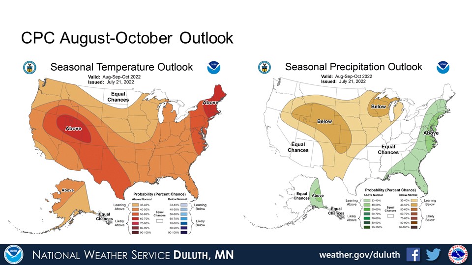
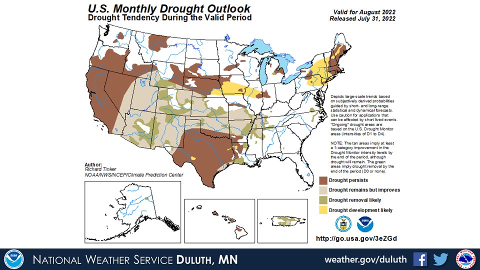
The CPC is forecasting equal chances for above or below normal precipitation and temperatures for August. The net result could very well be pockets of rainy and dry areas, which could improve or hinder drought conditions. The 3-month outlook through October favors dry and warmer temperatures. Drought may persist or worsen for some areas, mainly in northwest Wisconsin and east-central Minnesota, per the CPC’s one and three month outlooks.
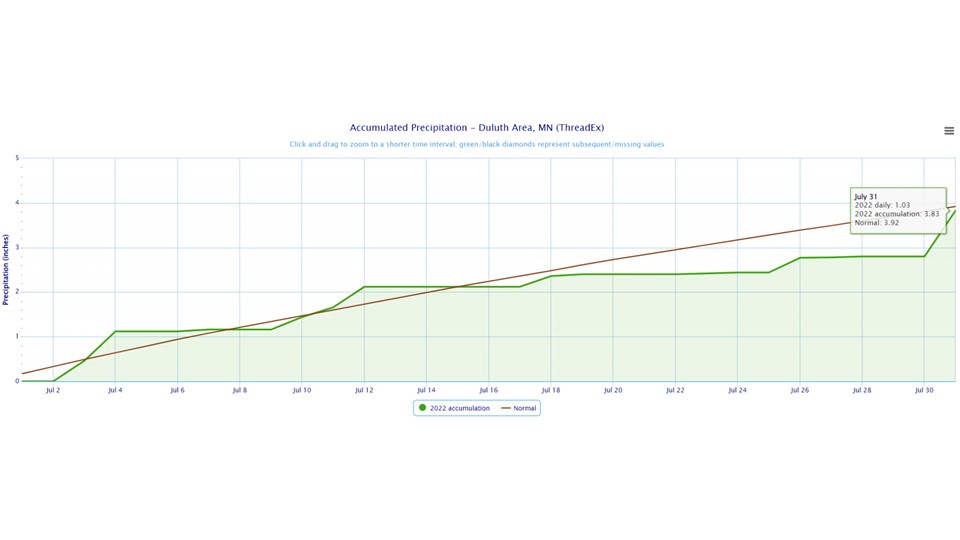
Duluth
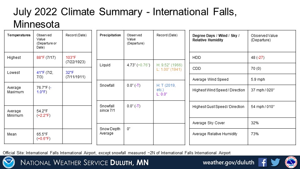
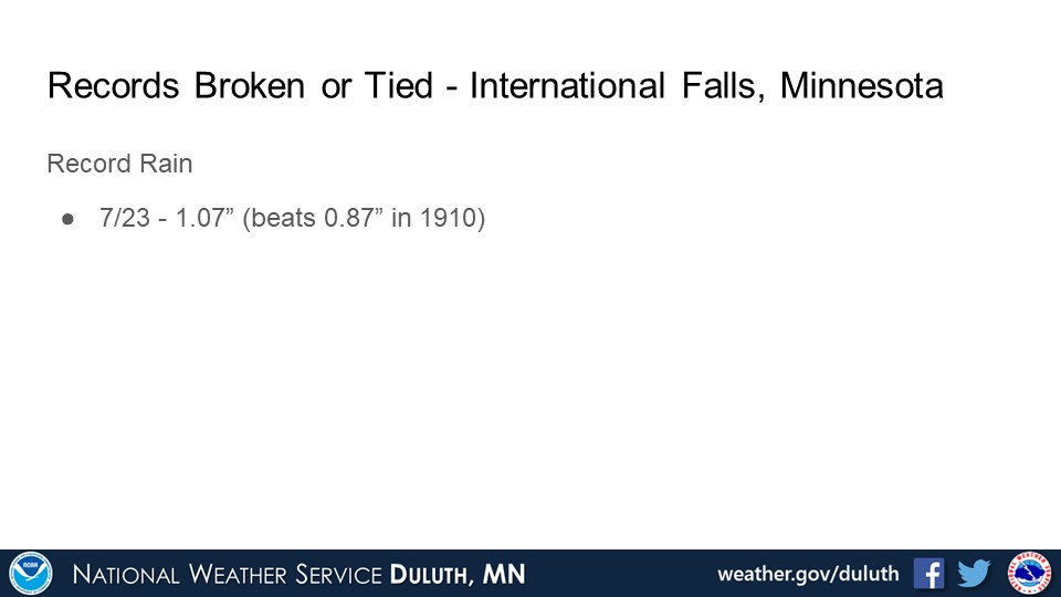
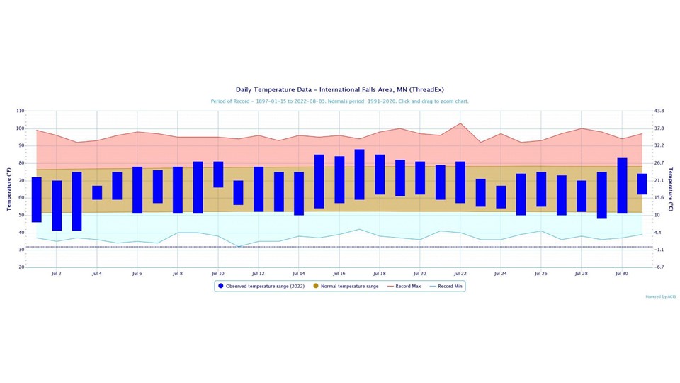
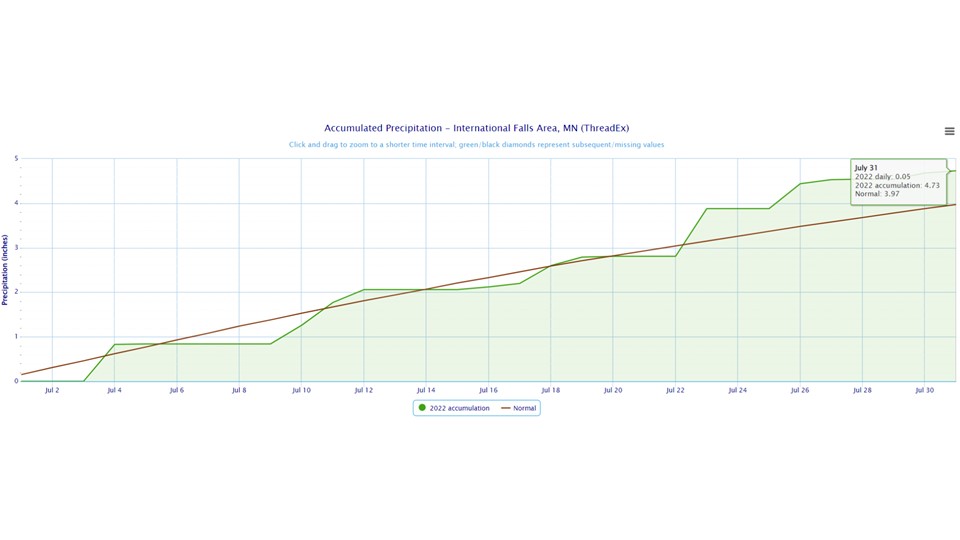
International Falls
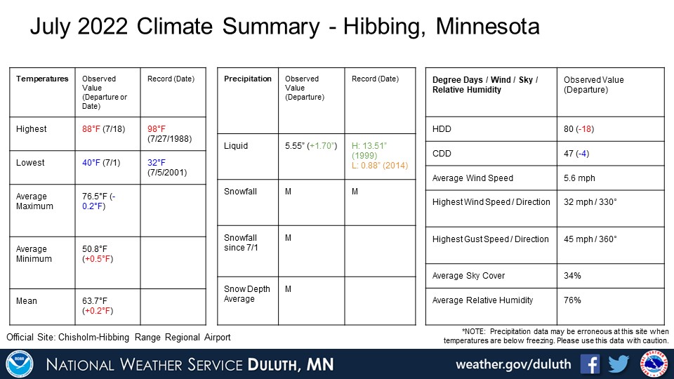
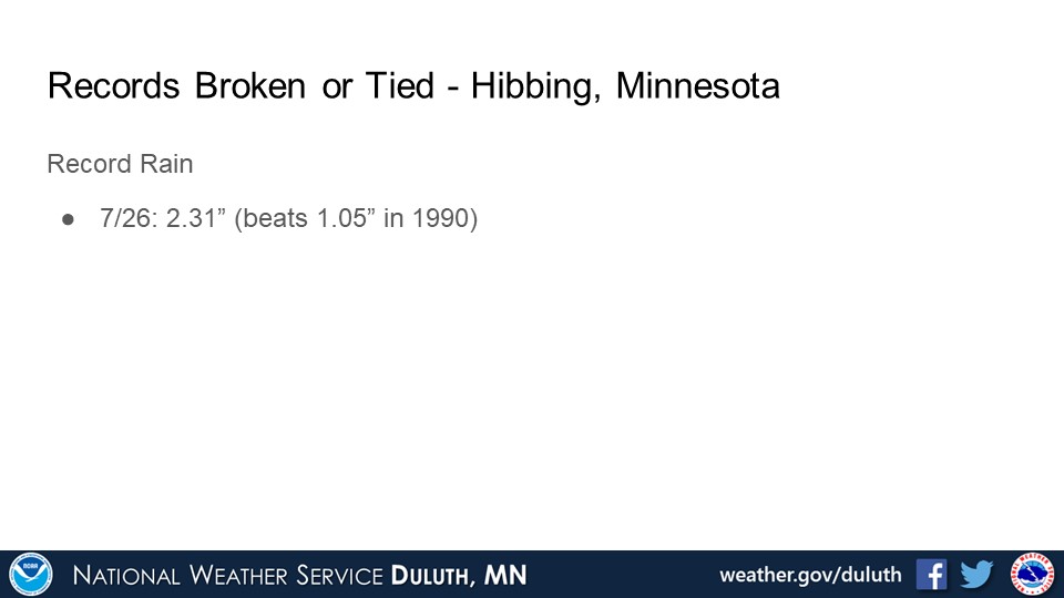
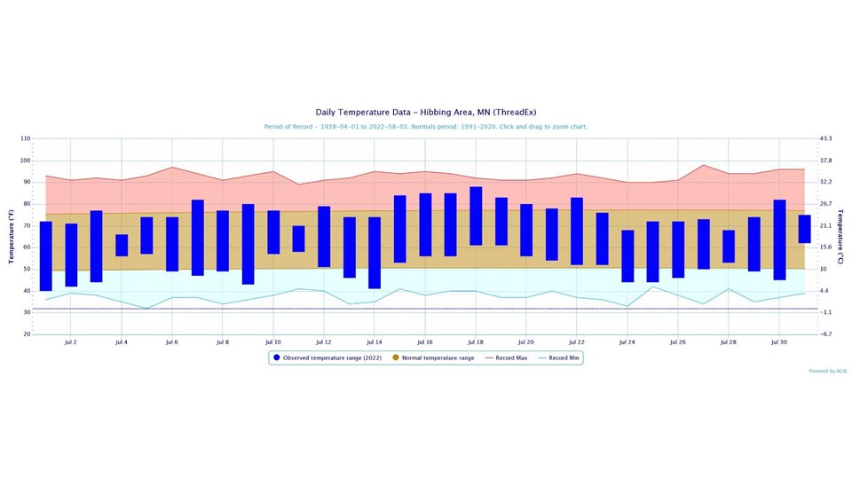
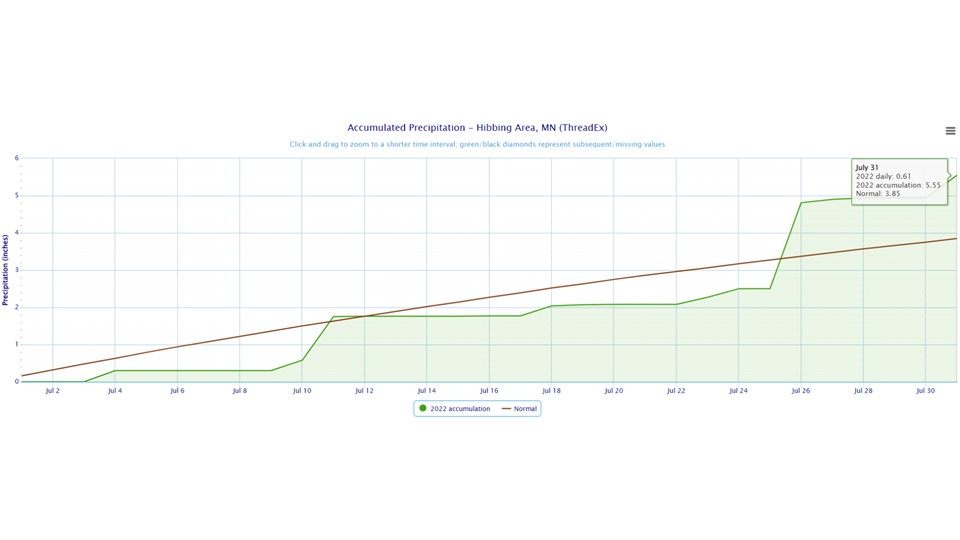
Hibbing
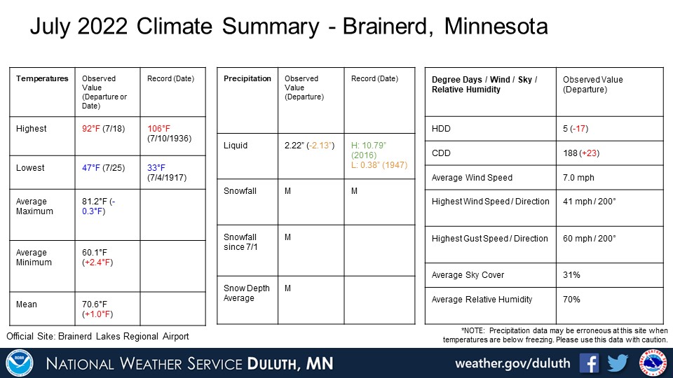
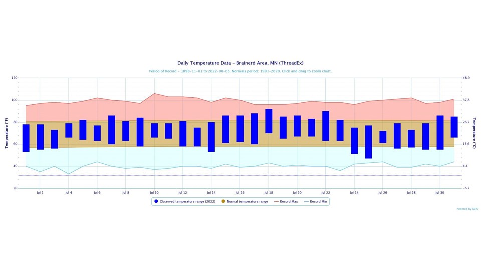
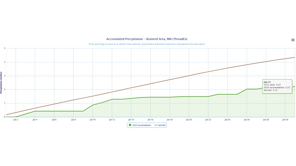
Brainerd
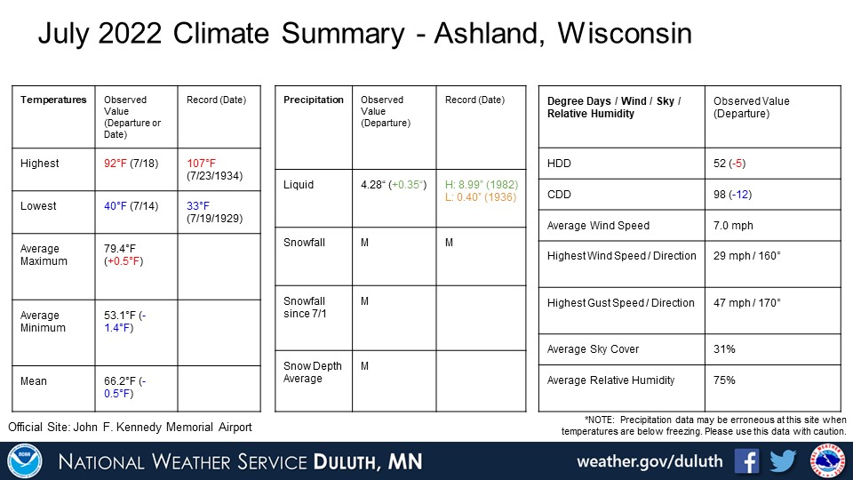
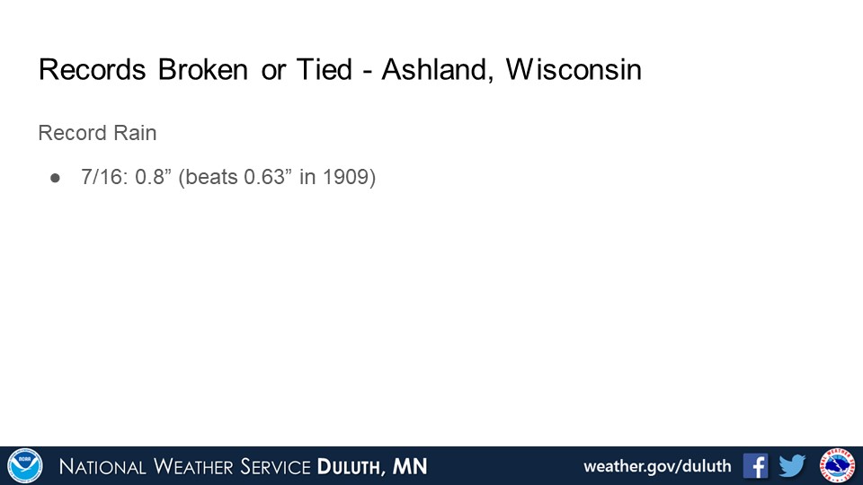
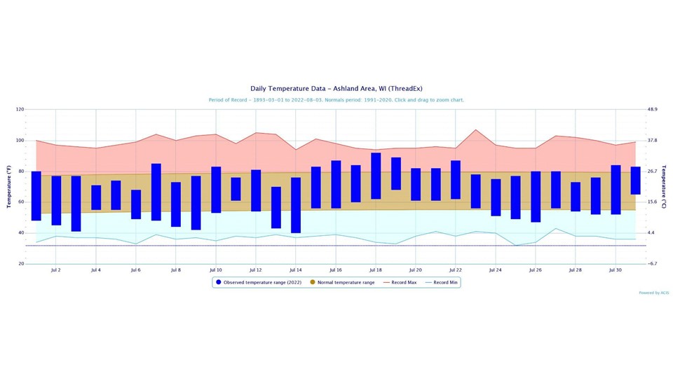
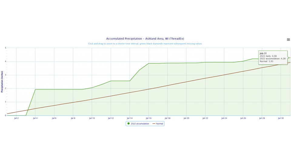
Ashland
Summary
Hydro
Outlook

 |
Media use of NWS Web News Stories is encouraged! Please acknowledge the NWS as the source of any news information accessed from this site. |
|

