
Scattered severe storms capable of large to very large hail, severe wind gusts, and a few tornadoes will be possible across the central Plains this evening. Heavy to excessive rainfall may bring a flooding threat from the Great Lakes to the Mid-South through tonight. Hot, dry and windy conditions will continue to bring a critical fire weather threat from the Southwest into the Great Basin. Read More >
Duluth, MN
Weather Forecast Office
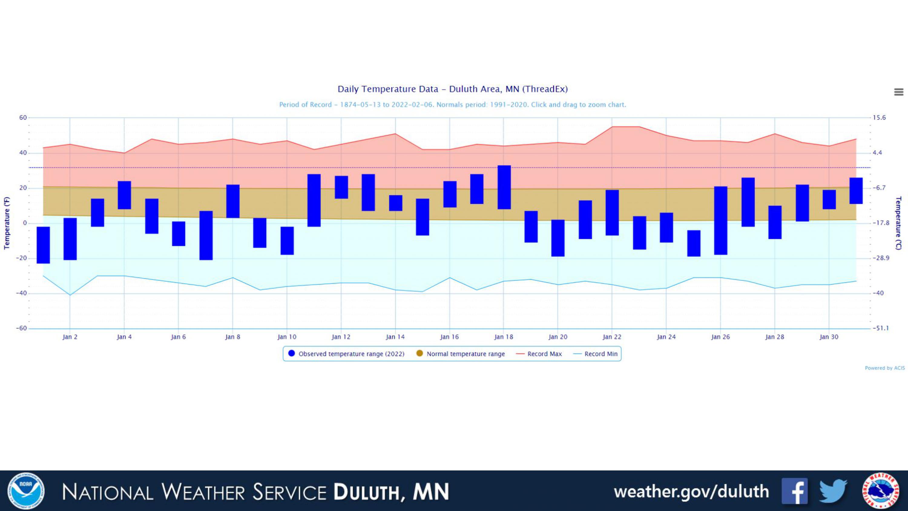
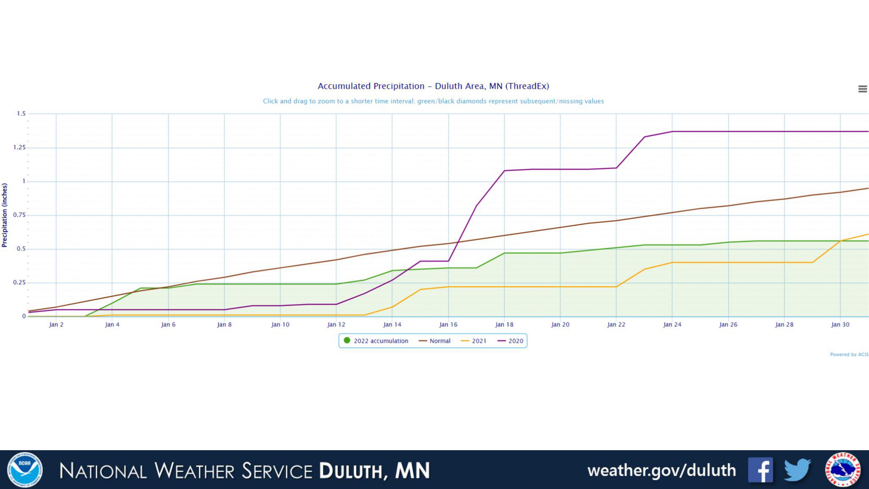
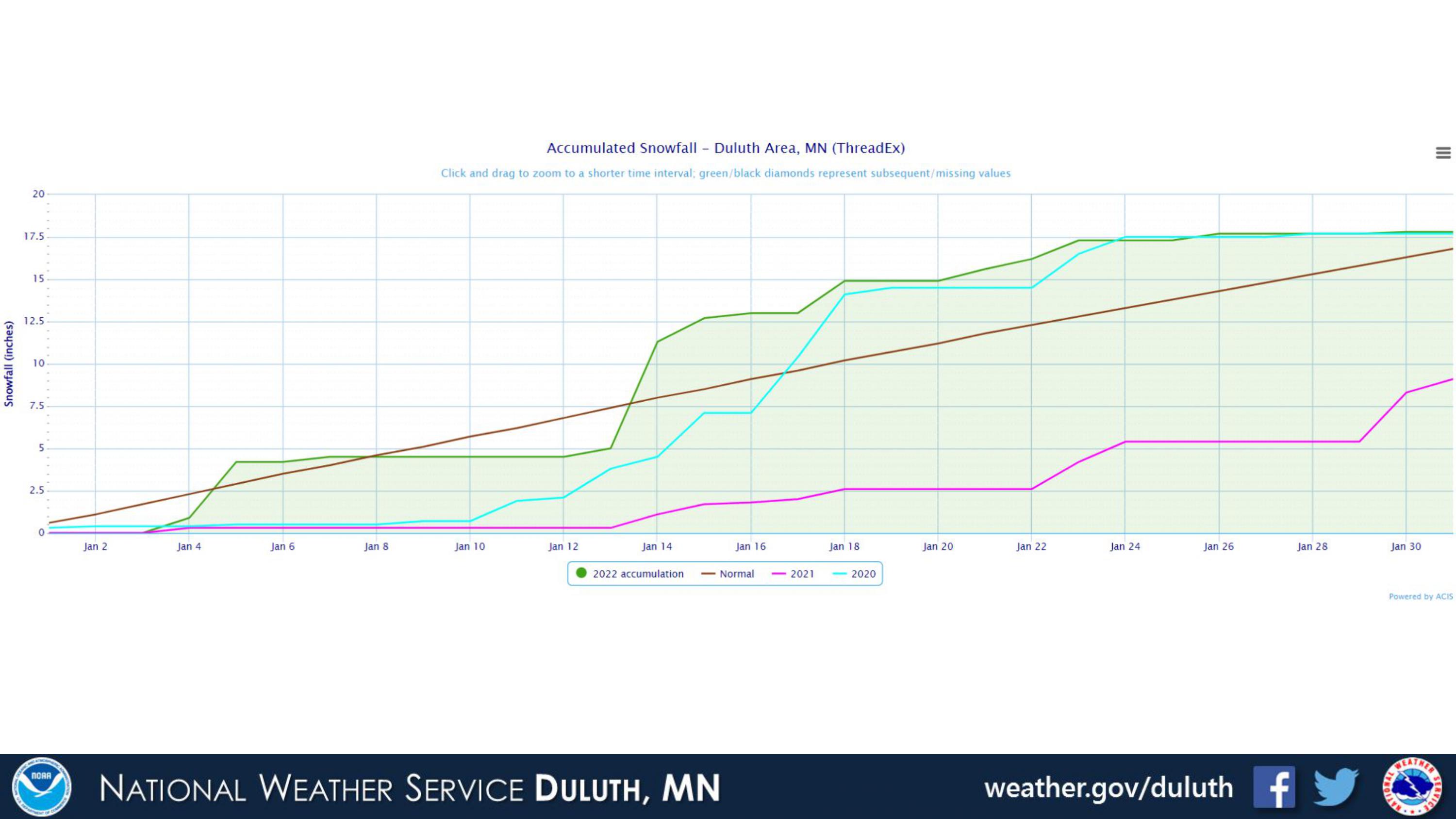
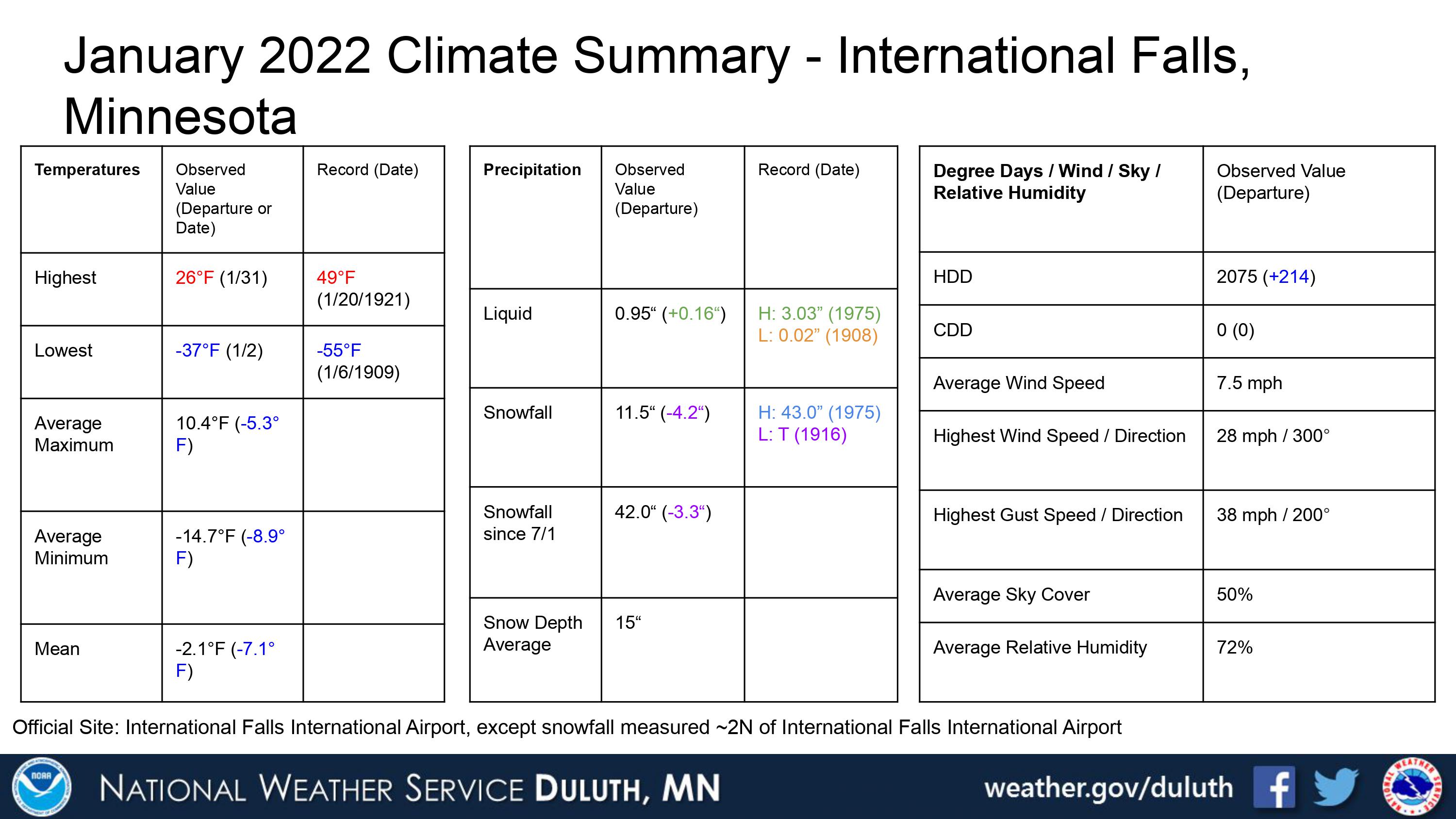
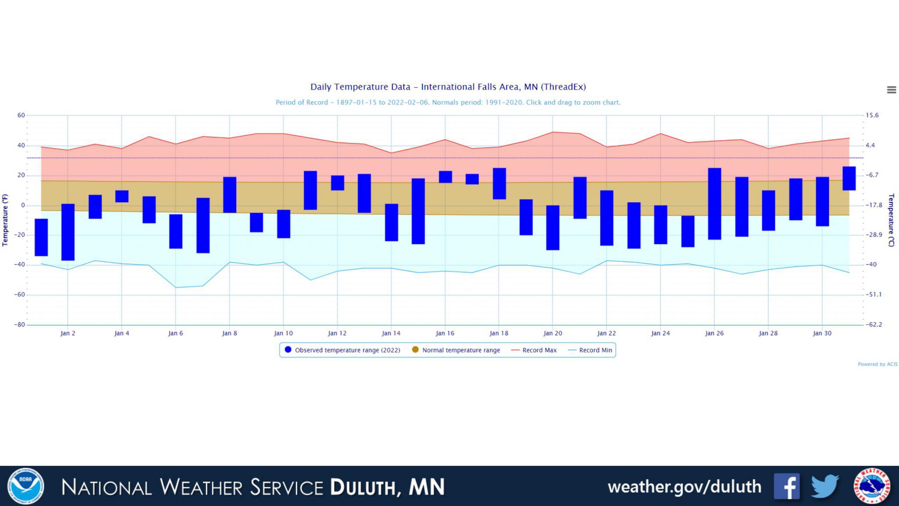
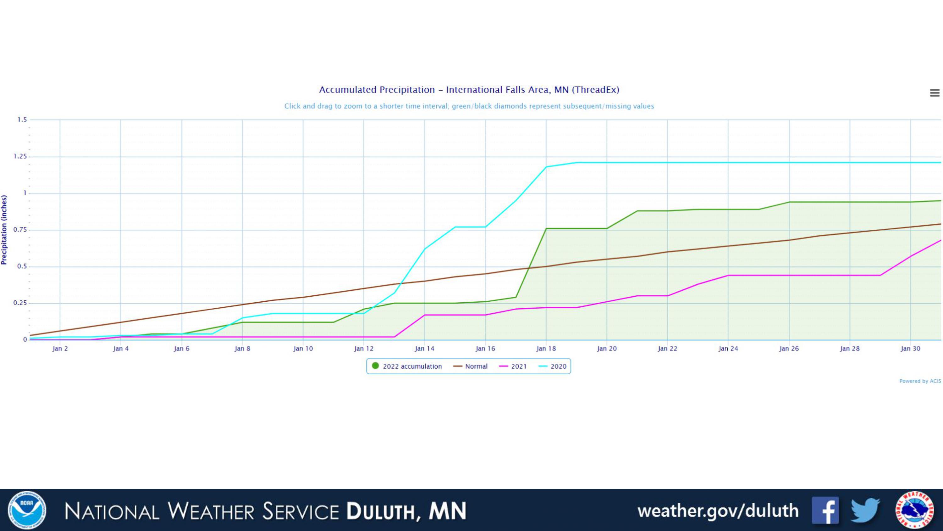
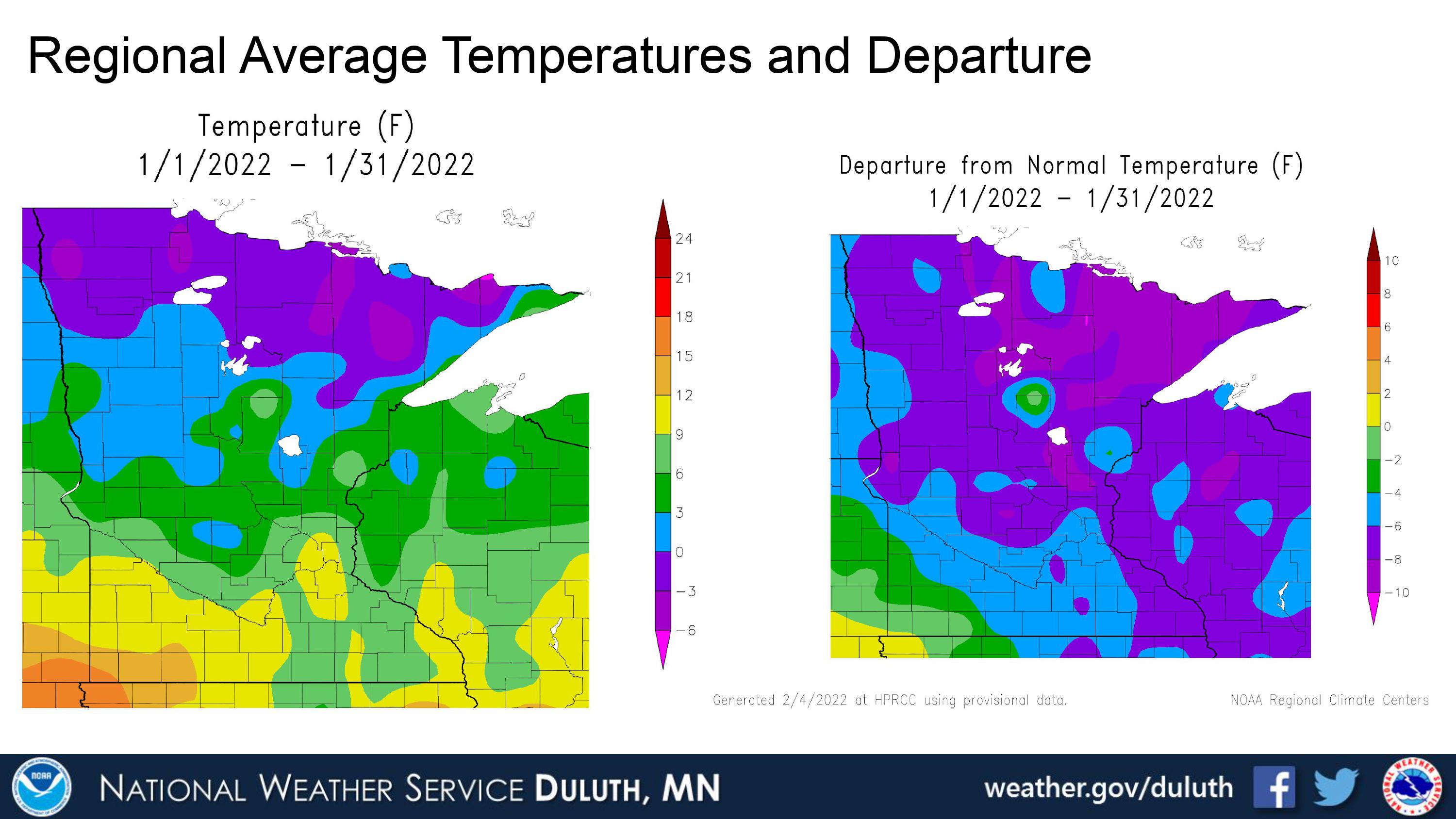
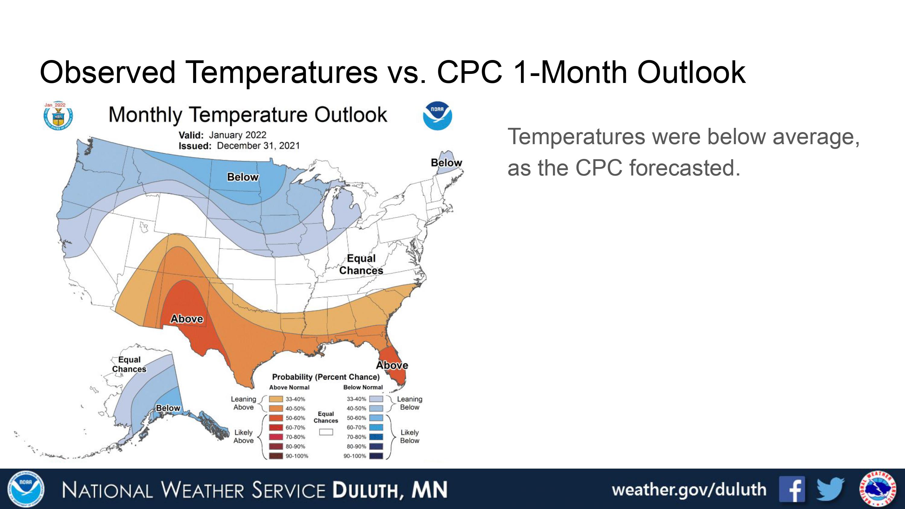
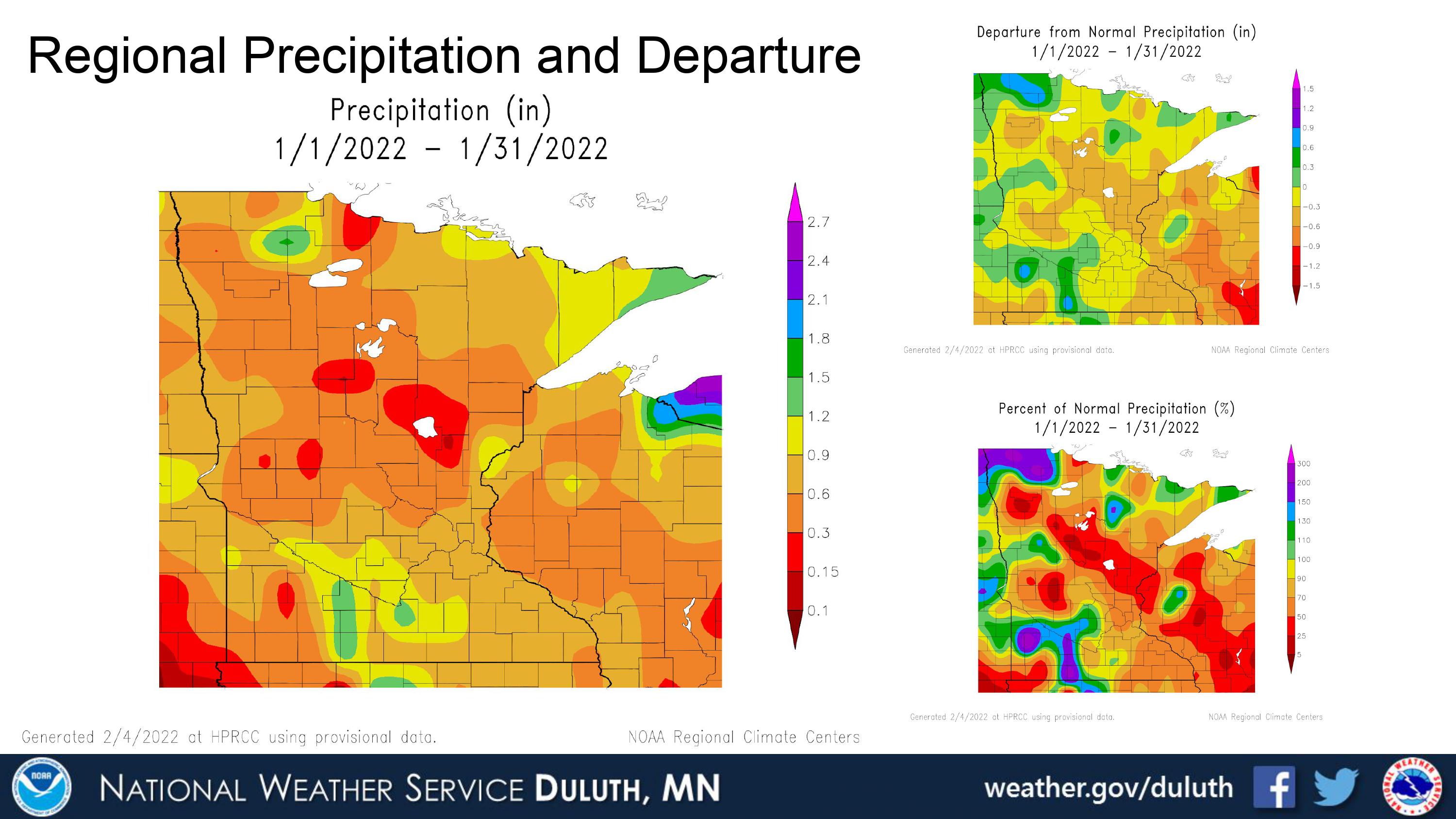
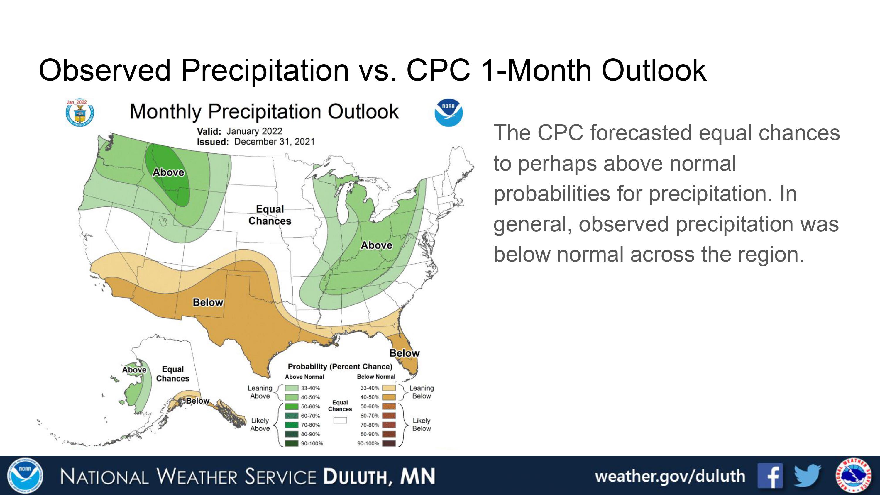
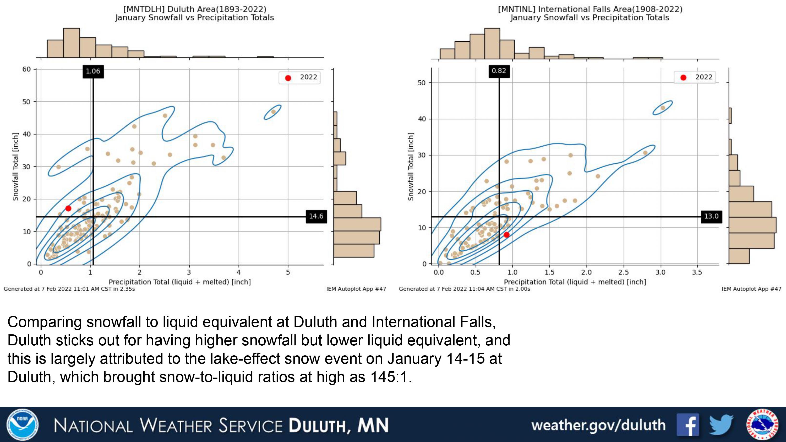
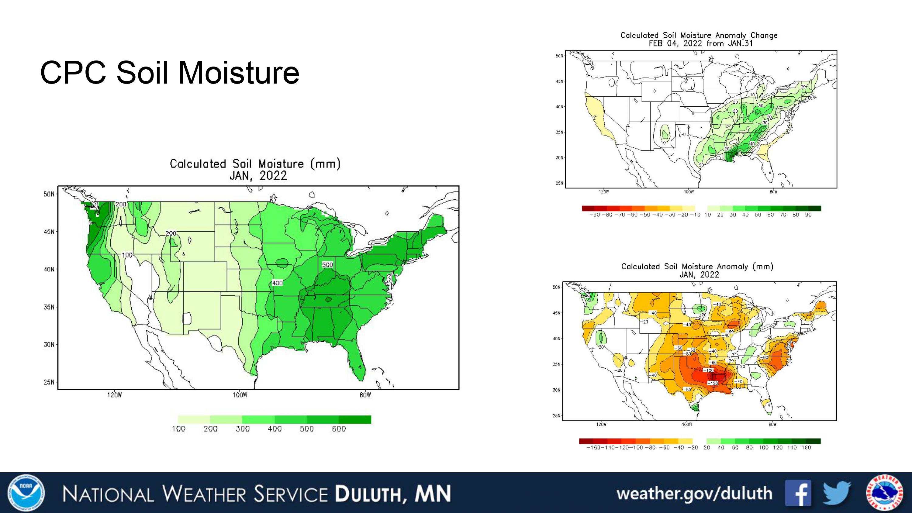
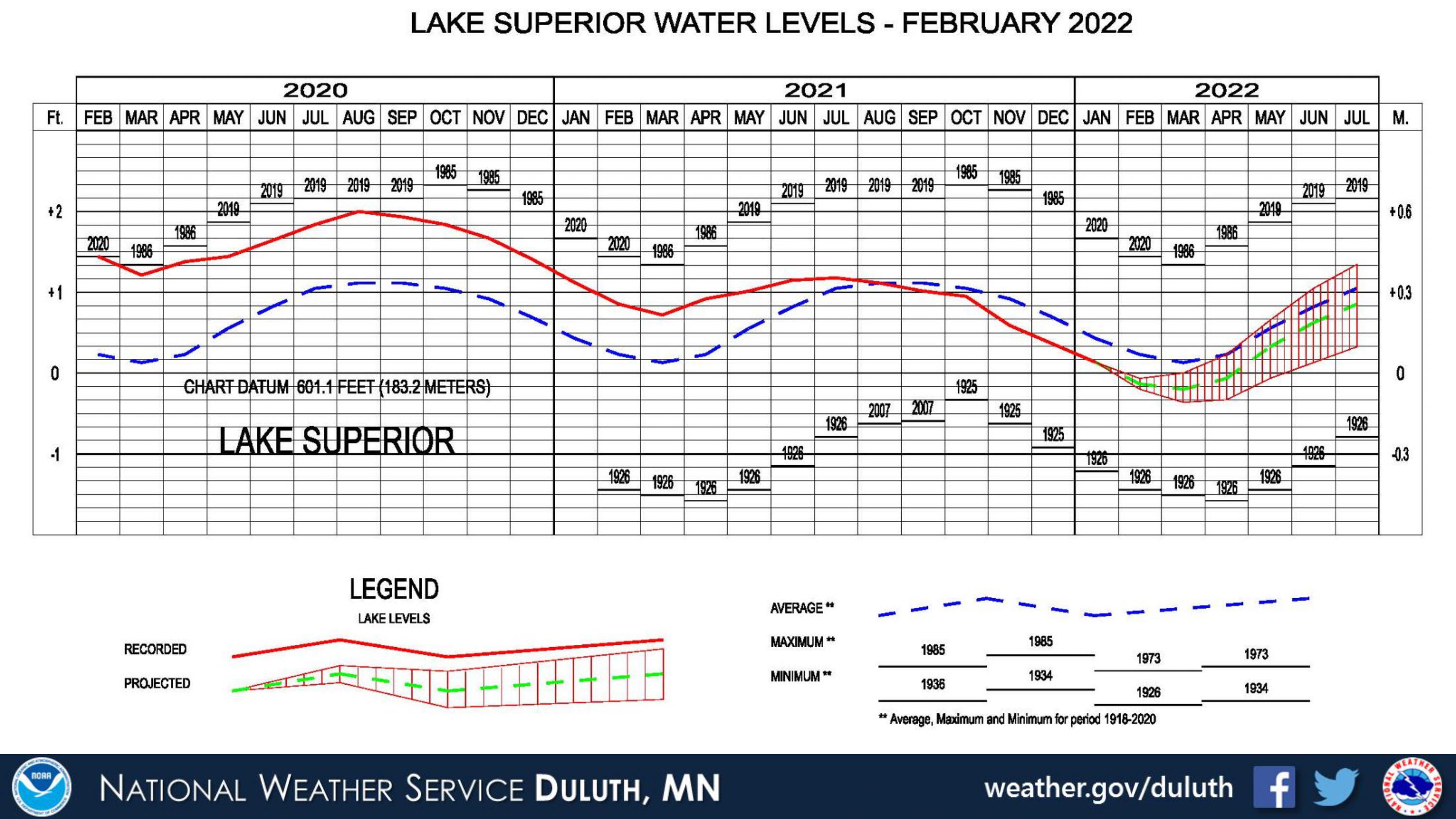
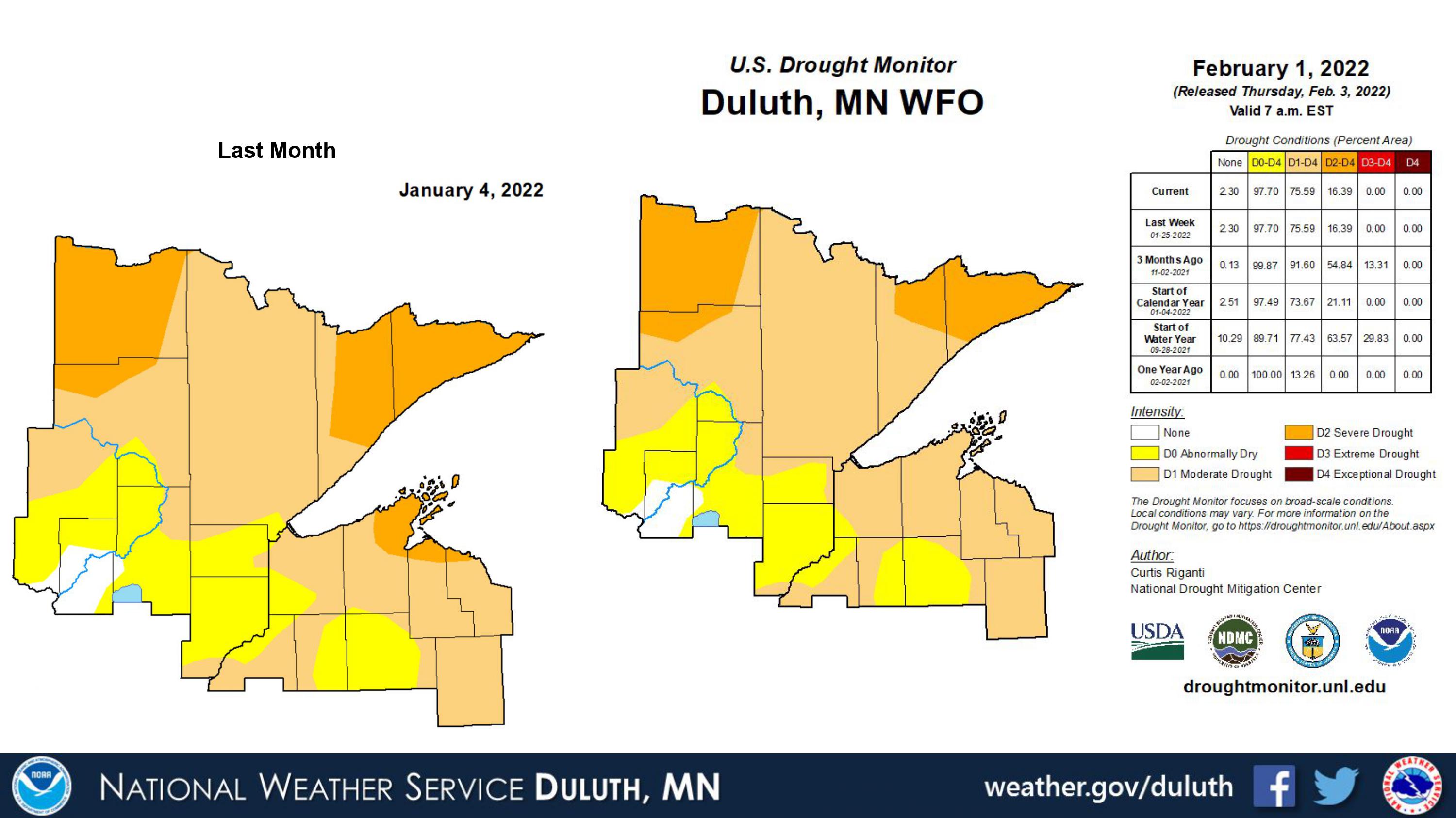
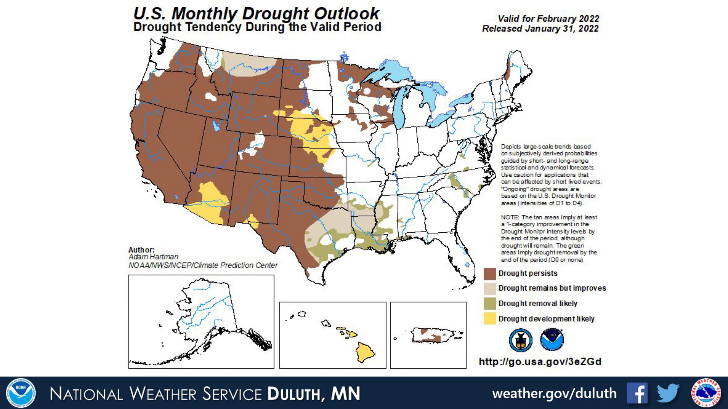
With all the crazy weather in December and warmth preceding it, it’s hard to believe that January was several degrees below average. But, after the mid-December Derecho, we plunged right into the depths of winter, and January brought several episodes of snow and cold. While the cold was generally not record-breaking, it was consistently cold for most of the month. Snow and liquid equivalent precipitation was generally below average, though a rogue lake-effect snow event brought Duluth’s snow totals just above average. Drought status remains relatively unchanged per the US Drought Monitor, and Lake Superior’s water levels are now likely to remain below average as we go into spring.
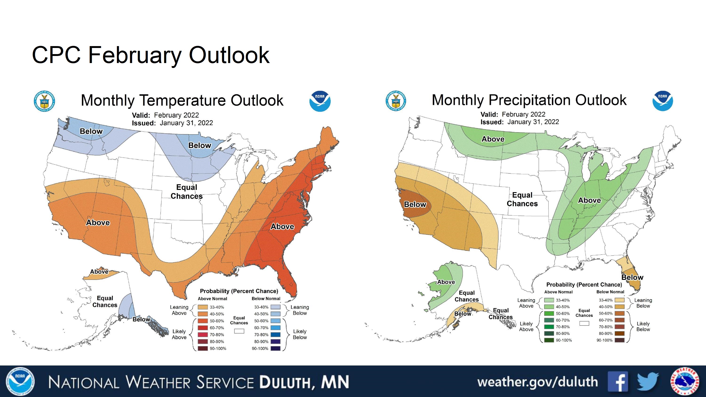
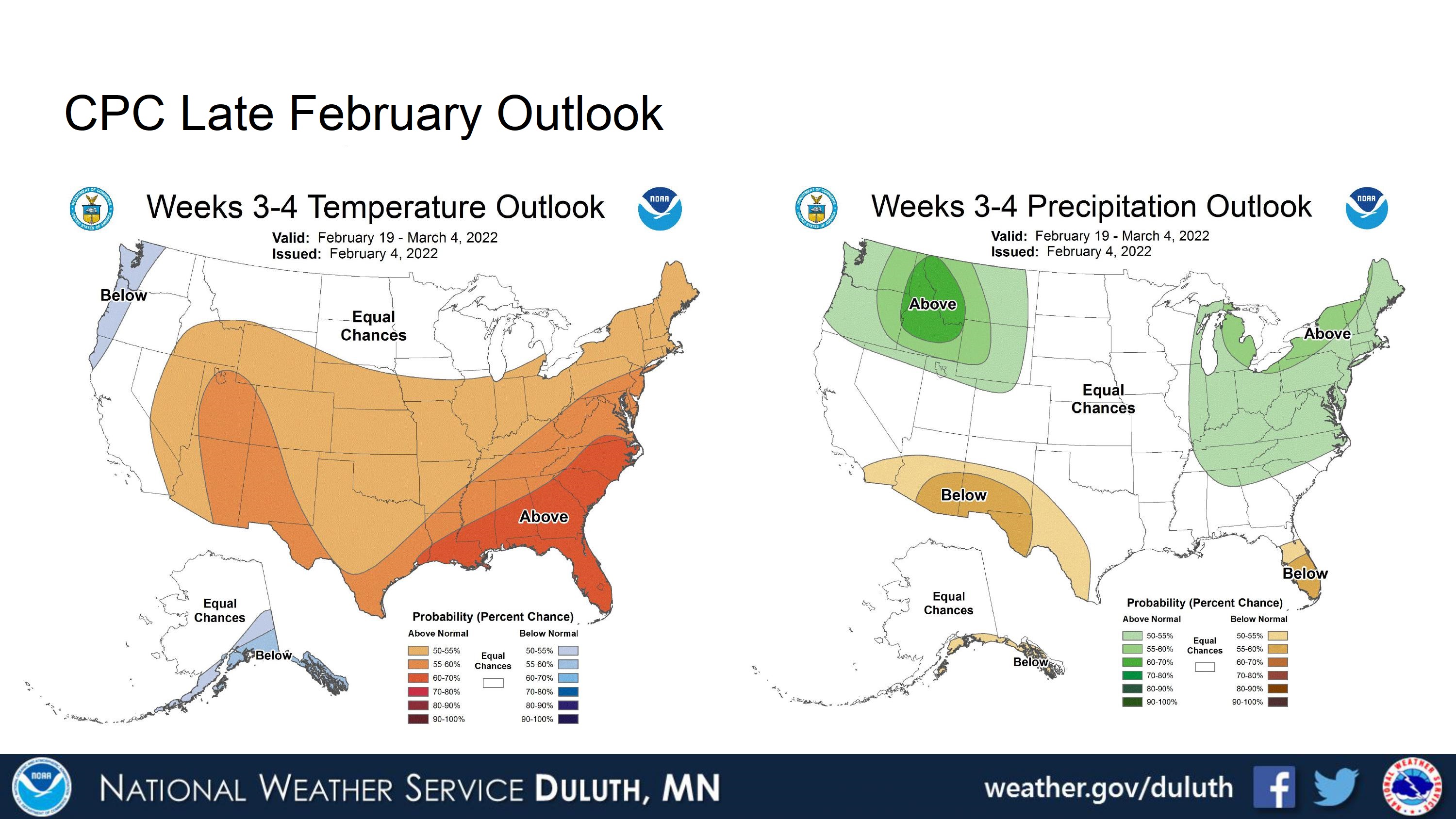
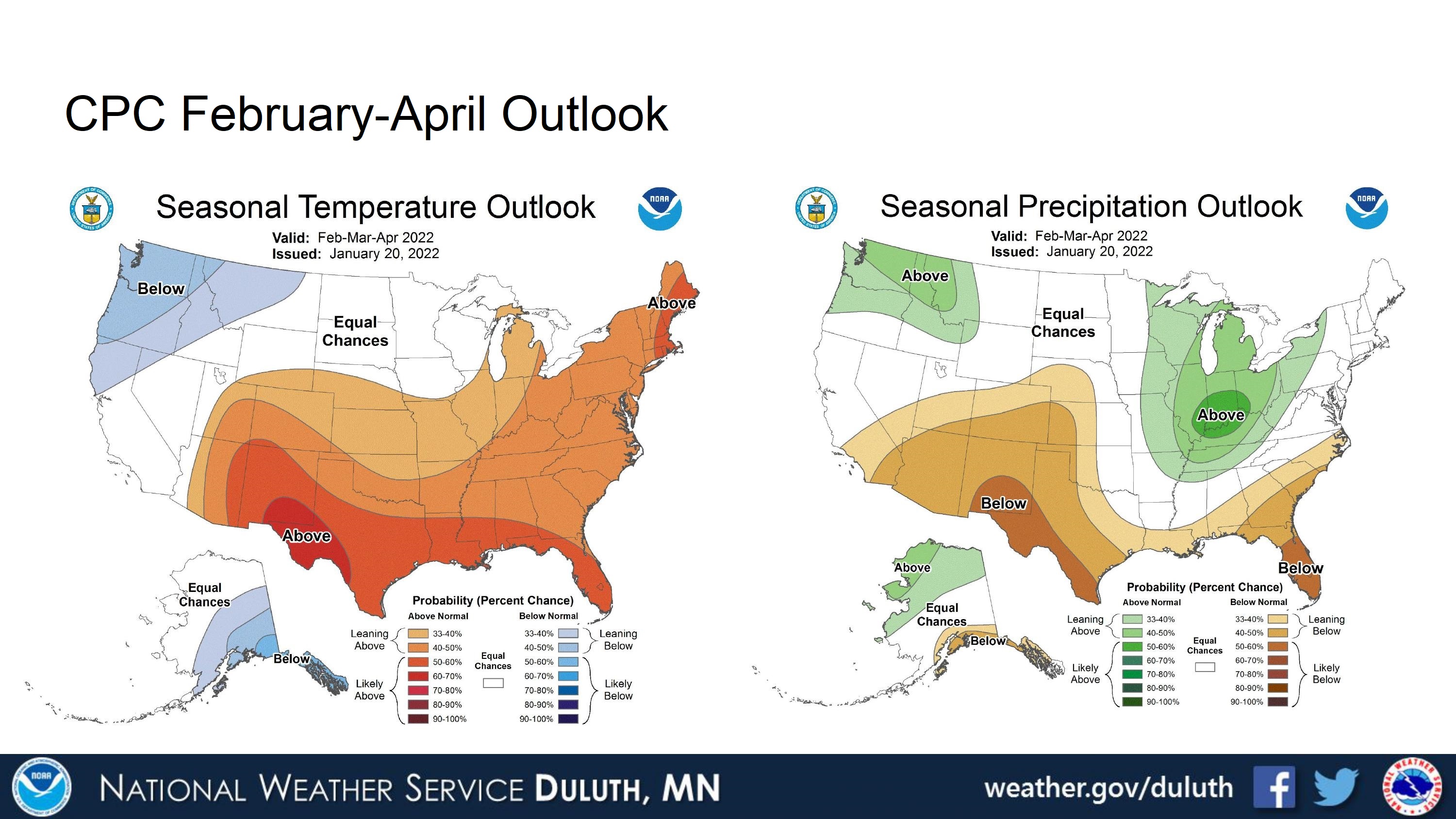
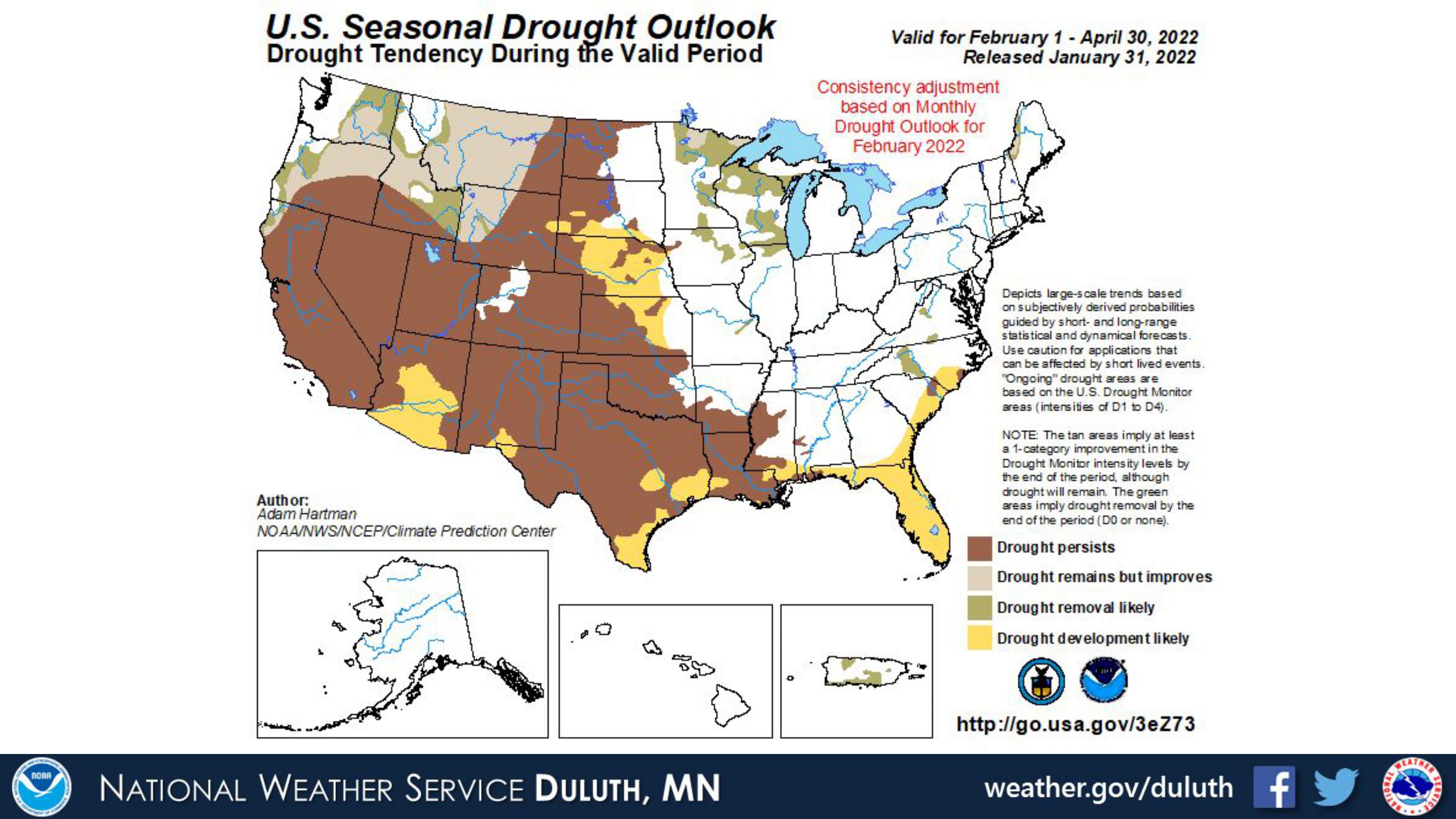
Per CPC’s forecasts, the rest of February may feature cooler temperatures and higher precipitation than normal with drought persisting (but possibly improving going into spring).
Duluth

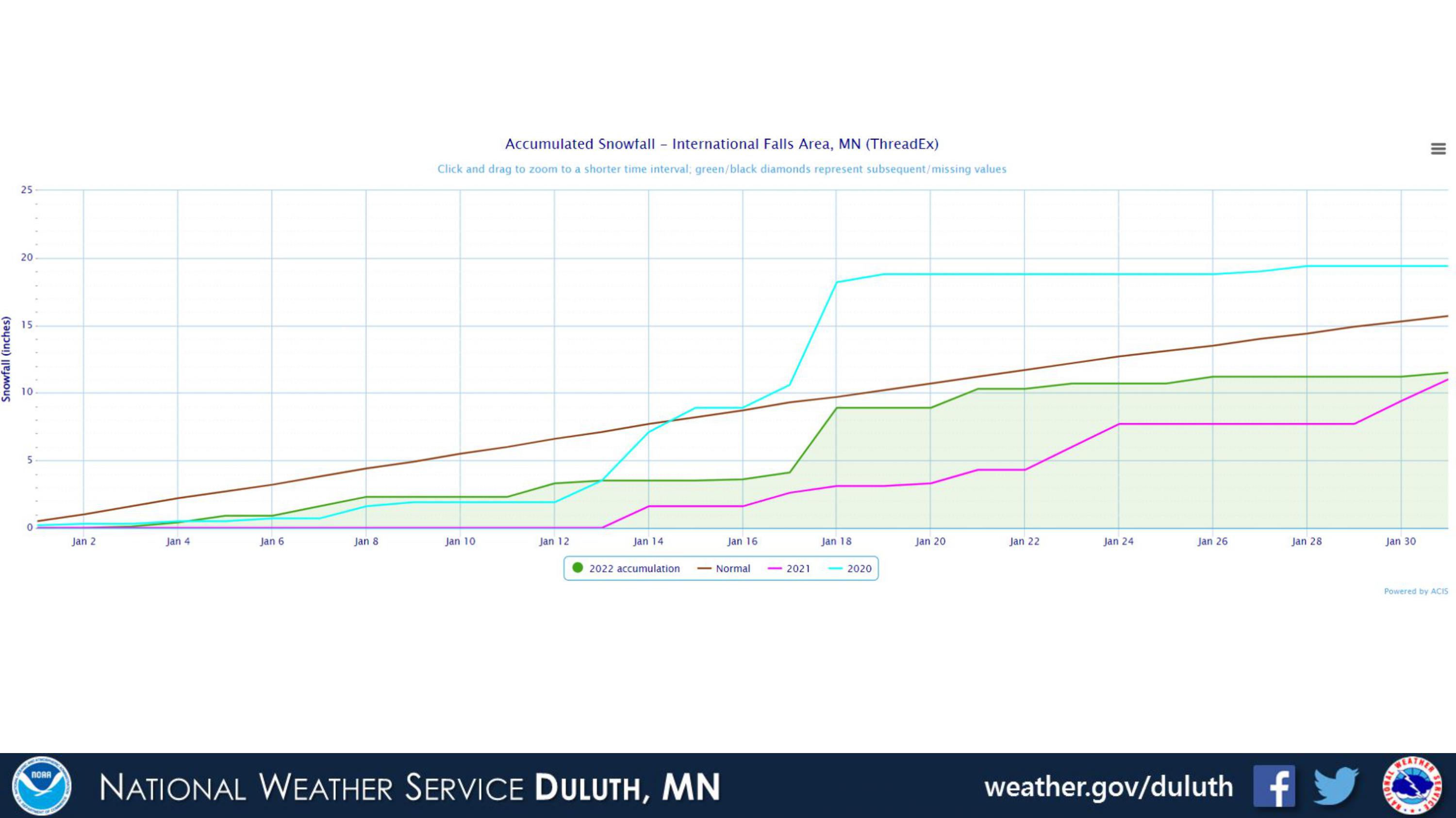
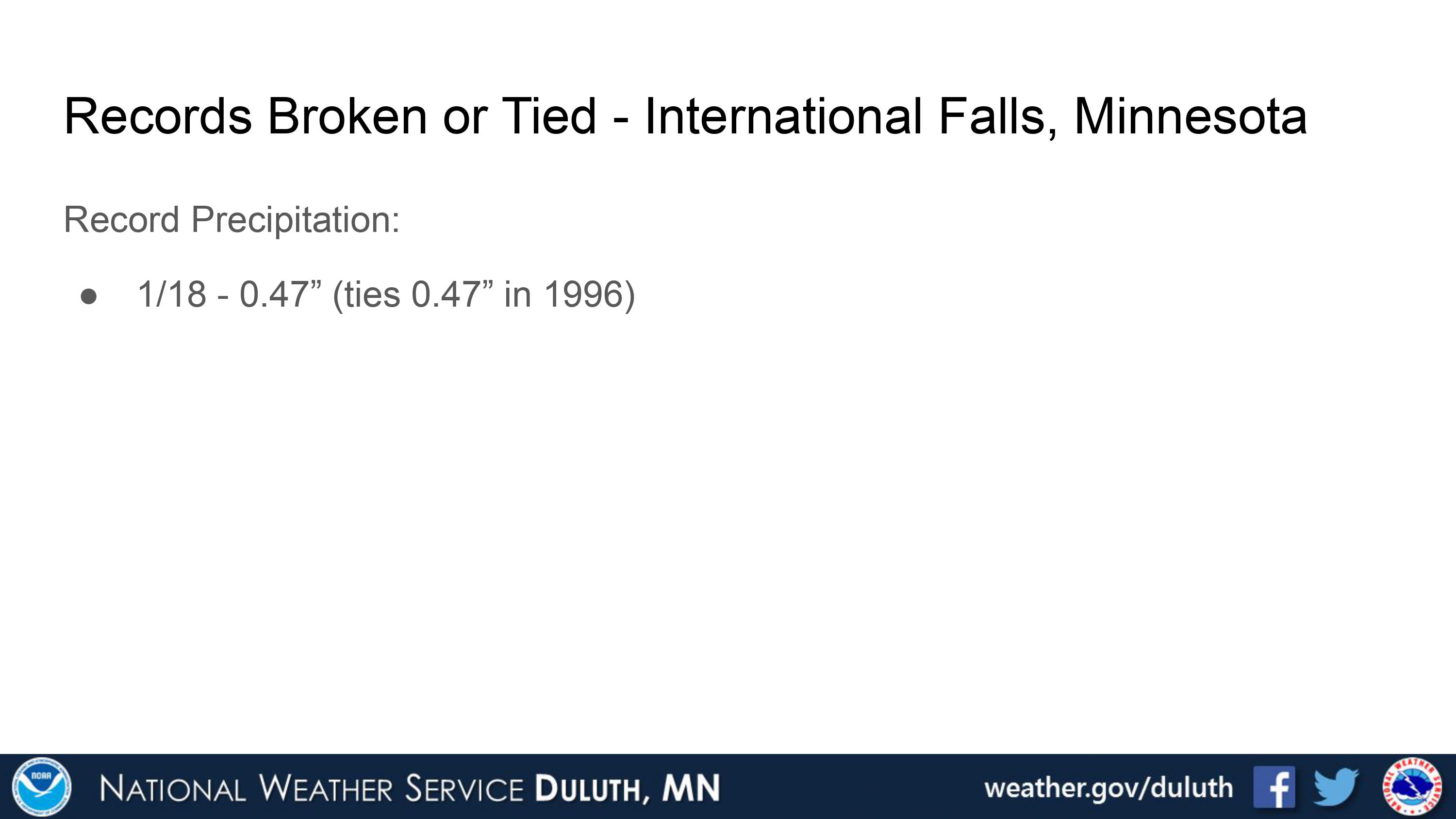
International Falls
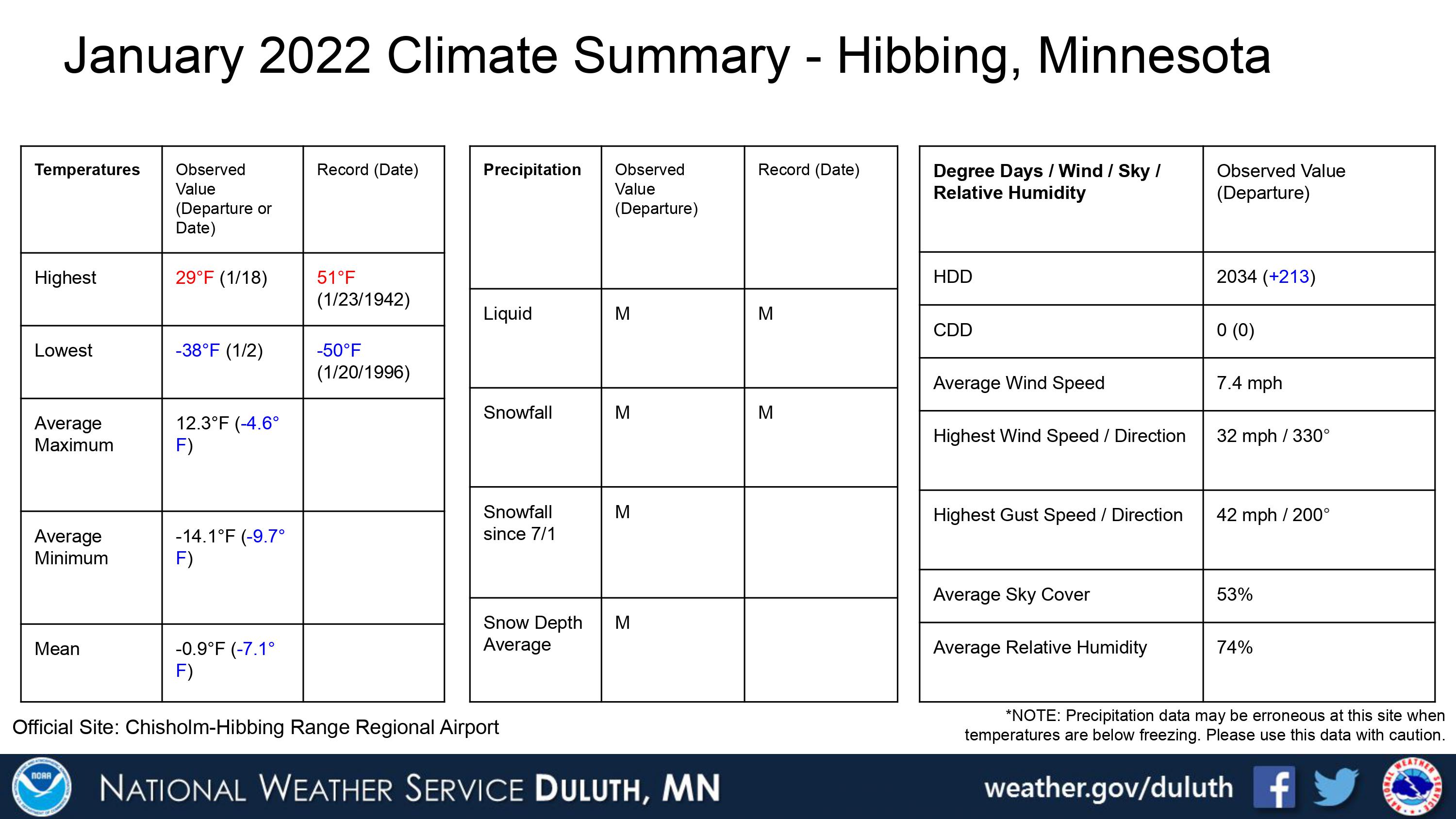
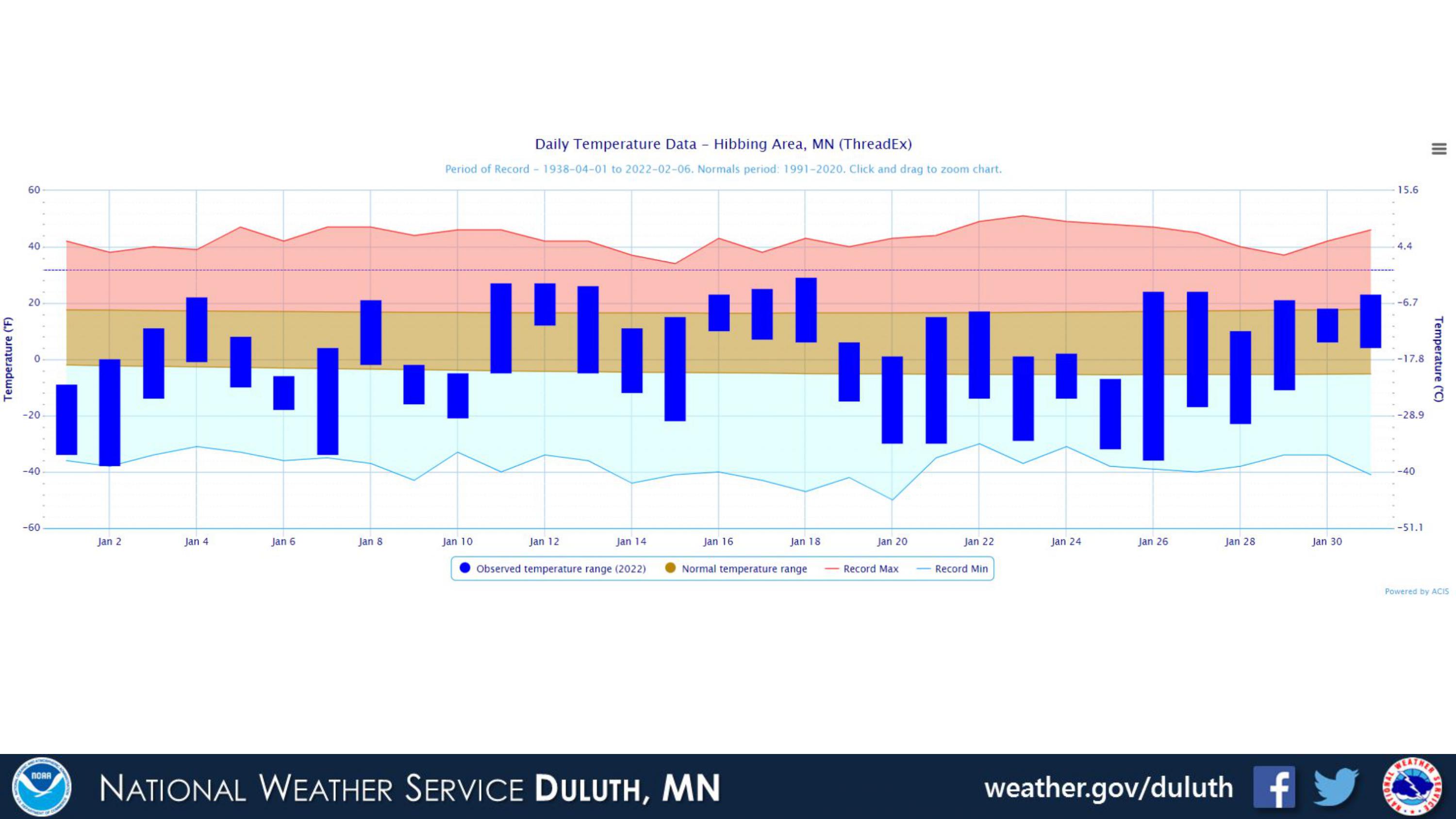
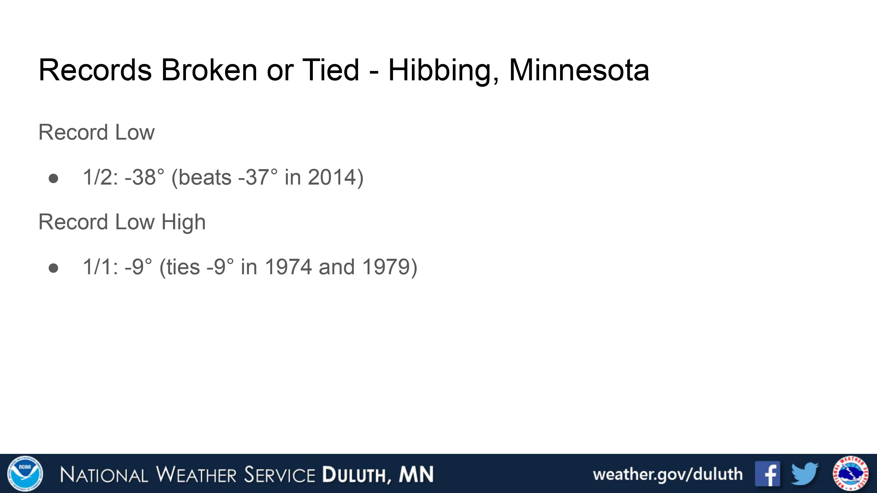
Hibbing
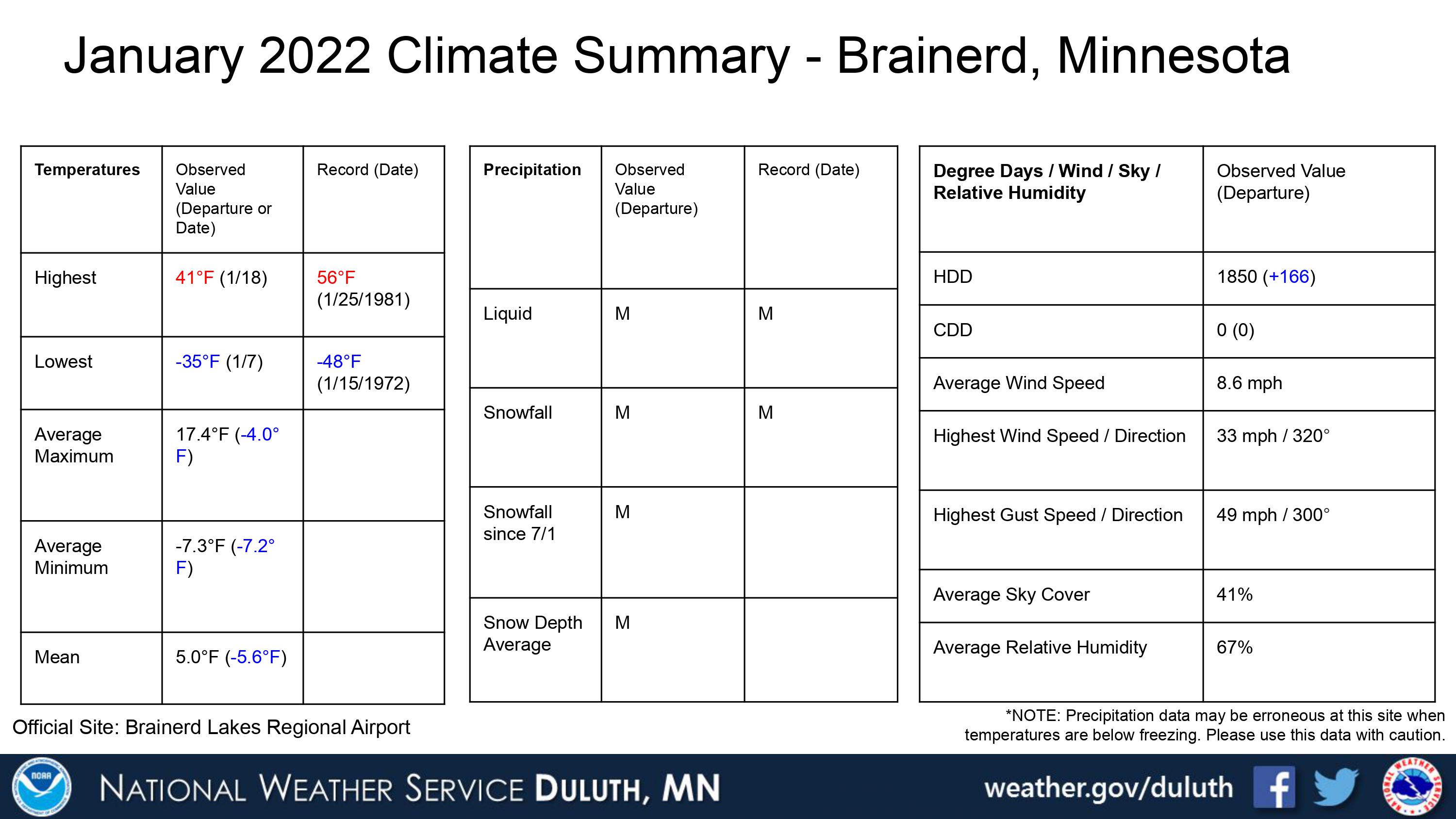
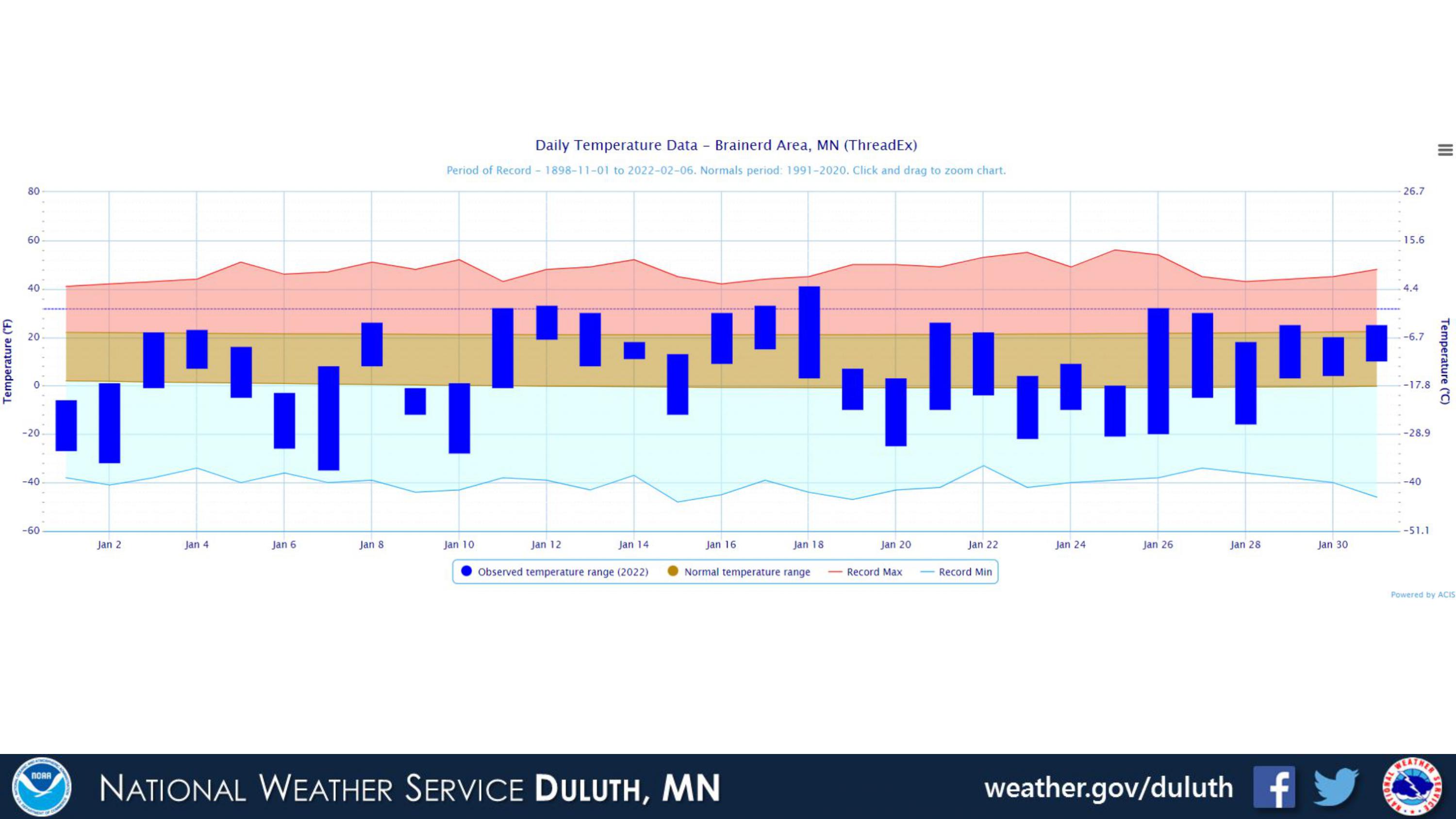
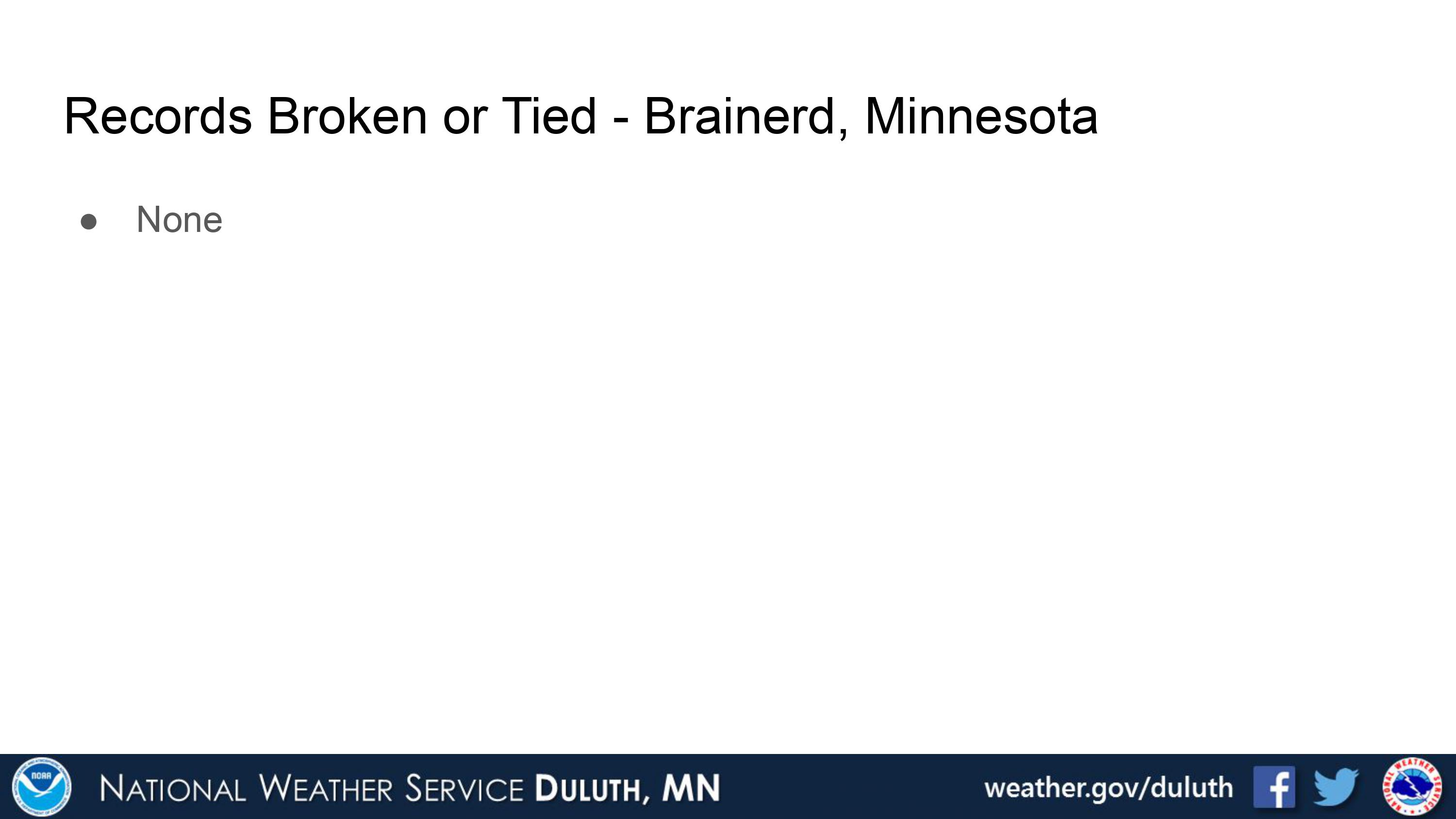
Brainerd
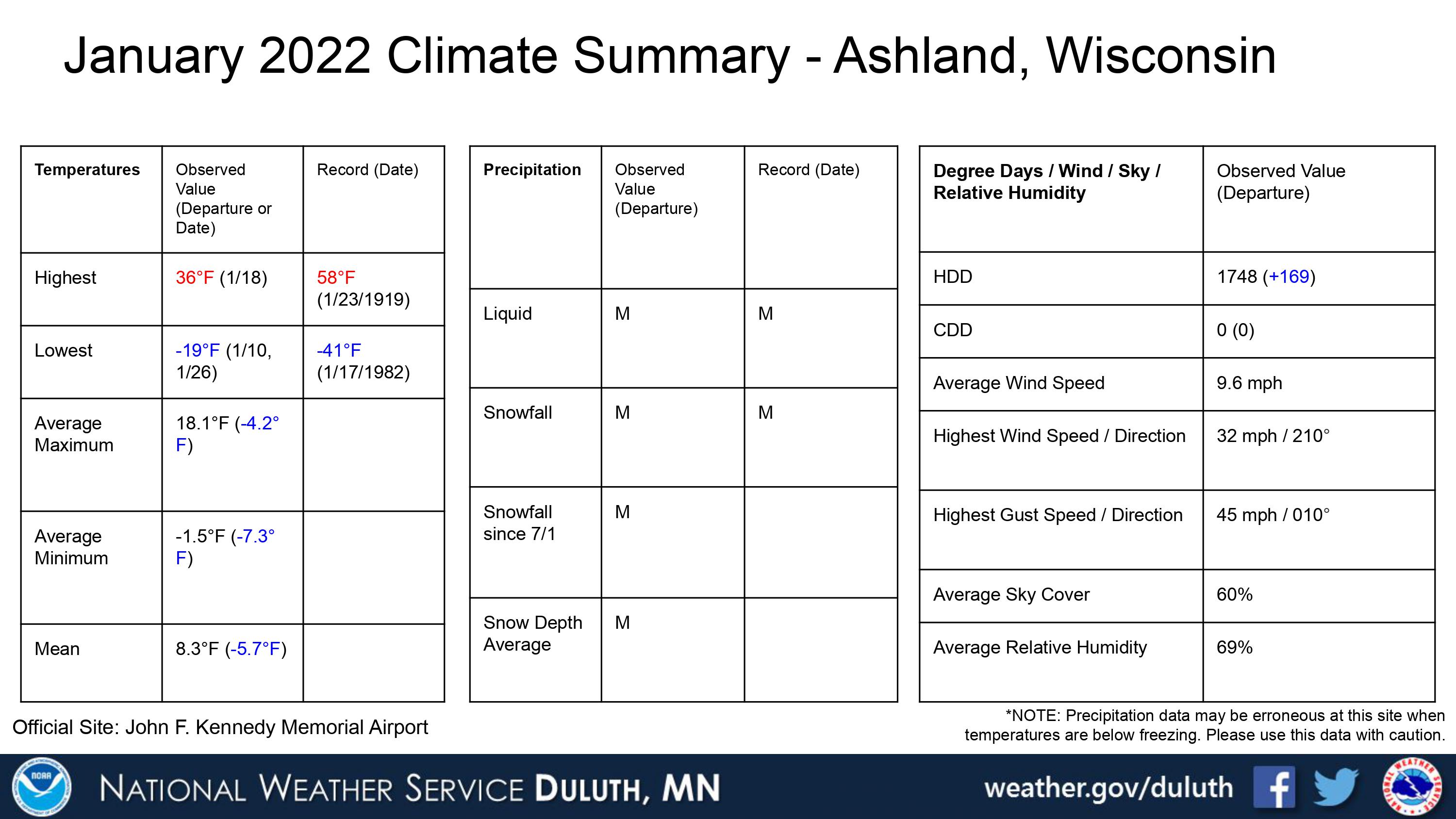
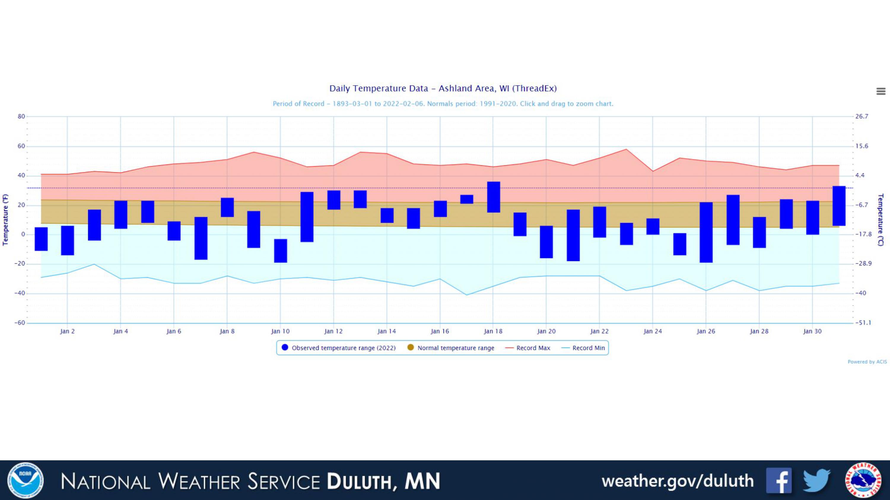
Ashland
Summary
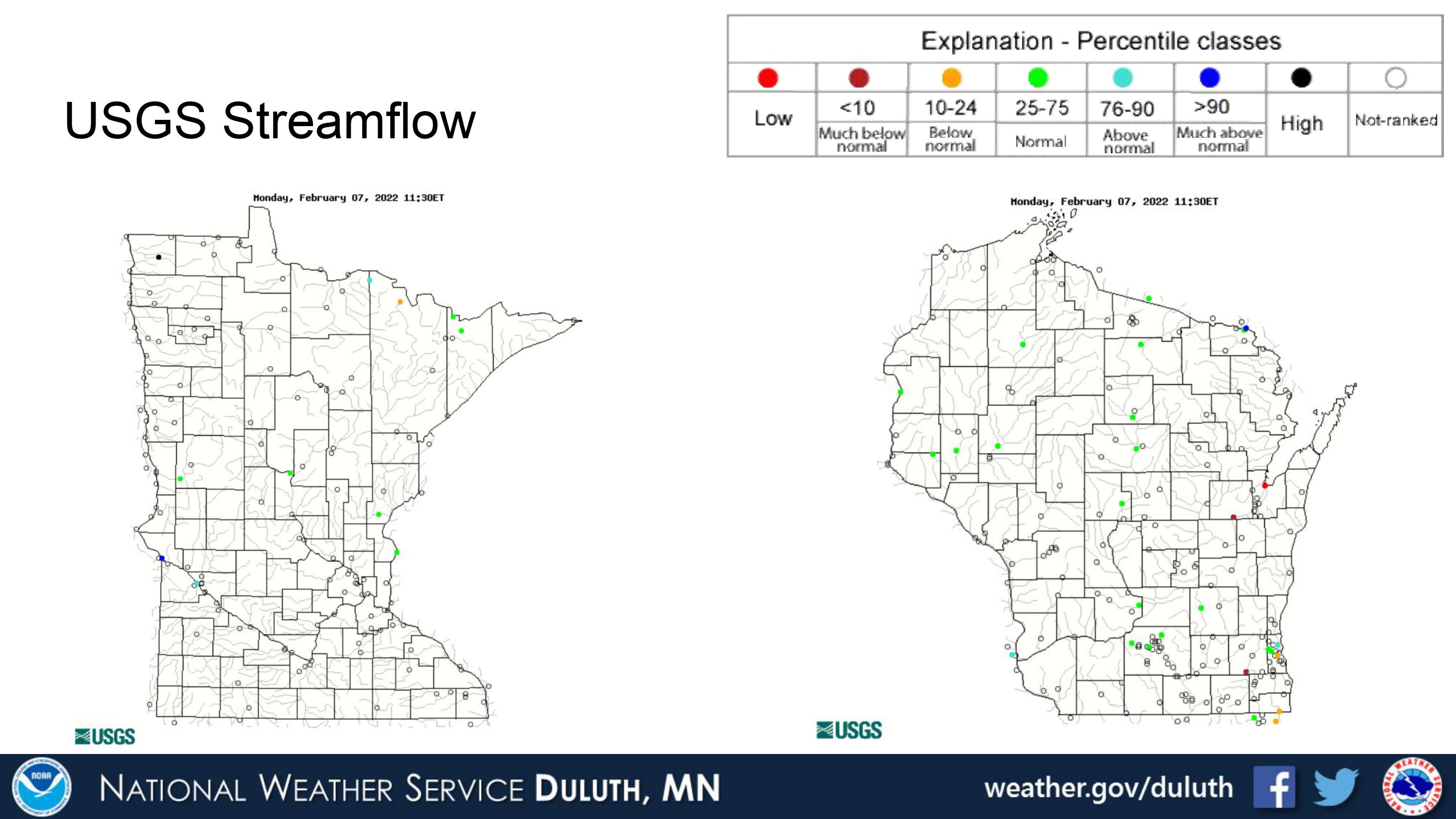
Hydro
Outlook
 |
Media use of NWS Web News Stories is encouraged! Please acknowledge the NWS as the source of any news information accessed from this site. |
|
Forecasts
Fire Weather
Great Lakes
Local Text Products
Winter Weather
Local Area Forecasts
Aviation
Marine
Rainy River Basin Page
Current Conditions
Current Observations
Public Information Statements
National Snowfall Map
NOHRSC Snow Analysis
Rain/Snow Reports
Winter Monitor
US Dept of Commerce
National Oceanic and Atmospheric Administration
National Weather Service
Duluth, MN
5027 Miller Trunk Highway
Duluth, MN 55811-1442
218-729-6697 - Duluth; 218-283-4615 - Intl Falls
Comments? Questions? Please Contact Us.

