Duluth, MN
Weather Forecast Office
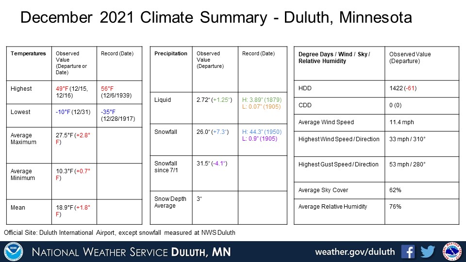
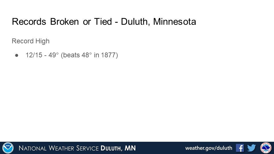
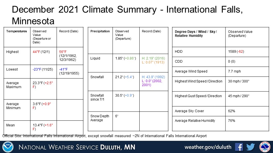
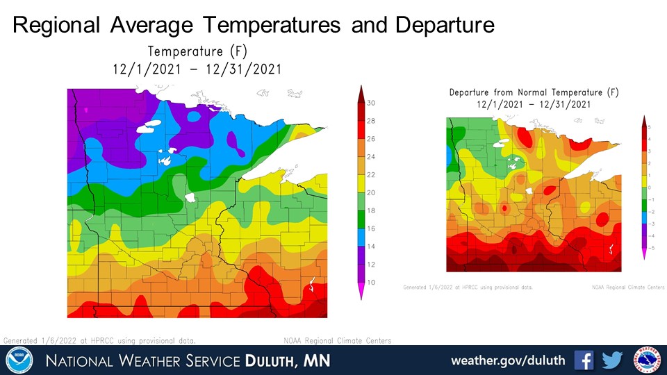
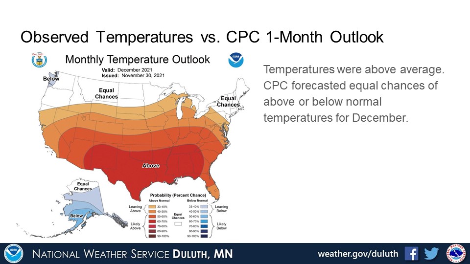
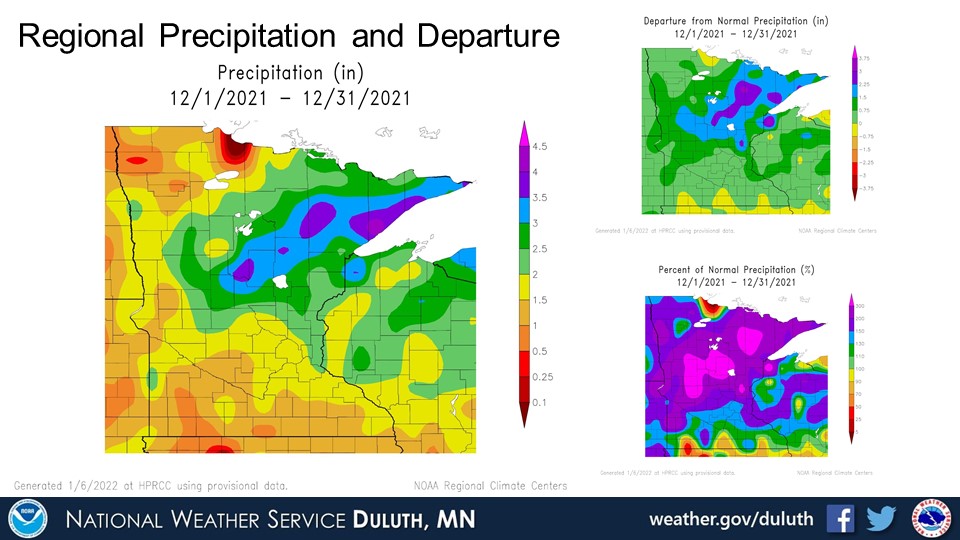
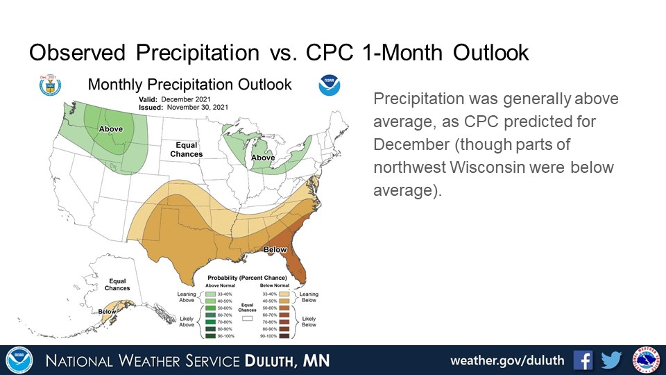
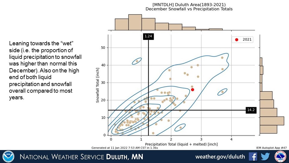
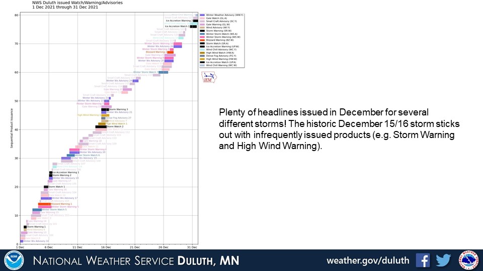
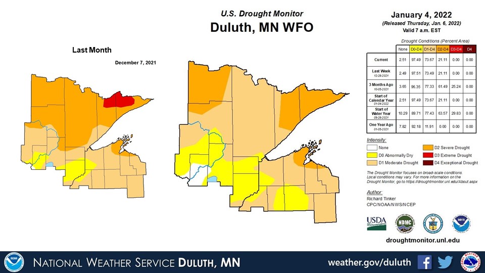
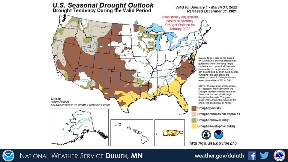
December 2021 featured above normal temperatures, precipitation, and snowfall at nearly all climate sites. The only exception was below normal precipitation at Ashland. This comes as no surprise as December was a pretty active month with several storms passing through the region. Perhaps the most notable is the historic December 15/16 storm that brought nearly every type of weather to the region, including high winds, thunderstorms, record highs, and some snowfall. There were some high rainfall amounts from this system and not a lot of snow. Towards the end of the month, however, snowstorms caused monthly snowfall to creep above normal at both Duluth and International Falls. All of this has led to some drought improvements, with Extreme drought removed from the Arrowhead and most areas now experiencing abnormally dry to moderate drought conditions. Pockets of severe drought still persist across Koochiching County, the Arrowhead, and the Bayfield Peninsula.
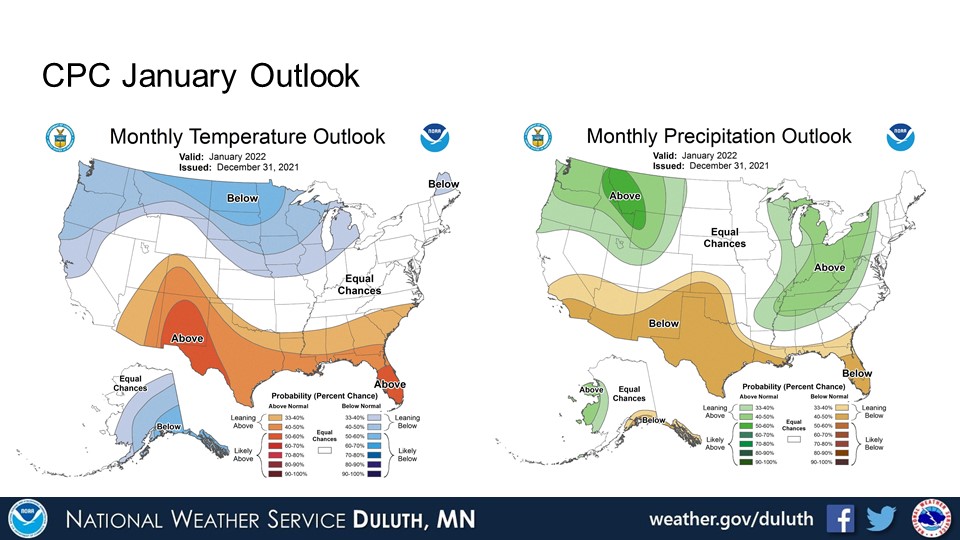
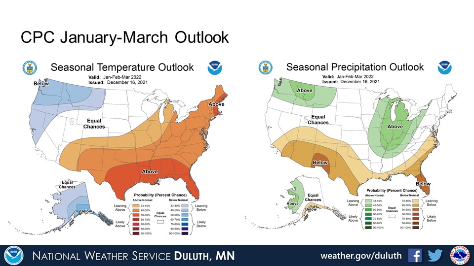
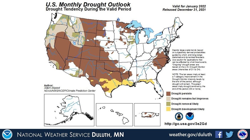
Looking ahead, the CPC predicted below normal temperatures for January (as we have seen thus far) and equal chances for above or below normal temperatures through March. Generally equal chances or above normal precipitation predicted through March. If we do continue to see an active weather pattern, drought conditions should continue to improve overall.
Duluth
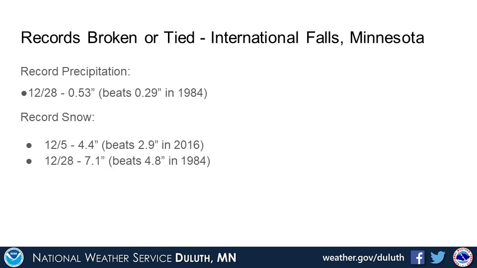
International Falls
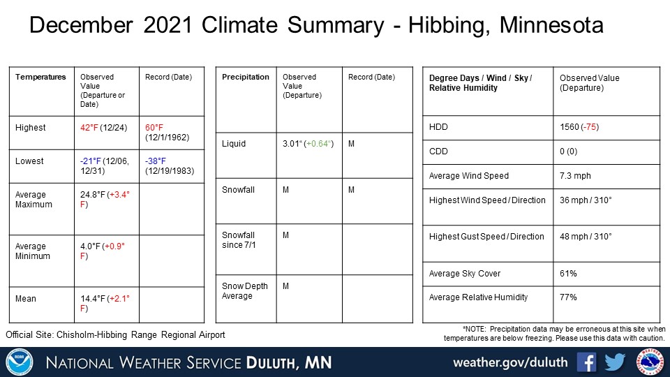
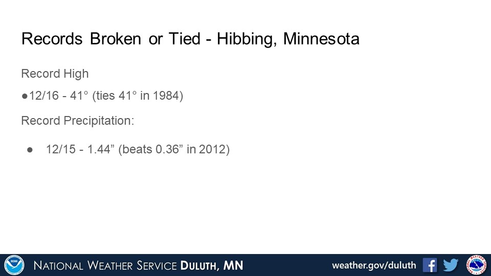
Hibbing
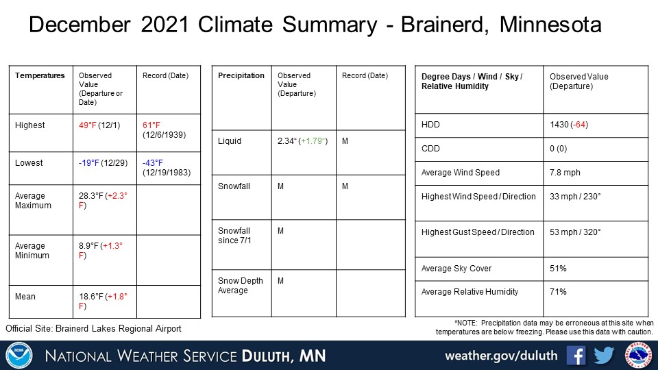
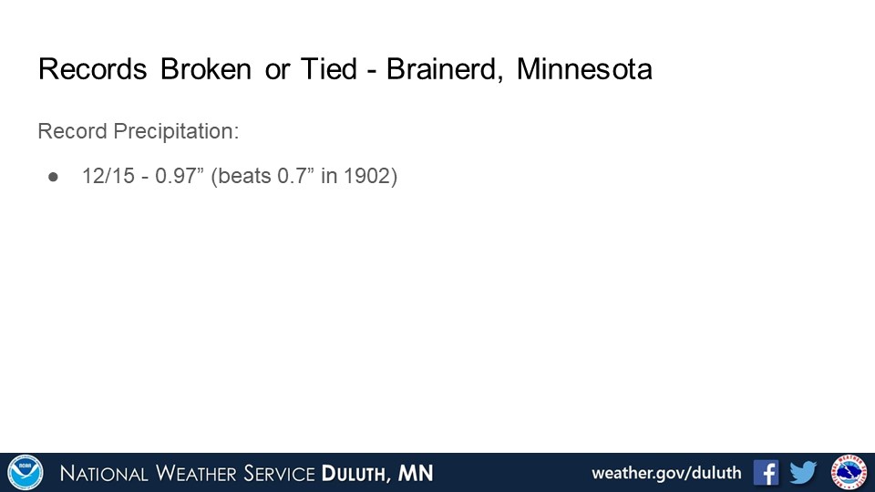
Brainerd
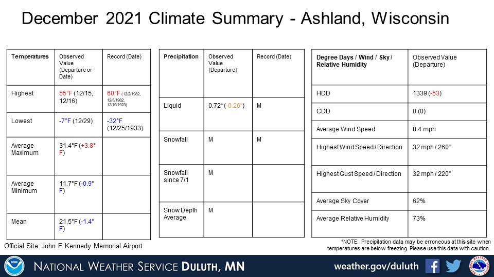
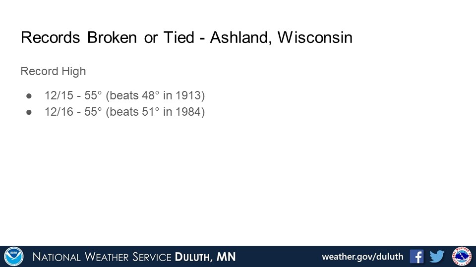
Ashland
Summary
Hydro
Outlook
 |
Media use of NWS Web News Stories is encouraged! Please acknowledge the NWS as the source of any news information accessed from this site. |
|
Forecasts
Fire Weather
Great Lakes
Local Text Products
Winter Weather
Local Area Forecasts
Aviation
Marine
Rainy River Basin Page
Current Conditions
Current Observations
Public Information Statements
National Snowfall Map
NOHRSC Snow Analysis
Rain/Snow Reports
Winter Monitor
US Dept of Commerce
National Oceanic and Atmospheric Administration
National Weather Service
Duluth, MN
5027 Miller Trunk Highway
Duluth, MN 55811-1442
218-729-6697 - Duluth; 218-283-4615 - Intl Falls
Comments? Questions? Please Contact Us.

