Scattered severe storms capable of large to very large hail, severe wind gusts, and a few tornadoes will be possible across the central Plains this evening. Heavy to excessive rainfall may bring a flooding threat from the Great Lakes to the Mid-South through tonight. Hot, dry and windy conditions will continue to bring a critical fire weather threat from the Southwest into the Great Basin. Read More >
Overview
|
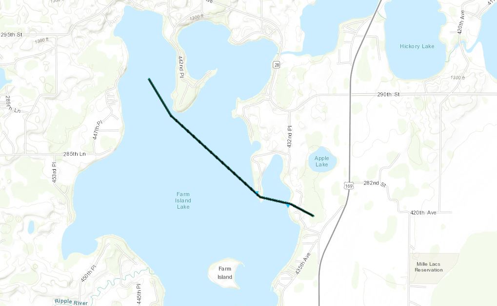
A few weak thunderstorms developed near Lake Mille Lacs the evening of the 26th ahead of a cold front. While the overall threat of severe storms was low, one of the storms did produce a waterspout over Farm Island Lake that did produce damage along the shore. This storm produced additional funnel clouds, but no other waterspouts or tornadoes were reported. |
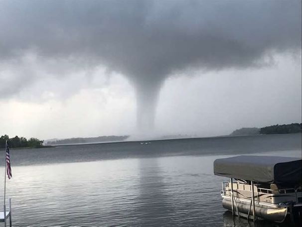
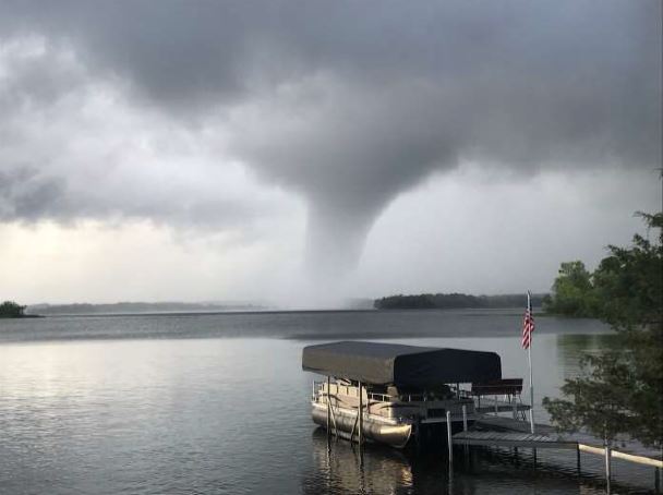 The waterspout from the southeast corner of the lake. (Photo courtesy Tim Meyer) |
Waterspout
|
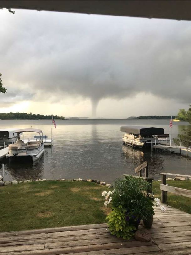
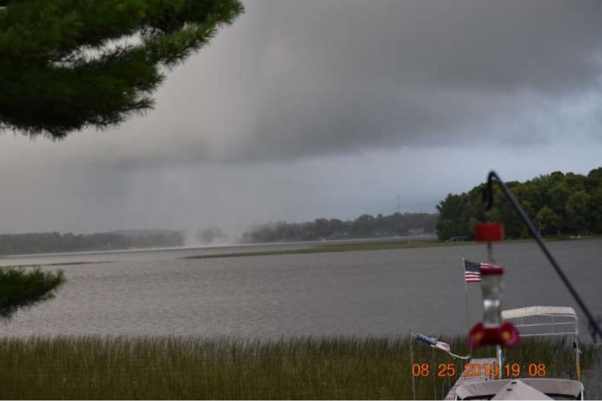
Waterspout - Farm Island Lake, MN
|
||||||||||||||||
|
||||||||||||||||
The Enhanced Fujita (EF) Scale classifies tornadoes into the following categories:
| EF0 Weak 65-85 mph |
EF1 Moderate 86-110 mph |
EF2 Significant 111-135 mph |
EF3 Severe 136-165 mph |
EF4 Extreme 166-200 mph |
EF5 Catastrophic 200+ mph |
 |
|||||
Damage Photos
 |
 |
 |
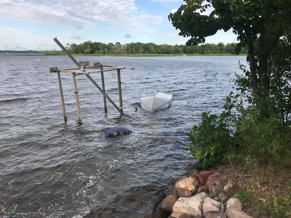 |
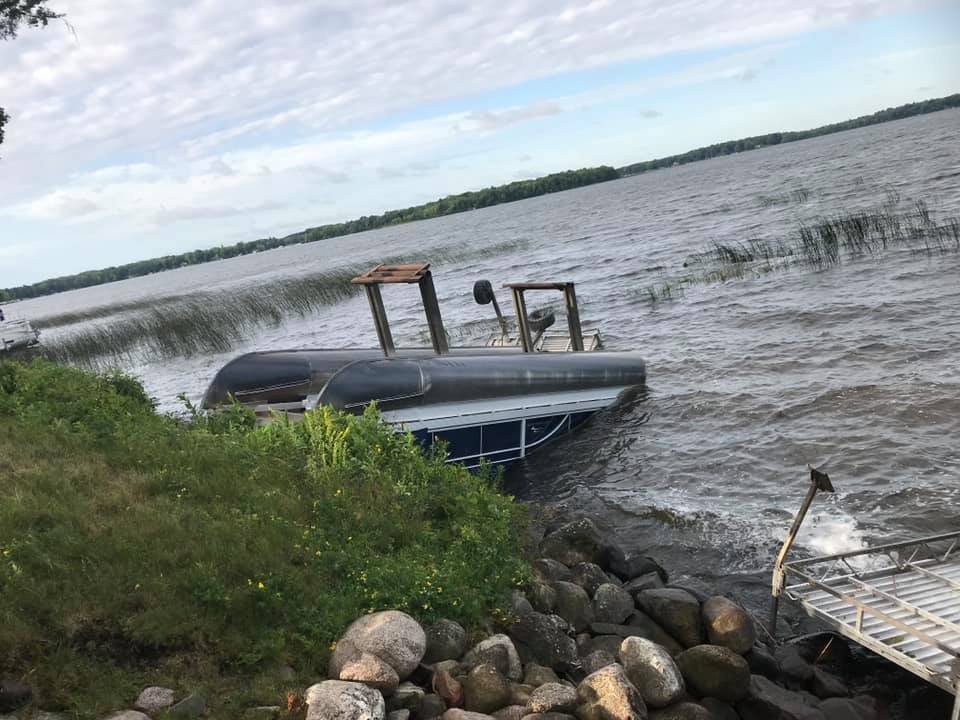
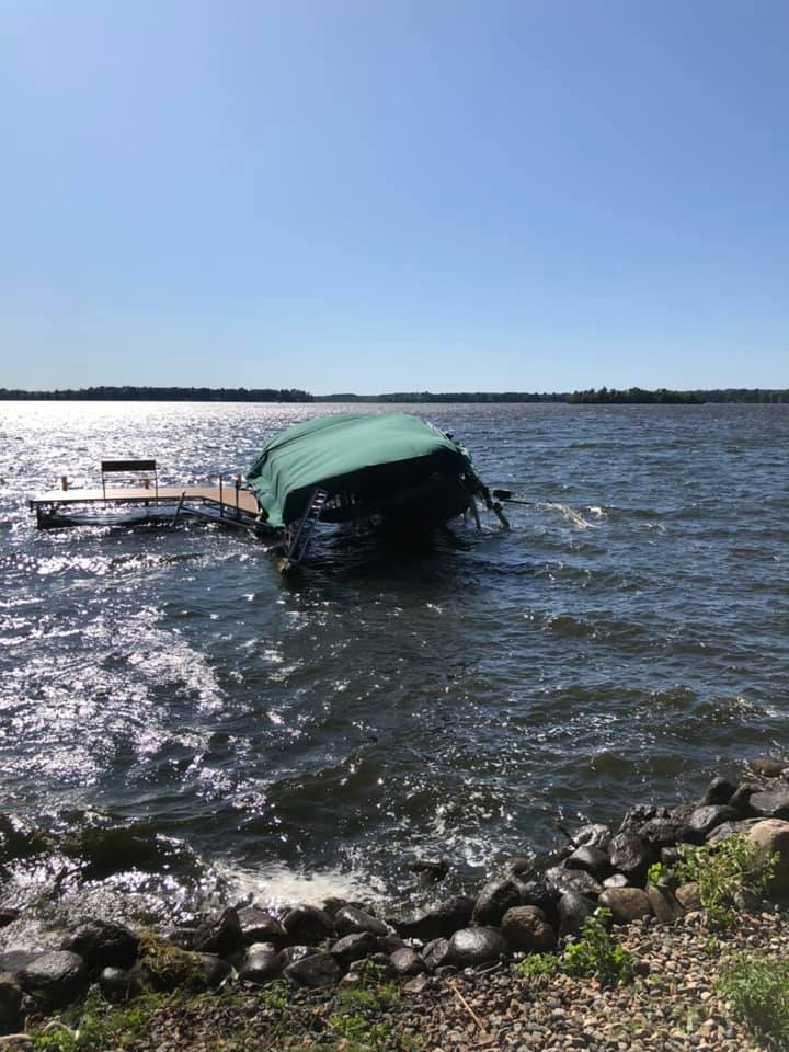
| Damage that occurred where the waterspout moved ashore on the eastern side of the lake. (Jim Hayes) |
Damage that occurred where the waterspout moved ashore on the eastern side of the lake. (Jim Hayes) |
Damage that occurred where the waterspout moved ashore on the eastern side of the lake. (Jim Hayes) |
Damage that occurred where the waterspout moved ashore on the eastern side of the lake. (Jim Hayes) |
 |
Media use of NWS Web News Stories is encouraged! Please acknowledge the NWS as the source of any news information accessed from this site. |
|