
Flash flooding threatens areas from the Tennessee Valley to the Carolinas as storms repeat along a stalled front. Monsoonal storms may trigger flooding in the Southwest. Dangerous heat expands across the Desert Southwest, Plains, mid-Mississippi Valley and Southern Tier. Critical fire weather for interior Pacific Northwest. Cooler, drier air brings brief relief to the Great Lakes and Northeast. Read More >
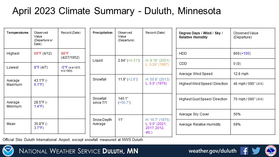
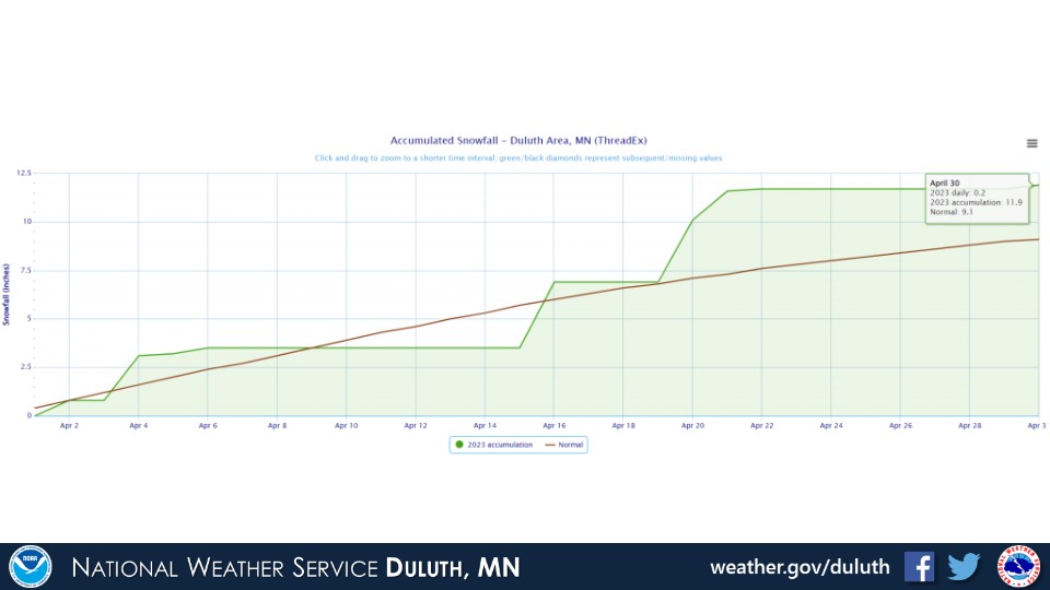
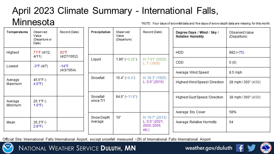
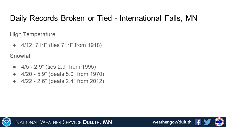
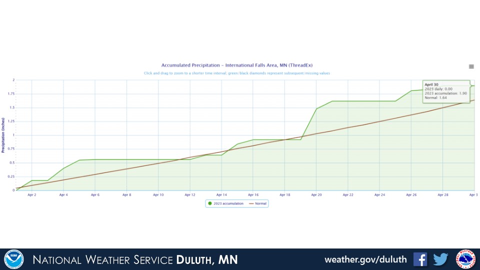
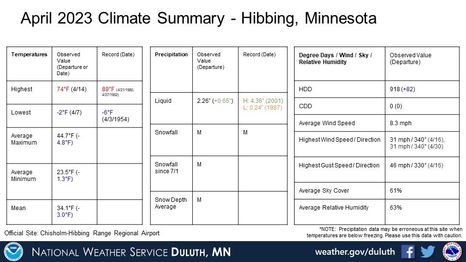
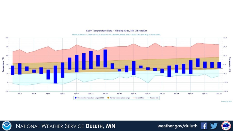
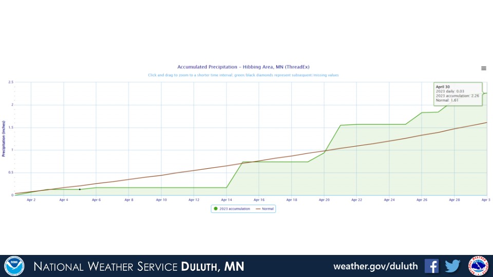
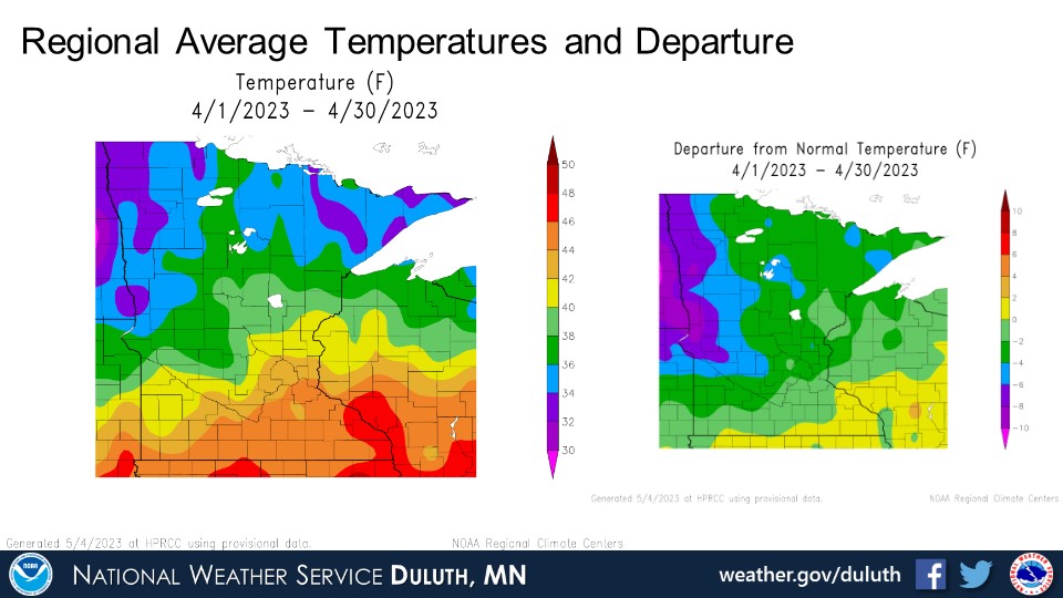
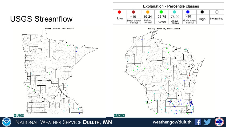
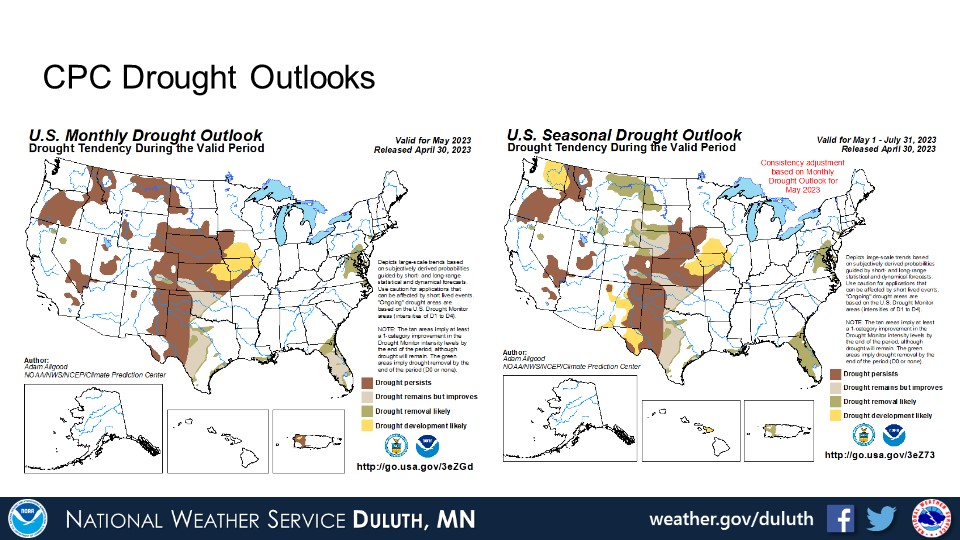
April 2023 was quite eventful weather-wise with temperatures trending a bit below normal and precipitation above normal pretty much everywhere. Within the below normal temperatures was about a week of well above normal temperatures early to mid month, which led to a rapid melt of a very unseasonably high snow pack across the region. This brought widespread minor areal and river/stream flooding with some areas where flooding was more impactful, including (but not limited to) Aitkin, Barnum, Moose Lake, and Clam Lake. More wintry and rainy weather followed this snow melt through the month. Record breaking seasonal snowfalls were set at several locations, including Duluth, with snow that fell in April. With all of the rain and snow, river levels generally remain elevated and drought conditions are pretty much non-existent. Flooding concerns are expected to continue into early May with snow pack still remaining over parts of the North Shore.
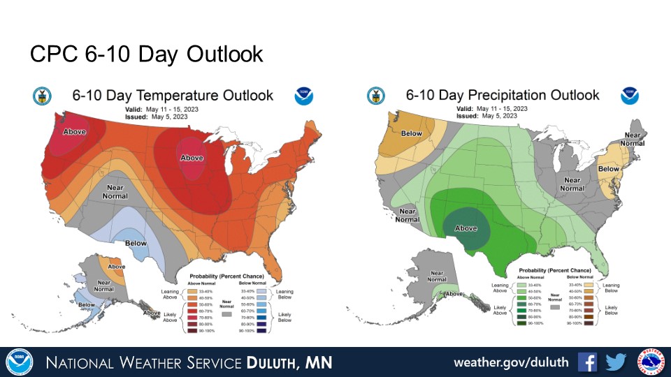
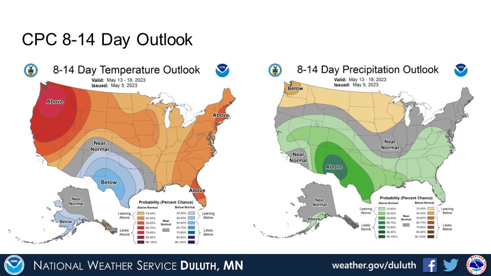
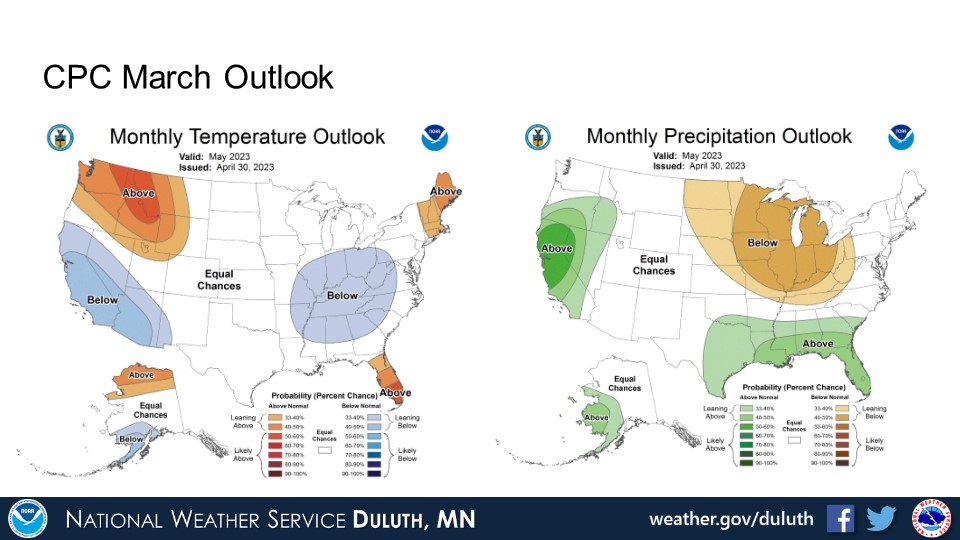
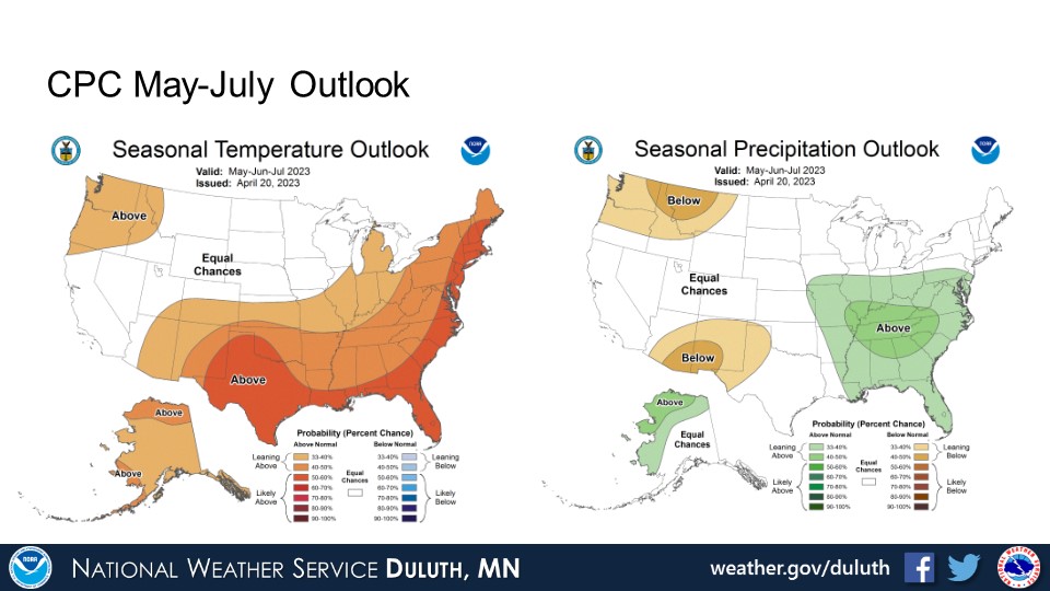
Looking ahead, above average temperatures are expected through May per CPC outlooks. There are no clear signals for above or below average temperatures or precipitation in the 3 month outlooks going into the early summer.
Duluth


International Falls


Hibbing

Brainerd


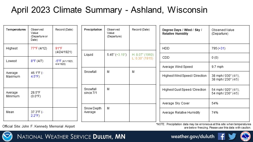
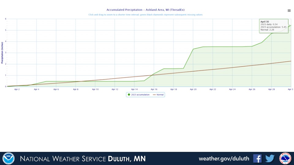
Ashland


Summary

Hydro


Outlook

 |
Media use of NWS Web News Stories is encouraged! Please acknowledge the NWS as the source of any news information accessed from this site. |
|

