Duluth, MN
Weather Forecast Office
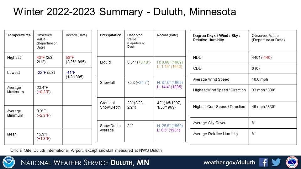
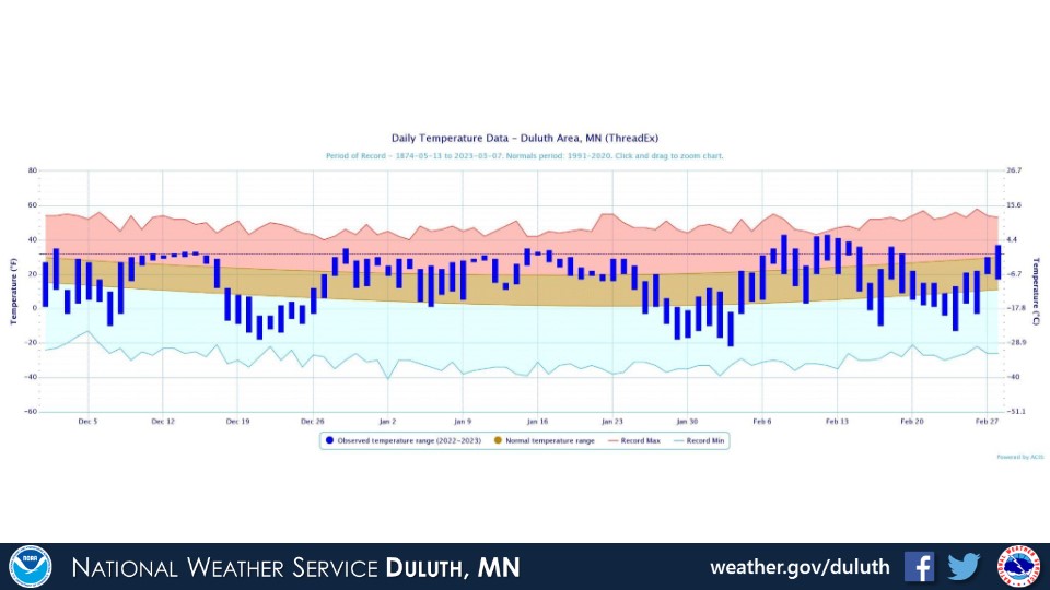
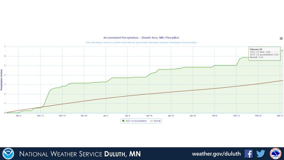
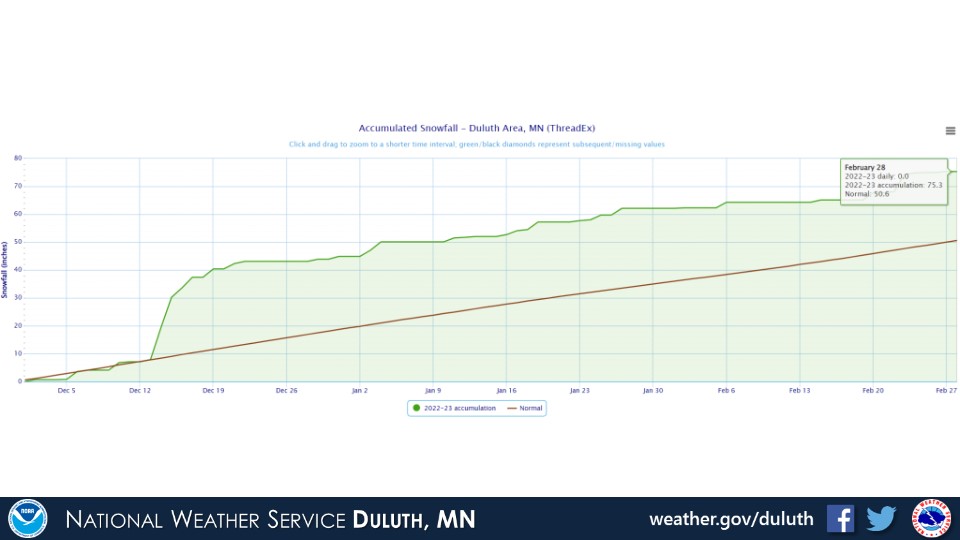
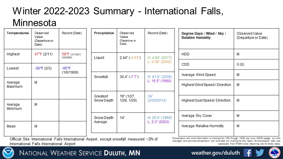
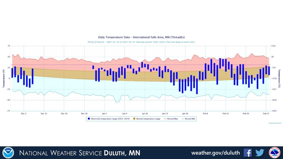
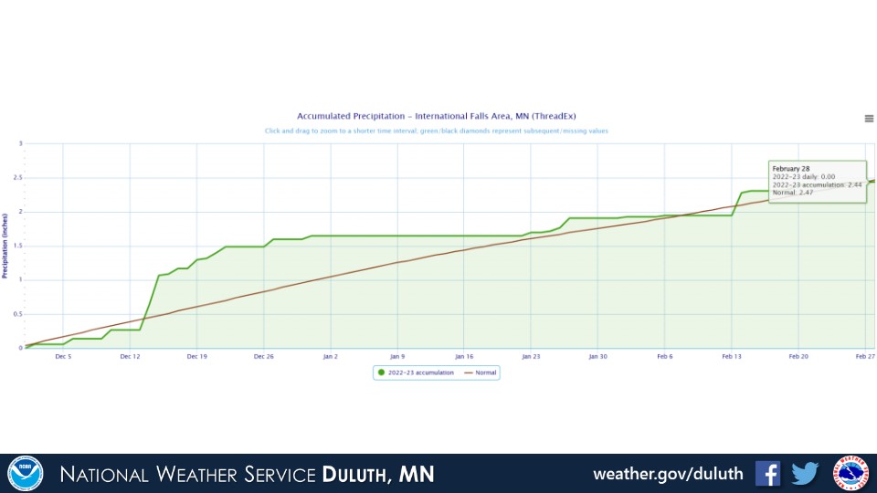
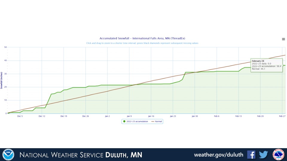
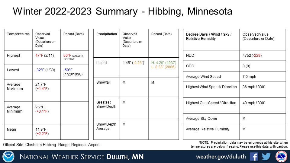
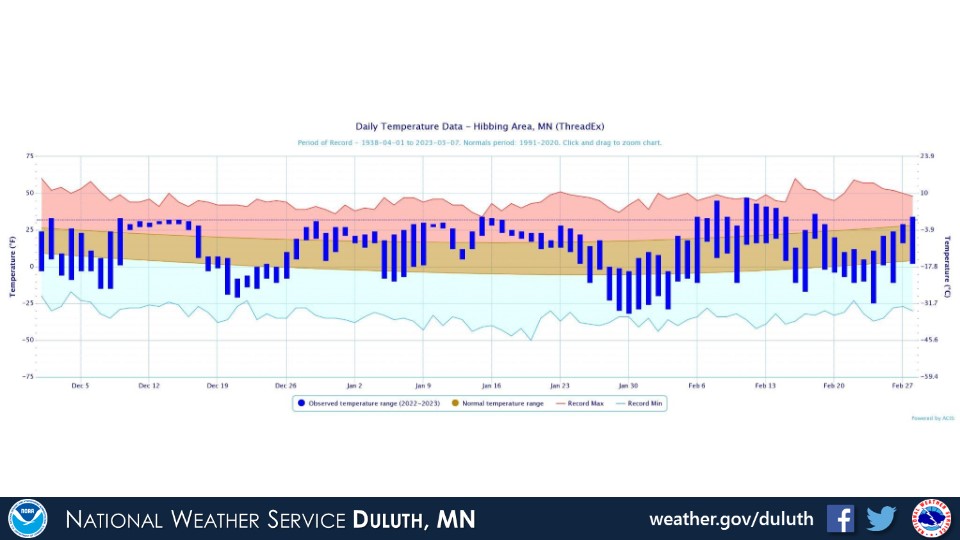
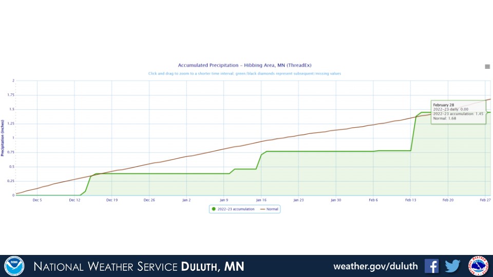
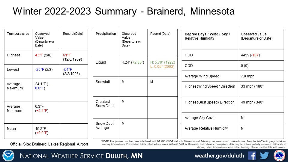
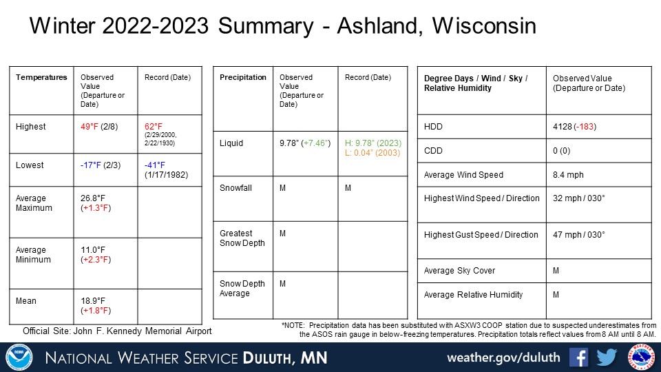
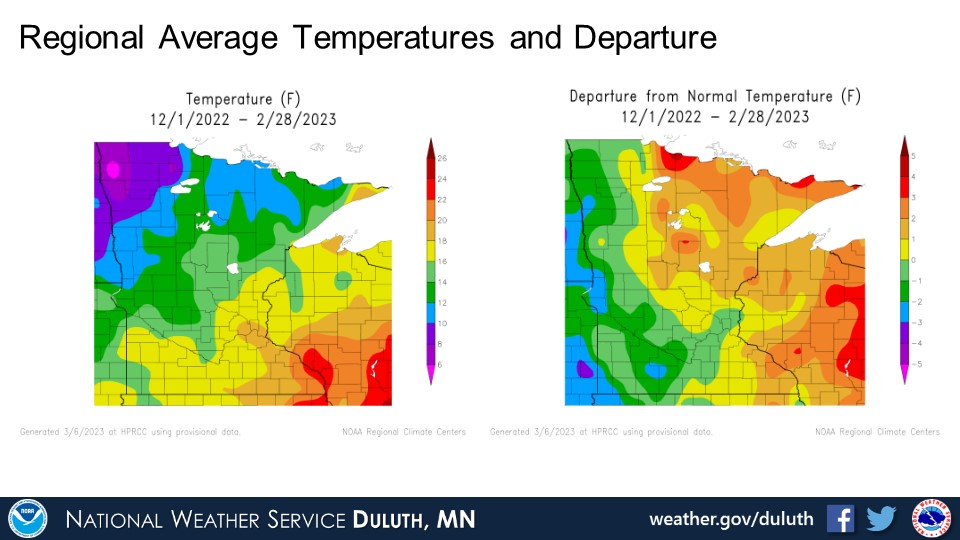
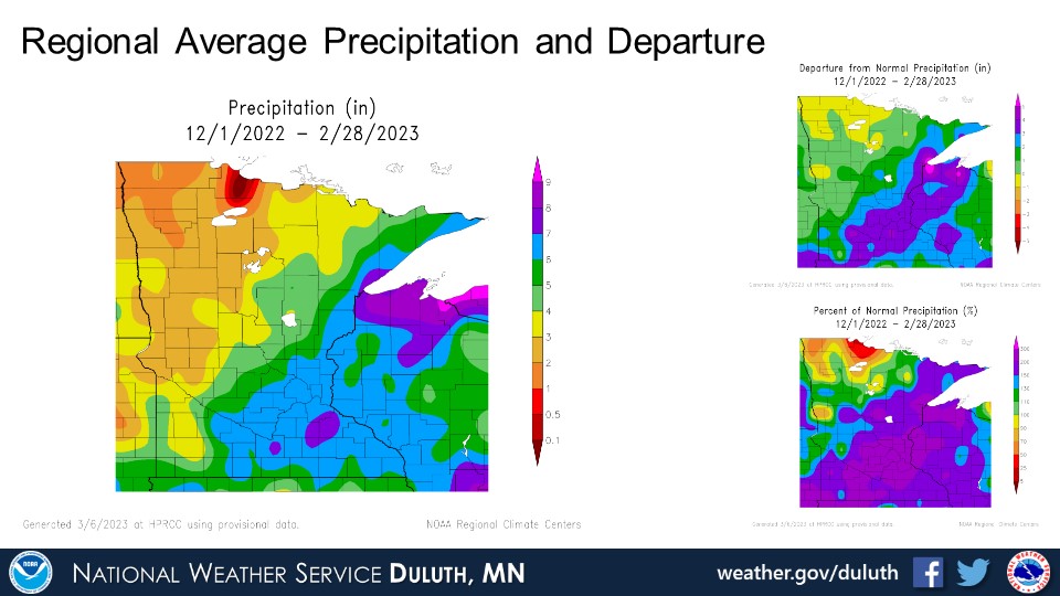
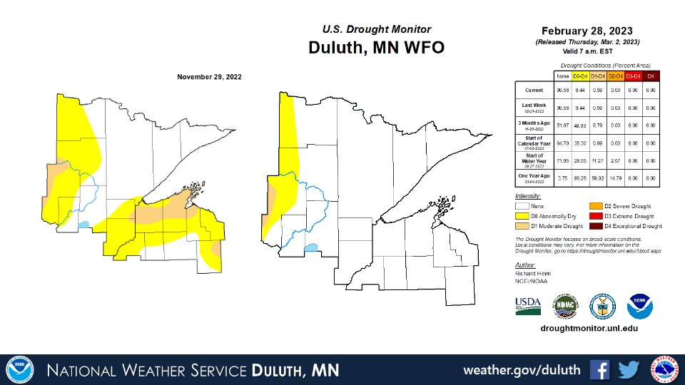
Winter 2022-2023 was warmer than average and with higher precipitation than average overall. The warmer weather was observed region wide with mean temperatures about 1 to 3 degrees above average. Precipitation and snowfall was above average for most places, with an exception being parts of northern Minnesota mainly north and west of the Iron Range. There, snow was a bit below average and precipitation around to slightly below average. For most of the winter, the storm tracks favored northwest Wisconsin and parts of northeast Minnesota, bringing the heavy snows in December and resulting in a monthly record snowfall for Duluth. Additional snow and even some rain fell in January and February. Drought that was previously present especially across Douglas/Bayfield counties has been removed, leaving only a sliver of some abnormally dry to moderate drought conditions in northern and north-central Minnesota.
Duluth
International Falls
Hibbing
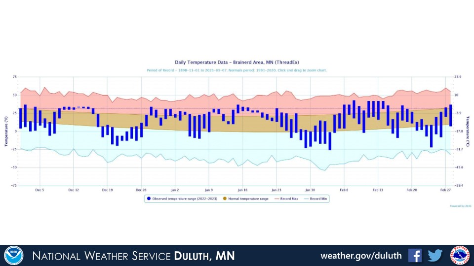
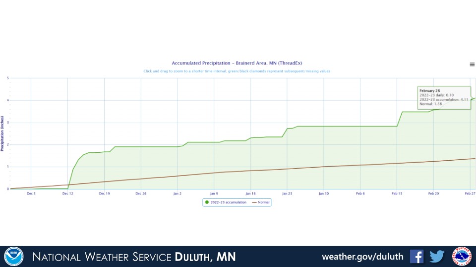
Brainerd
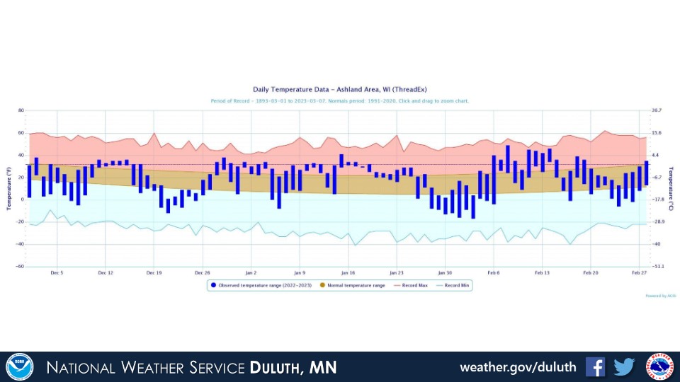
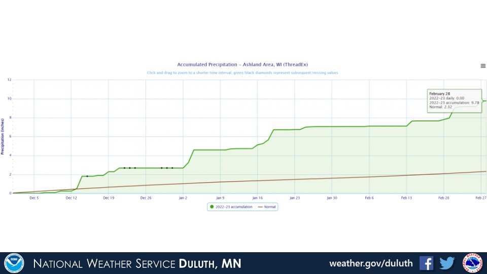
Ashland
Summary
 |
Media use of NWS Web News Stories is encouraged! Please acknowledge the NWS as the source of any news information accessed from this site. |
|
Forecasts
Fire Weather
Great Lakes
Local Text Products
Winter Weather
Local Area Forecasts
Aviation
Marine
Rainy River Basin Page
Current Conditions
Current Observations
Public Information Statements
National Snowfall Map
NOHRSC Snow Analysis
Rain/Snow Reports
Winter Monitor
US Dept of Commerce
National Oceanic and Atmospheric Administration
National Weather Service
Duluth, MN
5027 Miller Trunk Highway
Duluth, MN 55811-1442
218-729-6697 - Duluth; 218-283-4615 - Intl Falls
Comments? Questions? Please Contact Us.

