Overview
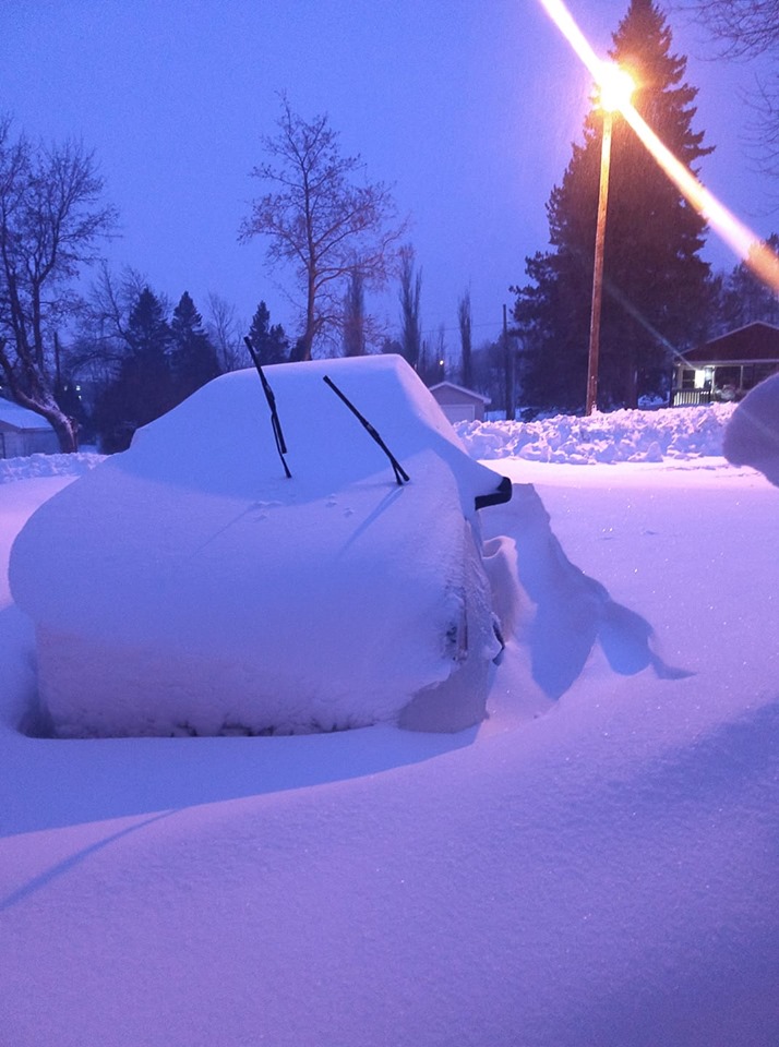
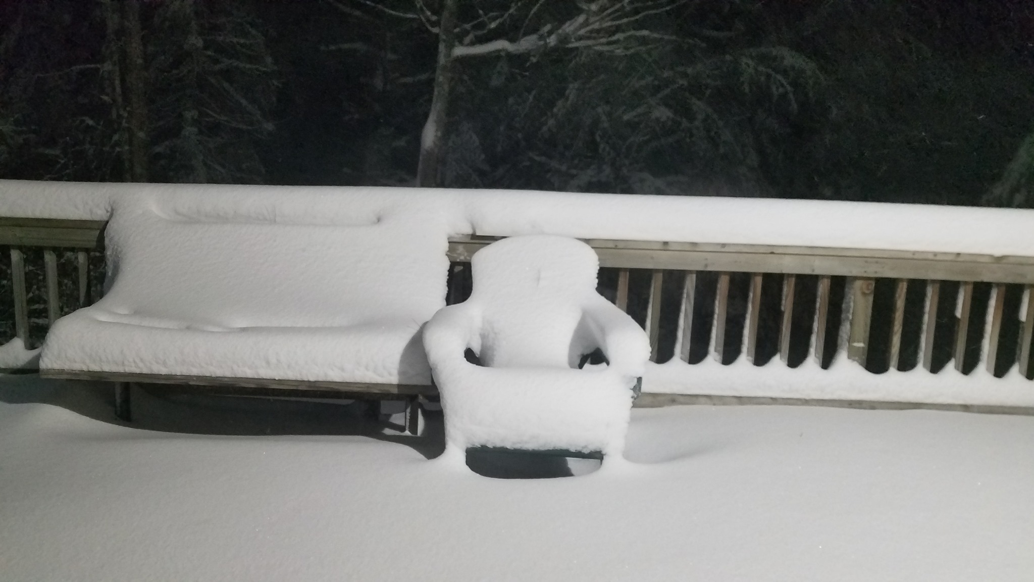
 A prolonged period of heavy snow buried most of the Northland under several inches, and in some cases, around two feet of snow! The snow was driven by a large area of low pressure that slowly progressed from the central Great Plains, over Nebraska, Iowa, and towards the southern Great Lakes region November 30 through December 1, 2019. A persistent, and very strong, easterly flow on the northern side of the low pressure system, helped to generate not only some lake enhanced snow off Lake Superior, but wind gusts between 35 to 45 mph that led to blizzard conditions along the North Shore, including Duluth. Visibilities less than or equal to one quarter of a mile were observed for several hours in Duluth, with numerous vehicles becoming stuck in snow drifts.
In all, 21.7 inches of snow fell in Duluth over the two-day span, which actually broke into the top-10 highest two-day snowfall total in recorded history for Duluth. This particular winter storm placed 9th on that list.
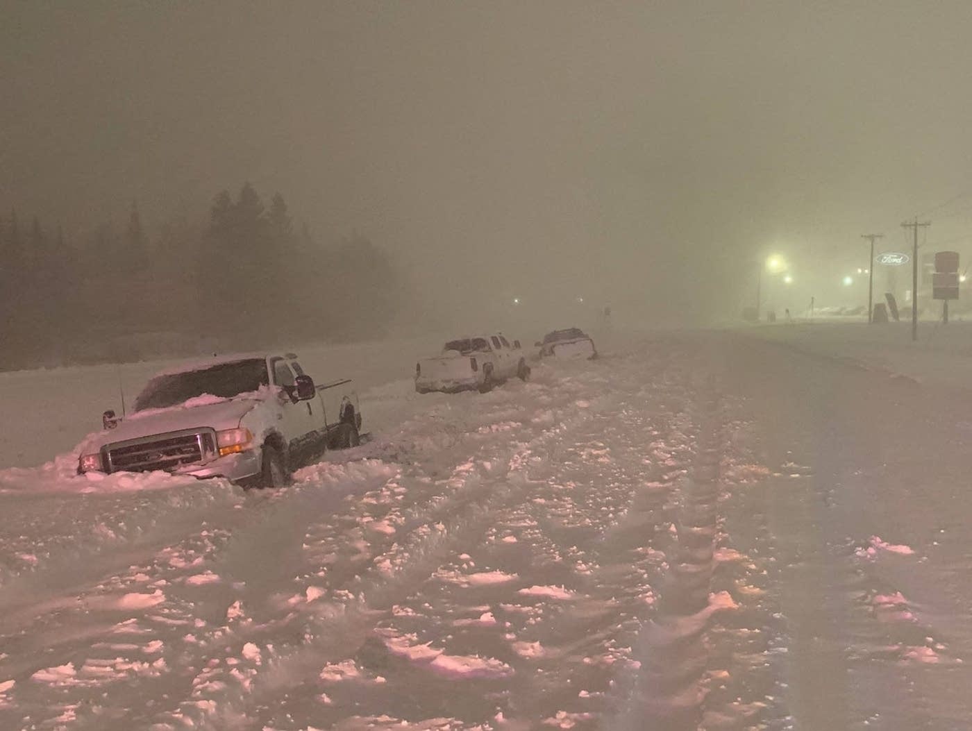
To the right: multiple vehicles stuck in snow drifts along MN Hwy 33 in Cloquet (courtesy of Cloquet Police Dept.).
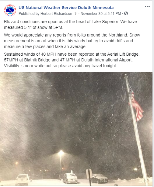
COVERAGE OF THE BLIZZARD:
Duluth News Tribune: Blizzard Timeline: Stories from Before, During, and After the Storm
MPR News: Duluth, Northeast Minnesota, Dig Out from Nearly Two Feet of Snow
Perfect Duluth Day: Thanksgiving Weekend Snowout 2019
MN DNR: The 2019 Thanksgiving Weekend Winter Storm
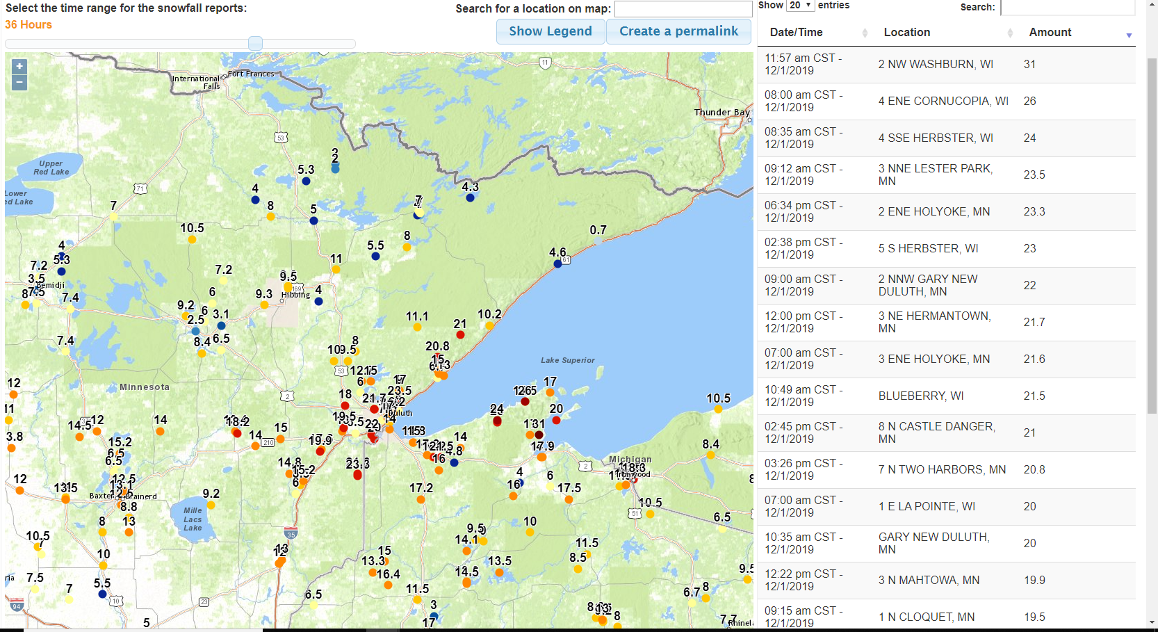
Snowfall Maps
Reports from Across the Northland (click image to enlarge)
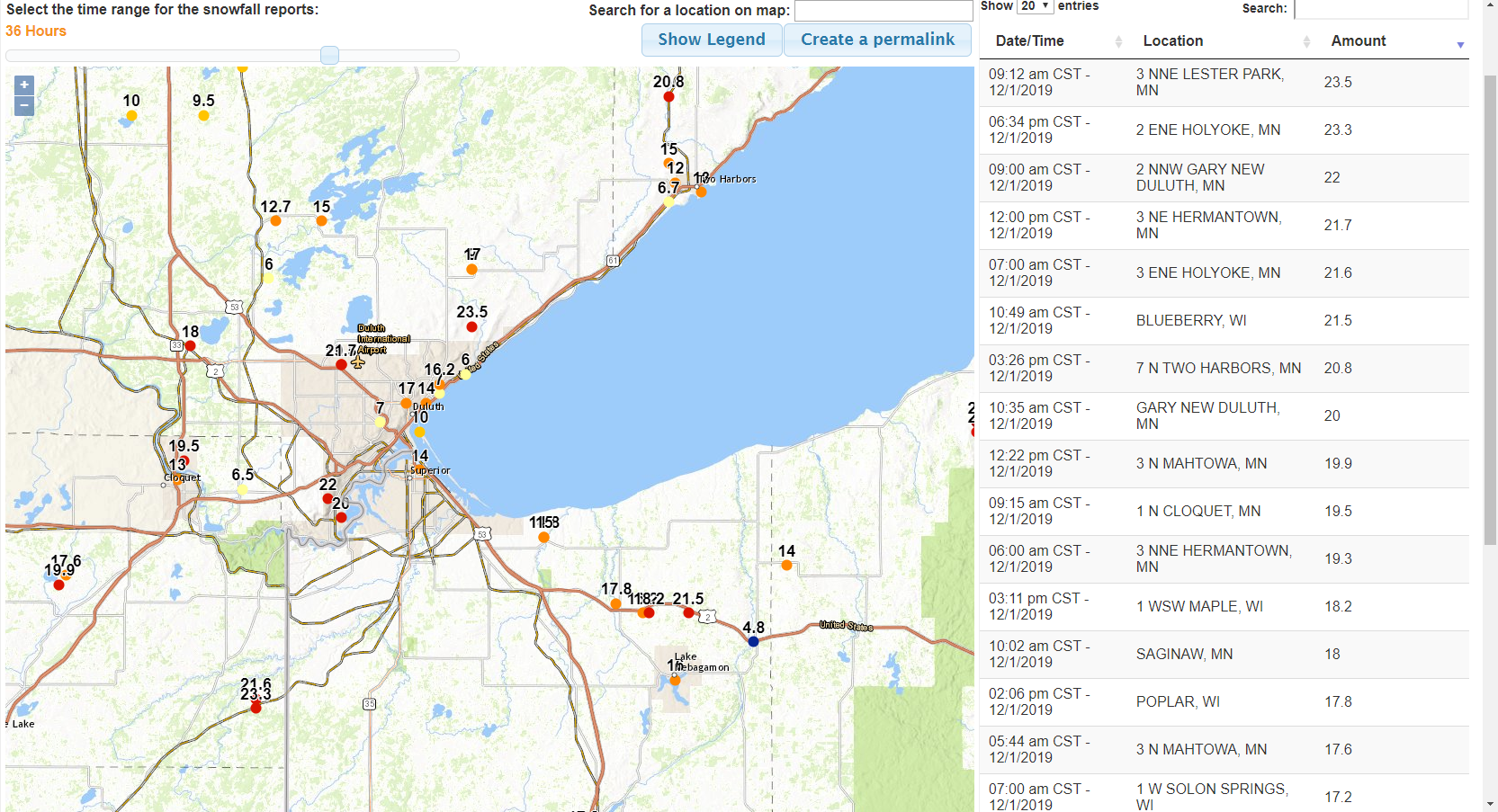
Closer View to the Twin Ports (click image to enlarge)
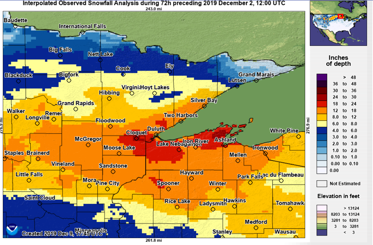
Snowfall Map from the National Operational Hydrologic Remote Sensing Center (NOHRSC) (click to enlarge)
Photos & Video
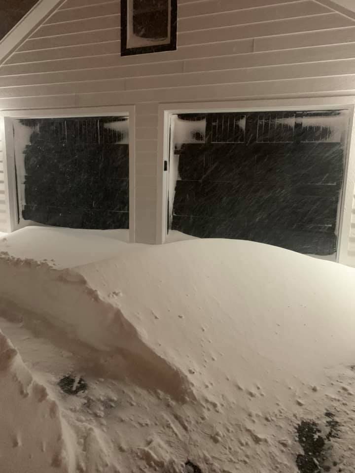 |
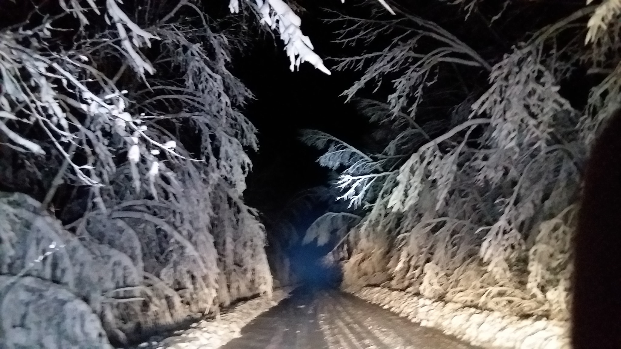 |
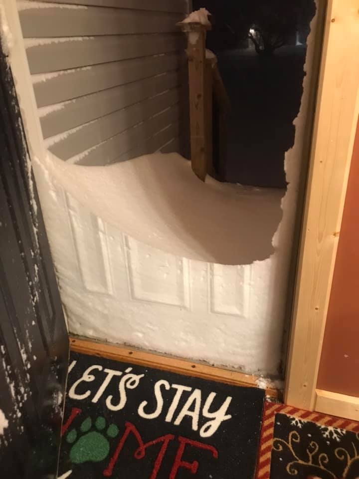 |
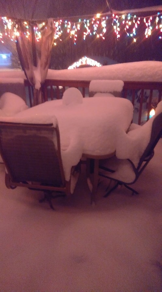 |
|
Duluth Heights (Carla Lysher) |
Birch Hill (Forrest Bates) |
Esko, MN |
McGregor |
 |
 |
 |
|
|
Silver Bay (24" Reported) |
View of Blizzard From NWS Duluth |
~21" of Snow in Duluth |
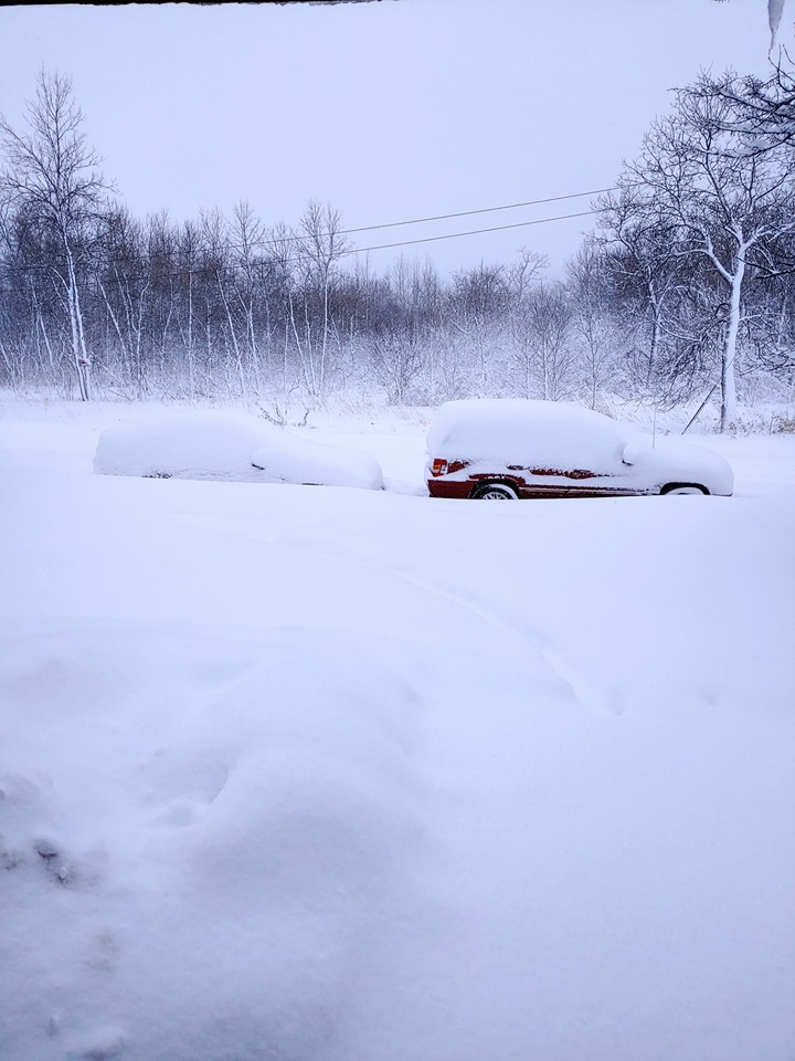
Vehicles Stuck along MN Hwy 33 in Cloquet |
 |
 |
 |
 |
|
3 miles NE of Twig |
Morgan Park, Duluth |
Nisswa, MN (17" Reported) |
Rice Lake, MN |
Radar and Environment
Radar Imagery
| A radar loop of this event will be posted on this page soon. In the meantime, you can view the radar loop at this webpage. |
Environment
 |
 |
 |
 |
|
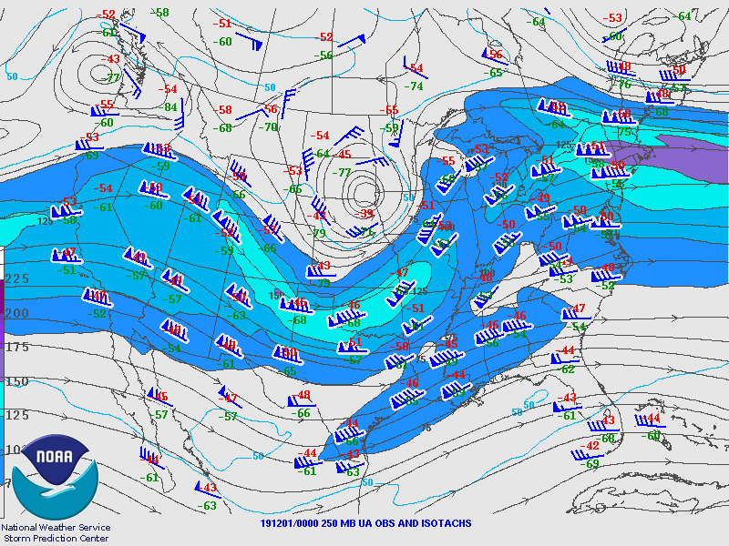
250 mb Map, Valid on November 30, 2019 at 6 AM This shows a broad upper-level trough, based around the Four Corners region. Flow in excess of 130 knots indicates some very strong dynamics aloft to support such a potent system. |
250 mb Map, Valid on November 30, 2019 at 6 PM By this time, the trough continues progressing eastward, with a deepening upper-level low centered over southeast South Dakota. By this time, heavy snow was reported in Duluth and along the South Shore of Lake Superior. |
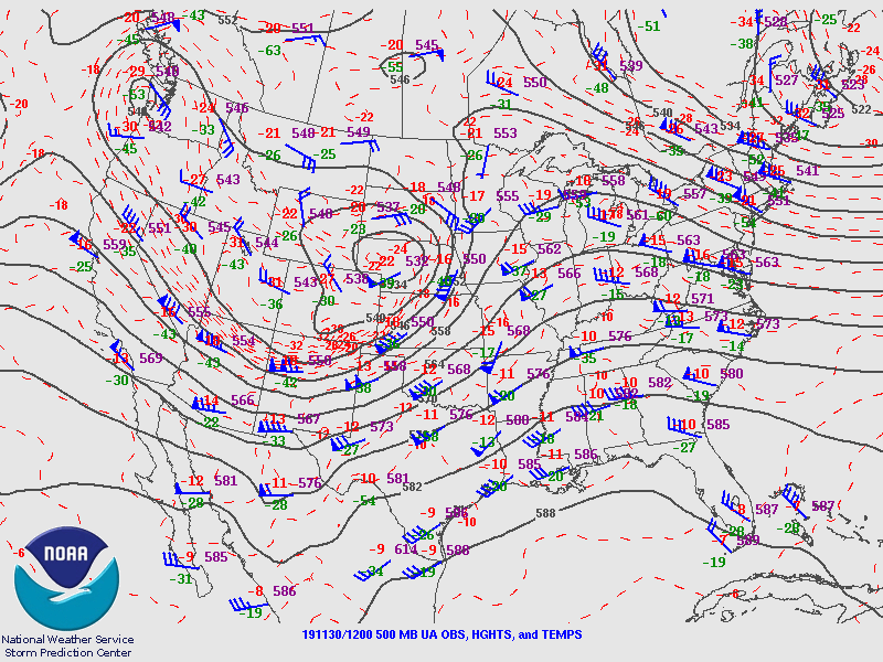
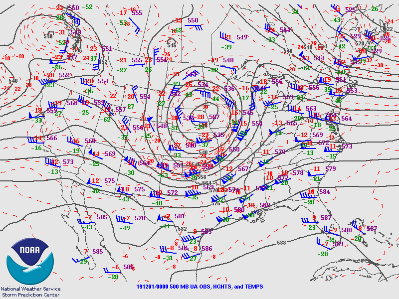
500 mb Map, Valid on November 30, 2019 at 6 AM Very strong flow in excess of 100 knots was observed along the base of the trough, with a deep low pressure center over western Nebraska. |
500 mb Map, Valid on November 30, 2019 at 6 PM The 500 mb low pressure continued to decrease, indicating rapid intensification. Little movement was seen in the low position, only now over the South Dakota, Iowa and Nebraska border. Heavy snow was ongoing in Duluth at this time. |
 |
 |
 |
|
|
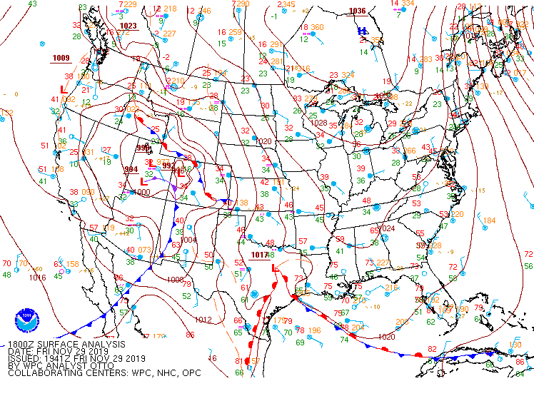
Surface Analysis of the Low Pressure System A Colorado Low formed, and then underwent rapid cyclogenesis, as well as slowed down over Nebraska and Iowa. Ultimately, the low reached a central pressure of 987 mb, along with a very tight pressure gradient along the northern periphery to help support blizzard conditions downwind of Lake Superior. |
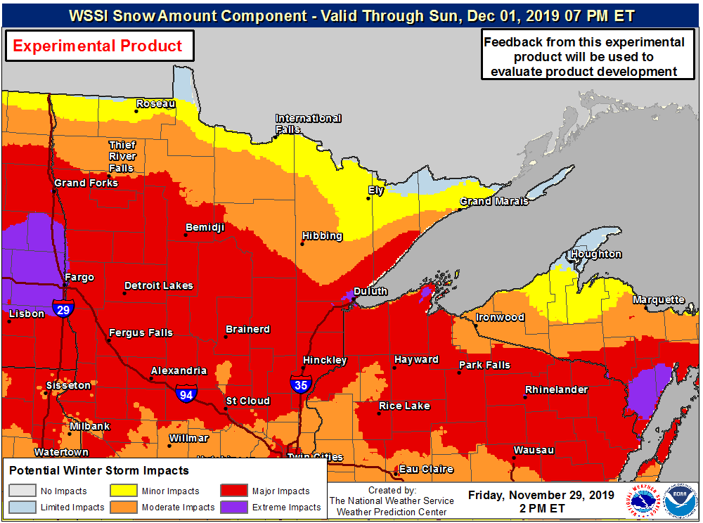
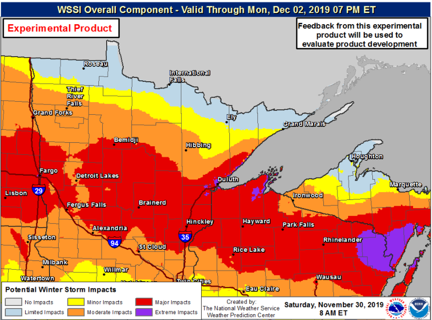
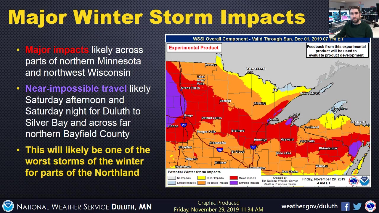
Weather Prediction Center's Weather Weather Severity Index Valid during the early afternoon hours of November 29, 2019. This shows the expected magnitude of impacts to society due to winter weather. The WSSI product did a pretty good job depicting Major Impacts for a large portion of our region, with a few areas of Extreme Impacts in Duluth, as well as the Bayfield Peninsula, where travel was virtually impossible for a time! |
Weather Prediction Center's WSSI Map. Valid for the morning hours of November 30, 2019, the day the event began. You can see the Extreme Impacts around the Twin Ports and Bayfield Peninsula have expanded from the previous map, which better captured the impacts of this event. |
|
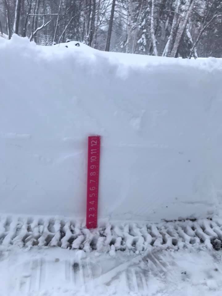
Snowfall Reports
Here is a list of snowfall reports (from highest to lowest):
Public Information Statement
National Weather Service Duluth MN
448 PM CST Sun Dec 1 2019

...SNOWFALL REPORTS FROM 11/30/2019 to 12/1/2019...

Location                     Amount    Time/Date       Lat/Lon
2 NNW Washburn               31.0 in   1157 AM 12/01   46.70N/90.91W
4 ENE Cornucopia             26.0 in   0800 AM 12/01   46.88N/91.02W
4 SSE Herbster               24.0 in   0835 AM 12/01   46.78N/91.24W
Duluth 8.0 NE                23.5 in   0912 AM 12/01   46.88N/92.01W
5 S Herbster                 23.0 in   0238 PM 12/01   46.77N/91.24W
Duluth 7.9 SW                22.0 in   0900 AM 12/01   46.70N/92.23W
NWS Duluth                   21.7 in   1200 PM 12/01   46.84N/92.21W
3 NE Holyoke                 21.6 in   0700 AM 12/01   46.49N/92.34W
Blueberry                    21.5 in   1049 AM 12/01   46.58N/91.68W
8 N Castle Danger            21.0 in   0245 PM 12/01   47.24N/91.53W
7 NNW Two Harbors            20.8 in   0326 PM 12/01   47.12N/91.71W
Gary New Duluth              20.0 in   1035 AM 12/01   46.68N/92.21W
Madeline Island              20.0 in   0700 AM 12/01   46.78N/90.77W
3 N Mahtowa                  19.9 in   1222 PM 12/01   46.61N/92.64W
2 NNE Cloquet                19.5 in   0915 AM 12/01   46.74N/92.45W
5 SSE Libby                  18.2 in   0942 AM 12/01   46.71N/93.29W
1 WSW Maple                  18.2 in   0311 PM 12/01   46.58N/91.74W
Saginaw                      18.0 in   1002 AM 12/01   46.86N/92.44W
Ashland                      17.9 in   0151 PM 12/01   46.58N/90.88W
Poplar                       17.8 in   0206 PM 12/01   46.59N/91.79W
2 NNW Mellen                 17.5 in   1243 PM 12/01   46.35N/90.67W
Solon Springs 1.2 W          17.2 in   0700 AM 12/01   46.35N/91.84W
Duluth 1.4 NNW               17.0 in   0800 AM 12/01   46.80N/92.11W
6 ENE Rice Lake              17.0 in   0753 AM 12/01   46.94N/92.01W
3 E Sand Bay                 17.0 in   0730 AM 12/01   46.93N/90.82W
Gile                         16.6 in   1122 AM 12/01   46.43N/90.22W
Spooner 10.6 WNW             16.4 in   0830 AM 12/01   45.88N/92.10W
Duluth 3.0 NE                16.2 in   0600 AM 12/01   46.82N/92.06W
Poplar 2.0 E                 16.2 in   0700 AM 12/01   46.58N/91.75W
Grand View                   16.0 in   0220 PM 12/01   46.37N/91.11W
1 NNW Lake Nebagamon         16.0 in   0711 AM 12/01   46.51N/91.70W
Breezy Point                 15.2 in   0105 PM 12/01   46.60N/94.22W
Moose Lake                   15.2 in   0102 PM 12/01   46.45N/92.77W
Duluth 15.4 NNW              15.0 in   0700 AM 12/01   46.99N/92.24W
Oulu                         15.0 in   1100 AM 12/01   46.63N/91.53W
7 ESE Superior               15.0 in   0130 PM 12/01   46.66N/91.90W
Two Harbors 2.1 NW           15.0 in   0700 AM 12/01   47.05N/91.71W
3 E Wright                   15.0 in   0600 AM 12/01   46.68N/92.95W
4 N Amnicon Falls S.P.       14.8 in   0950 AM 12/01   46.66N/91.90W
Kettle River                 14.8 in   0145 PM 12/01   46.49N/92.88W
4 WSW Northwoods Beach       14.5 in   0340 PM 12/01   45.89N/91.48W
7 WSW Pine River             14.5 in   0142 PM 12/01   46.69N/94.54W
2 NE Duluth                  14.0 in   0324 PM 12/01   46.80N/92.08W
1 N Superior                 14.0 in   0307 PM 12/01   46.73N/92.09W
Moose Lake                   13.5 in   0610 AM 12/01   46.45N/92.77W
1 N Motley                   13.5 in   1205 PM 12/01   46.35N/94.65W
4 NNW New Post               13.5 in   0300 PM 12/01   45.95N/91.22W
4 WSW Northwoods Beach       13.3 in   1020 AM 12/01   45.90N/91.48W
Oakland 9.0 ENE              13.3 in   0700 AM 12/01   45.95N/92.22W
Brainerd 1.4 NNW             13.1 in   0900 AM 12/01   46.37N/94.21W
Hinckley                     13.0 in   0913 AM 12/01   46.02N/92.94W
6 SE Saint Mathias           13.0 in   1245 PM 12/01   46.17N/94.15W
Two Harbors                  13.0 in   0700 AM 12/01   47.02N/91.66W
2 ENE Barrows                12.5 in   0748 AM 12/01   46.32N/94.21W
3 N Brainerd                 12.5 in   1130 AM 12/01   46.40N/94.19W
2 SW Hinckley                12.0 in   0125 PM 12/01   46.00N/92.96W
Pine River                   12.0 in   1004 AM 12/01   46.72N/94.40W
1 W Two Harbors              12.0 in   1023 AM 12/01   47.03N/91.70W
Butternut 3 N                11.5 in   0600 AM 12/01   46.05N/90.53W
Pence 0.1 E                  11.5 in   0700 AM 12/01   46.42N/90.27W
6 SE Saint Mathias           11.5 in   0830 AM 12/01   46.17N/94.15W
2.0 SE Spooner               11.5 in   0800 AM 12/01   45.80N/91.87W
4 N Hayward                  11.2 in   0700 AM 12/01   46.07N/91.48W
4 N Hayward                  11.2 in   0712 AM 12/01   46.07N/91.48W
Brimson                      11.1 in   0832 AM 12/01   47.28N/91.87W
4 SE Britt                   11.0 in   0947 AM 12/01   47.59N/92.51W
Bigfork                      10.5 in   0830 AM 12/01   47.75N/93.65W
Mercer 7.0 NNE               10.5 in   0700 AM 12/01   46.27N/90.03W
1 W Silver Bay               10.2 in   0937 AM 12/01   47.29N/91.30W
Clam Lake 4W                 10.0 in   0745 AM 12/01   46.17N/90.98W
3 E Payne                    10.0 in   0840 AM 12/01   47.10N/92.53W
1 WNW Chisholm               9.5 in    0745 AM 12/01   47.49N/92.89W
Canyon 4.6 NNE               9.5 in    0800 AM 12/01   47.10N/92.42W
Hayward 9.2 NNE              9.5 in    0600 AM 12/01   46.13N/91.41W
Keewatin 0.2 SSE             9.3 in    0800 AM 12/01   47.40N/93.08W
Cohasset 7.6 NNW             9.2 in    0800 AM 12/01   47.34N/93.70W
12 N Isle                    9.2 in    0800 AM 12/01   46.32N/93.50W
Phillips 1.3 S               9.2 in    0600 AM 12/01   45.68N/90.40W
Hayward 9.7 NE               9.0 in    0800 AM 12/01   46.12N/91.35W
7 WSW Pine River             9.0 in    0750 AM 12/01   46.69N/94.54W
Brainerd 7.7 SSE             8.8 in    0700 AM 12/01   46.25N/94.15W
1 NW Chisholm                8.8 in    0740 AM 12/01   47.50N/92.89W
3 W Phillips                 8.8 in    0750 AM 12/01   45.70N/90.46W
Phillips 0.4 SSW             8.5 in    0700 AM 12/01   45.69N/90.40W
Grand Rapids 6.2 SSW         8.4 in    0600 AM 12/01   47.14N/93.57W
Babbitt                      8.0 in    0700 AM 12/01   47.71N/91.95W
Celina 2 E                   8.0 in    1000 AM 12/01   47.87N/93.03W
Cotton 5.7 ESE               8.0 in    0800 AM 12/01   47.15N/92.36W
6 ESE Phillips               8.0 in    0851 AM 12/01   45.65N/90.29W
Cass Lake                    7.4 in    0800 AM 12/01   47.38N/94.61W
Bovey 15.9 N                 7.2 in    0700 AM 12/01   47.53N/93.40W
1 S Ely                      7.0 in    0816 AM 12/01   47.89N/91.85W
Ely                          7.0 in    0240 PM 12/01   47.90N/91.86W
Northome                     7.0 in    0755 AM 12/01   47.87N/94.27W
Grantsburg 0.6 SSW           6.5 in    0800 AM 12/01   45.77N/92.69W
6 SE La Prairie              6.5 in    1115 AM 12/01   47.16N/93.42W
4 NE Nisswa                  6.5 in    0843 AM 12/01   46.54N/94.25W
3 NE Nisswa                  6.5 in    0700 AM 12/01   46.50N/94.27W
8 NNW Coleraine              6.0 in    0816 AM 12/01   47.41N/93.49W
1 WSW Ely                    6.0 in    0812 AM 12/01   47.90N/91.86W
Grand Rapids 6.1 N           6.0 in    0700 AM 12/01   47.31N/93.55W

Observations are collected from a variety of sources with varying
equipment and exposures. We thank all volunteer weather observers
for their dedication. Not all data listed are considered official.

Snow totals listed above may not all be storm total amounts.
Forecasts
Here is a look at the progression of our forecasts, as well as notable social media content from this storm:
Facebook Live video at 1130 AM Friday, November 29, 2019: https://www.facebook.com/100067209588257/videos/2557804344254948
Placeholder
 |
Media use of NWS Web News Stories is encouraged! Please acknowledge the NWS as the source of any news information accessed from this site. |
|

