Snowy and Windy Start to 2012
Overview
|
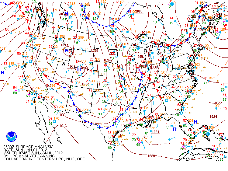
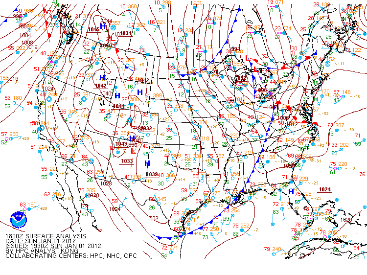
A trough of low pressure associated with a deepening low pressure center lifting across Iowa and into Wisconsin, brought a mix of icy conditions and snow to the Northland New Year's Eve. As the low pressure system departed to the east over the eastern Great Lakes New Year's Day 2012, it brought strong northwest winds gusting around 40 mph. The strong winds also resulted in a cool start to 2012 with temperatures falling into the teens through the afternoon. |
 January 1 Snow Map |
Snowfall Reports
287
NOUS43 KDLH 012258
PNSDLH

PRELIMINARY LOCAL STORM REPORT...SUMMARY
NATIONAL WEATHER SERVICE DULUTH MN
458 PM CST SUN JAN 01 2012

THE TOTALS BELOW ARE SEPARATED INTO SNOW...AND ICE AND SLEET
CATEGORIES...THEN BY AMOUNT...AND ARE NOT NECESSARILY THE FINAL
AMOUNT FOR EACH LOCATION. THANK YOU FOR YOUR REPORTS.


SNOW REPORTS LISTED BY AMOUNT

 INCHES  LOCATION                 ST  COUNTY           TIME
 ------  -----------------------  --  --------------   -------
  6.00   EXELAND                  WI  SAWYER           0730 AM
                 REPORT RELAYED FROM THE NWS MPX OFFICE.
  6.00   PARK FALLS               WI  PRICE            0611 AM
  5.50   GILE                     WI  IRON             0412 PM
                 STILL SNOWING.
  5.00   3 N BUTTERNUT            WI  ASHLAND          0631 AM
  4.80   5 SW BUTTERNUT           WI  PRICE            1008 AM
                 SNOW DEPTH 9 INCHES.
  4.80   3 W PHILLIPS             WI  PRICE            0755 AM
  4.50   8 S HAYWARD              WI  SAWYER           0334 PM
                 SIGNIFICANT BLOWING SNOW THIS AFTERNOON.
  4.50   UPSON                    WI  IRON             0930 AM
  4.00   SAXON                    WI  IRON             0308 PM
  4.00   9 NNE HAYWARD            WI  SAWYER           1008 AM
  4.00   WINTER                   WI  SAWYER           1002 AM
  4.00   CORNUCOPIA               WI  BAYFIELD         0744 AM
  4.00   6 SW CABLE               WI  SAWYER           0515 AM
                 REPORT FROM SEELEY. 8 INCHES SNOW DEPTH.
  3.90   6 W HAYWARD              WI  WASHBURN         0723 AM
  3.70   SSW GRANTSBURG           WI  BURNETT          1008 AM
  3.50   18 SW MELLEN             WI  ASHLAND          1008 AM
                 SNOW DEPTH 8 INCHES.
  3.50   CLAM LAKE                WI  ASHLAND          0949 AM
  3.50   OULU                     WI  BAYFIELD         0936 AM
  3.50   WEBB LAKE                WI  BURNETT          0731 AM
  3.50   4 N GRANTSBURG           WI  BURNETT          0516 AM
  3.50   HERTEL                   WI  BURNETT          0445 PM
  3.40   2 NW STONE LAKE          WI  WASHBURN         1008 AM
  3.00   BENNETT                  WI  DOUGLAS          0808 AM
  3.00   4 NE CLOVERLAND          WI  DOUGLAS          0723 AM
  3.00   SARONA                   WI  WASHBURN         0515 AM
                 SNOW DEPTH 5 INCHES.
  3.00   5 S HERBSTER             WI  BAYFIELD         0315 AM
  3.00   SOUTH RANGE              WI  DOUGLAS          0455 PM
  2.90   ASHLAND                  WI  ASHLAND          0510 AM
  2.80   MADELINE ISLAND          WI  ASHLAND          0949 AM
  2.80   MAPLE                    WI  DOUGLAS          0841 AM
  2.70   3 W BAYFIELD             WI  BAYFIELD         1215 AM
  2.50   3 E ORR                  MN  ST. LOUIS        0631 AM
  2.10   6 NW BRAINERD            MN  CROW WING        1008 AM
  2.00   TOGO                     MN  ITASCA           0949 AM
  2.00   CARLTON                  MN  CARLTON          0853 AM
  2.00   ASKOV                    MN  PINE             0829 AM
  2.00   COOK                     MN  ST. LOUIS        0800 AM
  1.80   ESKO                     MN  CARLTON          0739 AM
  1.50   10 NW GUNFLINT LAKE      MN  COOK             0940 AM
  1.50   SILVER BAY               MN  LAKE             0802 AM
  1.30   6 W TWO HARBORS          MN  ST. LOUIS        0820 AM
  1.30   5 SW BRUNO               MN  PINE             0435 PM
                 4 INCHES TOTAL OVER 2 DAYS...
  1.20   ILLGEN CITY              MN  LAKE             0748 AM
  1.00   INTERNATIONAL FALLS      MN  KOOCHICHING      1014 AM
  1.00   5 NW DULUTH              MN  ST. LOUIS        1014 AM
                 MEASURED AT THE NATIONAL WEATHER SERVICE
                 OFFICE IN DULUTH.
  1.00   3 WNW TWO HARBORS        MN  LAKE             1008 AM
  1.00   ELY                      MN  ST. LOUIS        1000 AM
  1.00   DULUTH                   MN  ST. LOUIS        0637 AM
                 REPORT FROM RICE LAKE TOWNSHIP.
  1.00   PROCTOR                  MN  ST. LOUIS        1205 AM
  0.90   LUTSEN                   MN  COOK             0745 AM
  0.80   2 S TOWER                MN  ST. LOUIS        0949 AM
  0.70   ISLAND LAKE              MN  ST. LOUIS        0949 AM
  0.50   DIXON LAKE               MN  ITASCA           0949 AM
  0.50   EMBARRASS                MN  ST. LOUIS        0631 AM
  0.40   4 S BRUNO                MN  PINE             0828 AM
  0.30   15 N GRAND RAPIDS        MN  ITASCA           0818 AM

$$
Wind Reports
| Peak Wind Gusts | |
|
Radar
 |
 |
 |
 |
| 4PM Dec 31st, 2011 | 6PM Dec 31st, 2011 | 8PM Dec 31st, 2011 | 10PM Dec 31st, 2011 |
 |
 |
 |
 |
| 12AM Jan 1st, 2012 | 2AM Jan 1st, 2012 | 8AM Jan 1st, 2012 | 12PM Jan 1st, 2012 |
Environment
Surface Maps/METAR Plots
 |
 |
 |
| 12PM Dec 31st, 2011 | 3PM Dec 31st, 2011 | 6PM Dec 31st, 2011 |
 |
 |
 |
| 9PM Dec 31st, 2011 | 12AM Jan 1st, 2012 | 3AM Jan 1st, 2012 |
 |
 |
 |
| 8AM Jan 1st, 2012 | 12PM Jan 1st, 2012 | 4PM Jan 1st, 2012 |
 |
Media use of NWS Web News Stories is encouraged! Please acknowledge the NWS as the source of any news information accessed from this site. |
|

