
A cold front lingering over Florida will continue to bring showers and thunderstorms to the state and a flash flooding threat to the east coast over the next couple of days. Fire weather concerns are expected in portions of the Florida panhandle into southeastern Georgia. A Kona Low is expected to bring strong winds, widespread heavy rainfall, and flooding concerns to Hawaii through the weekend. Read More >
Floods due to heavy rainfall, not associated with tropical cyclones, have been one of the greatest threats to lives and property in South Texas for years. In order to aid forecasters with predicting such events, pattern recognition maps depicting several synoptic scale meteorological variables were created. 24-hour observed rainfall amounts of three-inches or greater for the Corpus Christi (43 stations), Victoria (40 stations), and Laredo (32 stations) TX areas between 1/1/1979 and 7/31/2016 were considered. This period was chosen to coincide with the six "satellite-era" reanalysis datasets used in this study.
An event was defined as having two or more stations (e.g., multicity) within the same area (e.g., Victoria) on the same day observe three or more inches of rain and/or if at least one station within the same area experienced three inches or more of 24-hour rainfall on consecutive days. Corpus Christi, Victoria, and Laredo TX observed 47, 52, and 11 such events between 9/19/1979 and 5/16/2016. Reanalysis data was processed using NOAA Weather and Climate Toolkit, ArcGIS, and Python scripts. An analysis time of ± 30 minutes of 1200 UTC was used.
| Dataset | Source | Initial Resolution | Final Resolution |
|---|---|---|---|
| Climate Forecast System Reanalysis (CFSR) | NCEP's CFS Version 1 | T382 (˜ 38 km), 64 levels | 0.36° x 0.36° |
| Climate Forecast System Reanalysis (CFSv2) | NCEP's CFS Version 2 | T574 (˜ 27 km), 64 levels | 0.36° x 0.36° |
| Modern-Era Retrospective Analysis for Research and Applications (MERRA) | NASA's GEOS-5 Model | 2/3° longitude x 0.5° latitude, 72 levels | 5/8° x 5/8° |
| Modern-Era Retrospective Analysis for Research and Applications (MERRA-2) | NASA's GEOS-5 Model | 5/8° longitude x 0.5° latitude, 72 levels | 5/8° x 5/8° |
| ECMWF Interim Reanalysis (ERA-Interim) | ECMWF's IFS Version Cy31r2 | T255 (˜ 80 km), 60 levels | 0.36° x 0.36° |
| Japanese 55-year Reanalysis (JRA-55) | Japan Meteorological Agency's GSM Model (12/09) | T319 (˜ 55 km), 60 levels | 1.25° x 1.25° |
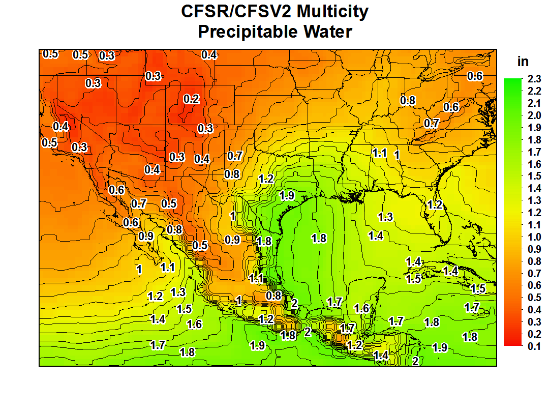
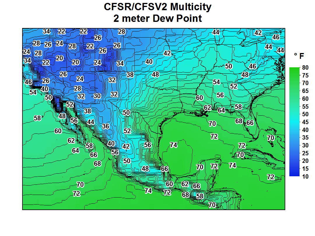
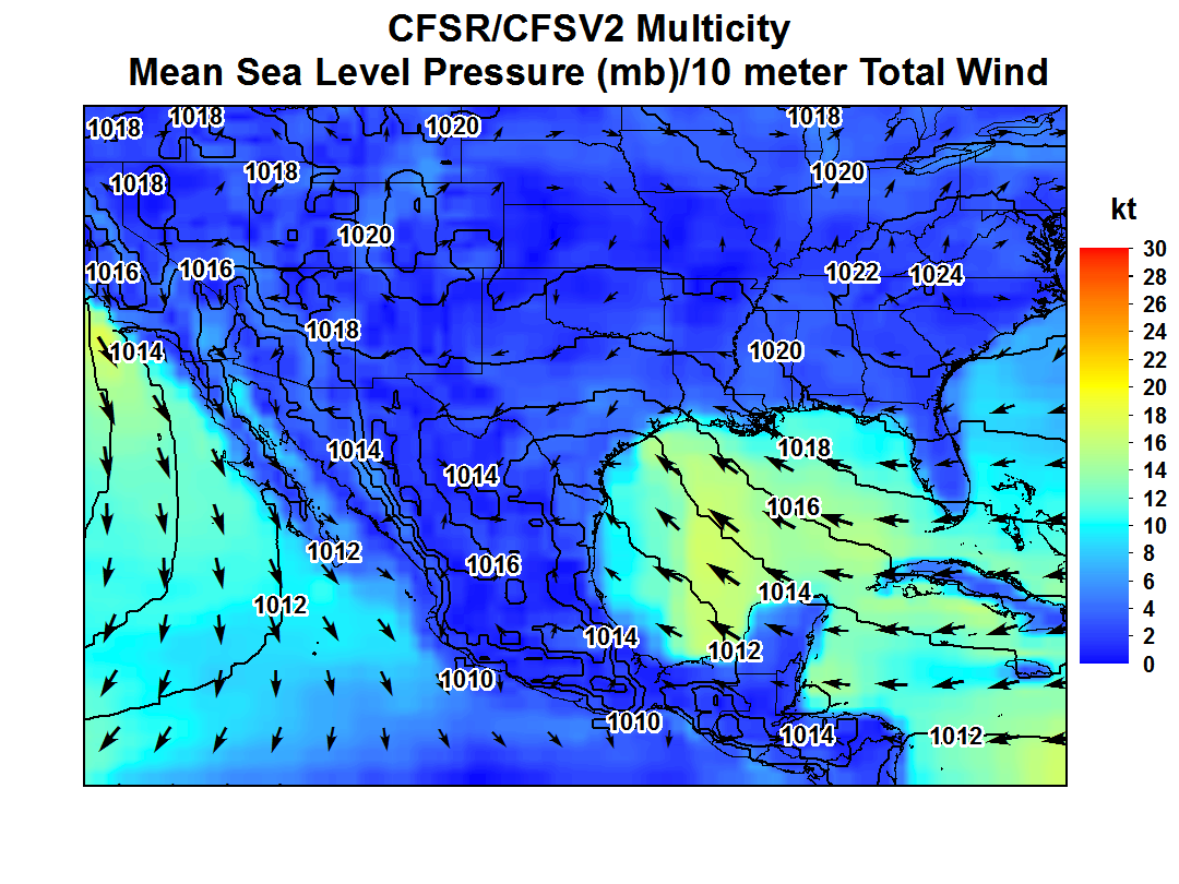
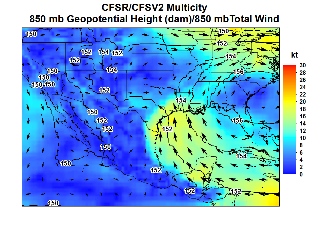
| Precipitable Water | 2 meter Dew Point Temperature | Mean Sea Level Pressure and 10 meter winds | 850 mb | 500 mb | 250 mb |
|---|---|---|---|---|---|
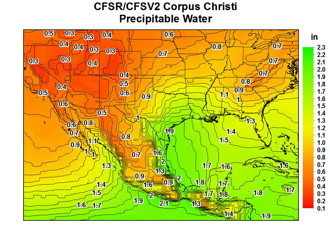
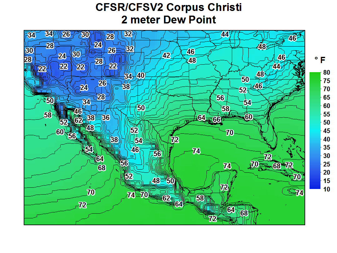
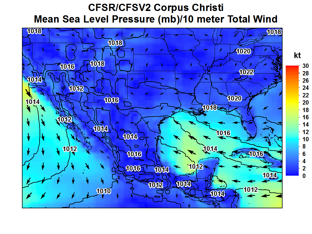
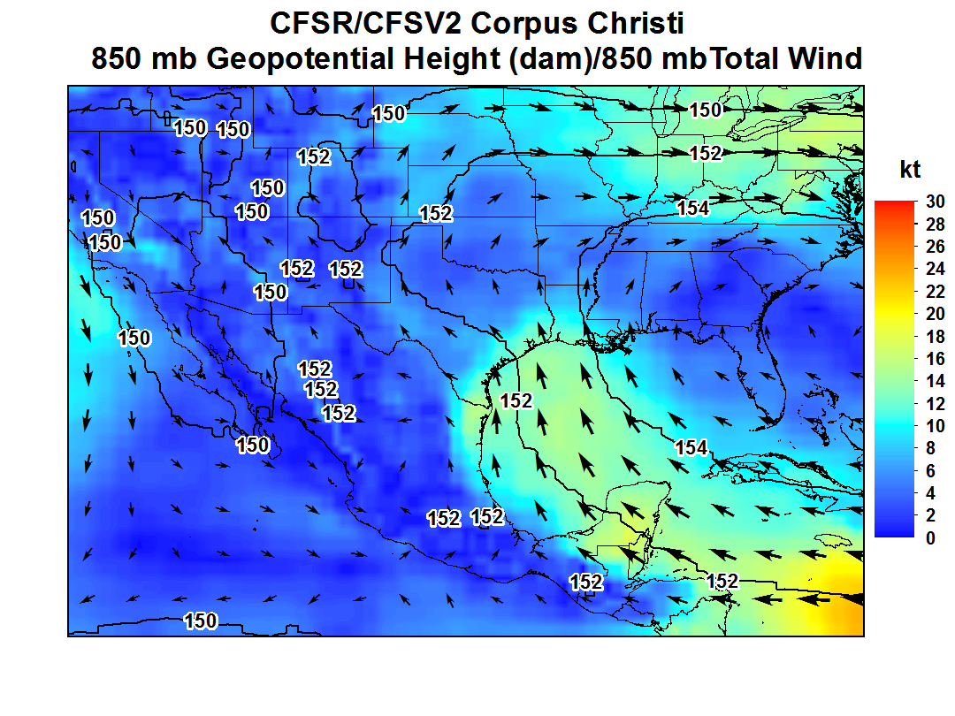
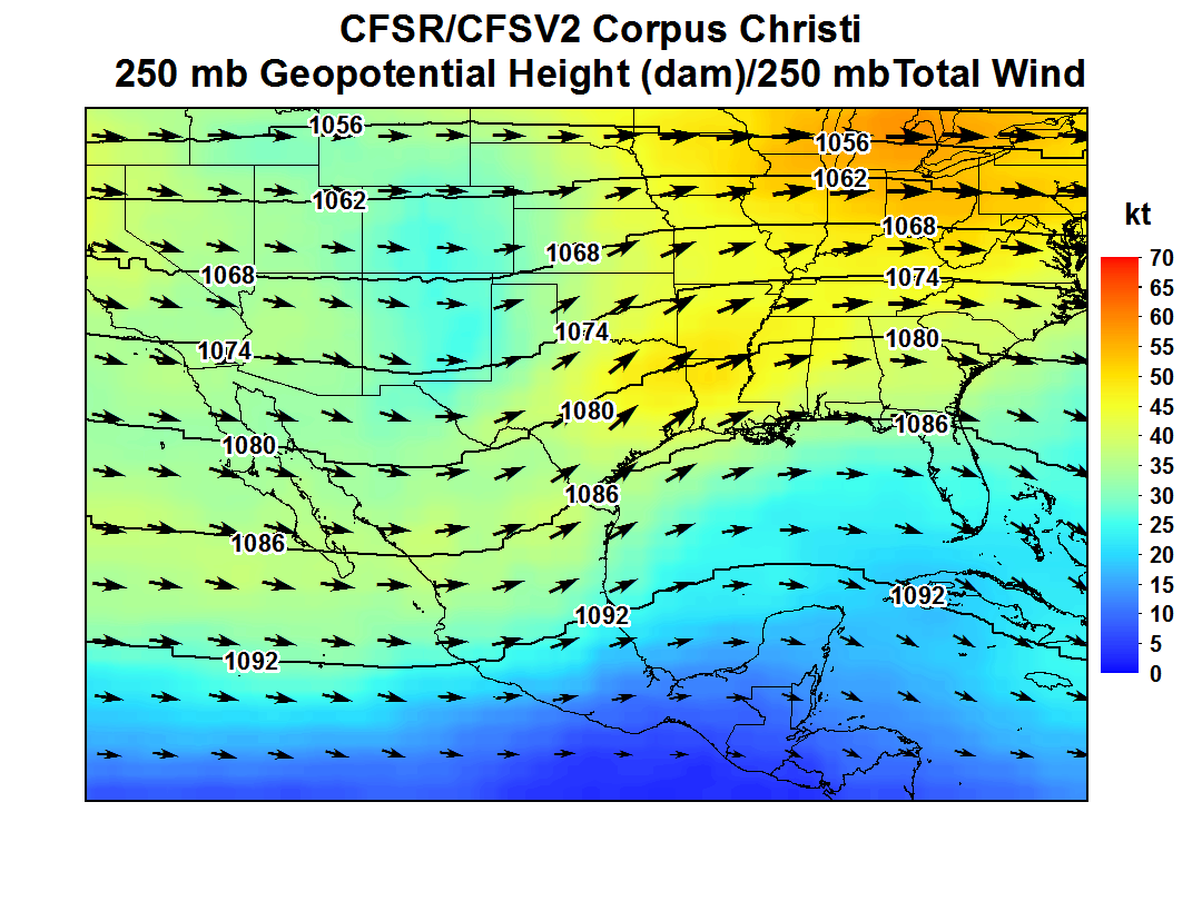
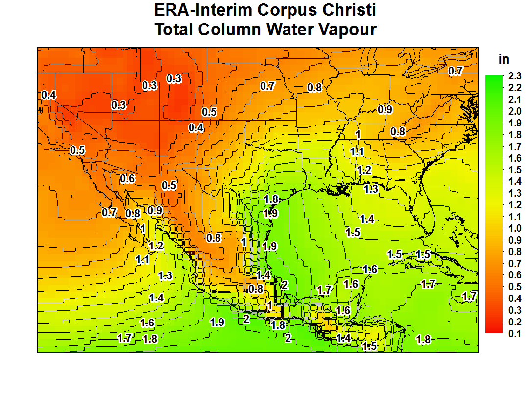
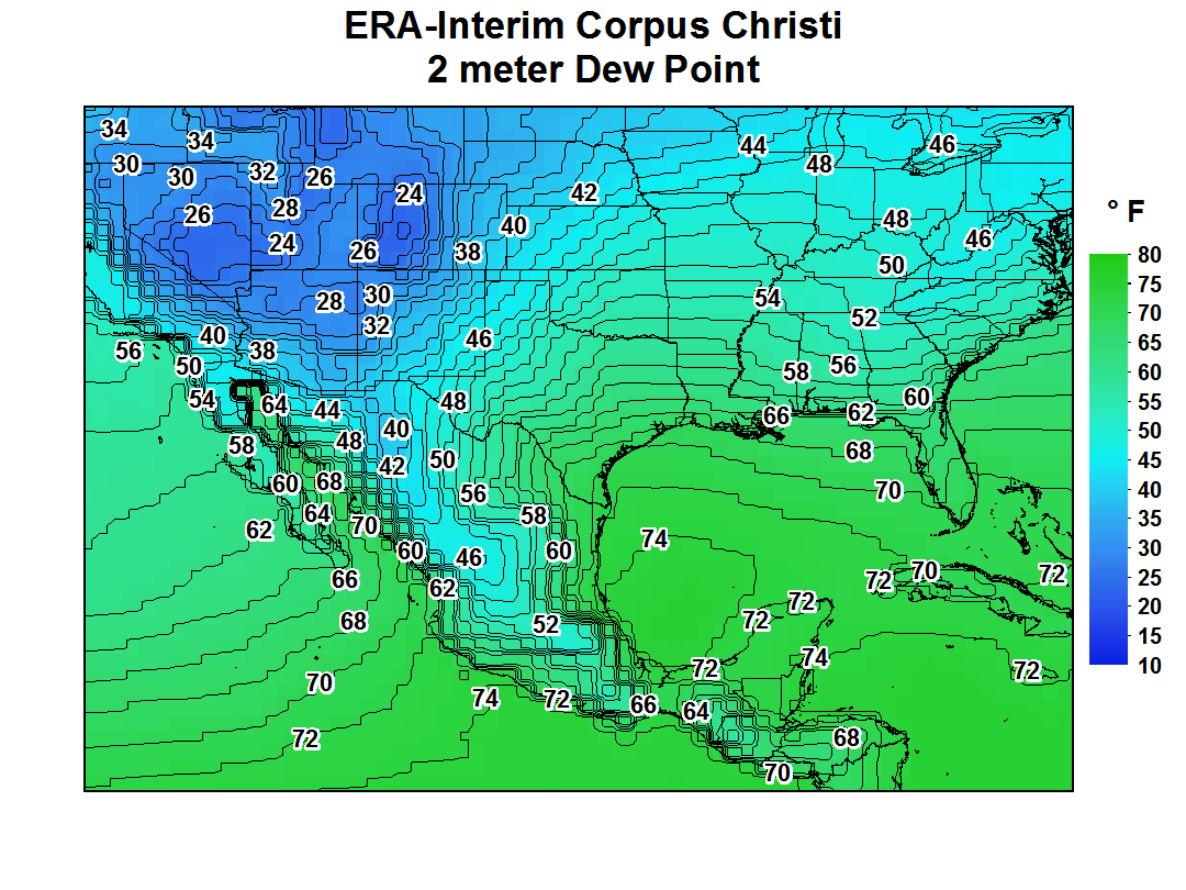
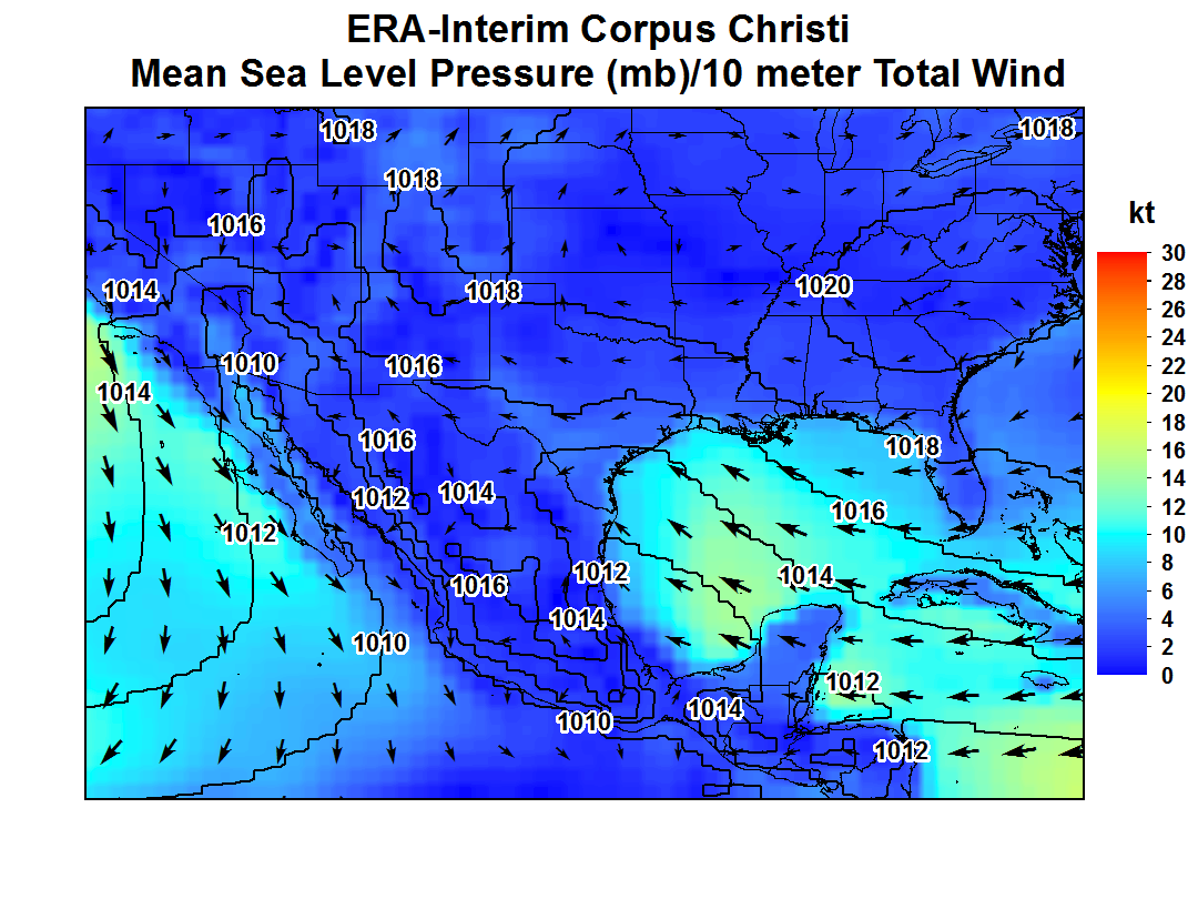
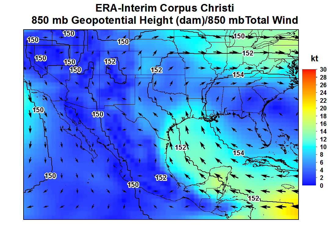
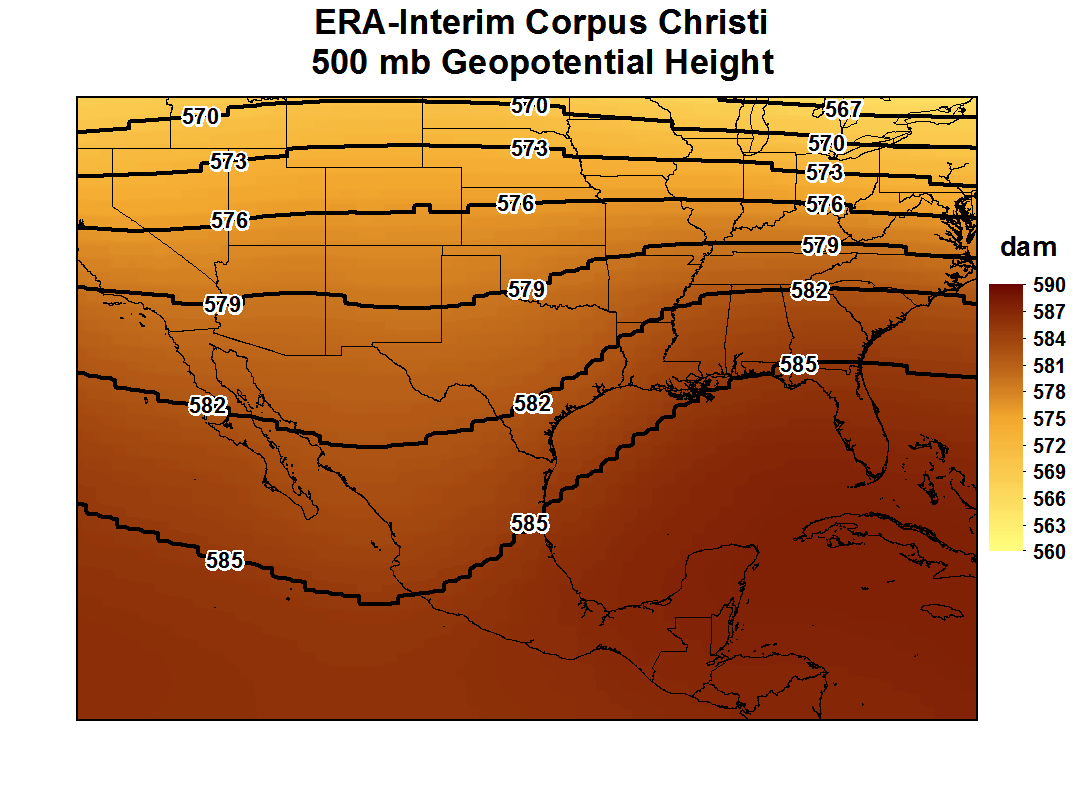
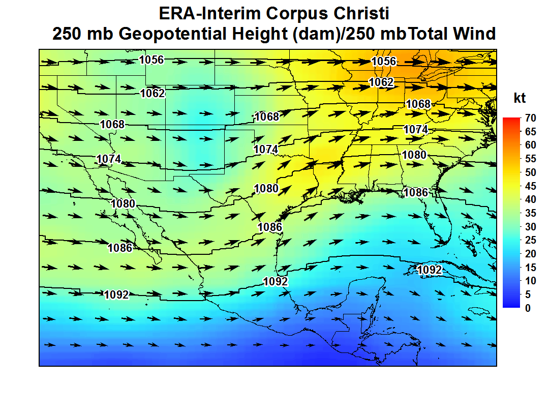
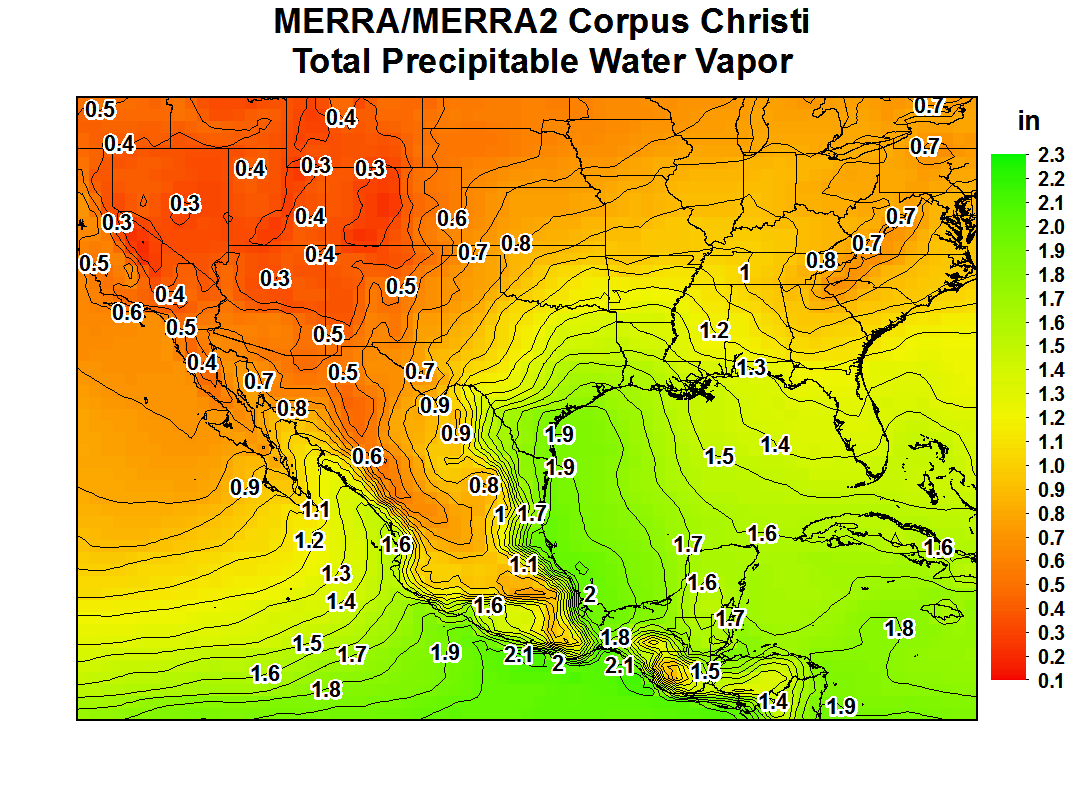
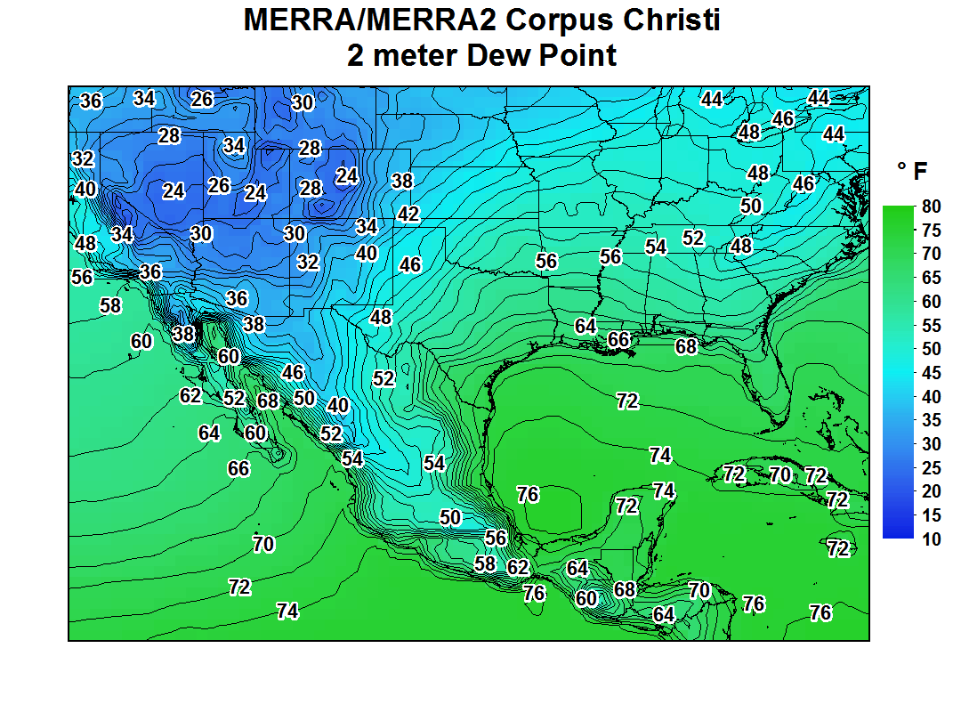
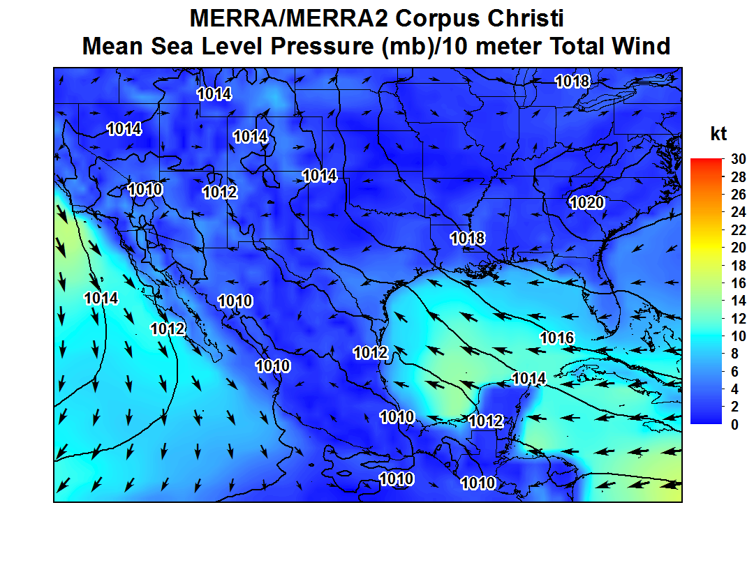
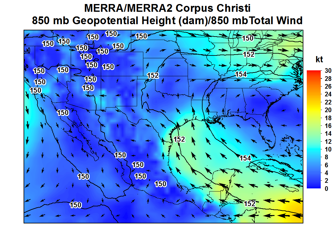
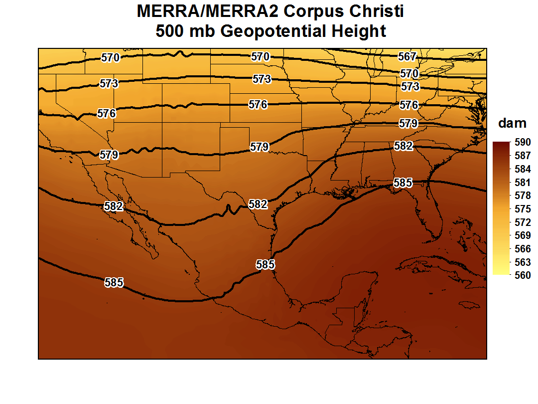
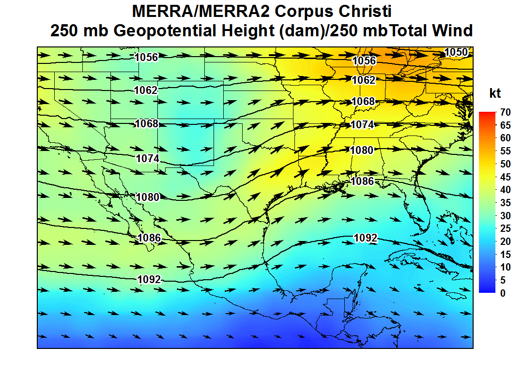
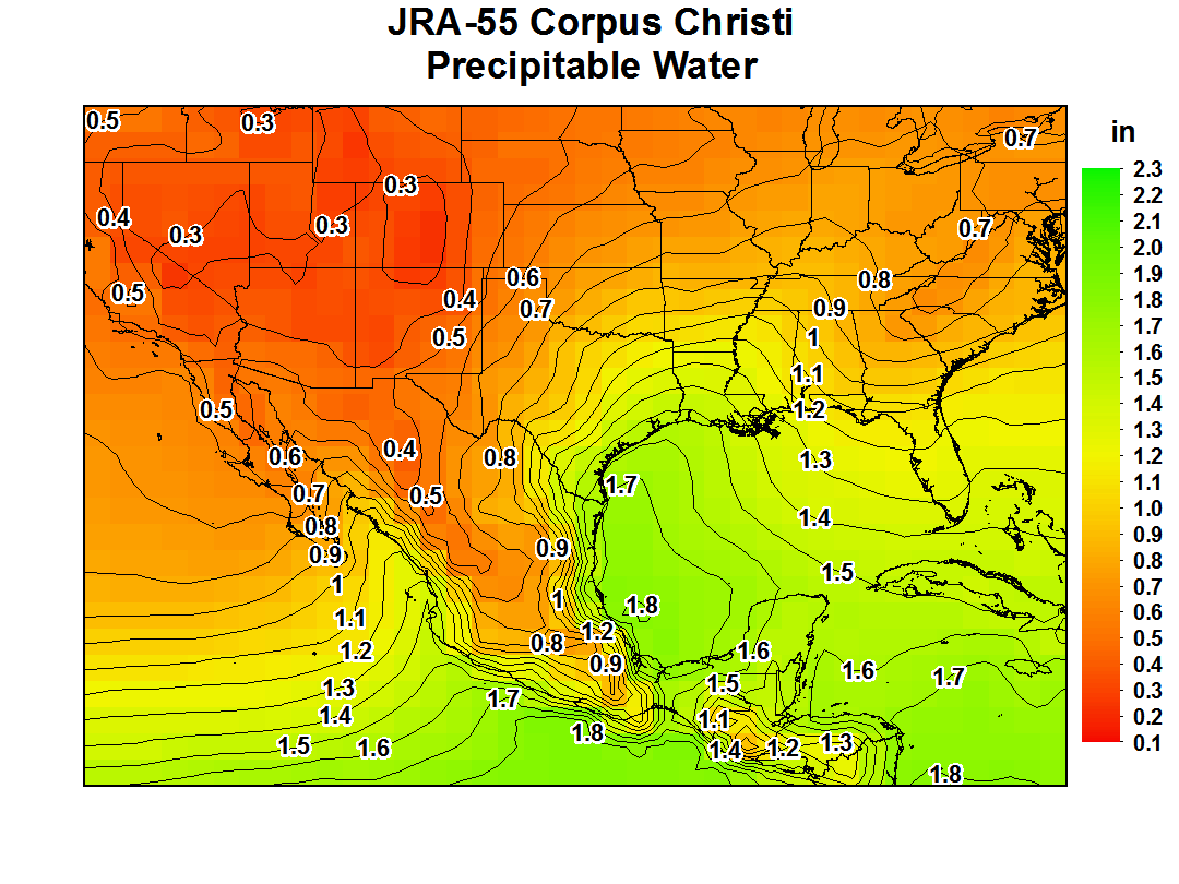
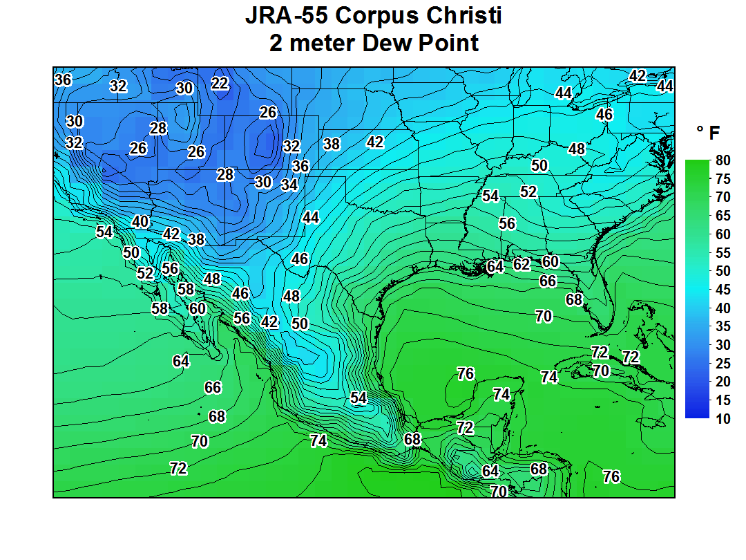
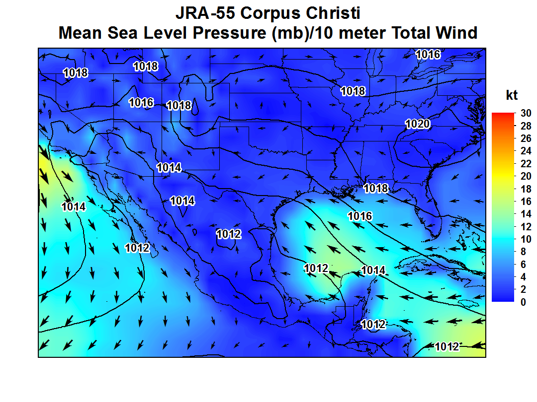
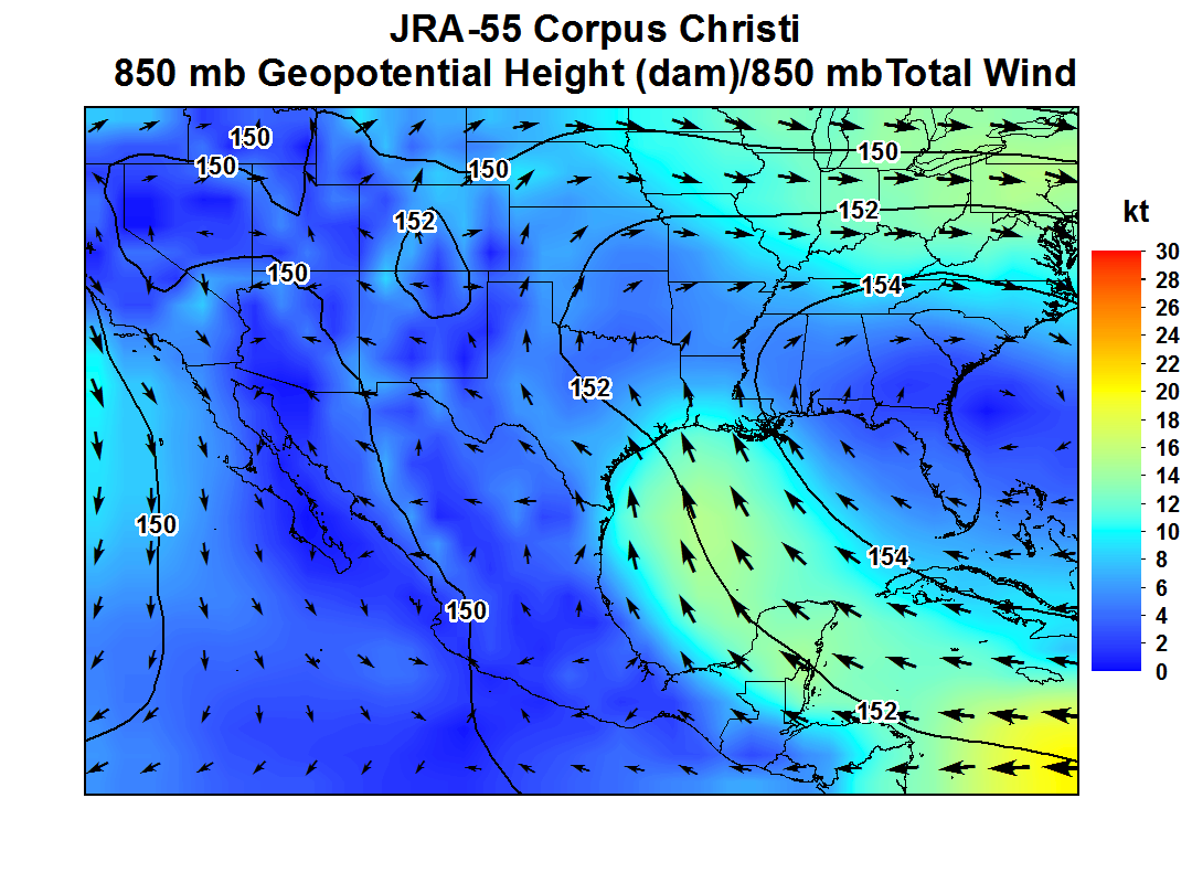
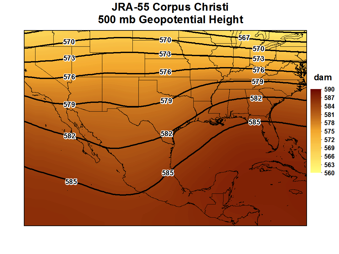
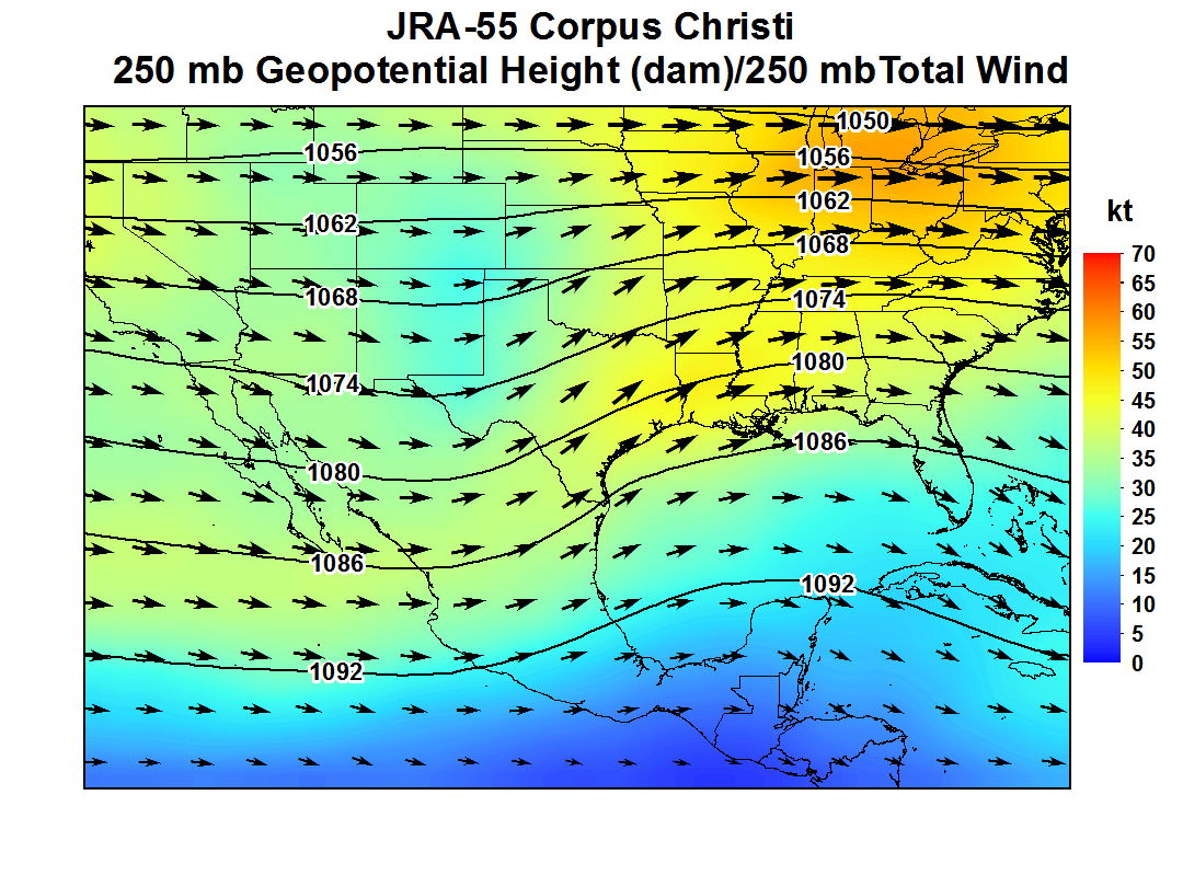
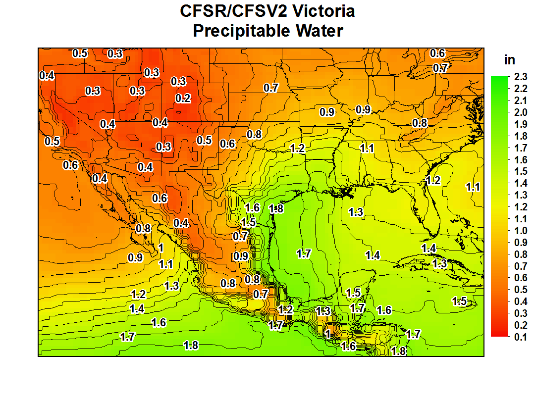
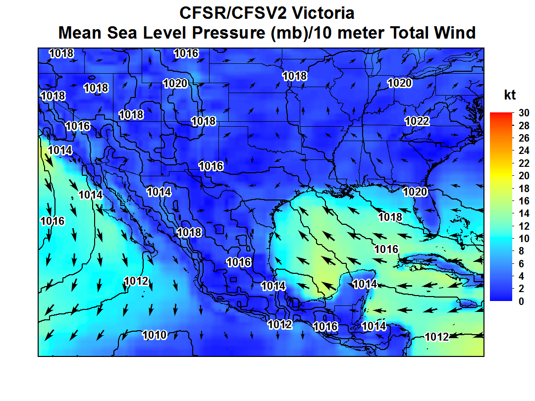
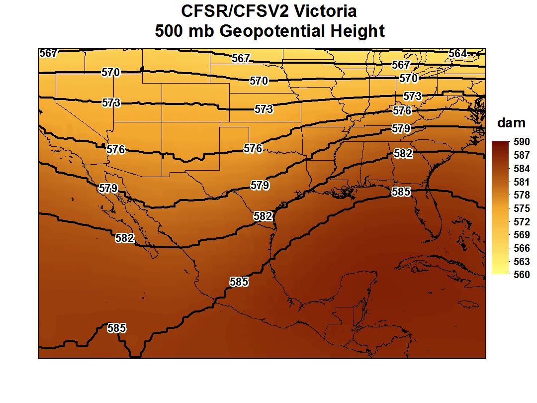
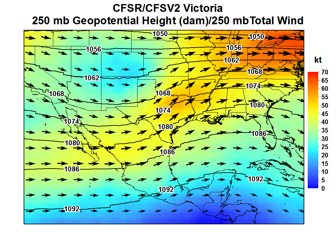
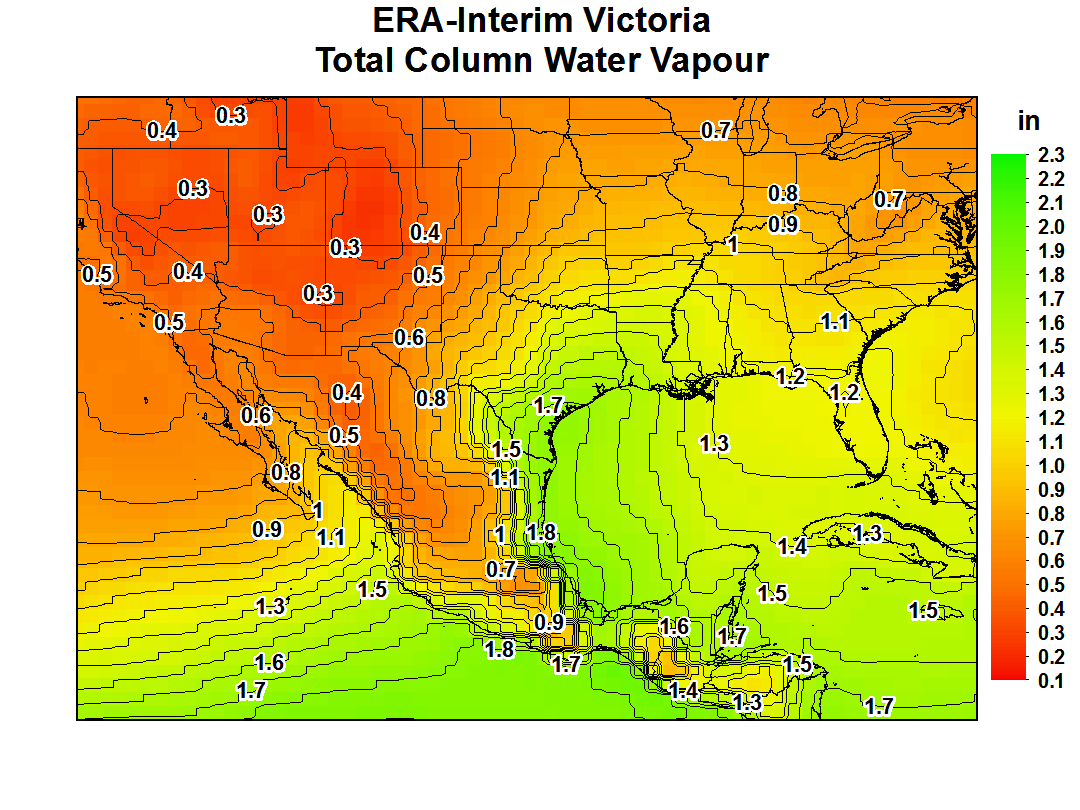
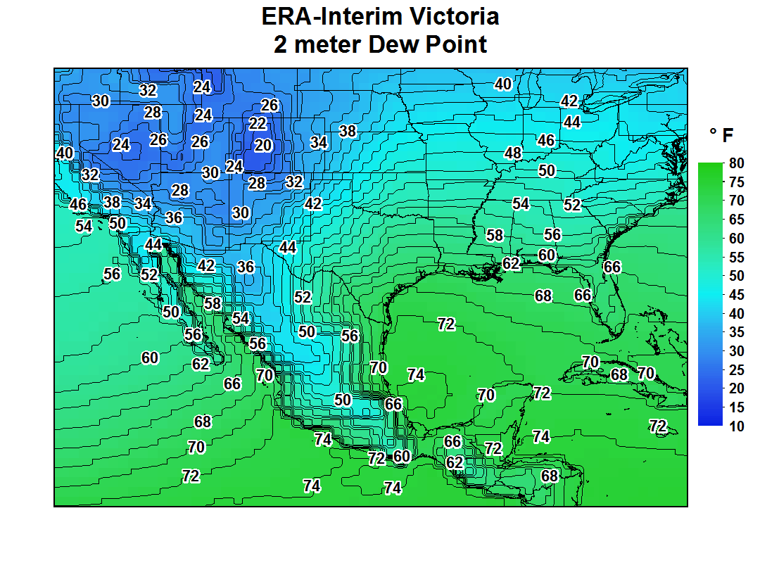
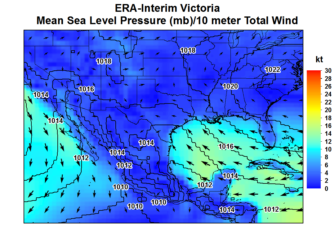
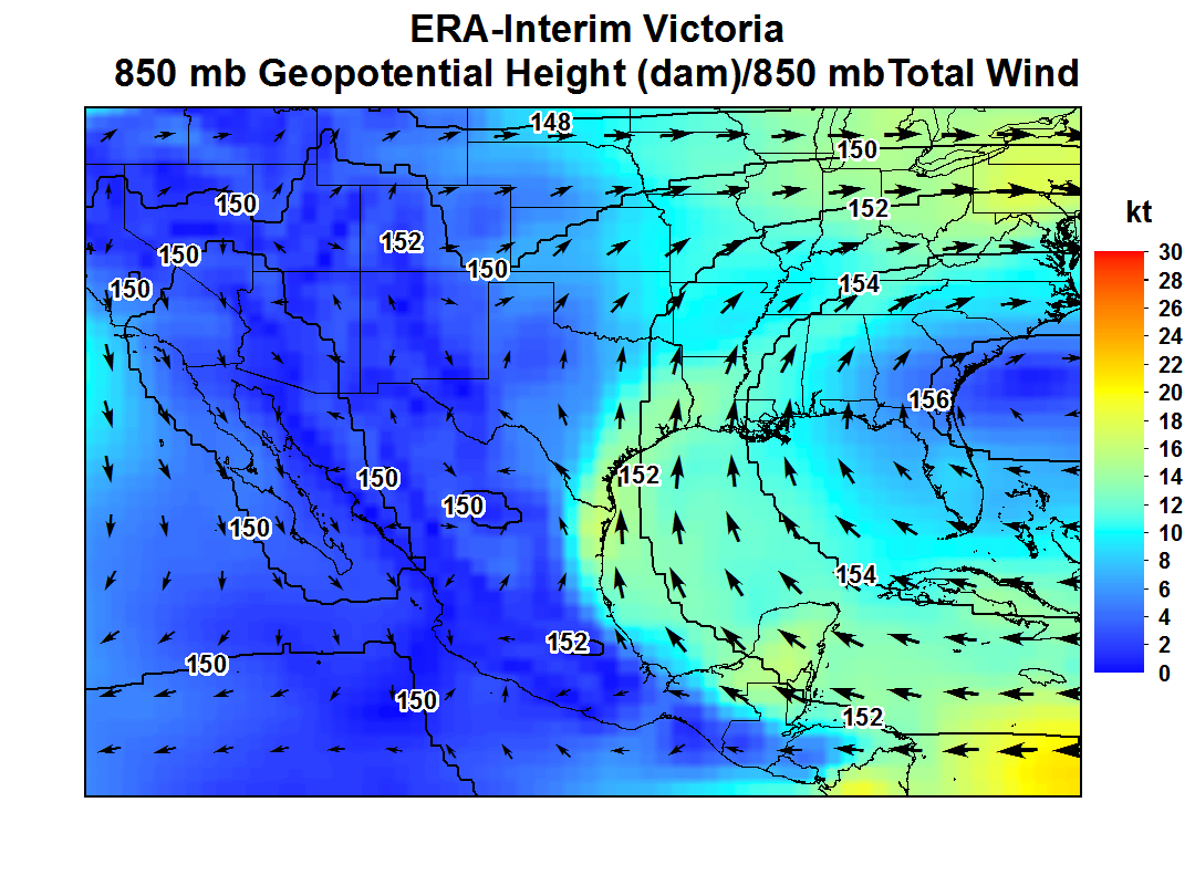
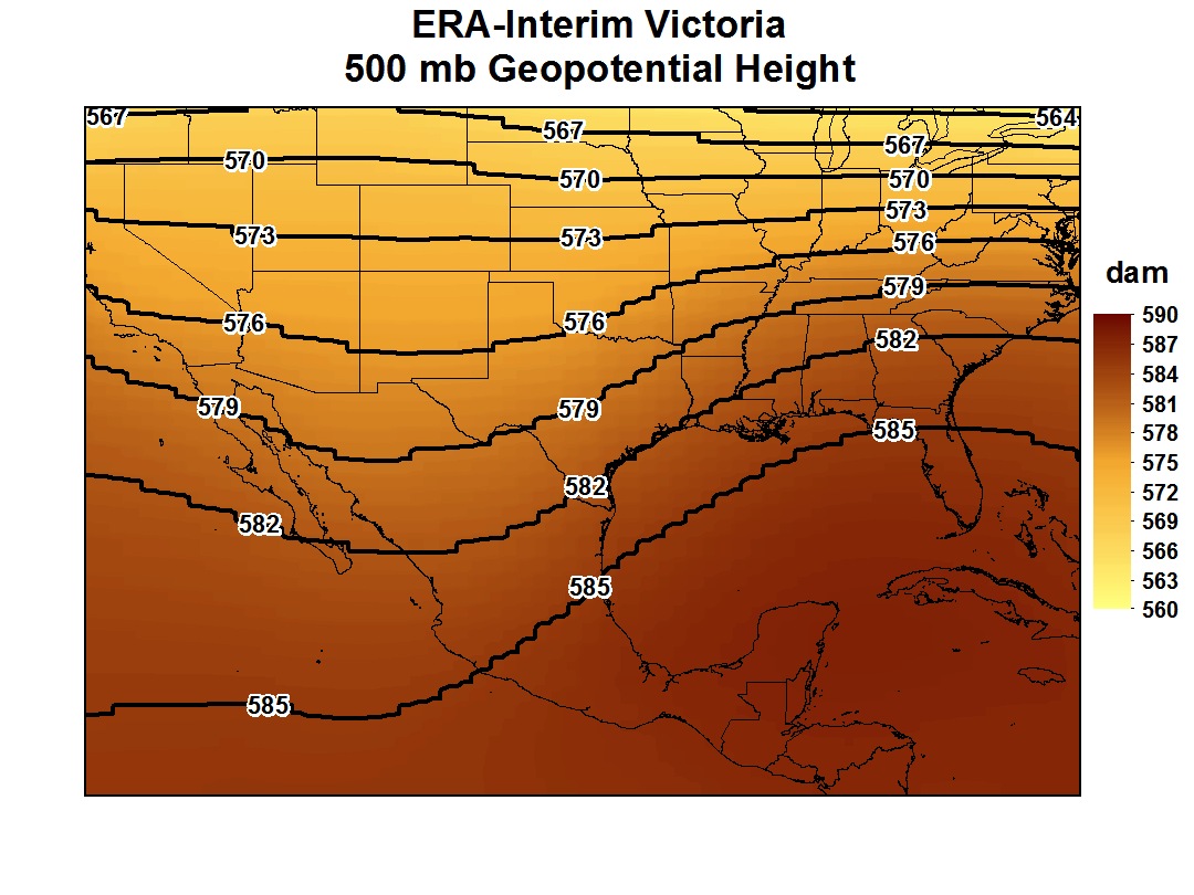
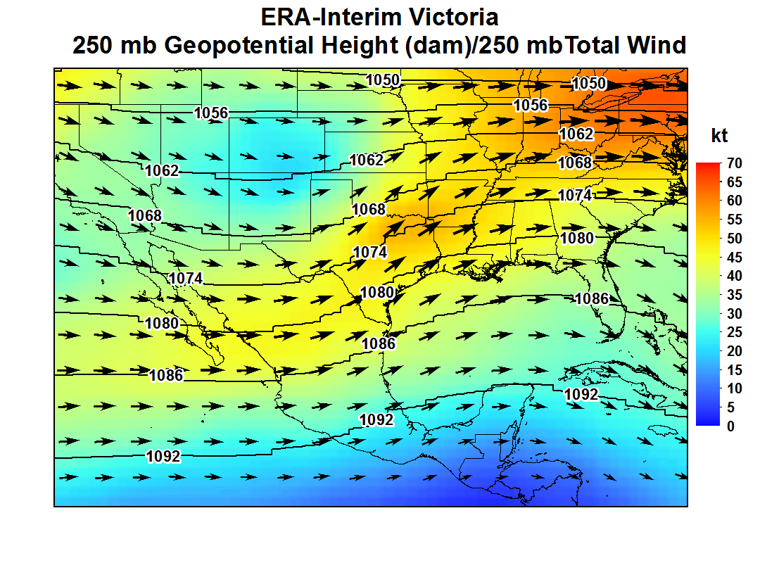
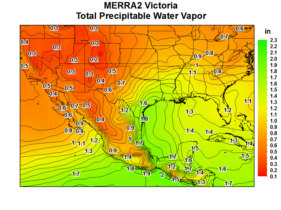
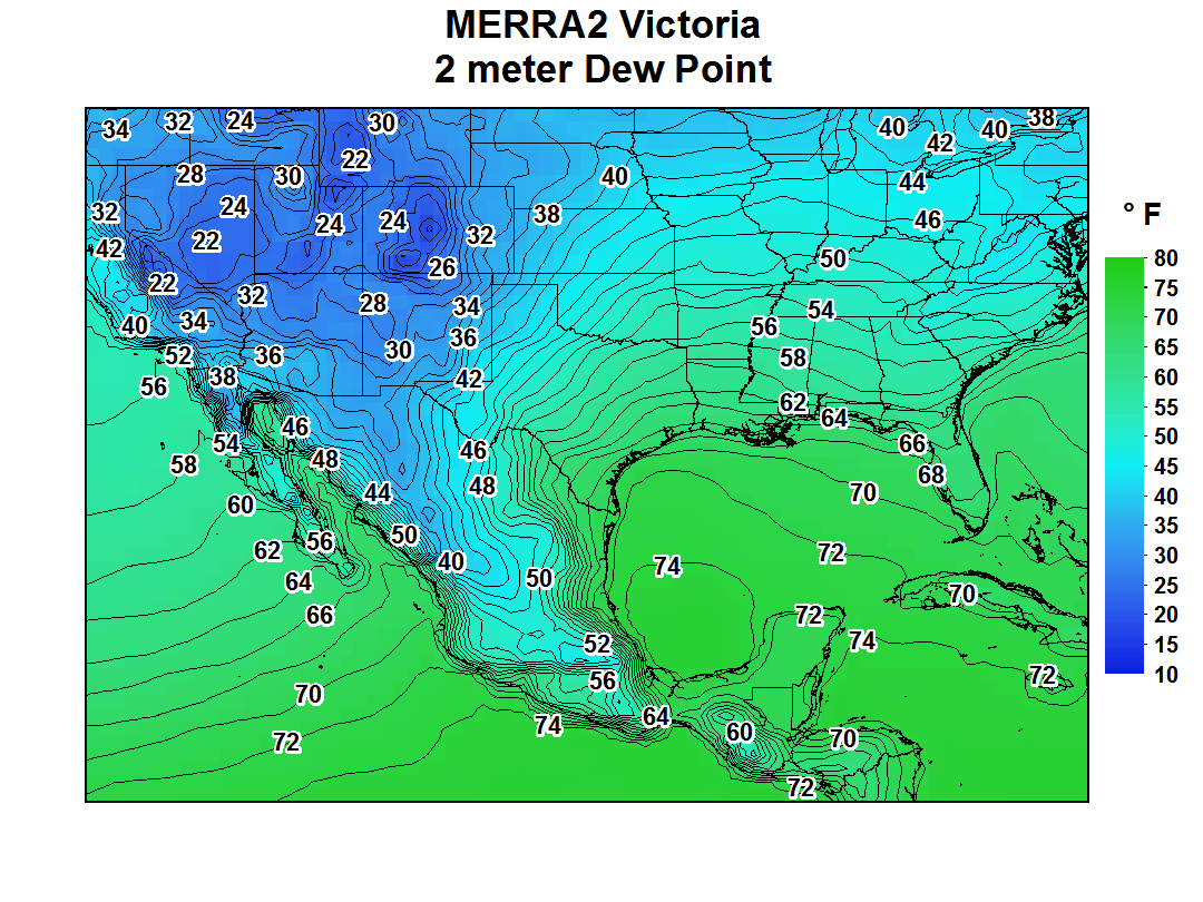
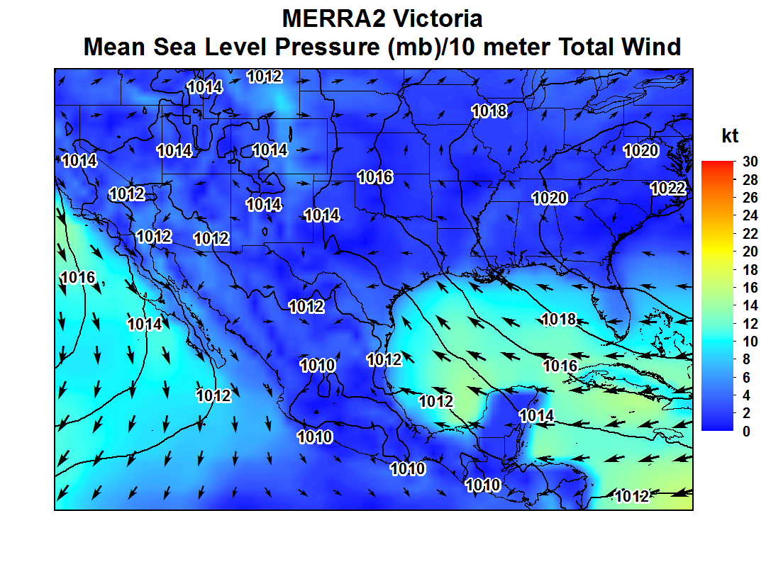
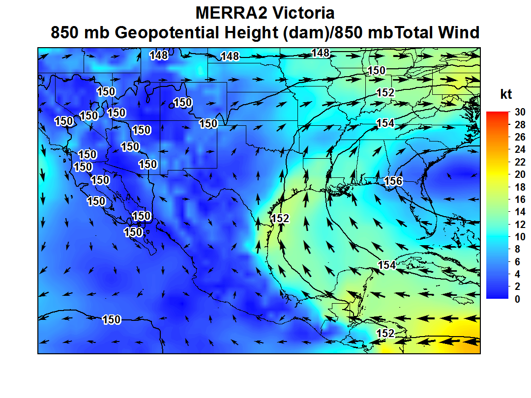
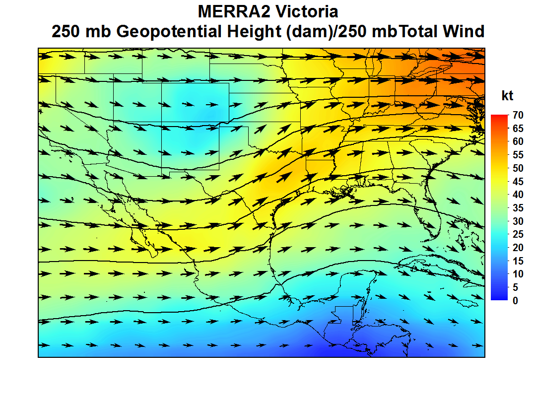
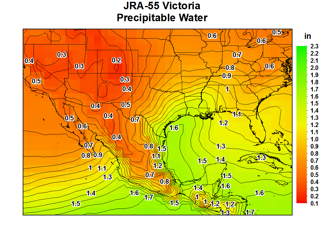
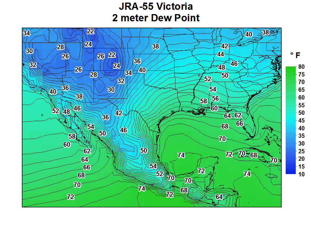
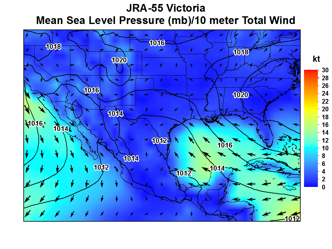
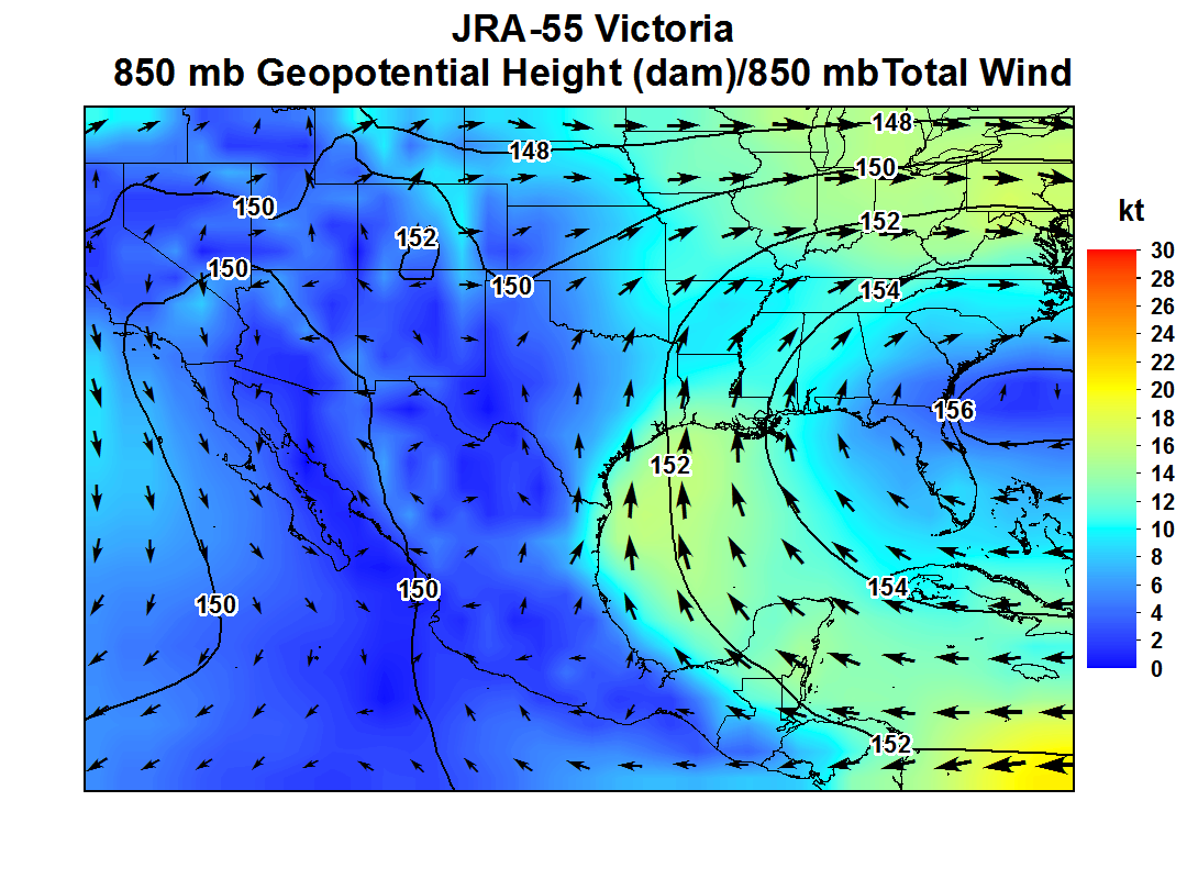
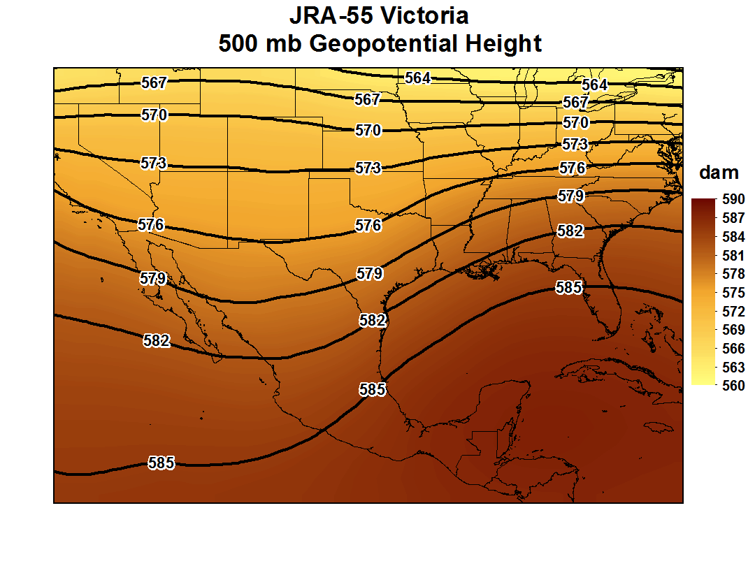
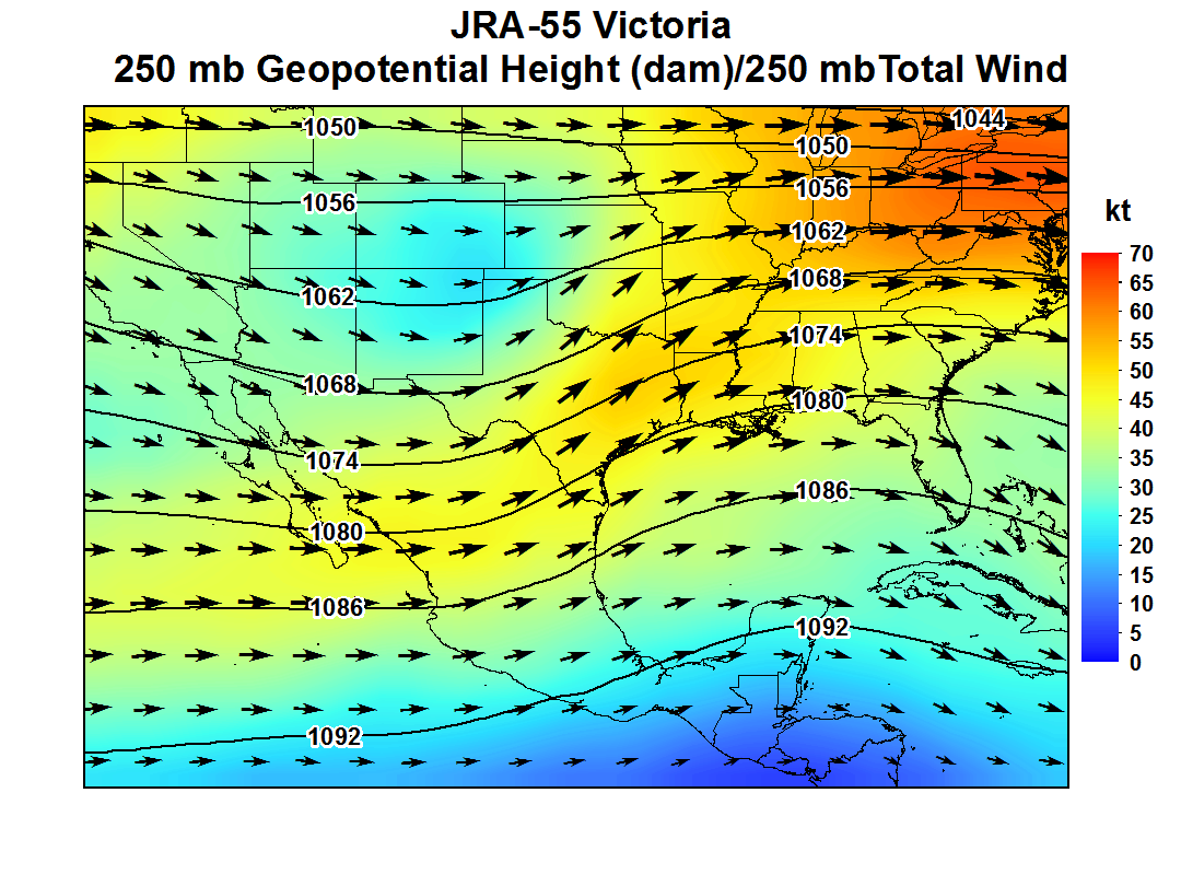
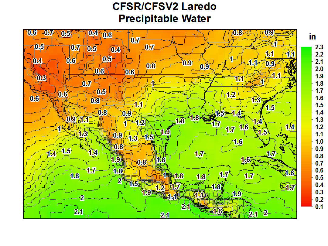
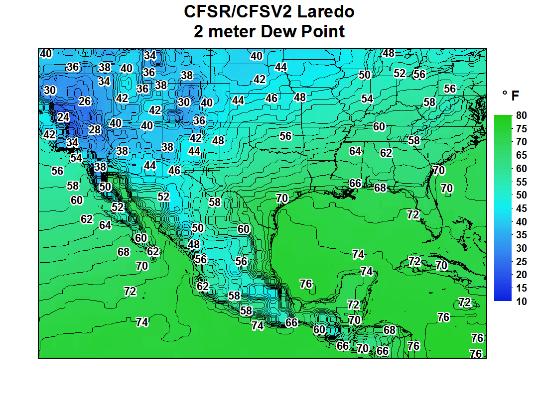
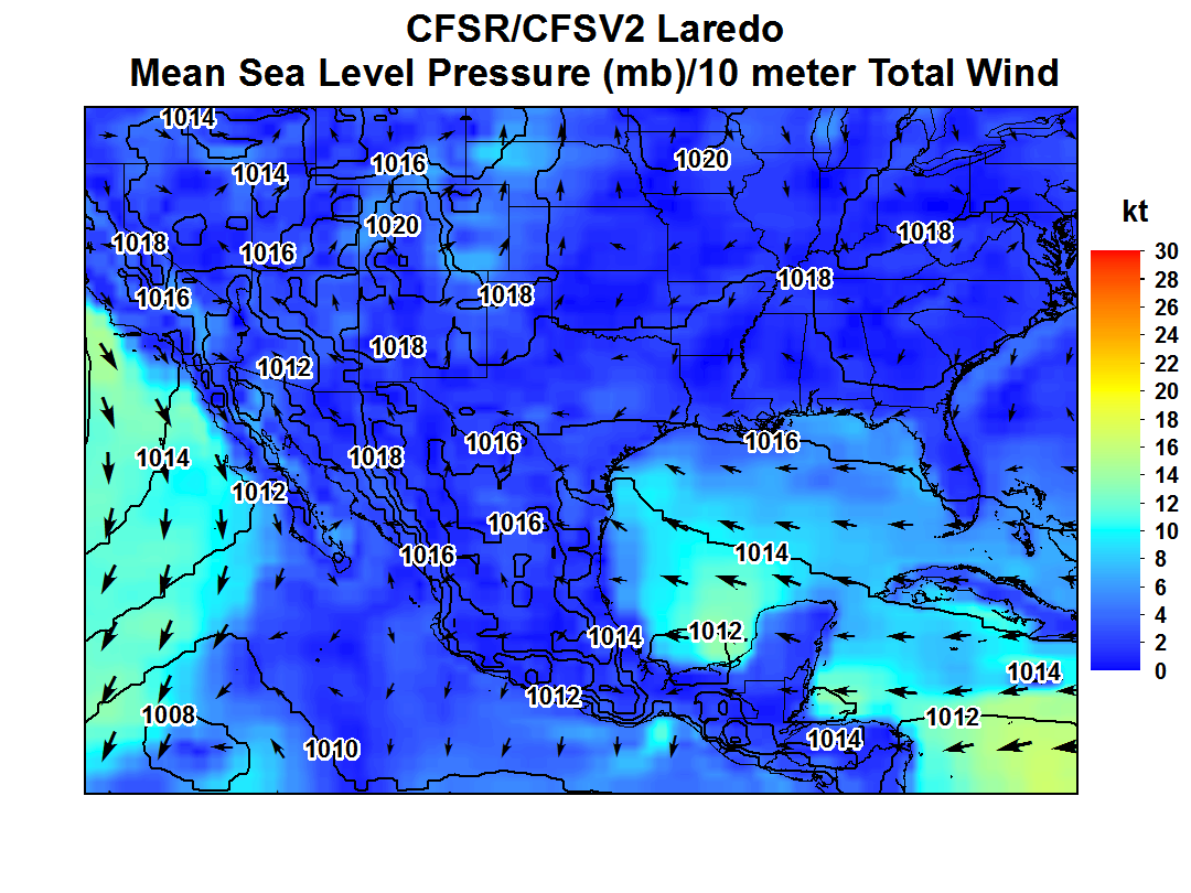
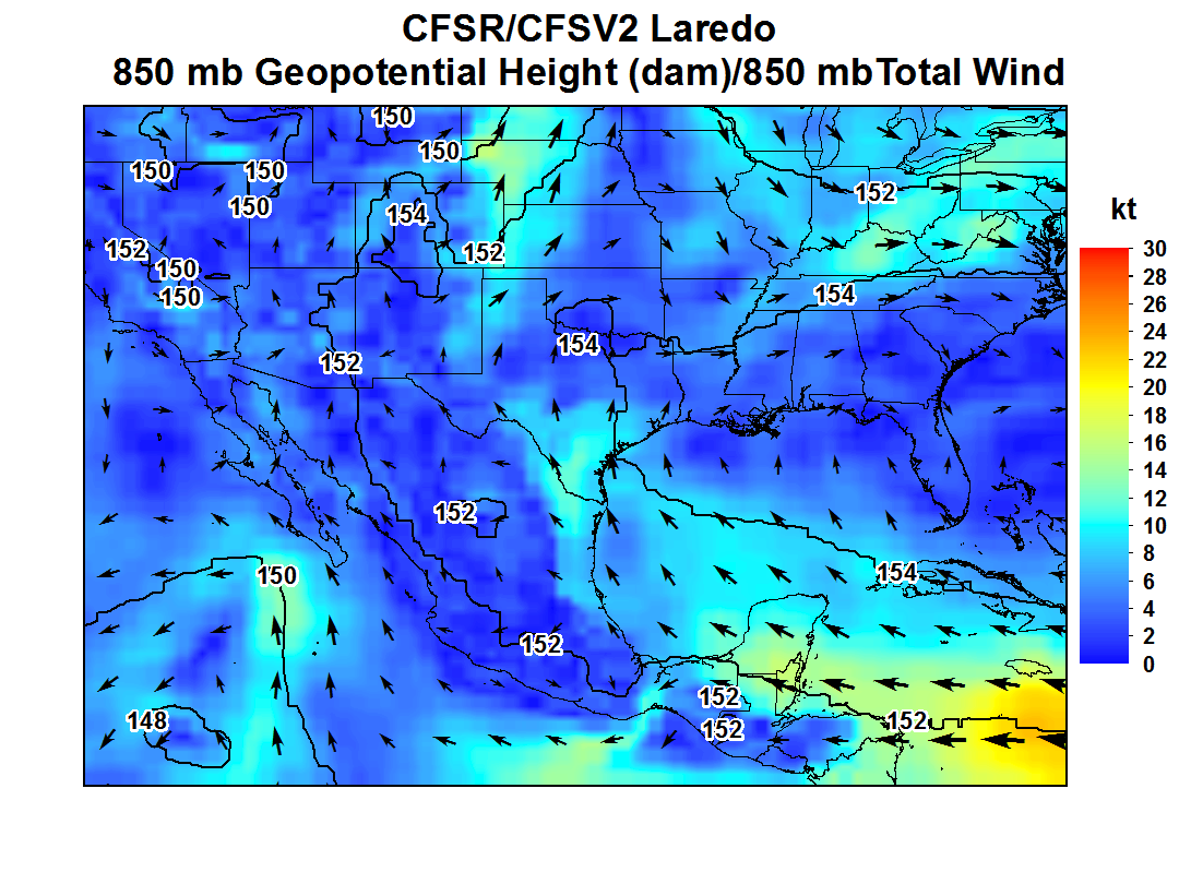
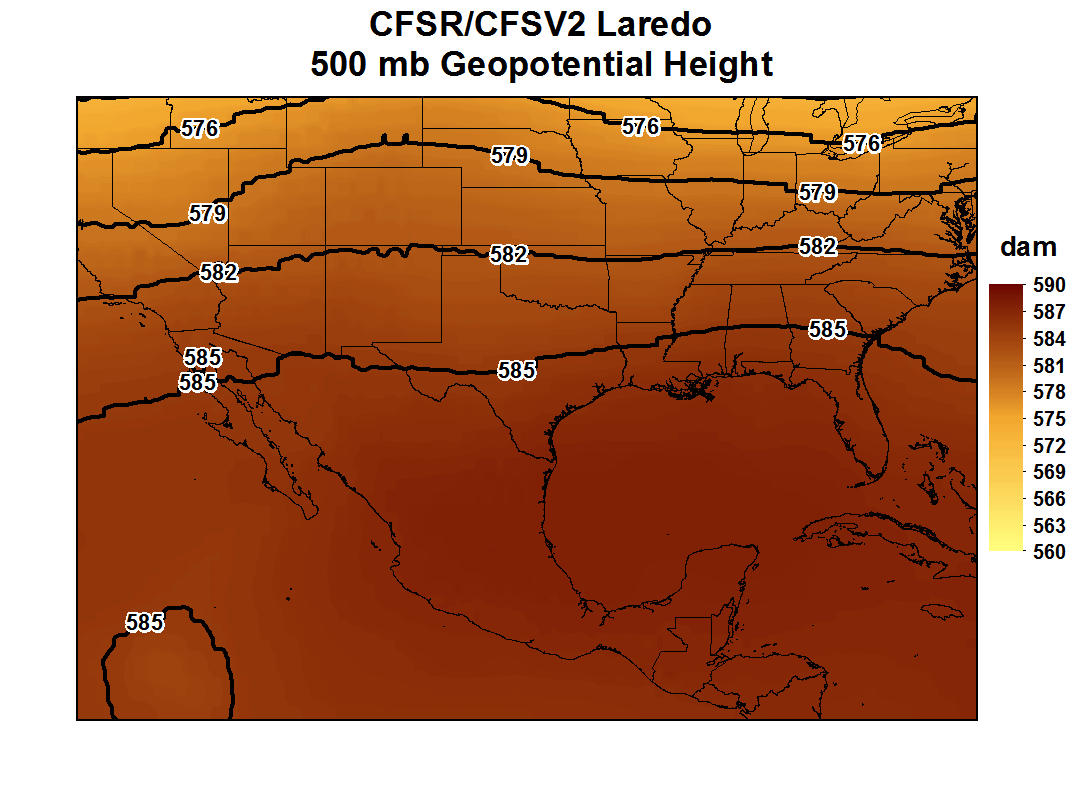
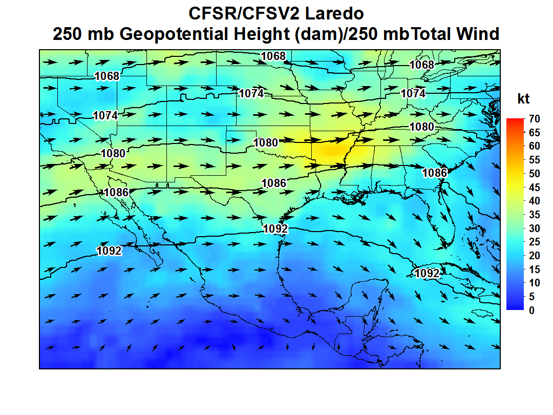
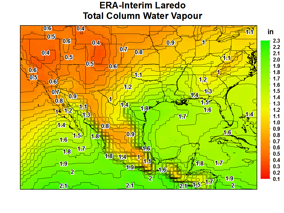
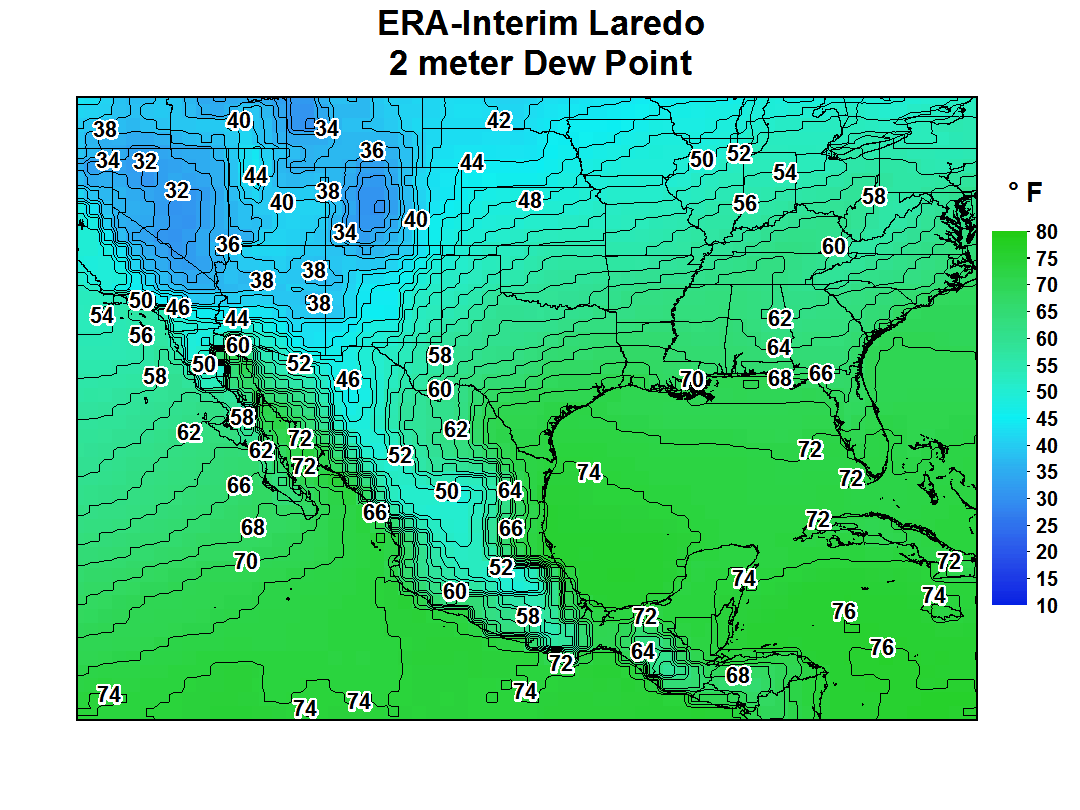
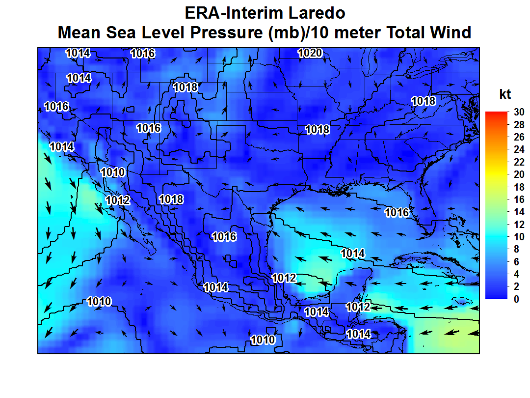
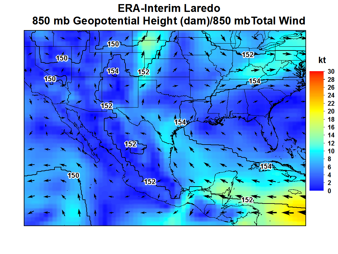
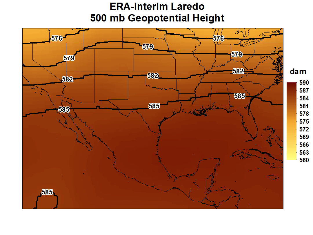
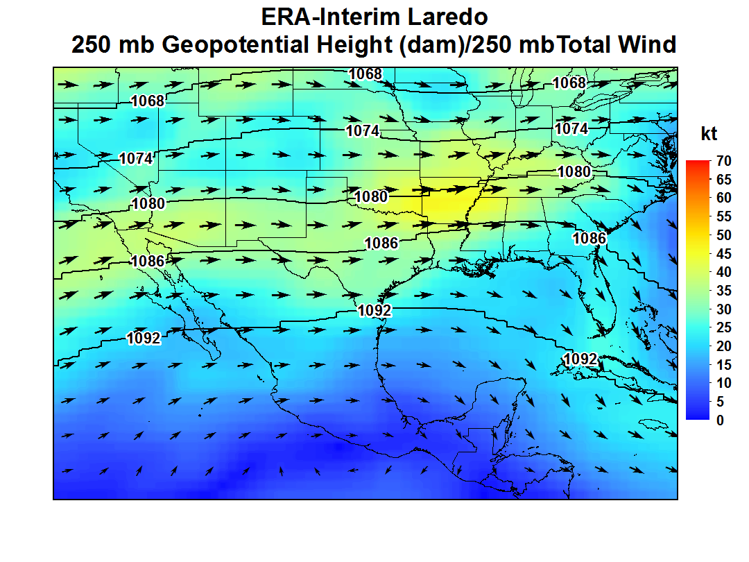
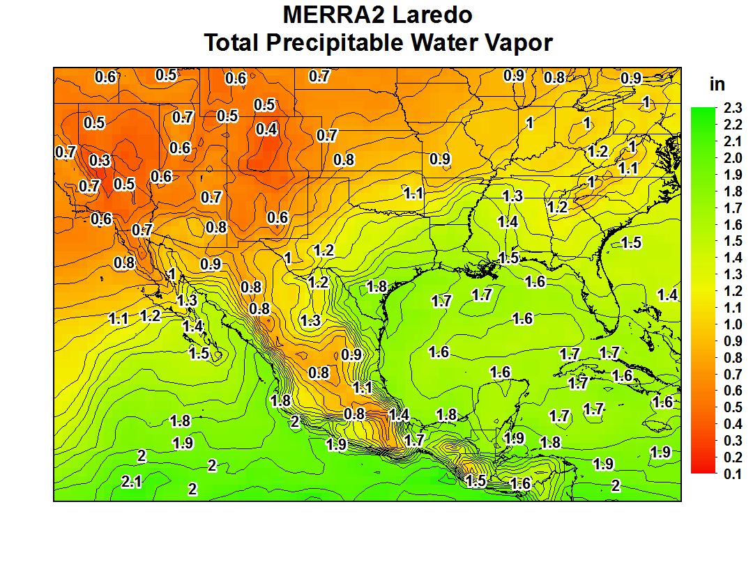
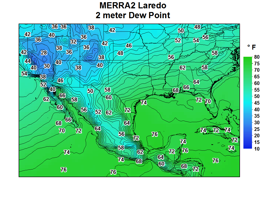
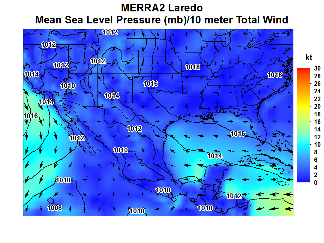
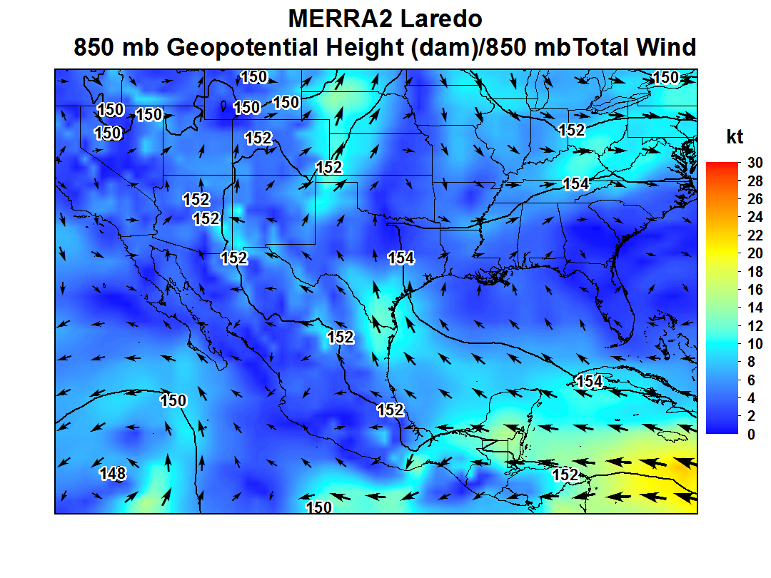
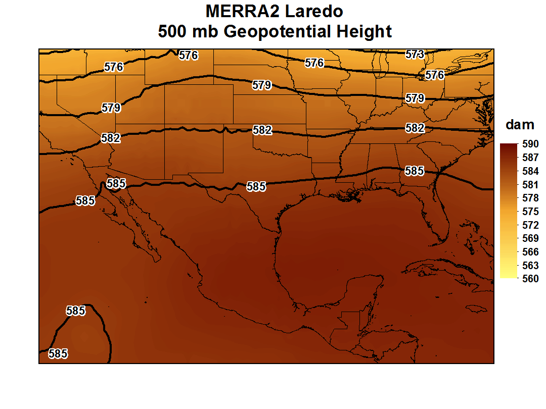
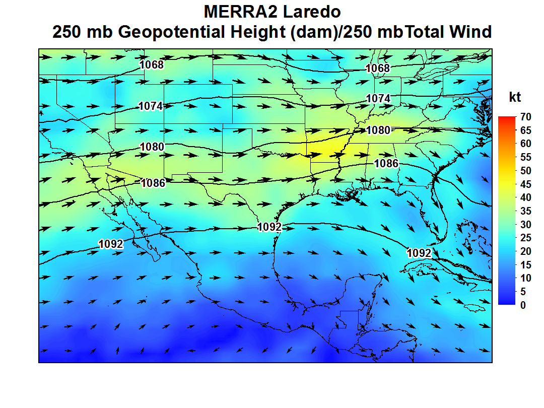
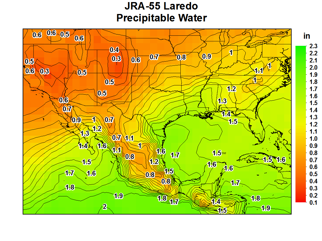
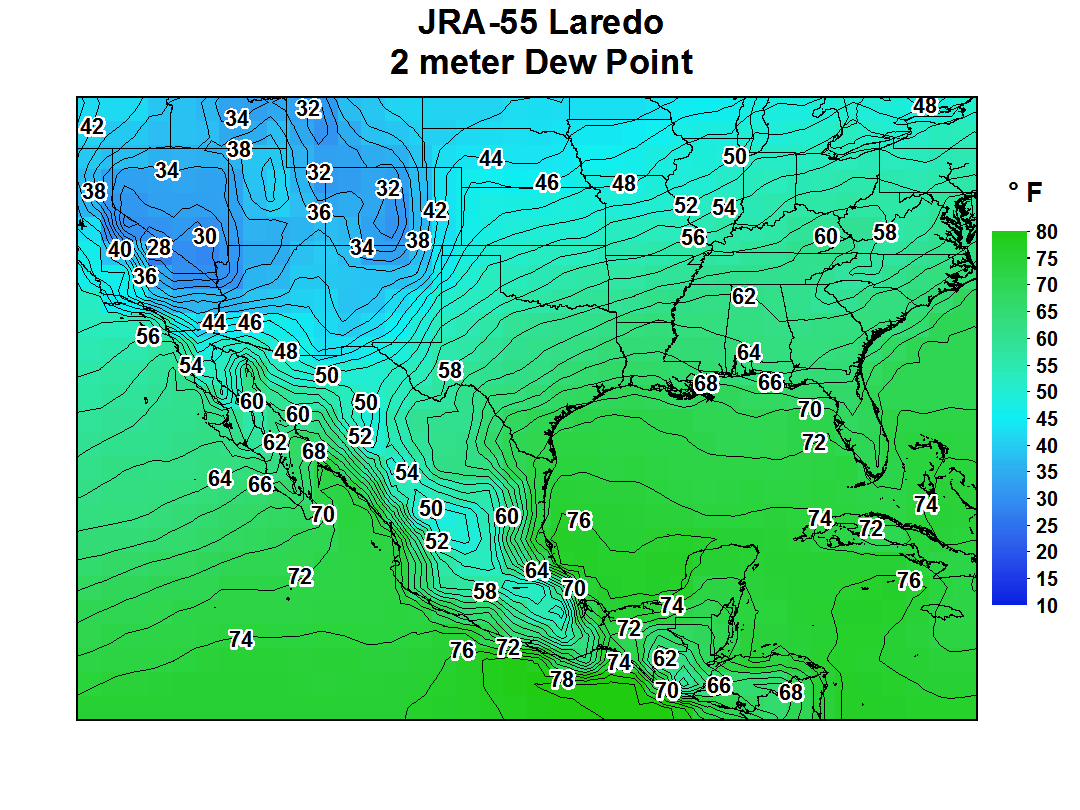
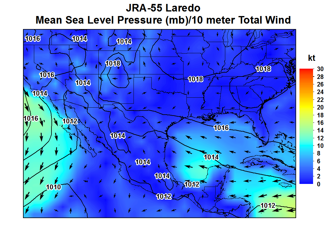
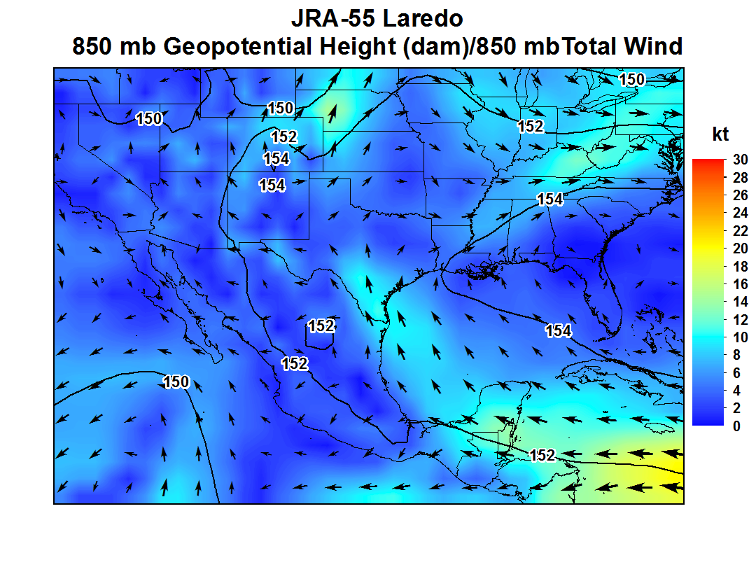
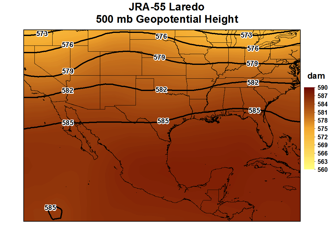
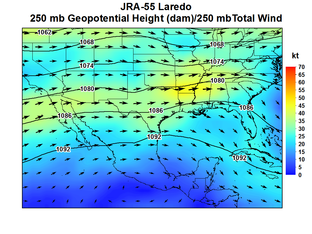
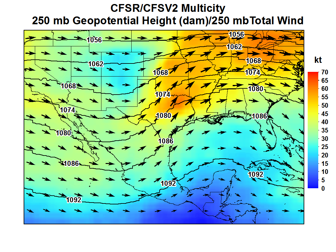
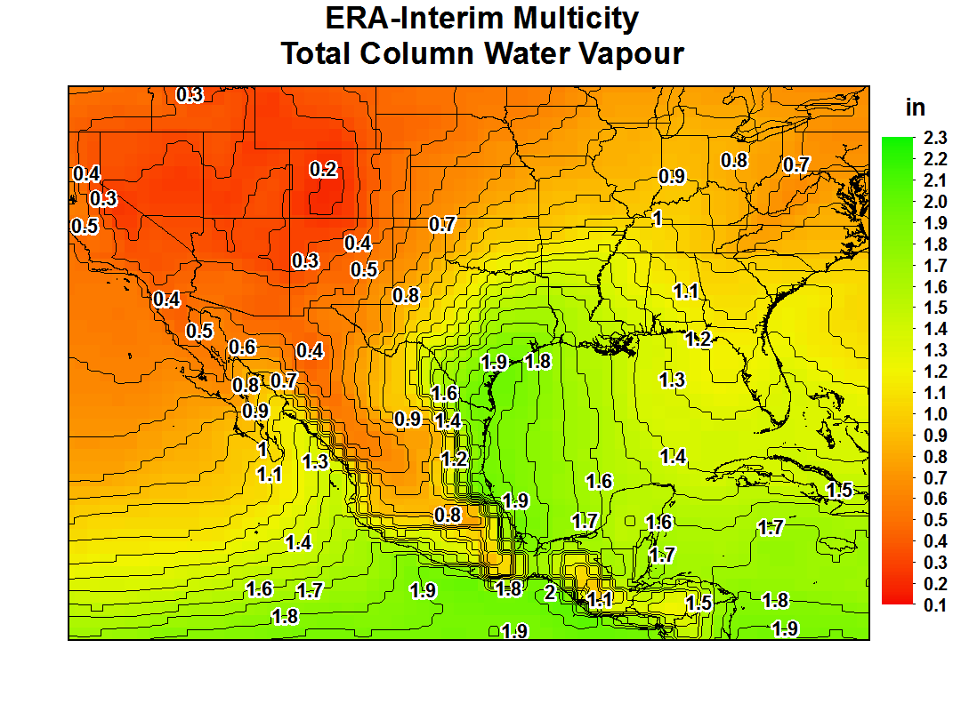
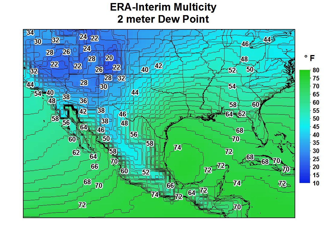
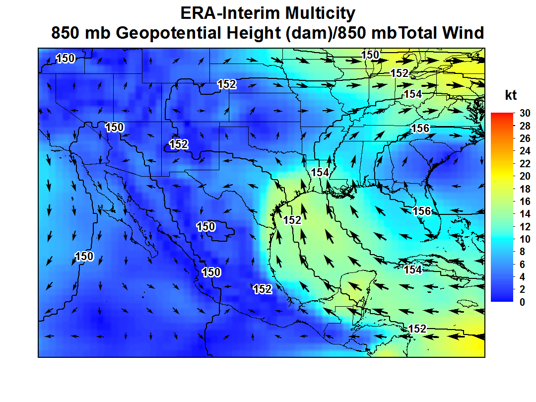
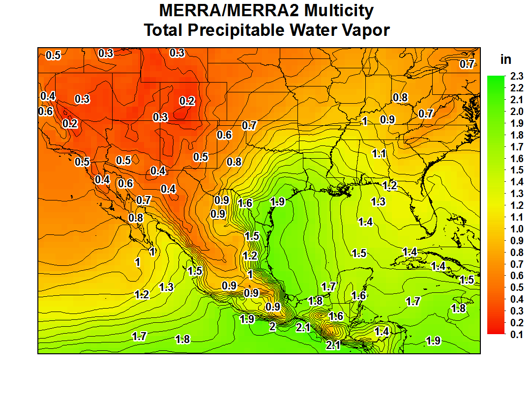
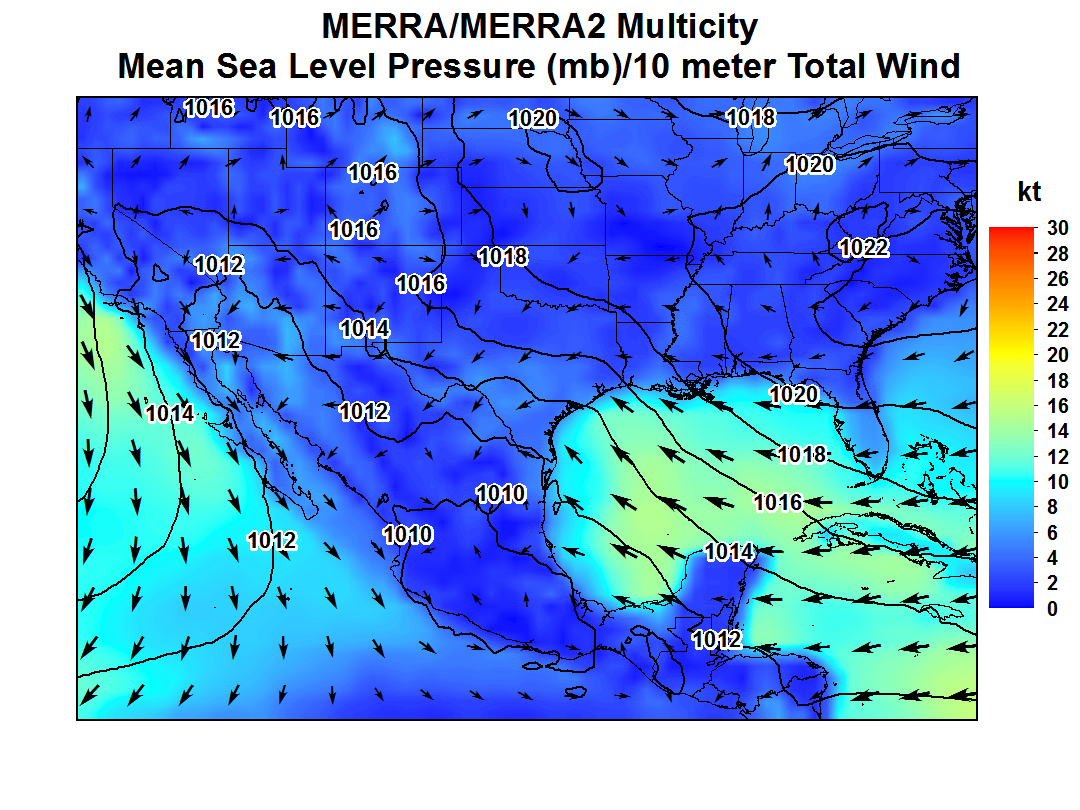
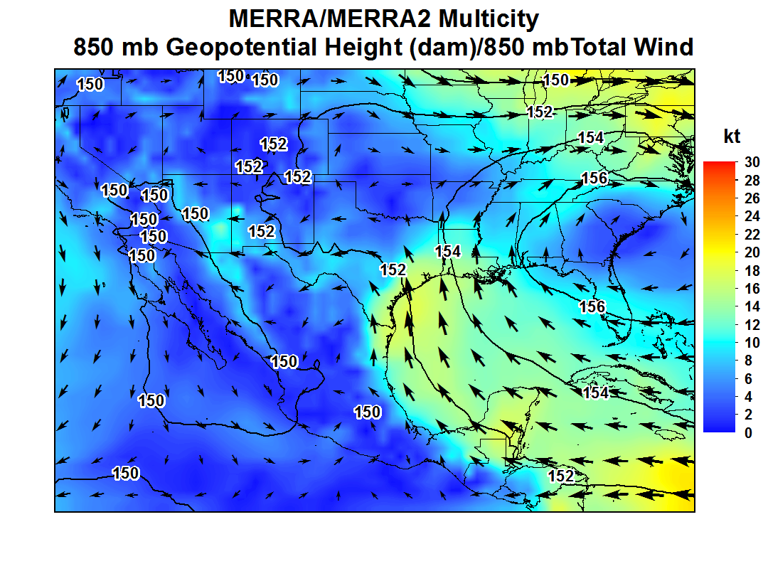
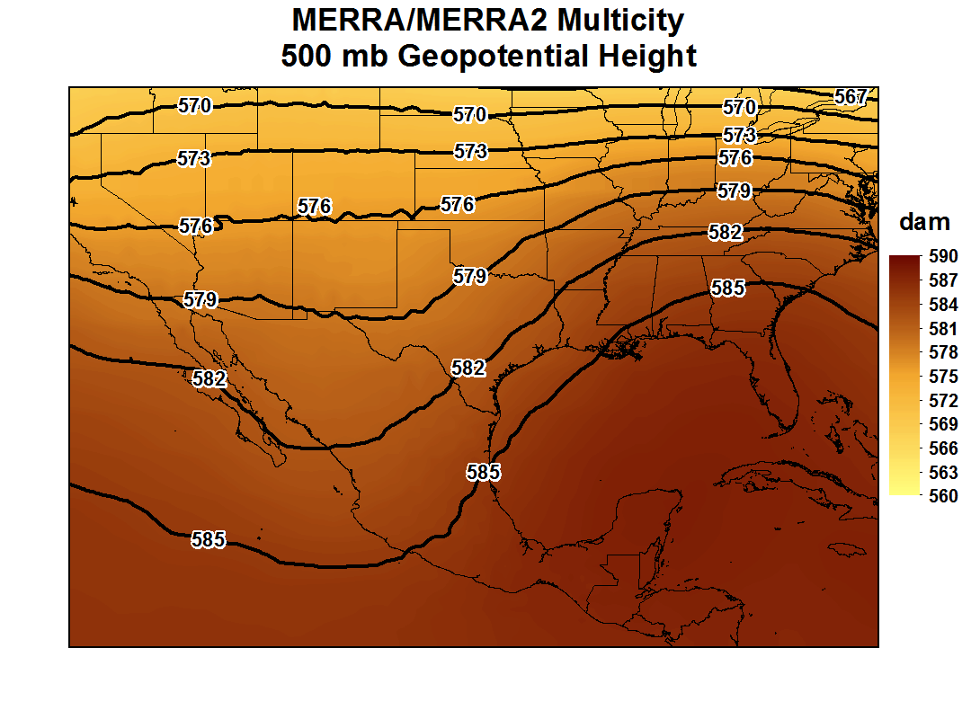
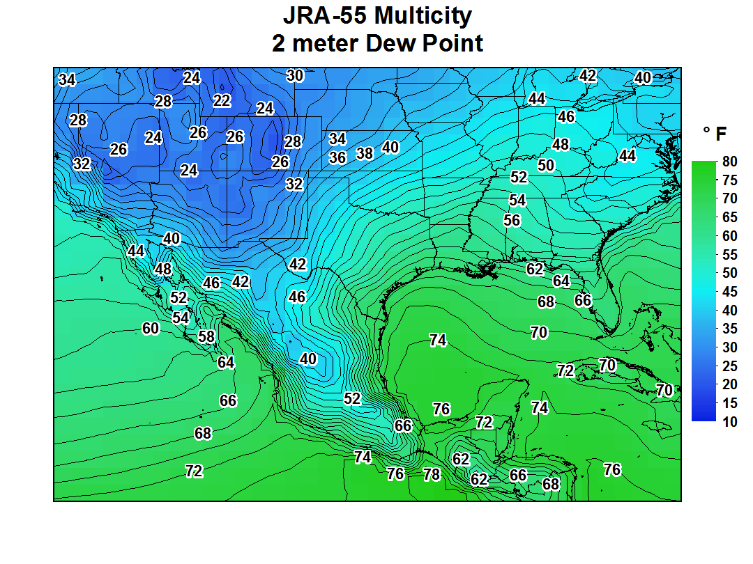
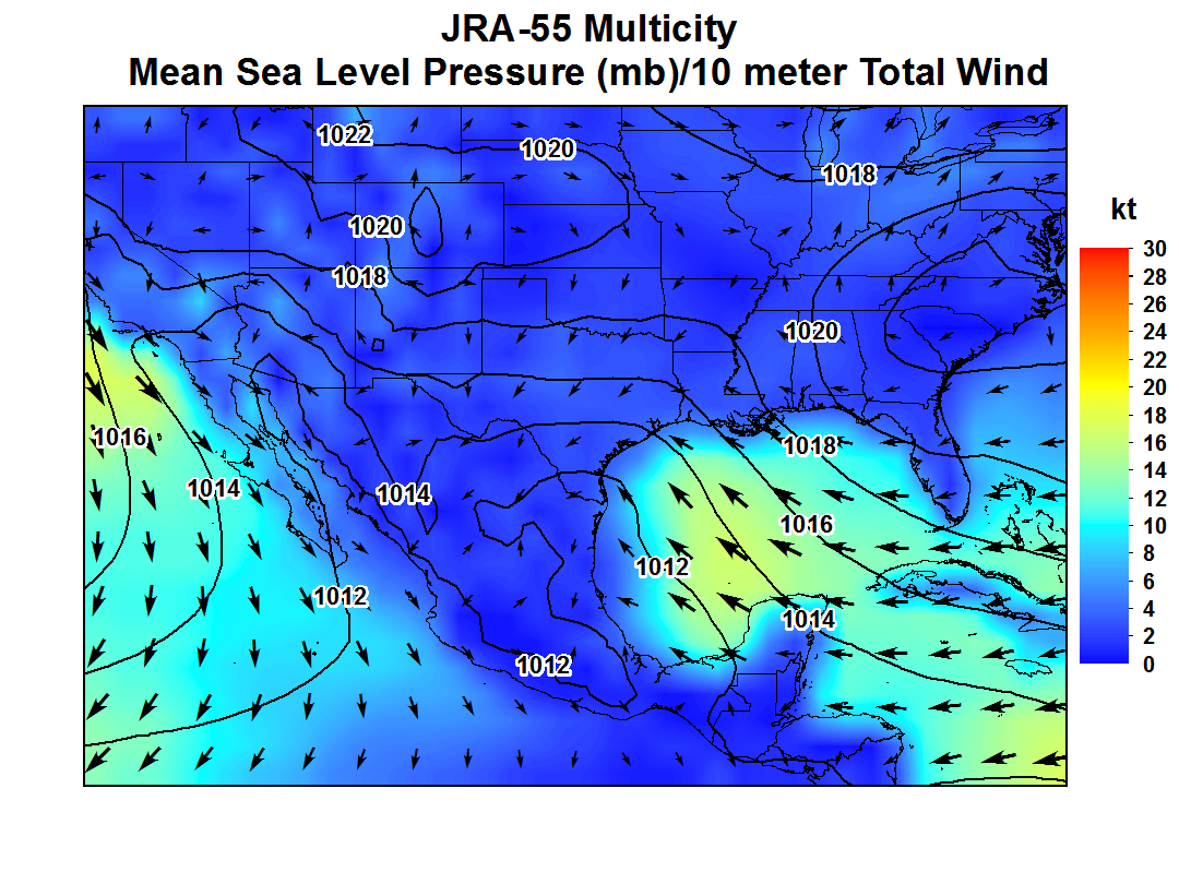
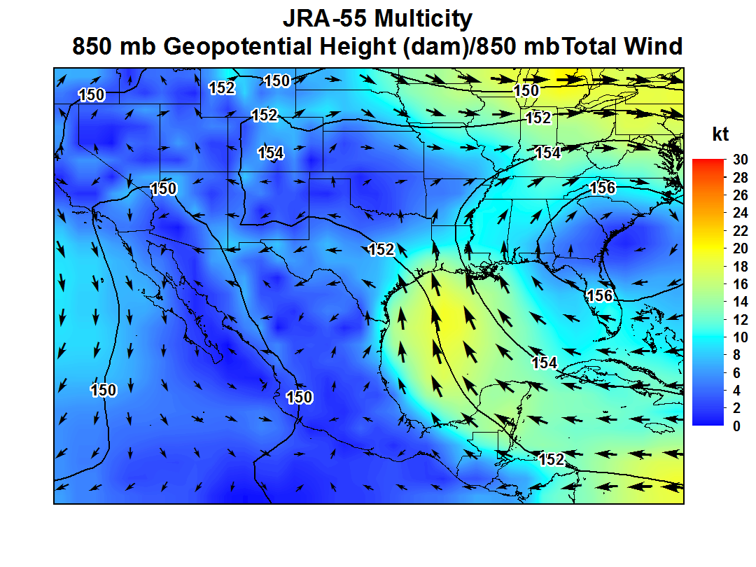
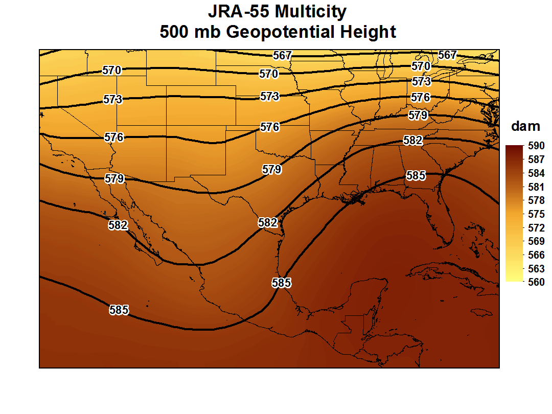
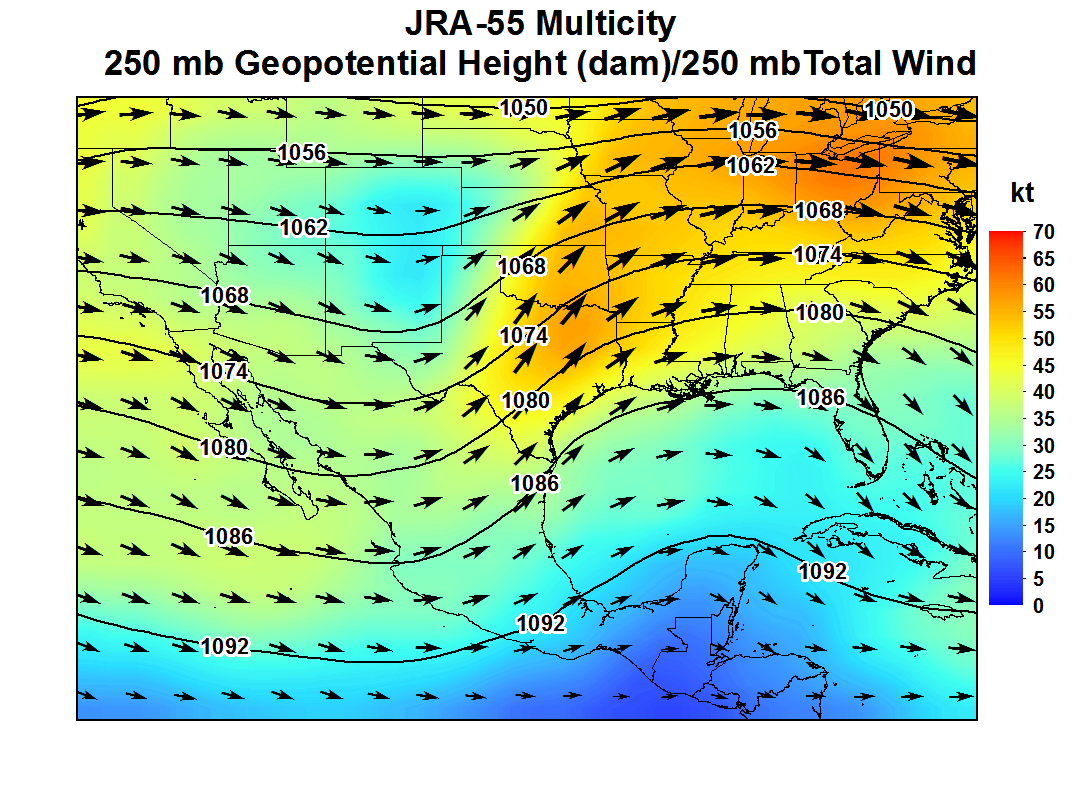
| 1.4-1.9" with values as high as 2" in the Western Gulf of America | 62-74 °F with values as high as 76 °F in the Western Gulf of America | Converging 5-15 kt SE/E/NE winds indicates a likely boundary across S/SE TX. High pressure centered over the Carolinas produces a wide open Gulf of America. | ˜10-20 kt S/SE LLJ originating from the Western Caribbean | Trough NM/W TX to NW Mexico (CRP/VCT), Zonal flow with a Weak Trough over W TX (LRD) | Trough NM to Central Mexico (CRP/VCT), Weak Trough W TX (LRD); Subtropical Jet (30-50 kt with 45-60 kt Jet Streak Ark-La-Tex Area) |
| Precipitable Water | 2 meter Dew Point Temperature | Mean Sea Level Pressure and 10 meter winds |
|---|---|---|
 |
 |
 |
| 850 mb | 500 mb | 250 mb |
 |
 |
 |
| Precipitable Water | 2 meter Dew Point Temperature | Mean Sea Level Pressure and 10 meter winds |
|---|---|---|
 |
 |
 |
| 850 mb | 500 mb | 250 mb |
 |
 |
 |
| Precipitable Water | 2 meter Dew Point Temperature | Mean Sea Level Pressure and 10 meter winds |
|---|---|---|
 |
 |
 |
| 850 mb | 500 mb | 250 mb |
 |
 |
 |
| Precipitable Water | 2 meter Dew Point Temperature | Mean Sea Level Pressure and 10 meter winds |
|---|---|---|
 |
 |
 |
| 850 mb | 500 mb | 250 mb |
 |
 |
 |
| Precipitable Water | 2 meter Dew Point Temperature | Mean Sea Level Pressure and 10 meter winds |
|---|---|---|
 |
 |
 |
| 850 mb | 500 mb | 250 mb |
 |
 |
 |
| Precipitable Water | 2 meter Dew Point Temperature | Mean Sea Level Pressure and 10 meter winds |
|---|---|---|
 |
 |
 |
| 850 mb | 500 mb | 250 mb |
 |
 |
 |
| Precipitable Water | 2 meter Dew Point Temperature | Mean Sea Level Pressure and 10 meter winds |
|---|---|---|
 |
 |
 |
| 850 mb | 500 mb | 250 mb |
 |
 |
 |
| Precipitable Water | 2 meter Dew Point Temperature | Mean Sea Level Pressure and 10 meter winds |
|---|---|---|
 |
 |
 |
| 850 mb | 500 mb | 250 mb |
 |
 |
 |
| Precipitable Water | 2 meter Dew Point Temperature | Mean Sea Level Pressure and 10 meter winds |
|---|---|---|
 |
 |
 |
| 850 mb | 500 mb | 250 mb |
 |
 |
 |
| Precipitable Water | 2 meter Dew Point Temperature | Mean Sea Level Pressure and 10 meter winds |
|---|---|---|
 |
 |
 |
| 850 mb | 500 mb | 250 mb |
 |
 |
 |
| Precipitable Water | 2 meter Dew Point Temperature | Mean Sea Level Pressure and 10 meter winds |
|---|---|---|
 |
 |
 |
| 850 mb | 500 mb | 250 mb |
 |
 |
 |
| Precipitable Water | 2 meter Dew Point Temperature | Mean Sea Level Pressure and 10 meter winds |
|---|---|---|
 |
 |
 |
| 850 mb | 500 mb | 250 mb |
 |
 |
 |
| Precipitable Water | 2 meter Dew Point Temperature | Mean Sea Level Pressure and 10 meter winds |
|---|---|---|
 |
 |
 |
| 850 mb | 500 mb | 250 mb |
 |
 |
 |
| Precipitable Water | 2 meter Dew Point Temperature | Mean Sea Level Pressure and 10 meter winds |
|---|---|---|
 |
 |
 |
| 850 mb | 500 mb | 250 mb |
 |
 |
 |
| Precipitable Water | 2 meter Dew Point Temperature | Mean Sea Level Pressure and 10 meter winds |
|---|---|---|
 |
 |
 |
| 850 mb | 500 mb | 250 mb |
 |
 |
 |
| Precipitable Water | 2 meter Dew Point Temperature | Mean Sea Level Pressure and 10 meter winds |
|---|---|---|
 |
 |
 |
| 850 mb | 500 mb | 250 mb |
 |
 |
 |

