December 21, 2021 - A strong storm system moving across the central and southern United States resulted in widespread severe weather across the region on December 10 and 11. The National Weather Service (NWS) confirmed 66 tornadoes as of today (see list below), and several long track tornadoes. The storms travelled from Arkansas towards the Great Lakes. The most significant damage occurred in Arkansas, Tennessee, Missouri and Kentucky. Eight states reported tornadoes during the event. The NWS received nearly 400 reports of large hail, damaging winds and tornadoes across the area.
NWS Storm Prediction Center continuously monitored the potential for severe weather several days in advance of the event and issued outlooks highlighting the area of concern three days before the storms developed. On the morning of the event, the Storm Prediction Center upgraded the outlook to a Moderate Risk and called for “strong tornadoes” several hours before the worst thunderstorms formed.
NWS forecasts and watches continued through the day of the event, and warnings were issued with lead times well above average and sent out through NOAA Weather Radio, Wireless Emergency Alerts (WEA), the Emergency Alert System, the Emergency Managers Weather Information Network, NOAA Weather Wire Service, and National Weather Service social media accounts.
One of the more extraordinary aspects of this severe weather event was the long-lived nature of the tornado-producing thunderstorms. In particular, two supercell thunderstorms each traveled well over 100 miles, producing tornadoes along the way, before dissipating well after dark.

| City | County | State | EF Rating | Est Wind Speed | Path Length (Miles) |
|---|---|---|---|---|---|
| City | County | State | EF Rating | Est Wind Speed | Path Length (Miles) |
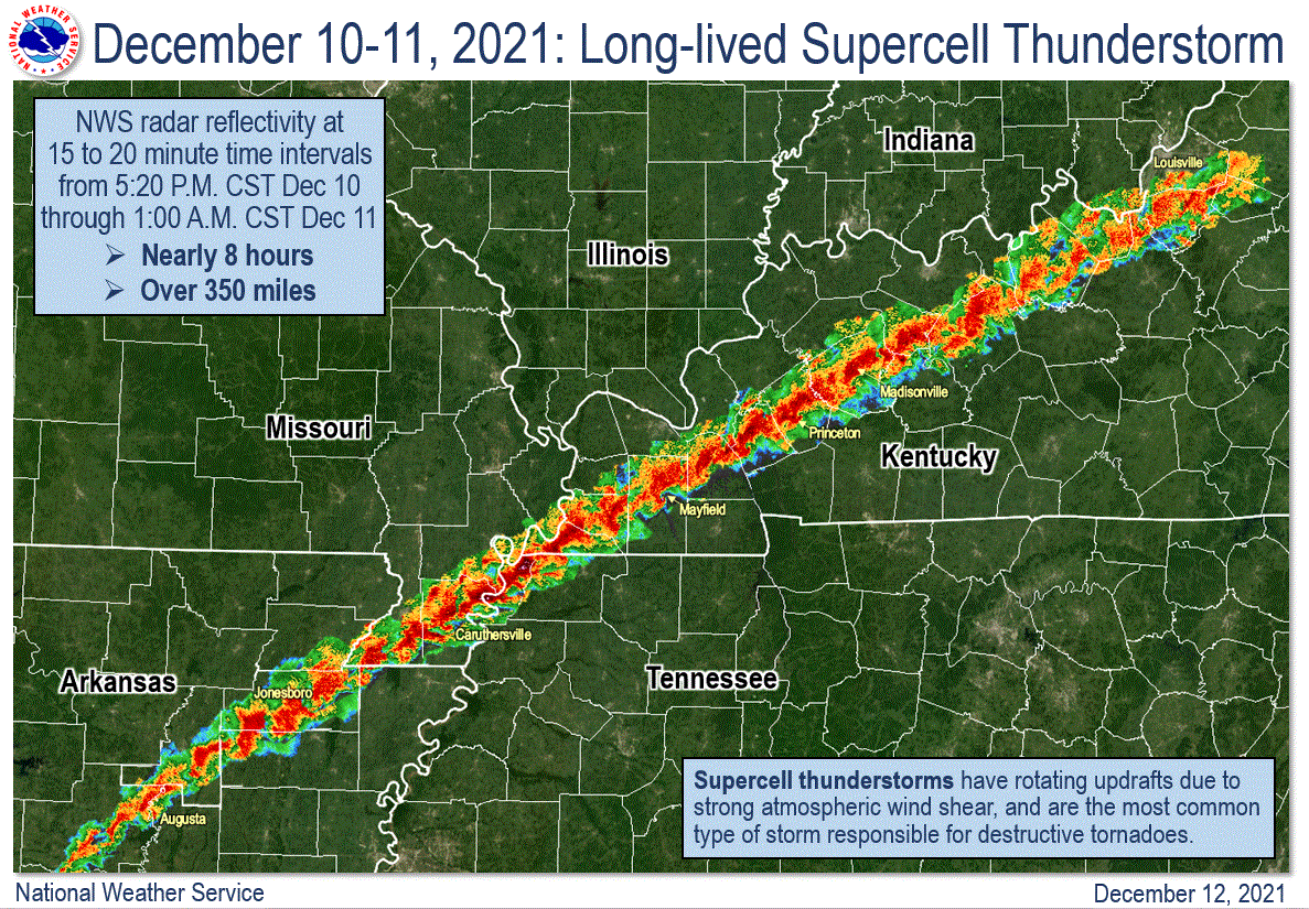
The tornadoes collapsed an occupied candle factory in Mayfield, Kentucky, an Amazon warehouse near Edwardsville, Illinois, and a nursing home in Monette, Arkansas.
After the storm, the NWS began conducting storm damage surveys. The eight surveys, below, include tornado track paths, photographs, radar imagery, and storm reports from the damage that has been examined up to this point. The data presented is preliminary and subject to change as new information becomes available.

