Overview
|
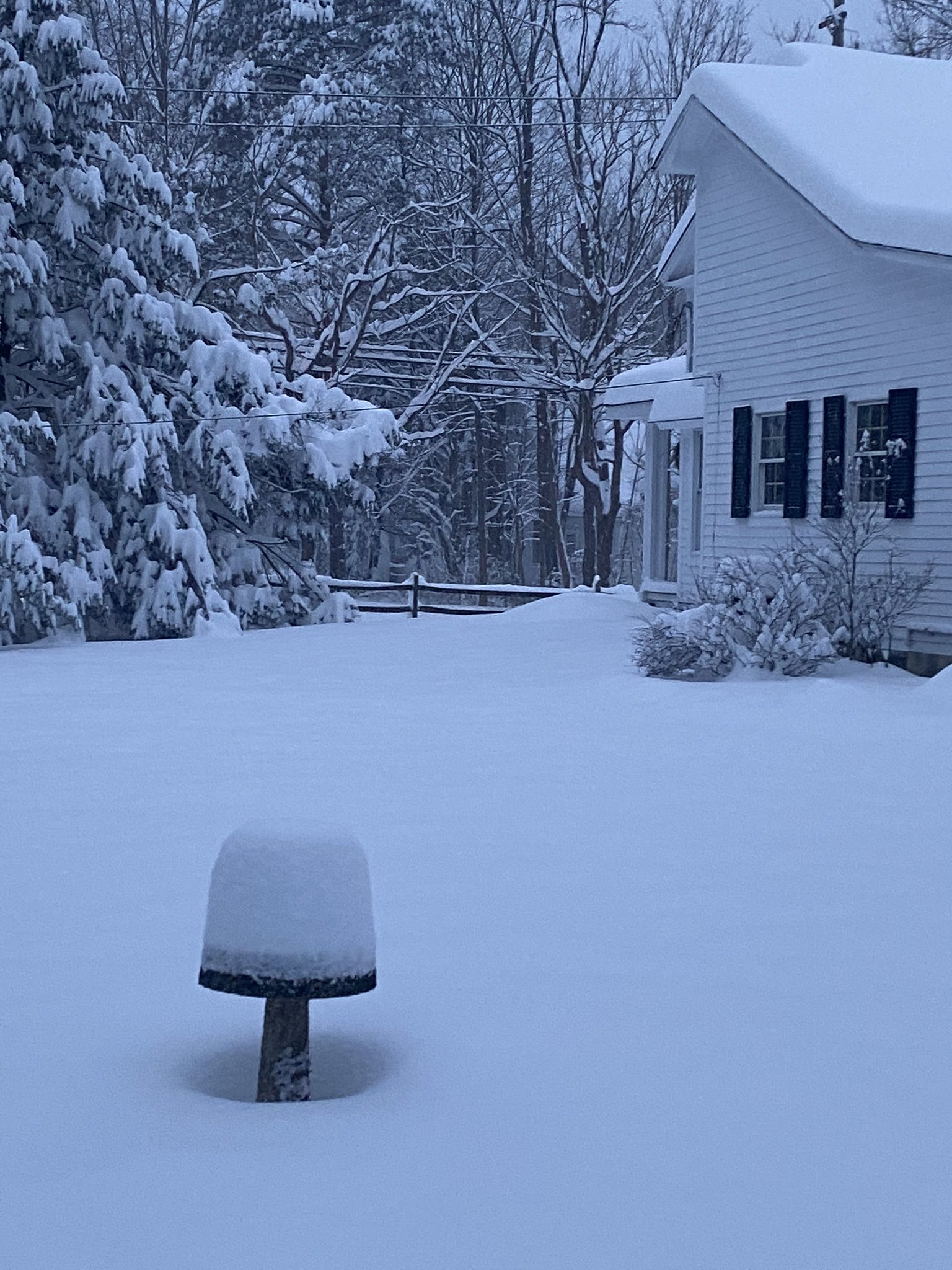
Low pressure developed across the Northern Plains and quickly deepened to 988 mb as it moved northeast across the Upper Midwest and Upper Great Lakes on Dec 23 and Dec 24. On the backside of this low, blizzard warnings were issued across the Upper Midwest, showing the strength of the surface and associated upper-level trough. As the first low began to weaken as it continued northeast into Canada, a piece of the upper trough broke off and dove south across the Ohio Valley on Christmas Day. This allowed for cyclogenesis to occur as another surface low pressure developed across the Southeast on Christmas eve. This low pressure system quickly moved north through the spine of the Appalachians, reaching the Mid-Atlantic by Christmas day and creating a tight temperature gradient aloft between the warm sector of the Mid-Atlantic and the now closed upper-level-low situated across the Ohio Valley. Thus, a brief window of intense frontogenesis at the 700 mb level occurred on Christmas eve across north-central Ohio, resulting in a heavy band of synoptic snow with rates in excess of one inch per hour. The upper trough became negatively tilted by Christmas morning, allowing colder air aloft to infiltrate across the region as the upper low began to stall across the Ohio Valley, trapping in low-level moisture and effectively starting the lake effect portion of the event. Temperatures around -15 degrees Celsius arrived by Christmas morning with predominantly northwest to west flow across Lake Erie persisting through Christmas day. This allowed lake effect snow to ramp up across the lakeshore from Cleveland, northeast through Erie, PA. Although inversion heights weren’t especially extreme for this lake effect event, lift within the dendritic growth zone (DGZ) was maximized for the majority of this event. This, coupled with sufficient low-level moisture trapped by the upper-level low, allowed for efficient lake effect snow with very high snow-to-liquid ratios (SLR) of 20:1 to possibly 25:1. By late Christmas day into Christmas night, another trough moved south across the Great Lakes, shifting winds more west to southwesterly. Lake effect banding was able to quickly reorganize with little wind shear within the boundary layer, resulting in a single band that significantly impacted the lakeshore counties of Lake, Ashtabula, and Erie with snowfall rates of 1 to 2 inches per hour. Some frictional convergence along the lakeshore may have also helped enhance snowfall rates with southwest winds on land and west winds across the lake. The highest snowfall totals for this event were actually located nearest to the lakeshore, with up to 30 to 36 inches along the Lake, Ashtabula, and Erie lakeshore counties. |
|
Photos & Video
 |
 |
 |
 |
| A snowy street from W10 and Auburn Ave in Tremont, Cleveland, OH. (Credit Lou Muenz) |
A snowy scene with colorful lights in Sagamore Hills, OH (Credit Chris Tyson) |
A snowy scene with colorful lights on Christmas Day in Parma, OH. (Credit Bob Leech) |
Snow in Medina, OH with a Christmas tree backdrop. (Credit Elliot Gilfix) |
 |
 |
 |
 |
| Incredible snow piles in Mentor-on-the-Lake, OH. (Credit Kev Celeste) |
Snow from Gates Mills, OH. (Credit Renee DeLuca) |
Snow in Perry, OH. (Credit Cheryl Dudley) |
A snowy scene from Erie, PA. (Credit Birder Katie) |
 |
 |
 |
 |
| Snow piling up in Shaker Heights, OH. (Credit K. Purcell) |
A snowy scene in Lakewood, OH on Christmas day. Around 13 inches fell here. (Credit Lynne Kokoczka) |
A snowy scene from Willoughby, OH on Christmas Day. (Credit Courtney Heil) |
A snow-covered street in Cleveland Heights, OH. (Credit Stacy McGaugh) |
Radar
.gif) |
 |
| Radar loop from 10:30 AM EST Dec 24 through 7:00 AM EST Dec 26. Tan county outlines indicate Winter Weather Advisories while Pink county outlines indicate Winter Storm Warnings. | Additional radar loop showing composite reflectivity, streamlines, and wind vectors from Dec 24 to Dec 26. |
Storm Reports
Public Information Statement
Spotter Reports
National Weather Service Cleveland OH
1112 PM EST Fri Jan 1 2021
...Storm Total Snowfall from December 24-26 2020 Winter Storm...
The following are snowfall totals from midday December 24 to
midday December 26, 2020 storm that has been affecting our region.
Appreciation is extended to highway departments, cooperative
observers, Skywarn spotters and media for these reports.
********************STORM TOTAL SNOWFALL********************
LOCATION STORM TOTAL TIME/DATE COMMENTS
SNOWFALL OF
/INCHES/ MEASUREMENT
OHIO
...Ashland County...
1 NNE Sullivan 9.3 700 AM 12/26 CoCoRaHS
Perrysville 7.5 648 PM 12/25 Trained Spotter
3 WSW Hayesville 7.1 930 PM 12/25 Trained Spotter
...Ashtabula County...
1 ESE Ashtabula 32.0 700 AM 12/26 CoCoRaHS
3 W Ashtabula 28.0 600 AM 12/26 Trained Spotter
1 WSW Conneaut 24.0 1035 AM 12/26 Trained Spotter
3 W Ashtabula 23.0 915 AM 12/26 Trained Spotter
2 SW Edgewood 21.8 500 AM 12/26 Trained Spotter
Edgewood 20.5 913 PM 12/25 Trained Spotter
3 ENE Trumbull 19.5 830 AM 12/26 Trained Spotter
1 ENE Geneva 19.0 600 PM 12/25 Trained Spotter
3 E South Madison 18.1 753 AM 12/26 Trained Spotter
1 SSE Kelloggsville 18.0 940 AM 12/26 Trained Spotter
2 S Harpersfield 17.0 851 PM 12/25 Trained Spotter
2 ESE Pierpont 15.5 853 AM 12/26 Trained Spotter
2 S Ashtabula 15.0 755 AM 12/26 Trained Spotter
2 ESE Monroe Center 14.2 806 AM 12/26 Trained Spotter
1 ENE Jefferson 13.8 652 PM 12/25 Trained Spotter
1 E Orwell 9.8 816 AM 12/26 Trained Spotter
2 N Cherry Valley 9.0 827 AM 12/25 Trained Spotter
2 N Cherry Valley 8.6 911 PM 12/25 Trained Spotter
...Crawford County...
1 W Galion 6.7 743 AM 12/26 Trained Spotter
3 WSW Tiro 4.8 821 AM 12/26 Trained Spotter
1 NE Bucyrus 4.0 700 AM 12/26 Co-Op Observer
...Cuyahoga County...
South Euclid 20.9 829 AM 12/26 Trained Spotter
1 E Cleveland Height 18.5 300 PM 12/25 Trained Spotter
1 W Shaker Heights 17.5 1006 AM 12/26 Trained Spotter
1 W Chagrin Falls 17.4 828 AM 12/26 Trained Spotter
1 WSW Cleveland Heig 17.3 813 AM 12/26 Trained Spotter
2 SW Cleveland Heigh 17.1 734 AM 12/26 Trained Spotter
1 SSW Solon 17.1 859 AM 12/26 Trained Spotter
1 ENE Lyndhurst 16.0 923 AM 12/25 Trained Spotter
1 SSW Westlake 15.8 800 AM 12/26 CoCoRaHS
2 NE Euclid 13.5 1100 PM 12/25 Trained Spotter
7 SW Cleveland 13.3 1000 PM 12/25 CoCoRaHS
1 NW Lakewood 12.8 834 PM 12/25 Trained Spotter
3 SW North Royalton 12.5 837 PM 12/25 Trained Spotter
1 NE Maple Heights 12.3 900 AM 12/25 Trained Spotter
2 NNW Euclid 11.3 1117 AM 12/26 Trained Spotter
2 NNW Parma 11.2 800 AM 12/26 CoCoRaHS
Cleveland-Kamms Corn 11.0 1022 AM 12/25 Trained Spotter
1 NNE Seven Hills 10.9 900 AM 12/26 CoCoRaHS
2 SSE Parma 10.8 1200 PM 12/25 Trained Spotter
1 SE Strongsville 10.5 721 AM 12/26 Trained Spotter
1 SSW Lakewood 10.3 820 AM 12/25 CoCoRaHS
Cleveland Hopkins Ai 10.2 651 AM 12/26 Trained Spotter
1 NW Berea 10.0 600 AM 12/26 CoCoRaHS
Cleveland-Old Brookl 10.0 615 AM 12/26 Trained Spotter
Seven Hills 8.5 514 PM 12/25 Trained Spotter
2 SE Brecksville 8.2 700 AM 12/26 CoCoRaHS
...Erie County...
5 NNE Wakeman 8.9 800 AM 12/26 CoCoRaHS
2 NNE Castalia 6.3 645 AM 12/26 CoCoRaHS
Huron 6.0 901 AM 12/26 Trained Spotter
N Berlin Heights 5.9 700 AM 12/26 CoCoRaHS
ENE Milan 4.5 800 AM 12/25 CoCoRaHS
...Geauga County...
2 ESE South Thompson 18.8 1057 AM 12/26 Trained Spotter
Chardon 17.3 934 AM 12/26 Trained Spotter
2 SE South Madison 17.0 316 PM 12/25 Trained Spotter
4 S Madison 16.5 700 AM 12/26 CoCoRaHS
2 W Burton 15.6 730 AM 12/26 Trained Spotter
1 S Montville 13.3 600 AM 12/26 Trained Spotter
1 NE Middlefield 12.5 800 AM 12/26 CoCoRaHS
...Hancock County...
1 SSW Findlay 1.2 1020 PM 12/25 Trained Spotter
...Holmes County...
Killbuck 3.8 929 PM 12/24 Broadcast Media
1 E Millersburg 3.5 911 PM 12/24 Emergency Manager
...Huron County...
3 NW New London 9.3 545 AM 12/26 Trained Spotter
1 E Norwalk 3.5 900 AM 12/25 CoCoRaHS
...Knox County...
2 SE Centerburg 9.9 800 AM 12/26 Co-Op Observer
4 NNW Fredericktown 9.0 700 AM 12/26 CoCoRaHS
...Lake County...
1 WSW Madison 29.2 600 AM 12/26 Trained Spotter
1 NW Concord 22.2 830 AM 12/26 Trained Spotter
2 ESE Mentor 21.9 914 AM 12/26 Trained Spotter
1 NNE Kirtland Hills 21.6 803 AM 12/26 Trained Spotter
2 WNW Concord 21.5 944 AM 12/26 Trained Spotter
North Madison 21.5 650 AM 12/26 Trained Spotter
1 S Waite Hill 20.6 845 AM 12/26 Trained Spotter
3 SW Willoughby 17.8 700 AM 12/26 CoCoRaHS
1 SE Concord 16.8 728 AM 12/26 Trained Spotter
1 E Mentor 16.2 801 AM 12/26 Trained Spotter
1 SSE Mentor 13.8 833 AM 12/26 Trained Spotter
...Lorain County...
2 NE North Ridgevill 14.4 700 AM 12/26 Trained Spotter
1 E Sheffield Lake 13.2 856 AM 12/26 Trained Spotter
Elyria 9.6 906 AM 12/26 Trained Spotter
1 S Oberlin 7.0 800 AM 12/26 Co-Op Observer
4 N Lagrange 7.0 700 AM 12/25 Co-Op Observer
3 SE Elyria 5.6 748 AM 12/26 Trained Spotter
6 SW Wellington 5.0 800 AM 12/25 CoCoRaHS
...Lucas County...
7 NNE Swanton 2.5 700 AM 12/26 CoCoRaHS
4 SE Toledo 1.5 700 AM 12/26 CoCoRaHS
Toledo Express Airpo 1.0 700 AM 12/26 Trained Spotter
3 SSW Oregon 0.8 800 AM 12/26 CoCoRaHS
2 ENE Toledo 0.5 700 AM 12/25 CoCoRaHS
2 NNE Waterville 0.5 900 AM 12/25 CoCoRaHS
...Mahoning County...
Canfield 7.7 759 AM 12/26 Trained Spotter
1 NW Austintown 7.0 943 PM 12/25 Trained Spotter
1 NNW Canfield 5.3 913 AM 12/26 Trained Spotter
...Marion County...
Marion 4.0 233 PM 12/25 Trained Spotter
4 SSE Marion 2.9 700 AM 12/26 CoCoRaHS
...Medina County...
1 ENE Medina 10.2 730 AM 12/26 CoCoRaHS
1 NE Brunswick 9.9 700 AM 12/26 CoCoRaHS
2 ESE Hinckley 9.9 846 AM 12/26 Trained Spotter
1 ENE Brunswick 9.9 1240 PM 12/26 Trained Spotter
2 N Lodi 8.9 632 PM 12/25 Trained Spotter
5 WNW Wadsworth 7.5 500 AM 12/26 CoCoRaHS
Medina 7.0 1159 PM 12/24 CoCoRaHS
2 E Homerville 6.0 839 AM 12/25 Trained Spotter
...Morrow County...
5 ESE Mount Gilead 7.0 600 AM 12/26 CoCoRaHS
...Ottawa County...
3 W Port Clinton 2.0 900 AM 12/25 CoCoRaHS
7 W Port Clinton 1.8 800 AM 12/26 CoCoRaHS
...Portage County...
2 SSW Streetsboro 15.2 700 AM 12/26 CoCoRaHS
Hiram 13.0 942 AM 12/26 Trained Spotter
1 NNW Mantua 12.5 800 AM 12/26 CoCoRaHS
2 WNW Aurora 11.5 700 AM 12/26 CoCoRaHS
4 NE Kent 11.3 800 AM 12/26 CoCoRaHS
1 ENE Mogadore 9.8 841 AM 12/26 Trained Spotter
1 SSW Brady Lake 9.4 727 PM 12/25 Trained Spotter
2 W Kent 9.0 700 AM 12/25 CoCoRaHS
1 ENE Streetsboro 8.4 821 PM 12/25 Trained Spotter
1 E Ravenna 8.0 1130 AM 12/25 CoCoRaHS
2 W Aurora 7.5 830 AM 12/25 CoCoRaHS
1 W Craig Beach 7.4 700 AM 12/26 Co-Op Observer
...Richland County...
1 W Mansfield 9.5 822 PM 12/25 Trained Spotter
1 NW Lexington 8.9 720 AM 12/26 CoCoRaHS
5 NW Mifflin 7.5 820 PM 12/25 Trained Spotter
5 WSW Mansfield 6.5 800 AM 12/25 CoCoRaHS
1 NNE Shelby 6.5 1159 PM 12/25 CoCoRaHS
3 W Olivesburg 6.5 430 AM 12/25 NWS Employee
Mansfield Lahm Airpo 6.4 700 AM 12/26 Trained Spotter
...Sandusky County...
2 ENE Fremont 2.5 914 AM 12/26 Trained Spotter
...Seneca County...
5 SE Tiffin 1.5 700 AM 12/25 CoCoRaHS
2 NNW Mexico 1.3 528 PM 12/25 Trained Spotter
...Stark County...
1 W Canton 11.4 1235 PM 12/26 Trained Spotter
4 S Alliance 8.5 600 AM 12/26 Trained Spotter
1 ESE Alliance 8.3 741 AM 12/26 Trained Spotter
3 NW Waynesburg 7.4 817 AM 12/26 Trained Spotter
1 NE Canton 7.3 824 AM 12/26 Trained Spotter
...Summit County...
1 NW Tallmadge 11.4 905 AM 12/26 Trained Spotter
New Franklin 11.2 1124 AM 12/26 Trained Spotter
1 SW Munroe Falls 11.0 700 AM 12/26 Co-Op Observer
1 N Bath 10.8 700 AM 12/26 Trained Spotter
Akron-Canton Airport 10.5 651 AM 12/26 Trained Spotter
1 NW Boston Heights 10.0 819 AM 12/26 Trained Spotter
2 SE Cuyahoga Falls 9.8 810 AM 12/26 Trained Spotter
1 NNE Bath 9.3 719 AM 12/26 Trained Spotter
2 W Akron 9.0 800 AM 12/25 CoCoRaHS
Fairlawn 9.0 1029 AM 12/26 Trained Spotter
2 ESE Fairlawn 8.5 828 PM 12/25 Trained Spotter
3 SSW Barberton 8.0 952 PM 12/25 Trained Spotter
1 ESE Cuyahoga Falls 7.4 700 AM 12/25 CoCoRaHS
...Trumbull County...
1 WNW Newton Falls 14.1 753 AM 12/26 Trained Spotter
Youngstown Regional 10.7 651 AM 12/26 Trained Spotter
Cortland 10.0 630 AM 12/26 Trained Spotter
2 WSW Warren 7.8 802 AM 12/26 Trained Spotter
2 NNW Southington 7.5 930 AM 12/25 Trained Spotter
...Wayne County...
3 ENE Doylestown 11.0 838 PM 12/25 Trained Spotter
2 NE Apple Creek 6.5 700 AM 12/25 CoCoRaHS
4 SSE West Salem 5.0 826 AM 12/25 CoCoRaHS
W Mount Eaton 5.0 900 AM 12/25 CoCoRaHS
...Wood County...
2 WSW Perrysburg 2.0 500 AM 12/26 CoCoRaHS
1 W Bowling Green 1.4 700 AM 12/26 CoCoRaHS
1 S Bowling Green 1.0 650 PM 12/25 Trained Spotter
...Wyandot County...
4 NW Harpster 1.1 641 PM 12/25 Trained Spotter
PENNSYLVANIA
...Crawford County...
4 WNW Crossingville 17.5 1102 PM 12/25 Trained Spotter
6 E Atlantic 13.3 827 AM 12/26 Trained Spotter
1 S Meadville 13.0 959 AM 12/26 Trained Spotter
1 NNE Meadville 12.6 915 AM 12/26 Trained Spotter
1 NE Meadville 11.4 744 AM 12/26 Trained Spotter
3 WNW Springboro 10.4 700 AM 12/26 Co-Op Observer
1 WNW Conneaut Lake 7.8 700 AM 12/25 CoCoRaHS
...Erie County...
1 NNW Girard 30.5 413 AM 12/26 Trained Spotter
3 ENE McKean 29.5 854 AM 12/26 Trained Spotter
4 S Wesleyville 25.5 737 AM 12/26 Trained Spotter
1 W McKean 23.7 801 AM 12/26 Trained Spotter
4 SE Harborcreek 23.0 600 AM 12/26 Trained Spotter
2 ESE North East 22.2 715 AM 12/26 Trained Spotter
2 W Avonia 21.5 840 AM 12/26 Trained Spotter
4 W Colt Station 21.4 754 AM 12/26 Trained Spotter
1 WNW North East 20.0 1005 AM 12/26 Trained Spotter
6 SW Erie 19.8 600 AM 12/26 CoCoRaHS
1 NW Harborcreek 19.8 907 AM 12/26 Trained Spotter
3 NW Elgin 19.5 810 PM 12/25 Trained Spotter
Erie Intl Airport 18.7 700 AM 12/26 Trained Spotter
2 NW Edinboro 16.8 500 AM 12/26 Trained Spotter
2 E Edinboro 16.6 724 AM 12/26 Trained Spotter
2 WSW Erie 15.4 700 AM 12/26 Trained Spotter
2 SSW Corry 10.0 900 AM 12/26 Trained Spotter
&&
Environment
 |
 |
 |
| Figure 1: WPC surface analysis from Dec 23 through Dec 26 | Figure 2: Upper air analysis at 250 mb showing the deep, negatively tilted trough across the Ohio Valley | Figure 3: Upper air analysis at 500 mb showing the cut-off low across the Ohio Valley |
 |
 |
 |
| Figure 4: Frontogenesis at the 700 mb level from Dec 23 to Dec 25. Notice the intense frontogenetic banding at 00Z (7 PM EST) on Dec 25. This lines up with an intense band of synoptic snow that set up on a north/south axis along and west of I-71, resulting in inch per hour snowfall rates across this area. | Figure 5: Loop of 850 mb heights, temperatures, and winds. Notice 850 temperatures dipping around -14 to -15 degrees C across the snowbelt region with northwest to west flow across the lake, resulting in lake effect snow. | Figure 6: Loop of the “lake effect 2” composite on the SPC mesoanalysis. Shown is boundary-layer wind (blue/tan wind barbs), streamlines (black contours), and convergence (red contours) from 7 AM EST Dec 25 to 7 AM EST Dec 26. Note the boundary layer winds aligning westerly overnight Dec 25 into the morning of Dec 26 with increased values of convergence. This led to snowfall rates of 1 to 2 inches per hour across the primary snowbelt. |
 |
| Figure 7: Bufkit loop of the HRRR at KERI from 7 AM Dec 25 through 7 AM Dec 26, initialized at 7 PM EST Dec 24. Note the conditional instability with inversion heights less than 10,000 ft for the entire event. However, favorable omega/DGZ crossover with minimal shear in the boundary layer for certain portions of this event, (Dec 25 morning/Dec 25 night) and the abundance of boundary layer moisture allowed for single-banded lake effect snow with SLRs of 20:1 and perhaps higher around 25:1. |
 |
Media use of NWS Web News Stories is encouraged! Please acknowledge the NWS as the source of any news information accessed from this site. |
|


.png)
