Overview
|
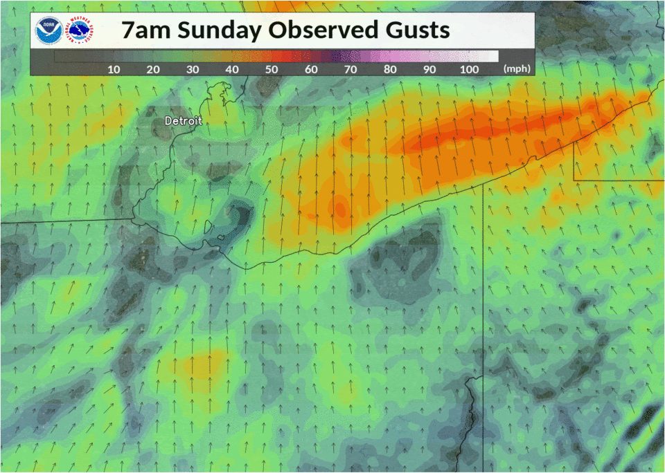
On Sunday, November 15th, a very potent upper level trough and strong 160 knot jet streak resulted in a deepening surface low down to 980 mb moving northeast across the Great Lakes region. The wind field ahead of this trough was particularly intense with upwards of 120 knots at 500mb and 70 knots at 850mb. A warm front extending from the low had moved north across northern Ohio early Sunday morning between 5-8 AM EST. Widespread showers did occur ahead of the warm front, clearing out and becoming less widespread as the warm front progressed northeastward. Farther west in central Indiana, the cold front initiated a line of isolated to scattered showers, quickly congealing into a fully developed line of thunderstorms as it progressed eastward towards Ohio. Temperatures ahead of the front/thunderstorms were in the mid to upper 50s with dew points right around 50. It’s noted that the analysis data seems a little lower in sfc T/Td than actual observations by about 2-5 degrees in temperature and ~1-2 degrees in dew point. Analysis had a slim corridor of 100-250 J/kg of SBCAPE with the line of t-storms. Positive differential potential vorticity advection (from the trough) and 250-850mb differential divergence (from upper-level jet streak circulation) were very strong with the front and pointed to strong upper-level forcing. Frontogenesis was also very strong along the cold front from the surface to 850mb. The result was widespread, damaging wind gusts across the entire NWS CLE forecast area with the line of thunderstorms, and for several hours after the frontal/t-storm passage. Observed gusts of 60 mph+ were common with the highest gust being 79 mph at Lorain Harbor Lighthouse. Damage was widespread to trees, power poles, and roofs, and other miscellaneous items. There were also widespread power outages, with over 150k people out of the power. Some power outages lasted more than 2 days! Every county except Lucas was under a Severe Thunderstorm Warning at some point and more than half of the NWS CLE forecast area had a High Wind Warning. Strong southwest winds also occurred across Lake Erie, with sustained winds greater than 50 knots and gusts greater than 60 knots Sunday afternoon/evening. For this reason, the NWS issued a Storm Warning for the entirety of Lake Erie, something that hasn’t happened since the remnants of Hurricane Sandy impacted the area in 2012. Storm-force winds resulted in a powerful seiche event, with a 14 ft differential between Buffalo (133.5” above LWD) and Toledo (34.5” below LWD). This additionally resulted in very high water levels at Erie, PA, where water levels peaked at 91.6” above LWD that evening. This resulted in significant lakeshore flooding at Presque Isle State Park and lakeshore communities of Millcreek Township, where evacuations of several homes took place that evening. |
Loop of Weather Prediction Center surface analysis |
Photos
|
|
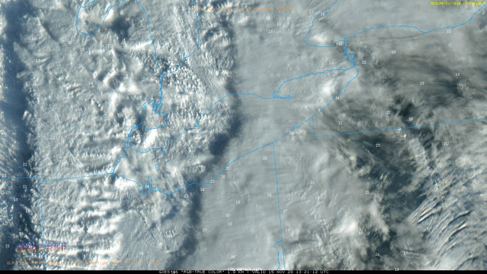
Radar and Satellite
|
 |
| Radar loop showing local storm reports, severe/warnings, and severe thunderstorm watches. |
Storm Reports
 |
 |
| Map of local storm reports. | Map of all convective warnings issued by NWS Cleveland overlaid with local storm reports. Polygons outlined in yellow represent severe thunderstorm warnings. Polygons outlined in red represent tornado warnings. Polygons outlined in purple represent special marine warnings. |
Click here for list of highest measured wind gusts in the NWS Cleveland forecast area
Click here for list of local storm reports in the NWS Cleveland forecast area
Environment
 |
 |
 |
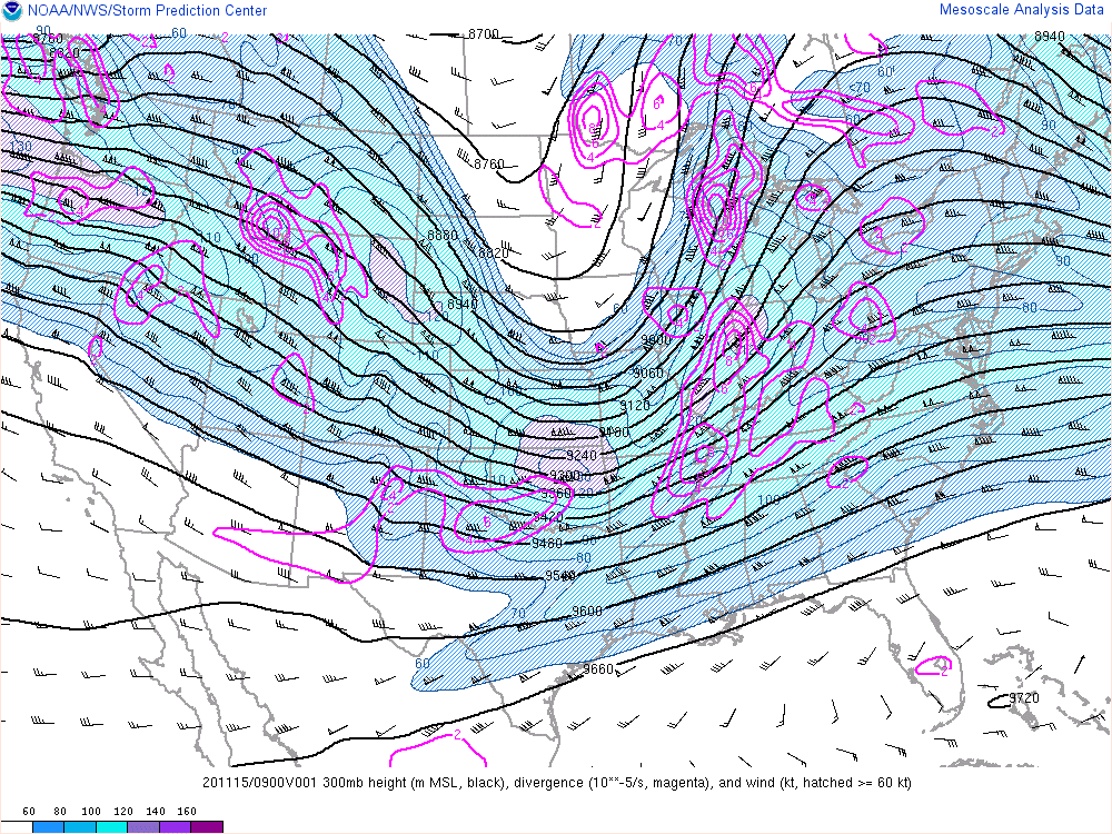
| Weather Prediction Center surface analysis 4 AM EST to 7 PM EST Sunday, Nov 15. | SPC mesoanalysis loop of the 300 mb wind field. Notice the enhanced 130 to 140-knot jet streak across the Ohio Valley. | SPC mesoanalysis loop of 925 mb frontogenesis on Nov 15. |
 |
 |
 |
| SPC mesoanalysis at 1 PM EST on Nov 15 showing 925 mb winds (about 2,000 feet above the surface). Notice the 50 to 60-knot wind barbs along the strong cold front which can be found by locating the tight gradient of red lines. | SPC mesoanalysis loop showing a narrow area of 100 to 250 J/kg surface-based CAPE across the area. | SPC mesoanalysis loop of low-level lapse rates (0 to 3 km) on November 15. |
Marine
 |
 |
 |
| Lake Erie water level graph from Toledo, OH on Nov 15,16. Notice that water levels decreased in excess of 25 inches below low water datum due to the strong southwesterly winds across the lake. | Lake Erie water level graph from Erie, PA on Nov 15,16. Notice that water levels increased in excess of 90 inches above low water datum. This lead to some coastal flooding in the area. | Lake Erie water level graph from Buffalo, NY on Nov 15,16. Notice that water levels increased in excess of 125 inches above low water datum. This lead to coastal flooding in the area. |
 |
 |
 |
| Lake Erie water level displacement graph, showing the drastic differences in water levels across the western, central, and eastern basins of the lake. | Loop showing the water displacement across Lake Erie in feet. | Loop showing the wave heights across Lake Erie on Nov 15,16. Wave heights peaked in excess of 20 feet at some points! |
 |
Media use of NWS Web News Stories is encouraged! Please acknowledge the NWS as the source of any news information accessed from this site. |
|