Overview
|
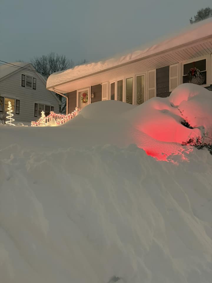
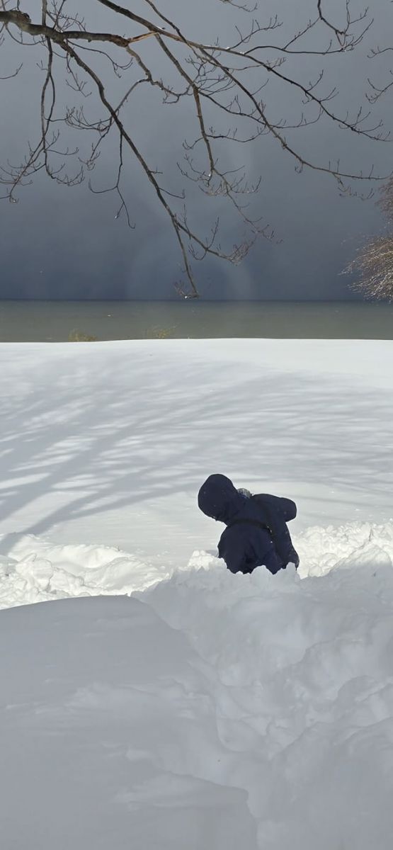
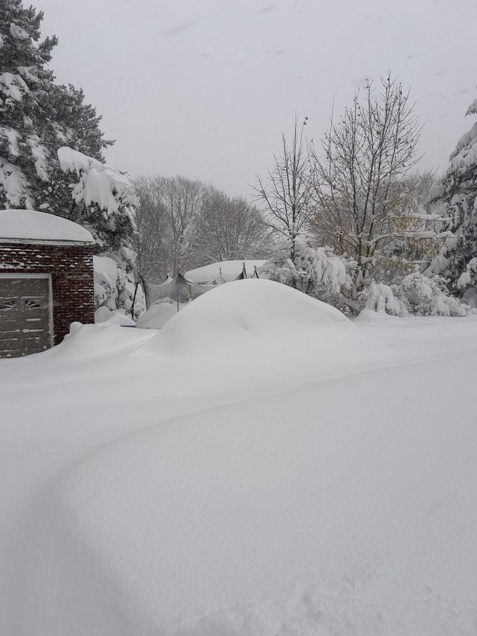
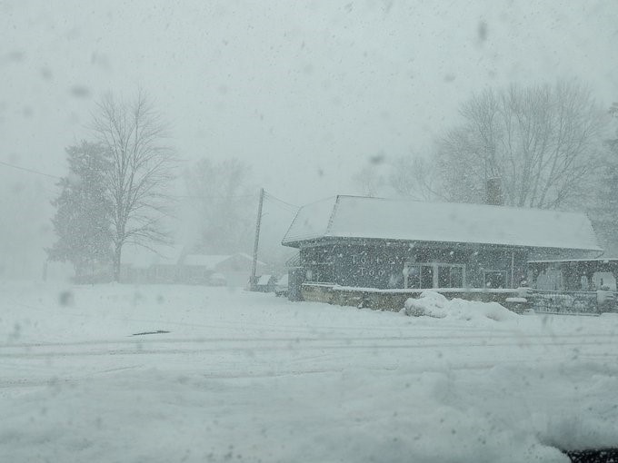
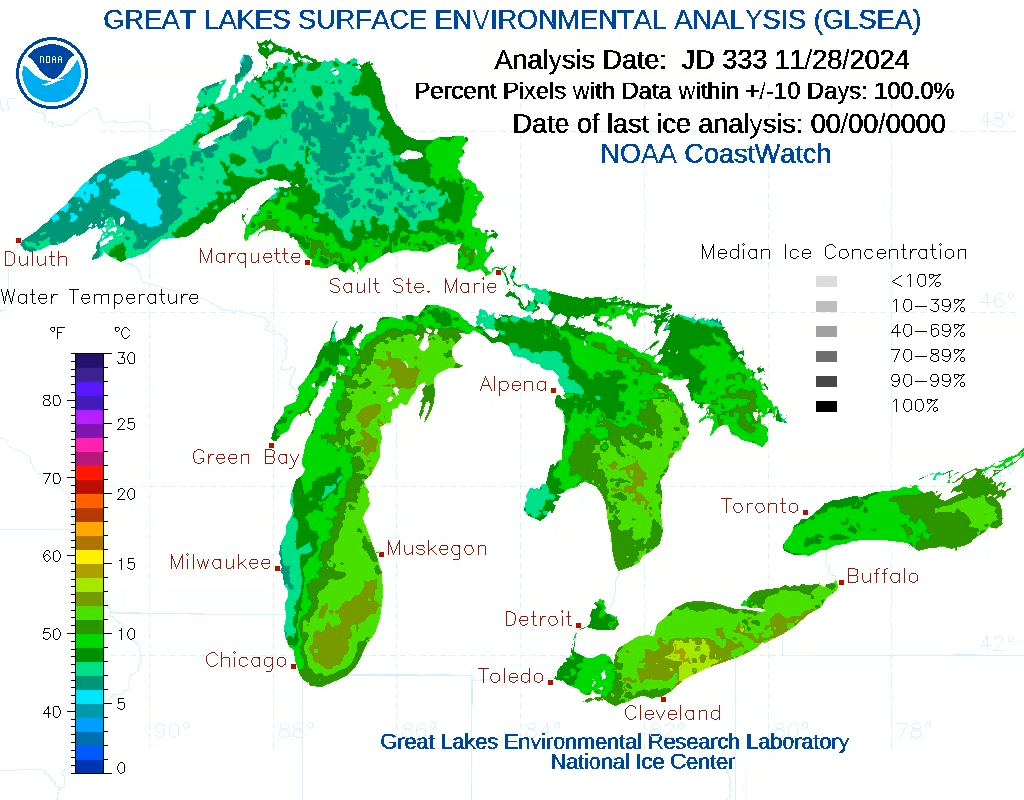
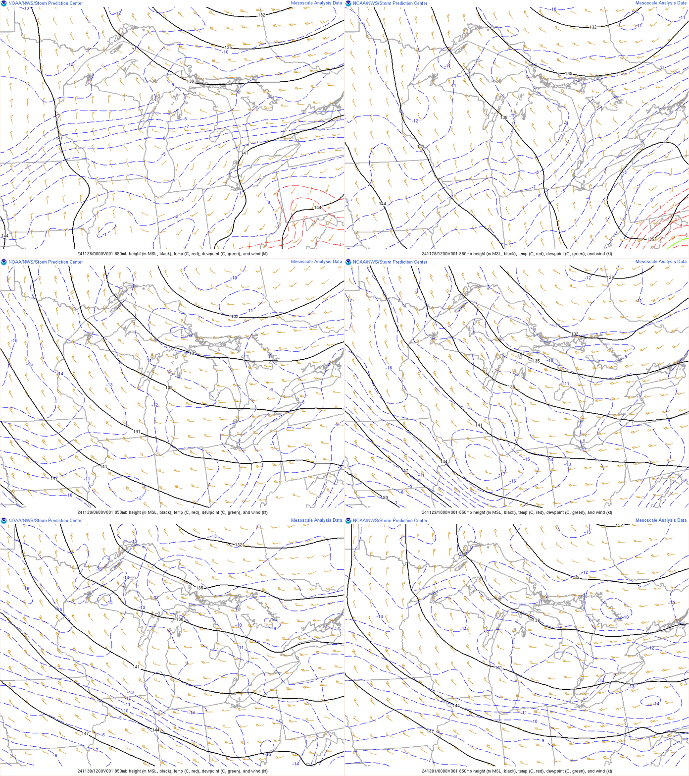
A historic lake effect snow event unfolded across the snowbelt region south and east of Lake Erie beginning Thanksgiving Day and continuing into December 3rd. A cold front brought the coldest air of the season to the region on Thanksgiving Day beginning a multi-day lake effect snow event. The cold air interacted with above-normal Lake Erie water temperatures in the upper 40s to near 50 degrees to produce heavy snow bands. Conditions were favorable for heavy lake effect snow due to the cold air, ample low-level moisture, and a fetch across Lake Erie that resulted in a single dominant band. The band produced heavy snow with rates of 1 to 3 inches per hour bringing significant impacts to Lake and Ashtabula Counties in Ohio, and Erie and Crawford Counties in Pennsylvania. By the morning of November 29, only about 12 hours after the snow began, snowfall totals of around a foot were already being reported in Ashtabula County. After roughly 24 hours, snowfall totals were approaching two and a half feet in Erie County Pennsylvania, and by the morning of November 30th, high-end reports were exceeding 3 feet of snow in peak areas of extreme Northeast Ohio and Northwest Pennsylvania. Finally, during the afternoon on November 30th, the flow across Lake Erie became more southwesterly, pushing the heavy snow band north over Lake Erie and directing it towards Buffalo, New York. This brought a much-needed break to areas that received a tremendous amount of snow. This was not the end of the heavy snowfall as lake effect snow bands moved back south on Sunday, December 1, bringing another foot of snow to portions of Lake County. Lake effect snow continued at times through December 3rd. By the end of the 5-day event, snowfall amounts ranged from 2 to 5 feet across the snowbelt of Northeast Ohio and Northwest Pennsylvania. A few of the highest snowfall totals include 63.2 inches in Saybrook, OH, and 63.8 inches in Girard, PA. Significant impacts were felt with this heavy lake effect snow storm, including disrupting travel over the Holiday weekend. Portions of Interstate 90 and Interstate 86 were shut down on November 29th, stranding motorists for hours. The Pennsylvania National Guard was asked to assist during the storm and helped to rescue stranded motorists. In addition, the weight of the snow damaged trees and bushes and even some property. Reports of roofs collapsing have been received from Lake, Ashtabula, and Erie County where the heaviest snow fell. After only a short break, snow and windy conditions resumed during the early morning hours of December 5th.
|
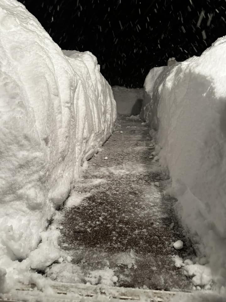 Saybrook was the big winner in Ashtabula County in Ohio, with a storm total snow of 63.2 inches - credit Erin Buckley Arsulic. |
Snow/Ice
Observed storm total snow map from November 28, 2024 to December 3, 2024. Values are interpolated from the below public information statement (PNS).
Storm Total Snow Reports
Public Information Statement
Spotter Reports
National Weather Service Cleveland OH
The following are unofficial observations that include the major
lake effect snowfall that occurred across the region since Thursday
night November 28th. Appreciation is extended to our volunteer snow
spotters, cooperative observers, and CoCoRaHS for these reports.
This summary also is available on our home page at
weather.gov/cle/pns_all
********************STORM TOTAL SNOWFALL********************
LOCATION TOTAL TIME/DATE COMMENTS
SNOWFALL MEASURED
(inches)
OHIO
...Ashtabula County...
1 NNE Saybrook 63.2 910 PM 12/03 Trained Spotter
1 NNE Geneva 50.5 800 AM 12/03 Trained Spotter
2 ESE Monroe Center 45.2 830 PM 12/03 Trained Spotter
Edgewood 42.3 820 AM 12/03 Trained Spotter
2 S Ashtabula 40.0 550 PM 12/03 Trained Spotter
3 E South Madison 37.8 800 AM 12/04 Trained Spotter
3 S Kingsville 34.0 800 AM 12/03 Trained Spotter
4 SE Harpersfield 26.3 738 PM 12/01 Trained Spotter
3 ENE Trumbull 25.0 934 AM 12/03 Trained Spotter
3 NNE Andover 9.0 800 AM 12/04 Trained Spotter
1 E Orwell 7.4 700 AM 12/03 Trained Spotter
2 NNW Cherry Valley 4.0 900 AM 12/03 Trained Spotter
...Cuyahoga County...
2 NE Euclid 9.0 832 AM 12/03 Trained Spotter
1 SSE Mayfield 5.0 500 AM 12/03 Trained Spotter
1 NNE Richmond Heigh 2.6 636 AM 12/03 Trained Spotter
1 ENE Lyndhurst 2.6 710 AM 12/03 Trained Spotter
Pepper Pike 1.1 800 AM 12/03 Trained Spotter
1 WSW Shaker Heights 0.7 815 AM 12/03 Trained Spotter
2 SW Cleveland Heigh 0.1 600 PM 12/01 Trained Spotter
Middleburg Heights T 730 AM 11/29 Trained Spotter
...Geauga County...
4 S Madison 33.0 700 AM 12/03 CoCoRaHS
2 ESE South Thompson 22.6 855 AM 12/03 Trained Spotter
1 S Montville 14.7 700 AM 12/03 Trained Spotter
Chardon 9.5 806 AM 12/03 Trained Spotter
3 SW Chardon 9.4 800 AM 12/03 Trained Spotter
2 ENE Russell Center 3.8 700 AM 12/03 Trained Spotter
3 WSW Auburn Corners 2.6 800 AM 12/03 Trained Spotter
...Hancock County...
1 SSW Findlay 0.5 945 AM 12/03 Trained Spotter
...Lake County...
North Madison 45.0 630 AM 12/03 Trained Spotter
3 W South Madison 40.0 645 AM 12/03 Trained Spotter
2 WSW North Madison 36.1 920 AM 12/03 Trained Spotter
2 WNW Concord 34.1 855 AM 12/03 Trained Spotter
1 SSE Mentor 29.2 850 AM 12/03 Trained Spotter
2 ESE Perry 27.8 708 AM 12/03 Trained Spotter
Mentor-on-the-Lake 25.3 830 AM 12/03 Trained Spotter
3 N Willoughby 24.0 700 AM 12/03 CoCoRaHS
2 SSW Mentor-On-the- 24.0 845 PM 12/02 Trained Spotter
2 S Waite Hill 20.8 930 AM 12/03 Trained Spotter
1 W Eastlake 15.9 830 AM 12/03 Trained Spotter
Willoughby 13.0 745 AM 12/03 Trained Spotter
...Lorain County...
3 SE Elyria T 800 PM 12/02 Trained Spotter
...Lucas County...
3 N Holland 0.1 715 AM 12/03 Trained Spotter
1 ESE Neapolis T 915 AM 12/01 Trained Spotter
...Mahoning County...
2 ESE Austintown 0.9 654 AM 11/30 Trained Spotter
Canfield 0.7 900 AM 11/30 Trained Spotter
...Morrow County...
Mount Gilead T 700 AM 12/02 Trained Spotter
...Portage County...
Hiram 2.0 800 AM 12/03 Trained Spotter
2 W Ravenna 0.5 700 PM 11/29 Trained Spotter
...Richland County...
1 W Mansfield 0.2 930 AM 12/02 Trained Spotter
...Seneca County...
4 S Old Fort T 615 PM 12/01 Trained Spotter
...Stark County...
2 ENE Canton 0.5 520 AM 11/30 Trained Spotter
...Summit County...
1 W Barberton 3.0 735 PM 12/01 Trained Spotter
1 NW Tallmadge 0.7 800 PM 11/29 Trained Spotter
3 N Portage Lakes T 715 PM 12/01 Trained Spotter
...Trumbull County...
Cortland 2.7 630 AM 12/03 Trained Spotter
1 WNW Newton Falls 1.2 700 AM 12/03 Trained Spotter
...Wayne County...
2 ESE Doylestown 0.2 830 PM 12/01 Trained Spotter
...Wood County...
2 NW Tontogany 0.6 815 AM 12/03 Trained Spotter
PENNSYLVANIA
...Crawford County...
3 NW Venango 38.0 704 AM 12/04 Trained Spotter
3 WNW Springboro 34.4 700 AM 12/04 Co-Op Observer
5 SW Canadohta Lake 14.1 710 PM 12/03 Trained Spotter
1 N Meadville 9.7 730 PM 12/04 Trained Spotter
3 SE Meadville 7.7 830 PM 12/04 Trained Spotter
3 NE Cochranton 5.4 700 PM 12/03 Trained Spotter
...Erie County...
Girard 63.8 612 PM 12/03 Trained Spotter
4 SE Harborcreek 61.0 600 PM 12/03 Trained Spotter
2 ESE North East 59.7 700 PM 12/03 Trained Spotter
Northwest Harborcreek 55.2 845 PM 12/03 Trained Spotter
4 S Wesleyville 55.0 800 PM 12/03 Trained Spotter
4 W Colt Station 54.7 700 AM 12/04 Trained Spotter
1 WNW North East 53.0 500 AM 12/04 Trained Spotter
2 ESE Erie 50.0 650 AM 12/04 Trained Spotter
Erie Intl Airport 49.4 700 AM 12/04 Trained Spotter
1 NW Harborcreek 48.5 700 AM 12/04 Trained Spotter
2 NW Edinboro 45.5 500 PM 12/03 Trained Spotter
2 WSW Erie 43.8 530 AM 12/04 CoCoRaHS
1 WNW North East 43.3 800 AM 12/04 CoCoRaHS
2 SW Wesleyville 42.2 710 AM 12/04 Trained Spotter
2 E Edinboro 38.9 700 AM 12/04 Trained Spotter
Union City 28.2 700 AM 12/04 Trained Spotter
1 NNW Corry 24.2 730 AM 12/04 CoCoRaHS
1 WNW Union City 22.3 730 AM 12/04 Trained Spotter
&&
*****METADATA*****
:12/03/2024, 910 AM, OH, Ashtabula, Saybrook, 1, NNE, 41.84070, -80.86420, SNOW, 61.7, Inch, Trained Spotter, Storm Total Snow,
:12/03/2024, 800 AM, OH, Ashtabula, Geneva, 1, NNE, 41.81510, -80.93680, SNOW, 49.0, Inch, Trained Spotter, Storm Total Snow,
:12/03/2024, 820 AM, OH, Ashtabula, Edgewood, , , 41.87240, -80.73630, SNOW, 38.6, Inch, Trained Spotter, Storm Total Snow,
:12/03/2024, 830 AM, OH, Ashtabula, Monroe Center, 2, ESE, 41.82750, -80.53430, SNOW, 38.4, Inch, Trained Spotter, Storm Total Snow,
:12/03/2024, 800 AM, OH, Ashtabula, South Madison, 3, E, 41.72600, -80.99100, SNOW, 34.8, Inch, Trained Spotter, Storm Total Snow,
:12/03/2024, 800 AM, OH, Ashtabula, Kingsville, 3, S, 41.84780, -80.68690, SNOW, 34.0, Inch, Trained Spotter, Storm Total Snow,
:12/01/2024, 738 PM, OH, Ashtabula, Harpersfield, 4, SE, 41.71930, -80.89970, SNOW, 26.3, Inch, Trained Spotter, Storm Total Snow,
:12/03/2024, 934 AM, OH, Ashtabula, Trumbull, 3, ENE, 41.69720, -80.90560, SNOW, 23.0, Inch, Trained Spotter, Storm Total Snow,
:12/02/2024, 550 PM, OH, Ashtabula, Ashtabula, 2, S, 41.85190, -80.79980, SNOW, 36.5, Inch, Trained Spotter, Storm Total Snow,
:12/03/2024, 700 AM, OH, Ashtabula, Orwell, 1, E, 41.53570, -80.83330, SNOW, 7.4, Inch, Trained Spotter, Storm Total Snow,
:12/03/2024, 800 AM, OH, Ashtabula, Andover, 3, NNE, 41.65450, -80.55170, SNOW, 9.0, Inch, Trained Spotter, Storm Total Snow,
:12/03/2024, 900 AM, OH, Ashtabula, Cherry Valley, 2, NNW, 41.63680, -80.66740, SNOW, 4.0, Inch, Trained Spotter, Storm Total Snow,
:12/03/2024, 832 AM, OH, Cuyahoga, Euclid, 2, NE, 41.62110, -81.49220, SNOW, 9.0, Inch, Trained Spotter, Strom Total Snow,
:12/03/2024, 500 AM, OH, Cuyahoga, Mayfield, 1, SSE, 41.54670, -81.43110, SNOW, 5.3, Inch, Trained Spotter, Storm Total Snow,
:12/03/2024, 636 AM, OH, Cuyahoga, Richmond Heights, 1, NNE, 41.57090, -81.49890, SNOW, 2.6, Inch, Trained Spotter, Storm Total Snow,
:12/03/2024, 710 AM, OH, Cuyahoga, Lyndhurst, 1, ENE, 41.52070, -81.47650, SNOW, 2.6, Inch, Trained Spotter, Storm Total Snow,
:12/03/2024, 800 AM, OH, Cuyahoga, Pepper Pike, , , 41.48280, -81.46860, SNOW, 1.1, Inch, Trained Spotter, Storm Total Snow,
:12/03/2024, 815 AM, OH, Cuyahoga, Shaker Heights, 1, WSW, 41.46960, -81.56100, SNOW, 0.7, Inch, Trained Spotter, Storm Total Snow,
:12/01/2024, 600 PM, OH, Cuyahoga, Cleveland Heights, 2, SW, 41.49480, -81.58670, SNOW, 0.1, Inch, Trained Spotter, Storm Total Snow,
:11/29/2024, 730 AM, OH, Cuyahoga, Middleburg Heights, , , 41.36570, -81.81100, SNOW, T, Inch, Trained Spotter, Storm Total Snow,
:12/03/2024, 700 AM, OH, Geauga, Madison, 4, S, 41.71240, -81.03870, SNOW, 33.0, Inch, CoCoRaHS, Storm Total Snow,
:12/03/2024, 700 AM, OH, Geauga, Montville, 1, S, 41.59040, -81.04760, SNOW, 14.7, Inch, Trained Spotter, Storm Total Snow,
:12/03/2024, 855 AM, OH, Geauga, South Thompson, 2, ESE, 41.64130, -81.01310, SNOW, 22.6, Inch, Trained Spotter, Storm Total Snow,
:12/03/2024, 806 AM, OH, Geauga, Chardon, , , 41.58450, -81.20430, SNOW, 9.5, Inch, Trained Spotter, Storm Total Snow,
:12/03/2024, 800 AM, OH, Geauga, Auburn Corners, 3, WSW, 41.36270, -81.26990, SNOW, 2.6, Inch, Trained Spotter, Storm Total Snow,
:12/03/2024, 800 AM, OH, Geauga, Chardon, 3, SW, 41.54560, -81.24420, SNOW, 9.4, Inch, Trained Spotter, Storm Total Snow,
:12/03/2024, 700 AM, OH, Geauga, Russell Center, 2, ENE, 41.47660, -81.31240, SNOW, 3.8, Inch, Trained Spotter, Storm Total Snow,
:12/03/2024, 945 AM, OH, Hancock, Findlay, 1, SSW, 41.02880, -83.64930, SNOW, 0.5, Inch, Trained Spotter, Storm Total Snow,
:12/03/2024, 630 AM, OH, Lake, North Madison, , , 41.83430, -81.05210, SNOW, 45.0, Inch, Trained Spotter, Storm Total Snow,
:12/03/2024, 645 AM, OH, Lake, South Madison, 3, W, 41.72610, -81.11270, SNOW, 40.0, Inch, Trained Spotter, Storm Total Snow,
:12/03/2024, 920 AM, OH, Lake, North Madison, 2, WSW, 41.81750, -81.08390, SNOW, 36.1, Inch, Trained Spotter, Storm Total Snow,
:12/03/2024, 855 AM, OH, Lake, Concord, 2, WNW, 41.68070, -81.26540, SNOW, 34.1, Inch, Trained Spotter, Storm Total Snow,
:12/03/2024, 708 AM, OH, Lake, Perry, 2, ESE, 41.75810, -81.11330, SNOW, 27.8, Inch, Trained Spotter, Storm Total Snow,
:12/02/2024, 845 PM, OH, Lake, Mentor-On-the-Lake, 2, SSW, 41.69410, -81.38060, SNOW, 24.0, Inch, Trained Spotter, Storm Total Snow,
:12/03/2024, 830 AM, OH, Lake, Mentor-on-the-Lake, , , 41.71190, -81.36000, SNOW, 25.3, Inch, Trained Spotter, Storm Total Snow,
:12/03/2024, 930 AM, OH, Lake, Waite Hill, 2, S, 41.57980, -81.37750, SNOW, 20.8, Inch, Trained Spotter, Storm Total Snow,
:12/03/2024, 830 AM, OH, Lake, Eastlake, 1, W, 41.65890, -81.45020, SNOW, 15.9, Inch, Trained Spotter, Storm Total Snow,
:12/03/2024, 850 AM, OH, Lake, Mentor, 1, SSE, 41.67970, -81.32880, SNOW, 29.2, Inch, Trained Spotter, Storm Total Snow,
:12/03/2024, 745 AM, OH, Lake, Willoughby, , , 41.64030, -81.41170, SNOW, 13.0, Inch, Trained Spotter, Storm Total Snow,
:12/03/2024, 700 AM, OH, Lake, Willoughby, 3, N, 41.69310, -81.40620, SNOW, 24.0, Inch, CoCoRaHS, Storm Total Snow,
:12/02/2024, 800 PM, OH, Lorain, Elyria, 3, SE, 41.35140, -82.05940, SNOW, T, Inch, Trained Spotter, Storm Total Snow,
:12/03/2024, 715 AM, OH, Lucas, Holland, 3, N, 41.66390, -83.71670, SNOW, 0.1, Inch, Trained Spotter, Storm Total Snow,
:12/01/2024, 915 AM, OH, Lucas, Neapolis, 1, ESE, 41.48700, -83.85510, SNOW, T, Inch, Trained Spotter, Storm Total Snow,
:11/30/2024, 654 AM, OH, Mahoning, Austintown, 2, ESE, 41.08580, -80.70360, SNOW, 0.9, Inch, Trained Spotter, Storm Total Snow,
:11/30/2024, 900 AM, OH, Mahoning, Canfield, , , 41.03640, -80.76580, SNOW, 0.7, Inch, Trained Spotter, Storm Total Snow,
:12/02/2024, 700 AM, OH, Morrow, Mount Gilead, , , 40.55030, -82.83560, SNOW, T, Inch, Trained Spotter, Storm Total Snow,
:12/03/2024, 800 AM, OH, Portage, Hiram, , , 41.31510, -81.14340, SNOW, 2.0, Inch, Trained Spotter, Storm Total Snow,
:11/29/2024, 700 PM, OH, Portage, Ravenna, 2, W, 41.16250, -81.27210, SNOW, 0.5, Inch, Trained Spotter, Storm Total Snow,
:12/02/2024, 930 AM, OH, Richland, Mansfield, 1, W, 40.76100, -82.54260, SNOW, 0.2, Inch, Trained Spotter, Storm Total Snow,
:12/01/2024, 615 PM, OH, Seneca, Old Fort, 4, S, 41.18620, -83.13980, SNOW, T, Inch, Trained Spotter, Storm Total Snow,
:11/30/2024, 520 AM, OH, Stark, Canton, 2, ENE, 40.82260, -81.33730, SNOW, 0.5, Inch, Trained Spotter, Storm Total Snow,
:12/01/2024, 735 PM, OH, Summit, Barberton, 1, W, 41.01460, -81.62760, SNOW, 3.0, Inch, Trained Spotter, Storm Total Snow,
:11/29/2024, 800 PM, OH, Summit, Tallmadge, 1, NW, 41.11800, -81.43810, SNOW, 0.7, Inch, Trained Spotter, Storm Total Snow,
:12/01/2024, 715 PM, OH, Summit, Portage Lakes, 3, N, 41.03330, -81.52580, SNOW, T, Inch, Trained Spotter, Storm Total Snow,
:12/03/2024, 630 AM, OH, Trumbull, Cortland, , , 41.32920, -80.72720, SNOW, 2.7, Inch, Trained Spotter, Storm Total Snow,
:12/03/2024, 700 AM, OH, Trumbull, Newton Falls, 1, WNW, 41.19800, -80.97290, SNOW, 1.2, Inch, Trained Spotter, Storm Total Snow,
:12/01/2024, 830 PM, OH, Wayne, Doylestown, 2, ESE, 40.95740, -81.66270, SNOW, 0.2, Inch, Trained Spotter, Storm Total Snow,
:12/03/2024, 815 AM, OH, Wood, Tontogany, 2, NW, 41.43980, -83.77720, SNOW, 0.6, Inch, Trained Spotter, Storm Total Snow,
:12/03/2024, 815 AM, OH, Wood, Pemberville, 2, WSW, 41.39850, -83.48940, SNOW, 0.1, Inch, Trained Spotter, Storm Total Snow,
:12/04/2024, 704 AM, PA, Crawford, Venango, 3, NW, 41.80120, -80.15900, SNOW, 38.0, Inch, Trained Spotter, Storm Total Snow,
:12/04/2024, 830 PM, PA, Crawford, Meadville, 3, SE, 41.61820, -80.10990, SNOW, 7.7, Inch, Trained Spotter, Storm Total Snow,
:12/03/2024, 730 PM, PA, Crawford, Meadville, 1, N, 41.66190, -80.14660, SNOW, 9.7, Inch, Trained Spotter, Storm Total Snow,
:12/03/2024, 710 PM, PA, Crawford, Canadohta Lake, 5, SW, 41.77290, -79.90840, SNOW, 14.1, Inch, Trained Spotter, Storm Total Snow,
:12/03/2024, 700 PM, PA, Crawford, Cochranton, 3, NE, 41.55580, -80.00960, SNOW, 5.4, Inch, Trained Spotter, Storm Total Snow,
:12/04/2024, 700 AM, PA, Crawford, Springboro, 3, WNW, 41.81660, -80.43330, SNOW, 34.4, Inch, Co-Op Observer, Storm Total Snow,
:12/03/2024, 612 PM, PA, Erie, Girard, , , 41.99880, -80.31810, SNOW, 63.8, Inch, Trained Spotter, Storm Total Snow,
:12/03/2024, 700 AM, PA, Erie, North East, 2, ESE, 42.20020, -79.80210, SNOW, 56.4, Inch, Trained Spotter, Storm Total Snow,
:12/04/2024, 700 AM, PA, Erie, Colt Station, 4, W, 42.11730, -79.89620, SNOW, 54.7, Inch, Trained Spotter, Storm Total Snow,
:12/03/2024, 800 AM, PA, Erie, Wesleyville, 4, S, 42.08010, -80.01430, SNOW, 50.5, Inch, Trained Spotter, Storm Total Snow,
:12/03/2024, 600 PM, PA, Erie, Harborcreek, 4, SE, 42.12730, -79.89500, SNOW, 61.0, Inch, Trained Spotter, Storm Total Snow,
:12/03/2024, 845 PM, PA, Erie, Northwest Harborcreek, , , 42.14850, -79.99350, SNOW, 55.2, Inch, Trained Spotter, Storm Total Snow,
:12/04/2024, 700 AM, PA, Erie, Harborcreek, 1, NW, 42.17920, -79.97560, SNOW, 48.5, Inch, Trained Spotter, Storm Total Snow,
:12/04/2024, 650 AM, PA, Erie, Erie, 2, ESE, 42.11130, -80.05100, SNOW, 50.0, Inch, Trained Spotter, Storm Total Snow,
:12/03/2024, 500 AM, PA, Erie, Edinboro, 2, NW, 41.89670, -80.15670, SNOW, 45.5, Inch, Trained Spotter, Storm Total Snow,
:12/04/2024, 710 AM, PA, Erie, Wesleyville, 2, SW, 42.11570, -80.04130, SNOW, 42.2, Inch, Trained Spotter, Storm Total Snow,
:12/04/2024, 700 AM, PA, Erie, Edinboro, 2, E, 41.87170, -80.08500, SNOW, 38.9, Inch, Trained Spotter, Storm Total Snow,
:12/04/2024, 700 AM, PA, Erie, Union City, , , 41.89180, -79.84780, SNOW, 28.2, Inch, Trained Spotter, Storm Total Snow,
:12/04/2024, 700 AM, PA, Erie, Erie Intl Airport, , , 42.08160, -80.17780, SNOW, 49.4, Inch, Trained Spotter, Storm Total Snow,
:12/04/2024, 530 AM, PA, Erie, Erie, 2, WSW, 42.11570, -80.13180, SNOW, 43.8, Inch, CoCoRaHS, Storm Total Snow,
:12/04/2024, 730 AM, PA, Erie, Corry, 1, NNW, 41.93250, -79.63950, SNOW, 24.2, Inch, CoCoRaHS, Storm Total Snow,
:12/04/2024, 800 AM, PA, Erie, North East, 1, WNW, 42.22060, -79.85510, SNOW, 43.3, Inch, CoCoRaHS, Storm Total Snow,
$$
Photos & Video
 |
 |
 |
 |
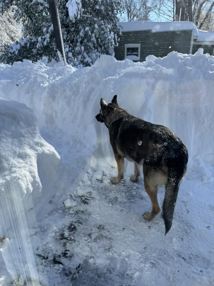
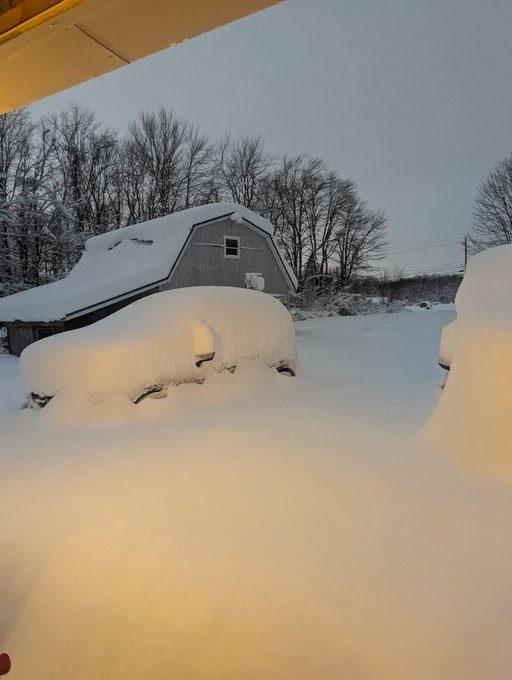
| Ashtabula, OH on November 30, 2024. 36 inches of snow had fallen at the time of the picture. (Gina DiAngelo Petrochello) |
Austinburg, OH. 34 inches of snow had fallen at the time of the picture. (Lino P Stavole) |
Geneva, OH. Over 3 feet of snow had fallen at the time of the picture. (Bo Varga) |
Conneaut, OH on December 1, 2024. 3.5 to 4 feet had fallen at the time of the picture. (Alica Bosch) |
 |
 |
 |
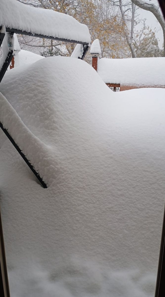
| Conneaut, OH on November 30, 2024. 36 inches of snow had fallen at the time of the picture. (Ambie Lee) |
Erie, PA on November 30, 2024. 32 inches of snow had fallen at the time of the picture. (Katie French) |
Conneaut, OH on November 30, 2024. Over 4 feet of snow had fallen at the time of the picture. (Mary Pryately) |
 |
 |
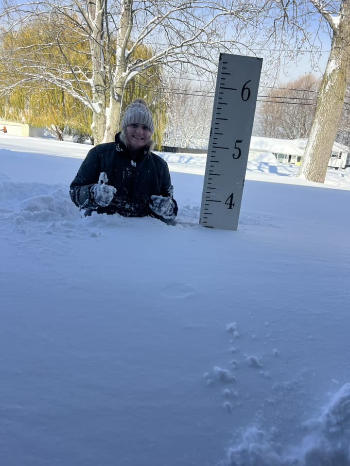 |
| North Kingsville, OH on November 30, 2024. 34 inches had fallen at the time of the picture. (Matt Cebron) |
Mentor, OH on December 1, 2024. (M Tumarkin) |
North Kingsville, OH on November 30, 2024. 3.5 feet of snow had fallen at the time of the picture. (Jennifer Lynn Williams-Downey) |
 |
 |
 |
| Perry, OH on November 30, 2024. 2 feet of snow had fallen at the time of the picture. (Kristin King) |
Perry, OH on December 1, 2024. 20 inches of snow had fallen at the time of the picture. (Kimberly Waite Finch) |
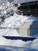
Conneaut, OH on December 1, 2024. 4 feet of snow had fallen at the time of the picture which resulted in a metal shed roof collapsing. (Jeannie Tagle) |
Radar
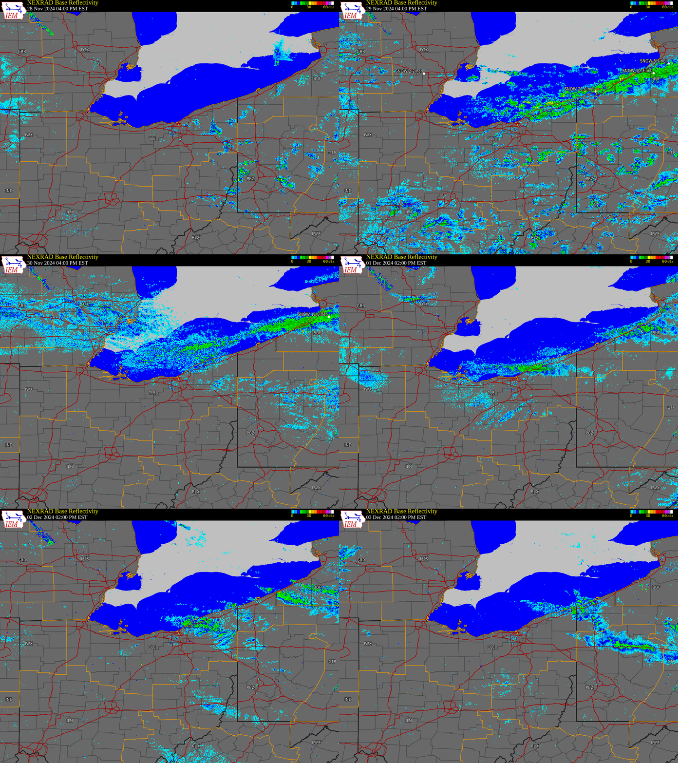 |
| Radar loop from November 28, 2024 at 4 PM EST to December 3, 2024 at 2 PM EST. |
Environment
 |
 |
 |
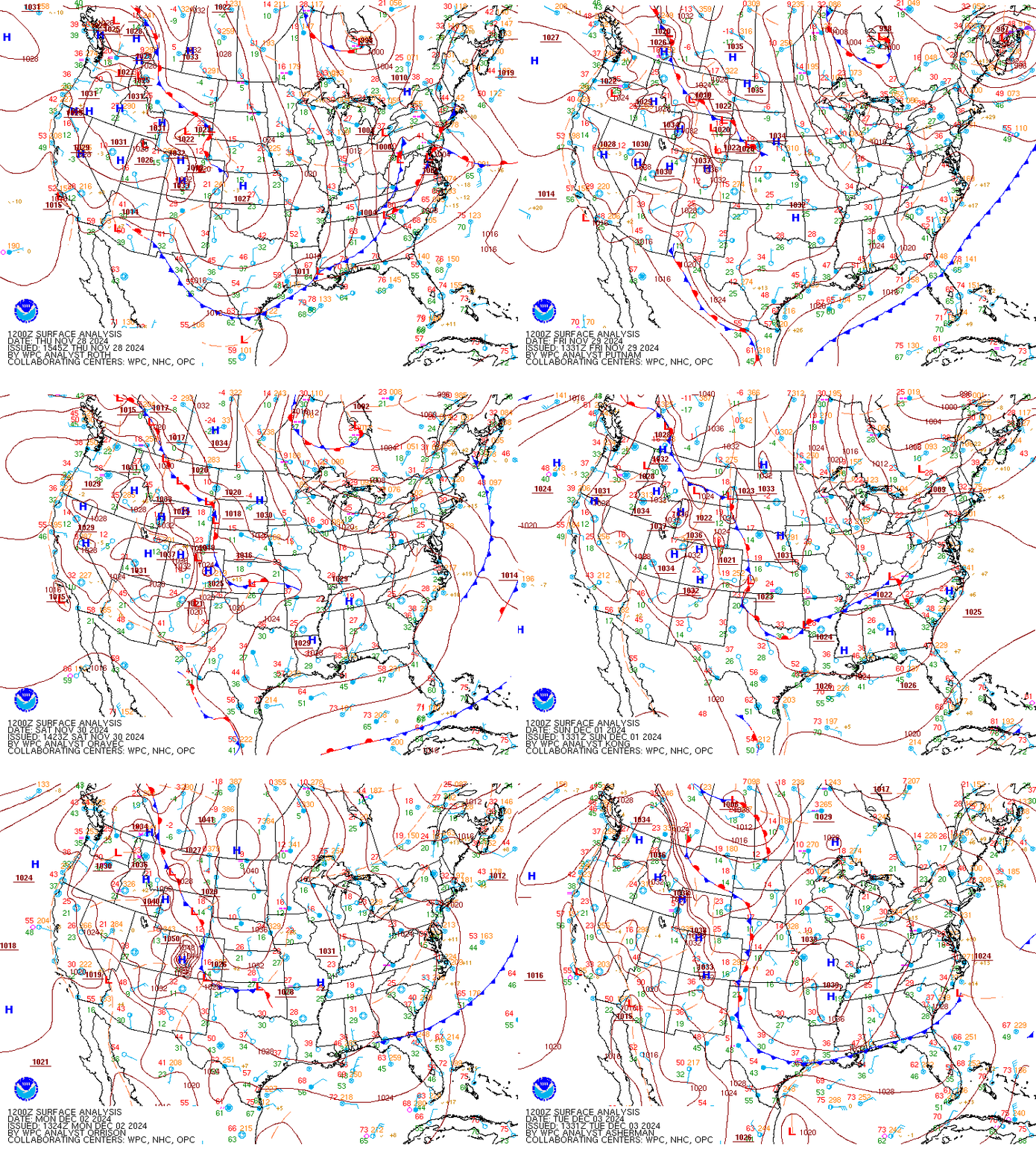
| Figure 1: WPC surface analysis loop from November 28, 2024 at 7 AM EST to December 3, 2024 at 7 AM EST. | Figure 2: GFS area sounding valid 1 PM EST on November 29, 2024, initialized on November 28 at 7 AM EST. Note the strong omega within a fairy deep dendritic growth zone (DGZ). There is also minimal westerly boundary layer shear present. | Figure 3: GFS area sounding valid 1 PM EST on December 2, 2024, initialized on December 1, 2024 at 7 AM EST. Note that the omega is maximized below the DGZ (albeit still fairly thick). Boundary layer shear begins to increase from the northwest. |
 |
 |
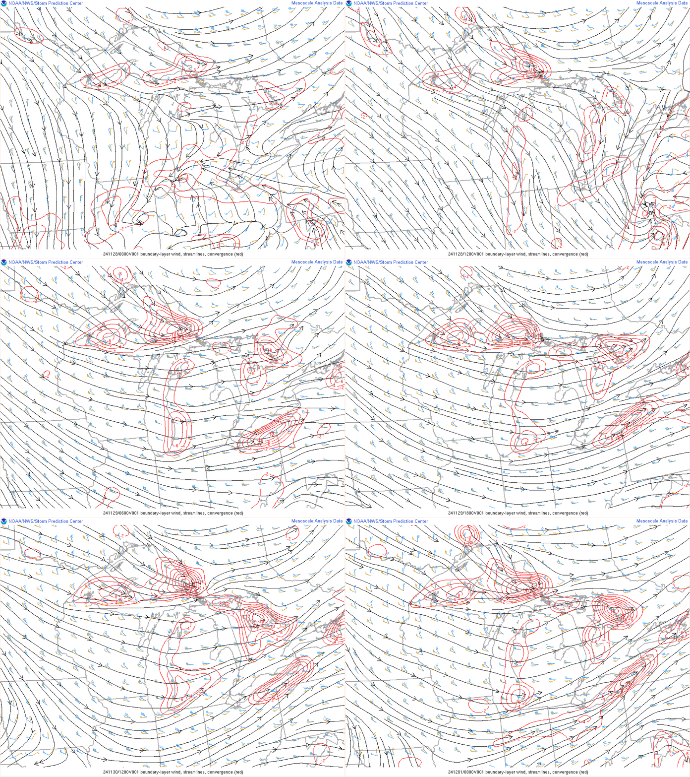 |
| Figure 4: Great Lakes surface water temperature analysis on November 28, 2024. Note water temperatures for Lake Erie are generally in the upper 40s and lower 50s with a "hot spot" of mid to upper 50s across the central basin of the lake. | Figure 5: 850 MB wind (black) and temperature (blue) analysis loop from November 27, 2024 at 7 PM EST to November 30, 2024 at 7 PM EST. Note 850 MB temperatures falling to near -14 degrees C with primarily westerly mid-level flow. | Figure 6: Boundary layer wind streamlines (black) overlaid with convergence (red) loop from November 27, 2024 at 7 PM EST to November 30, 2024 at 7 PM EST. Note subtle ripples in the streamlines across the Great Lakes, indicating the presence of a thermal lake-aggregate trough. This trough often increases the convergence and can result in more intense lake effect snow bands. |
 |
Media use of NWS Web News Stories is encouraged! Please acknowledge the NWS as the source of any news information accessed from this site. |
 |