Overview
A potent mid/upper trough swung across the Great Lakes and Ohio Valley during the day Saturday. This resulted in a strong surface low that tracked from Iowa Friday night to New England by Saturday night. A cold front rapidly progressed from the Midwest through northern Ohio and northwest Pennsylvania Friday night, and a strong low-level jet in response to the increasing upper level forcing allowed supercell thunderstorms over the Upper Mississippi Valley to grow upscale into a line of severe thunderstorms which swept eastward across Illinois, Indiana, Ohio, and western Pennsylvania late Friday night. Instability, or the fuel needed for thunderstorms, rapidly decreased from west to east over northern Ohio Friday night, but very strong deep layer shear of 60 to 80 knots combined with at least weak instability allowed damaging straight line winds to persist with the line all the way into western Pennsylvania. Winds of 50 to 70 mph were common with this line of severe thunderstorms. There was also embedded weak rotation leading to an EF-0 tornado on the northwest side of Bucyrus, Ohio.
After a short break Saturday morning, a secondary cold front tied to the main piece of the mid/upper trough swept across northern Ohio and northwest Pennsylvania from late morning into early afternoon. Abundant forcing along the front and continued high amounts of shear led to the development of a second squall line of severe thunderstorms. The thunderstorms first initiated near I-75 then intensified as they moved rapidly eastward. Winds of 50 to 70 mph were again common with this line leading to dozens of downed trees and power lines from north central Ohio through northwest Pennsylvania. Localized wind gusts of 80 mph or greater were measured at Oregon and the Fairport Harbor Lighthouse. There were also embedded microbursts that contained small pockets where winds were estimated to over 80 mph in northeast Ohio and northwest Pennsylvania. Unfortunately, a fatality occurred in Trumbull County where a 13 year old boy was killed when a tree fell on a home on Park Road just to the west of Leavittsburg, OH. The two rounds of severe thunderstorms led to at least hundreds of downed trees and dozens of downed power lines. Some communities were left without power for as long as 4 days. Besides the thunderstorms, several hours of gusty winds of 40 to 50 mph continued Saturday afternoon before finally diminishing Saturday evening.
Tornadoes:
|
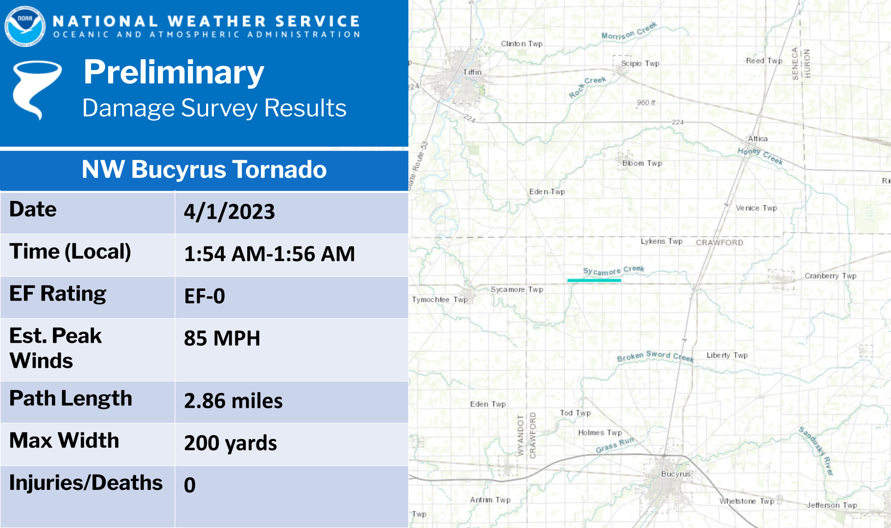
Tornado - Bucyrus
|
||||||||||||||||
The Enhanced Fujita (EF) Scale classifies tornadoes into the following categories:
| EF0 Weak 65-85 mph |
EF1 Moderate 86-110 mph |
EF2 Significant 111-135 mph |
EF3 Severe 136-165 mph |
EF4 Extreme 166-200 mph |
EF5 Catastrophic 200+ mph |
 |
|||||
Photos
 |
 |
 |
 |
| Large pine tree uprooted in Guys Mills, PA (JR Byers on Facebook) |
Tree blocking road in Williamsfield, OH near the PA border. (MWC Weather on Twitter) |
Barn destroyed in Williamsfield, OH (MWC Weather on Twitter) |
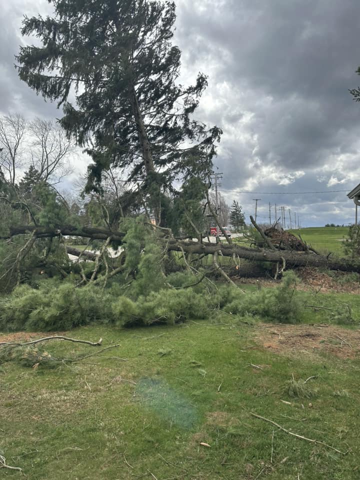
Large pine tree uprooted in Liberty Township, OH (Leanne Lee on Facebook) |
 |
 |
 |
 |
| Large tree uprooted in Girard, OH (Patrick O'Hara on Twitter) |
Tree snapped in Girard, OH (Patrick O'Hara on Twitter) |
Large pine tree uprooted in Girard, OH (Patrick O'Hara on Twitter) |
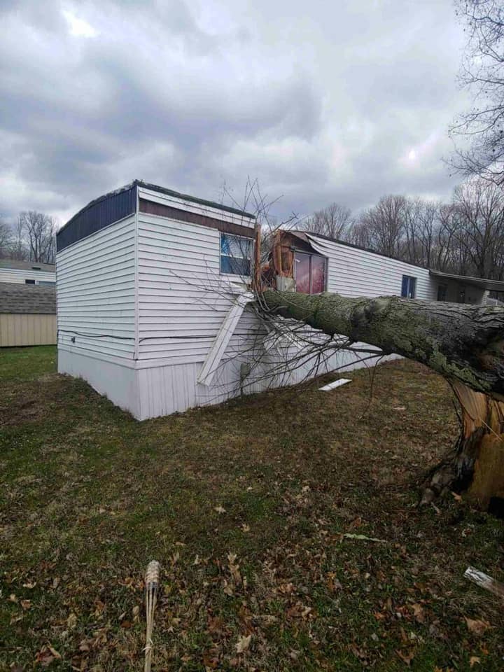
Pine tree on a house in Poland, OH (Amber Stewart on Facebook) |
 |
 |
 |
 |
| Pine tree on a deck in Poland, OH (Amber Stewart on Facebook) |
Multiple trees down in a yard in Poland, OH (Amber Stewart on Facebook) |
Post light snapped in Canfield, OH (Ray Kennedy on Facebook) |
Tree on a house in Cranberry, OH (Mary Be on Facebook) |
 |
 |
 |
 |
| Multiple pine trees down in Poland, OH (Jennifer Marie Eaves on Facebook) |
Tree snapped in North Lima, OH (Matt on Twitter) |
Large oak tree snapped in Warren, OH (Thomas E Kosan on Facebook) |
Pine tree uprooted in Concord, OH (Randy Labbato on Facebook) |
 |
 |
 |
 |
| Huge oak tree smashed a Jeep and took down power lines in Middlebranch, OH (Dale Lamm on Facebook) |
Barn off foundation in Perrysville, OH (Sharon Kline-Strimple on Facebook) |
Tree through a mobile home in Garrettsville, OH (Kelly Amon on Facebook) |
Top of pine tree snapped in Springfield Township, OH (Deb Maglott Thornton Nutter on Facebook) |
 |
 |
 |
 |
| Large tree uprooted in western Medina County, OH (Geoffrey Moreland on Facebook) |
Pine tree fell onto a house in Kinsman, OH (Tim Kuhn on Facebook) |
Large pine tree uprooted in Medina, OH (Hillary Hayes on Facebook) |
Large pine tree downed in Perry Township, OH (Emily Hahn on Facebook) |
 |
 |
 |
 |
| Tree on garage in Guys Mills, PA (JR Byers on Facebook) |
Pine tree snapped in Copley, OH (Michelle Fox on Facebook) |
Tree and power pole snapped in Middlebranch, OH (Court Meister on Facebook) |
40 foot pine tree uprooted in Massillon, OH (Danielle Henderson on Facebook) |
 |
 |
 |
 |
| Cuyahoga Falls, OH (Jasmin Powell on Facebook) |
Greendale Cemetery in West Mead Township, PA (Donna Bean on Facebook) |
10 trees snapped or uprooted on a property in Green, OH (Melinda Muzi on Facebook) |
Large pine tree uprooted in Windsor, OH (MWC Weather on Twitter) |
Radar
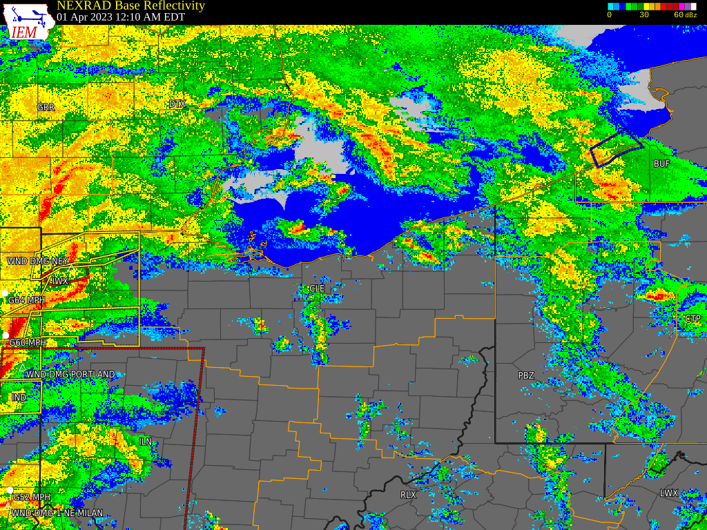 |
| Radar Loop: 12 AM to 5 PM Saturday, April 1st |
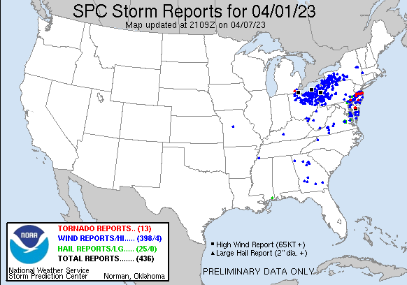
Storm Reports
Public Information Statement
National Weather Service Cleveland OH
810 PM EDT Sat Apr 1 2023

...HIGHEST MEASURED WIND REPORTS FROM THE LAST 24 HOURS...

Location                     Speed     Time/Date       Provider
8 ENE Oregon                 82 MPH    0130 PM 04/01   NDBC
Fairport, OH                 80 MPH    1248 PM 04/01   NOS-NWLON
Cleveland                    70 MPH    0241 AM 04/01   ASOS
Lorain Elyria                70 MPH    0222 AM 04/01   ASOS
Kirtland                     65 MPH    1205 PM 04/01   DAVIS
Arcadia                      64 MPH    1126 AM 04/01   CWOP
Wooster                      64 MPH    0131 PM 04/01   ASOS
Martin                       62 MPH    0120 AM 04/01   CWOP
Ashtabula                    62 MPH    0119 PM 04/01   ASOS
Mansfield                    62 MPH    1159 AM 04/01   ASOS
Findlay                      61 MPH    1101 AM 04/01   ASOS
1 WNW Tontogany              60 MPH    1050 AM 04/01   CWOP
Lemoyne                      60 MPH    0109 AM 04/01   CWOP
Canal Fulton                 60 MPH    1240 PM 04/01   CWOP
Akron Fulton International A 59 MPH    1237 PM 04/01   ASOS
Toledo                       59 MPH    1053 AM 04/01   ASOS
Youngstown                   59 MPH    0114 PM 04/01   ASOS
Kipton                       58 MPH    0230 AM 04/01   CWOP
Danbury Twp                  58 MPH    1145 AM 04/01   CWOP
Meadville                    58 MPH    0137 PM 04/01   ASOS
Marion                       58 MPH    1131 AM 04/01   ASOS
4 WNW Port Clinton           57 MPH    1130 AM 04/01   NDBC
Sullivan                     57 MPH    1205 PM 04/01   DAVIS
Toledo, OH                   57 MPH    0112 AM 04/01   NOS-NWLON
Cleveland                    56 MPH    0106 PM 04/01   ASOS
3 NE North East              56 MPH    0130 PM 04/01   NDBC
9 NE Port Clinton            56 MPH    0100 PM 04/01   NDBC
Parma                        55 MPH    1230 PM 04/01   CWOP
Clevlnd Cuyahoga             55 MPH    1245 PM 04/01   AWOS
Erie                         55 MPH    0155 AM 04/01   ASOS
Port Clinton                 54 MPH    1215 PM 04/01   AWOS
Cleveland, OH                53 MPH    0248 AM 04/01   NOS-NWLON
Lorain                       53 MPH    1213 PM 04/01   CWOP
Akron-Canton Regional Arpt   53 MPH    0156 PM 04/01   ASOS
Toledo                       53 MPH    1213 PM 04/01   ASOS
Shaker Heights               52 MPH    1252 PM 04/01   CWOP
Mt Vernon Knox               52 MPH    1255 PM 04/01   AWOS
3 NNW Erie                   51 MPH    0118 PM 04/01   NDBC
Cortland                     51 MPH    0509 PM 04/01   CWOP
Fairview High School         50 MPH    1230 PM 04/01   MESOWEST
Medina                       50 MPH    1228 PM 04/01   CWOP
Youngstown                   50 MPH    0115 PM 04/01   CWOP
Fremont                      50 MPH    1145 AM 04/01   CWOP

&&
Environment
Large Scale Environment
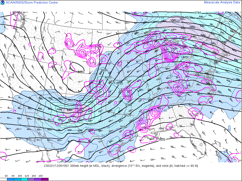
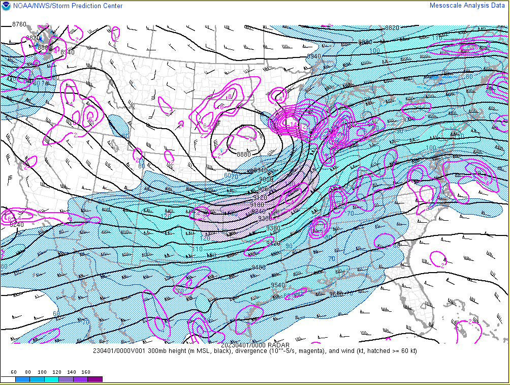
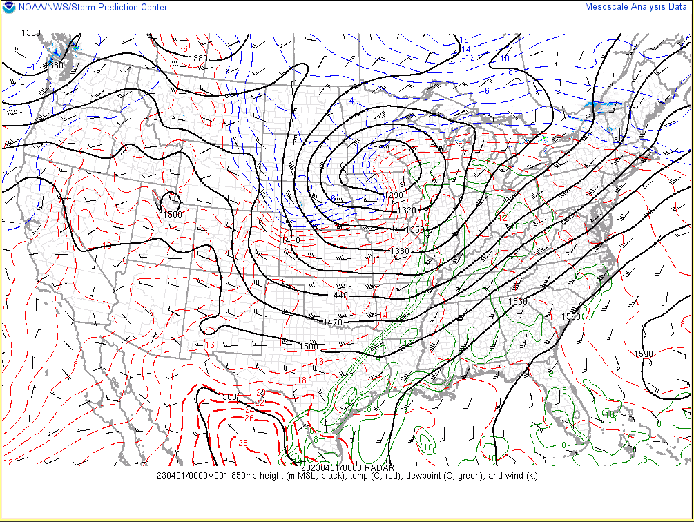
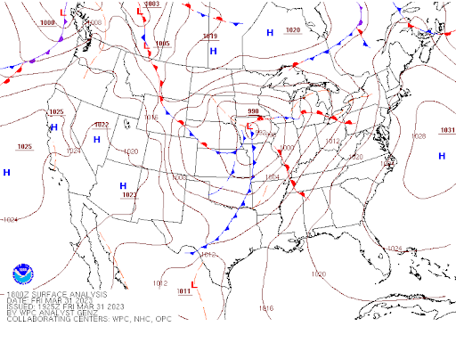
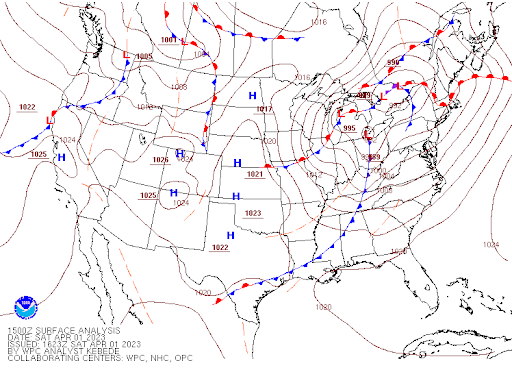
A deep mid/upper trough progressed from the Rockies Friday morning (March 31st) into the Great Lakes by Saturday morning (April 1st) while becoming negatively tilted. A negatively tilted trough is when the trough axis becomes oriented northwest to southeast, and this signifies a strengthening and maturing storm system. As this mid/upper trough shifted toward the region Friday night into Saturday, upper level divergence strengthened over the Ohio Valley and lower Great Lakes in response to the left exit region of a 150-160 knot upper level jet streak. This diverging air in the upper levels led to an intensifying low-level jet (around 850 mb) Friday night through Saturday morning which allowed warm and moist air to advect northward into the region. Besides pulling the warm and moist air northward to fuel thunderstorms, this low-level jet also supplied a tremendous amount of shear for the thunderstorms to tap into. An initial cold front pushed eastward across northern Ohio and northwest Pennsylvania late Friday night into the early morning hours of Saturday as a surface low deepened and progressed into the Upper Midwest in response to the intense upper divergence and trough swinging negative. Convergence/lift along the frontal boundary was strengthened by the upper level divergence and strong 850 mb low-level jet. This front triggered a line of severe thunderstorms that swept rapidly eastward between Midnight and 4 AM. The very strong 850 mb jet led to widespread damaging winds with these storms, but a brief spin-up tornado occurred in Crawford County to the northwest of Bucyrus, OH. A second, and much stronger, cold front quickly followed late Saturday morning into the early afternoon hours as the surface low crossed the central Great Lakes. Strong convergence along this frontal boundary triggered another line of severe thunderstorms that developed near the I-75 corridor late Saturday morning and swept rapidly eastward through early afternoon. Damaging winds were again widespread as these storms tapped into the very strong wind speeds aloft and low-level shear. Much colder air poured across the region behind this second cold front as the mid/upper trough axis swung through the Great Lakes, so lingering showers ended as some light snow showers in far northeast Ohio and northwest Pennsylvania Saturday evening. A strong pressure gradient behind the exiting surface low also led to gusty winds of 40 to 50 mph Saturday afternoon as the colder air advected into the region before the winds diminished Saturday evening.
 |
 |
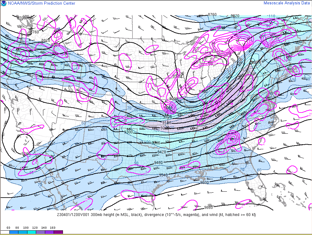 |
| 8 AM Friday March 31st 300 mb Heights and Divergence | 8 PM Friday March 31st 300 mb Heights and Divergence | 8 AM Saturday April 1st 300 mb Heights and Divergence |
 |
 |
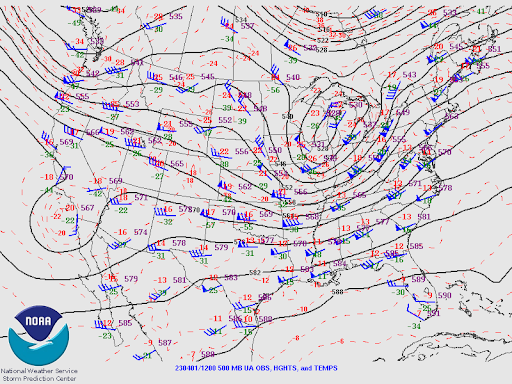 |
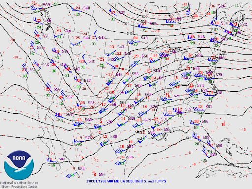
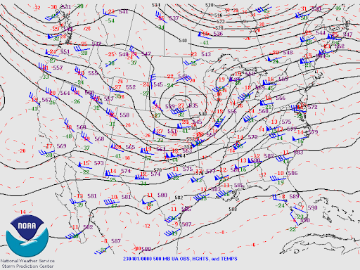
| 8 AM Friday March 31st 500 mb Heights | 8 PM Friday March 31st 500 mb Heights | 8 AM Saturday April 1st 500 mb Heights |
 |
 |
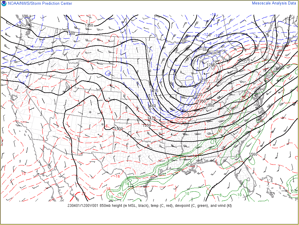 |
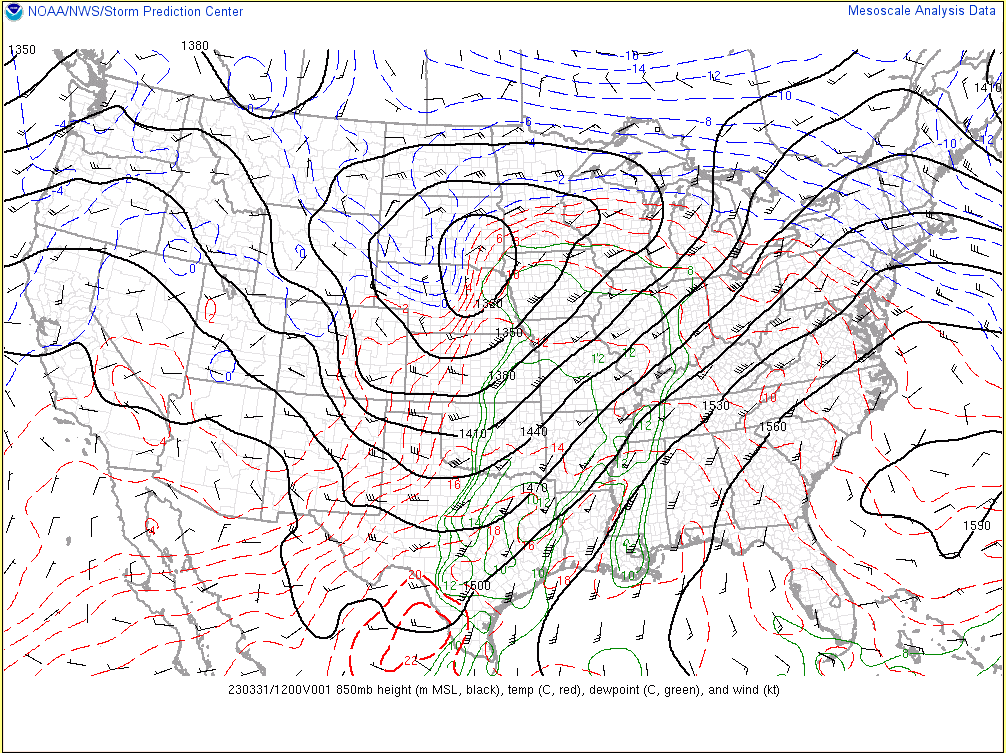
| 8 AM Friday March 31st 850 mb Heights, Temps, Dew Points, and Winds | 8 PM Friday March 31st 850 mb Heights, Temps, Dew Points, and Winds | 8 AM Saturday April 1st 850 mb Heights, Temps, Dew Points, and Winds |
 |
 |
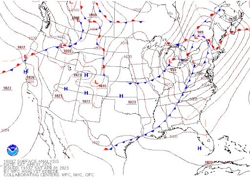 |
| 2 PM Friday March 31st Surface Analysis | 10 AM Saturday April 1st Surface Analysis | 2 PM Saturday April 1st Surface Analysis |
Near-Storm Environment
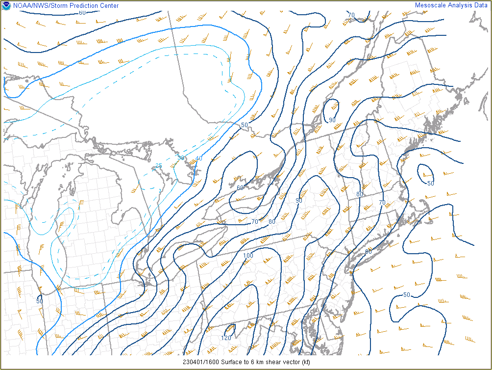
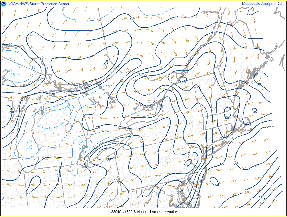
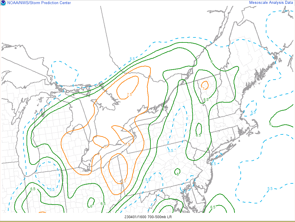
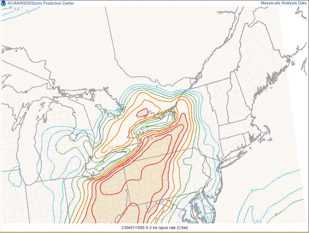
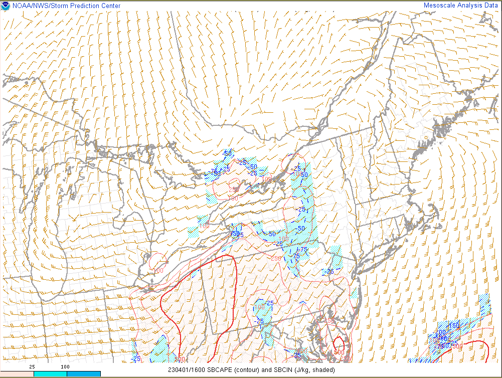
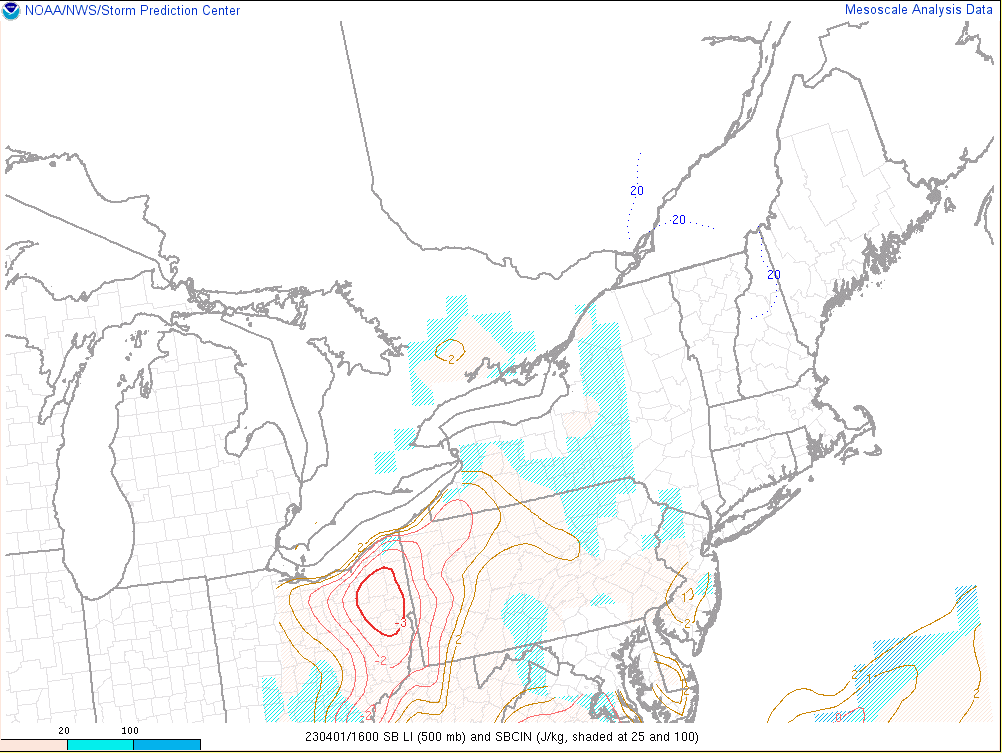
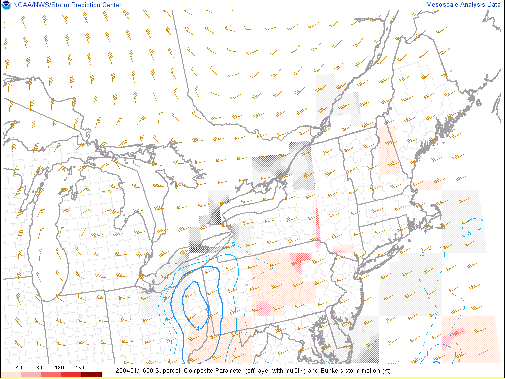
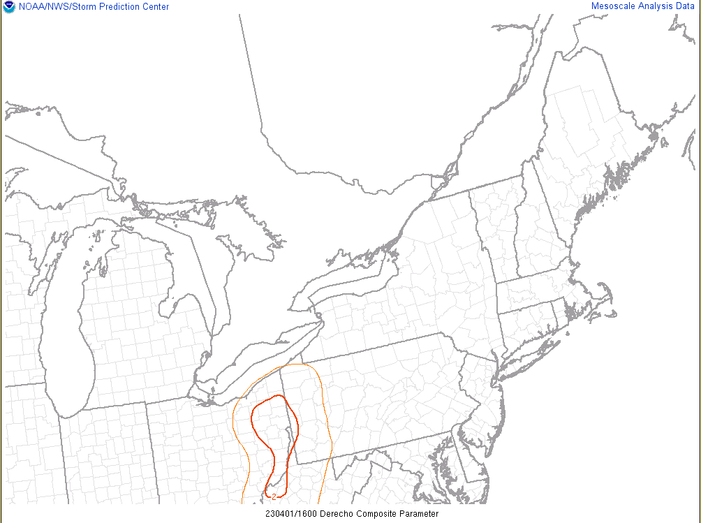
The intensifying low-level jet led to large deep layer (0-6) Km shear late Friday night through midday Saturday with values of 60 to 90 knots across the region. The low-level (0-1) Km shear was equally impressive with values of 20 to 40 knots. The thunderstorms tapped into this intense shear leading to widespread damaging winds as the main threat, but the strong 0-1 Km shear values combined with 0-1 Km storm relatively helicity values of at least 200 to 400 m2/s2 caused enough low-level turning for embedded supercells within both lines of thunderstorms. Even though only one tornado occurred, the embedded supercells enhanced the damaging winds in localized areas. In terms of the thermodynamics/instability, this was a classic high shear/low CAPE cold season severe weather event. The second line of thunderstorms had greater instability to work with due to some morning sunshine. Warming surface temperatures beneath steepening mid-level lapse rates of 7 to 8 C/Km allowed MLCAPE to build to 200 to 500 J/Kg across eastern Ohio and western Pennsylvania with over 500 J/Kg of surface-based CAPE. This combined with surface-based lifted indices as low as -4 led to strong updrafts within the line of thunderstorms as it moved into eastern Ohio by Noon Saturday. These strengthening storms, tremendous low and mid-level wind fields/shear, and steep low-level lapse rates of 8 to 9 C/Km all aided in the damaging winds that occurred. The enhanced wind potential in eastern Ohio and western Pennsylvania due to the best combination of shear and instability was also shown by the Derecho Composite Parameter which had values of 2 or higher by Noon Saturday. However, the Supercell Composite Parameter also increased to 4 or greater in eastern Ohio by Noon Saturday due to the low-level shear, helicity, and building instability. One of the simplest ways to visualize the severe weather potential was to look at the Modified SHERBE parameter. This relatively new composite parameter looks at combined values of instability and shear in high shear/low CAPE events. By Noon Saturday, the Modified SHERBE parameter was contouring very high values over central and eastern Ohio into Pennsylvania which really highlighted the potential for an organized cold season severe weather event.
 |
 |
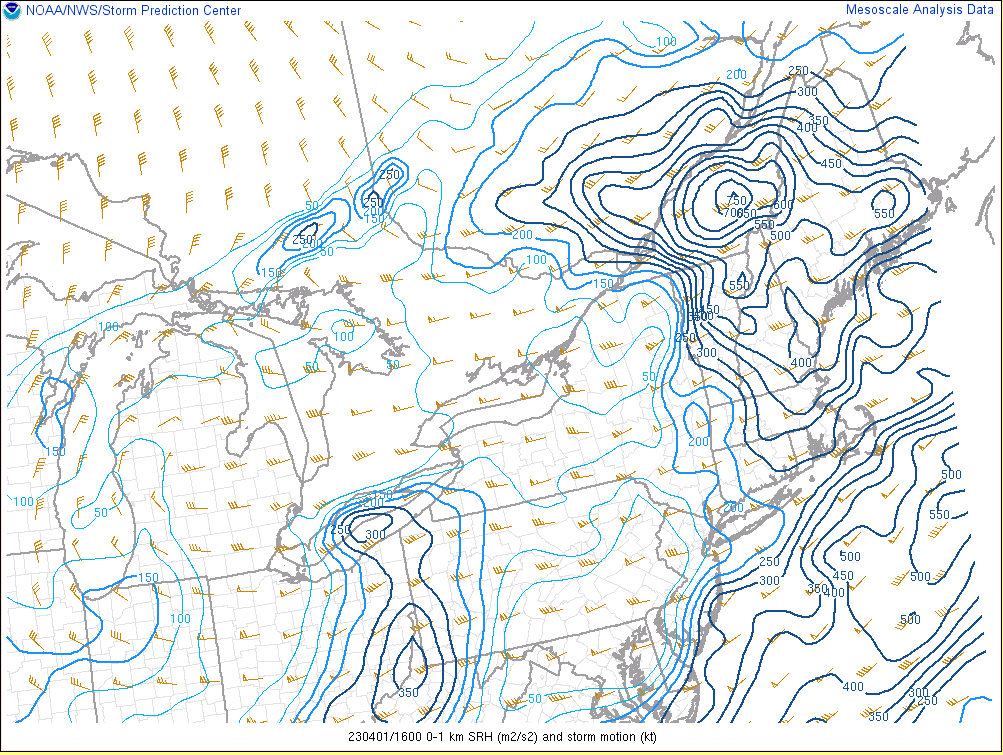 |
| 12 PM Saturday April 1st 0-6 Km Shear | 12 PM Saturday April 1st 0-1 Km Shear | 12 PM Saturday April 1st 0-1 Km SRH |
 |
 |
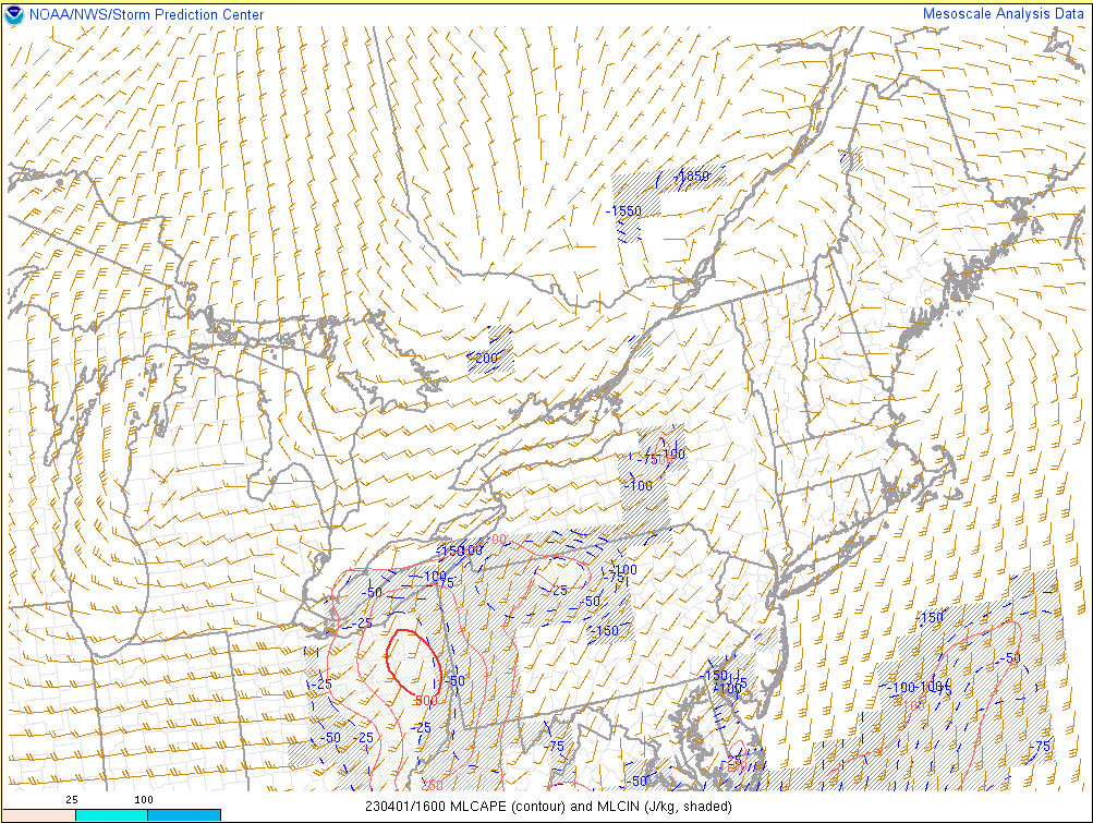 |
| 12 PM Saturday April 1st Mid-Level Lapse Rates | 12 PM Saturday April 1st Low-Level Lapse Rates | 12 PM Saturday April 1st MLCAPE |
 |
 |
 |
| 12 PM Saturday April 1st SBCAPE | 12 PM Saturday April 1st SB Lifted Index | 12 PM Saturday April 1st Supercell Composite |
 |
.gif) |
| 12 PM Saturday April 1st Derecho Composite | 8 AM to 2 PM Saturday April 1st Modified SHERBE |
 |
Media use of NWS Web News Stories is encouraged! Please acknowledge the NWS as the source of any news information accessed from this site. |
|