

Non-graphic information:
Preliminary Damage Survey
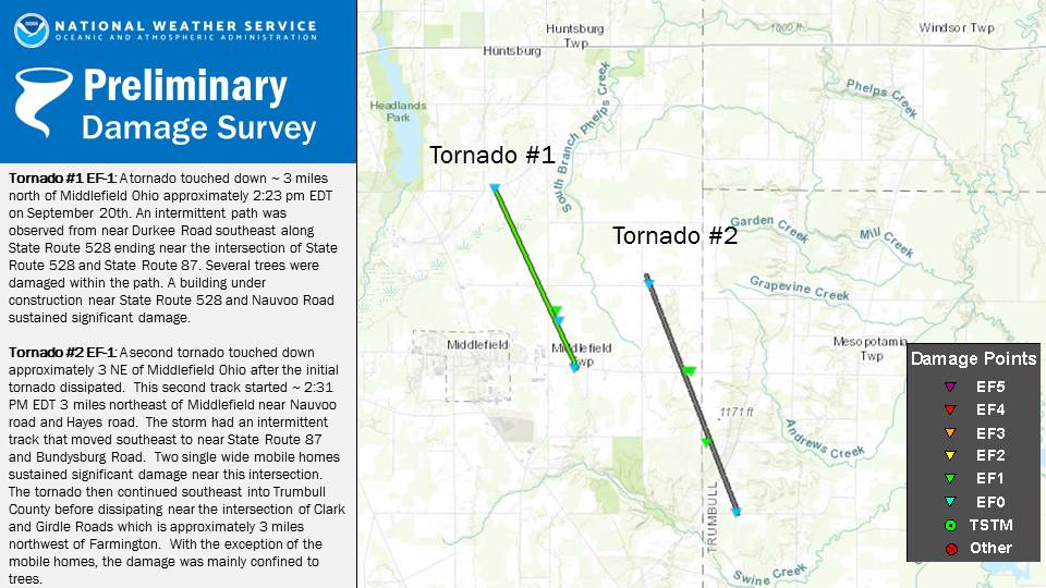
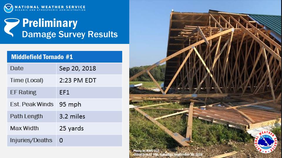
Tornado #1 EF-1: A tornado touched down ~ 3 miles north of Middlefield Ohio approximately 2:23 pm EDT on September 20th. An intermittent path was observed from near Durkee Road southeast along State Route 528 ending near the intersection of State Route 528 and State Route 87. Several trees were damaged within the path. A building under construction near State Route 528 and Nauvoo Road sustained significant damage.
|
|
|
|
Date |
Sep 20, 2018 |
|
Time (Local) |
2:23 PM EDT |
|
EF Rating |
EF1 |
|
Est. Peak Winds |
95 mph |
|
Path Length |
3.2 miles |
|
Max Width |
25 yards |
|
Injuries/Deaths |
0 |
Tornado #2 EF-1: A second tornado touched down approximately 3 NE of Middlefield Ohio after the initial tornado dissipated. This second track started ~ 2:31 PM EDT 3 miles northeast of Middlefield near Nauvoo road and Hayes road. The storm had an intermittent track that moved southeast to near State Route 87 and Bundysburg Road. Two single wide mobile homes sustained significant damage near this intersection. The tornado then continued southeast into Trumbull County before dissipating near the intersection of Clark and Girdle Roads which is approximately 3 miles northwest of Farmington. With the exception of the mobile homes, the damage was mainly confined to trees.
|
|
|
|
Date |
Sep 20, 2018 |
|
Time (Local) |
2:31 PM EDT |
|
EF Rating |
EF1 |
|
Est. Peak Winds |
95 mph |
|
Path Length |
4.1 miles |
|
Max Width |
25 yards |
|
Injuries/Deaths |
0 |