The above map shows how much rain has fallen over the past week, with the vast majority of that falling on September 11th and 12th. Parts of Ashtabula County, OH and western Erie County, PA had over 4 inches of rain in an approximately 35-40 hour period.
| Location | Rainfall - Friday evening - Sunday morning (Inches) | Source |
|---|---|---|
| Erie, PA | 3.90 | NWS ASOS |
| Ashtabula- Northeast OH Airport | 2.62 | NWS ASOS |
| 1 W of Pierpont (Asgtabula Co.) | 2.45 | CoCoRAHS |
| Conneaut (Astabula Co.) | 5.45 | Mesonet |
| Concord (Lake Co.) | 4.08 | Mesonet |
| 3 SW Willoughby (Lake Co.) | 2.96 | CoCoRAHS |
| 2 W South Russel (Geauga Co.) | 2.39 | CoCoRAHS |
| 1 WNW North East (Erie Co. PA) | 3.23 | CoCoRAHS |
| 2 SE Parma (Cuyahoga Co.) | 3.07 | CoCoRAHS |
| 1 NW Broadview Hts (Cuyahoga Co.) | 3.03 | CoCoRAHS |
| Brunswick (Medina Co.) | 2.56 | CoCoRAHS |
| Cleveland Hopkins Airport (Cuyahoga Co.) | 2.78 | NWS ASOS |
| Lost Nation Airport (Lake Co.) | 3.16 | AWOS |
| Millcreek EOC (Erie Co. PA) | 5.69 | EMA |
 Credit (above): Tom Boudreau, Lakeview Park Lorain, OH |
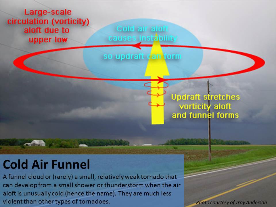
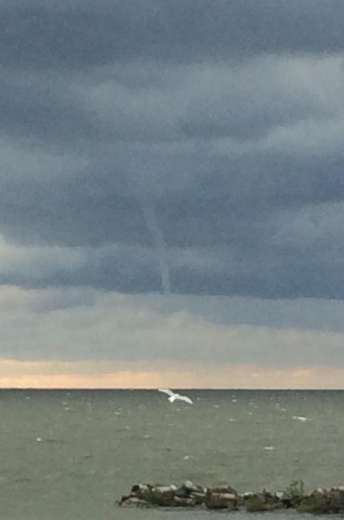
Cold Air Funnel: Cold air funnels almost never touch down, but on rare occasions they do and can cause minor damage. Note that the National Weather Service does not typically issue a tornado warning for a cold air funnel. Cold air funnels can develop from a small shower or thunderstorm when the air aloft is unusually cold (hence the name). The processes behind cold air funnel formation are not completely understood by meteorologists, and scientists are still researching this phenomenon. Cold air funnels are most commonly observed in the vicinity of a closed off, cold-core midlevel low. The cold air aloft associated with these lows provides an unstable environment in which showers and thunderstorms may form. This cold air is how cold air funnels get their name. However the cold air aloft only provides instability for convection, it does not govern how the funnel clouds form. The upper rotation associated with the upper low provides an environment rich with vorticity, or "spin". It is believed that within this spinning environment, localized areas of higher vorticity exist. Thanks to the cold air aloft, updrafts are able to develop and stretch the vorticity in the environment. Stretching of vorticity creates a column of rapidly-spinning air, and it is believed that this may lead to the development of a funnel cloud. |

Credit (above): Mark Porembka, Lakeview Park Lorain, OH