Charleston, SC
Weather Forecast Office
 |
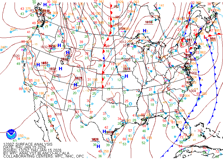
Surface AnalysisObservations, highs, lows, fronts, troughs, outflow boundaries, squall lines and drylines for much of North America. |
 |
SatelliteGOES and other satellite imagery. Eastern U.S. Visible | Loop |
 |
RadarWSR-88D Doppler radar imagery. Nearby radars: Columbia, SC | Wilmington, NC | Robins AFB, GA | Moody AFB, GA | Jacksonville, FL | Southeast U.S.
|
 |
Hydrology-Rivers/LakesThe National Water Prediction Service (NWPS) provides observations & forecasts for area rivers as well as precipitation information. |
 |
MarineBuoy and other marine observations, including tides. |
Hazards
Hazardous Weather Outlook
Graphical Outlook
One-Stop Briefing Page
Latest Weather Briefing
Local Storm Reports
Forecasts
Local Forecasts
Graphical
Weather Activity Planner
Forecaster Discussion
Aviation
Beach
Fire Weather
Lake Moultrie
Marine/Tides
Rivers
Winter
Heat
Wet Bulb Globe Temperature
Past Weather
Observed Weather
Climate Data/Plots
Observed Rainfall
Event Summaries
Today in Weather History
Coastal Flood Event Database
Local Tropical Cyclone History
Tropical Cyclone Reports
US Dept of Commerce
National Oceanic and Atmospheric Administration
National Weather Service
Charleston, SC
5777 South Aviation Avenue
North Charleston, SC 29406-6162
(843) 747-5860
Comments? Questions? Please Contact Us.


 Coastal Flood