
GOES infrared satellite imagery of Hurricane Hermine making landfall along the Florida coast.
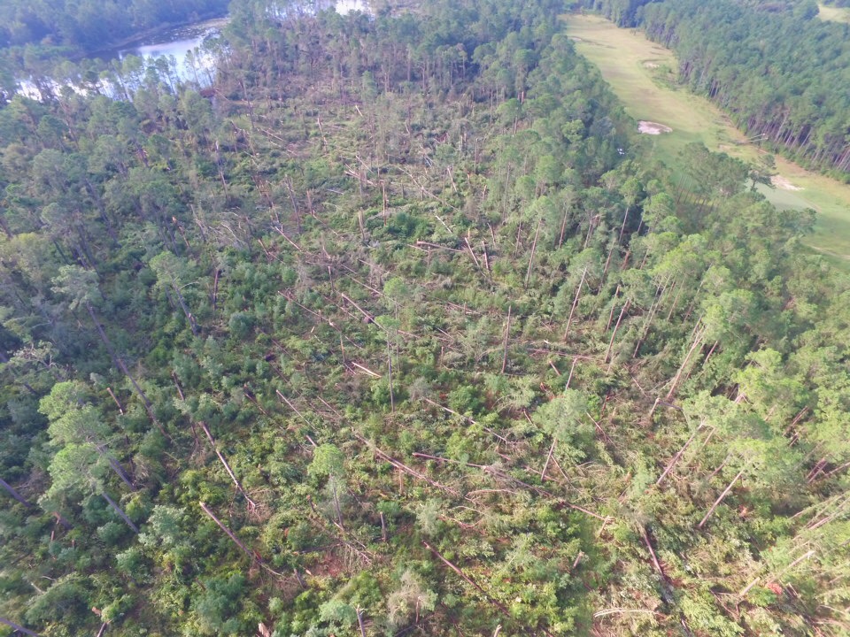
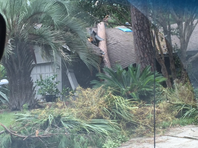
Hurricane Hermine made landfall along the Florida panhandle at Alligator Point as a Category 1 storm during the early morning of September 2. The storm then weakened to a tropical storm as it moved northeast through southeast Georgia and southeast South Carolina before exiting our County Warning Area early on September 3. Hermine produced strong wind gusts, heavy rain and 2 tornadoes across southeast SC/GA. For more details on impacts to the area check out our Post-Storm Report.
Click on image to enlarge

Click on images to enlarge
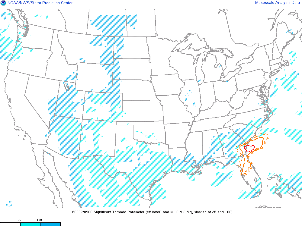
Two EF-1 tornadoes were produced by Hermine in the early morning on September 2, one in Liberty County, GA and another in Chatham County, GA. Conditions were very favorable for tornadoes across southeast GA during this time as can be seen by the 0-3 km Storm Relative Helicity (SRH) and Significant Tornado Parameter (STP) images below from 08Z (4 AM EDT) and 09Z (5 AM EDT) around the times of the tornadoes (data courtesy of the Storm Prediction Center).


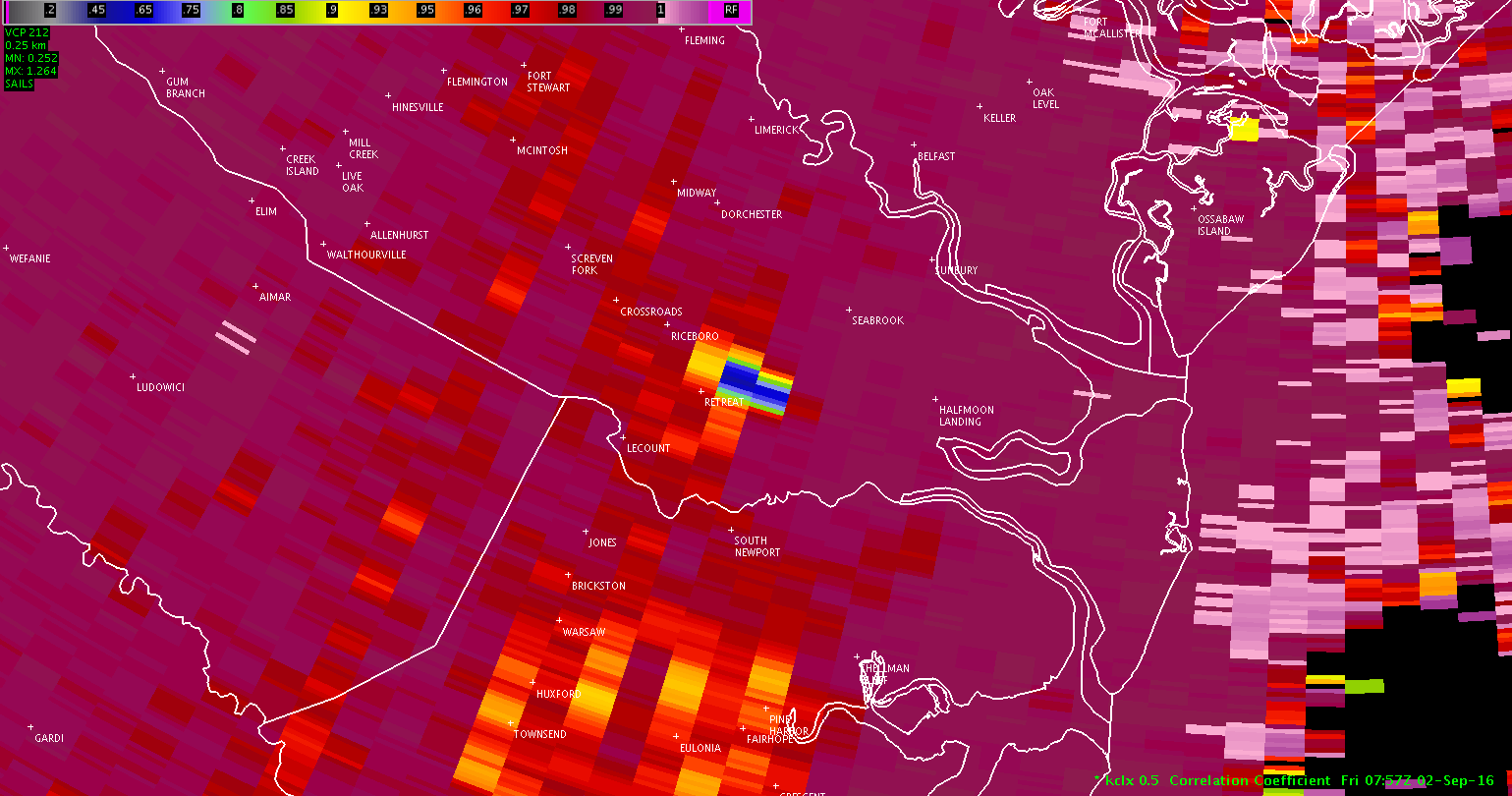
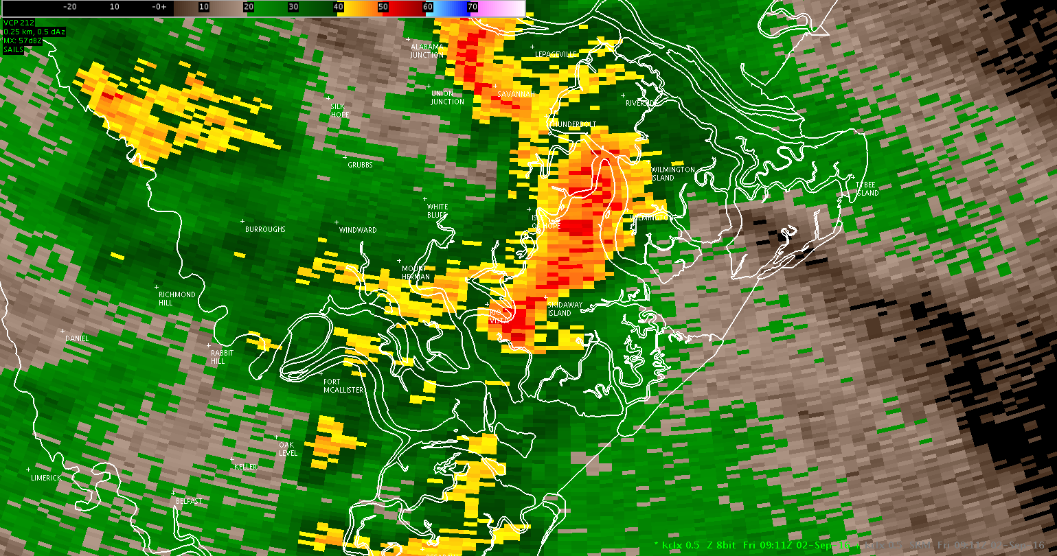
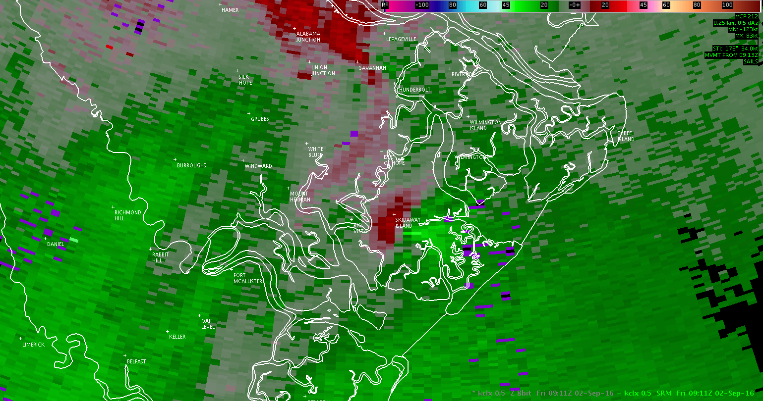
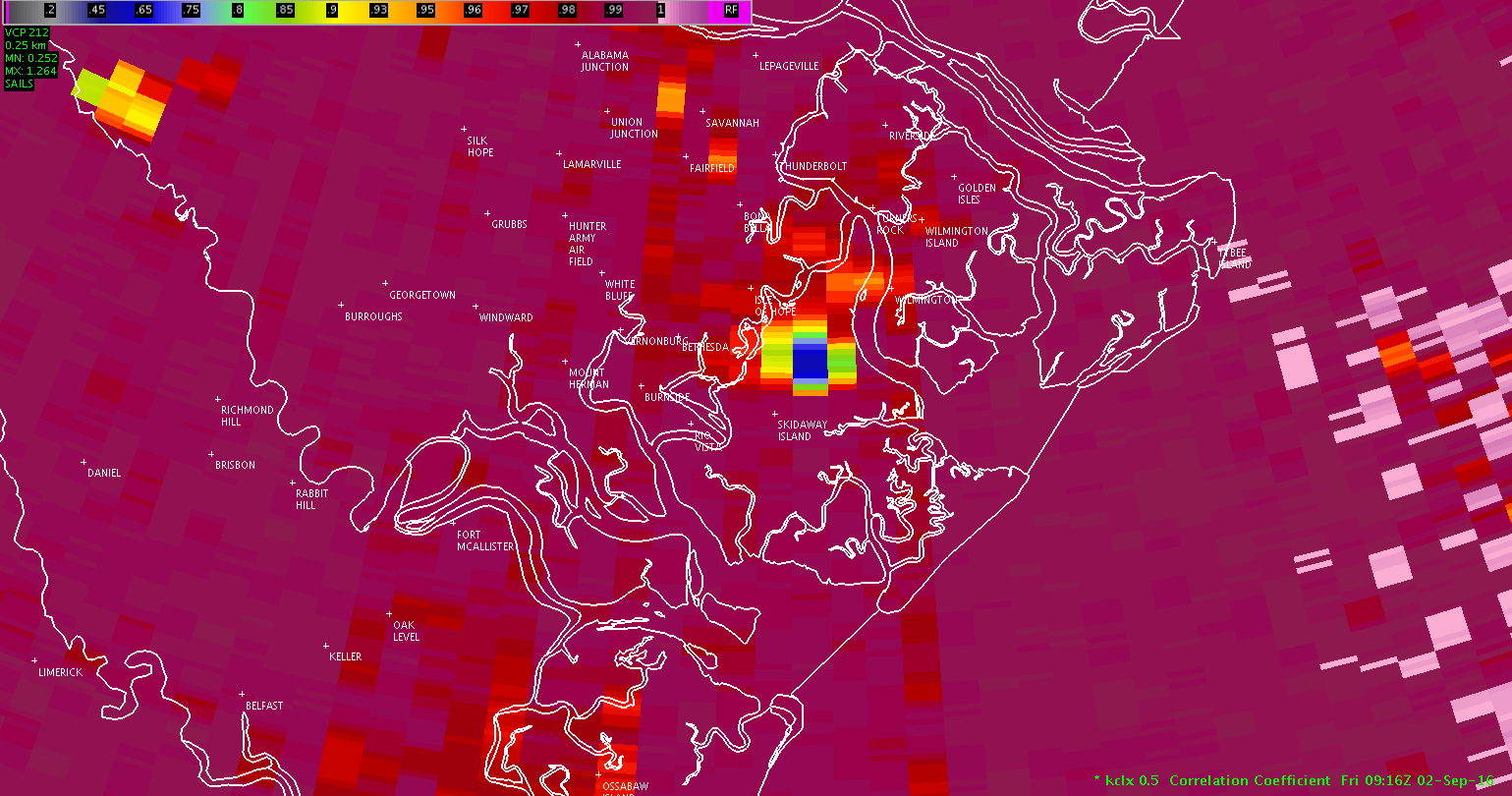
Below is data from the NWS Charleston doppler radar (KCLX) around the times of the tornadoes. Notice the lower correlation coefficients in the area of the tornadoes which is indicative of debris.
Click here for track map
| KCLX Base (0.5 Degree) Reflectivity (Sep 2, 2016 - 350 AM EDT ) | KCLX Base (0.5 Degree) Storm-Relative Velocity (Sep 2, 2016 - 350 AM EDT) | KCLX Base (0.5 Degree) Correlation Coefficient (Sep 2, 2016 - 357 AM EDT) |
 |
 |
 |
Click here for track map
| KCLX Base (0.5 Degree) Reflectivity (Sep 2, 2016 - 511 AM EDT ) | KCLX Base (0.5 Degree) Storm-Relative Velocity (Sep 2, 2016 - 511 AM EDT) | KCLX Base (0.5 Degree) Correlation Coefficient (Sep 2, 2016 - 516 AM EDT) |
 |
 |
 |
Click on images to enlarge
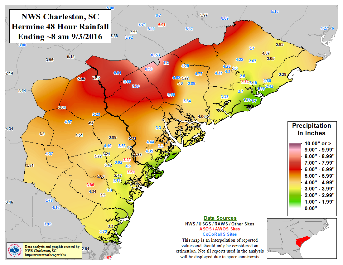

Hermine rainfall graphic courtesy of the Weather Prediction Center.
Click on images to enlarge
Fortunately, the highest storm surge (green line) occurred during low tide as seen in the graphics below for the tide gauges in Charleston Harbor (left) and at Fort Pulaski (right). Thus, saltwater inundation was minimal and produced little to no impact.
 |
 |
Click on images to enlarge
| Liberty County, GA | |||
 |
 |
||
| Chatham County, GA | |||
 |
 |
 |
 |


 Coastal Flood