Charleston, SC
Weather Forecast Office
 |
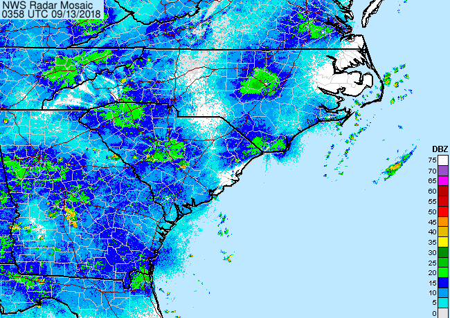 |
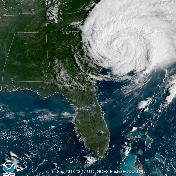
| GOES-E satellite (left) and WSR-88D radar (right) imagery of Florence affecting the Carolinas | |
Hurricane Florence made landfall near Wrightsville Beach, NC on September 14 as a Category 1 hurricane with maximum sustained winds of 90 mph before stalling and then slowly moving generally southwest near the southern NC coast while weakening to a tropical storm near the SC border. The storm then tracked inland toward the Lowcountry before shifting more westerly into the Midlands north of the Santee River. Click here for a surface weather map from the Weather Prediction Center at 1200 UTC (8 AM EDT) on September 15 showing Tropical Storm Florence over northeastern SC. The storm brought heavy rain and tropical storm force wind gusts mainly across the Charleston tri-county region but no significant widespread impacts occurred. Check out our Post-Storm Report for more details.
Click image to enlarge

Click images to enlarge

Click on the map above to expand and for a list of rainfall reports.

No significant storm surge occurred along the southern SC/northern GA coasts directly from Florence since the storm stayed well north of the area. Click here for NOAA tide level data across the region and here for water level data collected by the USGS.
Although there were a few reports of downed trees and some power outages around the Charleston area there was no widespread significant damage across southeast SC/GA.
Hazards
Hazardous Weather Outlook
Graphical Outlook
One-Stop Briefing Page
Latest Weather Briefing
Local Storm Reports
Forecasts
Local Forecasts
Graphical
Weather Activity Planner
Forecaster Discussion
Aviation
Beach
Fire Weather
Lake Moultrie
Marine/Tides
Rivers
Winter
Heat
Wet Bulb Globe Temperature
Past Weather
Observed Weather
Climate Data/Plots
Observed Rainfall
Event Summaries
Today in Weather History
Coastal Flood Event Database
Local Tropical Cyclone History
Tropical Cyclone Reports
US Dept of Commerce
National Oceanic and Atmospheric Administration
National Weather Service
Charleston, SC
5777 South Aviation Avenue
North Charleston, SC 29406-6162
(843) 747-5860
Comments? Questions? Please Contact Us.


 Coastal Flood