Click the tornado icon on the map to display the damage survey summary and on the tornado track for tornado details.

 |
 |
 |
 |
 |
| EF0 | EF1 | EF2 | EF3 | EF4 |
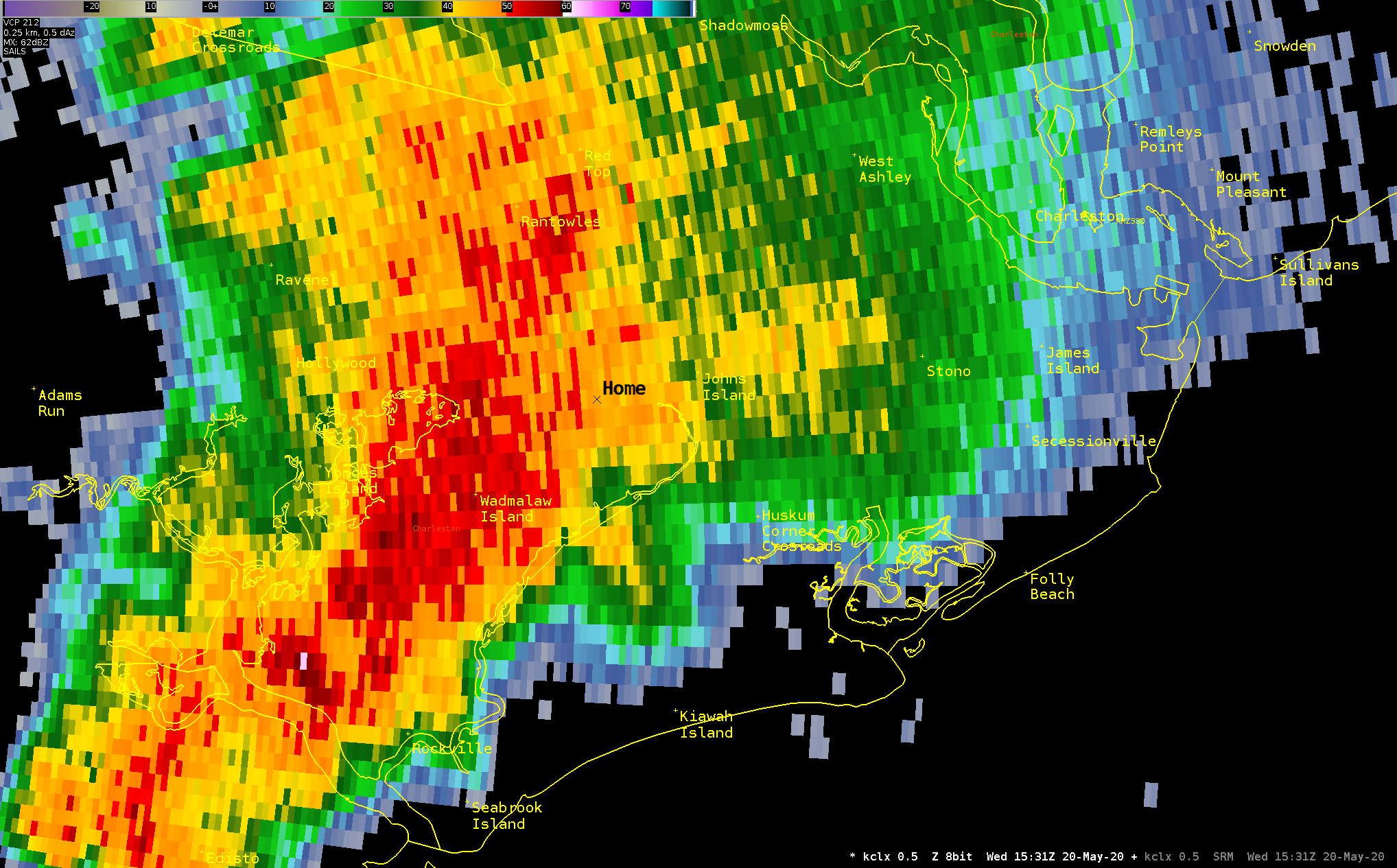
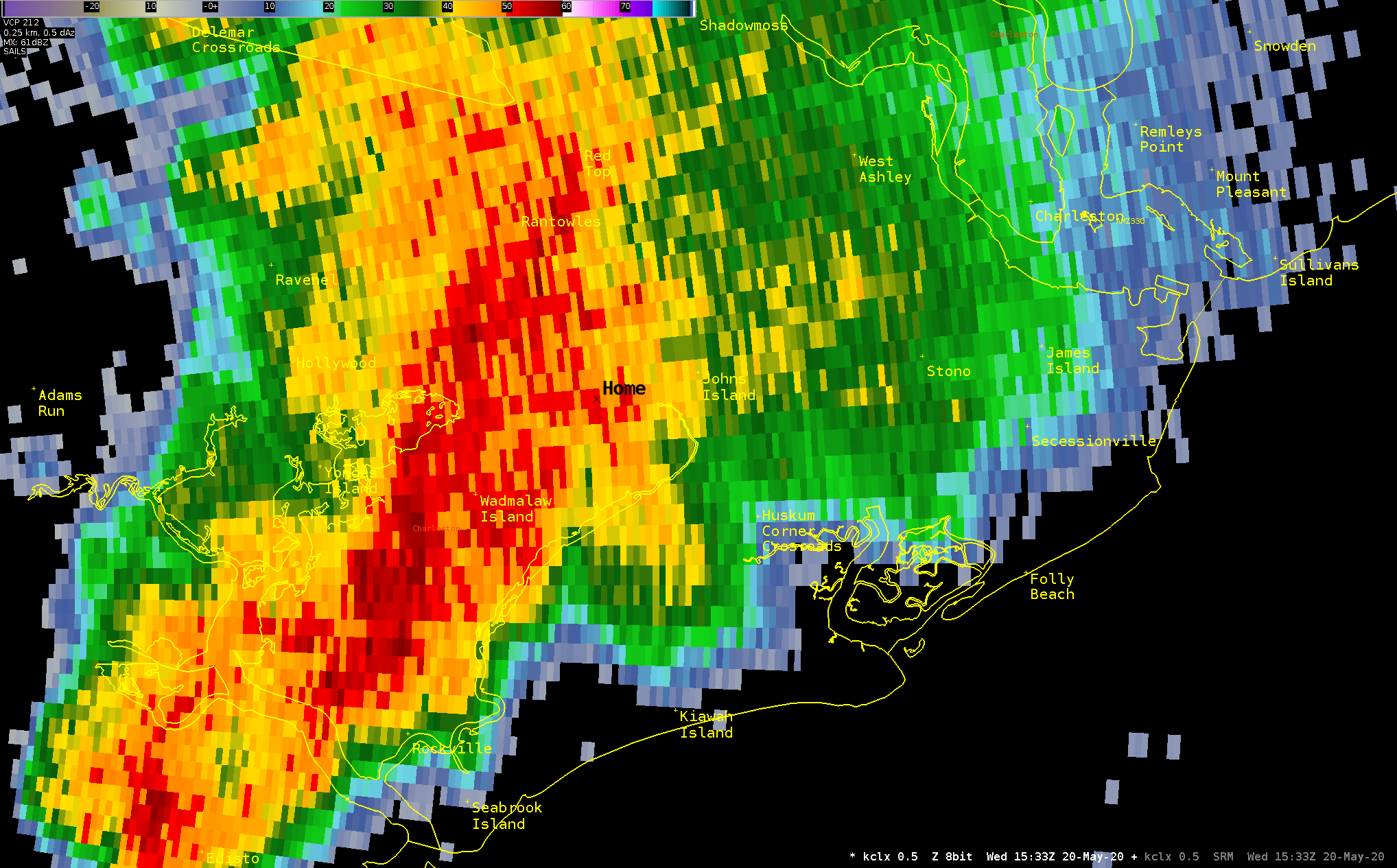
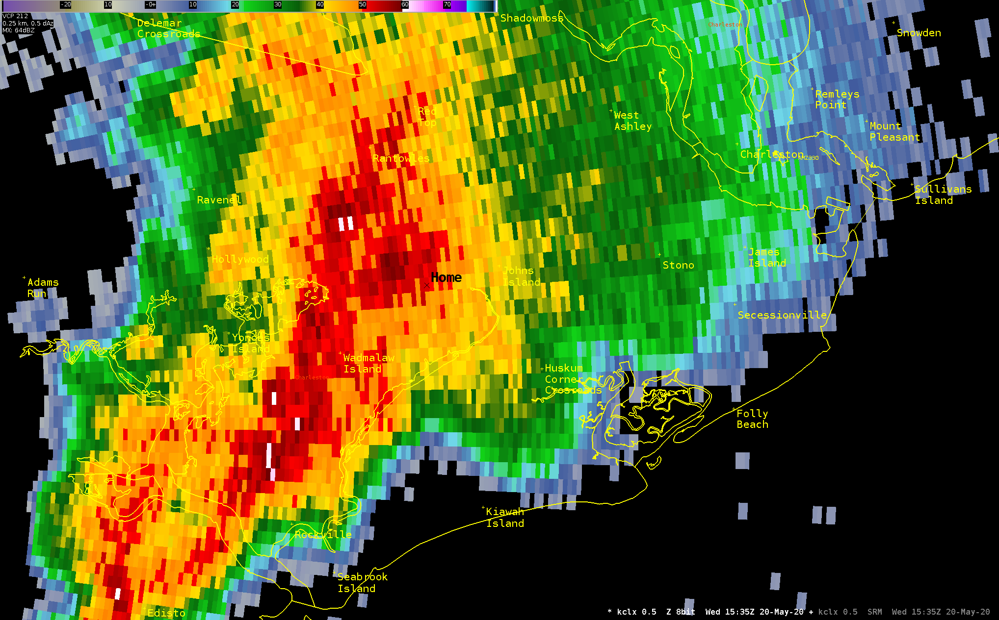
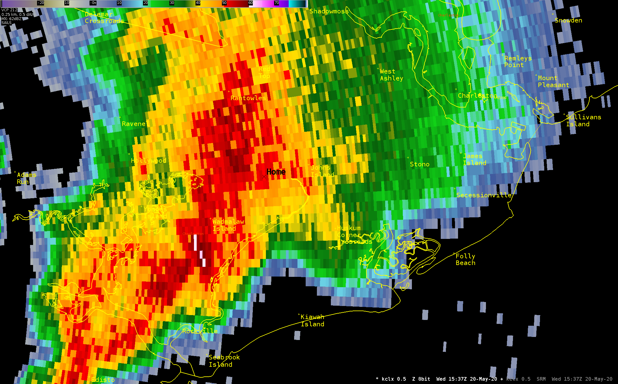
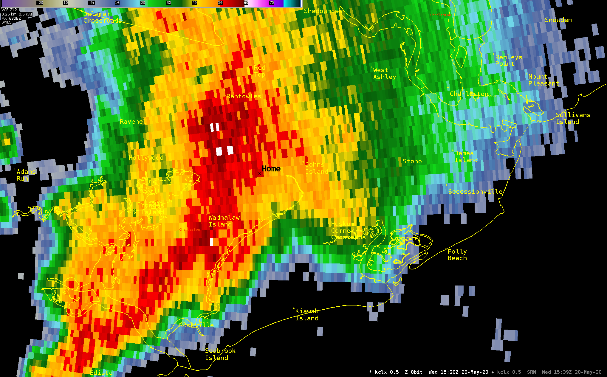
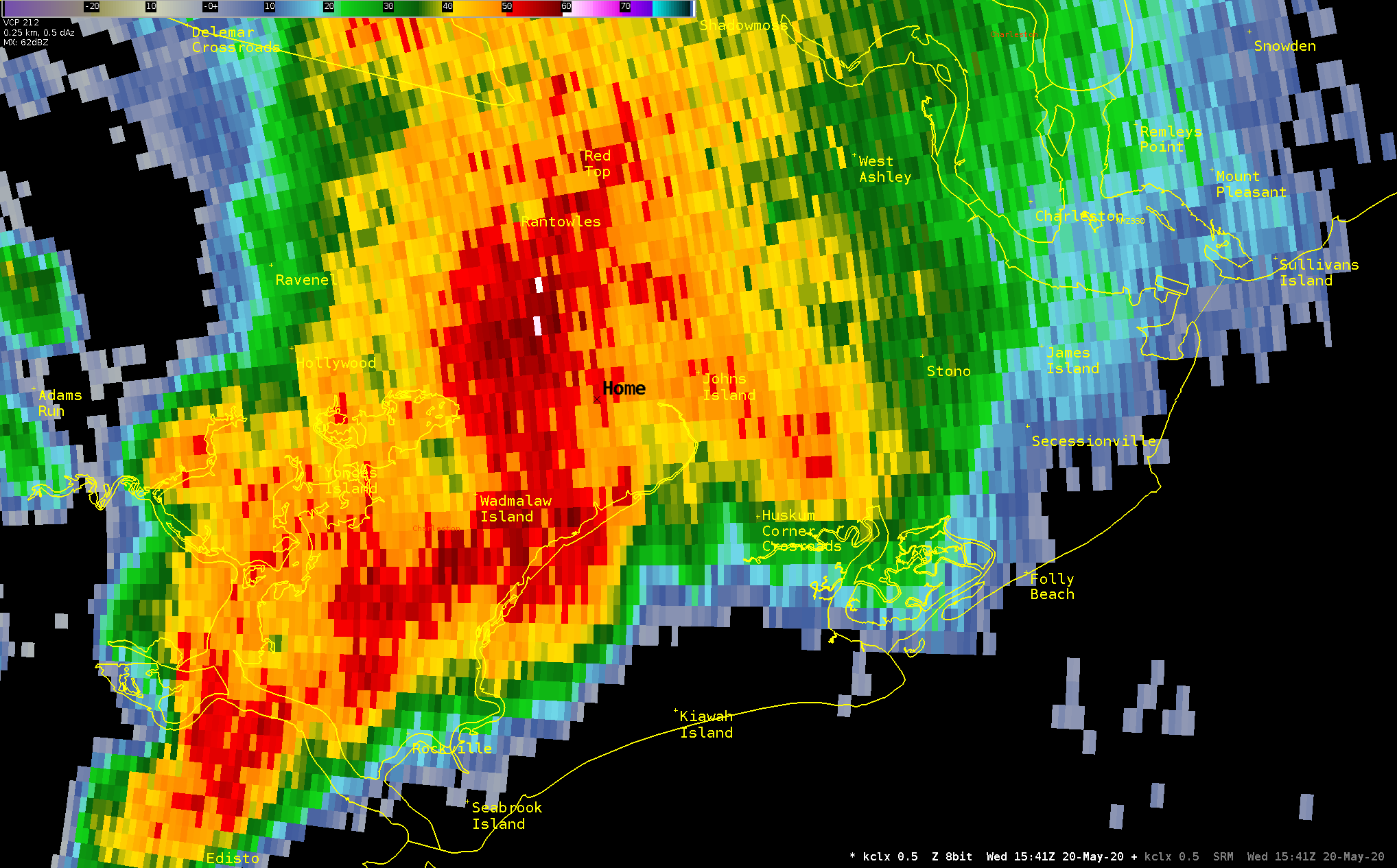
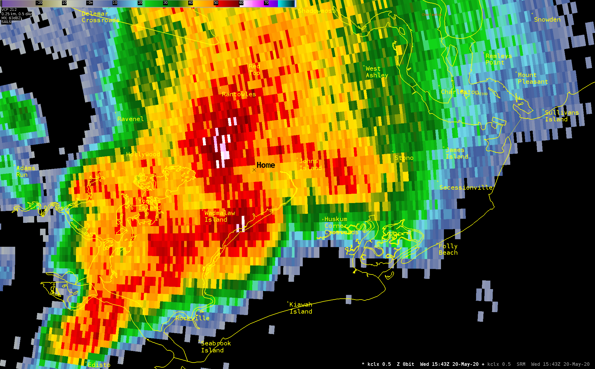
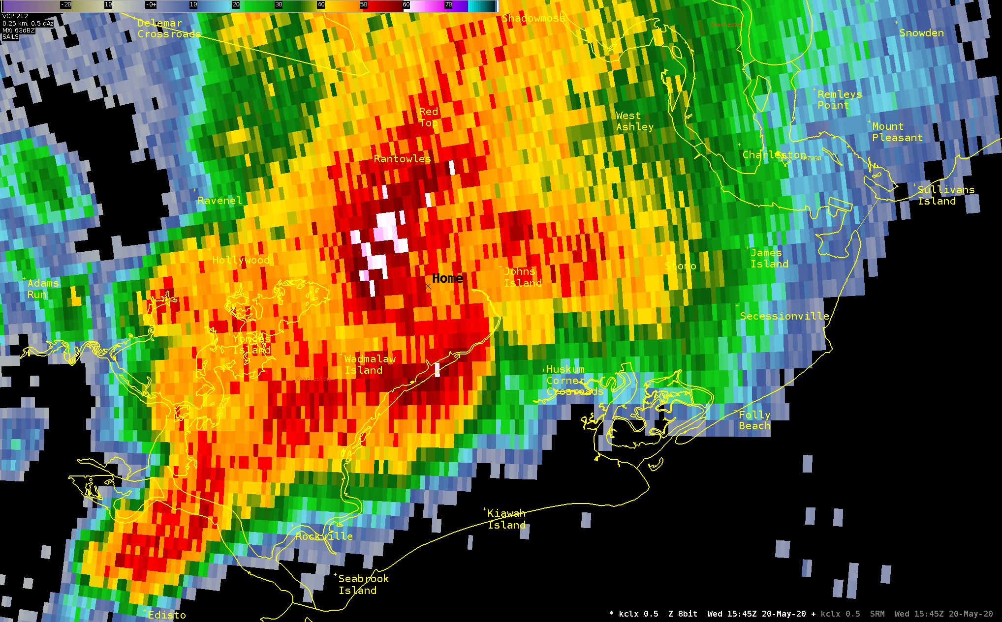
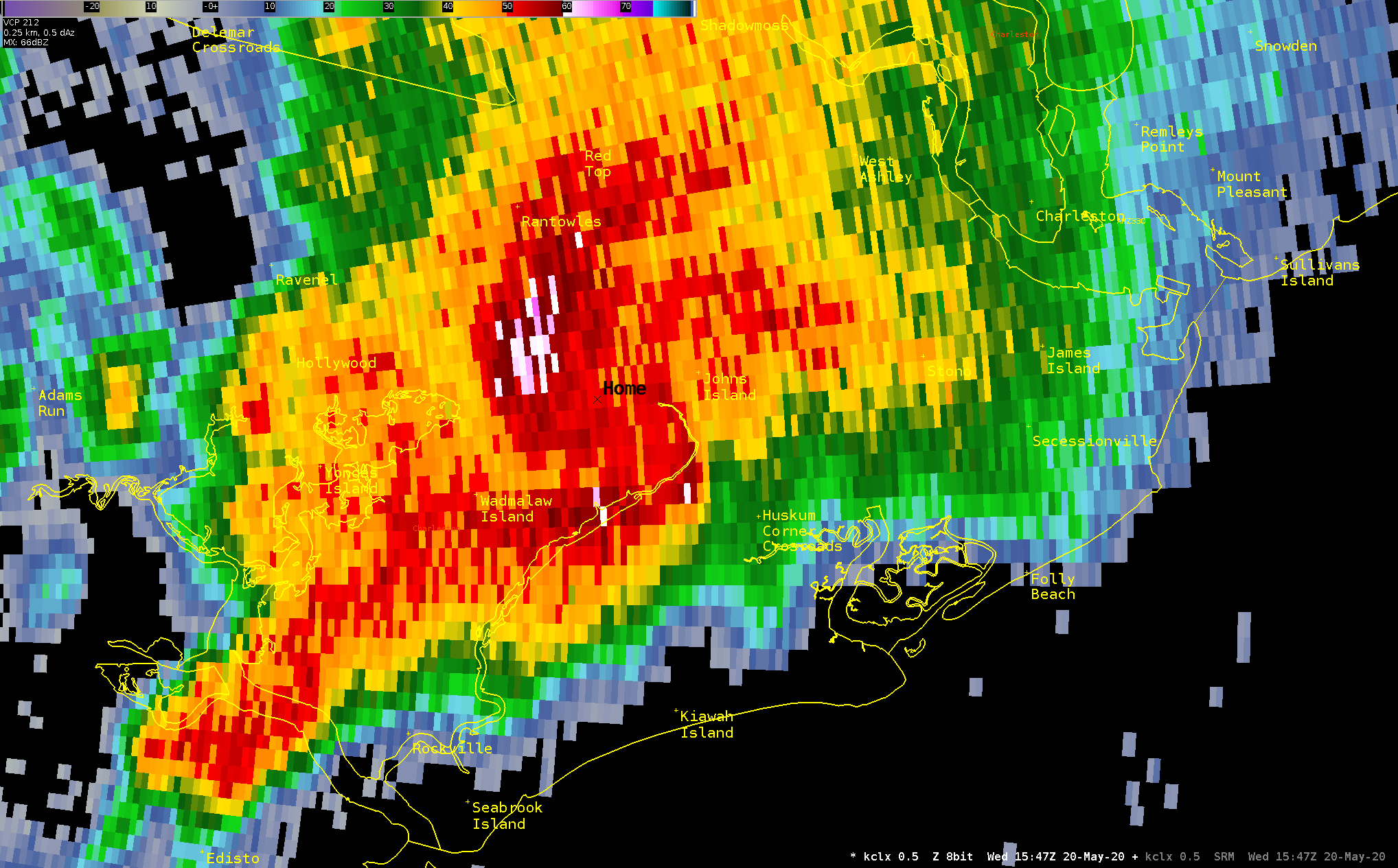
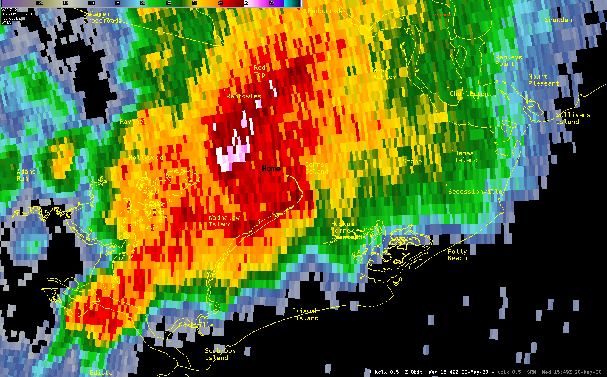
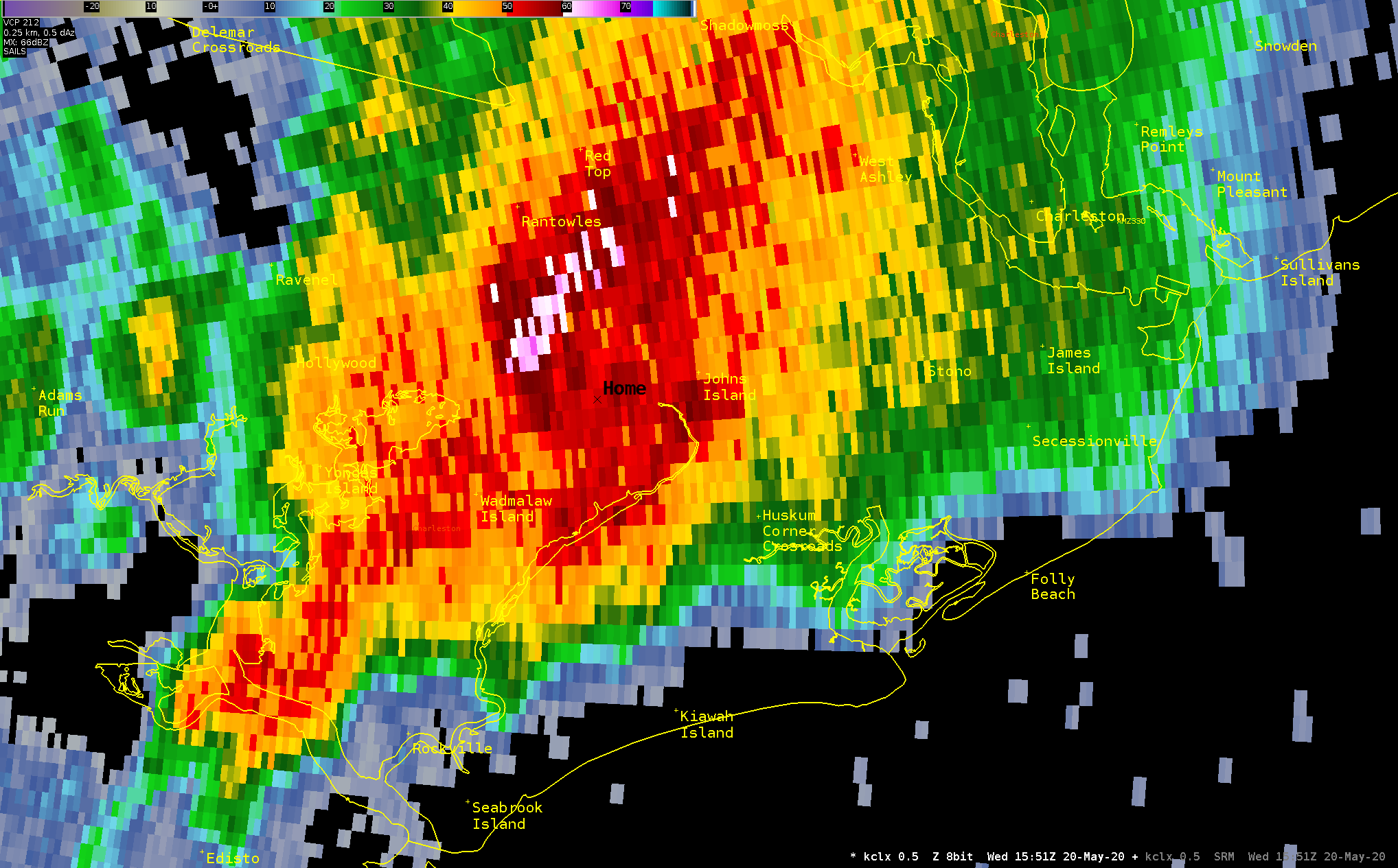
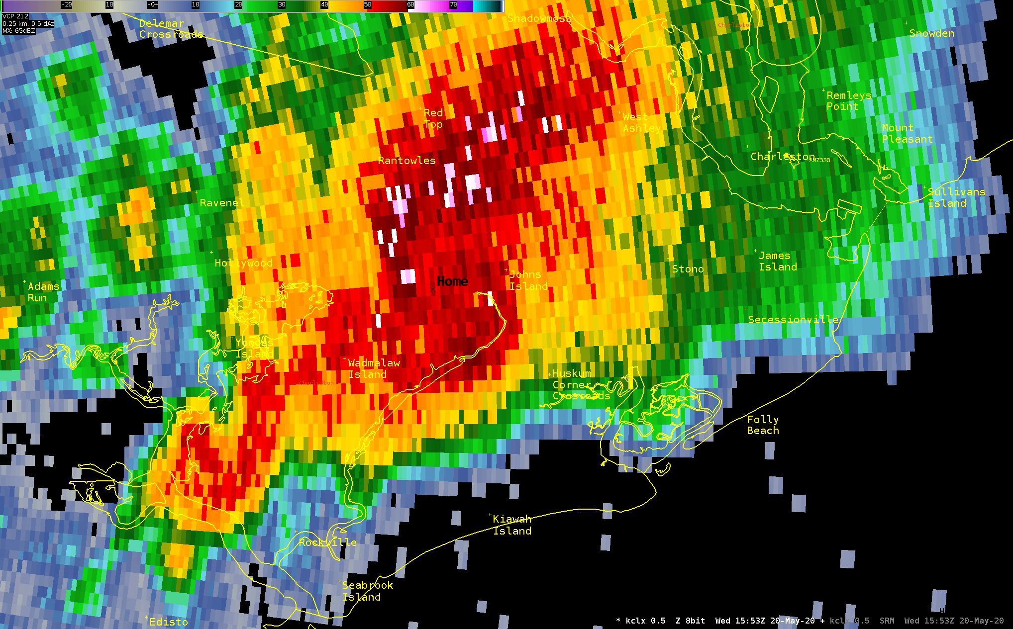
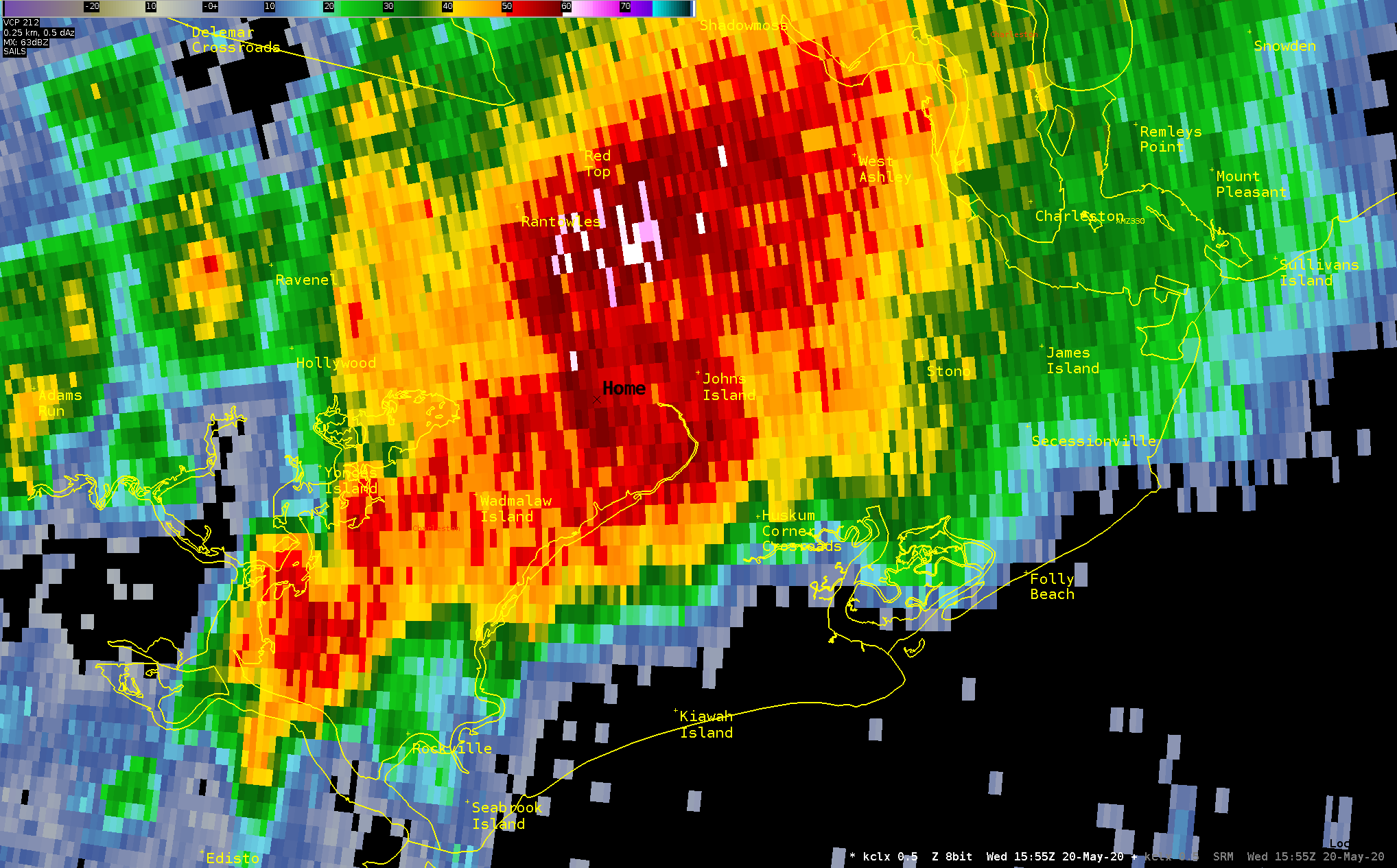
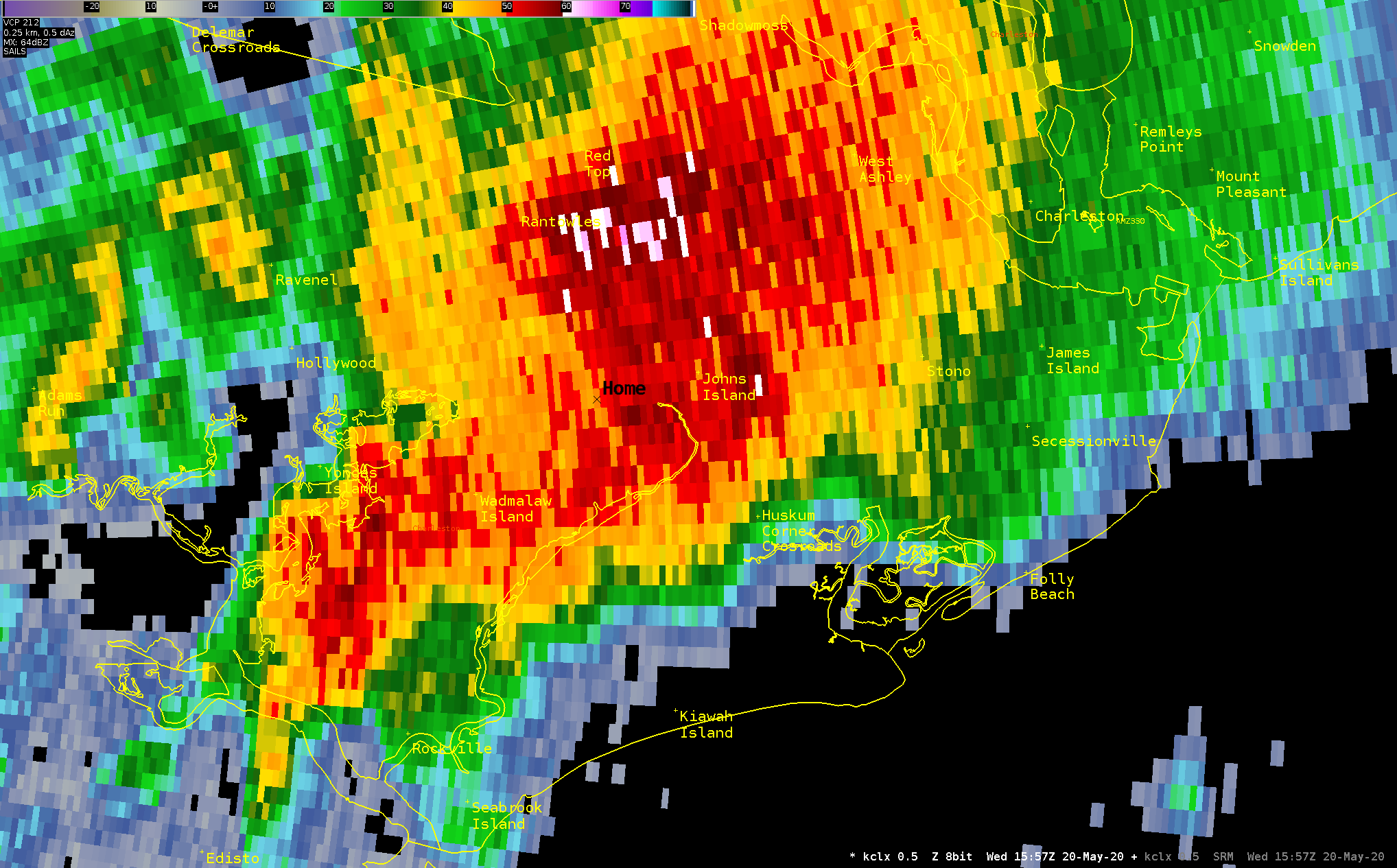
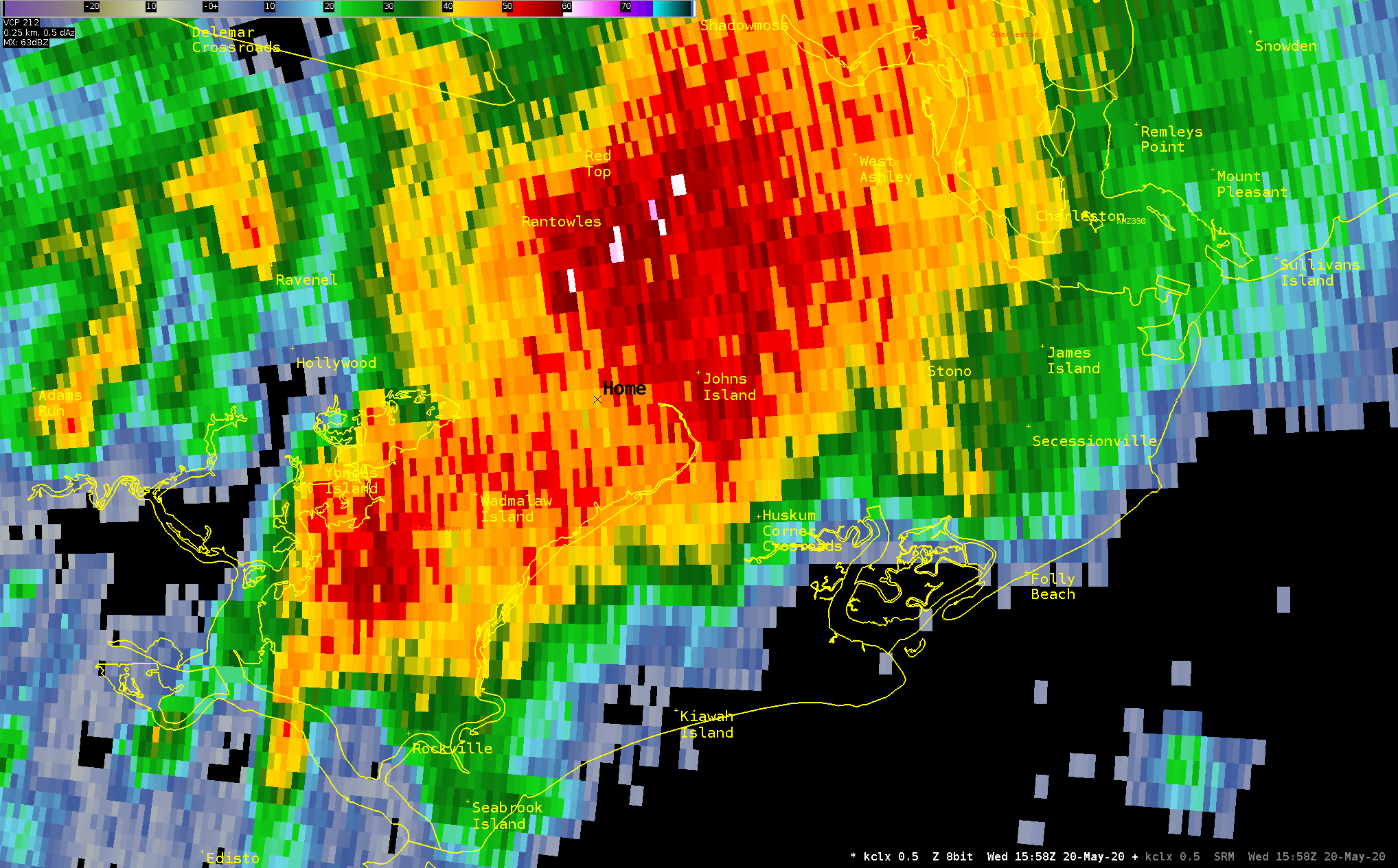
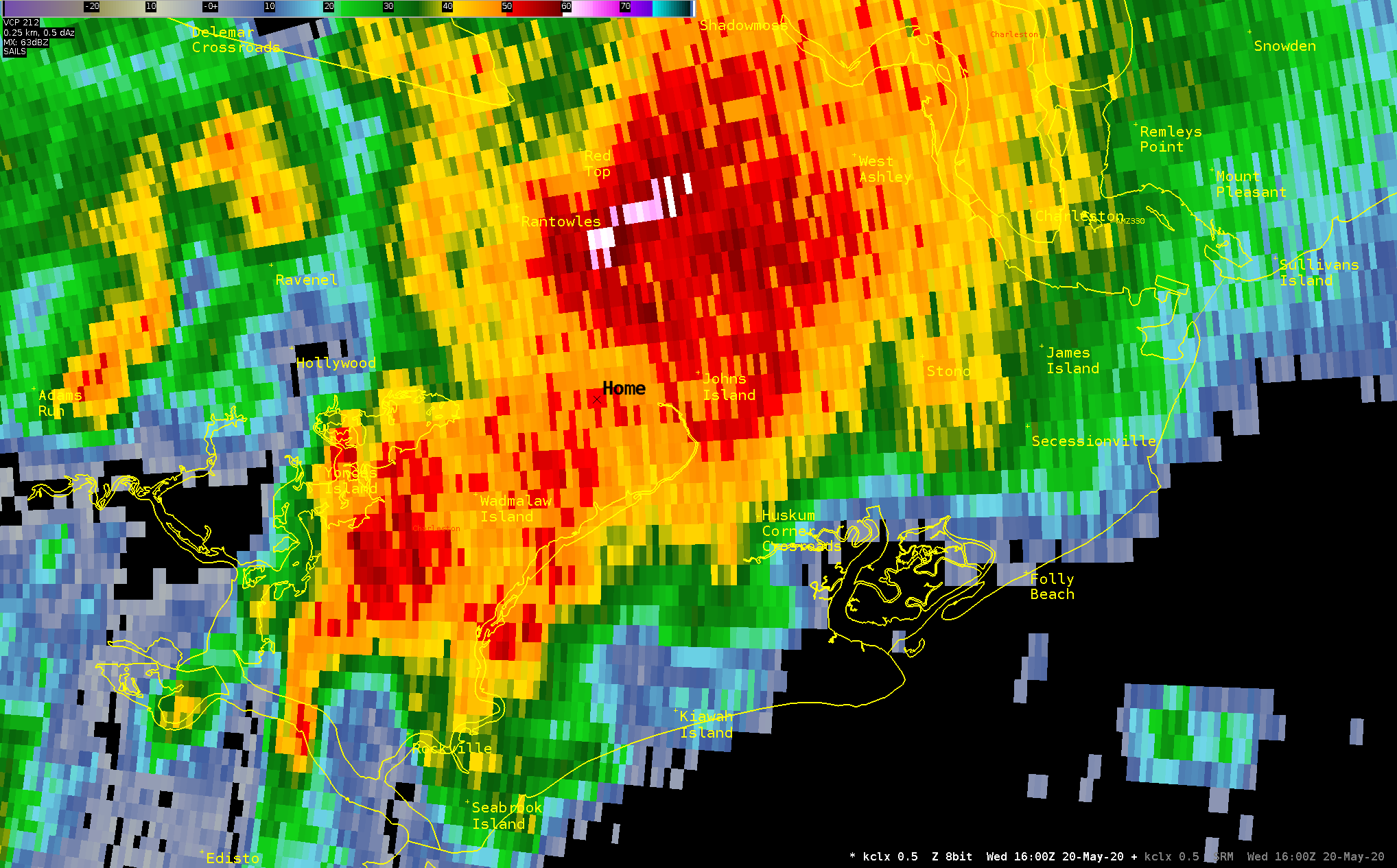
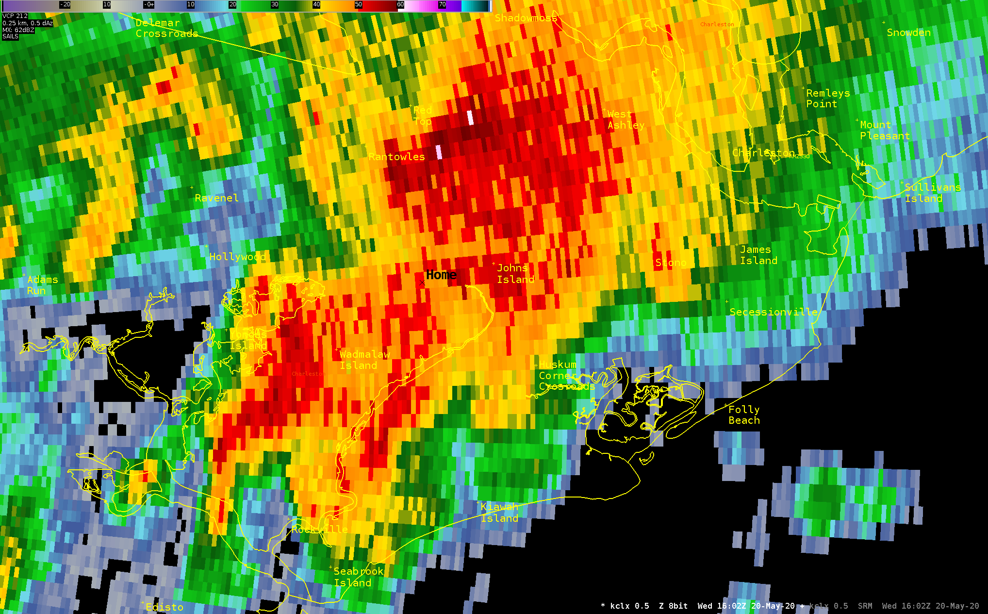
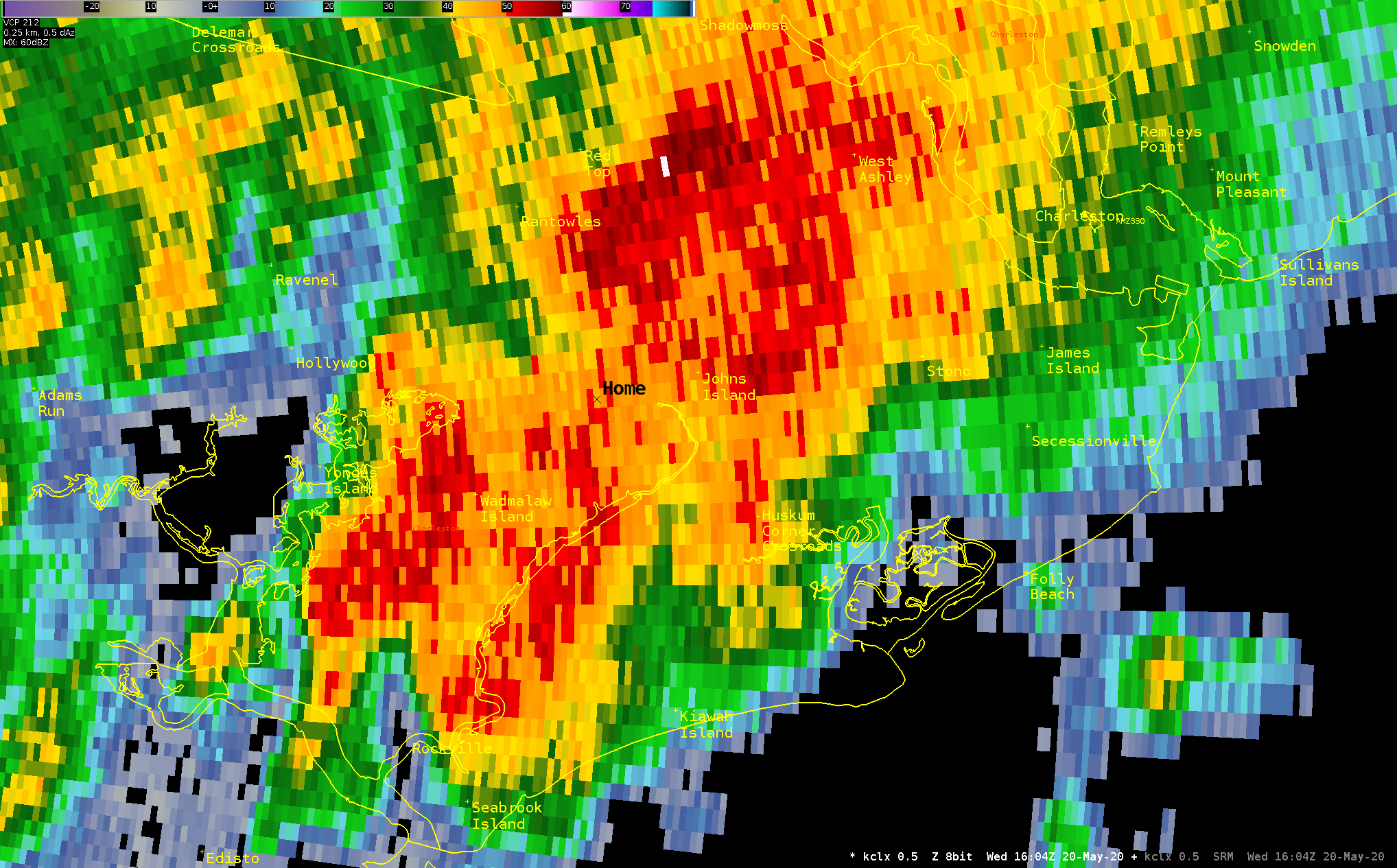
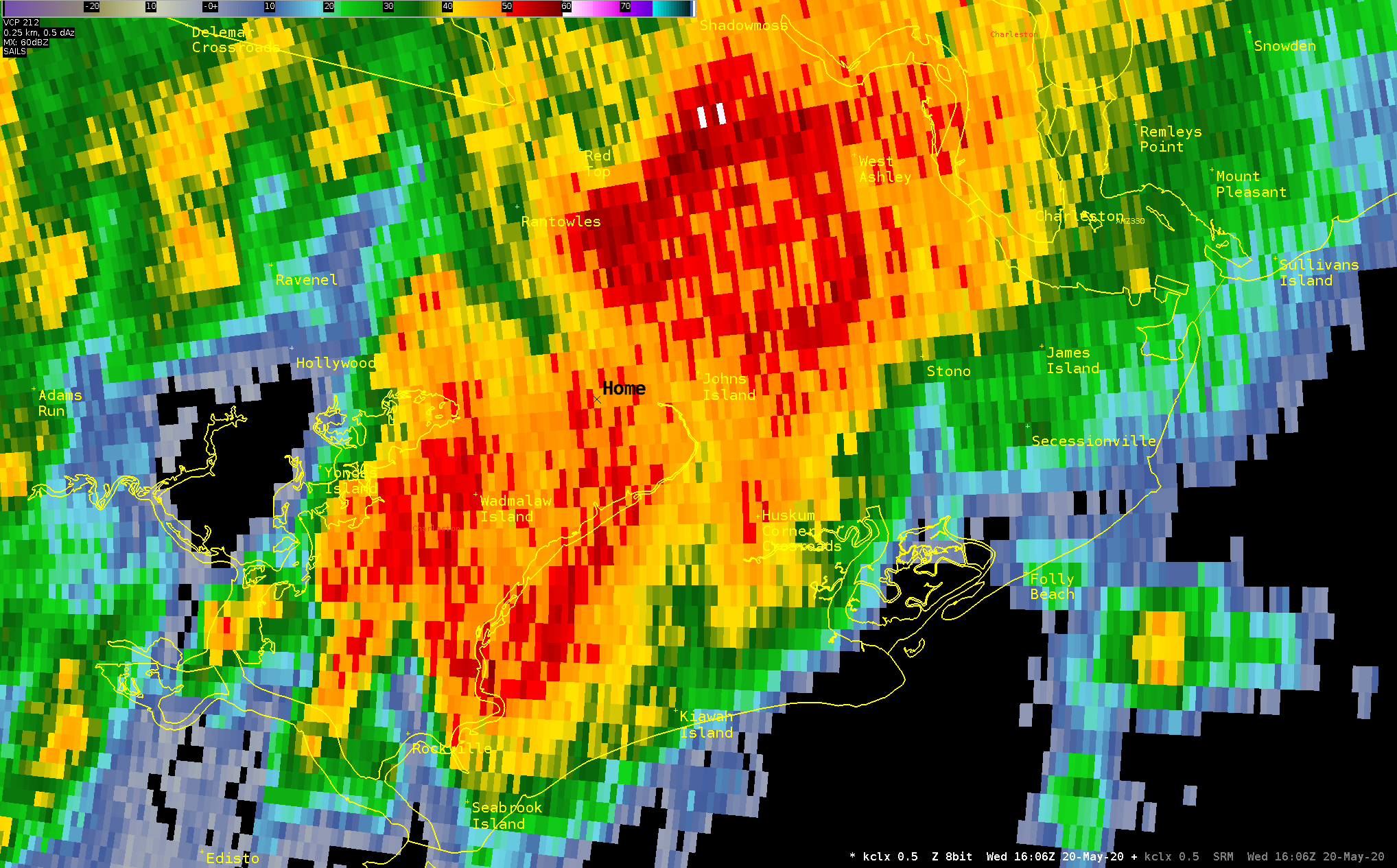
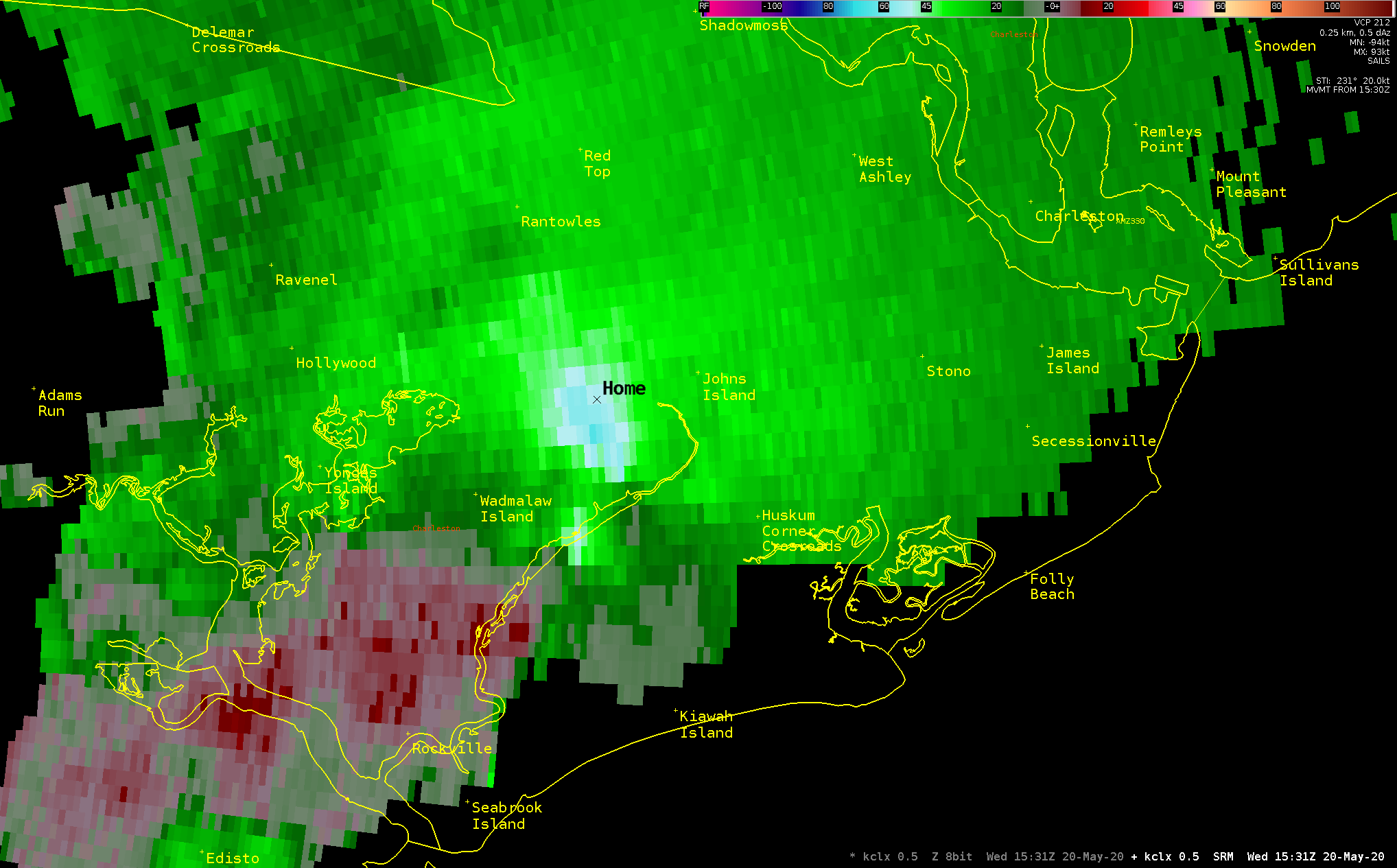
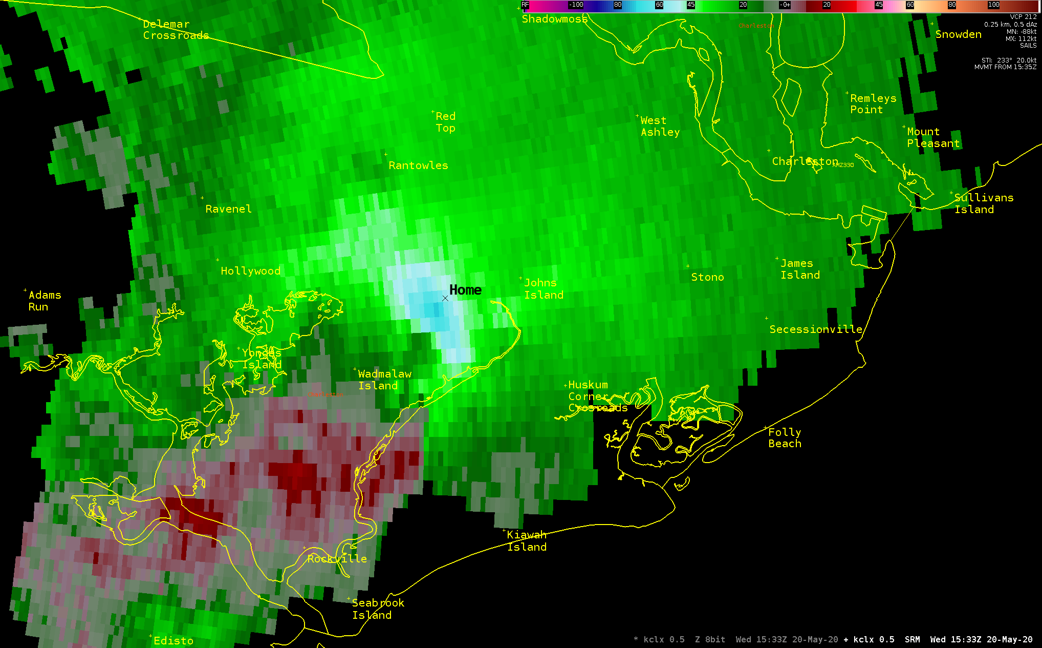
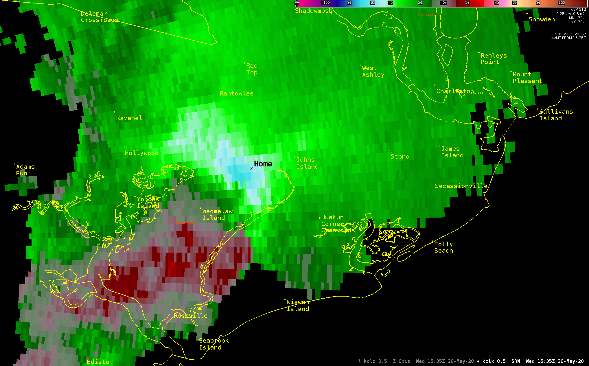
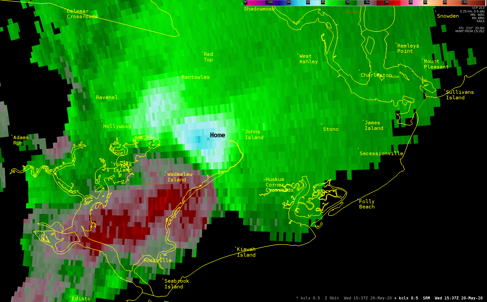
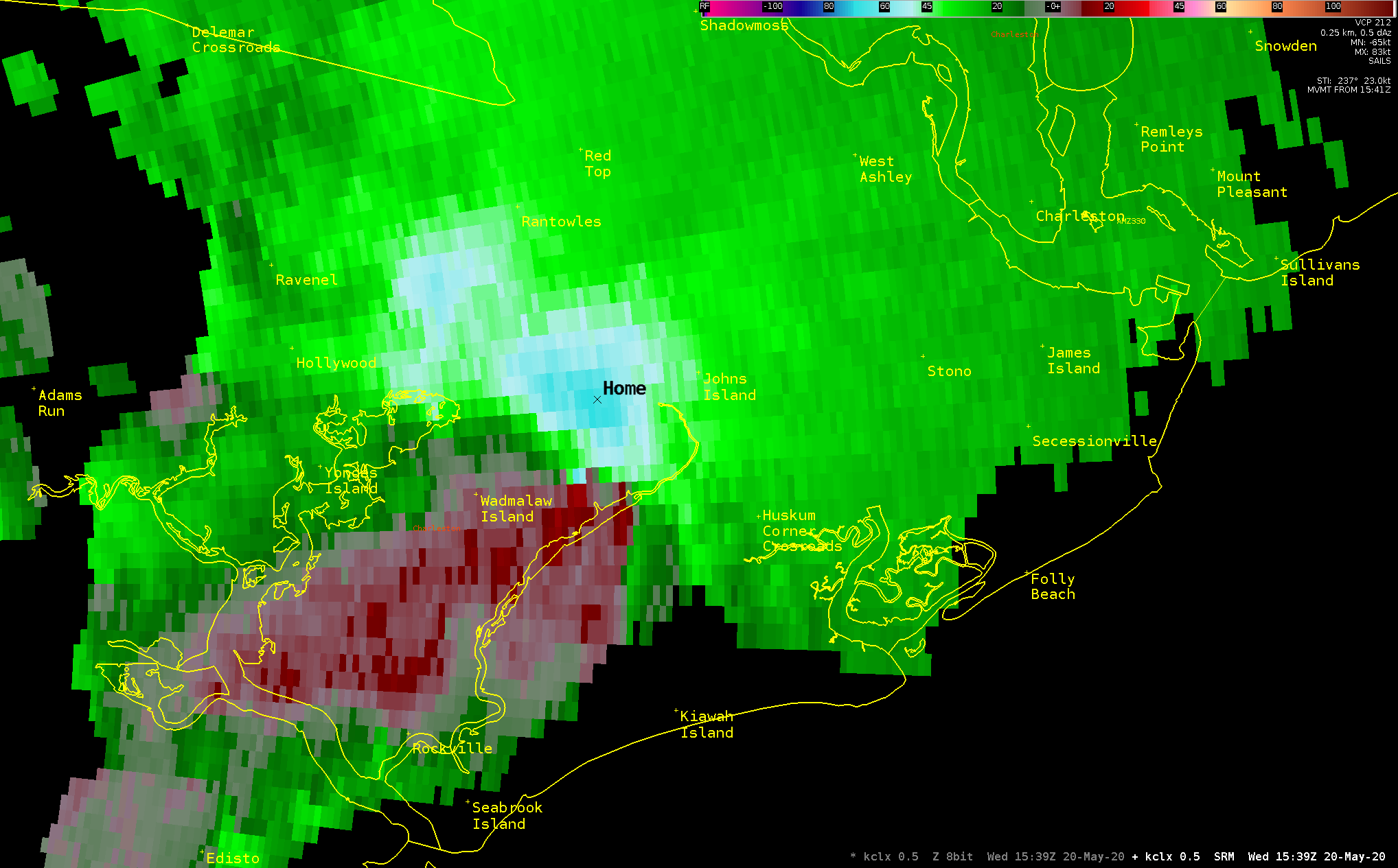
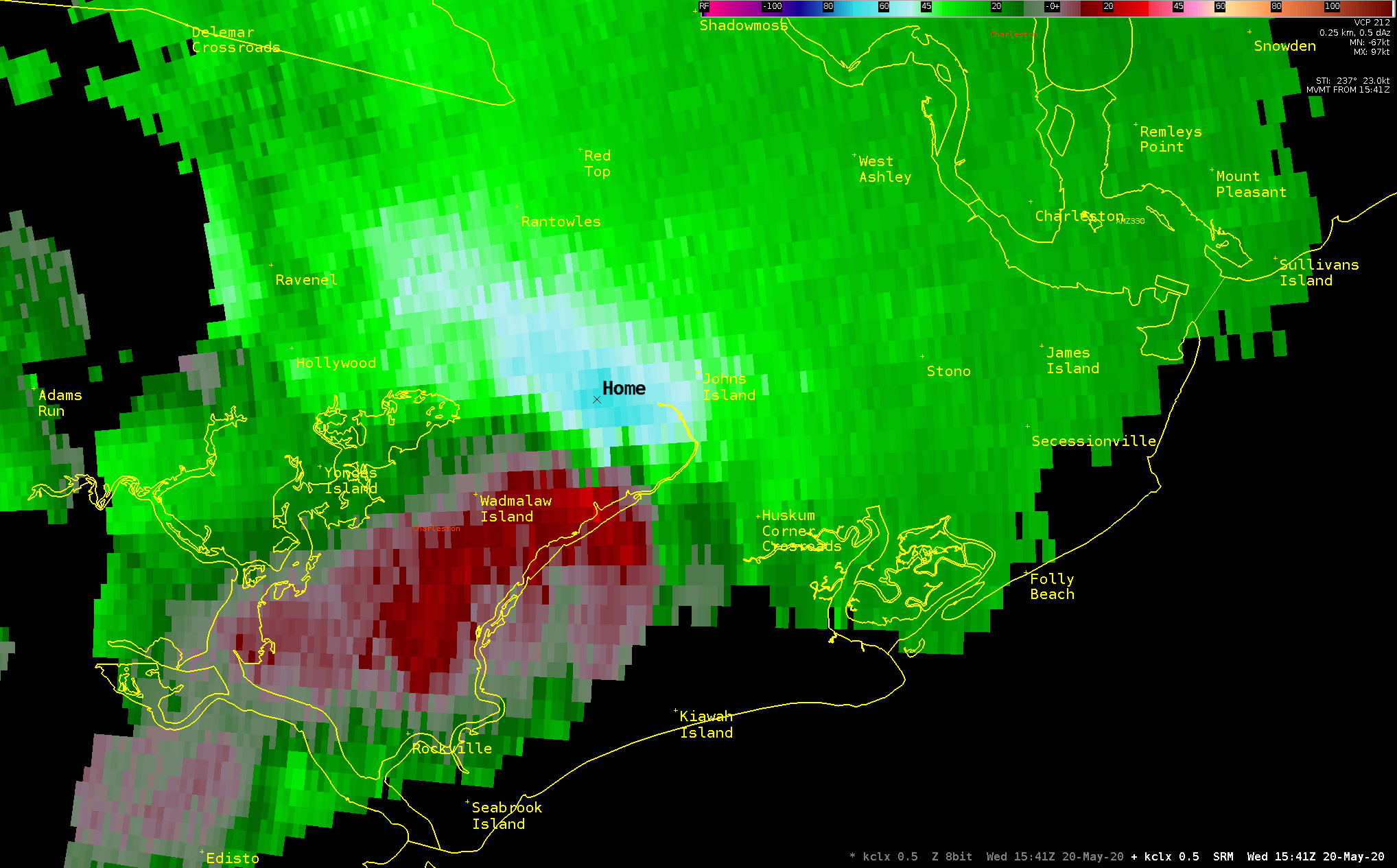
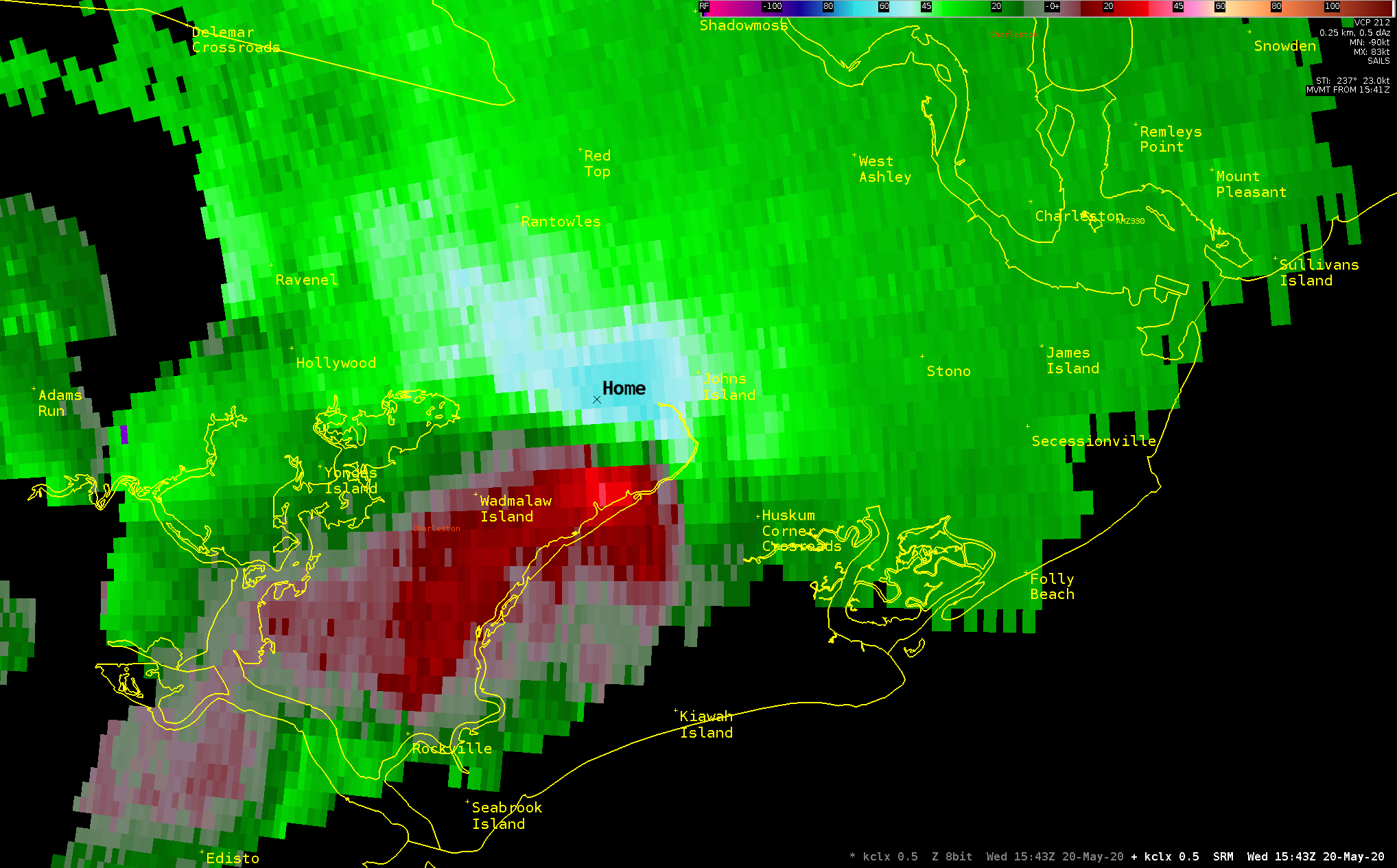
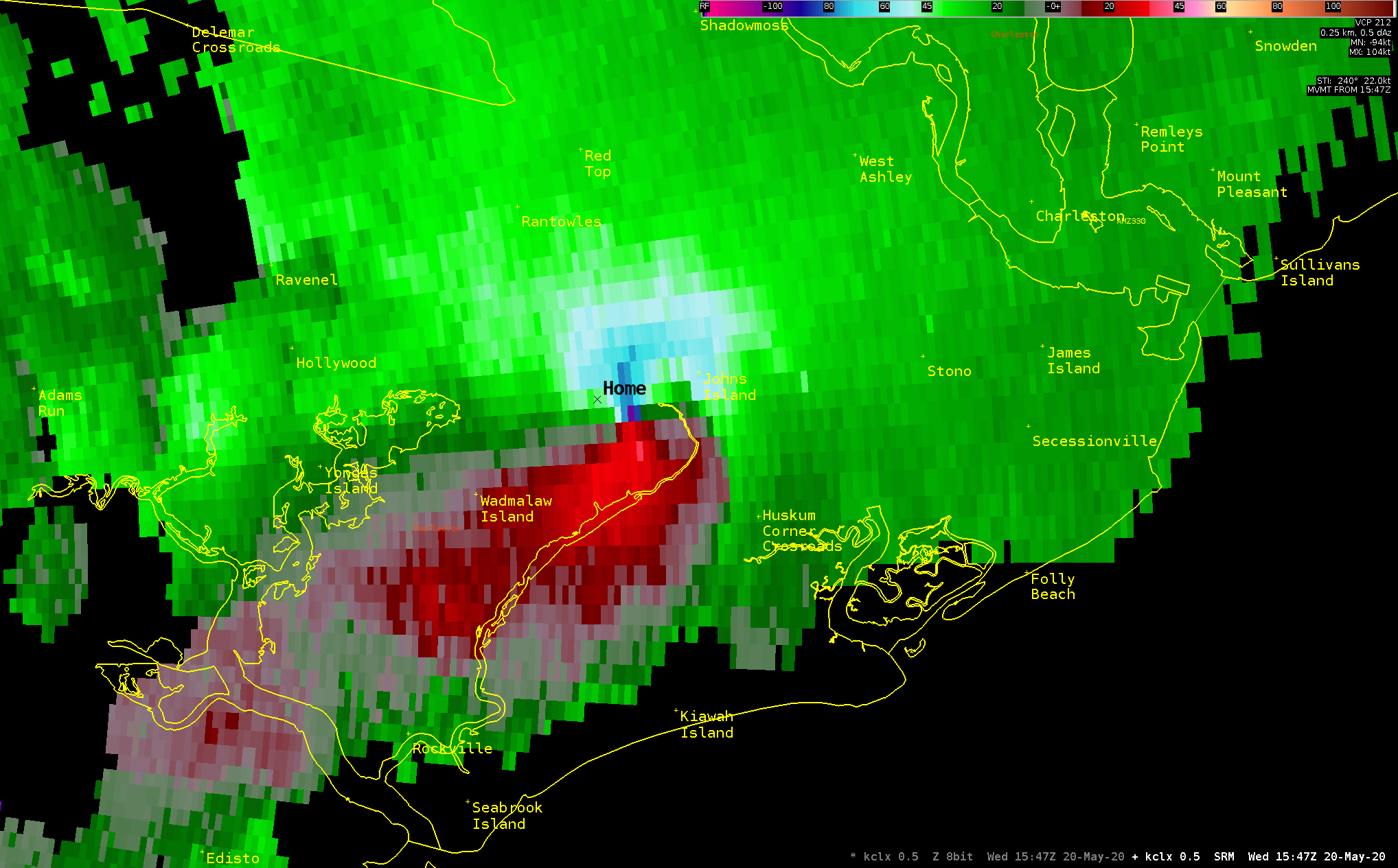
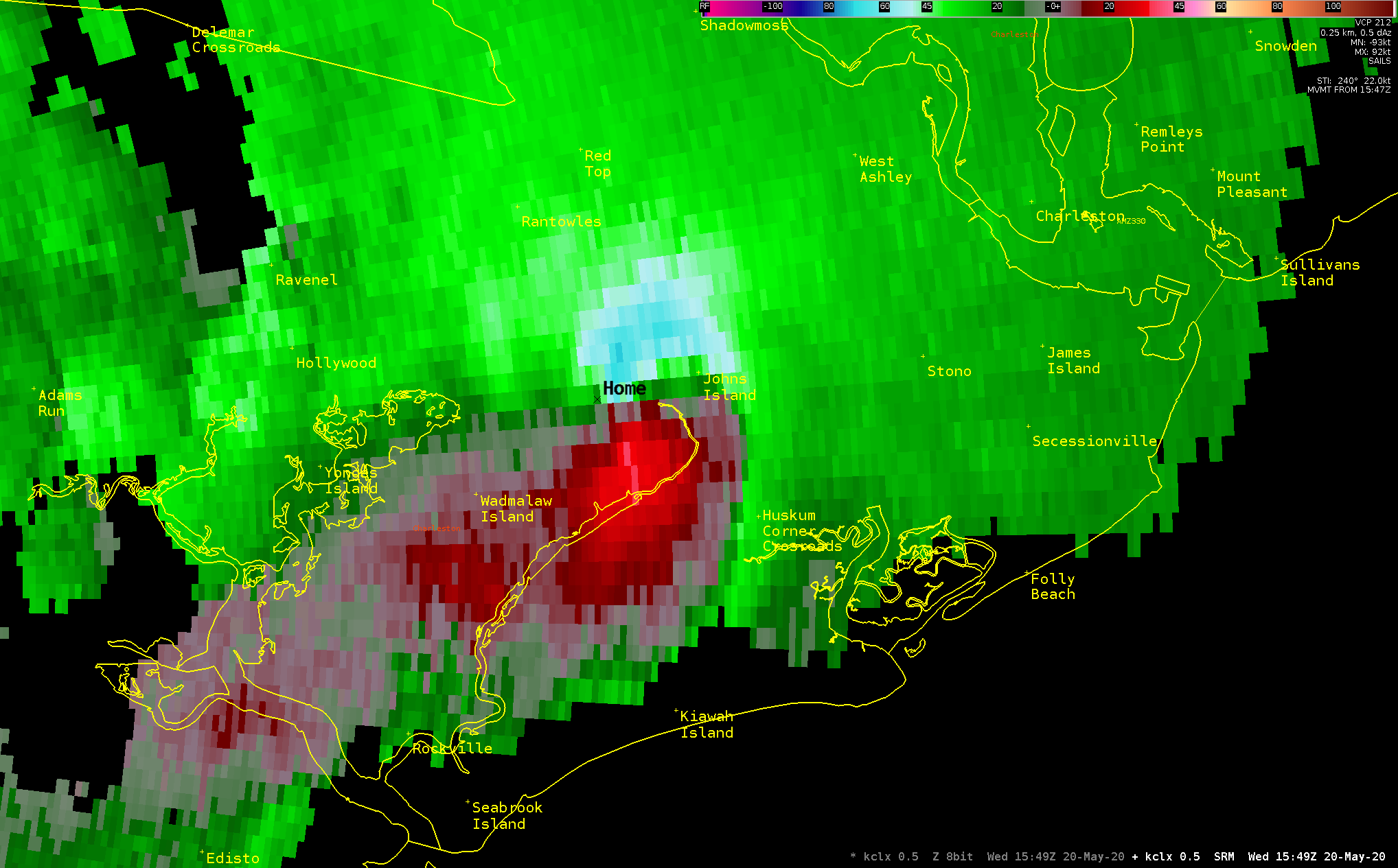
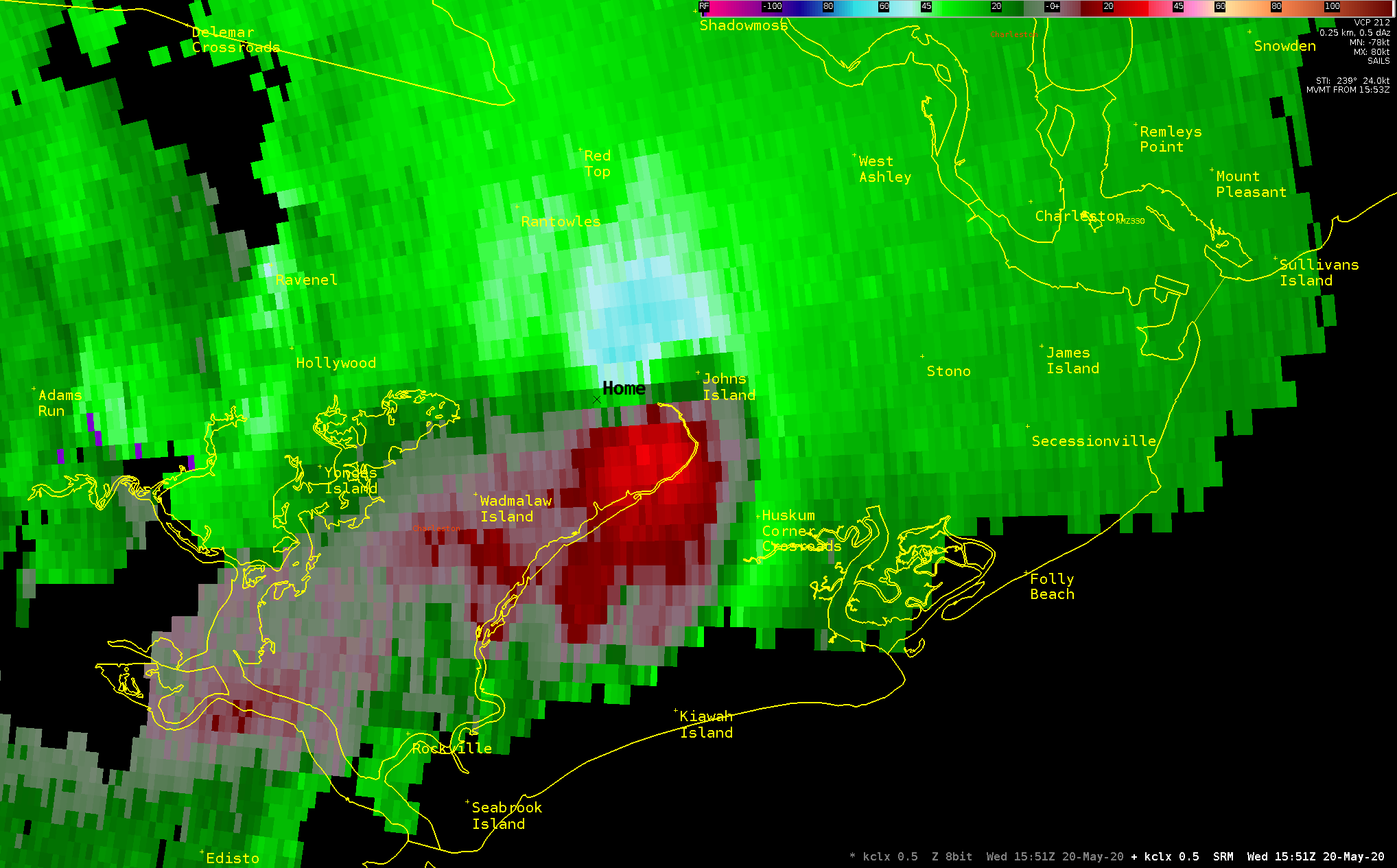
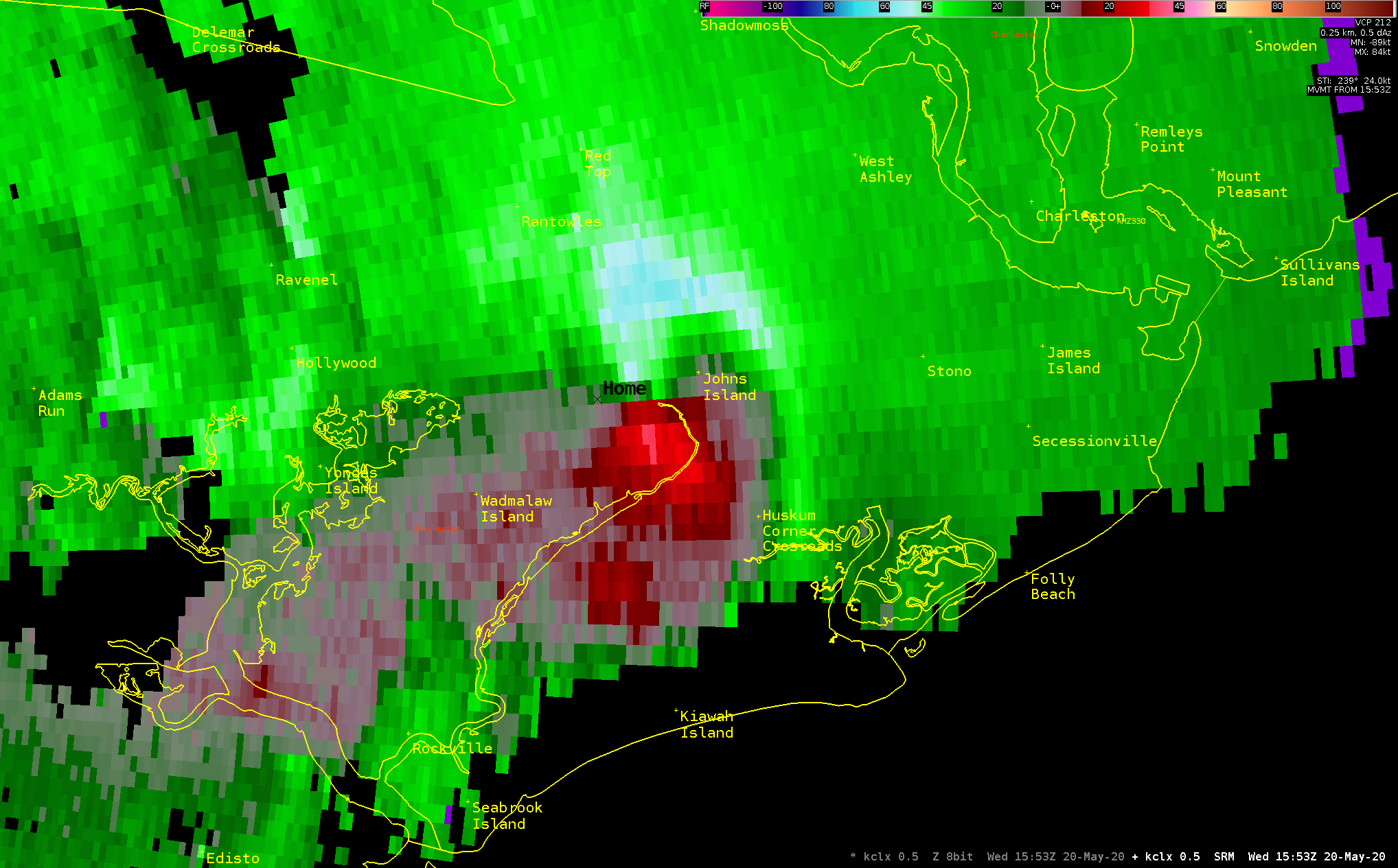
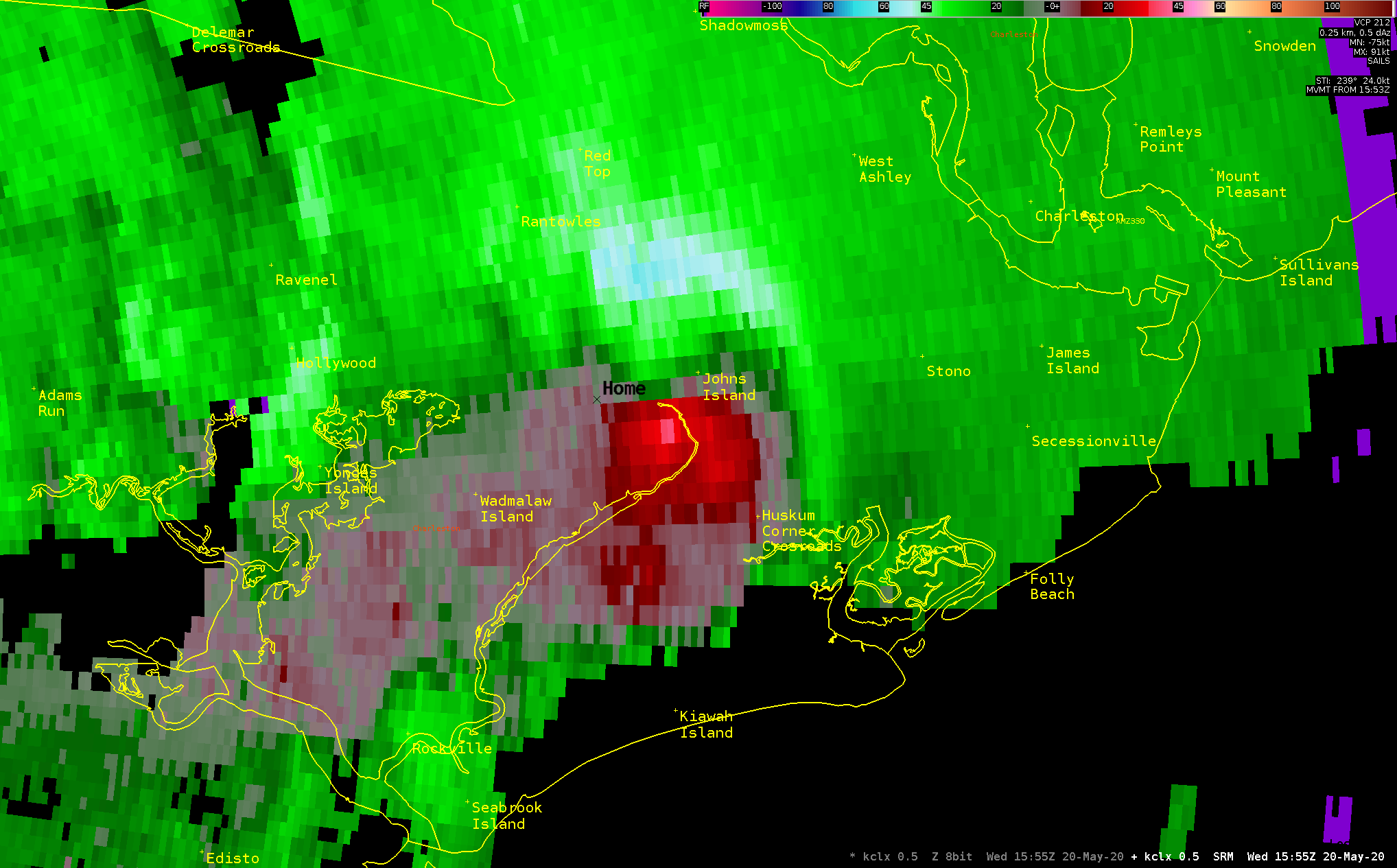
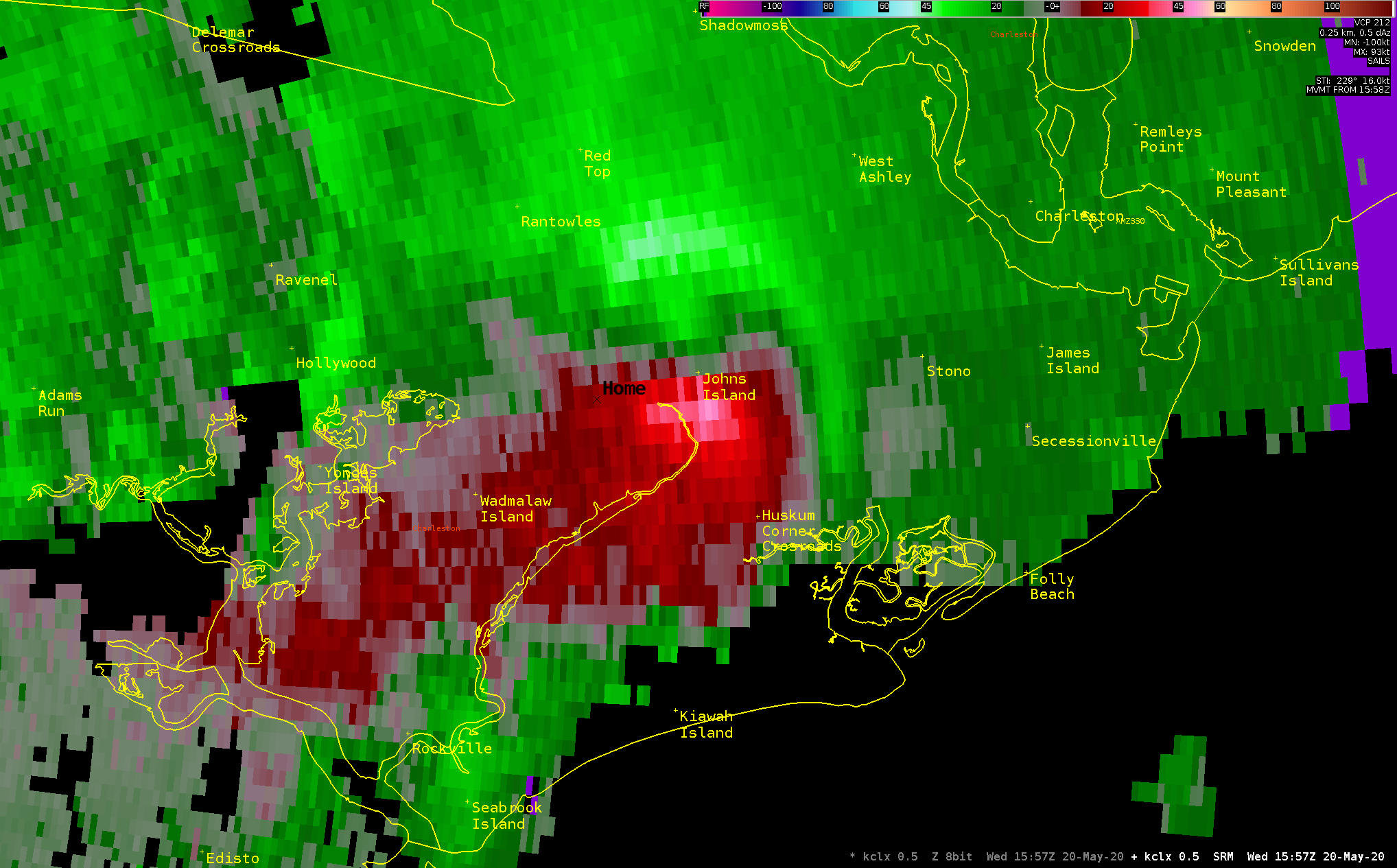
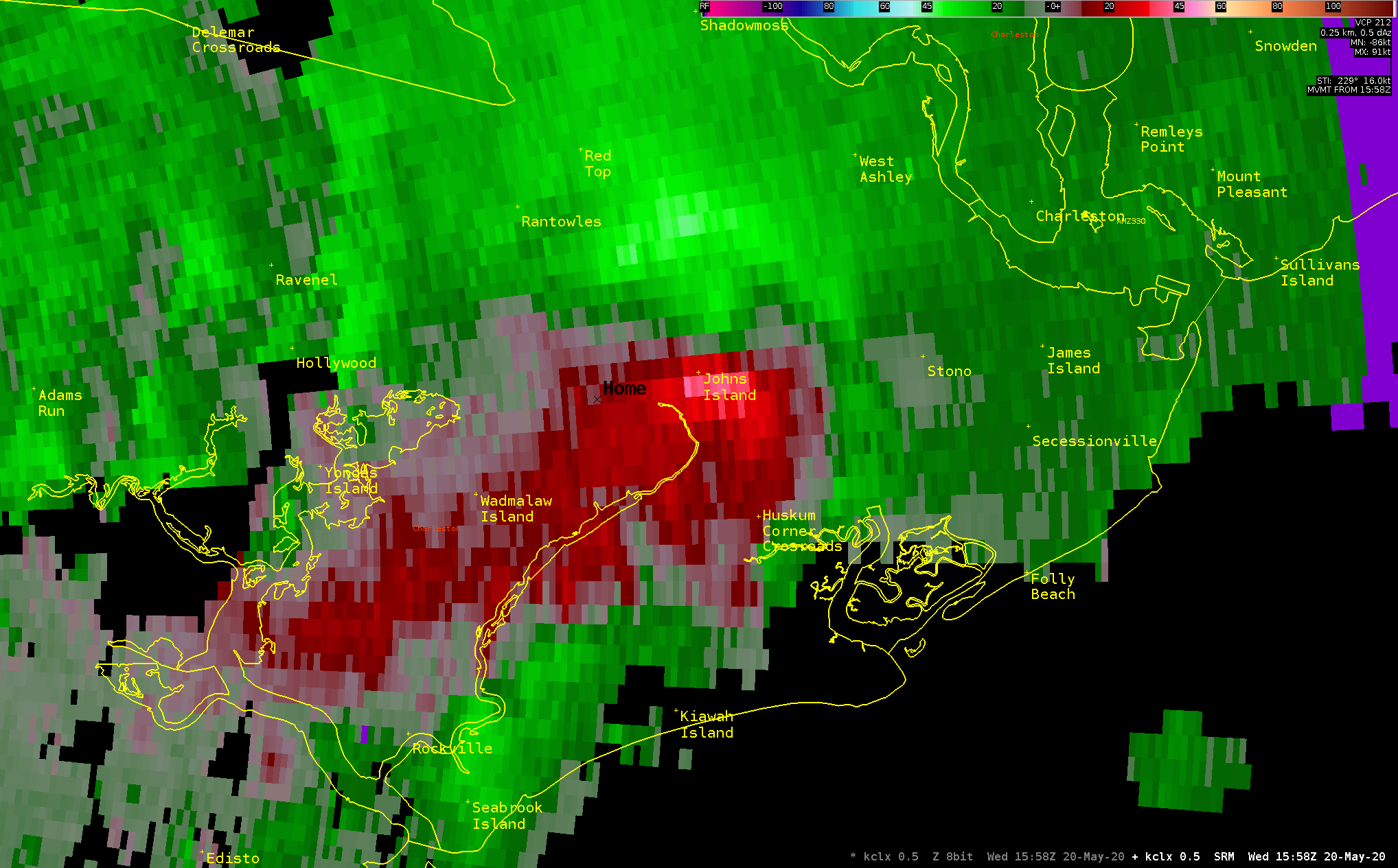
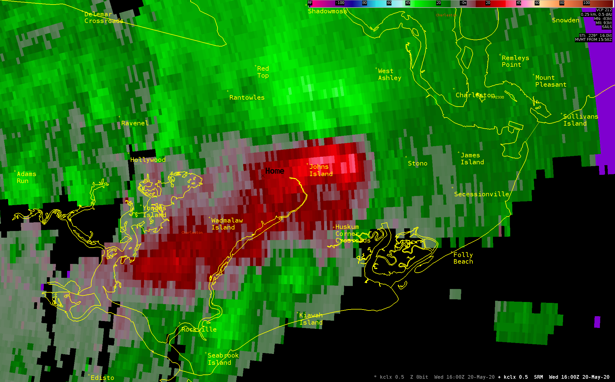
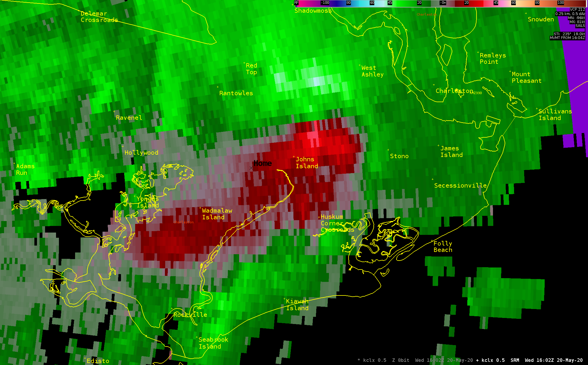
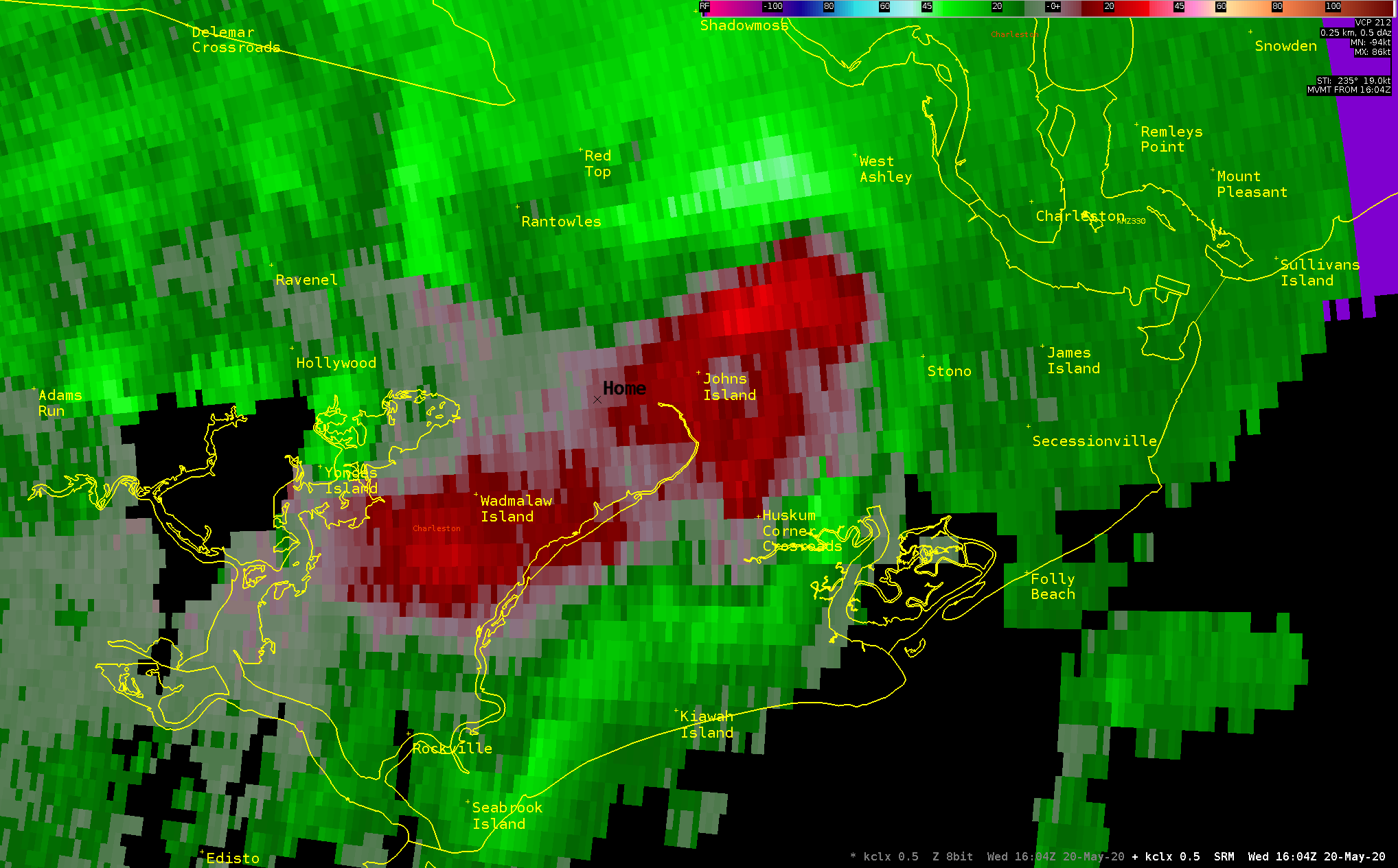
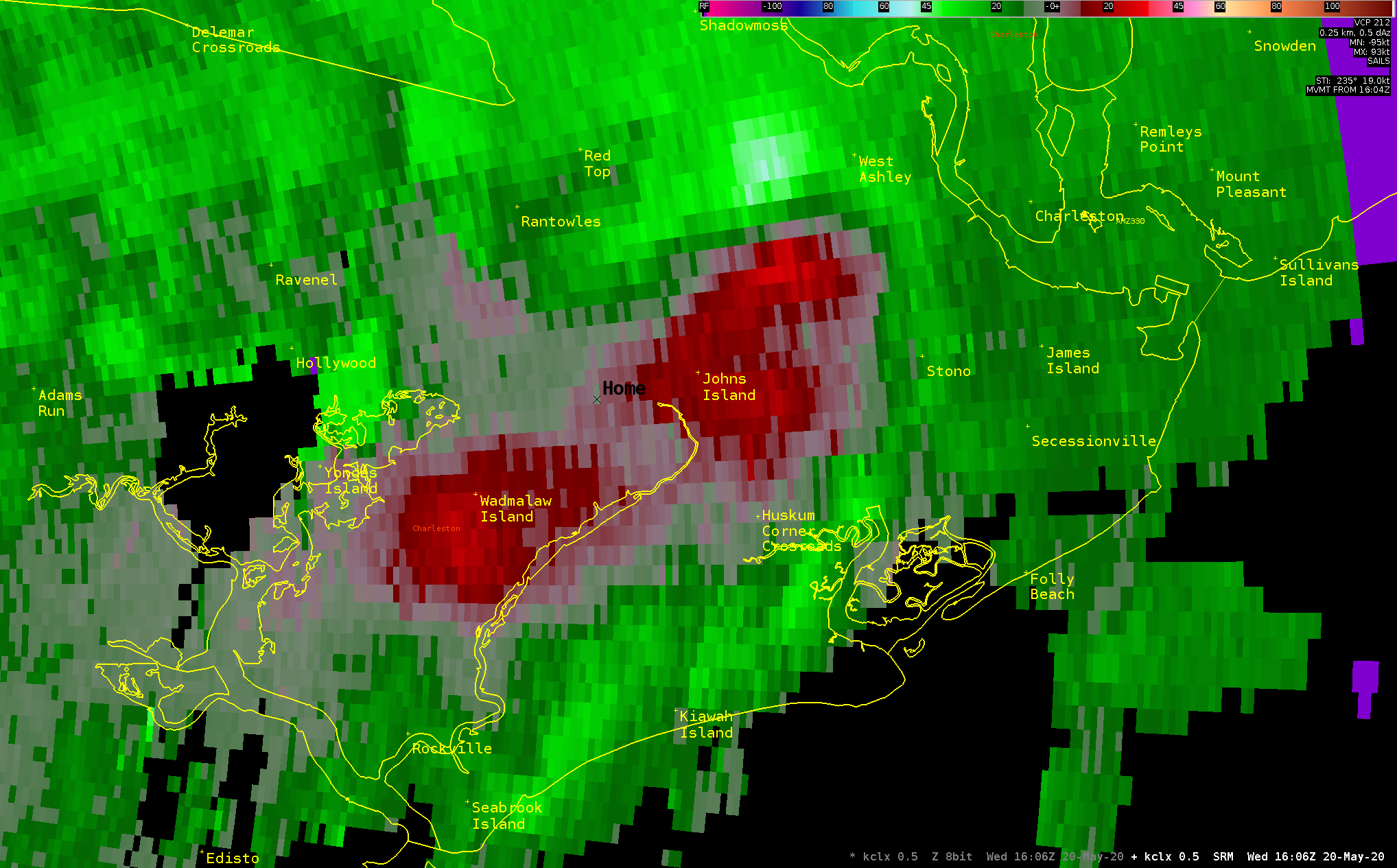
| EF1 Tornado on Johns Island, SC (Charleston County) | ||||||
| Start Time | Max EF-Scale Rating | Max Wind Speed | Max Path Width | Path Length | Fatalities | Injuries |
|---|---|---|---|---|---|---|
| 11:47 AM EDT | EF1 | 95 mph | 300 yards | 0.77 mi | 0 | 0 |
|
The tornado began just south of Chisolm Road and west of Chaineybriar Lane. It continued eastward across the southern portion of Shadberry Lane, dissipating over Church Creek, just southeast of Overlook Road. Along the path of the tornado, most of the damage was due to many snapped and uprooted trees. There were some homes that sustained mainly minor roof damage due to falling trees and/or large limbs. |
||||||
Radar Images (click on the X below to enlarge) |
||||||
|

|
|||||
Damage Pictures (courtesy of NWS Charleston - click to enlarge) |
||||||


 Coastal Flood