| Severe Downburst Impacts Summerville and Ladson Areas - June 10, 2024 | ||||||||||
| Start Time | End Time | Max Wind Speed | Max Damage Width | Damage Length | Fatalities | Injuries | ||||
|---|---|---|---|---|---|---|---|---|---|---|
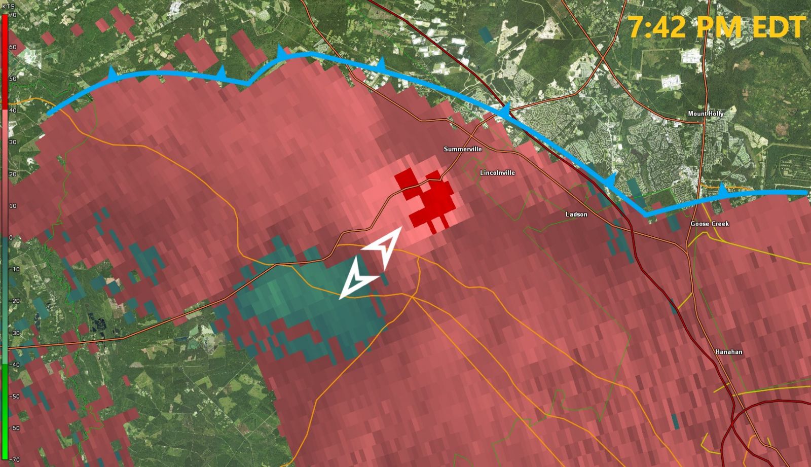
| 7:42 PM EDT | 7:58 PM EDT | 80 to 85 mph | 3.5 miles | 8.5 miles | 0 | 1 | ||||
|
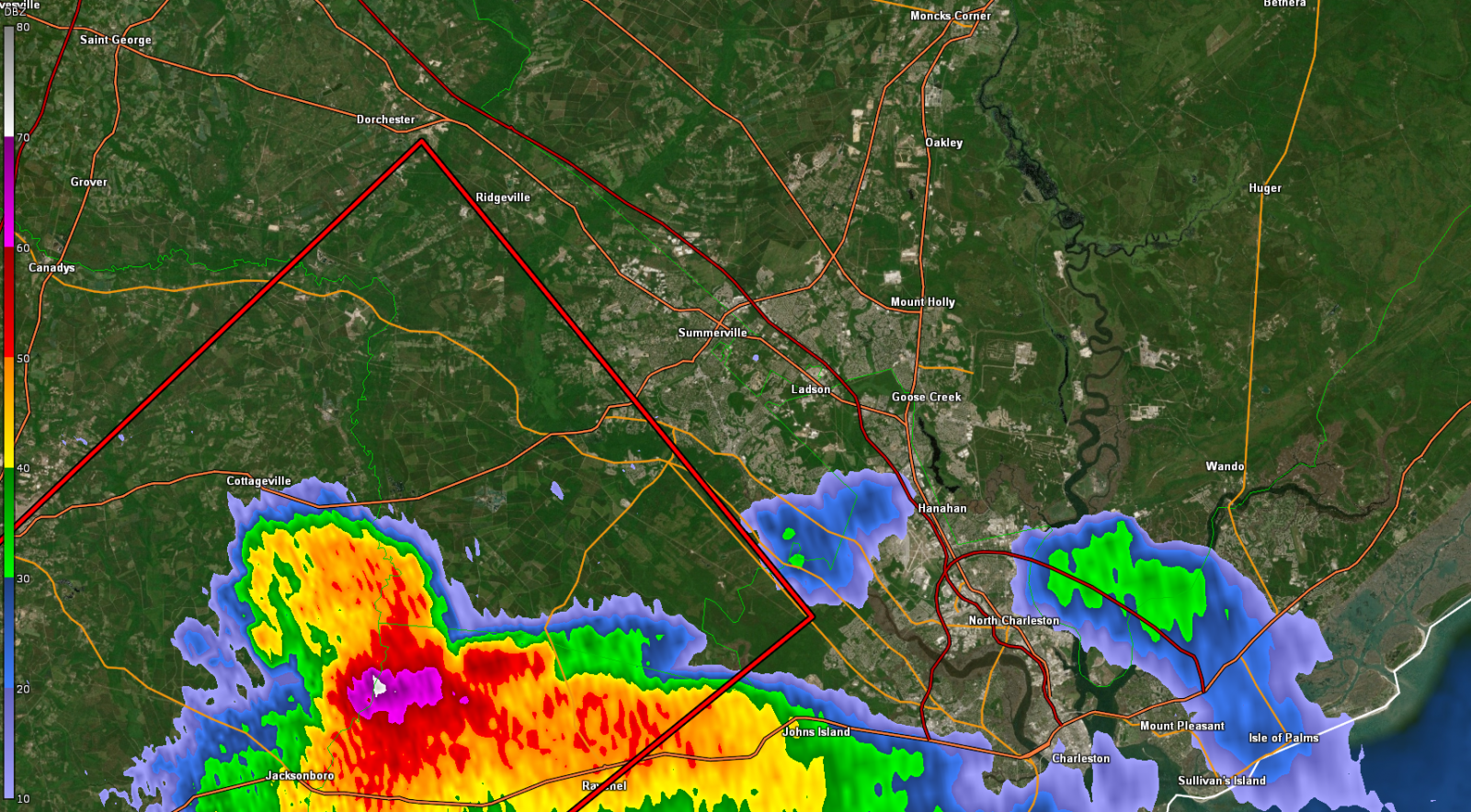
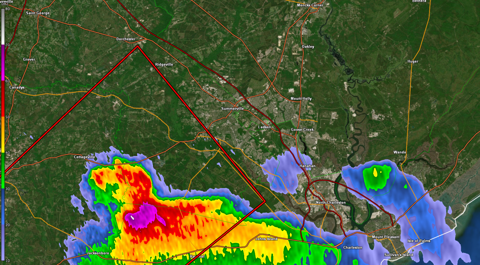
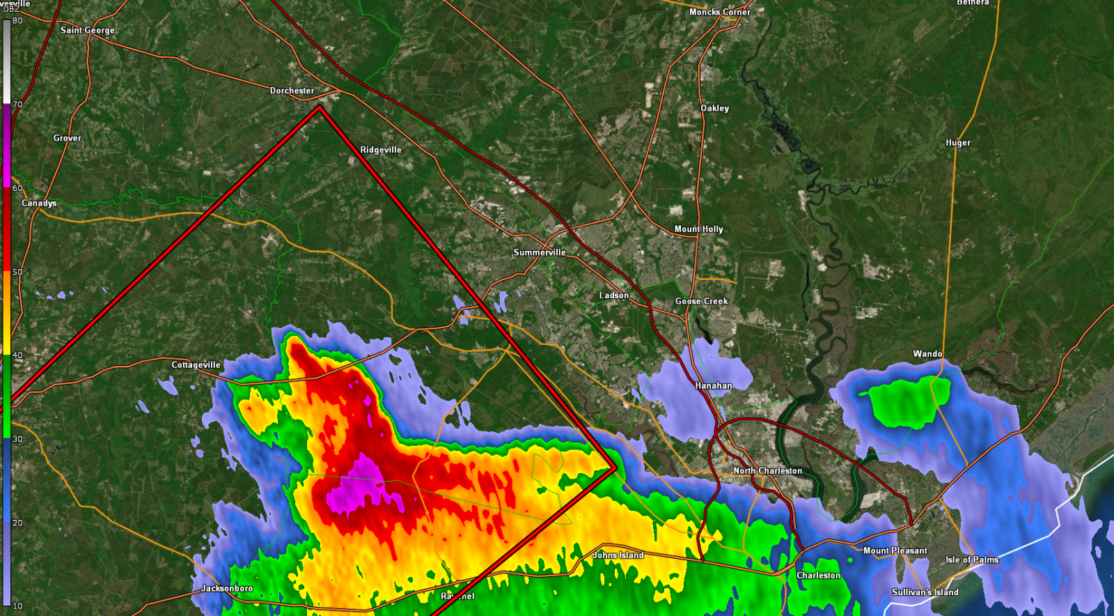
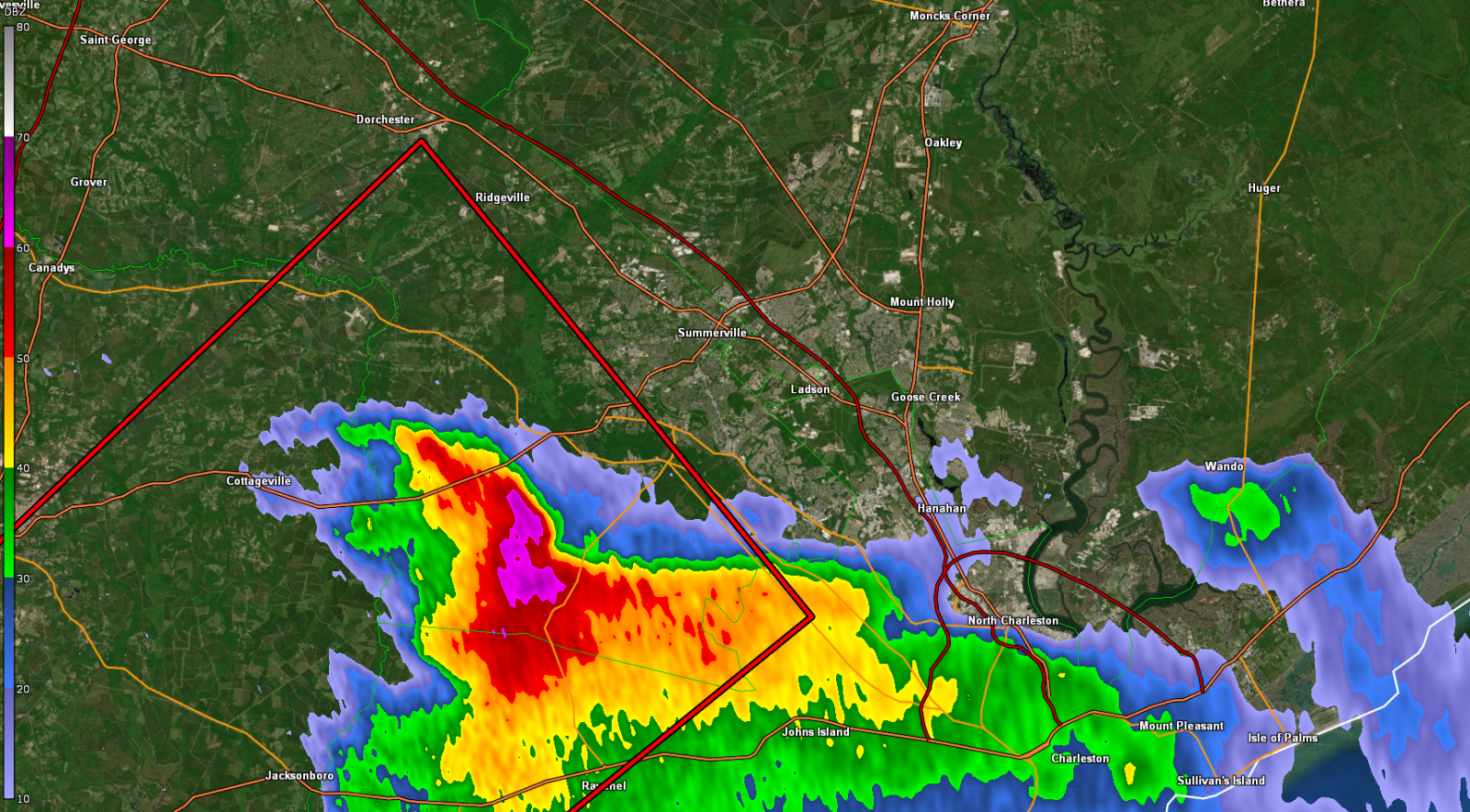
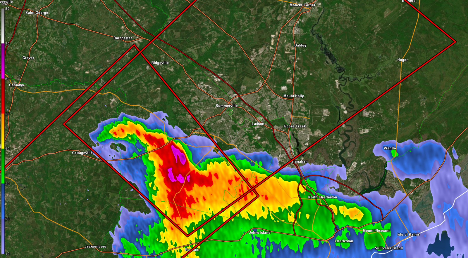
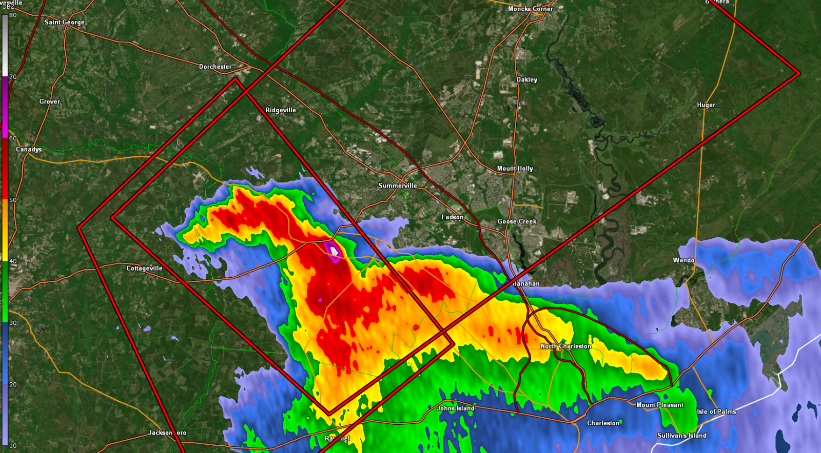
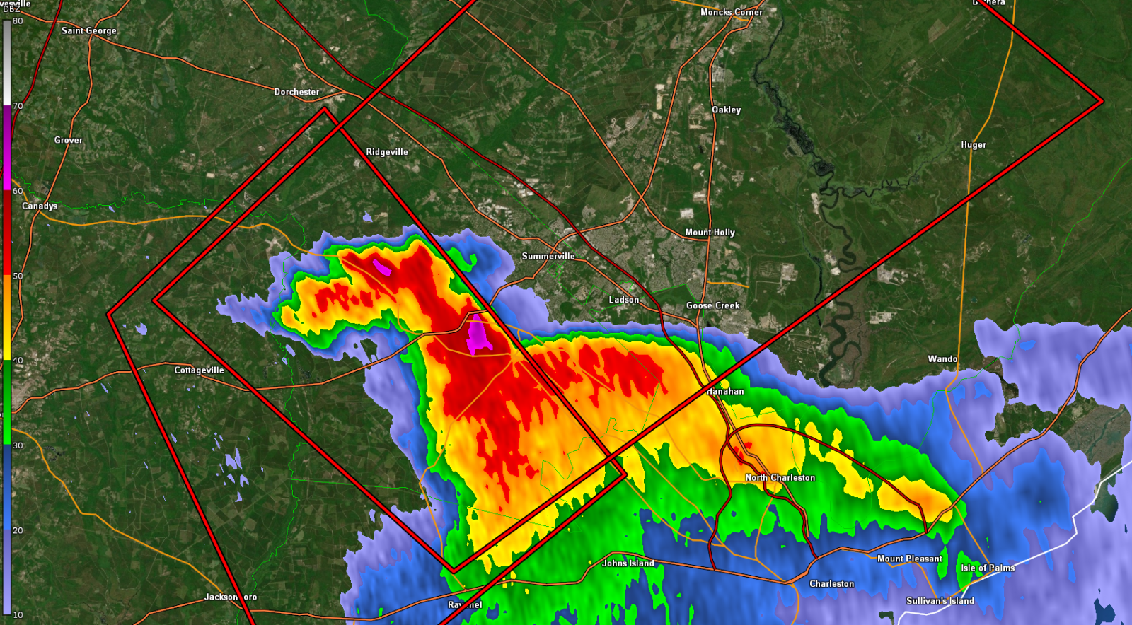
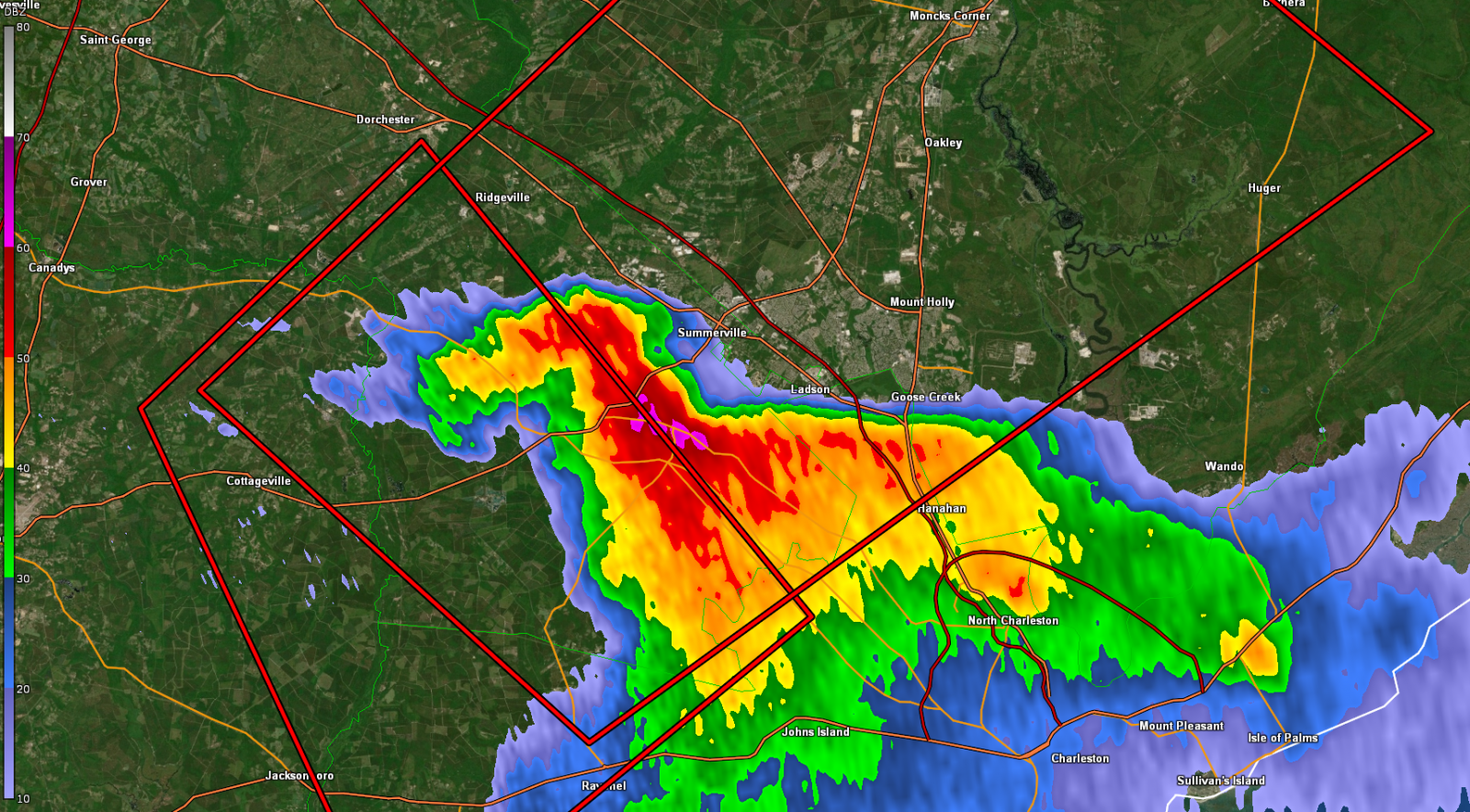
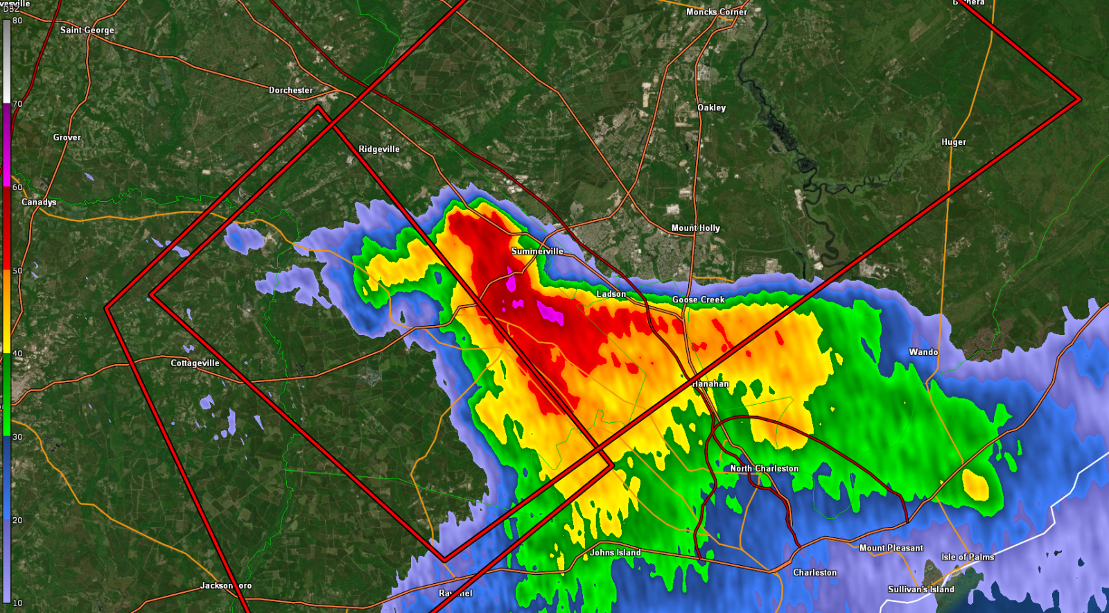
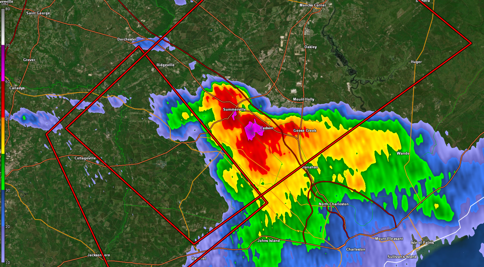
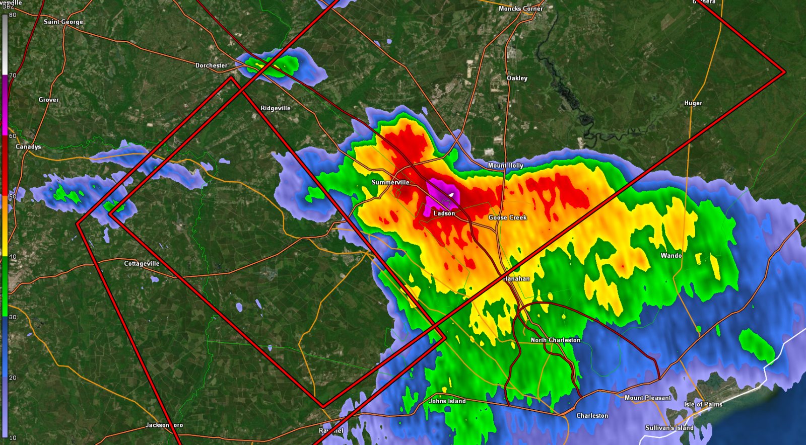
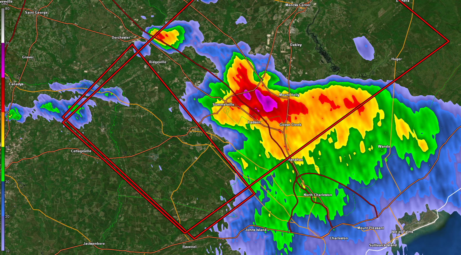
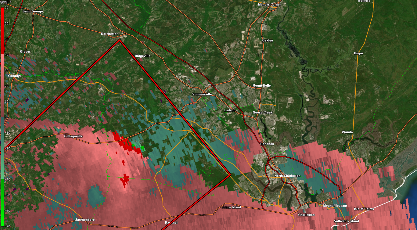
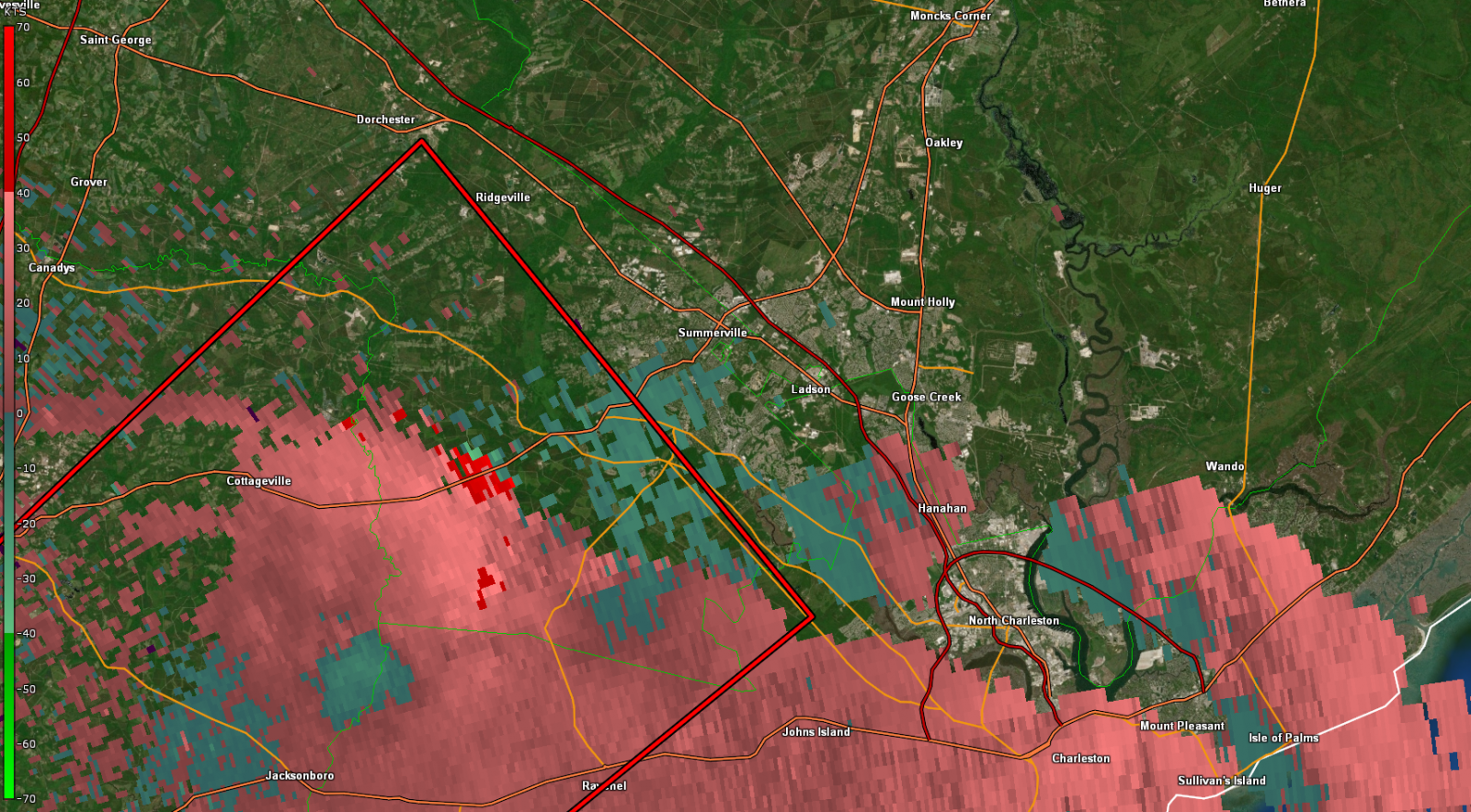
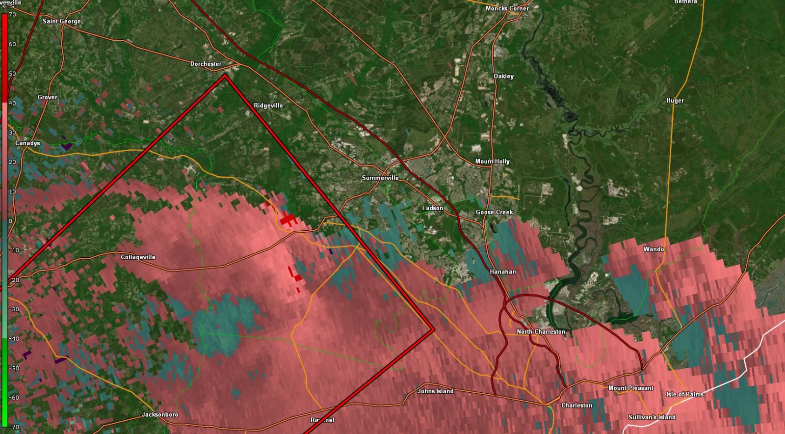
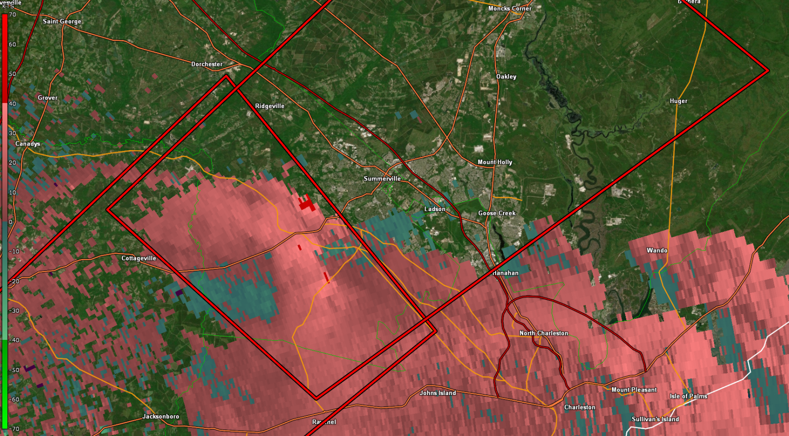
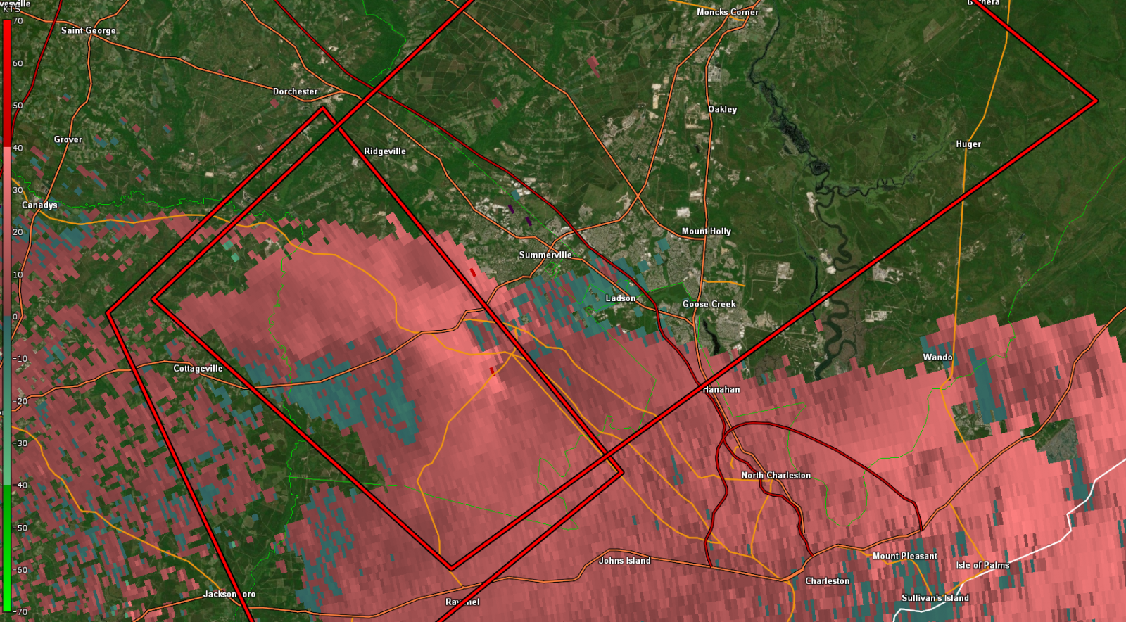
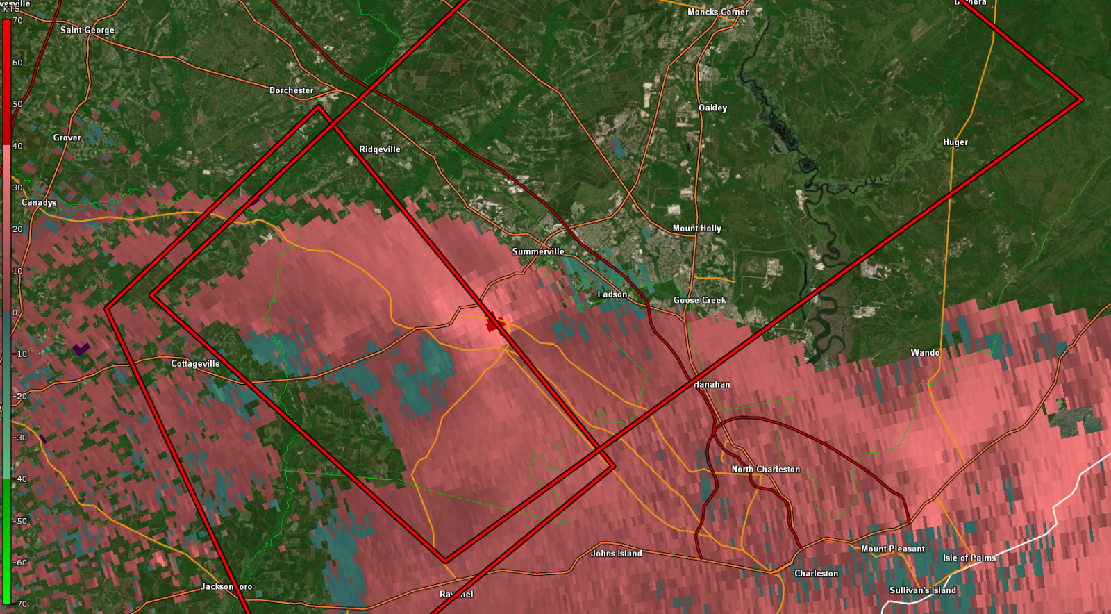
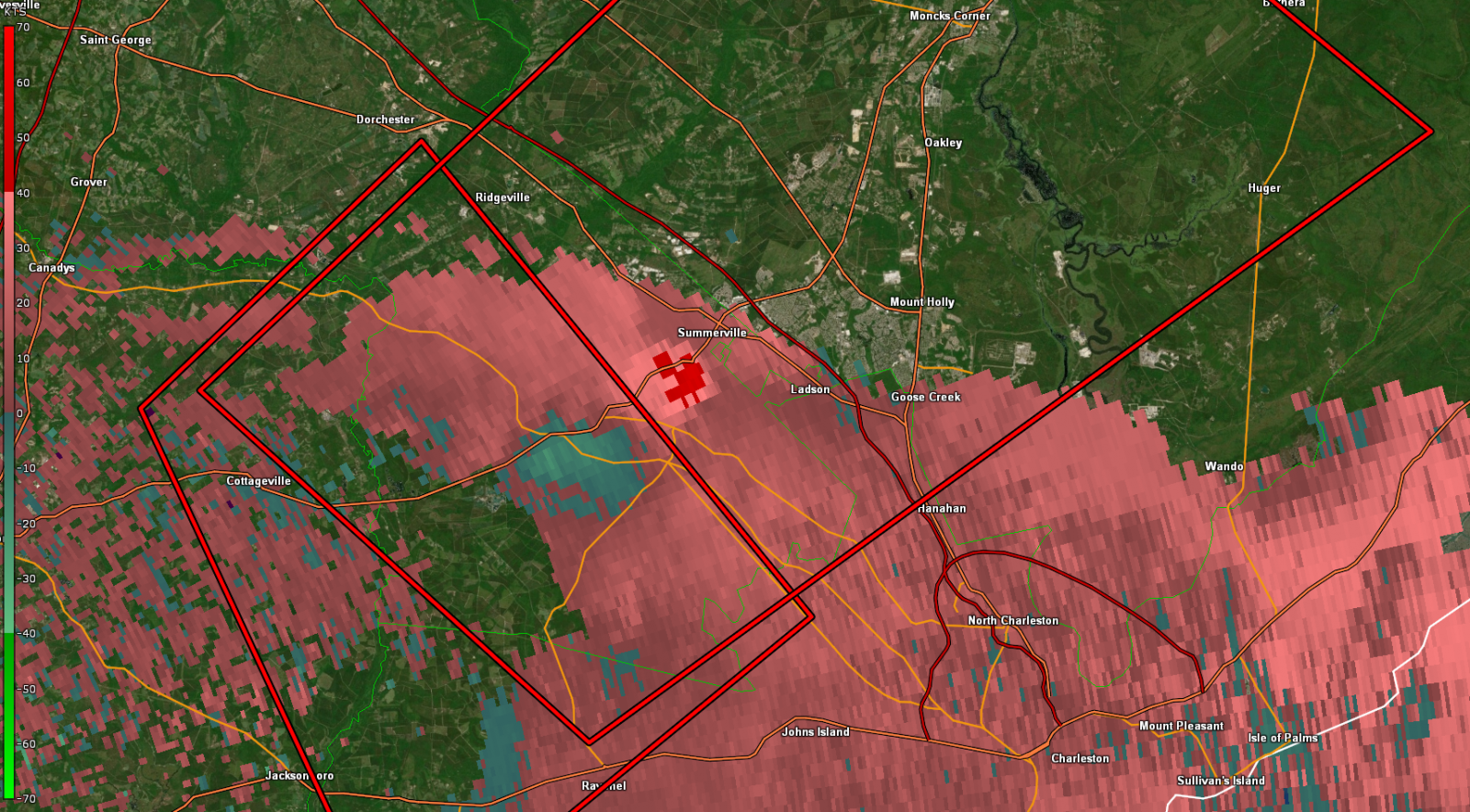
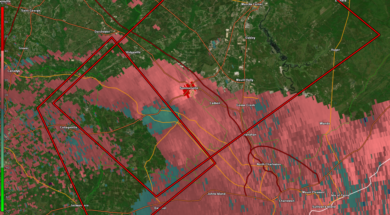
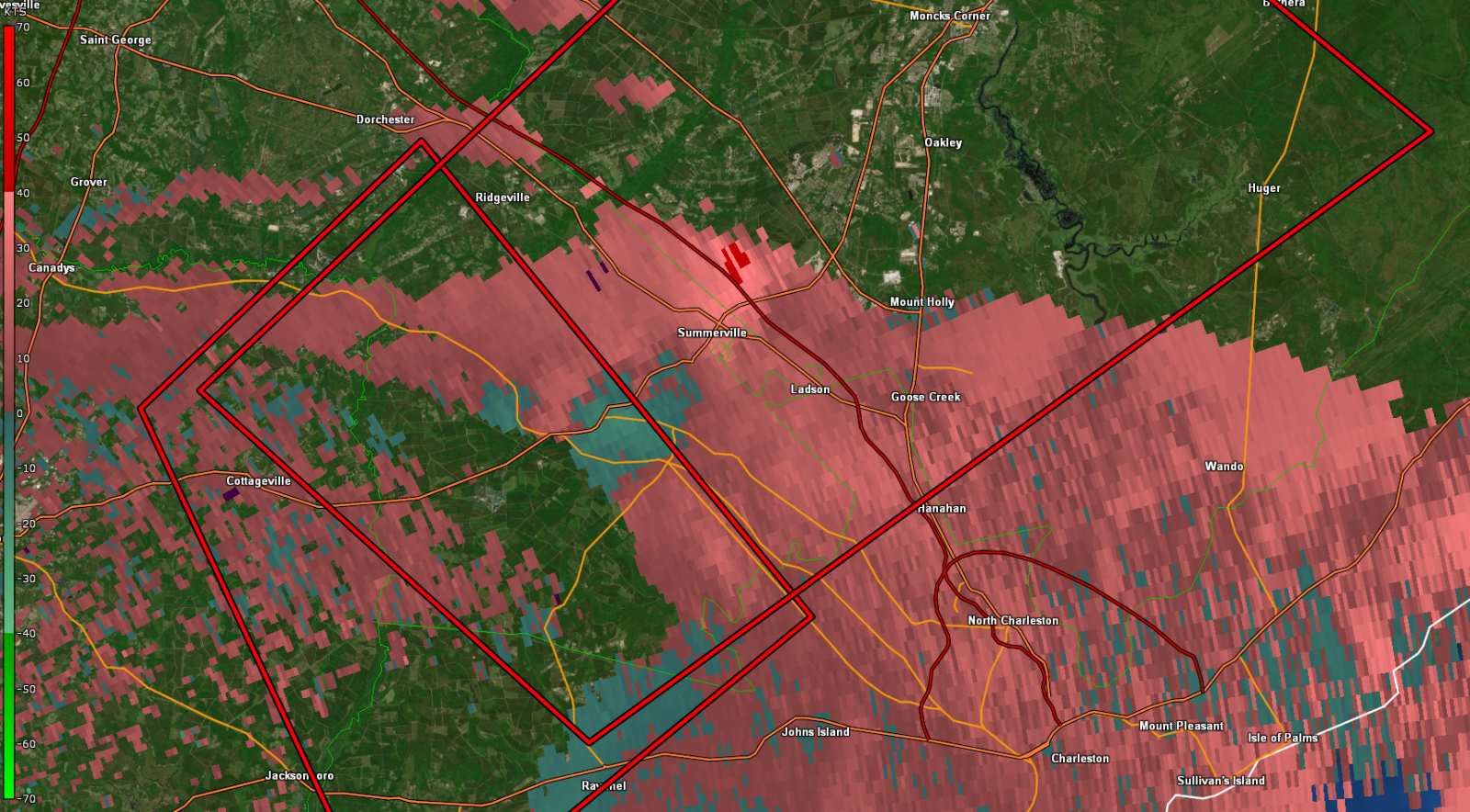
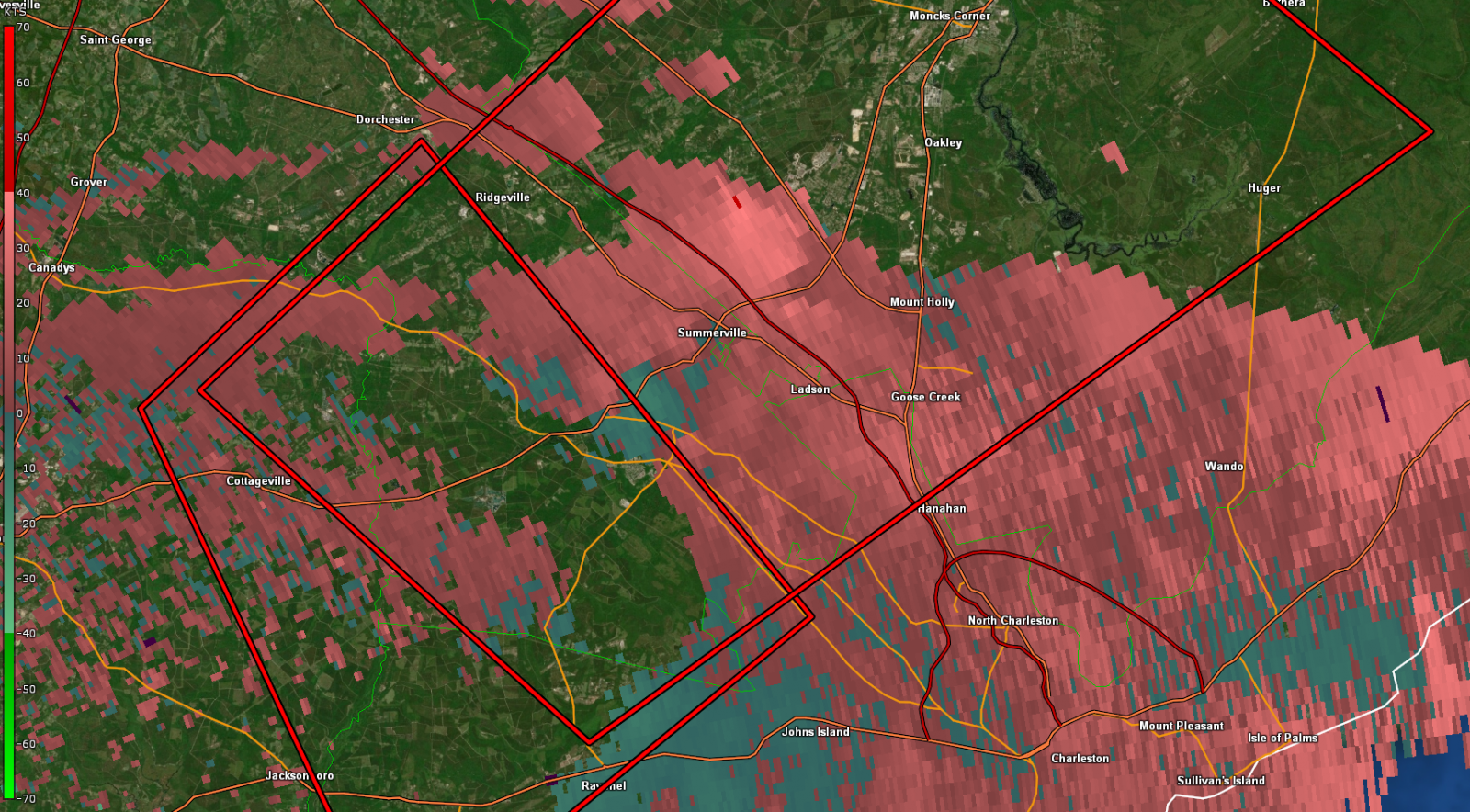
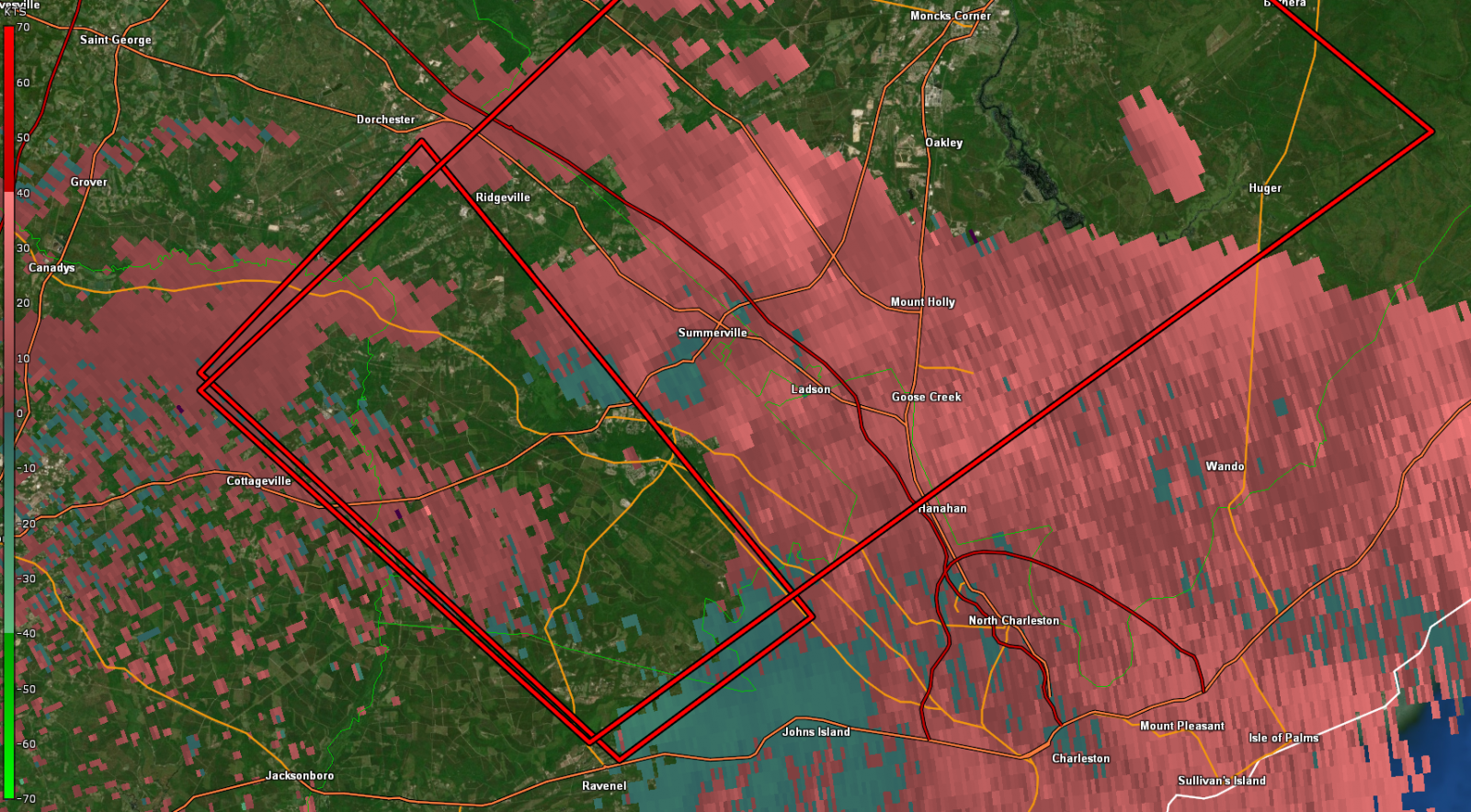
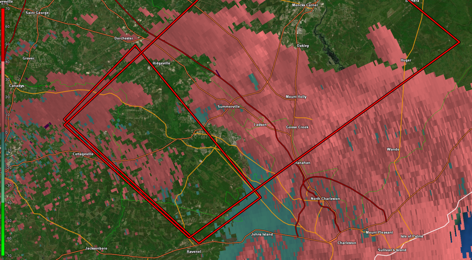
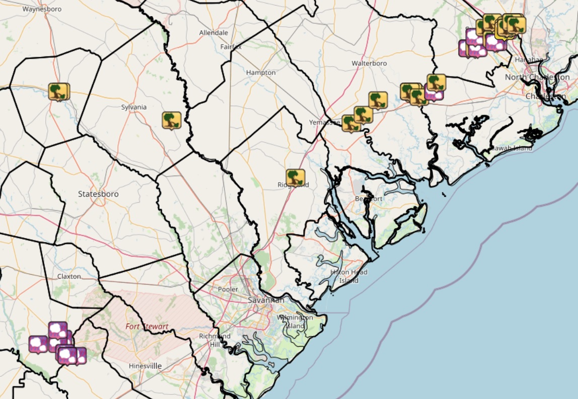
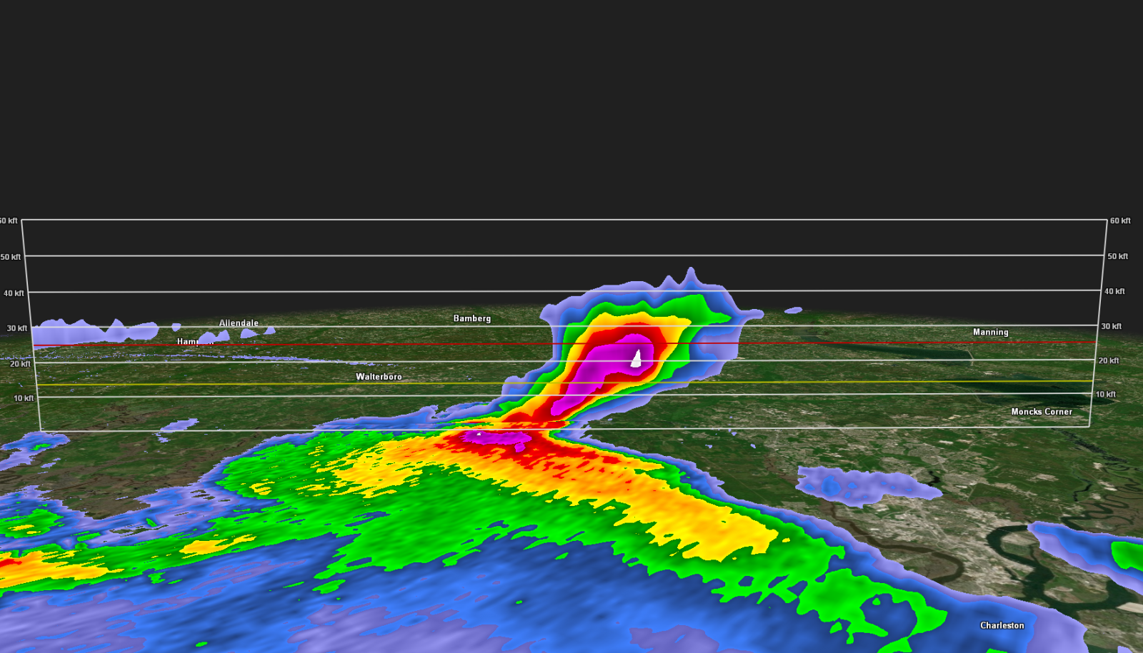
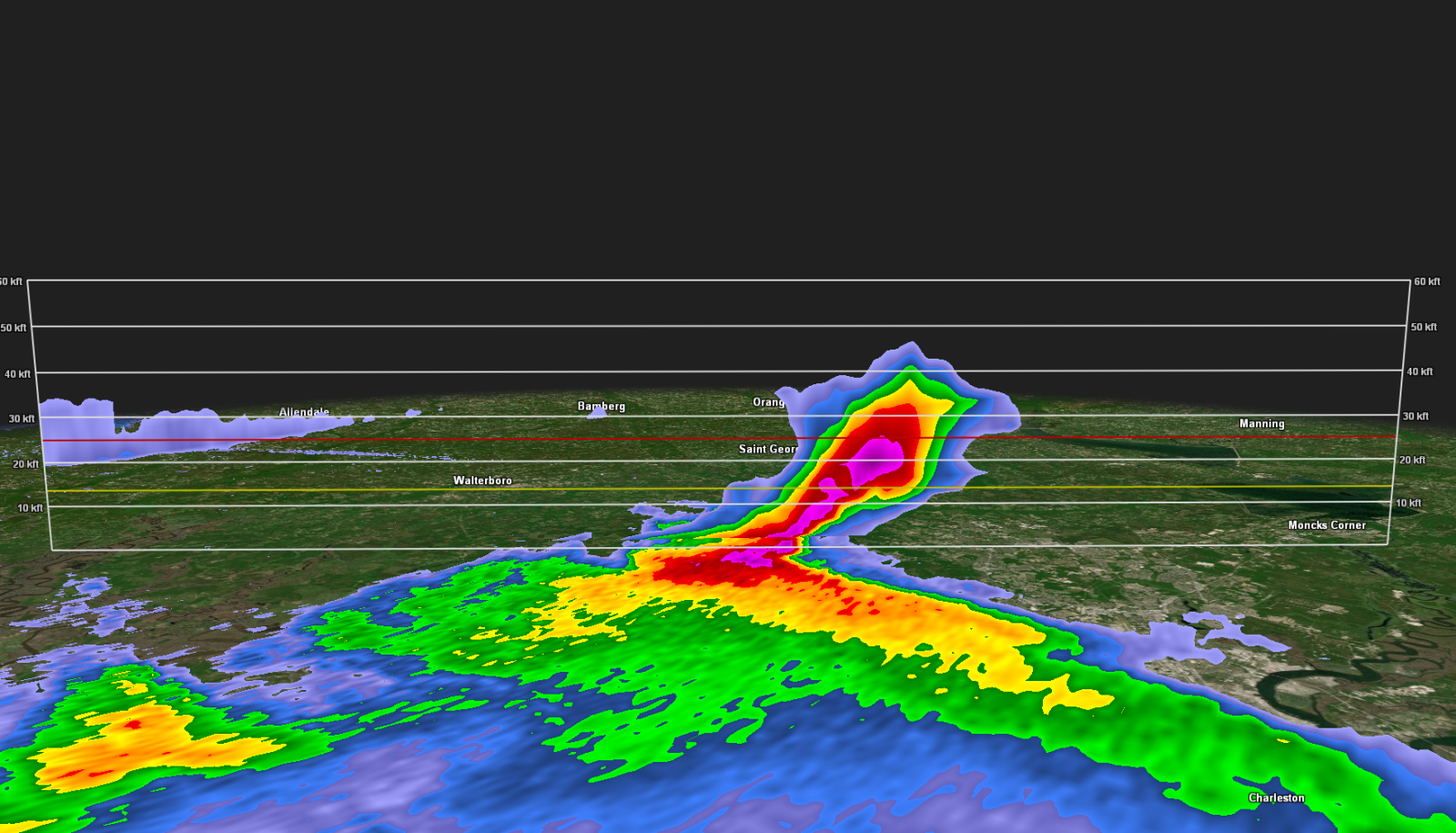
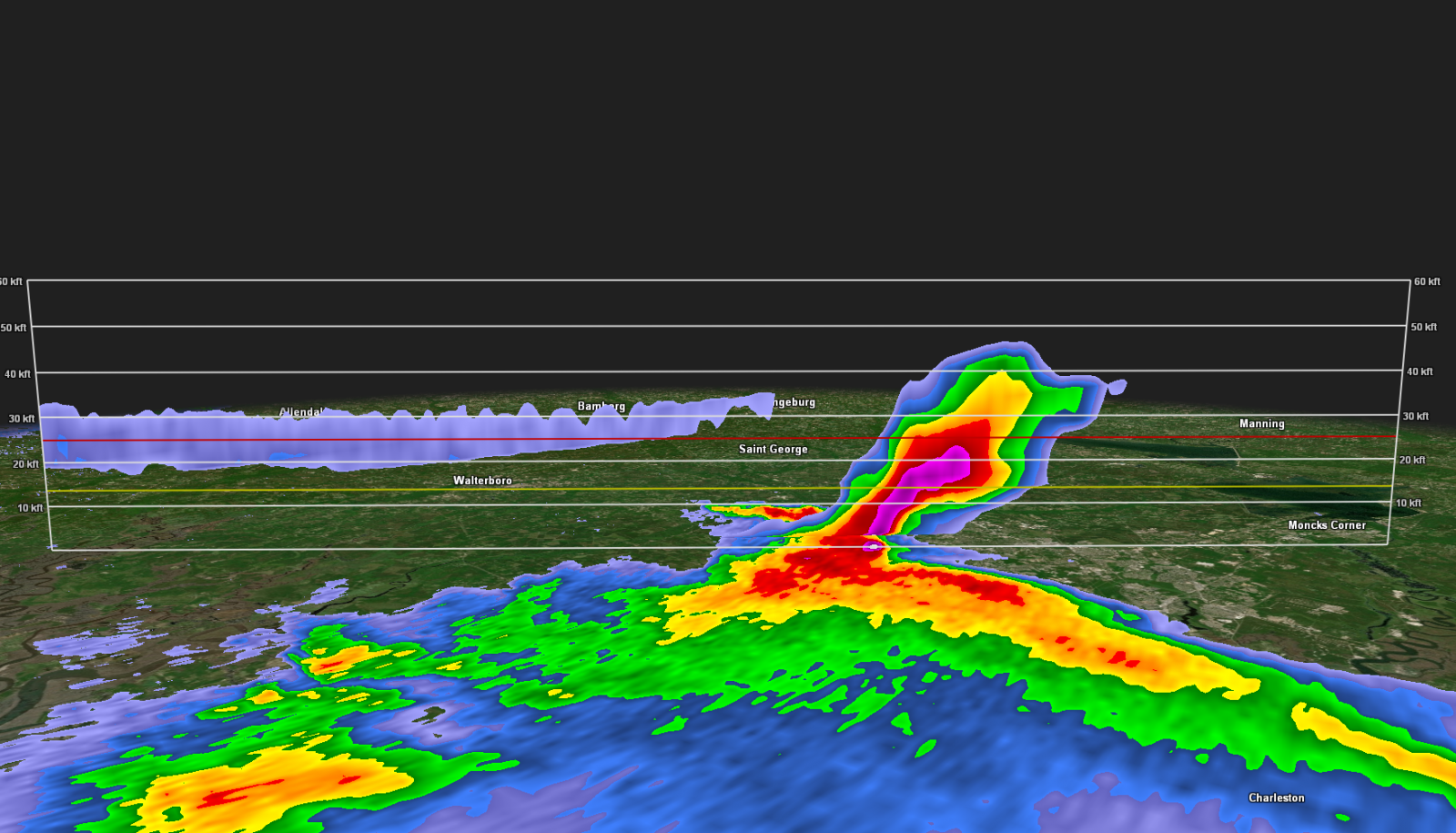
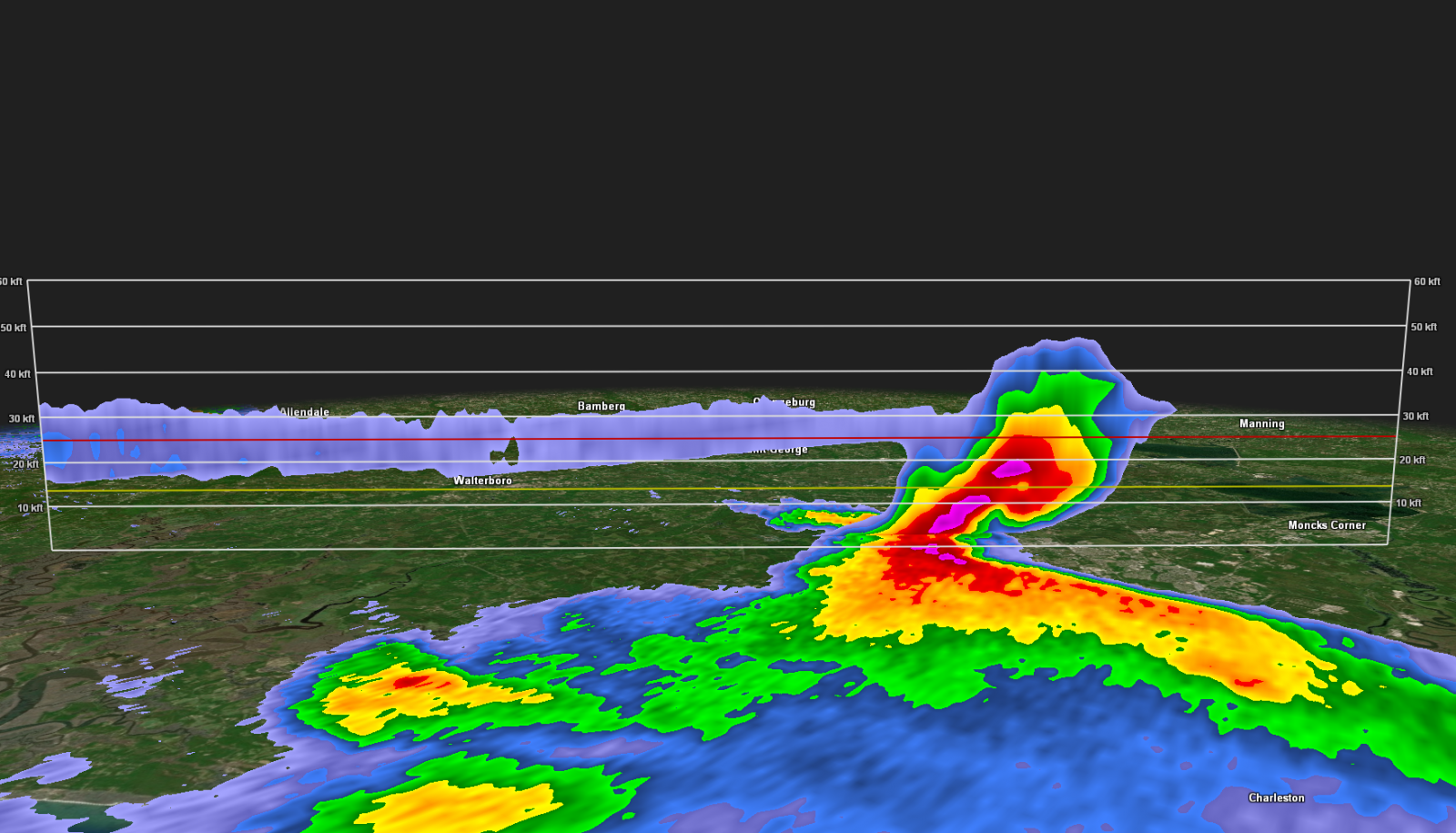
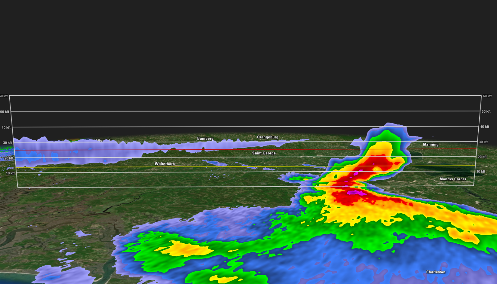
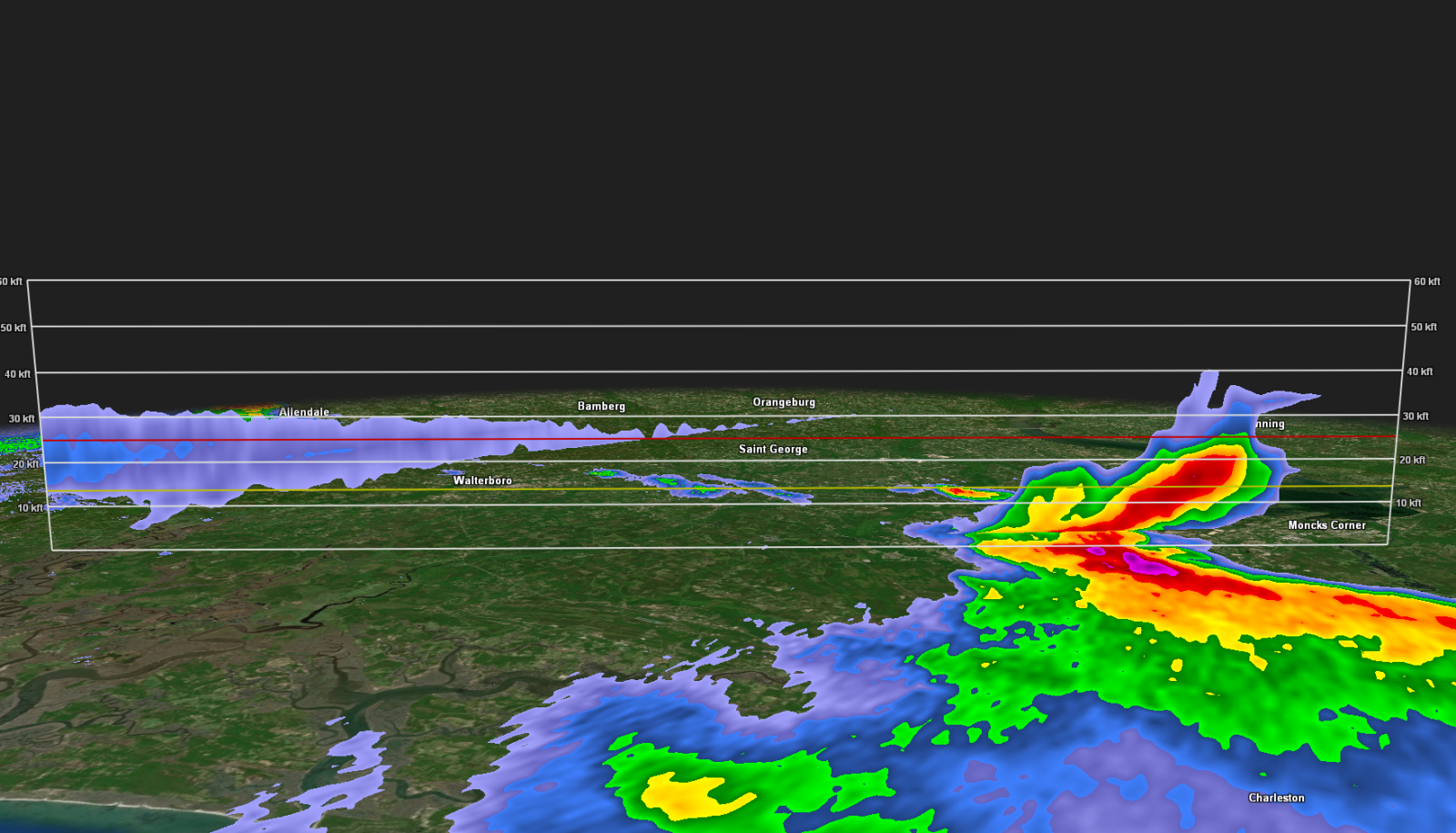
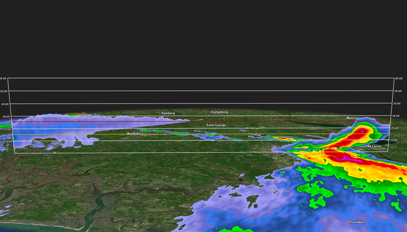
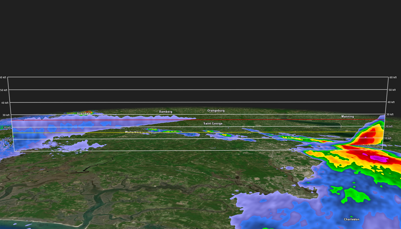
A supercell thunderstorm developed near the Savannah River during the afternoon of Monday June 10th and tracked northeastward through the early evening hours. This thunderstorm produced a long swath of very strong winds as it crossed inland portions of the Charleston Metro area, with widespread wind damage reported from around the intersection of Dorchester Rd and Boone Hill Rd to St. James Ave. The supercell also produced up to 2 inch hail (the size of a hen egg) as it was moving through the Charleston Tri-County area.
The survey found isolated to scattered damage from areas around Old Trolley Rd and Bacons Bridge Rd northeastward through southern and eastern portions of Summerville to around Main St. on the north side of Sangaree. Most of this damage consisted of large softwood trees snapped and uprooted and some hardwood tree limbs snapped. However, two areas of extensive damage were also found around the Quail Arbor Neighborhood off Old Trolley Rd and around Wisteria St and the Tall Pines Neighborhood along I-26 on the north side of Ladson. Within these two areas, both soft and hard wood trees were observed to have snapped near the trunks, several of which fell on residences and vehicles. A woman was injured when a tree fell on her residence on College Park Drive. Additionally, some damage to residential property was observed, including shingles and siding blown off and privacy fences blown down. Based on a uniform damage direction of generally north to northeast, a strong downburst producing damaging straight line winds is the most likely cause of the damage. |
||||||||||
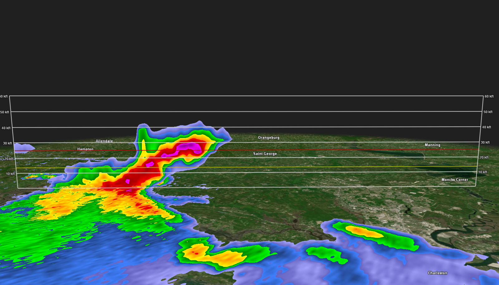
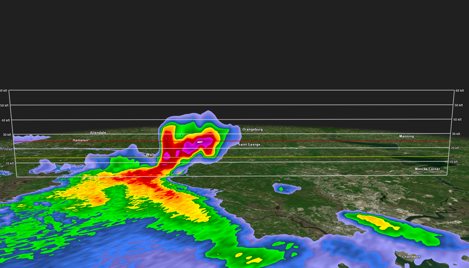
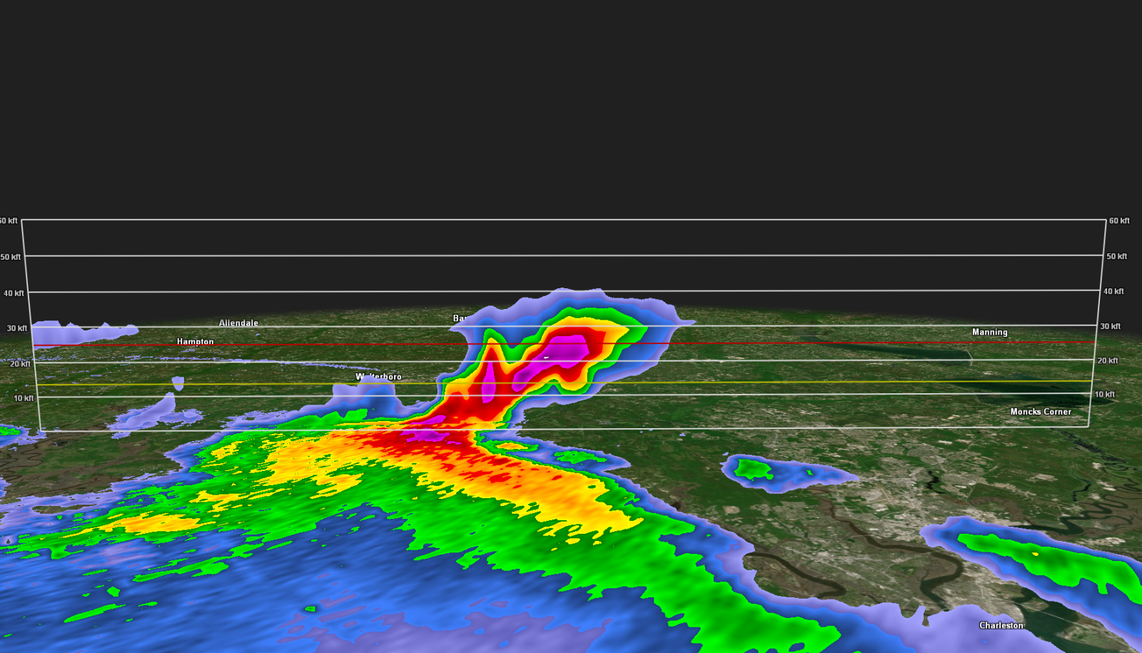
Radar Images (click on the X below to enlarge) |
||||||

|

|
|||||
Collection of storm reports from across southeast Georgia and South Carolina: Link
Huge hail in parts of Glennville, GA! Darla said this was not even the biggest hail! Hail of golf ball to tennis ball size! #gawx pic.twitter.com/rw4p5buJ0r
— Jeremy Nelson (@jnelsonWJCL) June 10, 2024
Looks like a driving range but that’s hail about golf ball sized again in Long County from Emma Smith, taken on Hwy 301 near the Long/Tattnall line. #gawx #firstalertwx pic.twitter.com/zerD76fS1K
— WTOC Jamie Ertle (@wtocjamie) June 10, 2024
Large hail off of Highway 61 in Summerville. Thanks for the photo Jessica Sapko! @WCBD @StormTeam2WCBD @NWSCharlestonSC pic.twitter.com/BwrTokYuDV
— Rob Fowler (@RobStormTeam2) June 11, 2024
Severe thunderstorm earlier around 7:52pm near Ladson. Video courtesy Drew Hawk. Damaging winds & hail! @WCBD @NWSCharlestonSC #chswx pic.twitter.com/Kk5gveaVp2
— Jed Christoph (@JedChristophWX) June 11, 2024
Cluster Pines Rd at Tall Pines Rd in Ladson,SC. Approx 7:50pm @NWSCharlestonSC @ryanhallyall pic.twitter.com/TVxfriOuCf
— Nicholas Royce (@hztdwjnzyr) June 11, 2024
@LIVE5WEATHER @chswx @BILLWALSHTV @NWSCharlestonSC
— GMoney (@GodNCountry4E) June 11, 2024
Video of hail incoming down in Summers Corner area of Summerville,SC
Video courtesy of Forrest Dangerfield. pic.twitter.com/q9zTou3b9L
I-26 saw major delays this evening after the storm pic.twitter.com/lguRKwwxSi
— WCBD News 2 | Count on 2 (@WCBD) June 11, 2024


 Coastal Flood