| A low pressure system developed over the Gulf and tracked northeast across the Florida Peninsula in the early morning hours of December 17. As it tracked northeastward it continued to strengthen, impacting the southeast coast with coastal flooding, dangerous marine conditions, flash flooding, and gusty winds. The climate sites at the Savannah, GA (KSAV), Downtown Charleston, and North Charleston (KCHS) broke daily rainfall records. |
|

List of the storm total rainfall reports: Link
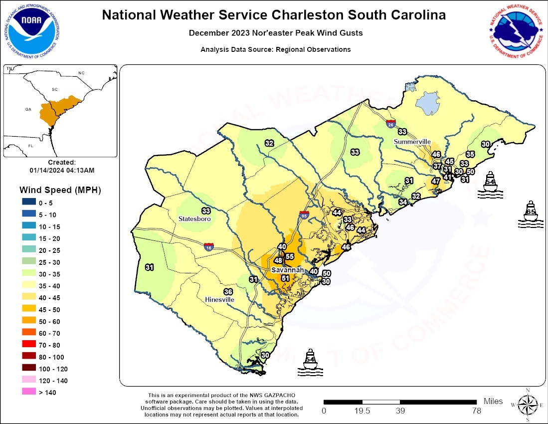
List of the highest wind gusts: Link
Collection of storm reports from across southeast Georgia and South Carolina: Link
 |
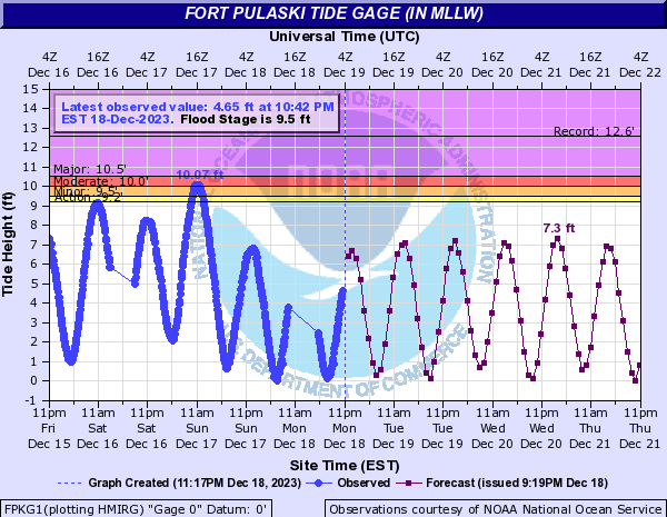 |
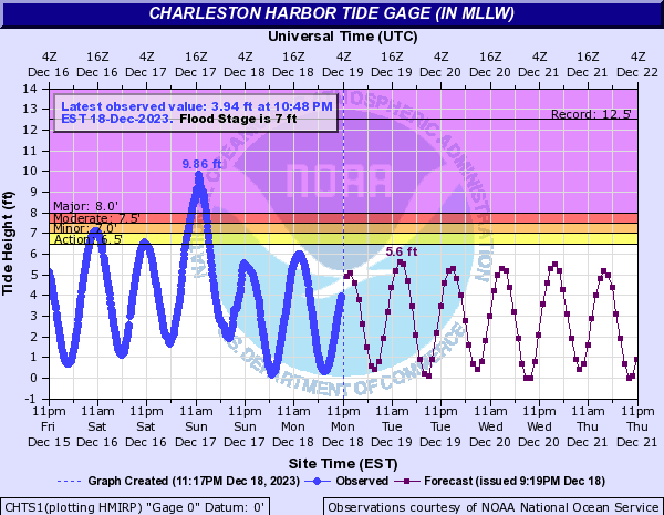
| Major coastal flooding was seen along the southeast South Carolina coast on December 17th, with the Charleston Harbor Tide Gage reaching a preliminary value of 9.86 ft MLLW, the 4th highest tide on record. This tide also broke the record for the highest non-tropical high tide value. | Moderate coastal flooding along the southeast Georgia coast on December 17th. The Fort Pulaski tide gage peaked at 10.07 ft MLLW, which is the 15th highest tide on record. |
SIGNIFICANT FLOODING ongoing in Charleston, SC. Up to 6 cars now stranded as flow from the river increases the depth of floodwaters. Live On @RadarOmega @foxweather and YouTube: https://t.co/E7DVxuYOBh pic.twitter.com/rbArEAnRS5
— Brandon Copic (@BrandonCopicWx) December 17, 2023
Very rough surf Folly Beach, SC this afternoon.
— Jed Christoph (@JedChristophWX) December 17, 2023
Here are a few shots from around the Folly Pier via Surfline cams…. #chswx #SCwx pic.twitter.com/Wk99rjZKWL
Vehicles travel through flood waters in the 2200 block of Ashley River Road near Magwood Drive in West Ashley. Creeks and ponds are swollen after torrential rain this morning. â¦@FOX24Charlestonâ© â¦@NWSCharlestonSCâ© #chsnews #chswx #scwx pic.twitter.com/h2If6FftsT
— Bill Burr (@BBonTV) December 17, 2023


 Coastal Flood