Thunderstorms developed ahead of a cold front in an environment favorable for tornadoes characterized by Mixed Layer CAPE (MLCAPE) of 1000 to 1500 J/kg and strong wind shear. The Significant Tornado Parameter was maximized over southeast GA in the vicinity of the confirmed EF-2 tornado that occurred across Bulloch and Effingham Counties during the early morning of February 9.

NWS Weather Prediction Center surface weather analysis at 4 am on February 9, 2017 showing a cold front approaching southeast SC/GA from the west.
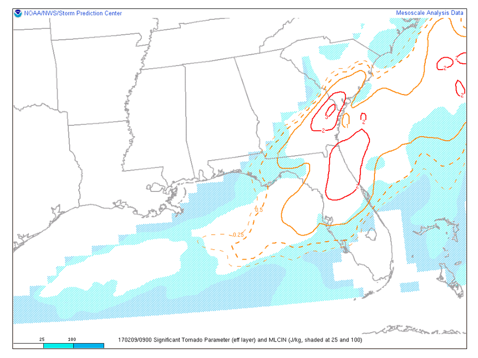
NWS Storm Prediction Center mesoscale analysis at 4 am on February 9, 2017 indicating the Significant Tornado Parameter maximized over southeast GA in the vicinity of the tornado.

Map showing the track of the tornado. Triangles represent the points of damage and associated damage ratings.
Click on images to enlarge
|
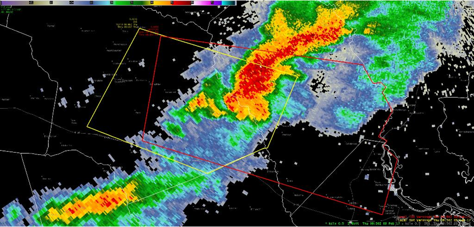
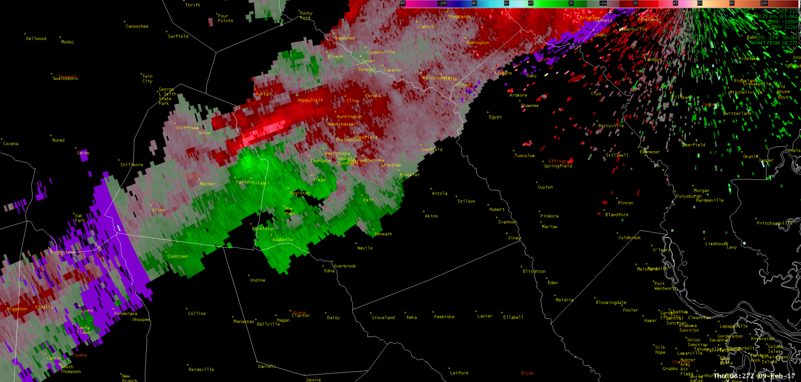
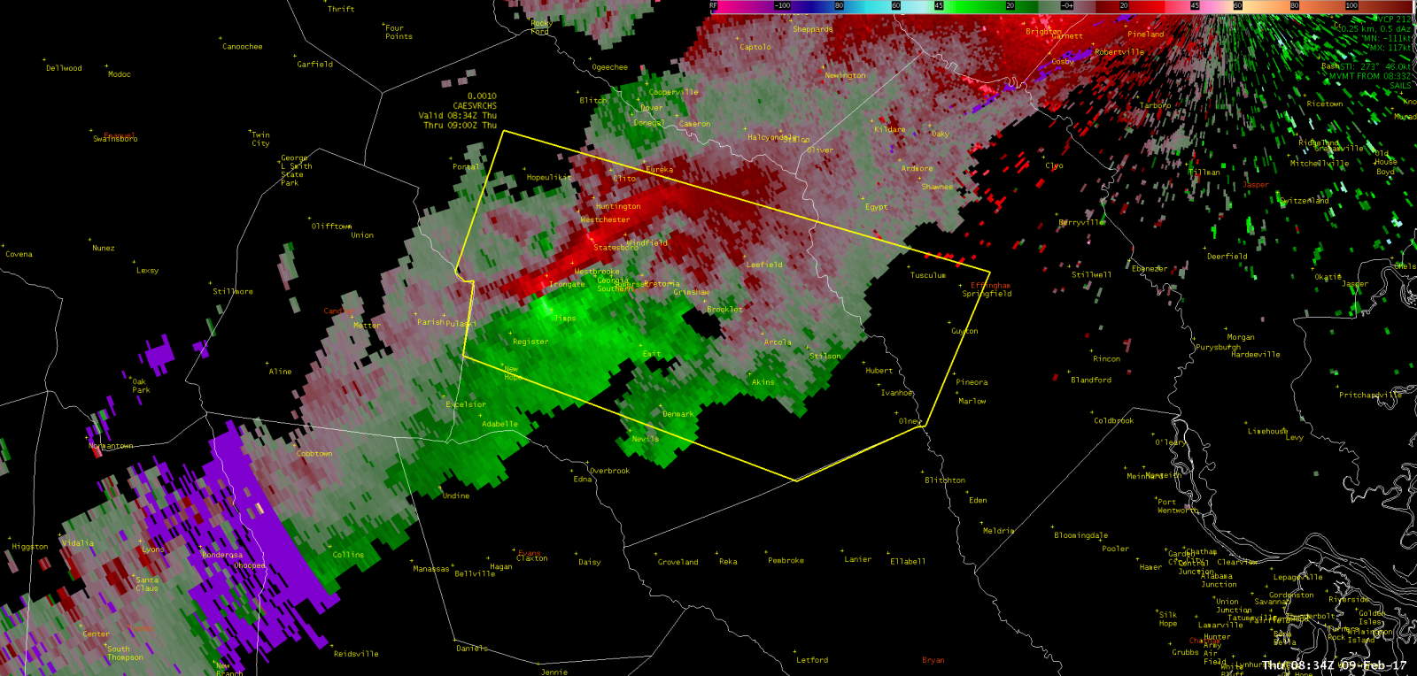
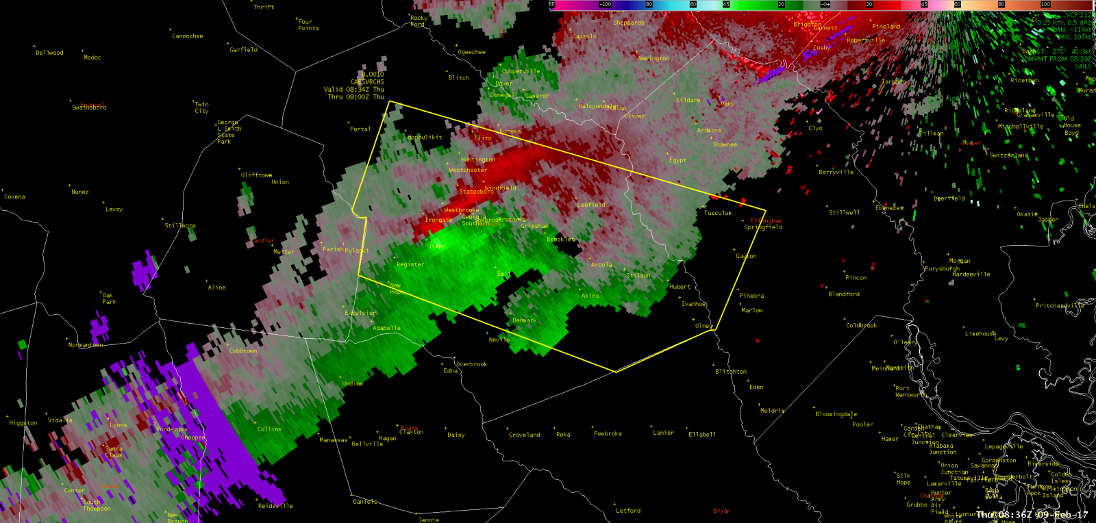
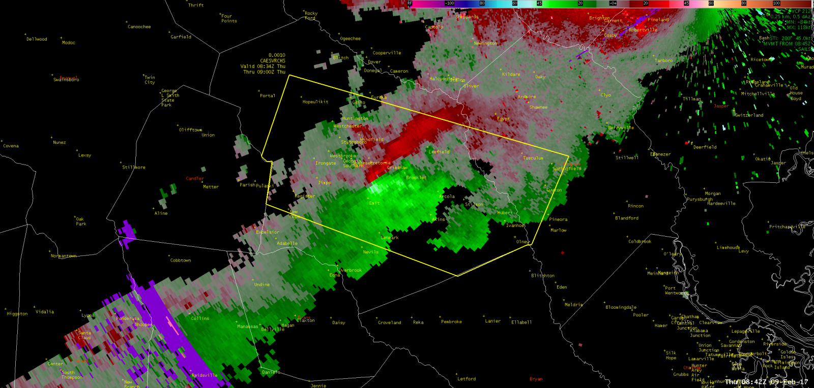
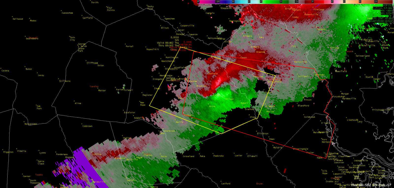
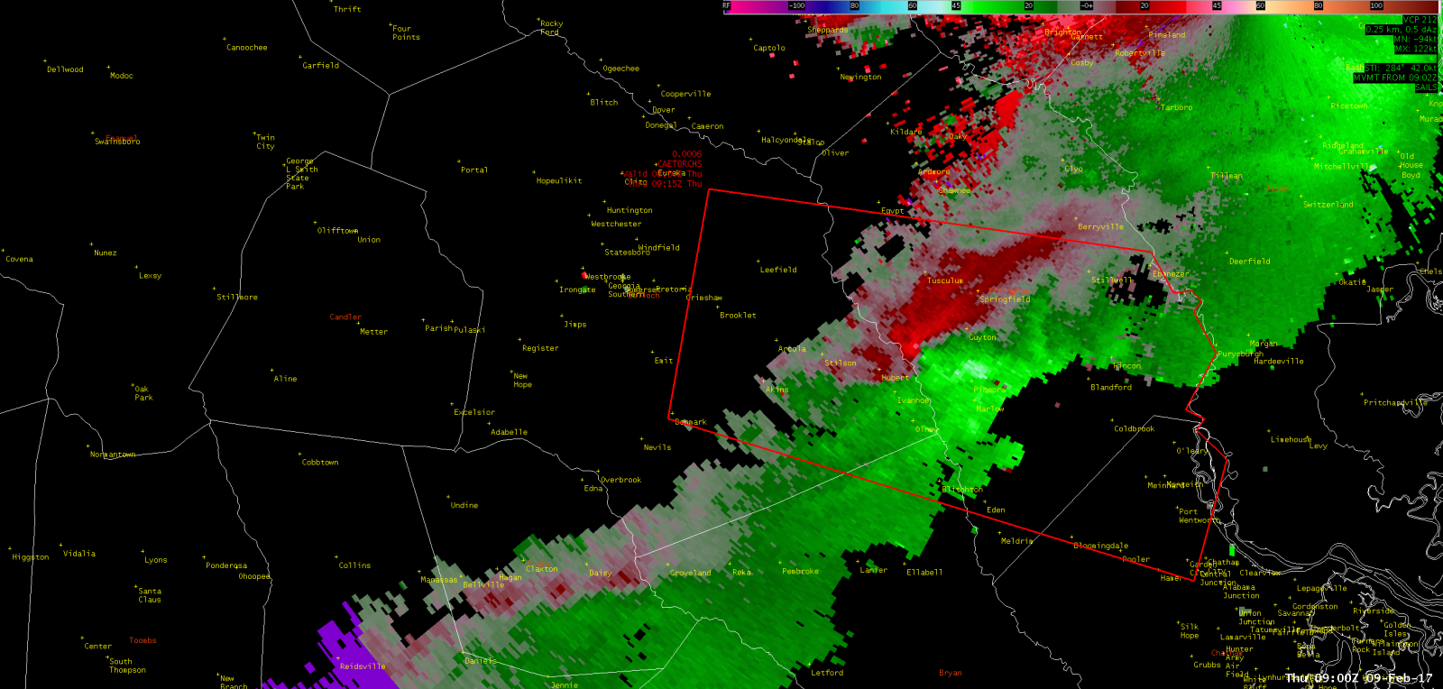
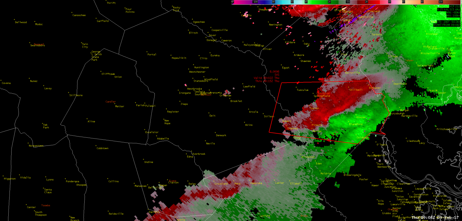
KCLX Base (0.5 Degree) Reflectivity (Feb 9, 2017 - 356 AM EST) |
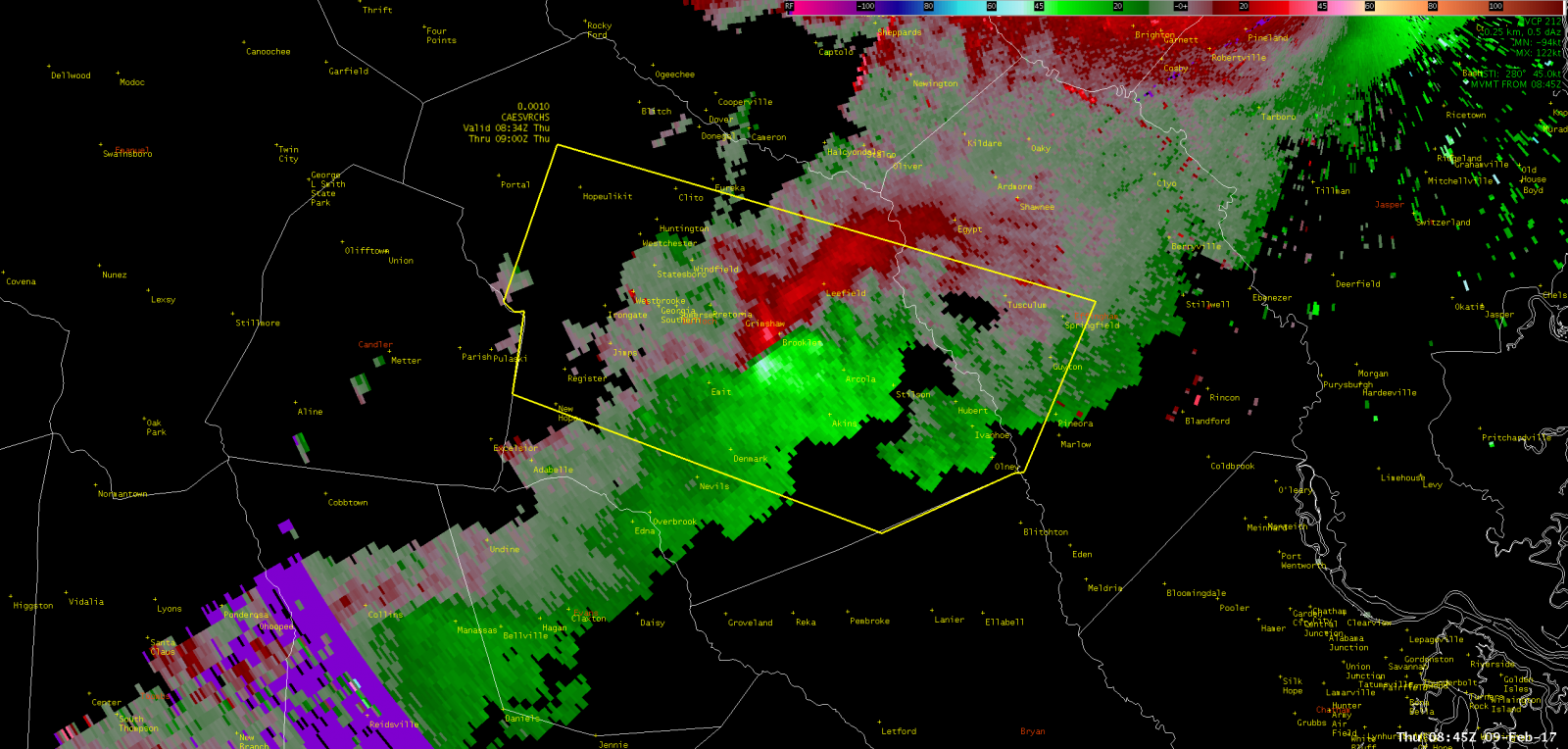
KCLX Base (0.5 Degree) Storm-relative Velocity (Feb 9, 2017 - 356 AM EST) |
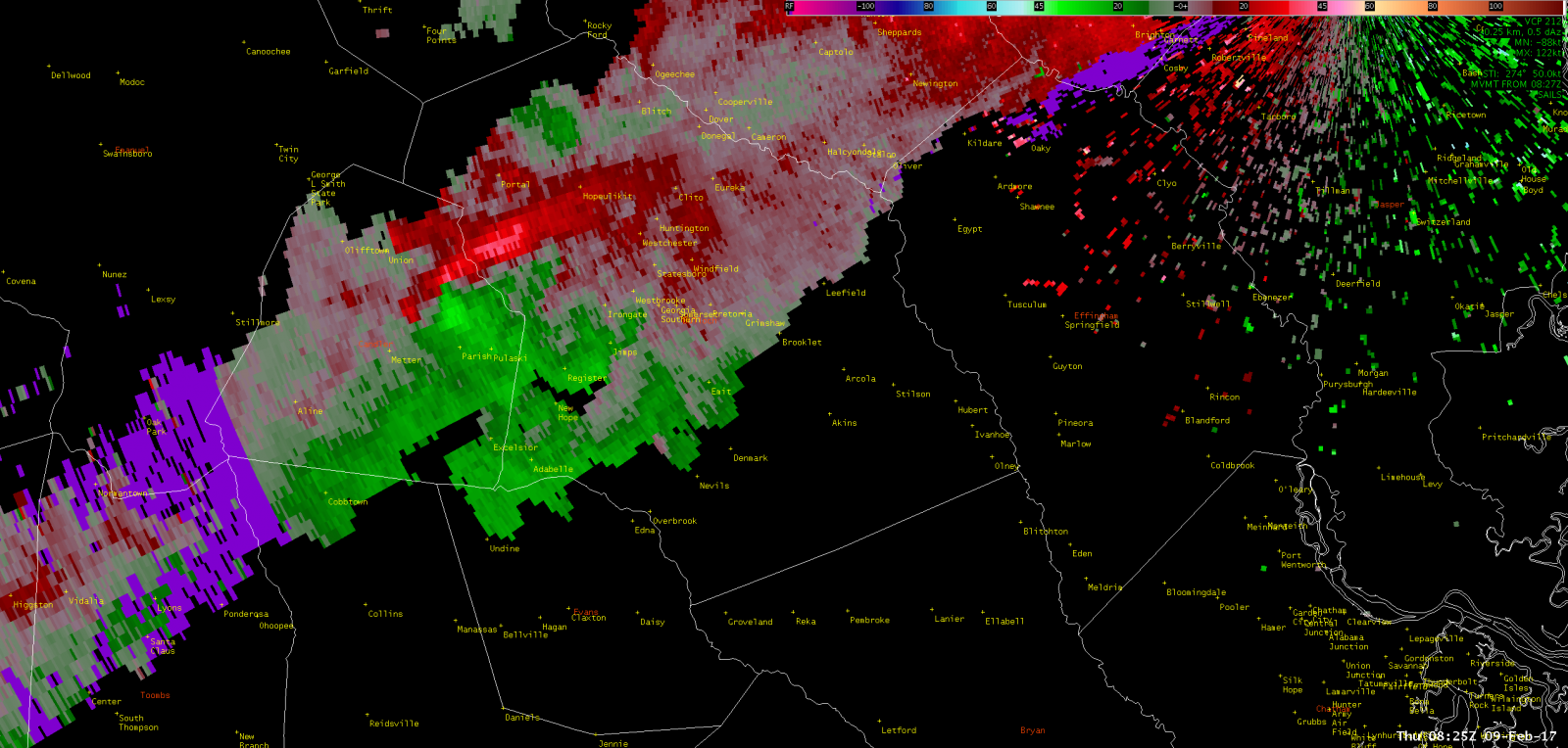
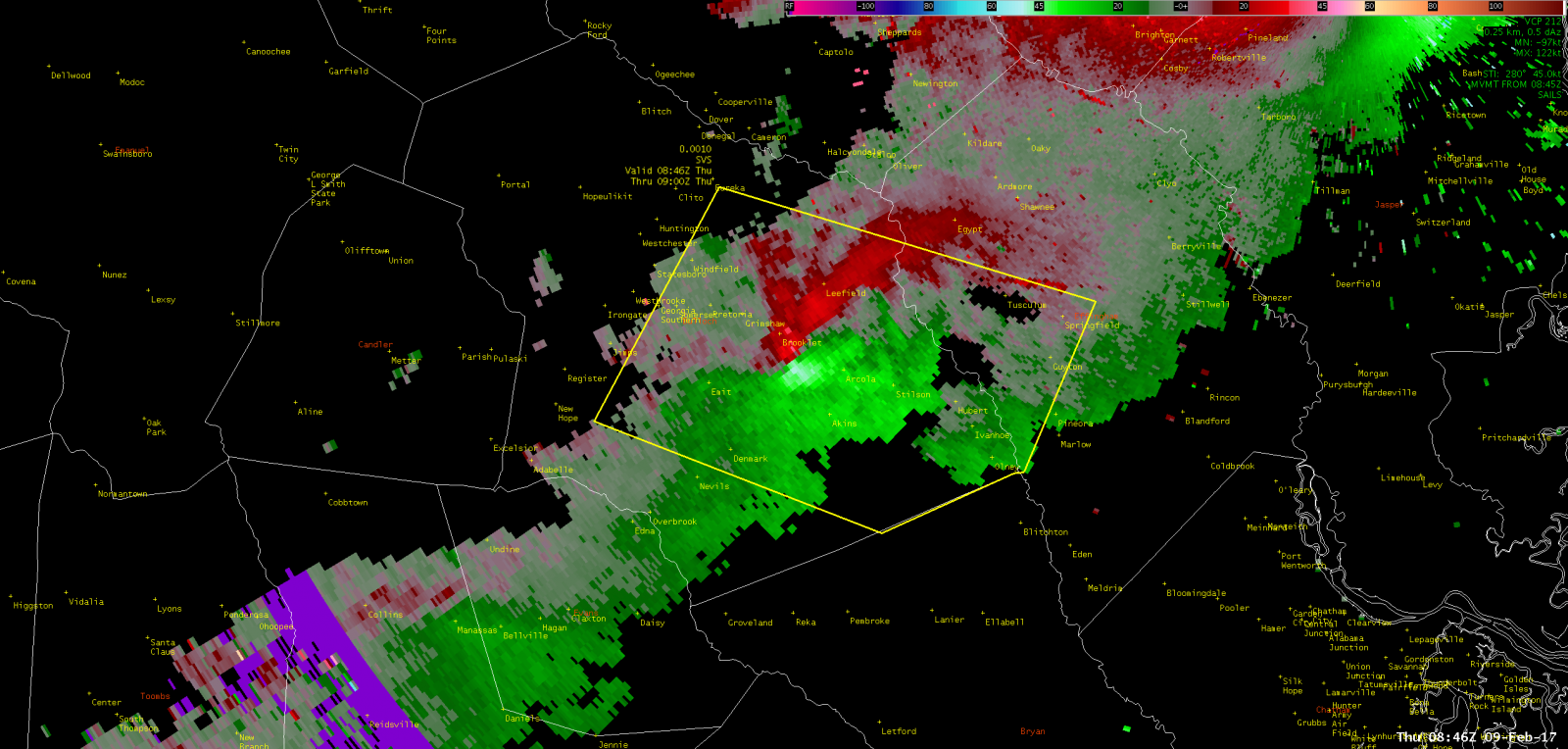
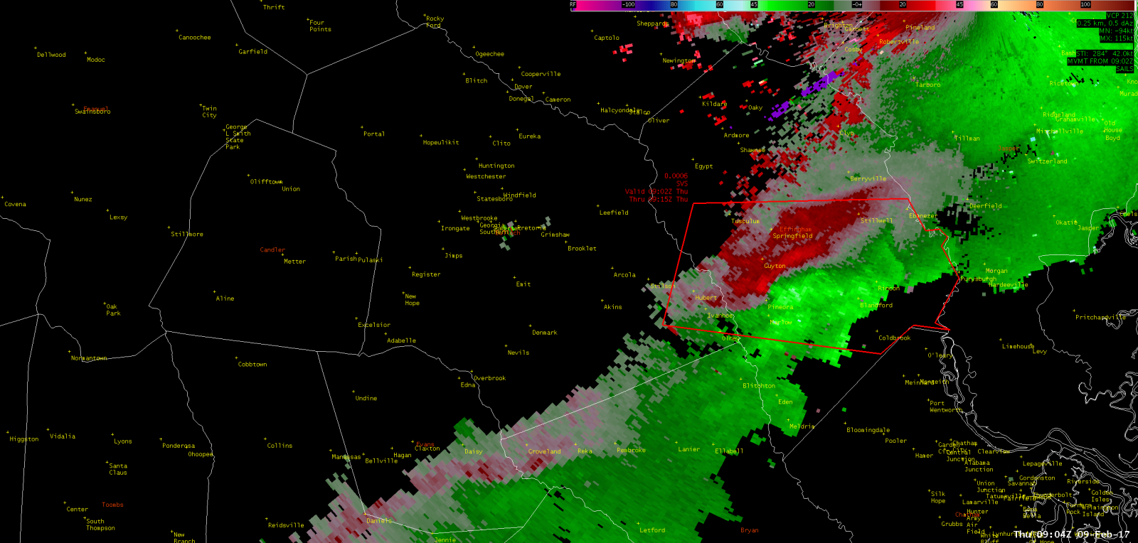
KCLX Base (0.5 Degree) Correlation Coefficient (Feb 9, 2017 - 356 AM EST) |
 |
 |
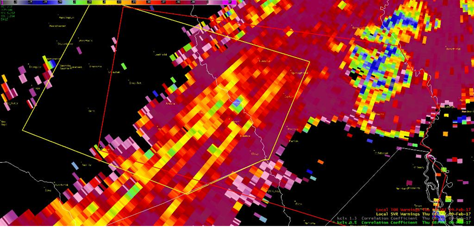 |
NWS Charleston, SC doppler radar reflectivity (left image above) indicated a "broken S" signature coincident with the strongest rotational couplet (middle image above) and lower correlation coefficient (right image above) which implies tornado debris. In the storm-relative velocity image, red colors indicate motion away from the radar, which is located to the northeast, and green colors indicate motion toward the radar.
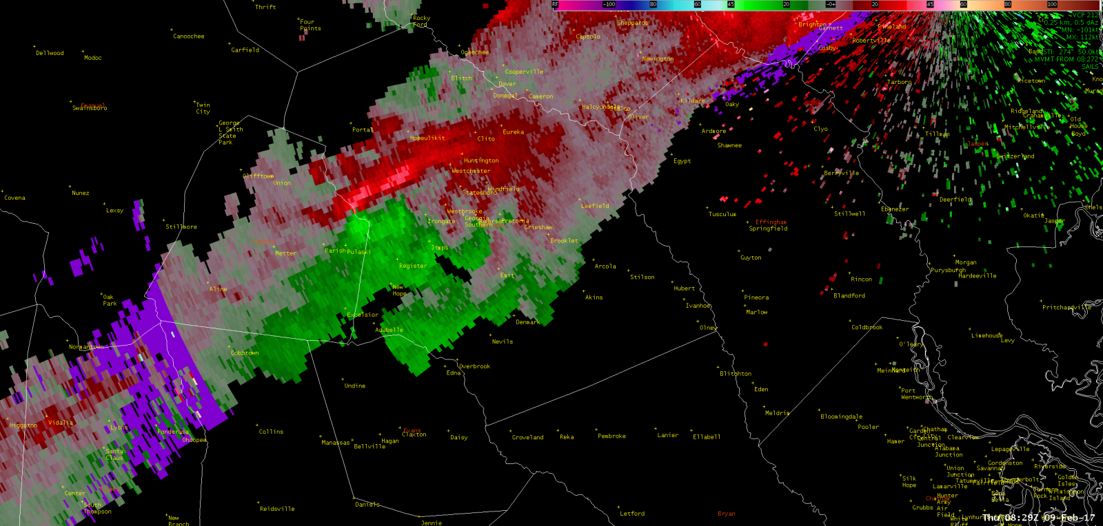
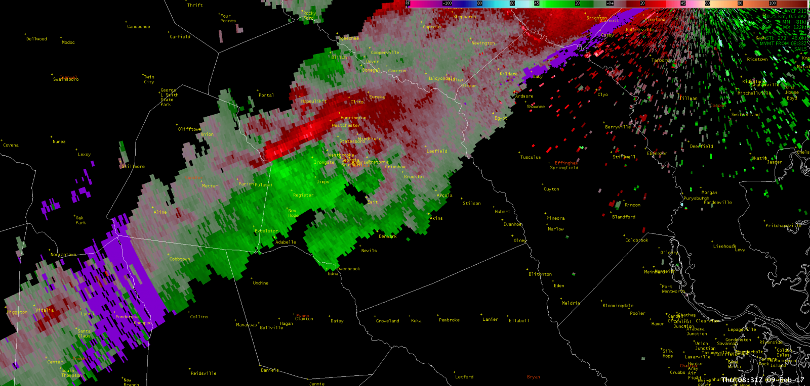
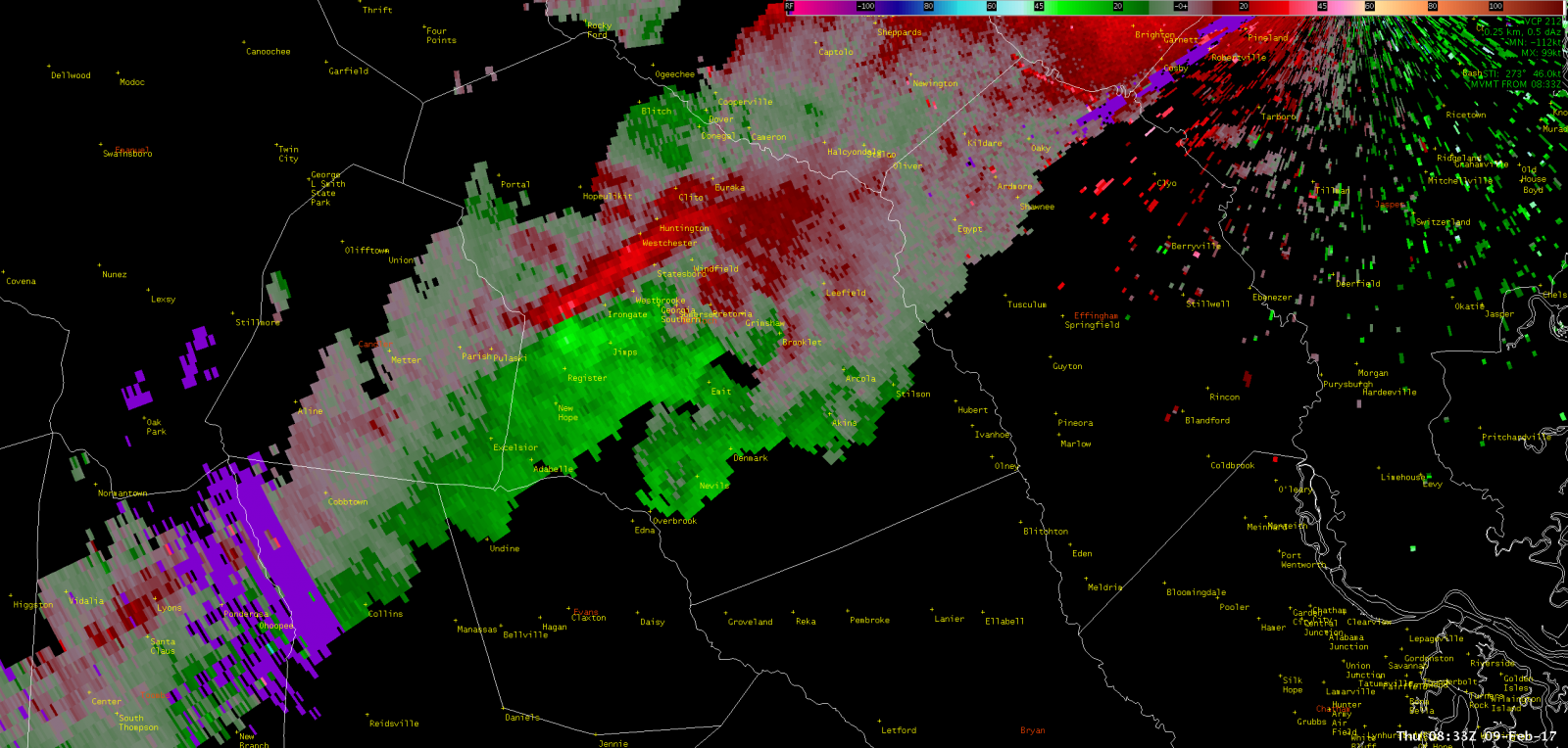
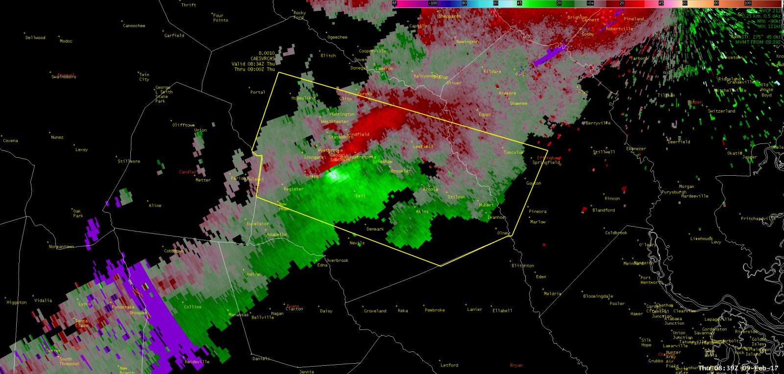
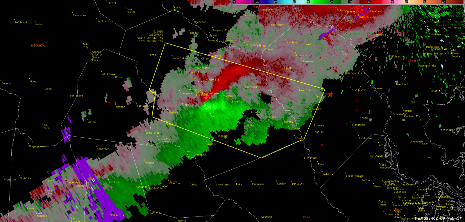
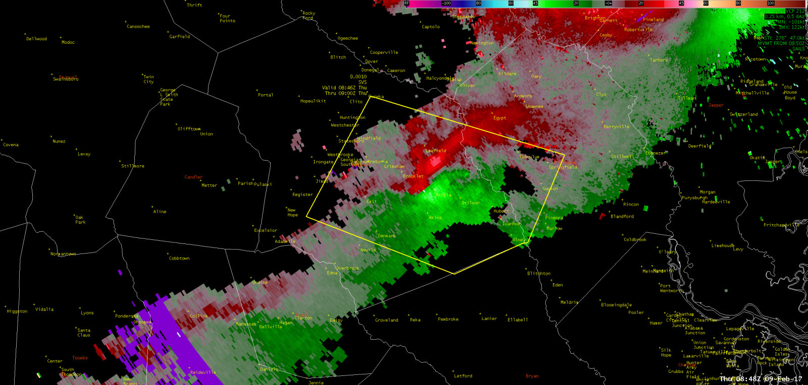
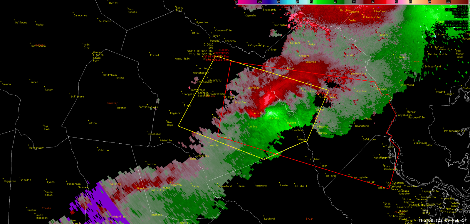

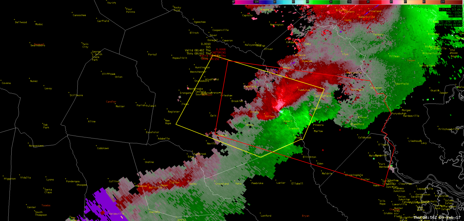
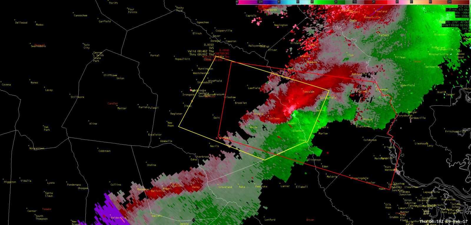
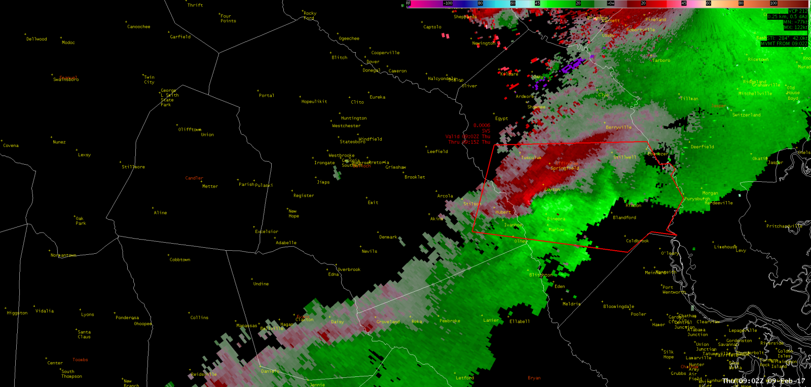
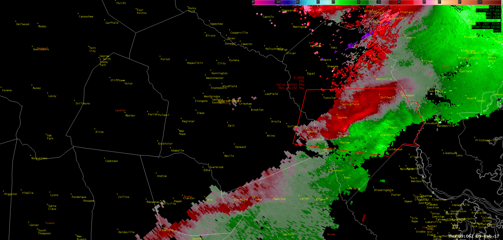

NWS Charleston, SC doppler radar storm-relative velocity loop showing the evolution of the tornado. Red colors indicate motion away from the radar and green colors indicate motion toward the radar.
Images courtesy of NWS Charleston, SC; click to enlarge
 |
 |
 |
 |
|
 |
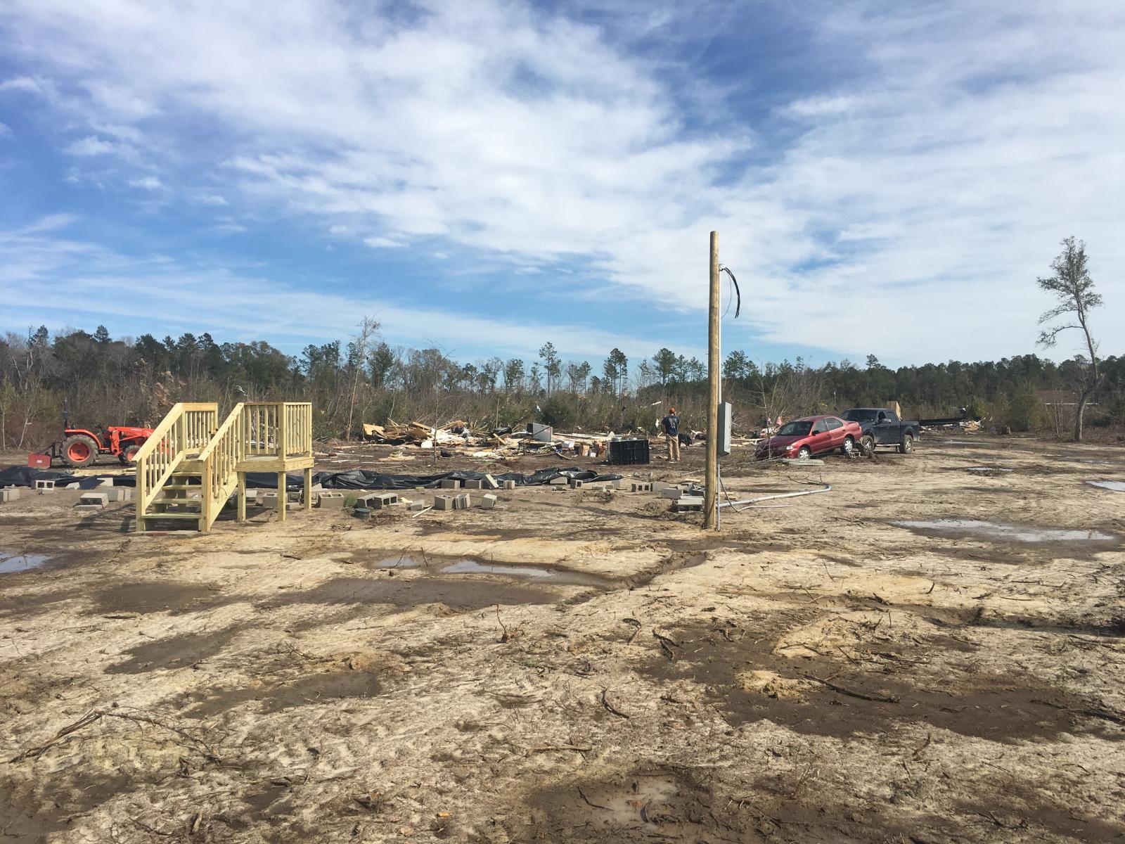
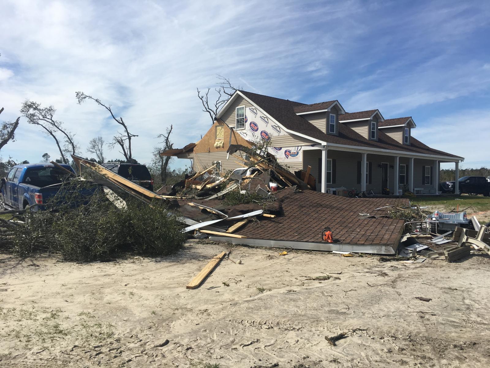
Public Information Statement...CORRECTED
National Weather Service Charleston SC
545 PM EST Fri Feb 10 2017

...TORNADO CONFIRMED CROSSING THE BULLOCH AND EFFINGHAM COUNTY LINE
IN GEORGIA...

Location...From 9 miles southeast of Brooklet to Pineora, Georgia
Date...02/09/2017
Estimated Time...351 AM EST
Maximum EF- Scale Rating...EF2
Estimated Maximum Wind Speed...130 mph
Maximum Path Width...300 yards
Path Length...10.6 miles
Beginning Lat/Lon...32.34N/ -81.56W
Ending lat/Lon...32.30N/ -81.40W
* Fatalities...0
* Injuries...7

* The information in this statement is preliminary and subject to
change pending final review of the event(s) and publication in
NWS Storm Data.

...Summary...
The National Weather Service in Charleston SC has confirmed a
tornado that stretched from southeastern Bulloch county to southwest
Effingham county in Georgia on 02/09/2017.

A storm survey team from the National Weather Service Office in
Charleston, SC confirmed a tornado, which stretched from 9 miles
southeast of Brooklet, GA, east-southeast to Pineora, GA.

The tornado began near Stillson-Leefield Road, in Bulloch county GA.
Most of the damage within the first few miles of the event was due
to many snapped and uprooted trees.

The most significant damage occurred near the center of the path,
in an area just west of South Old River Road to near Terrell
Road, in Bulloch County, GA. There were several mobile homes
along this portion of the path that were either completely
destroyed, or severely damaged. The extent of damage to the mobile
homes was the reason for the high-end EF2 rating. Two mobile homes
just north of Lillie Hagan Road were completely destroyed, being
flipped and tossed 30 to 40 feet from their foundations. Thankfully,
one of the mobile homes in this area was not occupied, but the other
one had five people inside, plus pets. All five were injured, one
seriously, with broken bones in their neck. Two pets in the same
mobile home survived, but one died from injuries sustained. A car
was pushed 20 to 30 feet and a large metal trucking container,
weighing approximately 9,000 pounds, pushed about 50 feet.

Continuing about 200 yards southeast along the path, a single
family home sustained moderate damage, mainly from projectiles and
debris hitting it from the mobile homes upstream. A large
carport/overhang was completely torn from the home, which then
fell on and damaged 3 cars. A large hole was punched through the
north wall of the home from debris hitting the window and pushing
into the home. Otherwise, some minor shingle damage was observed,
with 20-30% of the shingles missing. Another 200 yards southeast
of this home was another mobile home that was severely damaged. It
was lifted and rolled 30 to 40 feet off of its foundation,
crushing 2 cars before coming to rest on the edge of a bluff.
There were 2 people severely injured in this home with one pet
injured.

The tornado then continued across the Ogeechee River into
Effingham County, where most of the damage was in the EF1 range,
with hundreds of snapped pine and oak trees. Some minor structural
damage was found to a few homes just south of Rt 119, near Elkins
Cemetery Road. This damage was due to large trees falling on the
homes and carports.

Finally, after nearly 11 miles of damage and destruction, the
tornado lifted just east of Highway 17 in Pineora, GA in Effingham
county.

In addition to the mobile home and single family home damage,
there were hundreds of trees snapped and/or uprooted along the path.
Some of the most significant tree damage was found just along
South Old River Road, which caused this road to be closed for many
hours.

Of particular note with this event was that every victim claimed
they received the Warning via the Wireless Emergency Alert (WEA)
on their cell phones, with a lead time of 3 to 5 minutes before
the damage occurred. All of those affected attempted to take
appropriate protective action.

This information can also be found on our website at
weather.gov/chs.

For reference...the Enhanced Fujita Scale classifies tornadoes
into the following categories:

EF0...wind speeds 65 to 85 mph.
EF1...wind speeds 86 to 110 mph.
EF2...wind speeds 111 to 135 mph.
EF3...wind speeds 136 to 165 mph.
EF4...wind speeds 166 to 200 mph.
EF5...wind speeds greater than 200 mph.

$$


 Coastal Flood