A computer system upgrade will cause limited impacts to services between April 28, 2025 and April 30, 2025 Read More >
...A STATISTICAL PREVIEW OF CARIBOU'S NOVEMBER WEATHER...
Temperatures continue to rapidly cool with the average high falling from 45 degrees on the 1st to 32 by the end of the month. The average low temperature falls from 30 on the 1st to 18 by the end of November. The warmest temperature ever observed during the month of November was 68 degrees on November 1, 1956. The coldest temperature ever observed in November was 8 below on November 30, 1995.
November is on average the cloudiest month of the year at Caribou. Snow is possible at any time during the month of November, but the likelihood and frequency of snowfalls increases during the course of the month. The largest snowfalls of a foot or more have all been during the 2nd half of the month, and especially during the last 10 days of the month.
The largest calendar day snowfall of 20.9 inches was observed on November 21, 1986. In many years the winter snow pack becomes established during the 2nd half of the month. The snowiest November was in 1974 with a monthly total of 34.9 inches. 1960 holds the honors for the least snowy November with only 1.5 inches. The greatest snow depth ever observed during the month of November was 28 inches on November 27, 1974.
NOVEMBER: CARIBOU’S TOP 5 WARMEST (AVERAGE TEMPERATURES):
37.9 DEGREES 2011
36.8 2009
36.7 2006
36.5 1953
36.4 1948
NOVEMBER: CARIBOU’S TOP 5 COLDEST (AVERAGE TEMPERATURES):
25.0 DEGREES 1965
25.3 1949
25.6 1976
25.8 1986
27.1 1972
NOVEMBER: CARIBOU’S TOP 5 WETTEST
8.15 INCHES 1983
7.74 1963
7.39 2007
6.53 1950
6.06 2005
NOVEMBER: CARIBOU’S TOP 5 SNOWIEST
34.9 INCHES IN 1974
33.2 1949
28.1 1986
28.0 1968
27.0 1965
NOVEMBER: CARIBOU’S TOP 5 DRIEST
0.45 INCHES 1939
0.67 2012
1.21 1955
…NOVEMBER STATISTICS…
….TEMPERATURES (1981-2010 NORMALS)
AVERAGE HIGH……………………….....................................38.3
AVERAGE LOW………...........................................................24.7
MONTHLY AVERAGE…………………………………………..31.5
AVERAGE # OF DAYS W/HIGHS <32F……………………...7
AVERAGE # OF DAYS W/LOWS < 32F……………………..24 (23.9)
AVERAGE # OF DAYS W/LOWS <20F……………………...8
AVERAGE # OF DAYS W/LOWS <10F……………………...2
…PRECIPITATION…
MONTHLY AVERAGE………………………………………….....3.63 INCHES
AVERAGE DAYS WITH MEASURABLE PRECIPITATION…..14 (14.3)
LARGEST CALENDAR DAY RAINFALL………………………..2.22 INCHES, NOVEMBER 14, 2006
AVERAGE SNOWFALL…………………………………………..10.5 INCHES
MOST SNOWFALL………………………………………………..34.9 INCHES, 1974
LEAST SNOWFALL……………………………………………….1.5 INCHES, 1960
AVERAGE # OF DAYS W/SNOWFALL > 1 INCH………….….3 (2.8)
AVERAGE # OF DAYS W/SNOWFALL > 3 INCHES…………1
…MISCELLANEOUS NOVEMBER AVERAGES…
NORMAL HEATING DEGREE DAYS………………………..…1005
NORMAL COOLING DEGREE DAYS……………………….…0
MEAN WIND SPEED……………………………………………..8.3 MPH
AVERAGE NUMBER OF DAYS W/DENSE FOG…………..…2 (2.4)
MEAN NUMBER OF CLOUDY DAYS………………………….20 (20.4)
…SUNRISE AND SUNSET…
NOVEMBER 1ST……………………………………………..…7:15 AM/5:16 PM
NOVEMBER 30TH …………………………………………….6:56 AM/3:46 PM
LOSS OF DAYLIGHT………………………………………….1 HOUR 49 MIN
DAYLIGHT SAVINGS TIME ENDS…………………..………NOVEMBER 3RD
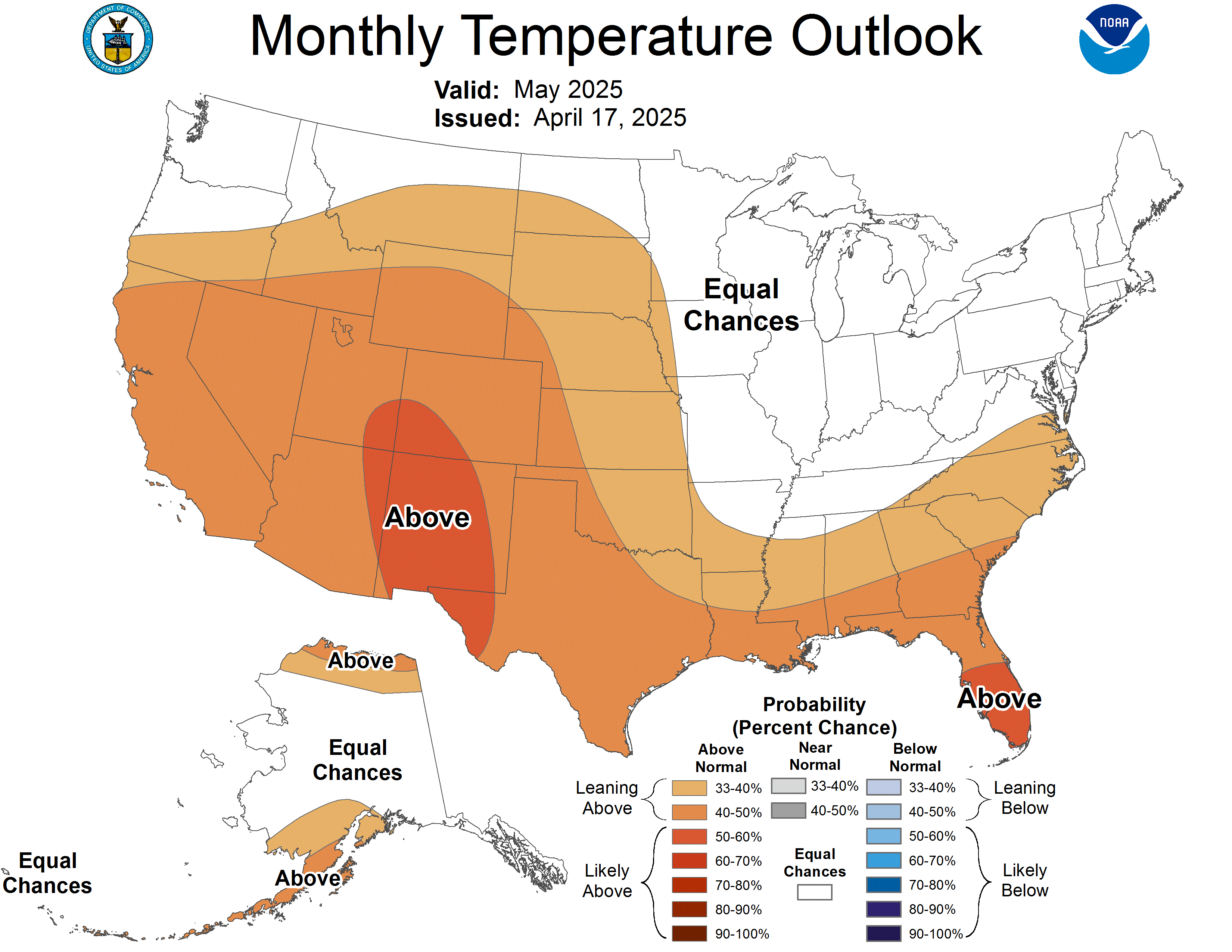
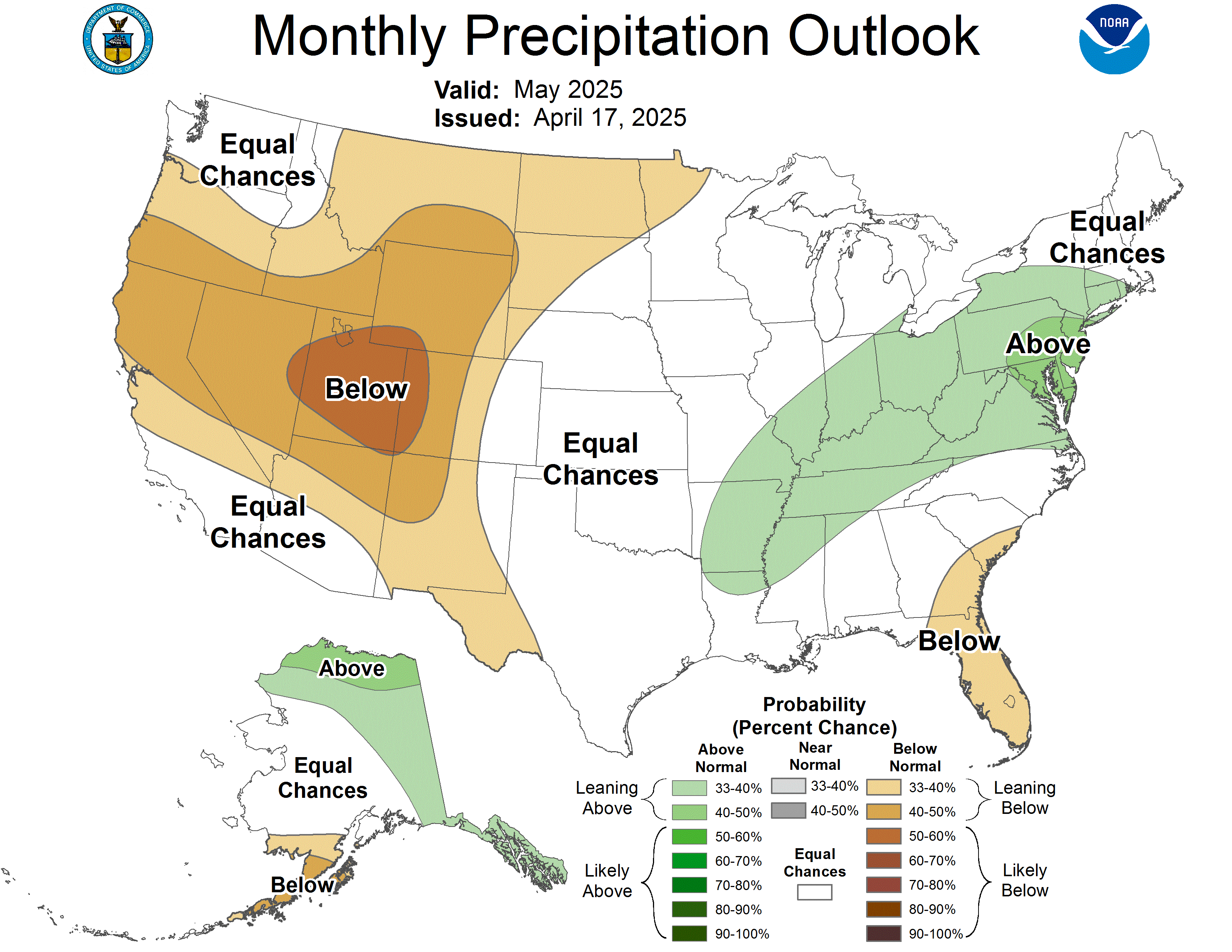
Outlook from the Climate Prediction Center for November:


There is an increased likelihood that temperatures will average above normal. There are no strong climate signals that would point toward an unusually wet (snowy) or dry November. These maps are available at the Climate Prediction Center at: http://www.cpc.ncep.noaa.gov/products/predictions/30day/