
Strong to severe thunderstorms will continue tonight across portions of the Ohio Valley into the Mid-Atlantic. Heavy rains may bring an isolated flash flooding threat over the central Appalachians, particularly in West Virginia. Moderate to heavy snow will continue over portions of northern Minnesota and the Upper Peninsula of Michigan through Tuesday morning. Read More >
| Tour 1: April 6th, 10 a.m. | Tour is full |
| Tour 2: April 6th, 2 p.m. | Tour is full |
| Tour 3: April 7th, 10 a.m. | Tour is full |
| Tour 4: April 7th, 2 p.m. | Tour is full |
This graphic shows the forecast for the percentage of the sky covered in clouds at any given location.

| City | Normal High Temperature | Record High Temperature | Record Cold High Temperature | Normal Low Temperature | Record Warm Low Temperature | Record Low Temperature |
|---|---|---|---|---|---|---|
| Caribou | 44°F | 64°F in 2021 | 23°F in 1982 | 26°F | 41°F in 2021 | 2°F in 1943 |
| Bangor | 50°F | 74°F in 1929 | 26°F in 1982 | 30°F | 47°F in 2010 | 16°F in 1982 |
| City | Record Precipitation | Record Snowfall | Normal Precipitation | Normal Snowfall | Record Snow Depth |
|---|---|---|---|---|---|
| Caribou | 0.62" in 2022 | 6.2" in 2012 | 0.10" | 0.4" | 42" in 1982 |
| Bangor | 1.44" in 2022 | 4.0" in 1989 | 0.12" | 0.2" | 14" in 1982 |
| City | Normal High Temp | Normal Low Temp | Record High Temp | Record Low Temp | Record Max Rainfall |
|---|---|---|---|---|---|
| Frenchville (1996-2023) | 42°F | 26°F | 61°F in 2021 | 7°F in 2003 | 0.31" in 2014* |
| Fort Kent (1893-2023) | 42°F | 21°F | 61°F in 2021 | -5°F in 1943 | 0.74" in 1933 |
| Houlton (1948-2023) | 45°F | 25°F | 70°F in 1981 | -5°F in 1972 | 0.71" in 1964 |
| Patten (1992-2017) | 44°F | 25°F | 62°F in 1993 | 13°F in 2015 | 1.32" in 1994 |
| Millinocket (1903-2023) | 47°F | 27°F | 65°F in 2021 | 10°F in 1995 | 1.69" in 1914 |
| Greenville (1920-2023) | 42°F | 26°F | 64°F in 2021 | 8°F in 1944 | 0.98" in 1924 |
| Dover-Foxcroft (1973-2023) | 47°F | 25°F | 68°F in 2010 | 12°F in 1982 | 0.91" in 2016 |
| Corinna (1947-2023) | 50°F | 28°F | 73°F in 2010 | 9°F in 2003 | 0.93" in 2016 |
| Grand Lake Stream (1961-2023) | 47°F | 29°F | 63°F in 2010 | 8°F in 2003 | 1.37" in 1982 |
| Baileyville/Woodland (1917-2023) | 48°F | 33°F | 69°F in 1922 | 15°F in 2003 | 1.70" in 2016 |
 |
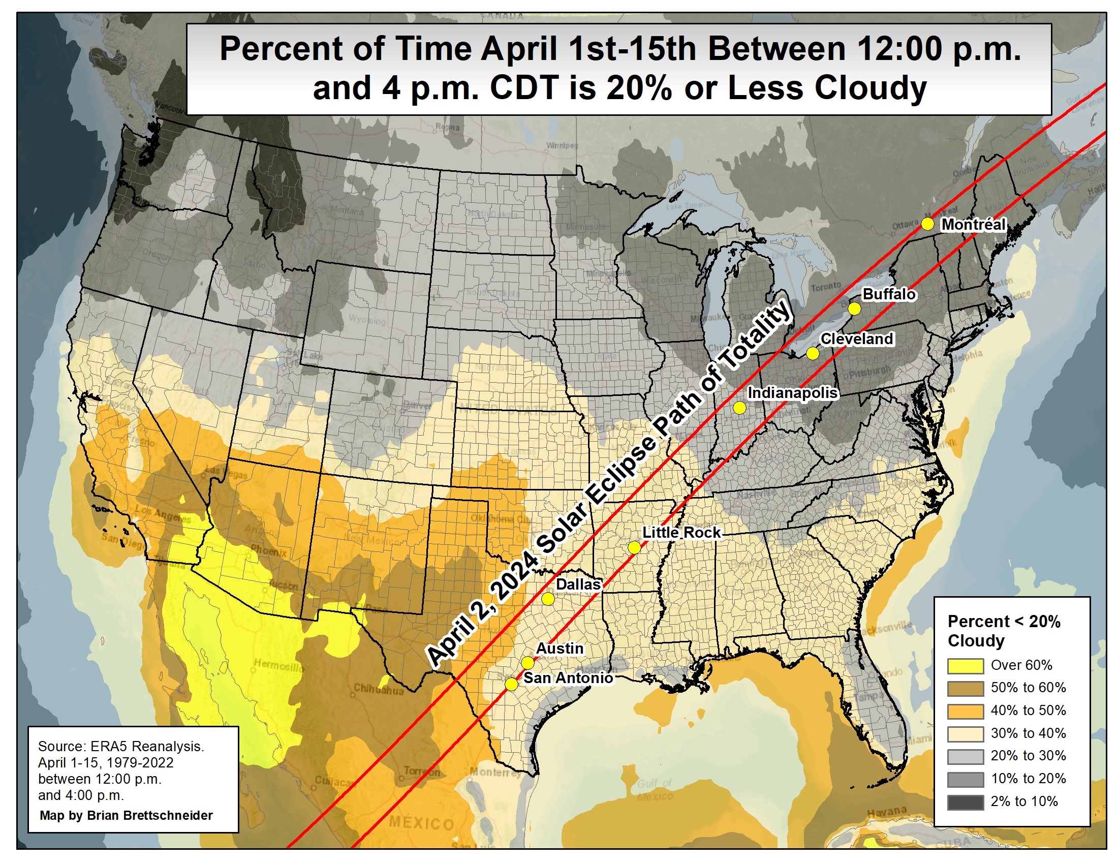 |
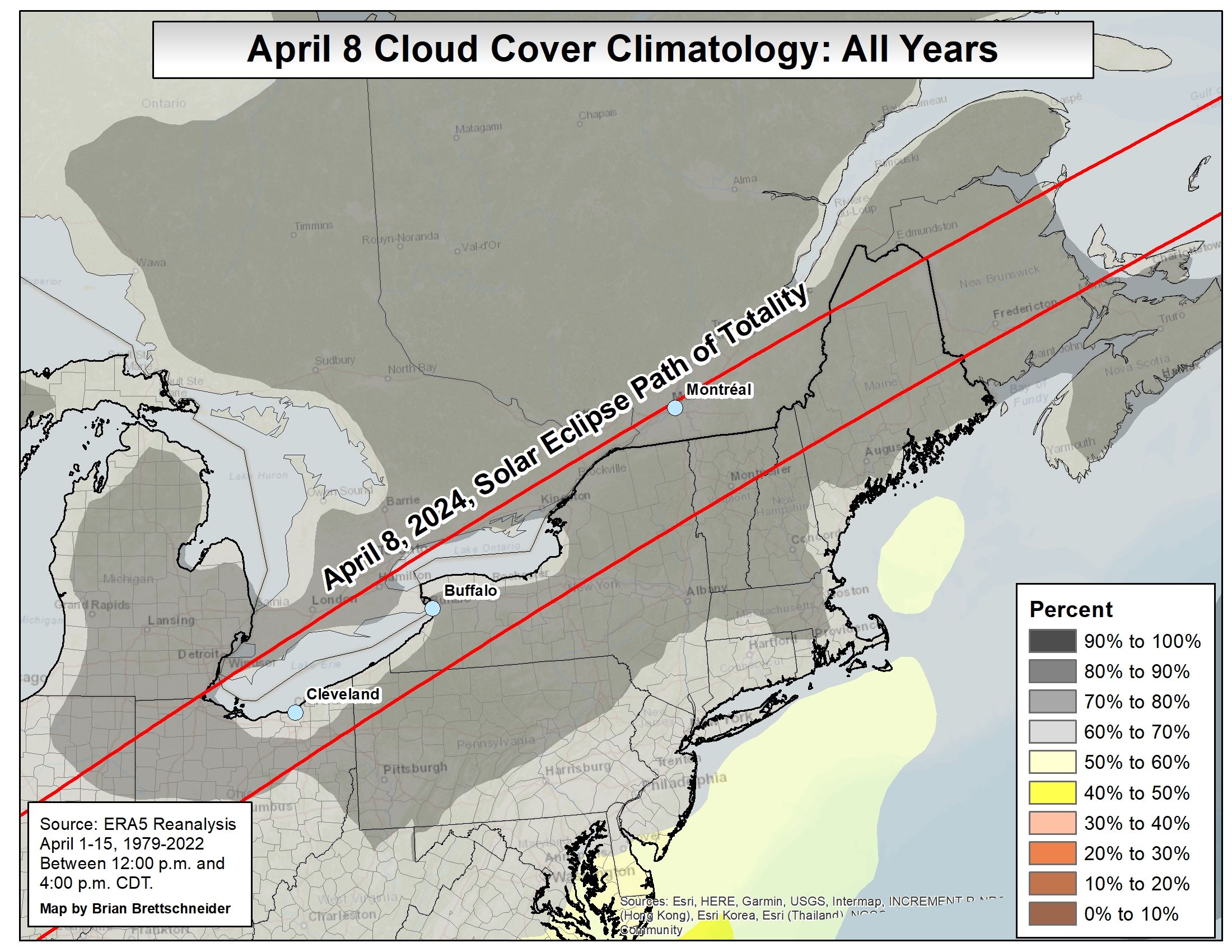
| Cloud Cover Climo for 1PM to 5PM EDT Apr 8 | Minimal Cloud Cover Climo for 1PM to 5PM EDT Apr 8 (Date on Image is Incorrect) |
 |
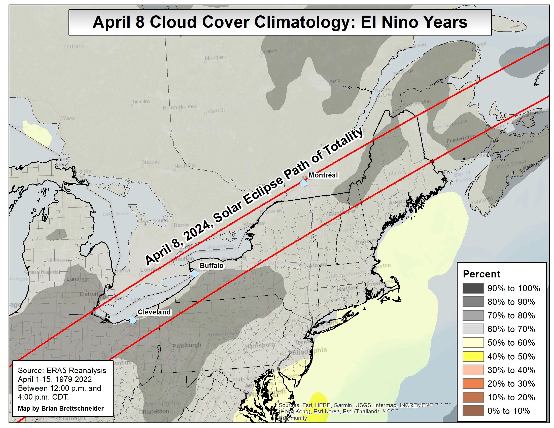 |
| Zoomed in Version of Cloud Cover Climatology | Cloud Cover Climatology, but Only for El Niño Years |
CIMSS / UW-Madison has a loop of sky cover at around 3 PM EDT (2PM EST) for the years 1979-2003: .gif format .mp4 format
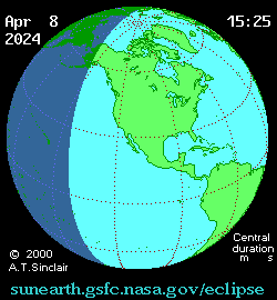
Below is timing information for selected Maine cities for the April 8, 2024 Total Eclipse. Timings are approximate and in Eastern Daylight Time. Calculate information for any city by visiting the US Naval Observatory site.
| City | Eclipse Begins | Totality Begins | Totality Peak | Totality End | Eclipse End | Totality Duration |
| Caribou | 2:22 PM | 3:32 PM | 3:33 PM | 3:34 PM | 4:40 PM | 2min 8.7sec |
| Presque Isle | 2:22 PM | 3:32 PM | 3:33 PM | 3:35 PM | 4:34 PM | 2min 49.5sec |
| Monticello | 2:22 PM | 3:31 PM | 3:33 PM | 3:35 PM | 4:40 PM | 3min 23.3sec |
| Houlton | 2:22 PM | 3:32 PM | 3:33 PM | 3:35 PM | 4:41 PM | 3min 20.1sec |
| Patten | 2:21 PM | 3:31 PM | 3:33 PM | 3:34 PM | 4:40 PM | 3min 20.8sec |
| Clayton Lake | 2:20 PM | 3:31 PM | 3:32 PM | 3:32 PM | 4:39 PM | 1min 30.6sec |
| Greenville | 2:19 PM | 3:30 PM | 3:31 PM | 3:33 PM | 4:39 PM | 3min 4.8sec |
| Millinocket | 2:20 PM | 3:31 PM | 3:32 PM | 3:34 PM | 4:40 PM | 2min 59sec |
| Lincoln | 2:21 PM | 3:32 PM | 3:33 PM | 3:34 PM | 4:40 PM | 1min 27.6sec |
| Danforth | 2:22 PM | 3:32 PM | 3:33 PM | 3:34 PM | 4:41 PM | 2min 16.5sec |
511 New England Road Conditions (traffic map and cameras from Maine Department of Transportation)


 Coastal Flood
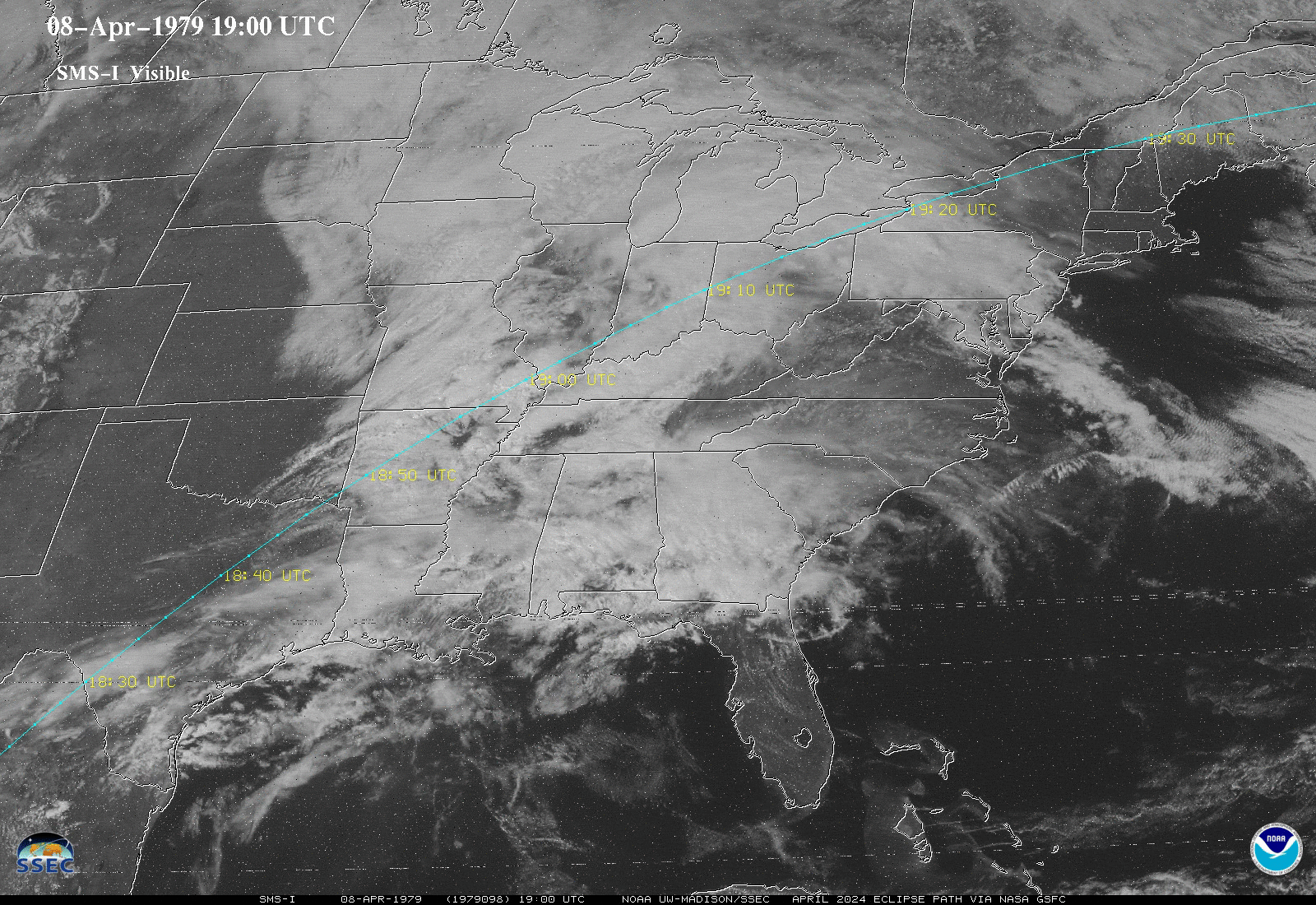