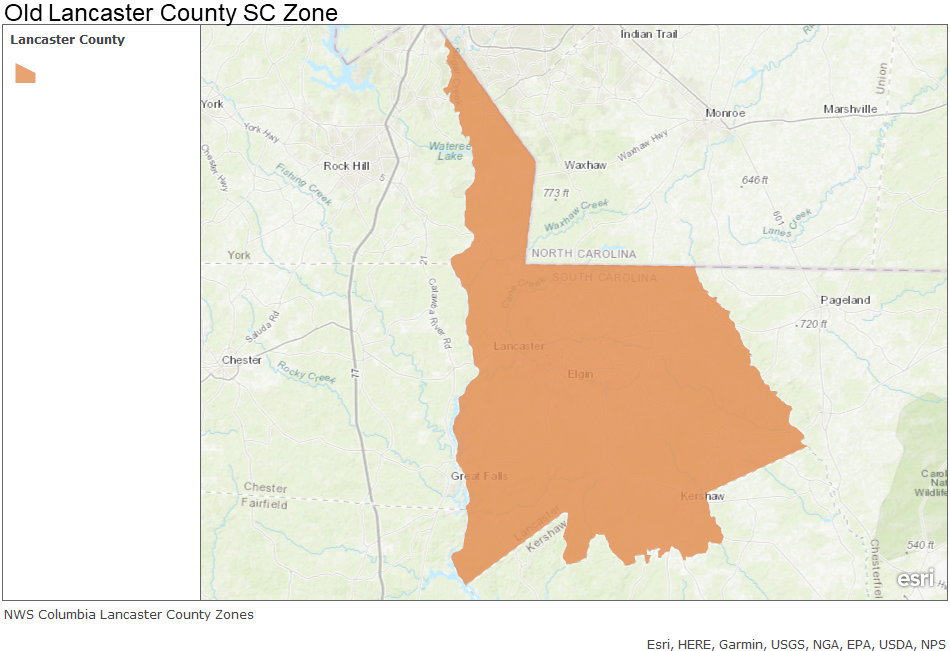
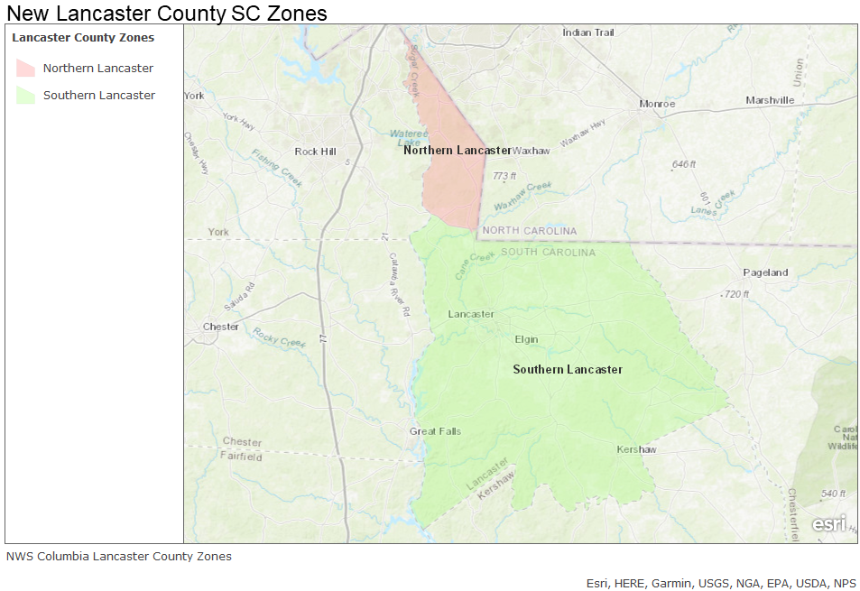
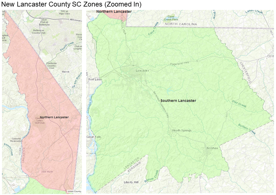
Effective Tuesday, April 2, 2019, The NWS Weather Forecast Office (WFO) in Columbia, SC (CAE) will add a new county segment within our County Warning Area (CWA). Lancaster County in far northern South Carolina will be divided into two public and fire weather forecast zones: Northern Lancaster and Southern Lancaster. The division will occur along South Carolina Route 5. This new county segment will also result in a new FIPS code for northern Lancaster County. Below are graphics depicting these changes:
 |
 |
 |
These changes are intended to provide increased flexibility and improved accuracy of forecast and various watches, warnings and advisories in the public weather program. These changes will result in more geographically precise forecast, watch and warning products for the general public and will enhance web-based graphical product consistency and appearance.
These zone changes require partners and users to take appropriate action to receive the new zone products using the Universal Generic Code (UGC) zone code format (Z) listed in Table 1. Products affected by this change are listed in Table 2.
| Current Public/Fire Zone Name / UGC | New Public/Fire Zone Name / New UGC |
|
Lancaster County / SCZ015 |
Northern Lancaster / SCZ115 Southern Lancaster / SCZ116
|
| Product Name | WMO Header | AWIPS ID |
|
Special Weather Statement Hurricane Local Statement Tropical Cyclone Watch/Warning Zone Forecast Product Hazardous Weather Outlook Non-Precipitation Watch/Warning/Advisory Winter Weather Watch/Warning/Advisory Area Forecast Matrices Fire Weather Message Flood Watch/Warning/Advisory Hydrologic Outlook Fire Weather Watch/Red Flag Warning Public Information Statement Point Forecast Matrices Area Forecast Discussion Precipitation and Temperature Summary Daily River and Lake Summary Hydrologic Statement Hydrologic Statement Air Quality Alert Air Quality Forecast |
WWUS82 KCAE WTUS82 KCAE WTUS82 KCAE FPUS52 KCAE FLUS42 KCAE WWUS72 KCAE WWUS42 KCAE FOUS52 KCAE FNUS52 KCAE WGUS62 KCAE FGUS72 KCAE WWUS82 KCAE NOUS42 KCAE FOUS52 KCAE FXUS62 KCAE SXUS52 KCAE FGUS52 KCAE FGUS82 KCAE SRUS42 KCAE AEUS72 KCAE AEUS72 KCAE |
SPSCAE HLSCAE TCVCAE ZFPCAE HWOCAE NPWCAE WSWCAE AFMCAE FWFCAE FFACAE ESFCAE RFWCAE PNSCAE PFMCAE AFDCAE HYDCAE RVDCAE RVSCAE RVACAE AQACAE AQICAE |
If you are affected by these changes, take the appropriate action so your system(s) recognize the new zone (Z) Universal Geographic Codes (UGC) and the new zone alignments.
An updated public zone map shapefile is available for download at: http://www.nws.noaa.gov/geodata/catalog/wsom/html/pubzone.htm
An updated fire zone map shapefile is available for download at: http://www.nws.noaa.gov/geodata/catalog/wsom/html/firezone.htm
The proposed changes to the CAE zone boundaries have been closely coordinated with local partners and customers.
|
John Quagliariello Warning Coordination Meteorologist National Weather Service Columbia, SC 2909 Aviation Way West Columbia, SC 29170 803-822-8135 John.Quagliariello@noaa.gov |
John Koch Public Program Leader National Weather Service Eastern Region Headquarters 630 Johnson Avenue Bohemia, NY 11716 631-244-0104 John.Koch@noaa.gov |

