Record rainfall fell over the Orangeburg area beginning the afternoon of November 6th and continuing through the overnight periods leading to significant flash flooding and river flooding which led to:
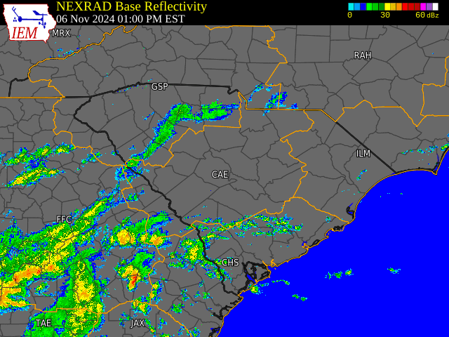
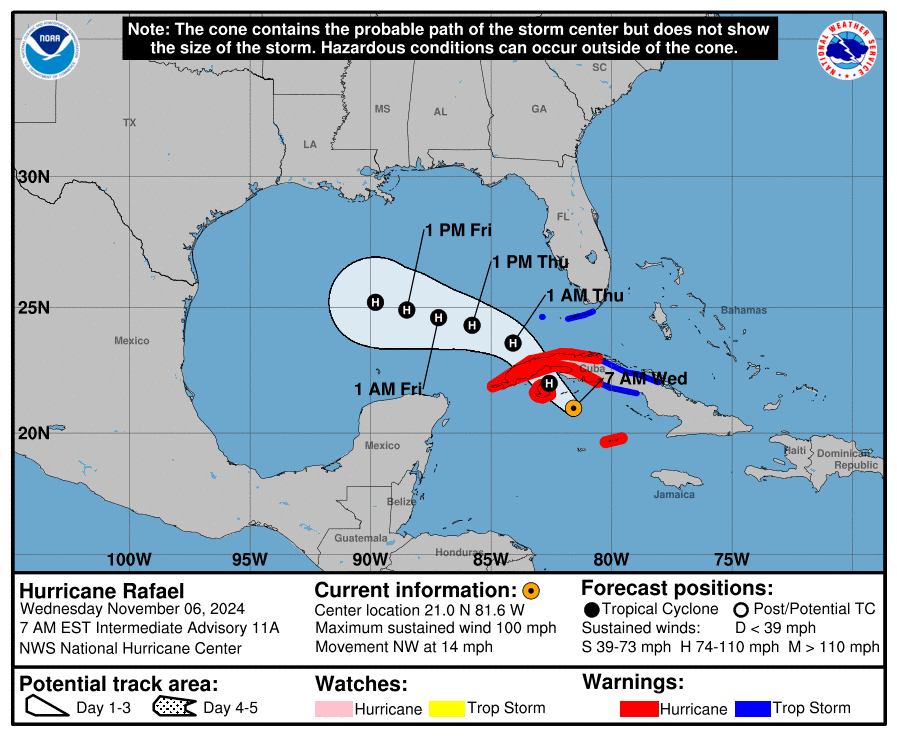
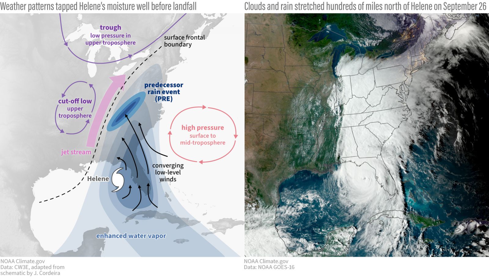
It all started with Hurricane Rafael. While Rafael never even made landfall in the United States (it moved into the central Gulf and weakened), moisture provided by the hurricane led to a Predecessor Rain Event (PRE) for portions of the area. A similar setup was observed earlier in the year with Hurricane Helene in the western Carolinas with high pressure offshore and a southwesterly jet stream.
This led to significant moisture transport into eastern Georgia and South Carolina. The main difference being that Helene made landfall and moved into Georgia and the Carolinas while Rafael remained over 600 miles away from Orangeburg, where the flooding was most impactful.
Example of predecessor rain event (PRE) from Hurricane Helene
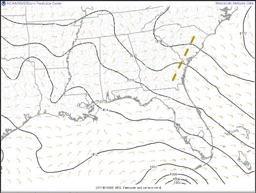
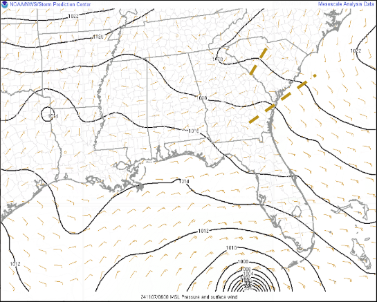
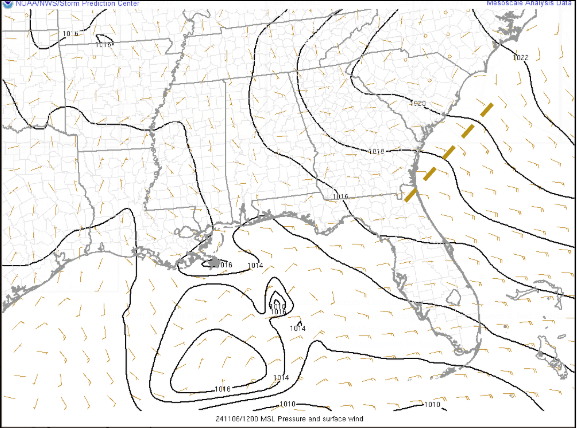
Surface - At the surface a trough developed near the coast which led to increasing low level convergence over much of the area. Multiple surface troughs were evident overnight in the forecast area.
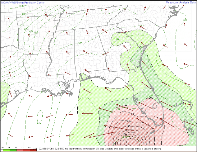
11/6 7am |
11/6 7pm |
11/7 1am |
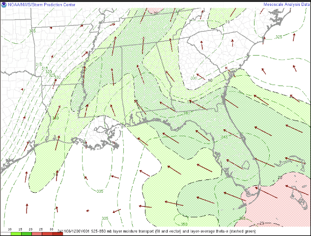
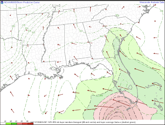
925-850mb Moisture Transport - Low level moisture rapidly increased as tropical moisture from Hurricane Rafael was transported north.
|
11/6 7am |
11/6 7pm |
11/7 1am |
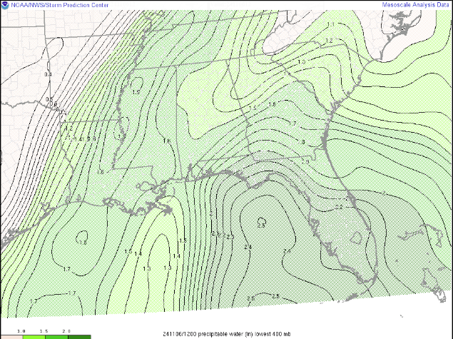
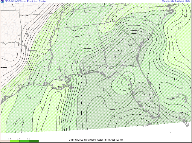
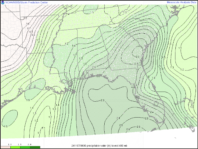
Precipitable Water (PWAT) - Measured PWAT of 2.1 inches from Charleston, SC sounding, record high for the date. Daily mean is around 0.8 inches.
|
11/6 7am |
11/6 7pm |
11/7 1am |
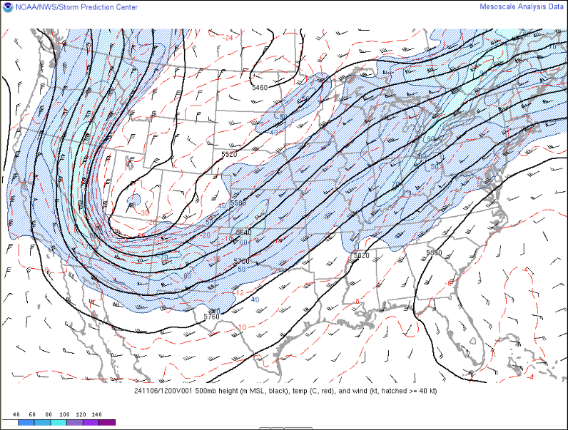
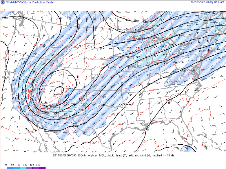
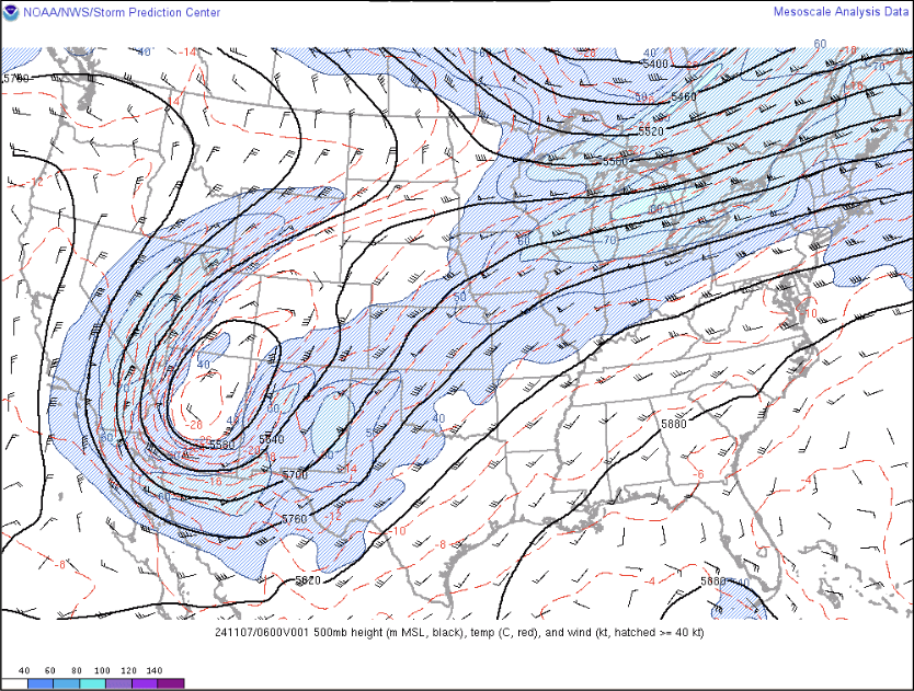
500mb Analysis - Deep trough and closed off low over the Four Corners region of the US leading to deep SW flow, further increasing moisture. Several shortwaves moved into the area, increasing lift.
|
11/6 7am |
11/6 7pm |
11/7 1am |
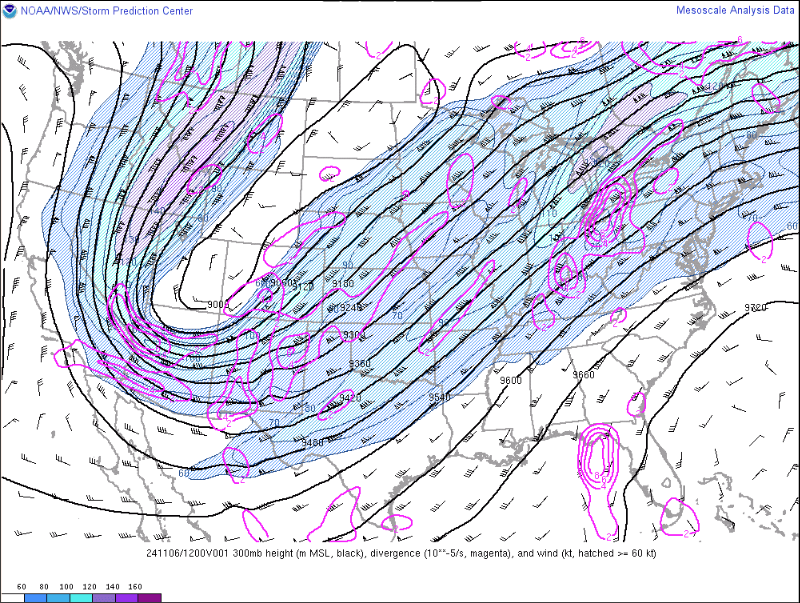
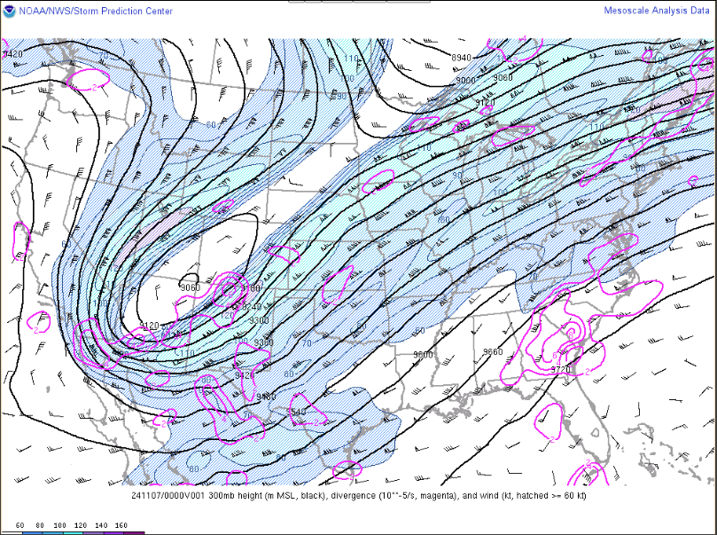
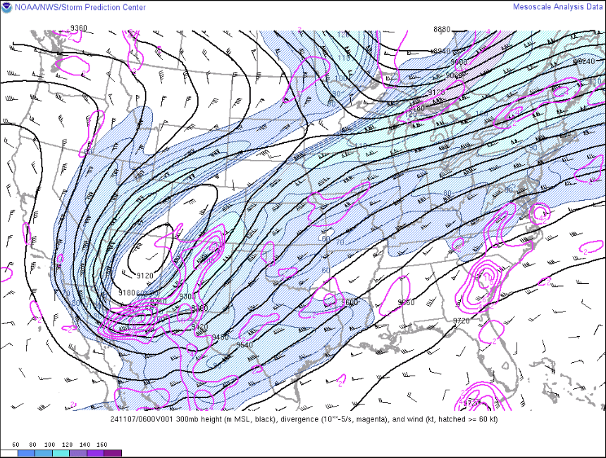
300mb Analysis - Strong upper level divergence increasing over the forecast area with a bullseye over where the highest rainfall fell.
|
11/6 7am |
11/6 7pm |
11/7 1am |
What resulted was a wide swath of over 8 inches of rain south of I-20. This led to significant flash flooding.
.png/OrangeburgFlood24(1)__600x458.png)
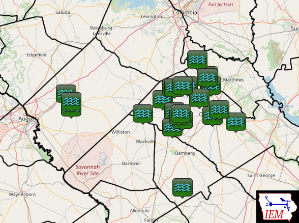
MRMS estimated rainfall with observations overlayed
|
Locations of Flash Flooding Local Storm Reports (LSRs) - mostly closed roads. |
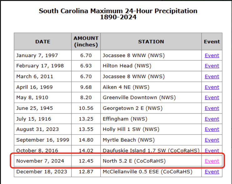
Highest rain amount observed was 12.45 inches at a CoCoRaHS gage near North which was a 24 hour South Carolina state maximum for the month of November. |
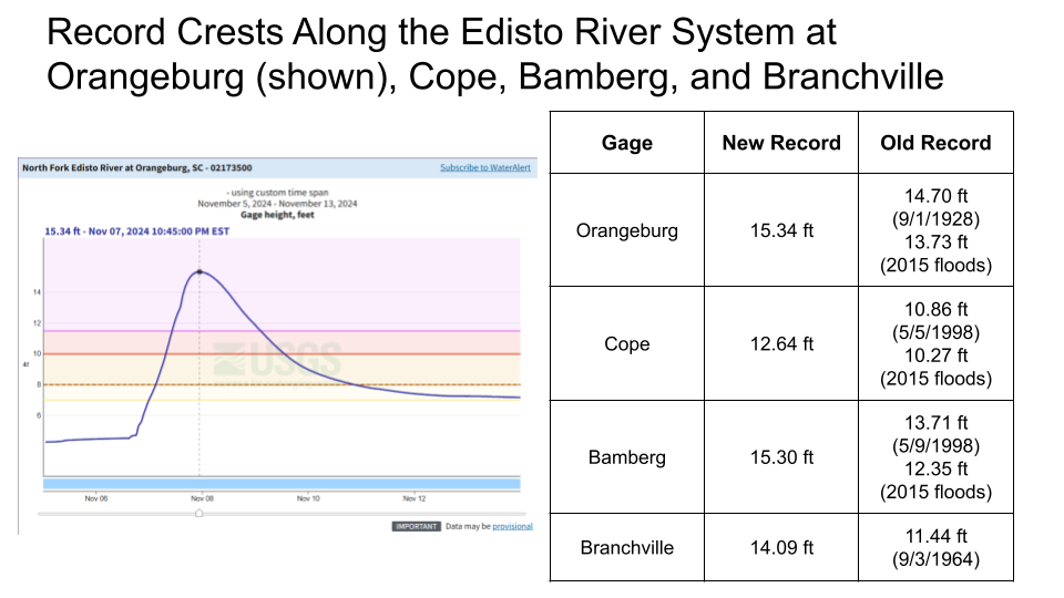
The heaviest rain fell late in the evening and into the overnight so while the flash flooding was significant, many people were either asleep or at least not on the roads that flooded. The most significant flooding occurred as areas rivers and streams rose during the day of November 7th. River levels rose to record highs, exceeding the flooding that occurred in 2015. Two fatalities occurred; one occurred in a vehicle driving into floodwater and the second occurred as a person was swept away in floodwater while trying to get to their stranded vehicle. A stark reminder of how important it is to Turn Around Don't Drown.
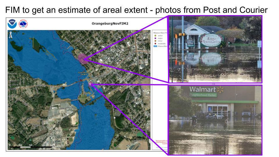
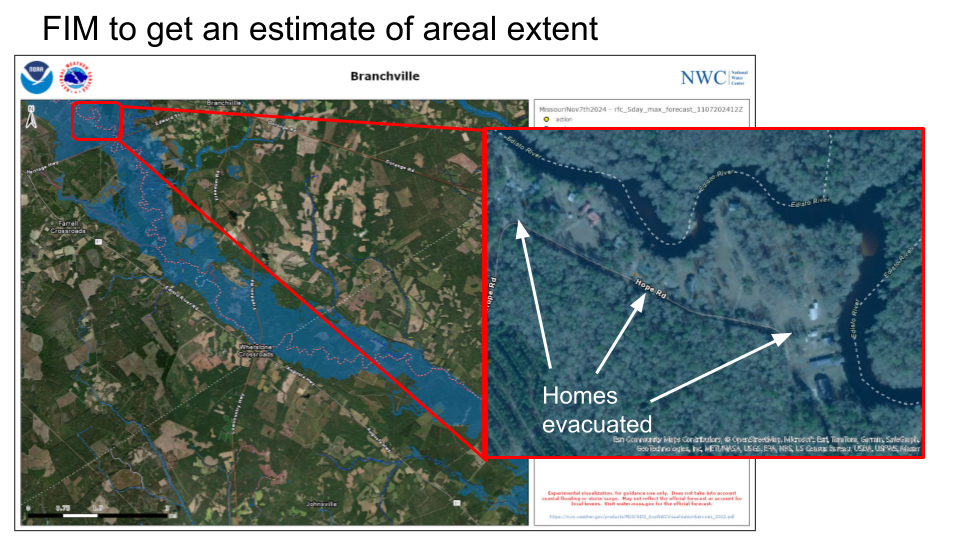
Utilizing Flood Inundation Mapping from the National Water Center, we can visualize the extent of river flooding in portions of the area.
 |
 |
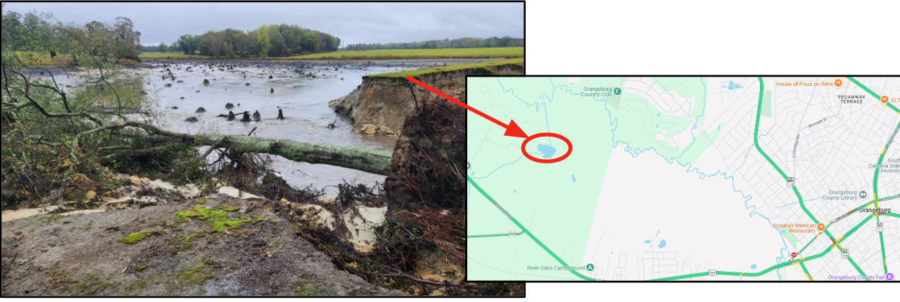
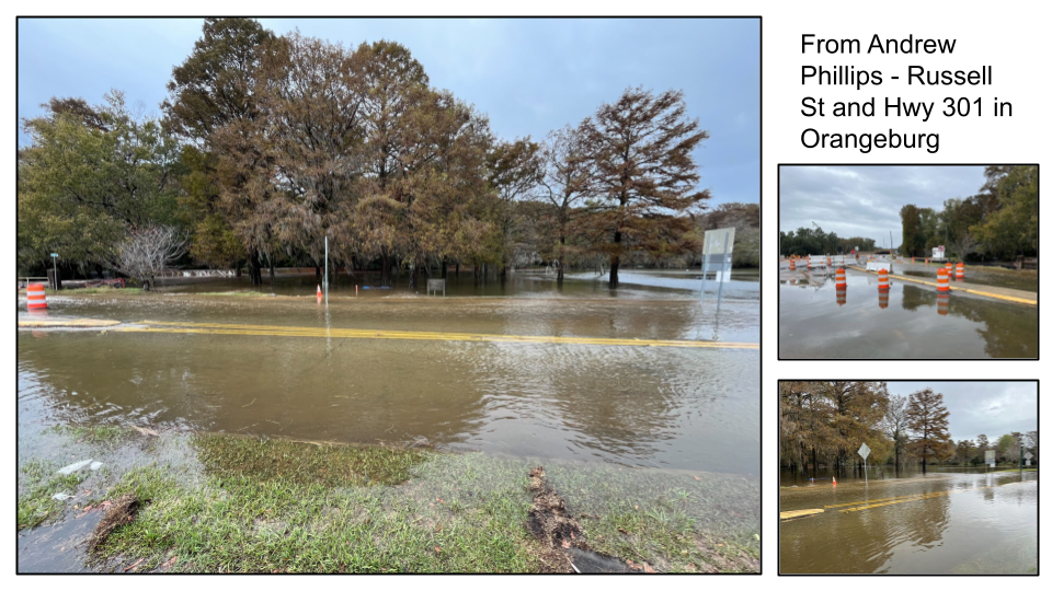
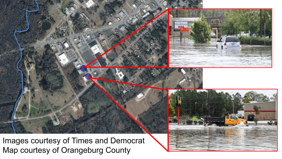
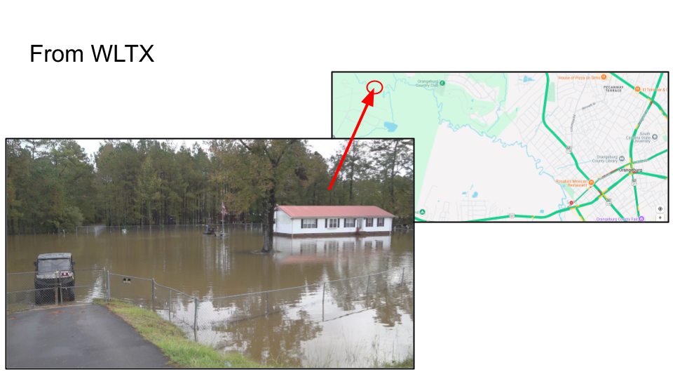
Additional reports and images of the flooding:
 |
 |
 |
 |