...October 1st-5th Historic Rainfall and Flooding...
Retrospective Story Map of Historic Rainfall and Flooding October 1st-5th 2015
Use the right and left arrows at the bottom of the storyboard to scroll through the story. Click on "Learn More" to see additional information.
Click here for a link to the full webpage of the Story above.
Event Synopsis
|
Event Synopsis...
A cold front came through late night Wed Sep 30th and stalled near the coast for several days due to an upper level flow that paralled the surface front. An upper level trough closed off and remained nearly stationary to our west for several days. A surface area of low pressure developed along the front near the coast or just offshore, while a strong area of surface high pressure built into eastern Canada. This resulted in a strong low level flow off the Atlantic. This flow pattern brought a long, deep fetch of moisture northwestward towards the Carolinas from Hurricane Joaquin.
The combination of upper divergence and lift east of the closed low, and a strong persistent low level flow off the Atlantic and associated low level moisture convergence and isentropic lift, along with a plume of tropical moisture getting entrained into the system, provided a band of heavy rain showers and a few thunderstorms that at times trained over the same areas and persisted for many hours.
The heaviest rain occurred from the Columbia vicinity, southeastward across lower Richland Co, Sumter Co, Calhoun Co, Clarendon Co and lower Orangeburg Co. The heaviest rainfall occurred late Saturday night Oct 3rd into the morning hours of Sunday Oct 4th. At times, rainfall rates of 2” inches per hour affected those locations for several hours. This heavy and persistant rainfall occurred over urban areas where runoff rates were high, and over grounds already wet from recent rains. This heavy rainfall caused numerous roadway and bridge closings due to dam failures, along with culvert and pipe washouts across the region. Numerous life saving swift water rescues were performed..
In general, a significant gradient in rainfall amounts occurred in our CWA, with 1-2 inches west of the Savannah River, 2-4 inches just on the east side of the Savannah River, with amounts ramping up to around 10 inches eastward into West Central Midlands, with 10-20 inches from Columbia SE across the Eastern Midlands. The NWS had been advertising this very heavy rainfall and flooding potential well in advance of the event.
During this event, Columbia Metro Airport set a new record for both the greatest one and two day rainfall totals.
Columbia Metro Airport Rainfall Record
Greatest 1-day rainfall…. 6.71 inches set on October 4, 2015
Old 1-day rainfall record….. 5.79 inches set on July 9, 1959
Greatest 2-day rainfall….. 10.28 inches set on October 3-4, 2015
Old 2-day rainfall record….. 7.69 inches set on August 16-17, 1949
|
Please note, some images below are rather large and may take a while to load on a slow connection.
Below is a map showing Rainfall Totals through the Evening of October 4th. Just below the image is the latest updated Public Information Statement detailing location amounts.
PUBLIC INFORMATION STATEMENT
NATIONAL WEATHER SERVICE COLUMBIA SC
815 PM EDT TUE OCT 6 2015
...UPDATED...
...EVENT TOTAL RAINFALL AMOUNTS...
RAIN FOR THIS EVENT GENERALLY BEGAN FRIDAY OCT 2ND. MOST OF THE
HEAVIEST AMOUNTS LISTED BELOW FELL SAT NIGHT OCT 3RD THROUGH SUNDAY
MORNING OCT 4TH. ONLY LIGHT ADDITIONAL AMOUNTS FELL IN SOME AREAS
SUNDAY AFTERNOON THROUGH MONDAY OCT 5TH. NO SIGNIFICANT ADDITIONAL
RAIN OBSERVED TUE OCT 6TH.
THIS LIST HAS BEEN QUALITY CONTROLLED AS MUCH AS POSSIBLE AND
GENERALLY RESTRICTED TO OFFICIAL AND OTHER RELIABLE RESOURCES. SOME
OF THESE STATIONS MAY HAVE RECEIVED SOME RELATIVELY LIGHT ADDITIONAL
AMOUNTS THAT ARE NOT REFLECTED IN THE TOTAL AMOUNTS. MANY OF THESE
ARE CONSIDERED PRELIMINARY NUMBERS. FOR BREVITY...ONLY THE HIGHEST
COCORAHS REPORTS WERE INCLUDED...AND ONLY REPORTS OF 5 INCHES OR
HIGHER ARE INCLUDED IN THIS LIST.
MUCH APPRECIATION IS EXTENDED TO RICHLAND COUNTY SC RCWINDS NETWORK...
NWS COOP OBSERVERS...COCORAHS OBSERVERS...USGS AND RAWS GAGES...AND
OTHERS.
LOCATION COUNTY/STATE AMOUNT (IN.)
GILLS CREEK RCWINDS - COLUMBIA RICHLAND CO SC 21.49
PUBLIC REPORT - MILLWOOD SUMTER SC SC 20.75
SUMTER 0.3NNE COCORAHS SUMTER CO SC 20.77
SUMTER 1.3SE COCORAHS SUMTER CO SC 20.61
WATEREE RCWINDS RICHLAND CO SC 20.36
HOLLY HILL 0.4N COCORAHS ORANGEBURG CO SC 20.28
SHAW AFB - SUMTER ASOS SUMTER CO SC 19.81
MANNING 8.2S COCORAHS CLARENDON CO SC 19.25
SUMMERTON 5.2SSE COCORAHS CLARENDON CO SC 19.19
LEESBURG HWY 601 RCWINDS RICHLAND CO SC 18.36
EASTOVER RCWINDS RICHLAND CO SC 18.35
SPRING VALLEY RCWINDS - COLUMBIA RICHLAND CO SC 17.91
FORT JACKSON RCWINDS RICHLAND CO SC 17.71
WEIR TOWER - FT JACKSON RAWS RICHLAND CO SC 17.30
CHAPIN 1.4S COCRAHS LEXINGTON CO SC 17.21
CHESTNUT OAKS MS WEATHERBUG SUMTER CO SC 17.14
MLK PARK RCWINDS - COLUMBIA RICHLAND CO SC 16.82
SANTEE NWR RAWS CLARENDON CO SC 16.74
HOLLY HILL COOP ORANGEBURG CO SC 16.61
SANTEE 2NE COCORAHS ORANGEBURG CO SC 16.50
WEDGEFIELD FD WEATHERBUG SUMTER CO SC 16.26
HOPKINS 3.9NNE COCORAHS RICHLAND CO SC 15.89
COLUMBIA 6.7N COCORAHS RICHLAND CO SC 15.71
MCGRADY FT JACKSON RAWS RICHLAND CO SC 15.71
SANDHILL EXP COOP RICHLAND CO SC 14.95
SUMTER EMA WEATHERBUG SUMTER CO SC 14.88
LONGTOWN COOP FAIRFIELD CO SC 14.15
CEDAR CREEK COOP RICHLAND CO SC 13.39
UNIV OF SC COOP - COLUMBIA RICHLAND CO SC 12.97
LITTLE MOUNTAIN COOP NEWBERRY CO SC 12.76
MANNING COOP CLARENDON CO SC 12.70
LUGOFF COOP KERSHAW CO SC 12.48
HAMILTON OWENS APT - COLUMBIA RICHLAND CO SC 12.42
CONGAREE NP RAWS RICHLAND CO SC 12.41
UNIV OF SC T. BUCKET - COLUMBIA RICHLAND CO SC 12.37
LAKE MURRAY DAM USGS LEXINGTON CO SC 11.60
COLUMBIA METRO APT ASOS LEXINGTON CO SC 11.44*
BISHOPVILLE COOP LEE CO SC 11.35
ORANGEBURG COOP ORANGEBURG CO SC 11.29
MCTIER CREEK USGS - MONETTA AIKEN CO SC 10.72
ORANGEBURG APT ASOS ORANGEBURG CO SC 10.59
NEWBERRY COOP NEWBERRY CO SC 9.92
NEWBERRY USGS NEWBERRY CO SC 9.83
CHESTERFIELD COOP CHESTERFIELD CO SC 9.23
SALUDA USGS SALUDA CO SC 9.23
BARNWELL COOP BARNWELL CO SC 8.80
WATEREE DAM COOP KERSHAW CO SC 8.62
BATESBURG COOP LEXINGTON CO SC 8.60
BAMBERG COOP BAMBERG CO SC 8.45
S. FORK EDISTO R USGS DENMARK BAMBERG CO SC 7.71
BLACK CREEK CHESTERFIELD USGS CHESTERFIELD CO SC 6.59
MCBEE USGS CHESTERFIELD CO SC 6.31
LITTLE R. USGS MT CARMEL MCCORMICK CO SC 5.47
PAGELAND USGS CHESTERFIELD CO SC 5.45
* COLUMBIA ESTABLISHED A NEW ALL TIME ONE DAY...TWO DAY...AND
THREE DAY RECORD RAINFALL AMOUNTS.
OBSERVATIONS ARE COLLECTED FROM A VARIETY OF SOURCES WITH VARYING
EQUIPMENT AND EXPOSURE. NOT ALL DATA LISTED ARE CONSIDERED OFFICIAL.
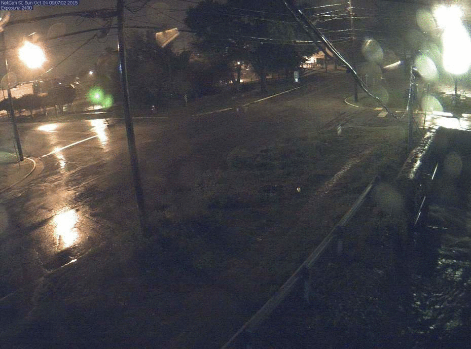
Next, click on the following image to show a loop of the Flooding that occurred during the morning hours of Oct 4th at the intersection of Whaley and Main in Columbia, SC
Below is an image linking to the earth Observatory site by Nasa. This page shows some before and after satellite images of Columbia, SC.
Radar Loop beginning on Oct 1st and ending on Oct 5th. This video loop is courtesy of a Facebook posting by Shea Gibson at Weatherflow.
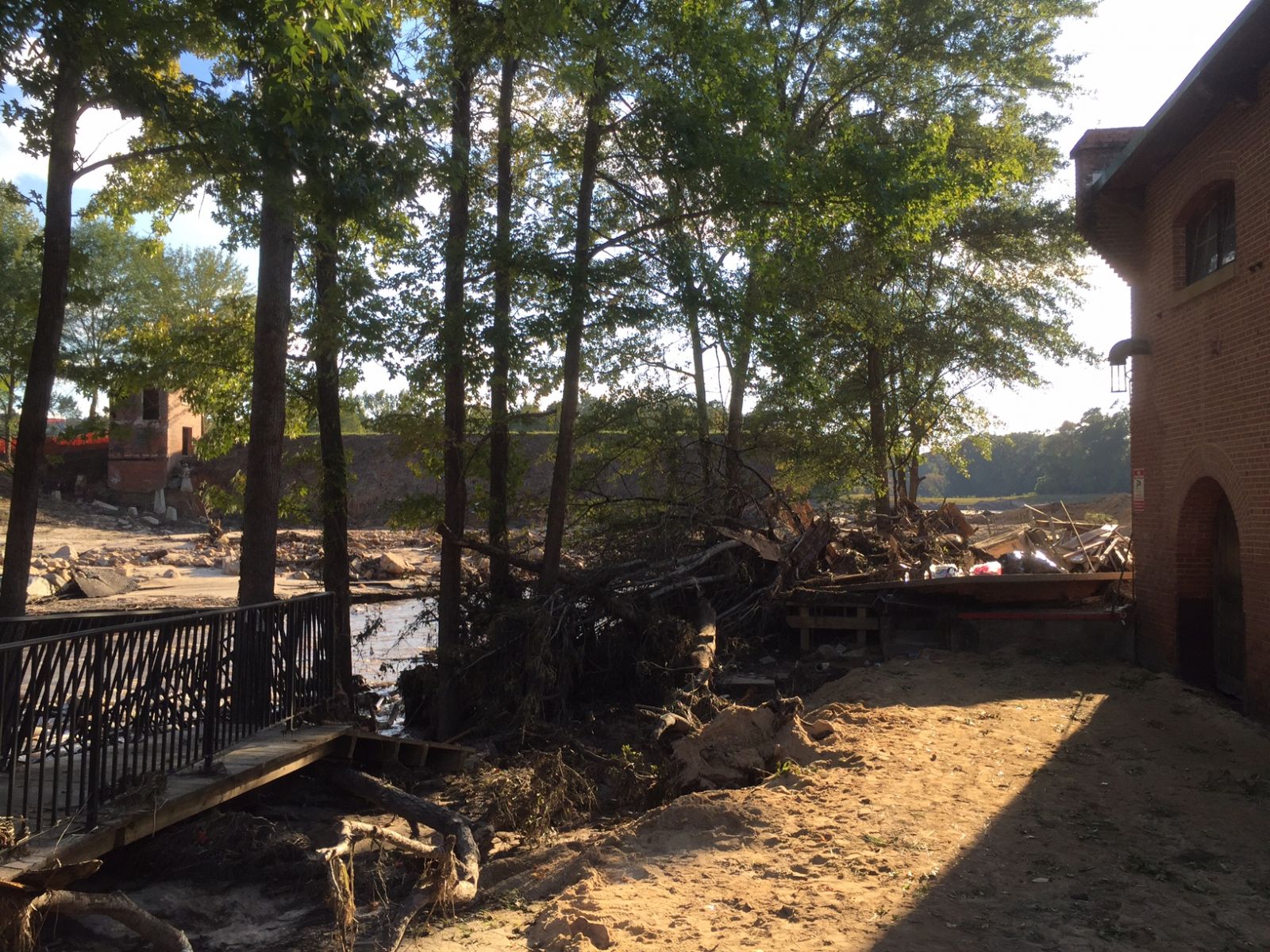
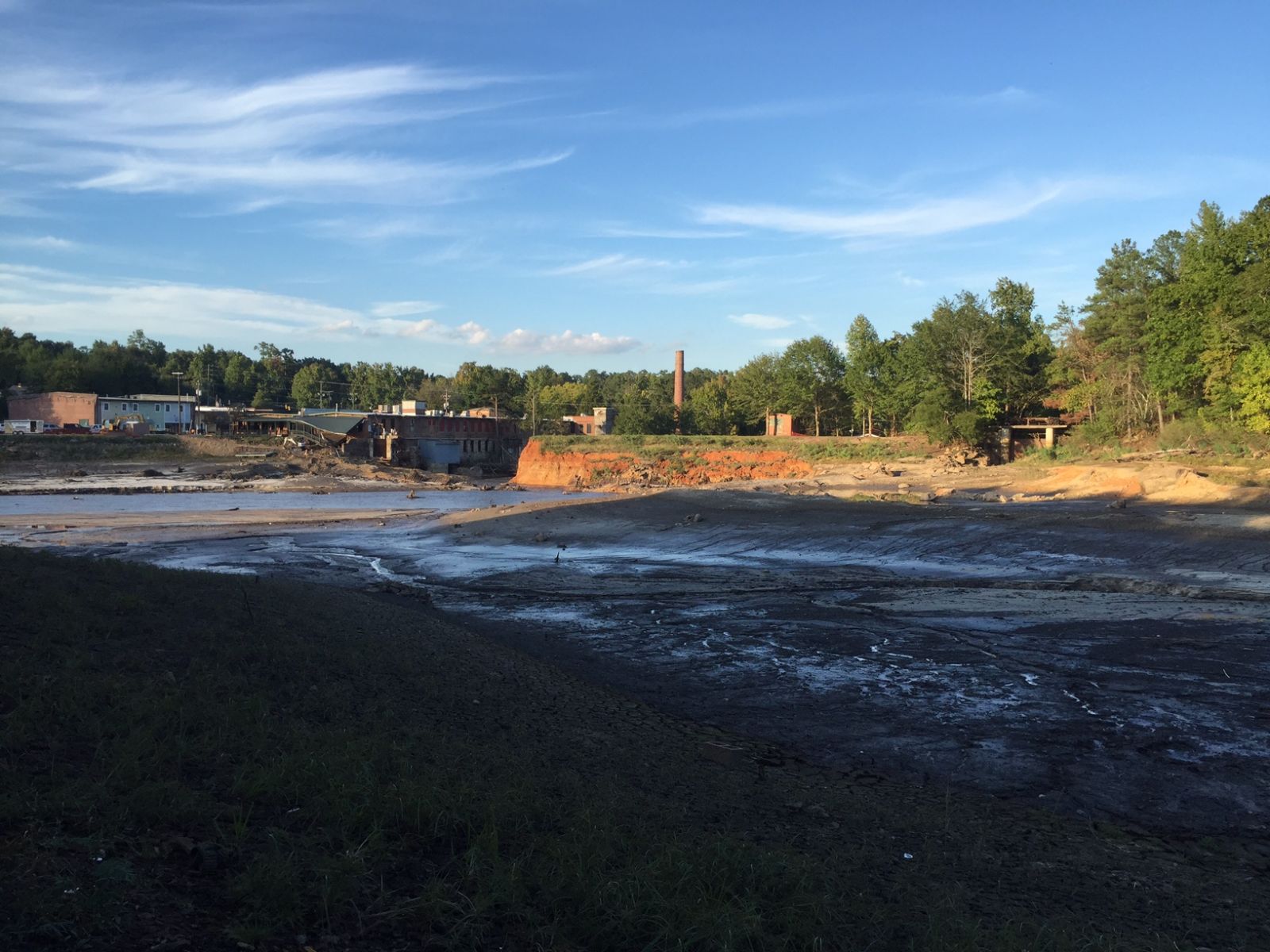
One of our partners, the South Carolina Emergency Management Division (SCEMD), has Numerous Flooding and Damage Images from across the state on their website. A direct link to their South Carolina Severe Flooding 2015 page can be found here. They also have some great before and after images, which can be found here.
Finally, here are some other Photos of Flooding from across the Region. (click for a larger image)
| |
|
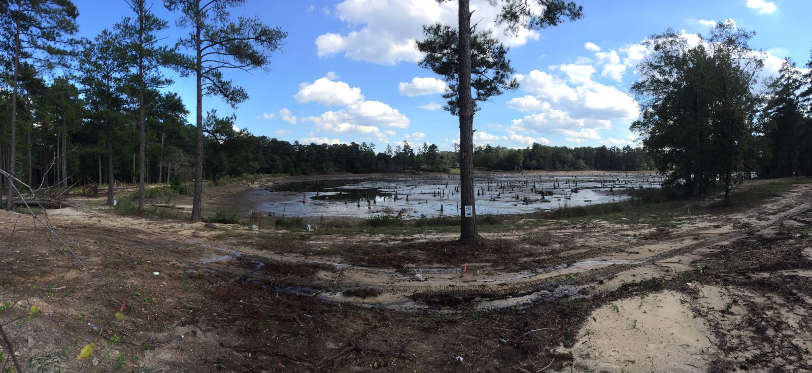
Barr Lake in Lexington - Courtesy NWS CAE |
Gibson Pond in Lexington - Photographer Unknown. |
Gibson Pond in Lexington - Courtesy NWS CAE |
|
Gibson Pond in Lexington - Courtesy NWS CAE |
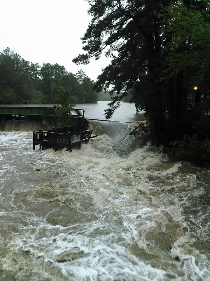
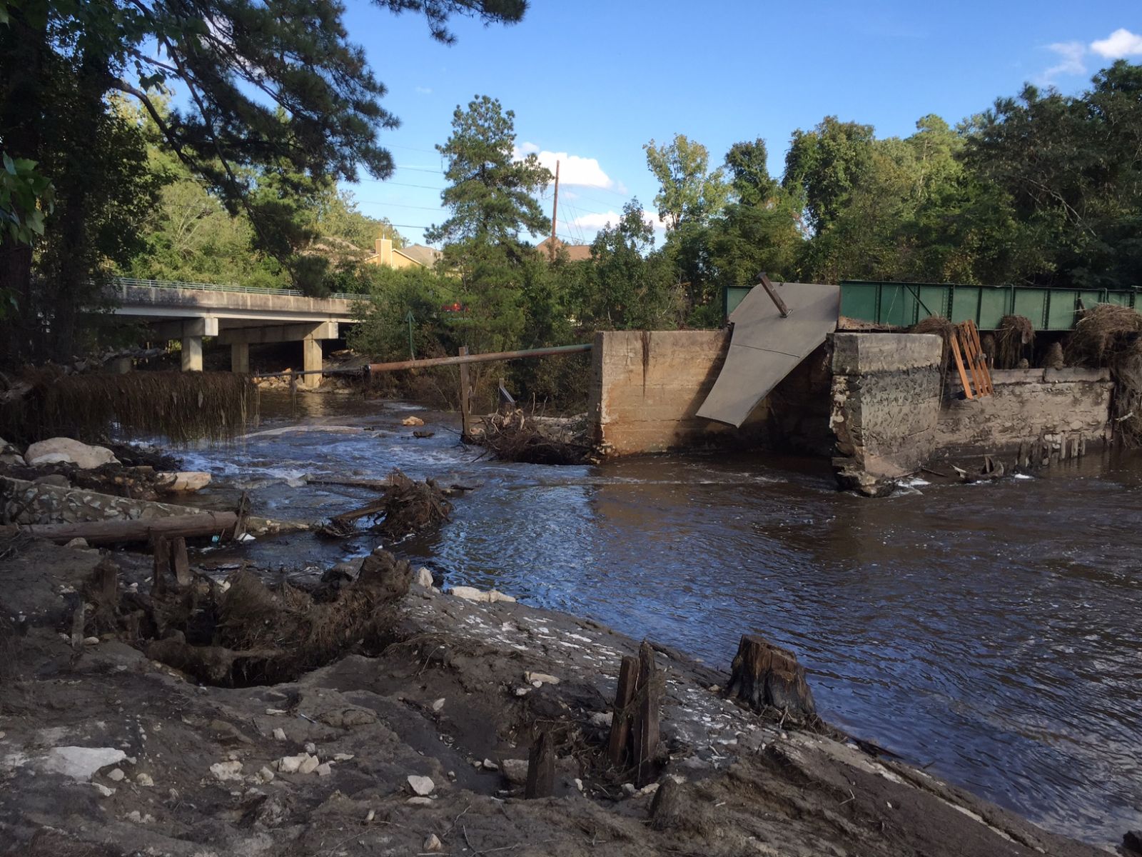
Old Mill Dam in Lexington -
Courtesy The State Paper |
Old Mill Dam in Lexington -
Courtesy NWS CAE |
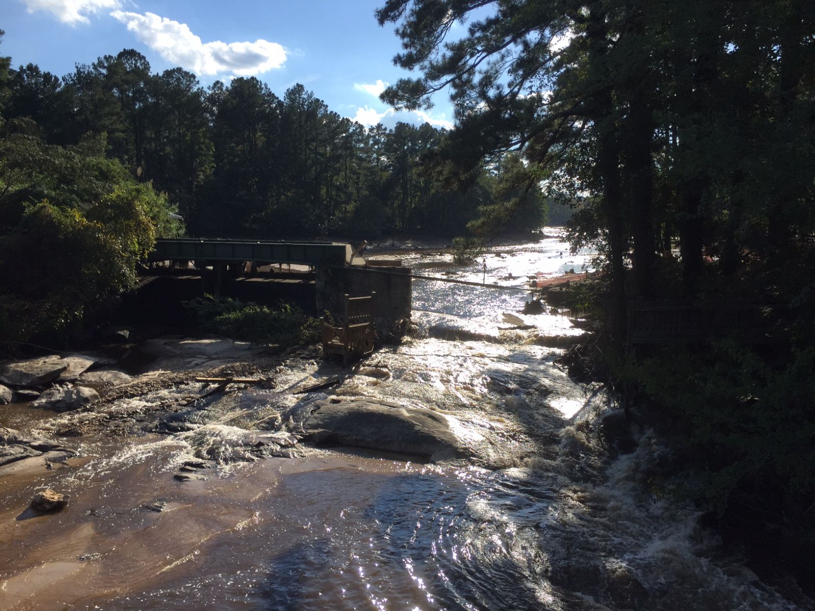
Old Mill Dam in Lexington -
Courtesy NWS CAE |
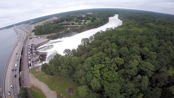
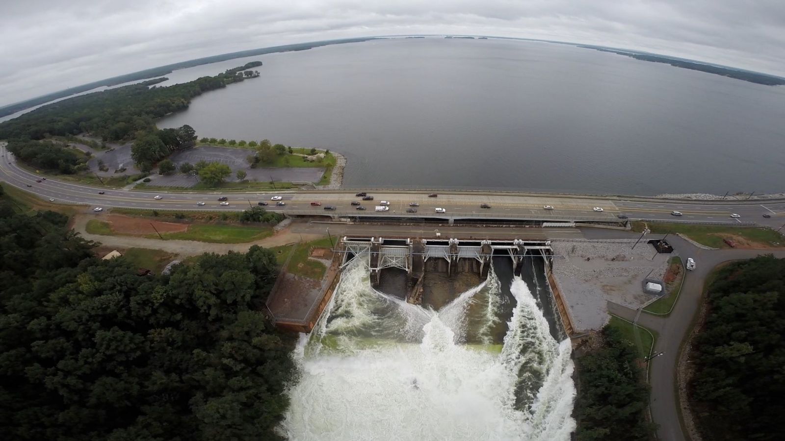
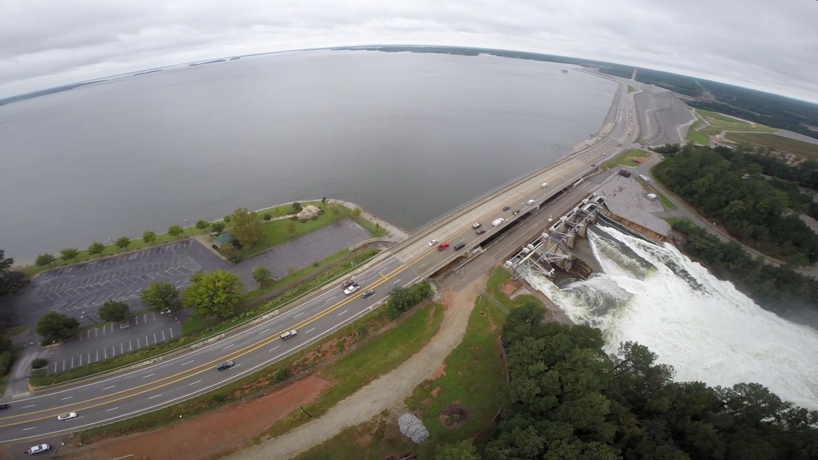
Lake Marion Water Release
|
Lake Murray Spillway - Courtesty Ebben M Aley |
|
Lake Murray Spillway - Courtesy Ebben M Aley |
Lake Murray Spillway - Courtesy Ebben M Aley |
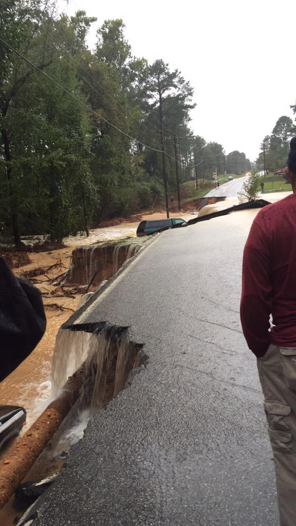
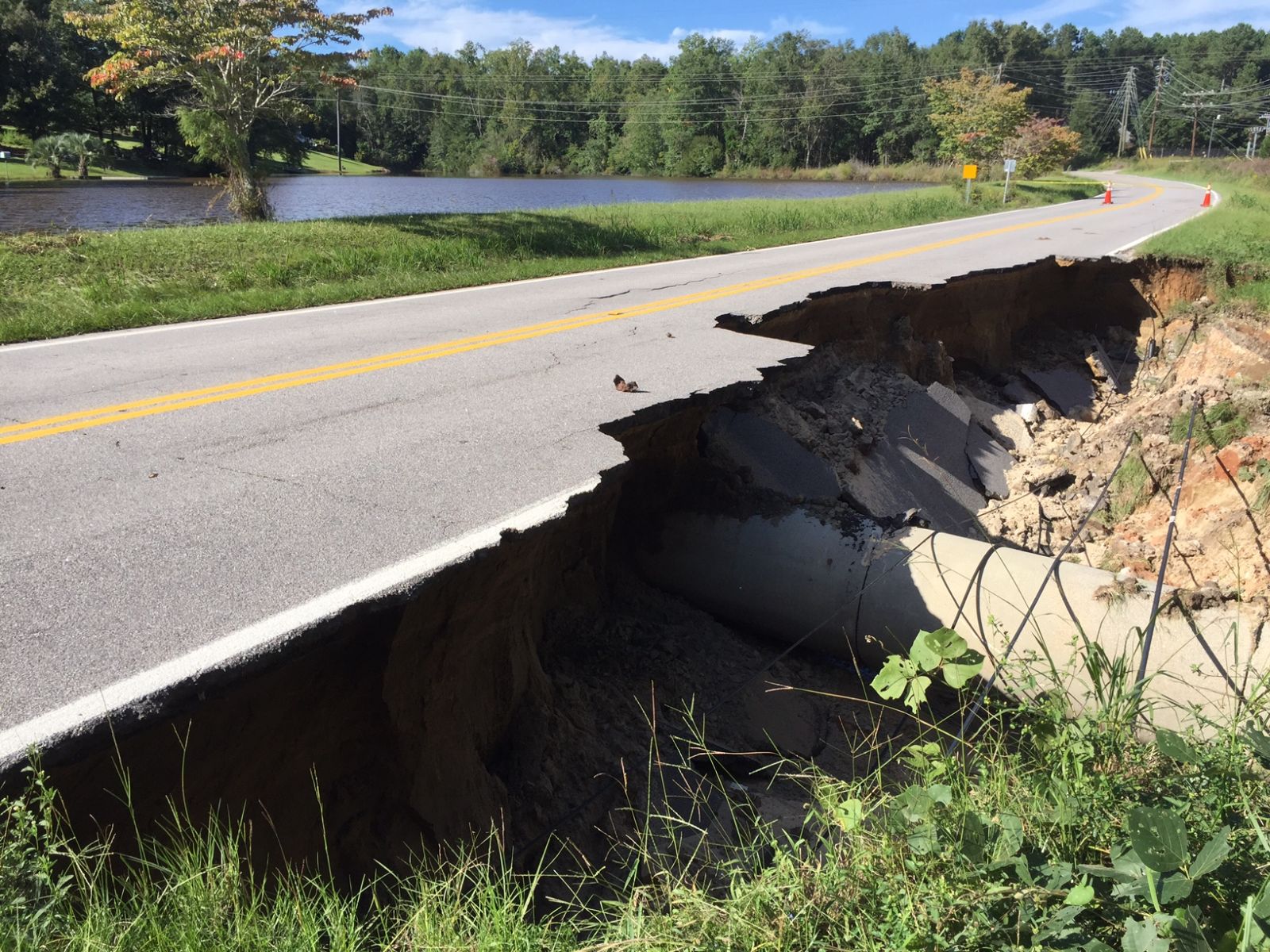
Roadway Washouts
|
|
Road Way Washout - Wise Ferry Rd in Lexington |
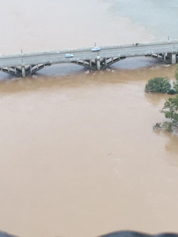
Richland County Flyover with Governor Nikki Haley - The State Paper
|
Richland County Flyover with Governor Nikki Haley - The State Paper |
|
Richland County Flyover with Governor Nikki Haley - The State Paper |
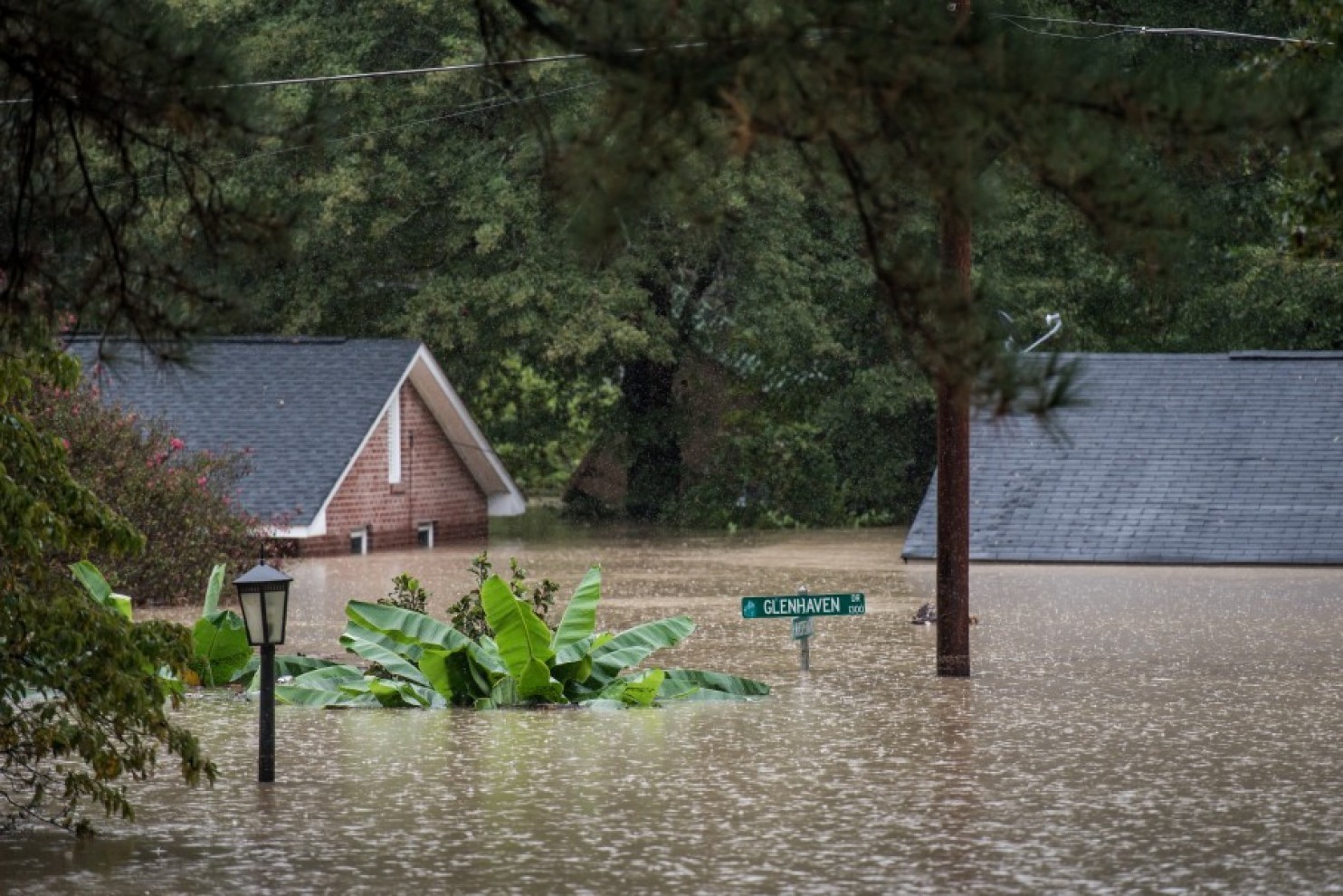
Glen Haven Dr - Courtesy Washington Post |
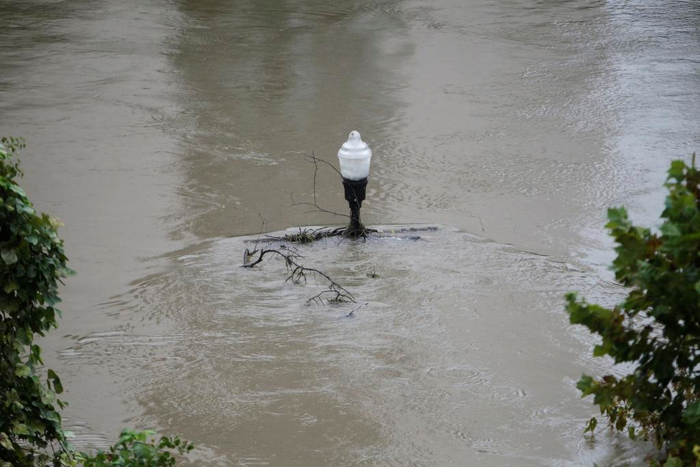
Lamp Post - Columbia, SC |
|


