On Monday, May 28th, 2018 Subtropical Storm Alberto made landfall near Laguna Beach, FL during the late afternoon and continued moving slowly northward toward the Tennessee Valley ushering warm and moist air into the Southeastern US. The Midlands and Central Savannah River Area (CSRA) were located in the front-right quadrant of the storm, which is historically favorable for tropical tornadoes.
(1).png)
May 28, 2018, 2 PM EDT Tropical Weather Outlook (National Hurricane Center)
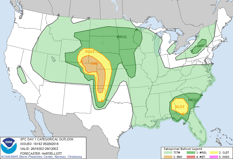
Southern South Carolina was in the marginal risk category for severe weather by the Storm Prediction Center. This included a 2% risk of tornadoes.
 |
 |
.png) |
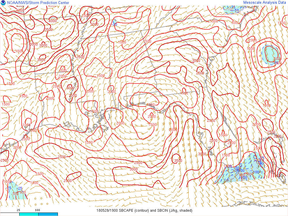 |
May 28, 2018, 2 PM EDT Surface Based Convective Available Potential Energy (SBCAPE) (J/kg) and Surface Based Convective Inhibition (SBCIN) (J/kg) (Mesoanalysis from Storm Prediction Center)
0-1km storm relative helicity values were around 75m2/s2 across southern South Carolina which supported rotating updrafts.
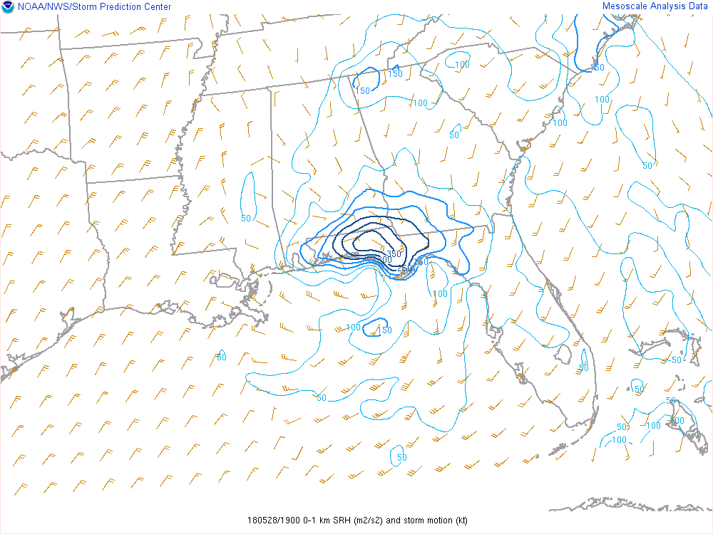 |
May 28, 2018, 3 PM EDT 0-1km Storm Relative Helicity (m2/s2) and storm motion vector (kt) (Mesoanalysis from Storm Prediction Center)
Storm Relative Velocity images from the KCAE radar show a rotational couplet tightening just before 3 PM.
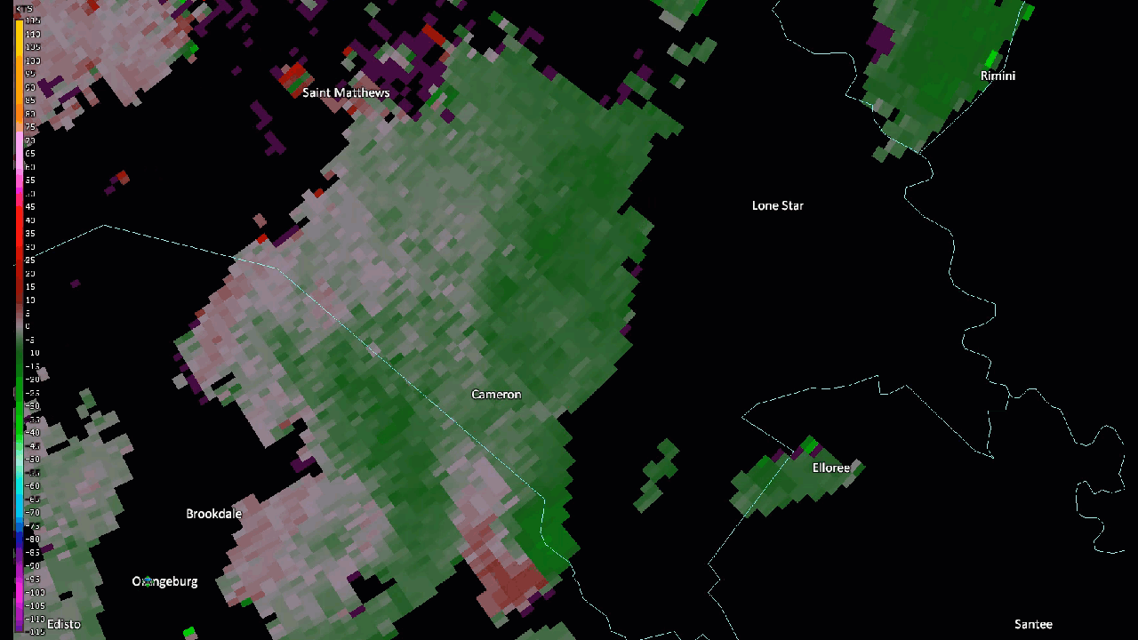 |
May 28, 2018 KCAE 0.5° Storm Relative Velocity (SRV) Loop from 2:41 pm to 3:46 pm.
The National Weather Service in Columbia confirmed that an EF0 tornado touched down near Cameron in Calhoun County, South Carolina on May 28th, 2018.
.png) |
Click image for larger view
A National Weather Service storm survey team determined that a tornado touched down near the Cameron Community Center on Saint John Road and traveled north-northeastward for 0.3 miles before lifting on May 28th, 2018 from 3:06 PM to 3:07 PM. Damage included uplifted trees, damage to the community center roof and garage door, a roof torn off of a baseball dugout, metal roofing ripped from Saint John Baptist Church, and damage to fencing and signs. Damage was consistent with an EF-0 tornado with maximum wind speeds of 80 mph.
Statistics Summary of the EF-0 Tornado in Calhoun County on May 28th, 2018
| Location | Estimated Start Time | Maximum EF-Scale Rating | Estimated Maximum Wind Speed | Maximum Path Width | Path Length | Fatalities | Injuries |
|---|---|---|---|---|---|---|---|
| Cameron, SC | 3:06 PM | EF0 | 80 MPH | 150 yards | 0.3 miles | 0 | 0 |
*This information is preliminary and subject to change pending final review of the event and publication in NWS Storm Data.
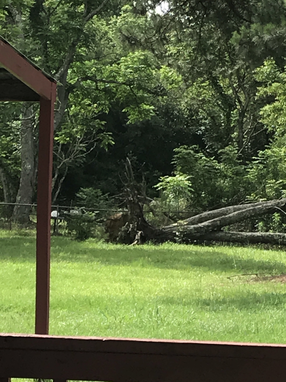 |
Hardwood tree uprooted behind a residence on Saint John Road.
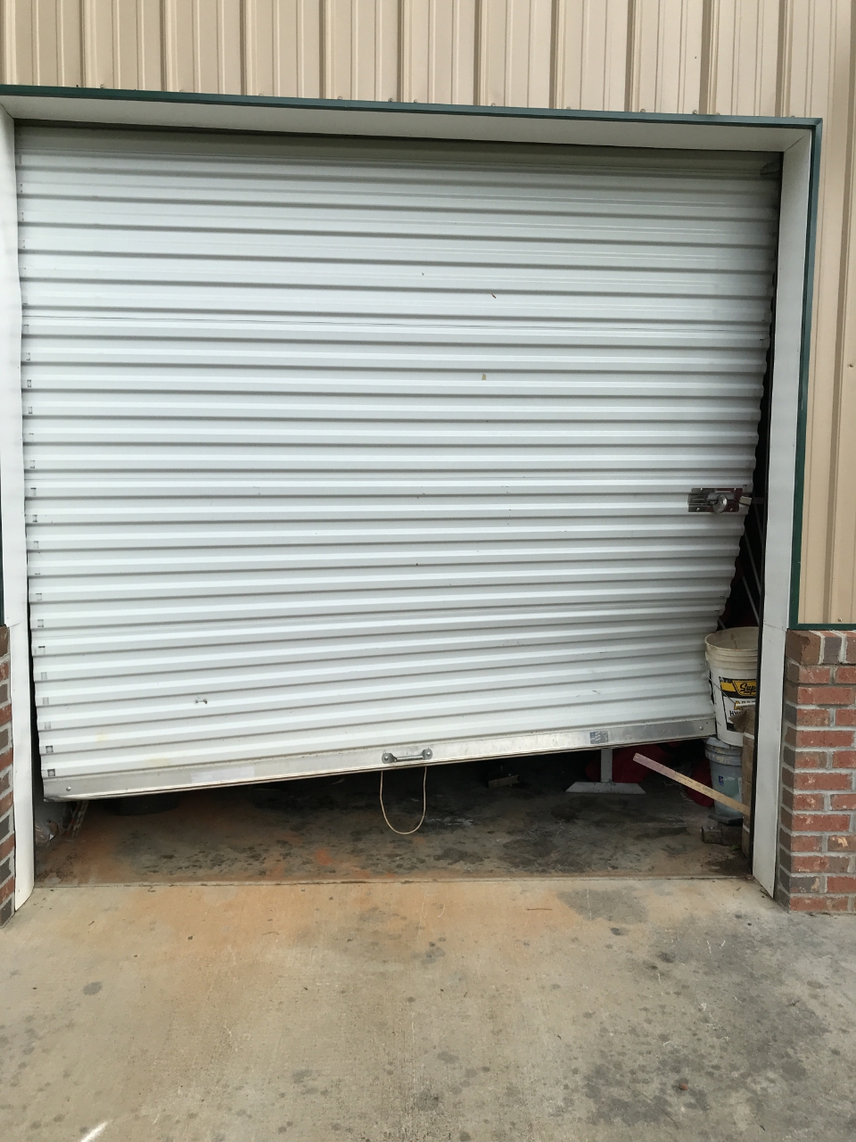 |
Garage on the Cameron Community Center blown in and twisted.
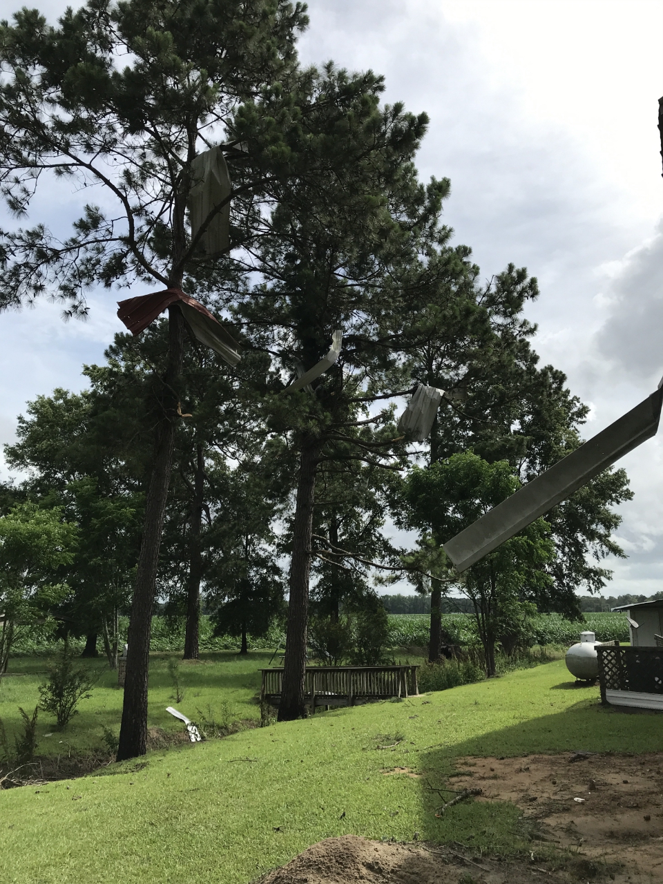 |
Metal roofing from Saint John Baptist Church flung into the trees behind the church.
 |
For reference: the Enhanced Fujita Scale classifies tornadoes
into the following categories:
EF0...Wind speeds 65 to 85 mph
EF1...Wind speeds 86 to 110 mph
EF2...Wind speeds 111 to 135 mph
EF3...Wind speeds 136 to 165 mph
EF4...Wind speeds 166 to 200 mph
EF5...Wind speeds greater than 200 mph

