Overview
|
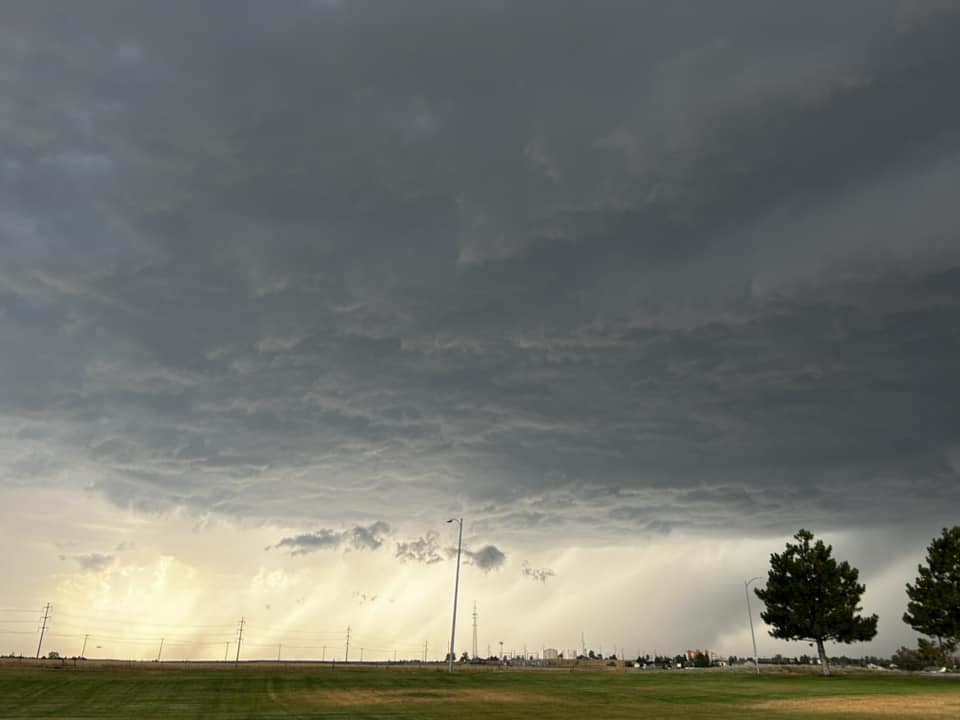
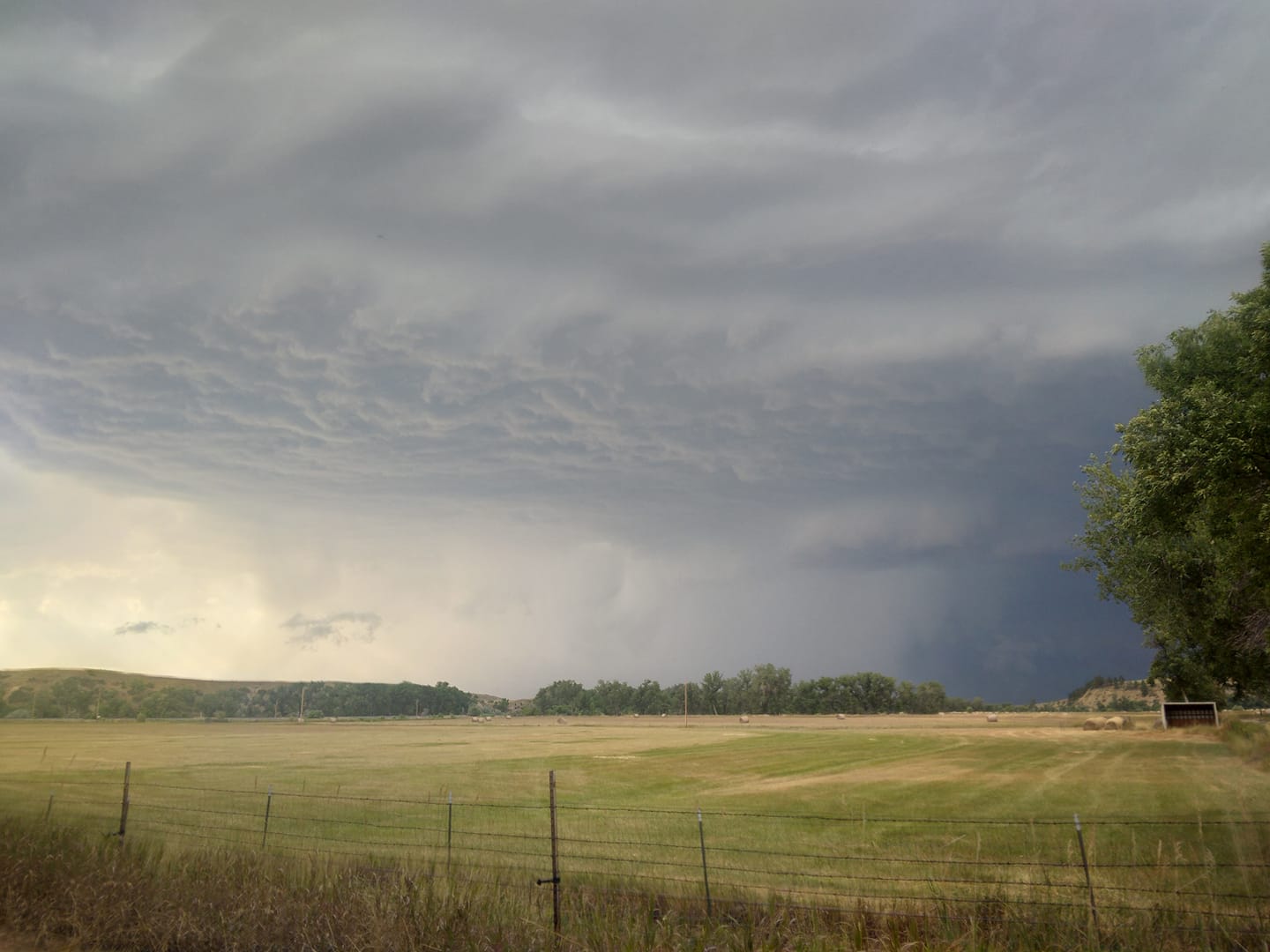
**Preliminary information and subject to change upon further review** Between 4:30 PM and 5:30 PM, a severe thunderstorm hit the Billings area, producing wind gusts up to 78 mph and causing extensive damage. The storm came from the northwest, and intensified quickly in the hour leading up to its arrival to Billings. After gusting to 76 mph at the Billings Airport, it went on from Billings and continued to produce gusts of 70 to 80 mph through Crow Agency and up to Lame Deer before quickly weakening as it went further east. The storm fortunately missed Hardin by just a few miles, passing by just to the south of town, though Hardin still had a gust to 47mph. |
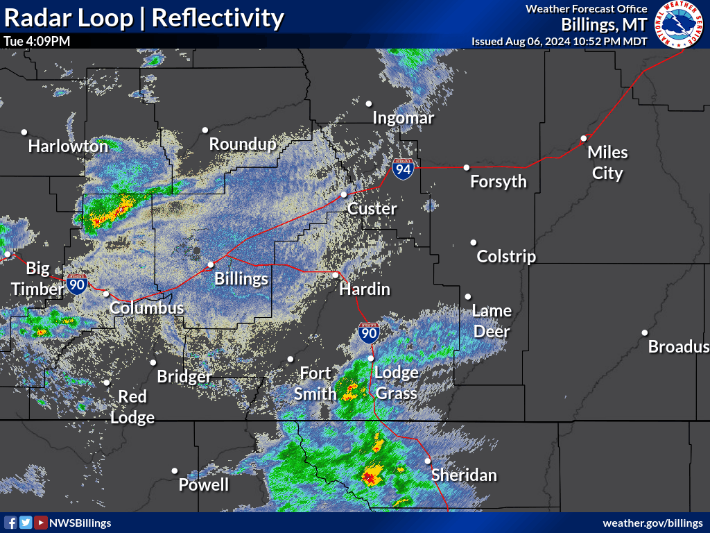 August 6, 2024 Radar Reflectivity Loop |
Photos:
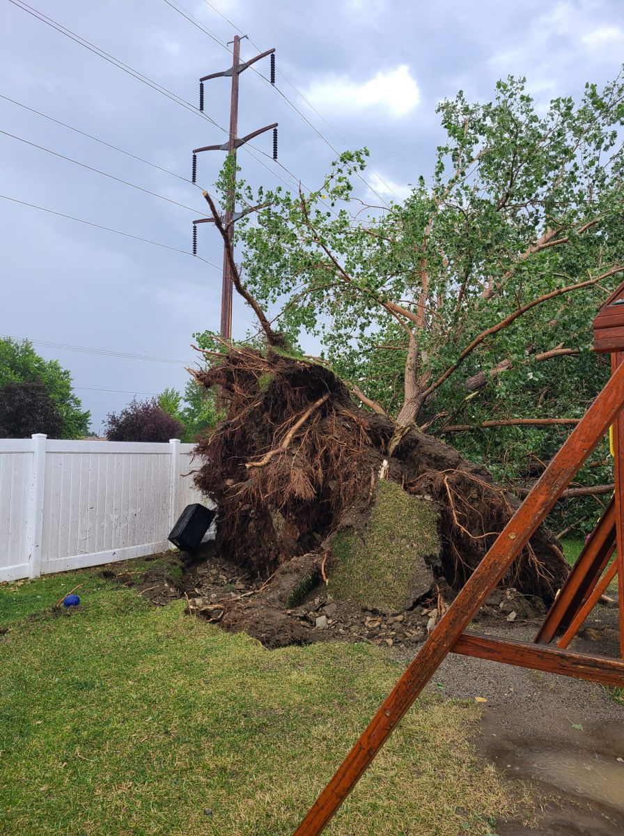
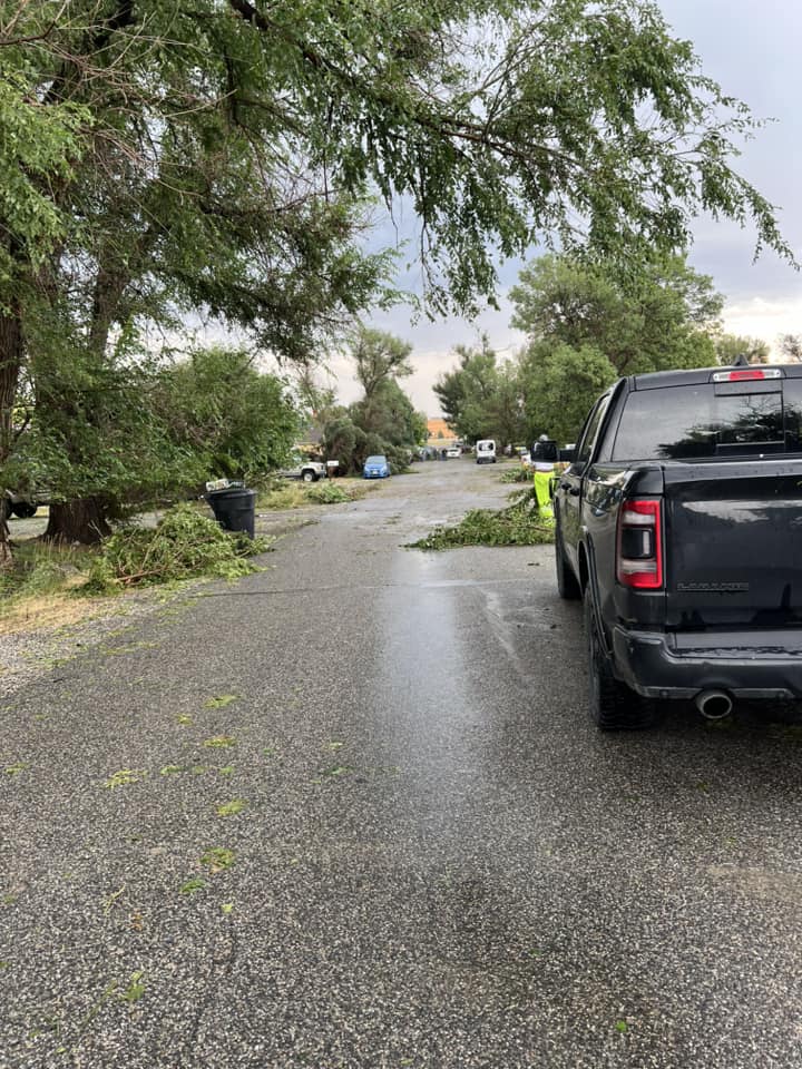
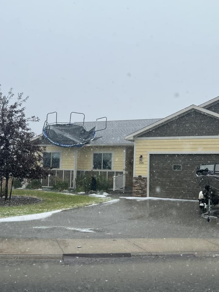
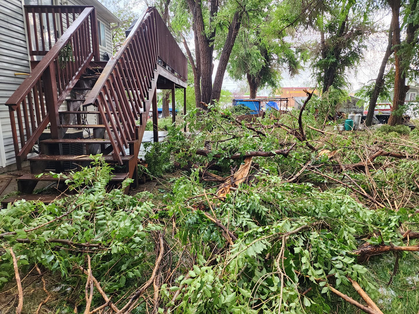
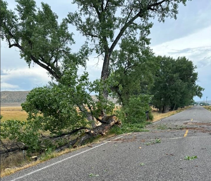
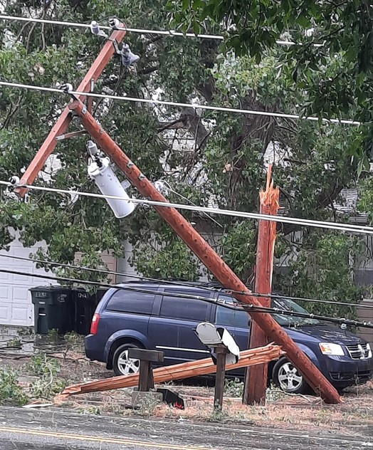
Extensive wind damage was reported in the Billings area.
 |
 |
 |
 |
| Uprooted Tree. Photo: Channa Schwab | Tree Damage. Photo: Aspen Willems Wasson | Tree Damage. Photo: Kate McLean | Wind Damage. Photo: Rob Seykora |
 |
 |
 |
 |
| From Billings Heights Looking West. Photo: Bea Marquez | Tree Damage. Photo: Tracey Grice | Tree Damage. Photo: Starla Kent | Tree Damage. Photo: Jennifer Evans |
 |
 |
 |
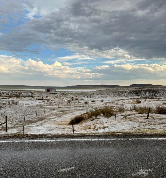 |
| Wind Damage In Lockwood. Photo: Starla Kent | Wind Damage. Photo: Luke Mangum | Wind Damage Along Pryor Road. Photo: Missy Falls Down | Hail Along Old Hardin Road. Photo: Missy Falls Down |
 |
 |
 |
 |
| Storm Near Lodge Grass, MT. Photo: Kelly Mountain Sheep | Utility Pole Damage In Billings Heights. Photo: Rayanne Choate | Tree Damage. Photo: Shawna Pyburn | Tree Damage In Billings Heights. Photo: Wendy Palato |
Reports & Timeline
Preliminary Local Storm Report...Summary
National Weather Service Billings MT
1043 AM MDT Wed Aug 7 2024

..TIME...   ...EVENT...      ...CITY LOCATION...     ...LAT.LON...
..DATE...   ....MAG....      ..COUNTY LOCATION..ST.. ...SOURCE....
            ..REMARKS..

0436 PM     Tstm Wnd Gst     2 SSW Sheridan          44.76N 106.97W
08/06/2024  M55 MPH          Sheridan           WY   ASOS


0450 PM     Tstm Wnd Gst     6 SSW Acton             45.85N 108.72W
08/06/2024  M64 MPH          Yellowstone        MT   Trained Spotter


0507 PM     Tstm Wnd Gst     1 NNW Billings          45.81N 108.54W
08/06/2024  M76 MPH          Yellowstone        MT   ASOS


0508 PM     Tstm Wnd Dmg     5 W Billings            45.80N 108.64W
08/06/2024                   Yellowstone        MT   Trained Spotter

            Snapped power pole, hanging.

0515 PM     Tstm Wnd Gst     3 SSW Lockwood          45.78N 108.43W
08/06/2024  E70 MPH          Yellowstone        MT   NWS Employee


0515 PM     Hail             2 SW Lockwood           45.80N 108.44W
08/06/2024  M1.00 Inch       Yellowstone        MT   Public

            Via social media. Reported in Lockwood.

0521 PM     Tstm Wnd Gst     6 S Lockwood            45.73N 108.40W
08/06/2024  M70 MPH          Yellowstone        MT   Other Federal


0530 PM     Tstm Wnd Gst     11 WSW Corinth          45.78N 108.16W
08/06/2024  M78 MPH          Yellowstone        MT   Dept of Highways


0715 PM     Hail             4 ENE Absarokee         45.55N 109.37W
08/06/2024  M1.00 Inch       Stillwater         MT   Public

            Report from Facebook.

0548 PM     Tstm Wnd Dmg     10 S Corinth            45.71N 107.94W
08/06/2024                   Big Horn           MT   Public

            Numerous grain bins destroyed along with
            other structural damage. Relayed via
            dispatch. Time estimated based on radar.

0614 PM     Tstm Wnd Gst     3 SSE Crow Agency       45.57N 107.44W
08/06/2024  M72 MPH          Big Horn           MT   Other Federal


0700 PM     Tstm Wnd Gst     6 SSW Stacey            45.64N 106.94W
08/06/2024  M66 MPH          Big Horn           MT   Mesonet


&&

$$
|
|
Timeline ● 4:32 PM | Severe Thunderstorm Warning issued for Billings area until 5:15 PM as the storm entered Yellowstone County. ● 4:45 PM | Initial storm begins to intensify and reaches Molt. Reported gust of 52 mph just west of Molt. ● 5:07 PM | Storm reaches the northern edge of Billings. Weather station at the airport reports a gust of 76 mph. ○ This is the second highest gust on record for Billings (at the official climate site at the airport). The highest gust ever recorded was 85 mph on July 7, 2007. ● 5:14 PM | Severe Thunderstorm Warning reissued for Billings area until 6:15 PM. ● 5:05-5:25 PM | Winds gusting 65-76 mph reported around town. Pea size hail also occurred, but a report of quarter-size hail was reported in Lockwood. ● 5:30 PM | A Weather Station at Indian Arrow (15 miles east of Billings along I-90), reported a gust of 78 mph. This is the highest recorded gust from the storm. ● 5:48 PM | Severe Thunderstorm Warning reissued, now for Hardin, Crow Agency, and Lame Deer until 6:45 PM. ● 6:00 PM | Storm moves just south of Hardin, barely missing it. They still record a gust of 47 mph at the Big Horn County Airport. ● 6:14 PM | Storm reaches Crow Agency, and the Weather Station at Little Bighorn Battlefield National Monument records a gust of 72 mph. ● 6:45 PM | Severe Thunderstorm warning reissued, now for portions of eastern Big Horn County until 7:15 PM. ● 7:00 PM | 7 miles north of Busby records a gust of 66 mph ● 6:45-7:15 PM | The storm quickly weakens before reaching Lame Deer. |
Radar
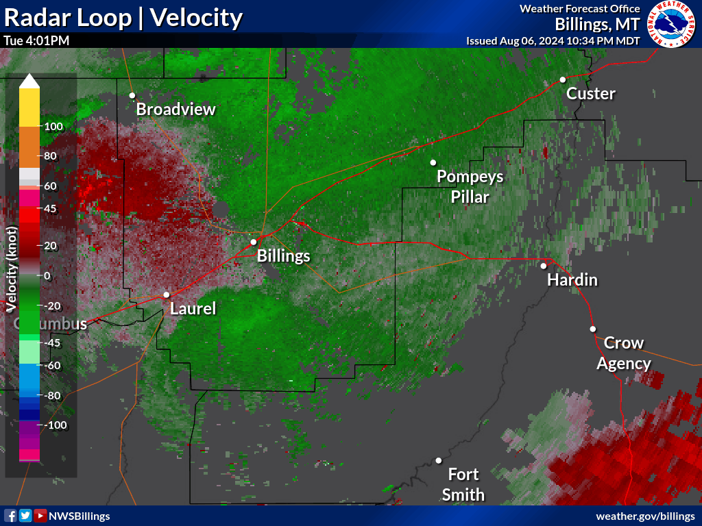 |
| August 6, 2024 Radar Velocity Loop |
 |
Media use of NWS Web News Stories is encouraged! Please acknowledge the NWS as the source of any news information accessed from this site. |
|

