Brownsville/Rio Grande Valley, TX
Weather Forecast Office
Early Morning Thunderstorms Produce Wind Damage in Southeastern Cameron County
Remnant of Eastern Pacific Tropical Storm Octave Feeds Energy Sufficient for Gusty Winds, Heavy Rainfall
Overview
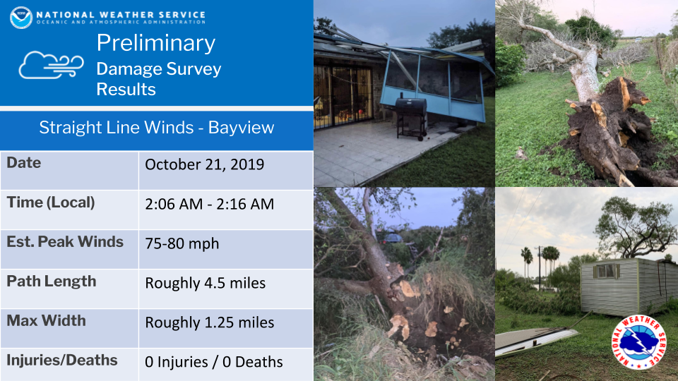
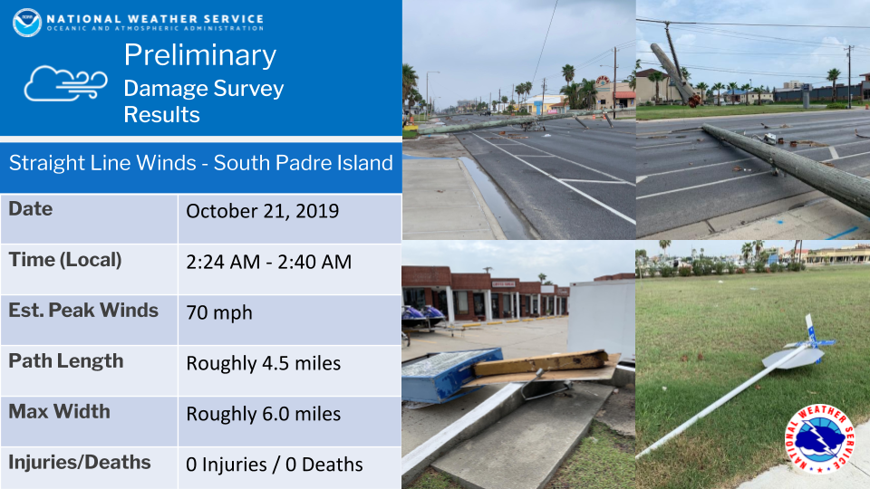
The combination of deep tropical moisture, an unstable atmosphere, and sufficient low level and mid to upper level, winds produced short period of potent thunderstorms that developed in northeast Mexico and moved quickly through Cameron County from the late evening of October 20th into the pre-dawn hours of October 21st. Individual cells raced northward at 30 mph, with wind gusts between 30 and 40 mph, from just before midnight through 3 or 4 AM. An organized stronger cluster developed a little after 2 AM, and peaked in intensity just after 230 AM. During the intensification process the cluster became a rotating thunderstorms, with a radar-indicated tornadic circulation near Boca Chica Beach. Farther north, two downburst signatures were noted (radar data coming soon), including a pulse microburst near Bayview and a more linear downburst signature that crossed South Padre Island. During the peak of the storms in Cameron County, more than 16 thousand AEP Texas utility customers lost power, and at one point all of South Padre Island had lost power due to 31 transmission poles that were taken down by the wind. Detailed mini-summaries of each surveyed event are shown below.
CURRENT HAZARDS
Daily Briefing (National)
Outlooks
Severe Weather Text
Local Storm Report
Submit a Storm Report
CURRENT CONDITIONS
Surface Observations (map)
Text Observations
Satellite
Rivers and Lakes
Observed Precip - RGV
Tides and Currents
CoCoRaHS Texas
FORECASTS
Forecaster's Discussion
Graphical
Hourly View
Activity Planner
Marine
South Padre Tides
Wave Prediction
Beach
Surf
Fire Weather
Aviation
Tropical
Winter Storm Severity Index
Model Guidance
US Dept of Commerce
National Oceanic and Atmospheric Administration
National Weather Service
Brownsville/Rio Grande Valley, TX
20 S. Vermillion Avenue
Brownsville, TX 78521
956-504-1432 (8 AM to 430 PM Mon-Fri)
Comments? Questions? Please Contact Us.

