 It was déjà vu all over again.
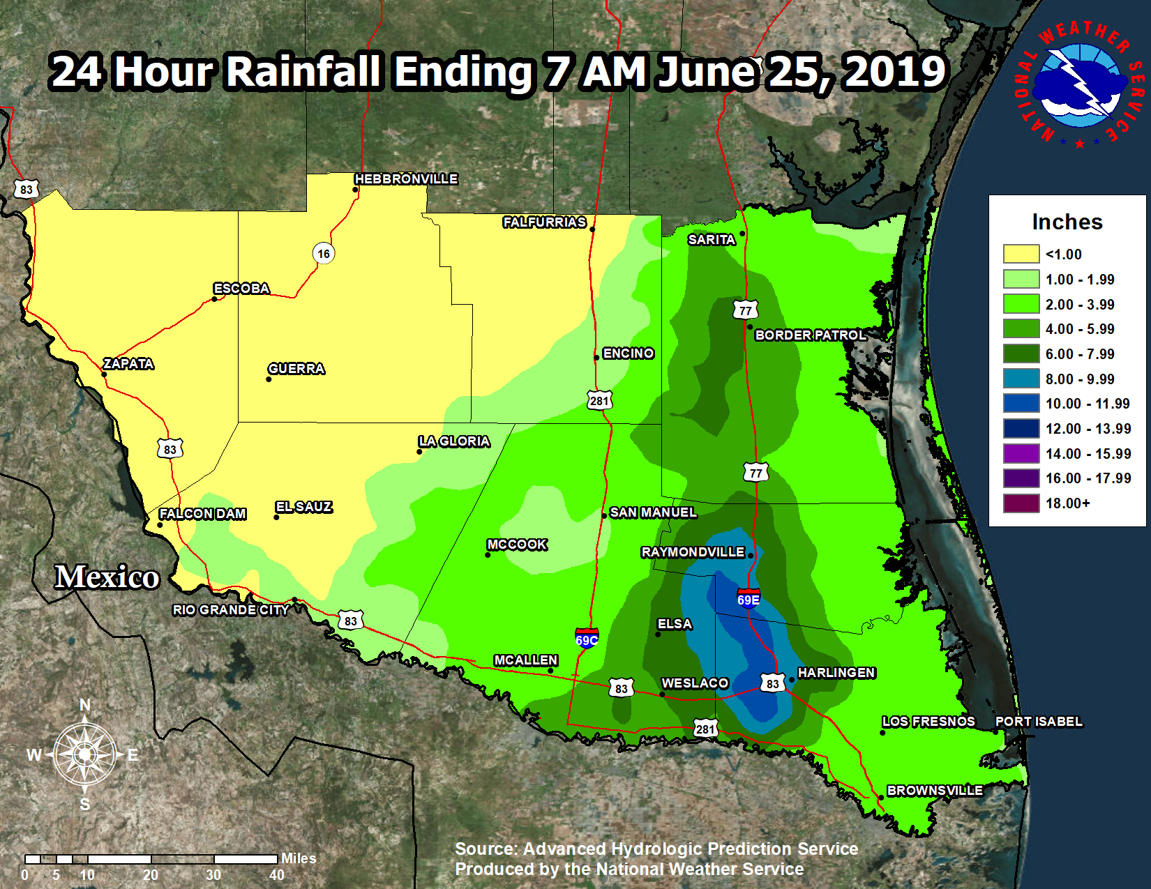
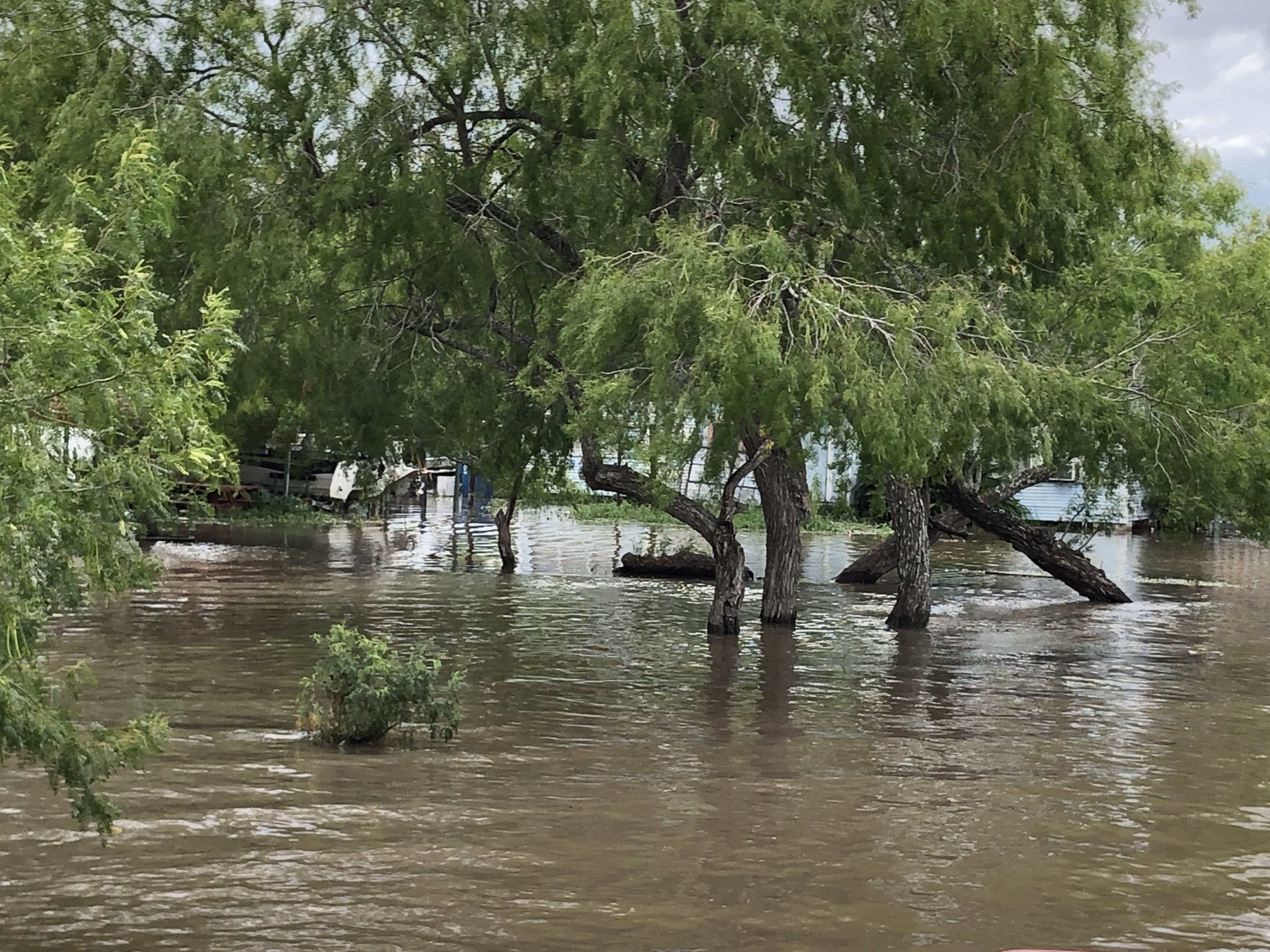
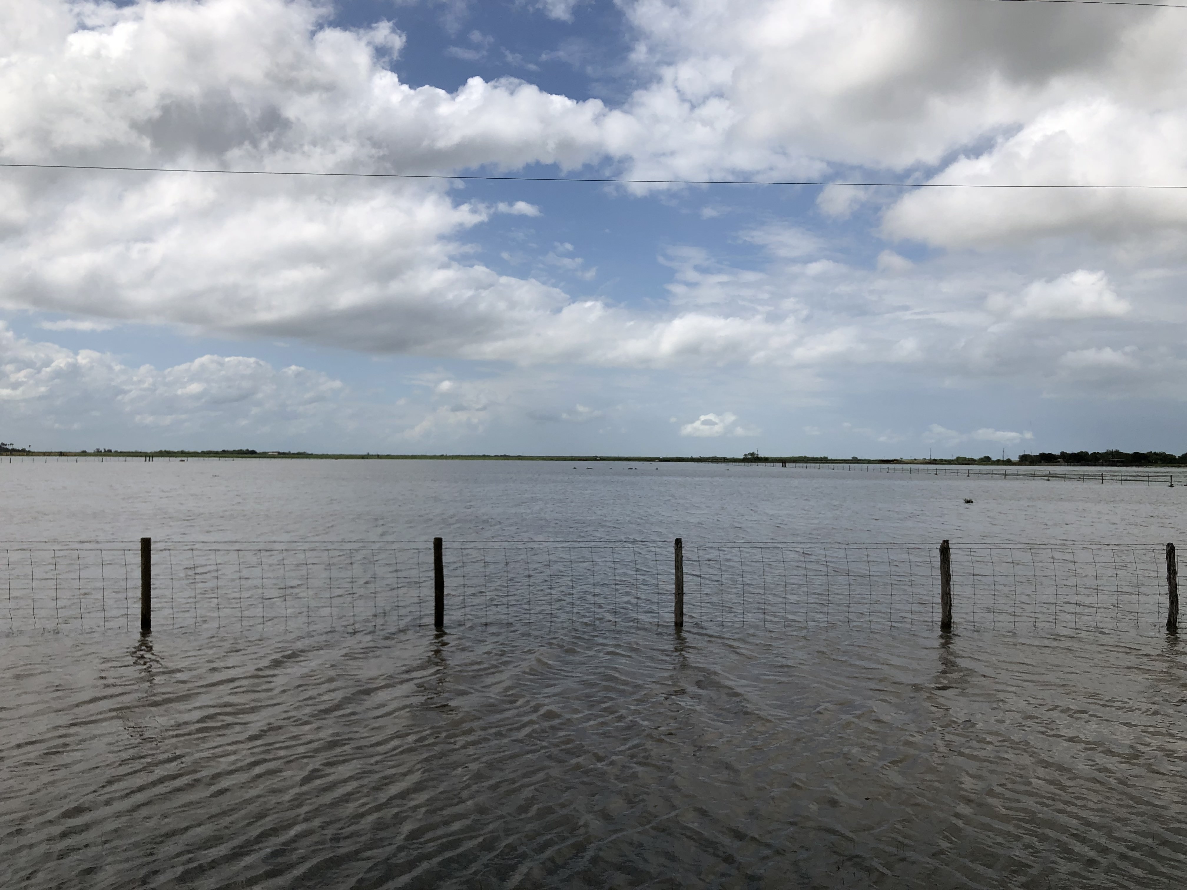
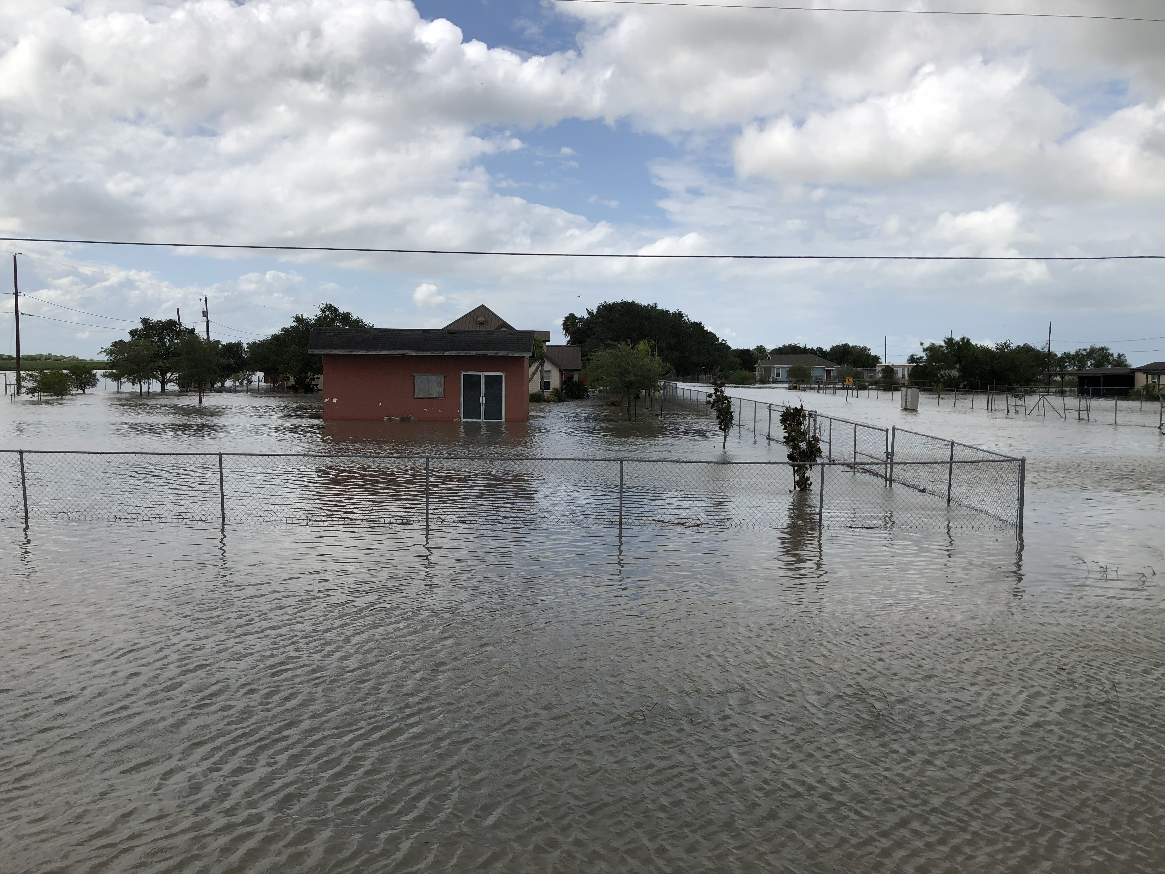
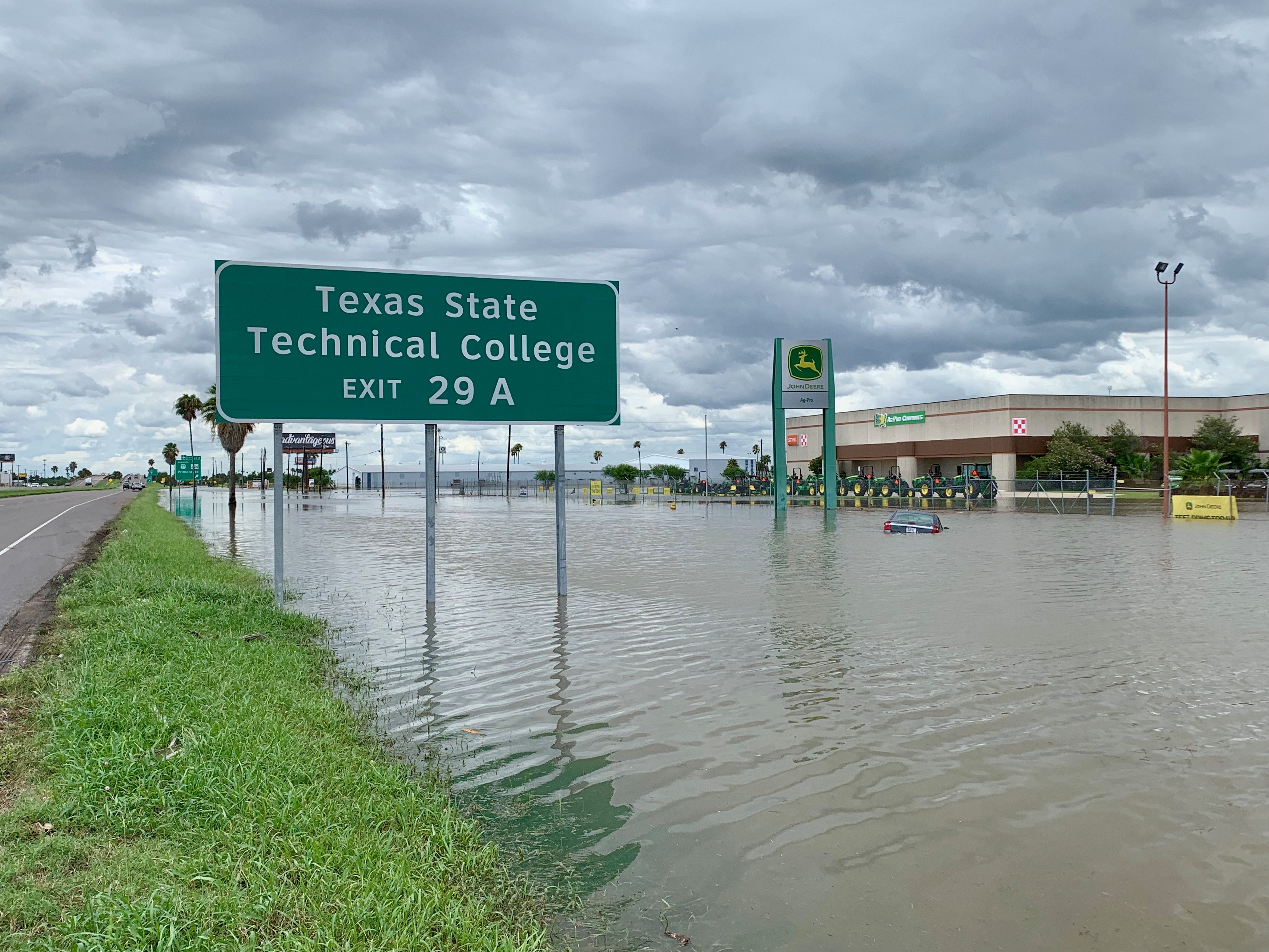
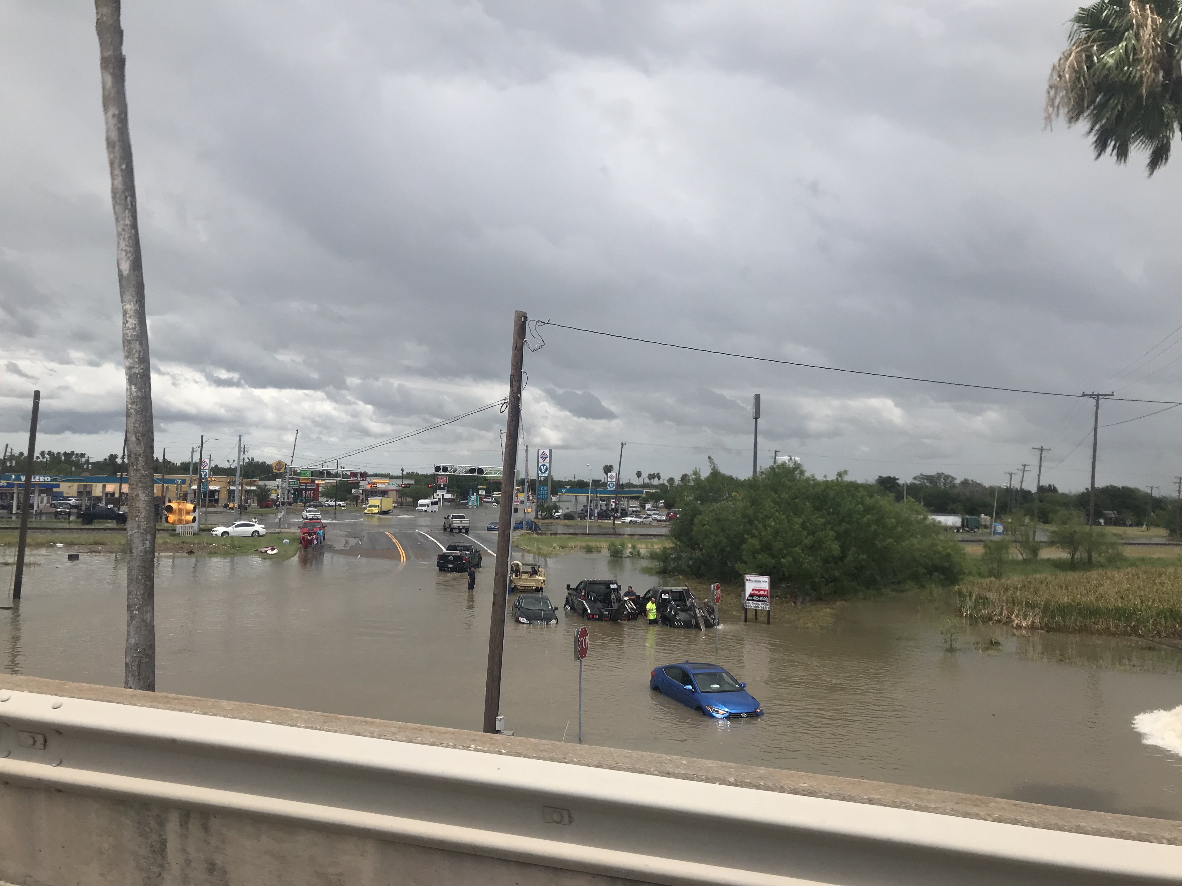
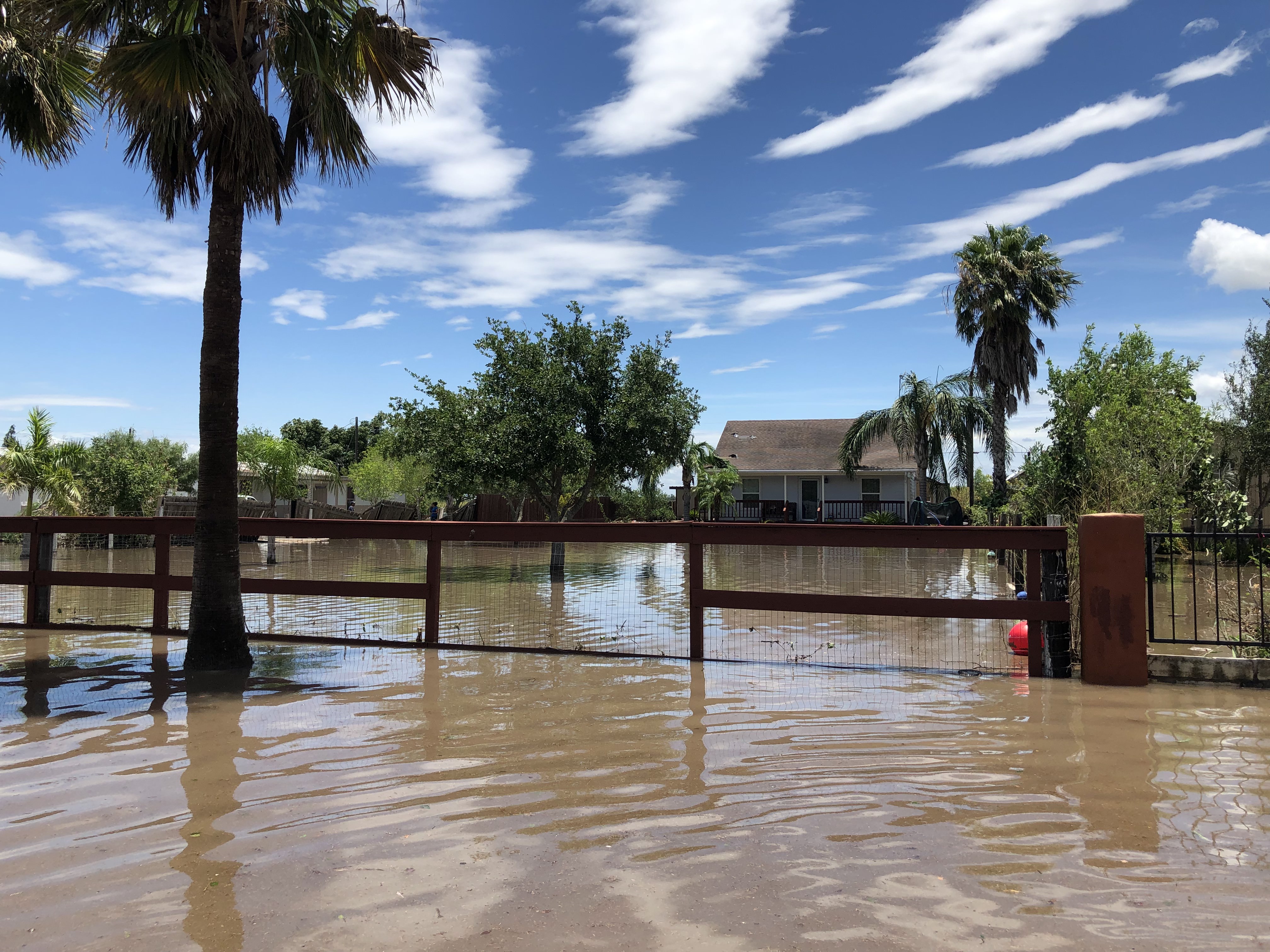
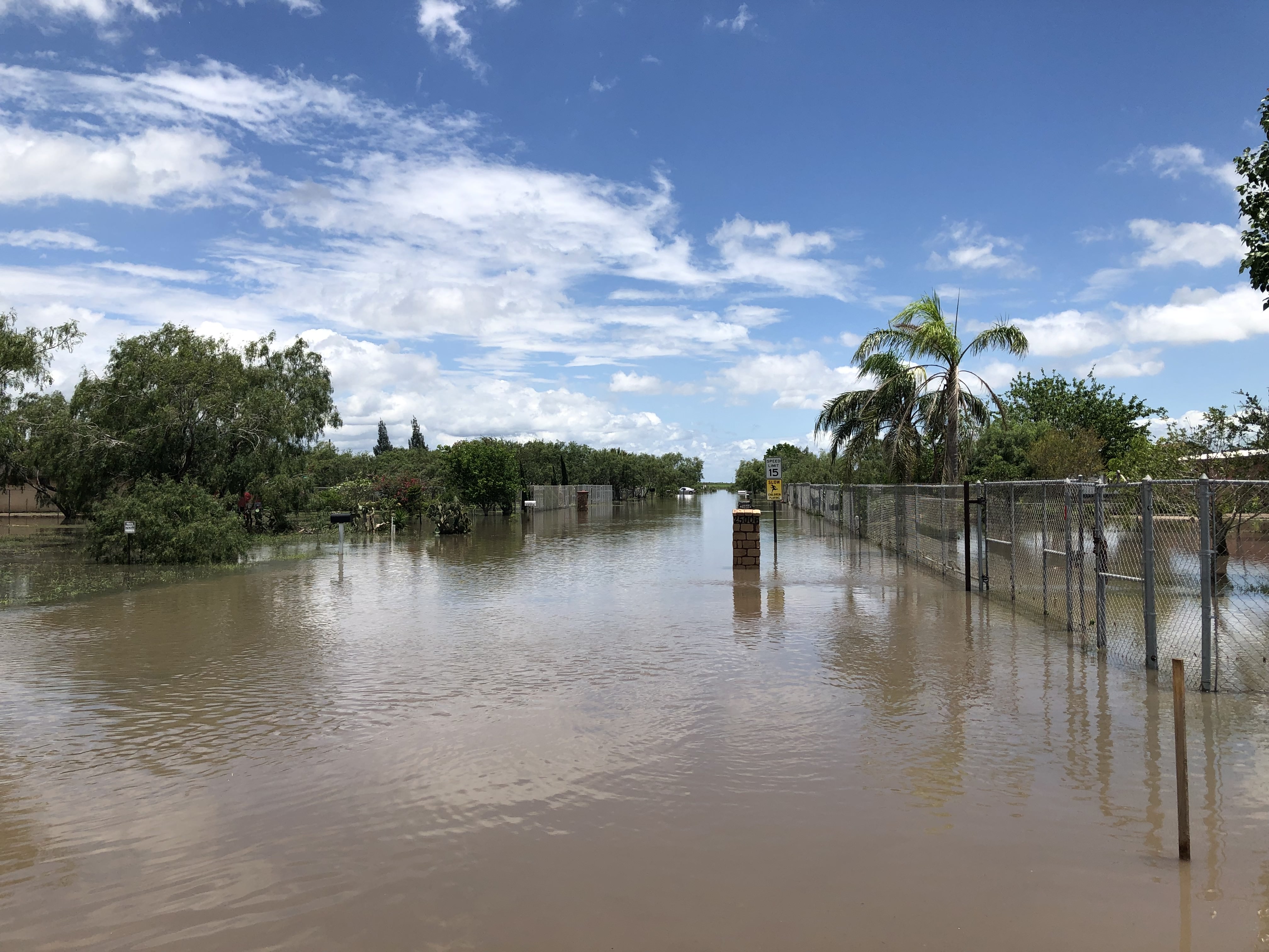
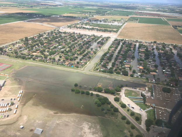
Just 367 days after the last of the Great June Flood of 2018 had left its memorable mark on nearly all of the populated Rio Grande Valley, a confluence of atmospheric events came together during the late afternoon and evening of June 24th, 2019, to produce another memorable - and unfortunate - situation for parts of the Rio Grande Valley. This time, the impacted area was smaller and less populated but the results the same. For most of Willacy County's population, the western third of Cameron, and a corner of eastern Hidalgo, the following occurred:
These single day rainfall totals, except for Brownsville and Edinburg, were above the monthly averages for June. For Harlingen, and Weslaco, these values were around three times the monthly average, and more than four times the monthly average for Raymondville.
Cities and towns with the most impact included:
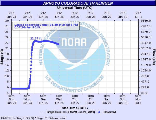
In addition to the neighborhood flooding, the location and intensity of the rainfall poured into Arroyo Colorado, with quite a bit of outflow into the Rio Grande as well.
Different Situation, Similar Result
Unlike the Great June Flood of 2018, the atmospheric setup couldn't have been any more different. This time, the situation - one that had been a persistent feature since April - was setup by yet another energy wave that moved through north central and east Texas, and spawned another round of severe weather (wind/hail) on Sunday, June 23rd. This was the initial feature that set the table to trigger the crazy...and scary...events of June 24th:
Additional details will be added to this report into July as more data are received from emergency management and other partners following damage assessments.
Public Information Statement
National Weather Service Brownsville TX
1034 AM CDT Tue Jun 25 2019

...RAINFALL AMOUNTS FROM A HEAVY RAIN EVENT ON JUNE 24TH AND 25TH...

Location                     Amount    Time/Date       Provider

...Texas...

...Cameron County...
Harlingen 4.7 WSW            11.60 in  0200 AM 06/25   COCORAHS
Harlingen 3.1 WSW            11.40 in  0700 AM 06/25   COCORAHS
Harlingen 4.4 W              11.12 in  0700 AM 06/25   COCORAHS
Harlingen 6.2 WSW            11.03 in  0700 AM 06/25   COCORAHS
Harlingen 4.2 W              11.00 in  0700 AM 06/25   COCORAHS
Harlingen 4.7 W              10.96 in  0700 AM 06/25   COCORAHS
Harlingen 0.4 N              8.60 in   0800 AM 06/25   COCORAHS
Harlingen Co-Op              6.29 in   0700 AM 06/25   COOP
Brownsville 3.5 N            4.52 in   0800 AM 06/25   COCORAHS
Lozano 1.4 S                 4.50 in   0700 AM 06/25   COCORAHS
Brownsville 1.7 NNE          4.18 in   0700 AM 06/25   COCORAHS
Brownsville 4.1 ENE          4.16 in   0800 AM 06/25   COCORAHS
Brownsville 0.1 SSE          4.05 in   0600 AM 06/25   COCORAHS
Brownsville 2.8 N            3.92 in   0800 AM 06/25   COCORAHS
Brownsville 1.5 WNW          3.73 in   0700 AM 06/25   COCORAHS
Brownsville 0.4 WSW          3.25 in   0655 AM 06/25   COCORAHS
Brownsville 2.2 W            3.14 in   0600 AM 06/25   COCORAHS
Los Fresnos 0.3 NE           3.12 in   0700 AM 06/25   COCORAHS
Brownsville 6.4 SE           2.70 in   0800 AM 06/25   COCORAHS
Los Fresnos 2.1 NNE          2.64 in   0558 AM 06/25   COCORAHS
Laguna Atascosa              2.39 in   0922 AM 06/25   RAWS
San Benito 7.8 E             2.38 in   0700 AM 06/25   COCORAHS
Brownsville 6.4 WNW          2.27 in   0740 AM 06/25   COCORAHS
Rancho Viejo 0.7 E           2.21 in   0700 AM 06/25   COCORAHS
Laguna Vista 0.3 N           1.97 in   0700 AM 06/25   COCORAHS
Laguna Vista                 1.43 in   1015 AM 06/25   CWOP

...Hidalgo County...
Santa Rosa 3 WNW Co-Op       15.20 in  0700 AM 06/25   COOP
Weslaco Co-Op                6.95 in   0726 AM 06/25   COOP
Mission                      3.46 in   1015 AM 06/25   CWOP
McAllen 3.5 N                3.20 in   0700 AM 06/25   COCORAHS
Mission 1.9 ENE              3.20 in   0730 AM 06/25   COCORAHS
Edinburg 2.4 N               3.08 in   0800 AM 06/25   COCORAHS
Mcallen                      2.83 in   1020 AM 06/25   AWS
McAllen 2.7 NNE              2.65 in   0800 AM 06/25   COCORAHS
Edinburg Co-Op               2.49 in   0700 AM 06/25   COOP
Mission                      2.37 in   1015 AM 06/25   CWOP
4 W Edinburg                 2.35 in   1020 AM 06/25   AWS
Mcallen Co-Op                2.20 in   0600 AM 06/25   COOP
Linn-San Manuel              2.19 in   0946 AM 06/25   RAWS
La Joya 11.1 N               1.90 in   0600 AM 06/25   COCORAHS
San Manuel Co-Op             1.74 in   0700 AM 06/25   COOP
La Joya Co-Op                1.65 in   0747 AM 06/25   COOP
Mission 9.6 N                1.38 in   0700 AM 06/25   COCORAHS

...Starr County...
Falcon Lake                  2.05 in   1011 AM 06/25   RAWS
Rio Grande City 17.7 NE      1.35 in   0600 AM 06/25   COCORAHS

...Willacy County...
Raymondville Co-Op           9.70 in   0700 AM 06/25   COOP
Port Mansfield Co-Op         2.53 in   0700 AM 06/25   COOP
Port Mansfield 1.1 SE        2.53 in   0700 AM 06/25   COCORAHS


Observations are collected from a variety of sources with varying
equipment and exposures. We thank all volunteer weather observers
for their dedication. Not all data listed are considered official.
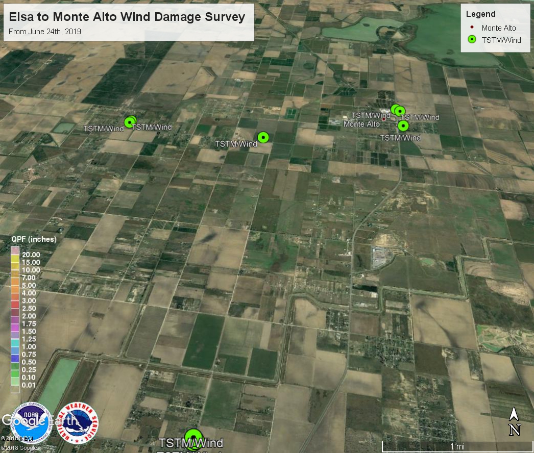
PUBLIC INFORMATION STATEMENT
NATIONAL WEATHER SERVICE BROWNSVILLE TX
947 PM CDT Tue Jun 25 2019

...NWS DAMAGE SURVEY FOR 06/24/2019 THUNDERSTORM WIND EVENT...

.MONTE ALTO STRAIGHT LINE WIND EVENT...

ESTIMATED PEAK WIND:    65 to 75 MPH
PATH LENGTH (STATUTE):  8.00 MILES
PATH WIDTH (MAXIMUM):   3.75 MILES
FATALITIES:             NONE
INJURIES:               NONE

START DATE:             JUN 24, 2019
START TIME:             0713 PM CDT
START LOCATION:         1.50 MILES NORTH OF MONTE ALTO
START LAT/LON:          26.3999/-97.9612

END DATE:               JUN 24, 2019
END TIME:               0730 PM CDT
END LOCATION:           1.75 MILES NORTHEAST OF SAN CARLOS
END LAT/LON:            26.3181/-98.0460

A SEVERE THUNDERSTORM PRODUCED SPORADIC STRAIGHT LINE WIND DAMAGE
FROM MONTE ALTO TO PORTIONS OF NORTH ELSA DURING THE EVENING OF
JUNE 24TH. STORM MOTION WAS SOUTHWEST AND BEGAN SNAPPING LARGE
TREE LIMBS AND UPROOTING A FEW TREES ON THE EAST SIDE OF MONTE
ALTO. WINDS ALSO CAUSED A FREE STANDING METAL TOWER TO COLLAPSE.
AS THE STORM MOVED SOUTHWESTWARD, LARGE SWATHS OF SUGAR CANE WERE
NOTICEABLY BENT TOWARDS THE GROUND. FURTHER WEST, TWO POORLY
CONSTRUCTED MOBILE HOMES WERE COMPLETELY DESTROYED AND ANOTHER WAS
ROLLED ON ITS SIDE. CLOSER TOWARDS ELSA OFF OF MONTE CRISTO RD
WERE OVER A DOZEN WOODEN POWER POLES SNAPPED ACROSS N MILE FIVE
1/2. IN ADDITION, SOME METAL SHEET ROOFING WAS TORN OFF OF A
NEARBY HOME AND A STORAGE SHED HAD CONSIDERABLE DAMAGE TO WALLS
AND ROOFING. CONSIDERING BUILDING MATERIALS AND CONDITION, PEAK
WIND SPEEDS WERE ESTIMATED AT 65 TO 75 MPH. SPECIAL THANKS TO
HIDALGO COUNTY EMERGENCY MANAGEMENT FOR THEIR ASSISTANCE.

NOTE:
THE INFORMATION IN THIS STATEMENT IS PRELIMINARY AND SUBJECT TO
CHANGE PENDING FINAL REVIEW OF THE EVENT AND PUBLICATION IN NWS
STORM DATA.
For a map, specific survey details, and photos of wind damage along the general path of the straight line winds in eastern Hidalgo County, click the image below. Download Google Earth to interact with the map after clicking

| June 24th, Afternoon: Kenedy to Willacy, reflectivity | June 24th, Afternoon: Southwest Kenedy, velocity |
|---|---|
 |
 |
| June 24th, Evening: Eastern Rio Grande Valley | |
 |
Satellite Videos
Full Disk GOES-East Clean IR Satellite Imagery - June 24, 2019 146 PM through 1141 PM (Wide View) |
Full Disk GOES-East Clean IR Satellite Imagery - June 24, 2019 454 PM through 1126 PM (Zoomed View) |
| Arroyo Colorado near Harlingen | Rio Grande Near San Benito |
|---|---|
 |
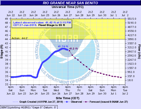 |
| Rio Grande near Brownsville | |
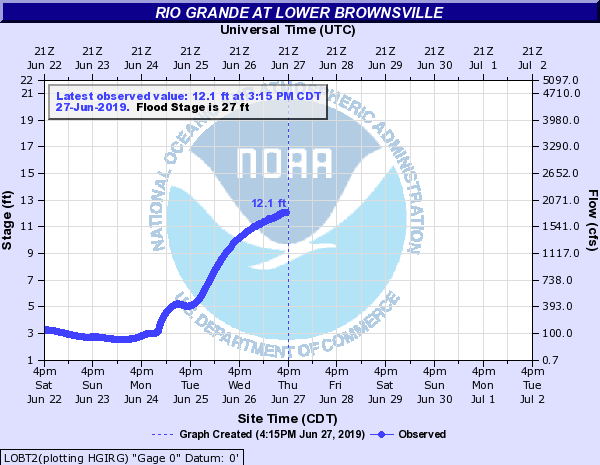 |

