|
Overview
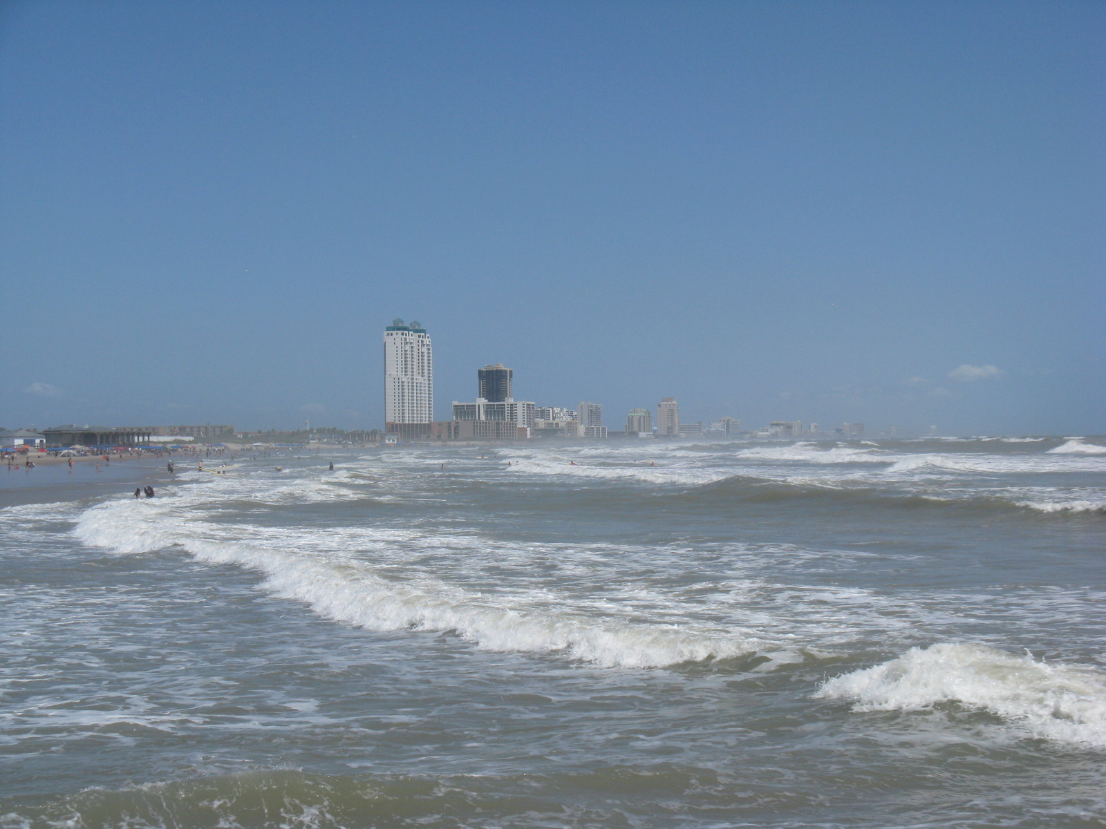
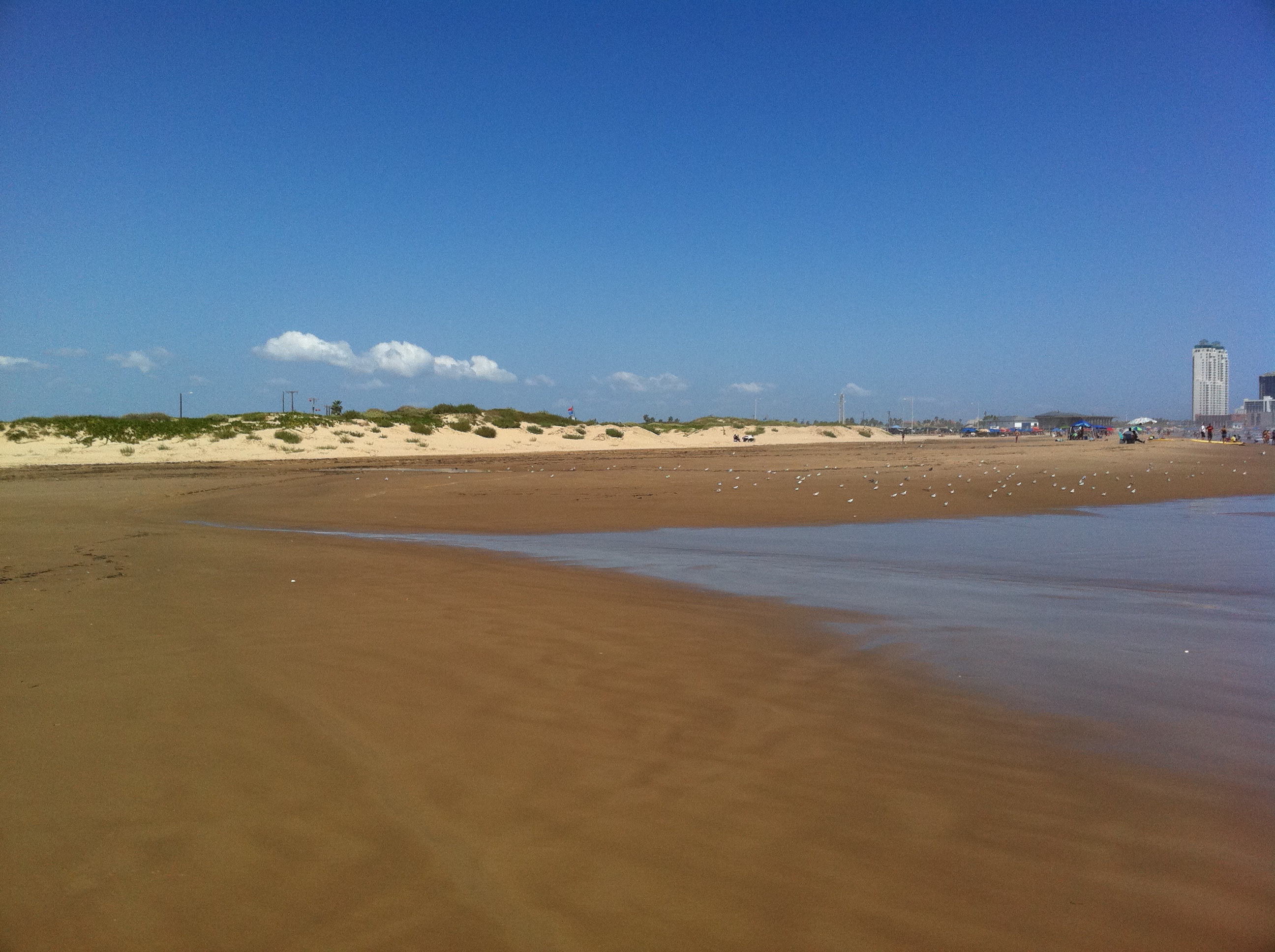
Tropical Storm Lee, spinning along the Louisiana Coast to begin the 2011 Labor Day weekend, pushed another batch of heat and sunshine across the Rio Grande Valley for the second time in a week, breaking a number of temperature records across several sites (below) on the calendar days of September 3rd and 4th, before a drying front brought significantly lower humidity and took away some of the heat by Labor Day Monday (September 5th). While Lee was scorching the land, the storm was stirring up the Gulf. Swells radiating from the slow moving system combined with astronomical high tides to build high surf and bring tide levels to the base of the dunes in some areas (above). Surfing waves approached 7 feet early on September 3rd before gradually subsiding through the weekend.
The Heat
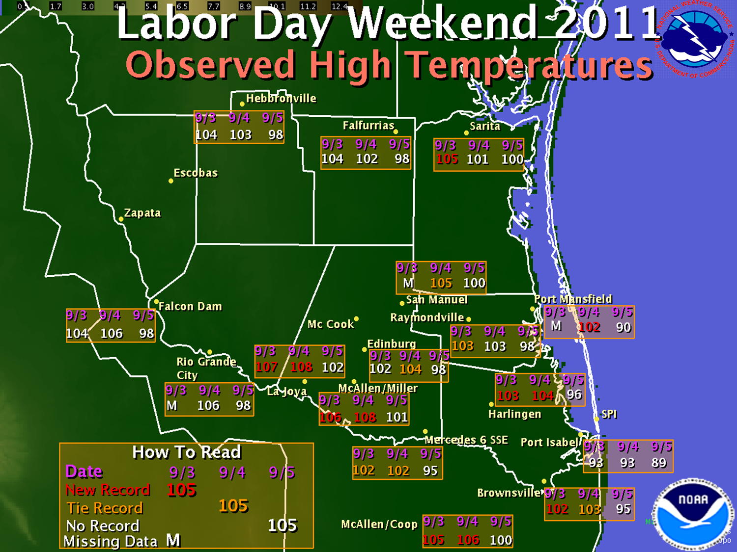
If it’s Sunday, it must be hot. So it seemed on September 4th, which surpassed August 28th as one of the hottest days of the year; in fact, when averaging temperatures from the Rio Grande Plains to the coast, the 28th surpassed May 20th as the hottest day, period. Even locations within 5 miles of the Gulf shore passed 100°F with Port Mansfield roasting at a record 102°F and Bayview/Cameron County Airport checking in with 101°F. Records fell across portions of the Lower and Mid Valley on the 3rd and 4th before mainly sub–100°F temperatures arrived on the 5th. Impressive as these temperatures were, for the Valley and Deep South Texas, the three day period fell shy of the hottest similar period in 2000, where temperatures ranged from near 105 in the Lower and Mid Valley to 110 in the Upper Valley and Brush Country.
Still, hot is hot. As of this writing, the NWS has heard of no significant human impact from the searing heat, despite a large number of outdoor activities across the Valley. Thanks to our public safety officials, media partners, and the community as a whole for staying safe in the heat.
The Surf
As thunderstorms pounded the central Gulf while Lee spun up, wind and wave energy radiated west toward South Padre Island, and by late afternoon September 2nd, tides had increased to more than 1 foot above predicted levels – already at astronmical high values (second highest for the month of September; highest predicted tides were forecast for the last few days of the month). Surf waves quickly built toward head height, and tides had risen toward the dunes, particularly at public beach access points north of the resorts. These beaches were quickly closed by Cameron County officials late on the 2nd, and tides continued to rise overnight, peaking at high tide after midnight and through daybreak on the beach and on the bayside. The high, rough, and confused surf kept the large holiday weekend crowds from venturing too far, and many people remained in water waist high or less on the 3rd. Conditions gradually subsided later on the 3rd through Sunday, September 4th, with waves lowering to 3 feet on Labor Day. Despite the lower waves, rip current risk remained moderate to high through the 5th. As of this writing, there were no reports of drownings due to the dangerous surf and rip currents despite large holiday weekend crowds.
...and The Fire
Or, the fire that never started. Perhaps a combination of advance warning, prudence, and good luck, no significant wildfires developed across Deep South Texas during the most critical threat periods during the afternoon of September 4th and again in many areas on September 5th. On the 4th, as temperatures soared in the 102 to 108°F range, humidity crashed below 15 percent along and west of Highway 281, accompanied by sustained winds of 15 to 20 mph with a few gusts to 25 mph. Such was not the case in Central, East, and Southeast Texas, where wildfires scorched hundreds of thousands of acres after ignition on the 4th.
Just How Dry?
Tropical Storm Lee’s development along the Louisiana coast, combined with a deepening mid atmospheric trough of low pressure sliding through the eastern half of the U.S., reinvigorated the "La Canícula" ("Dog Days") ridge of high pressure across the southwest U.S. and northern Mexico, funneling unusually dry air into all of Texas, including the Rio Grande Valley, at a time when typically the most rain falls. Each passing day of no rain puts the mid and upper Rio Grande Valley and Brush Country closer to an all time record driest water year (October 1 through September 30). Less than 10 inches of rain had fallen since October, 2010, mainly west of Highway 281 – only 10 to 25 percent of average. Extreme and Exceptional drought may well expand across the Valley if little or no rain falls before the end of September 2011. A map of rainfall for October 1st, 2010 through September 5th, 2011, can be found here.
|

