|
Overview
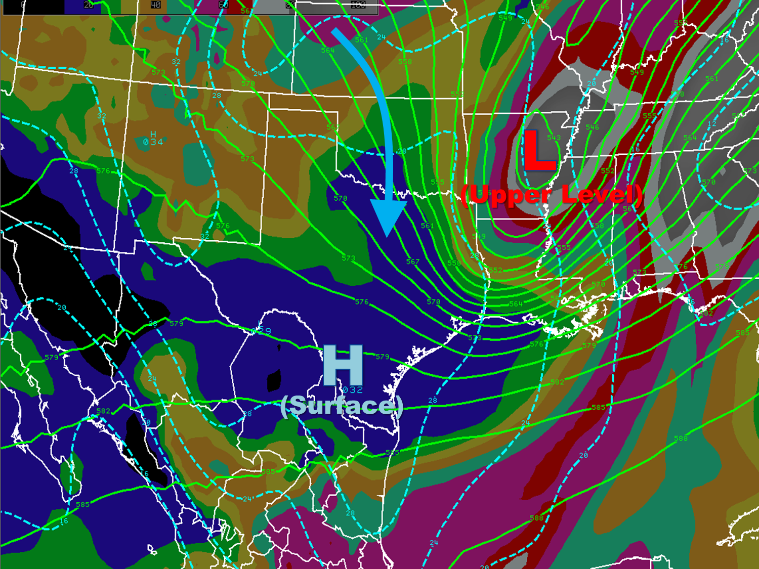
A series of upper level disturbances dropping from Alaska into the Desert Southwest U.S. during the first days of December brought terrifying Santa Ana Winds to Southern California, followed by unusually strong winds, then cold and snow to northern New Mexico over the first weekend of the month. The second wave of cold arrived in the Texas Panhandle on the 5th, courtesy of an arriving disturbance from the northern Rockies. The systems would phase by December 6th, then move past Texas by early on the 7th (below). As the strengthening upper system moved through the ArkLaTex, surface high pressure with a touch of arctic air drove through Texas, bringing another shot of dry, cold weather to the Rio Grande Valley.
Two More Freezes
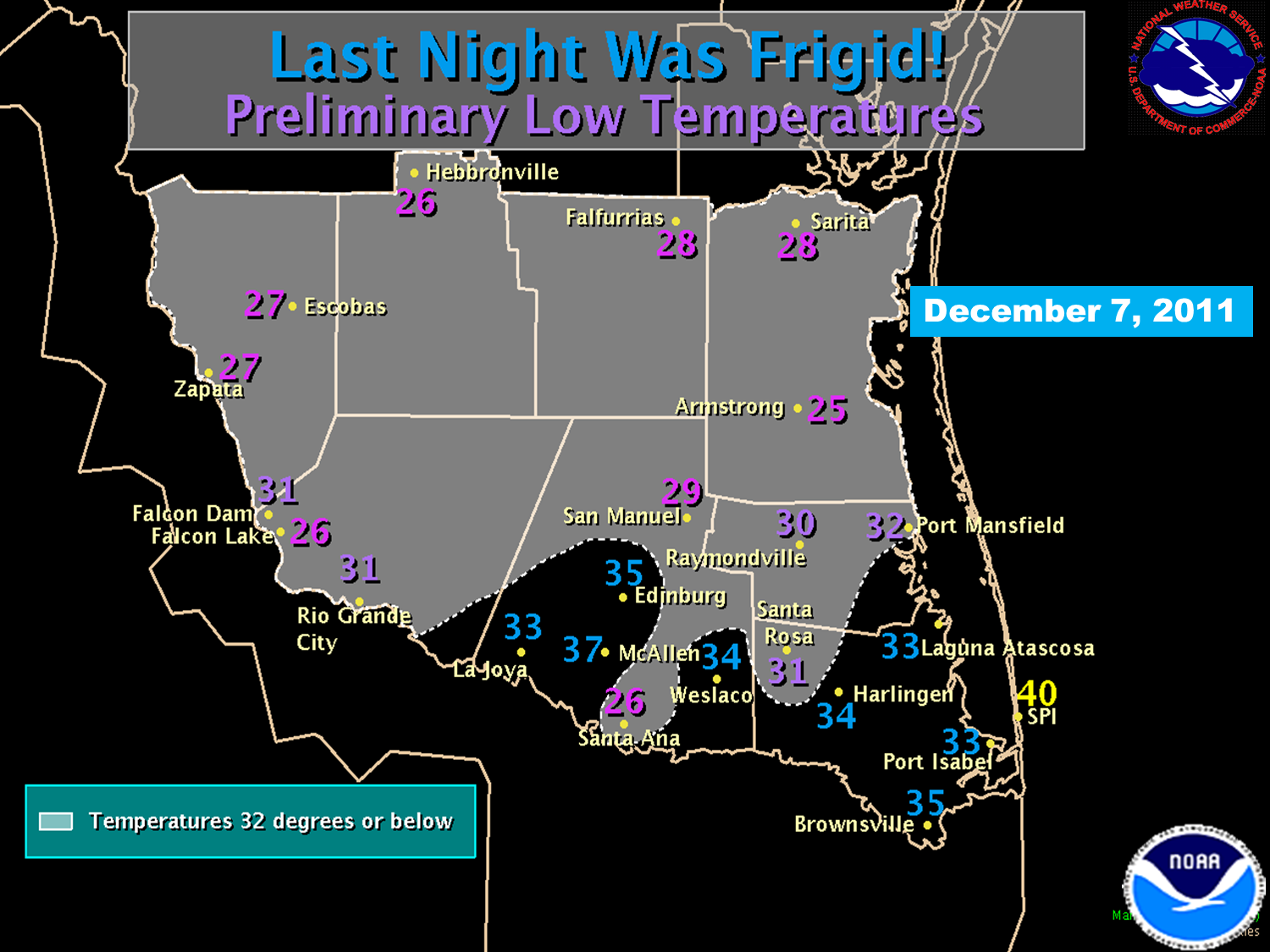
December 7th: Temperatures hovering near 50°F under a steely gray overcast during the afternoon of the 6th set the stage for a steady drop overnight, as skies cleared rapidly. By midnight on the 7th, ranchland locations from Zapata to Kenedy County had dipped into the lower to mid 30s, on their way to morning lows on the 7th in the mid to upper 20s. Across the Rio Grande Valley, temperatures fell into the 30s a few hours prior to daybreak, and sheltered/wind protected areas reached 32°F or lower between 4 and 6 AM. Low temperatures varied based on wind exposure and urban/rural locations. Where winds remained near or above 5 mph, and in urban centers such as McAllen, temperatures stayed in the mid 30s. Somewhat similar to the freeze on November 28th, dry air filtering into the region from the north kept humidity values in the 75 to 90 percent range, enough to preclude frost.
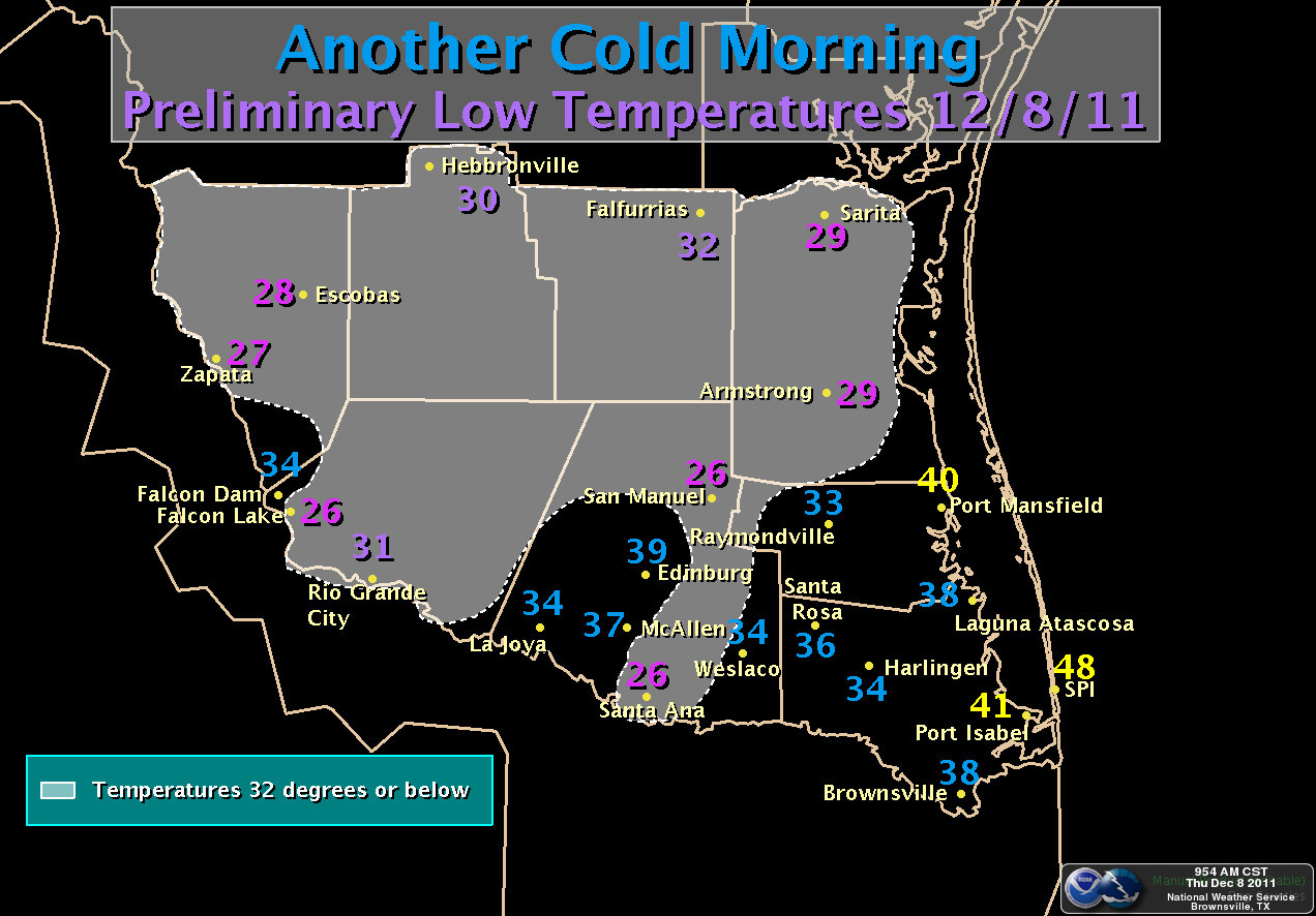
December 8th: Mostly clear skies, a dry start, and calm winds allowed temperatures to fall rapidly after sunset on the 7th, from still cool afternoon temperatures around 60 down into the 40s by 9 PM in most areas. By 10 PM, sheltered locations across the Upper Valley to the King Ranch had reached the upper 30s, on their way to minimum temperatures once again in the mid to upper 20s. Across the Lower Valley, low level winds began turning to the east; while surface winds were light to calm, the influence of the warmer Gulf brough temperatures up a few degrees in most areas when compared with December 7th. Still, a chilly morning (above, right).
The back to back freezes compounded the persistent drought, with the coldest temperatures across locations where Exceptional (D4, the worst level) Drought held forth.
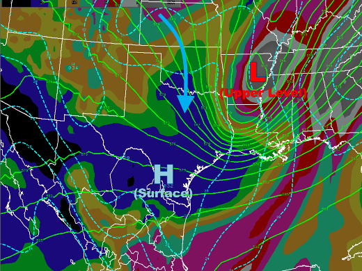
Chart of 500 mb flow pattern (green lines), surface pressures (dashed cyan lines), and mean relative humidity between 1000 and 500 mb (color shading) at 6 AM CST Wednesday, December 7th, 2011. Note the dry flow (cyan arrow) bringing Canadian air into Texas behind the Upper Level Low pressure system centered in Arkansas. Dark blue color shade indicates humidity below 30 percent; black shades below 10 percent. |

