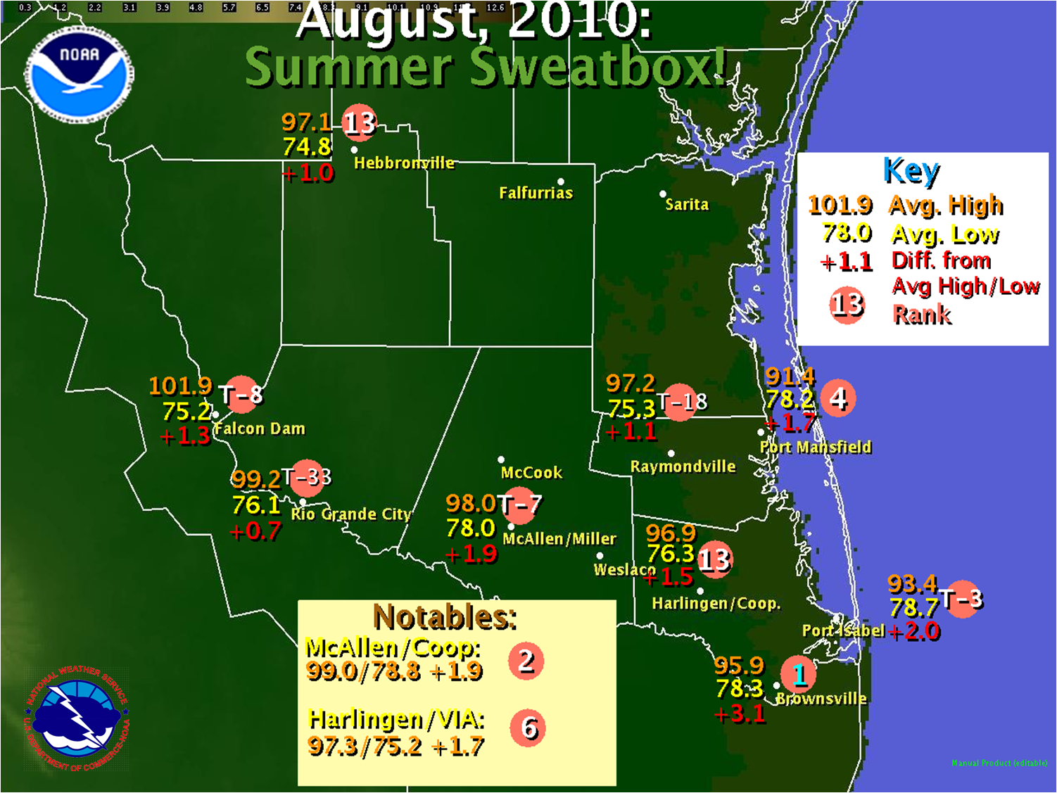
 Preliminary, unofficial average highs, lows, departures, and rank, for August 2010. August 2010: South Texas Sauna Record to Near Record Heat Across Deep South Texas |
|
Overview A brief climate review for August 2010 follows. Additional rainfall information, links, and other data may be provided in the next few weeks.
PUBLIC INFORMATION STATEMENT NATIONAL WEATHER SERVICE BROWNSVILLE TX 511 AM CDT WED SEP 1 2010 ...AUGUST 2010 CLIMATE ROUNDUP FOR DEEP SOUTH TEXAS... RECORD DATES FOR EACH LOCATION ARE AS FOLLOWS: BROWNSVILLE RECORDS BEGAN 1878... HARLINGEN RECORDS BEGAN 1911... MCALLEN RECORDS BEGAN 1941... .BROWNSVILLE... THE AVERAGE TEMPERATURE IN BROWNSVILLE FOR AUGUST WAS 87.13 DEGREES...3.1 DEGREES ABOVE NORMAL. THIS IS THE WARMEST AUGUST ON RECORD...AND THE THIRD WARMEST RECORDED MONTH IN BROWNSVILLE...BEHIND JUNE 1998 AND JULY 1980. ONE RECORD HIGH MINIMUM TEMPERATURE WAS SET ON THE 30TH. BROWNSVILLE AIRPORT RECEIVED 0.92 INCHES OF RAIN IN AUGUST...2.07 INCHES BELOW NORMAL. THIS IS THE 38TH DRIEST AUGUST IN BROWNSVILLE HISTORY. .HARLINGEN... THE AVERAGE TEMPERATURE IN HARLINGEN FOR AUGUST WAS 86.24 DEGREES...1.7 DEGREES ABOVE NORMAL. THIS IS THE 17TH WARMEST AUGUST ON RECORD WHEN COMBINING THE COOPERATIVE LOCATION WITH VALLEY INTERNATIONAL AIRPORT. TWO RECORD HIGH MINIMUM TEMPERATURES WERE SET OR TIED ON THE 20TH AND 30TH. HARLINGEN AIRPORT RECEIVED 0.16 INCHES OF RAIN IN AUGUST...2.76 INCHES BELOW NORMAL. THIS IS THE 8TH WETTEST AUGUST IN HARLINGEN...AND THE DRIEST AUGUST SINCE 1958. .MCALLEN... THE AVERAGE TEMPERATURE IN MCALLEN/MILLER AIRPORT FOR AUGUST WAS 87.98 DEGREES...1.9 DEGREES ABOVE NORMAL. THIS IS THE 7TH WARMEST AUGUST ON RECORD FOR MCALLEN. THREE RECORD HIGH MINIMUM TEMPERATURES WERE SET OR TIED ON THE 8TH...15TH...AND 30TH. MCALLEN AIRPORT RECEIVED 0.26 INCHES OF RAIN IN AUGUST...2.47 INCHES BELOW NORMAL. THIS IS THE 14TH DRIEST AUGUST ON RECORD.
|
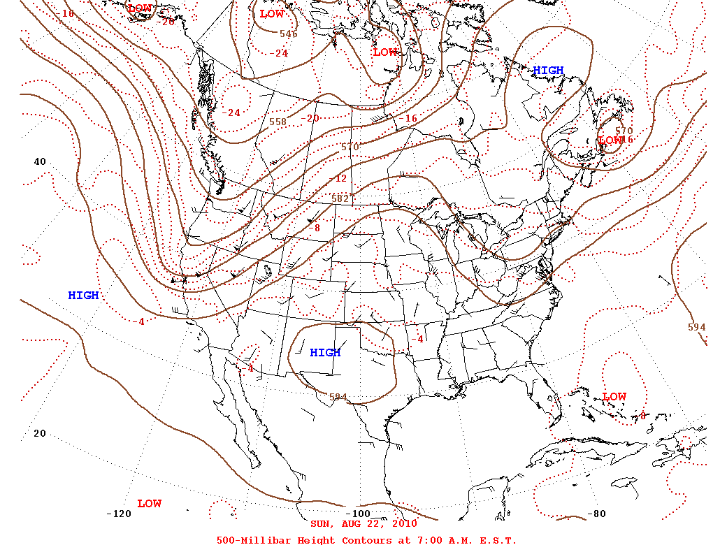 500 millibar heights for Sunday, August 22, just prior to the hottest temperatures of 2010 in Deep South Texas. Note the large high pressure cell across Texas, denoting very hot temperatures. This pattern generally prevailed for much of August 2010. |

