Brownsville/Rio Grande Valley, TX
Weather Forecast Office
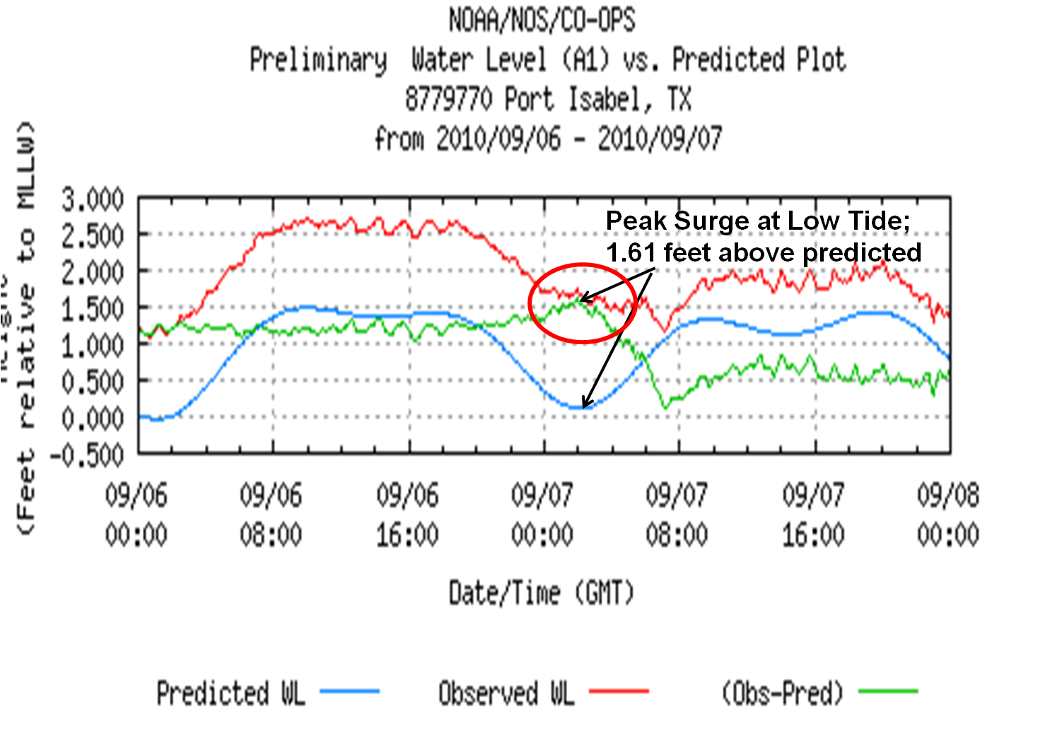
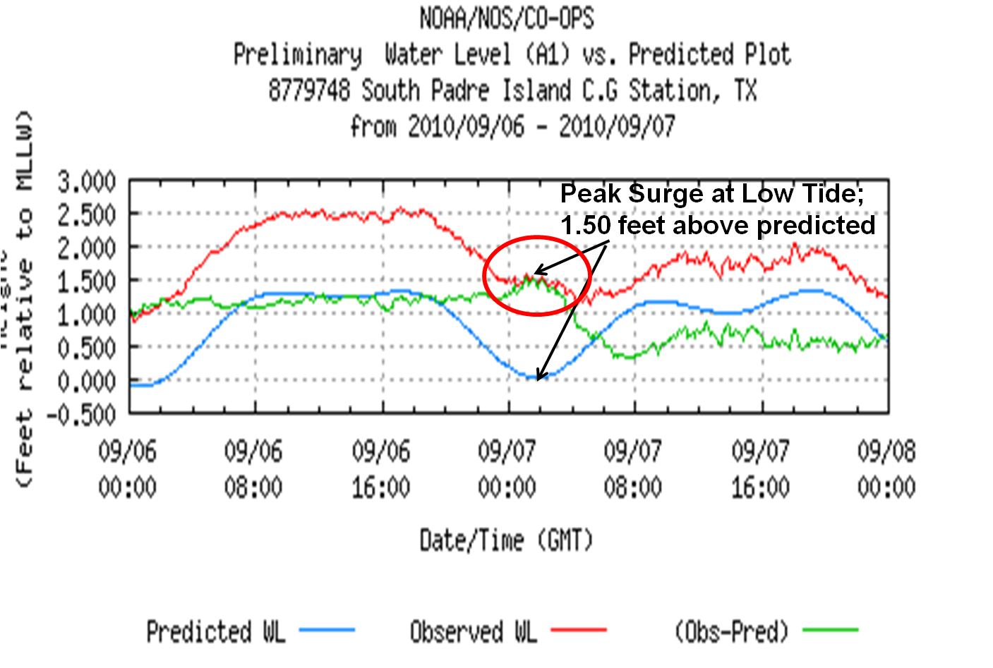
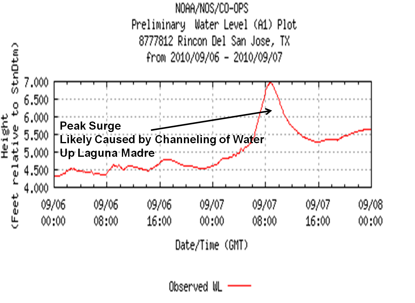
| Tropical Storm Hermine Storm Surge Summary Sept. 6–7 2010 Peak Water Rises Occur at Low Tide, but Impacts Felt in Channels Rapidly increasing winds turning from east to south as the center of Tropical Storm Hermine scooted across Cameron, Willacy, and into western Kenedy County overnight on September 6th and 7th brought a push of water onto the beaches and into the Brownsville Ship Channel. For primary residential and beach areas, the push occurred near low tide (first two graphs below), which produced no inundation issues, but water was able to reach the dune line and shut down vehicle traffic at public beach access points beginning during the afternoon of the 6th and continuing overnight. More interesting is what occurred when the water was forced through the thinning Laguna Madre and the Brownsville ship channel. The third graph below shows a much larger spike in water levels at Rincon del San Jose (Kenedy County) where the Laguna Madre runs through sand, salt, and mud flats on its way to Baffin Bay. Data suggest that a surge perhaps as high as 4 feet occurred during the pre dawn hours of September 7th, near the time of high tide. Reports from the Port of Brownsville indicated heavy wave action within the channel, with waves breaking over channel barriers around the time of Hermine’s passage to the west. |
|
 |
|
 |
|
 |
|
| Back to Index | |
CURRENT HAZARDS
Daily Briefing (National)
Outlooks
Severe Weather Text
Local Storm Report
Submit a Storm Report
CURRENT CONDITIONS
Surface Observations (map)
Text Observations
Satellite
Rivers and Lakes
Observed Precip - RGV
Tides and Currents
CoCoRaHS Texas
FORECASTS
Forecaster's Discussion
Graphical
Hourly View
Activity Planner
Marine
South Padre Tides
Wave Prediction
Beach
Surf
Fire Weather
Aviation
Tropical
Winter Storm Severity Index
Model Guidance
US Dept of Commerce
National Oceanic and Atmospheric Administration
National Weather Service
Brownsville/Rio Grande Valley, TX
20 S. Vermillion Avenue
Brownsville, TX 78521
956-504-1432 (8 AM to 430 PM Mon-Fri)
Comments? Questions? Please Contact Us.

