 |
|
| Midnight Madness: Tropical Storm Hermine Cameron and Willacy County Feel Full Force Sept. 6–7, 2010 |
|
|
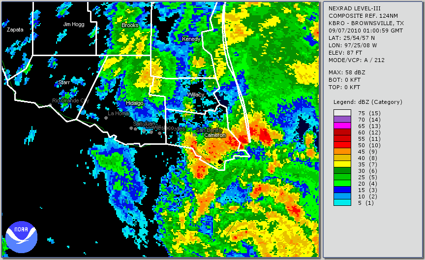
Storm Overview Hermine would track to the north–northwest at a steady 14 mph, with the center of circulation crossing the Rio Grande near Los Indios (Cameron County) at around midnight on Tuesday, September 7th. The center reached Harlingen at around 1 AM, Raymondville at around 2 AM, and progressed through the west portion of the King Ranch before exiting Deep South Texas near Falfurrias at around 5 AM. During that time, peak 1 minute sustained winds around the east periphery of the cyclone lessened only slightly, falling from 60 to 50 mph. 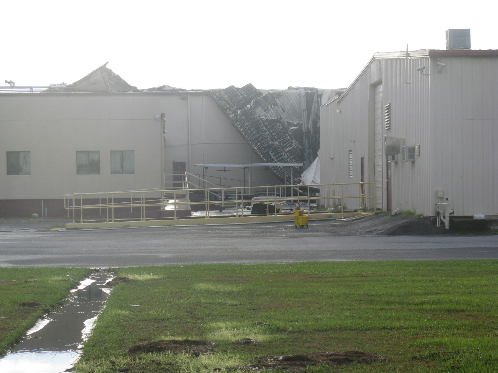 Roof damage at warehouse just north of downtown Harlingen A swath of damaging winds and flooding rains pounded Brownsville, Harlingen, and Raymondville as the eyewall of Hermine tracked along and east of Federal Highway 77 in Cameron and Willacy Counties. Peak wind gusts reached or exceeded 70 mph, causing widespread damage to trees and power lines. Rainfall of more than 3 inches in just a few hours flooded roads and farmland. More than 250,000 residents were impacted by the core of Hermine during the middle of the night, making for a memorable end to the Labor Day weekend. A map of the track, courtesy of the National Hurricane Center, is shown at the bottom of the page. |
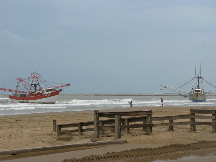 One of three vessels stranded near the entrance to the Brownsville Ship Channel on South Padre Island Impacts Boaters, particularly Mexican shrimping vessels, did their best to seek refuge in the Port of Brownsville prior to the arrival of the storm. Sixty–four vessels reached the Port, but 5 others became stranded at the coast, including three running aground in Texas and two in Mexico. Moving northward, the band waned for a few moments before reintensifying in southern Willacy County, ultimately slamming through Raymondville at around 1 AM with wind gusts estimated just below hurricane force (70 mph). Widespread damage included hundreds of snapped limbs, dozens of uprooted trees, power outages to 75 to 80 per cent of the county, and destruction of several poorly constructed roofs and lean–tos. At one home, a trampoline sailed into a window, causing a minor injury to a 5 year old girl. At a motor hotel along the expressway, roof decking was blown out, forcing 10 guests to escape the facility. Significant injuries were not reported, though at least one of the guests had minor scratches. Additional information, including damage estimates, will be available in the coming weeks. Click here for a preliminary formatted text report. |
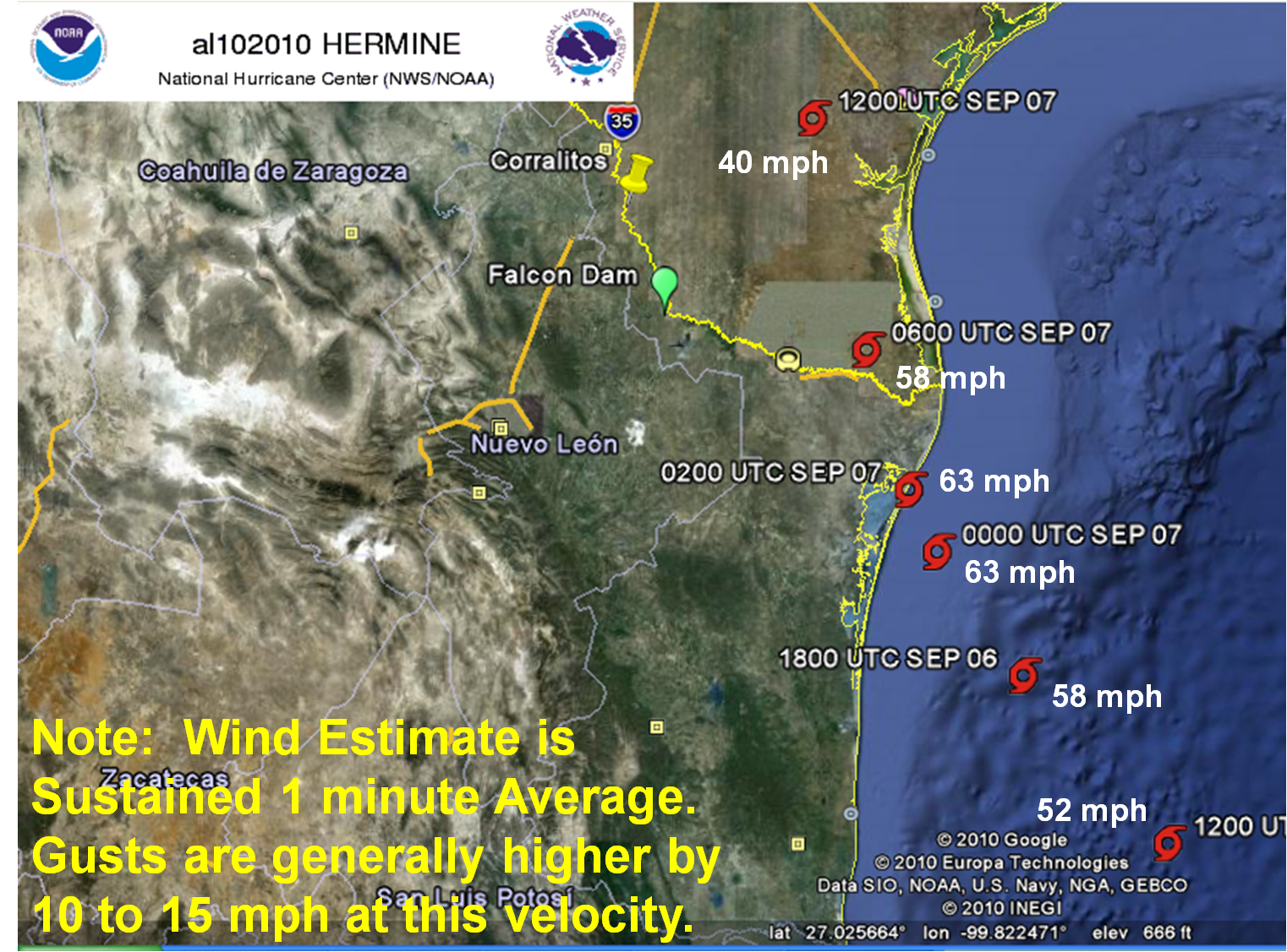 National Hurricane Center best track for Tropical Storm Hermine, September 5th through 7th portion. For interactive version, click here. |
|
| Back to Index | |

