| May 14th 2008: A "Hail" of an Evening! | |||||||||
|
 |
||||||||
| Estimated 70 to 75 mph Microburst, Large Hail Pummel Zapata
Event: Highway 496 Storage Units. The microburst slammed into the west facing wall of the first of two long, cinderblock structures, and lifted most of the roof up and over the first building, slamming it into the second building about 50 feet to the east. While the truss and bracing of the roof appeared sound, only long nails were found at the connections of the eaves. Missiles generated by the broken roof drove into both cinderblock, and an individual metal garage, in the second building. Another light metal structure, housing another set of individual storage units, separated and collapsed on the leeward side of the second building. Storage tanks and nearby structures. Several large fiberglass storage tanks were rolled, and damaged beyond repair, at a facility along Farm to Market (FM) 496 between FM 3074 and the Zapata County cemetary. On the same property, a manufactured home had numerous holes in its west facing wall, from wind driven pebbles and stones. The same home had fairly significant asphalt shingle damage to its roof. A nearby low metal tower was bent in half. Neighborhood damages. Hundreds of mesquite and ebony tree limbs of many shapes and sizes were snapped off, some onto roofs. Dozens of homes and other structures with poorly anchored roofing material sustained significant damage between FM 3074 southeast of FM 496, and up to Federal Highway 83. At least two barrel ("Spanish") tiled roofs, one at a large single family residence and another at a motel, were damaged; a large portion of tin roof was removed from a two story church a few blocks from the center of town. Hail was the other element. Nearly everyone surveyed noted dime to quarter sized hail, lasting for at least 20 minutes and perhaps as long as 40 minutes. Some stones may have been a little larger; one report of golf ball size hail was received along Federal Highway 83 about 6 miles south of the city. Two residents noted minor damage to vehicles from the wind driven hail. The table below shows preliminary statistics from the survey conducted on May 15th. Click here for a preliminary storm report. A map of the damage and track will be available at a later date. A host of Photographs were taken by NWS and local emergency management officials. Check back here for updates. Meteorology in Brief: |
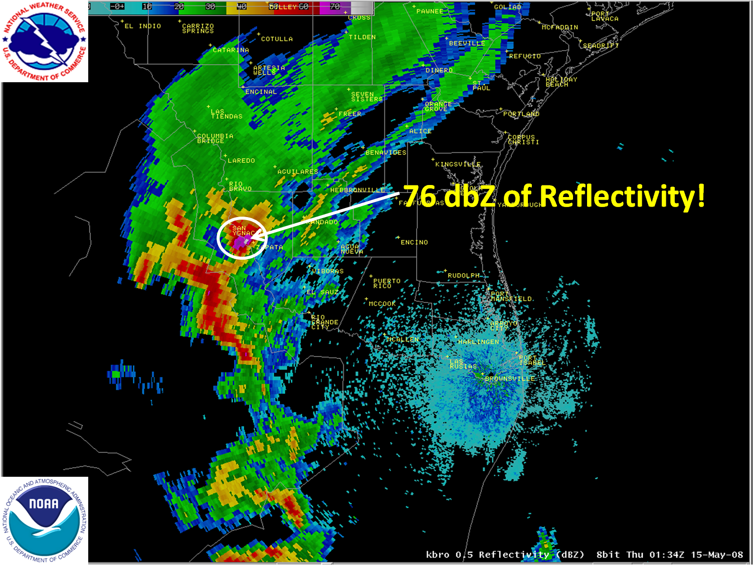
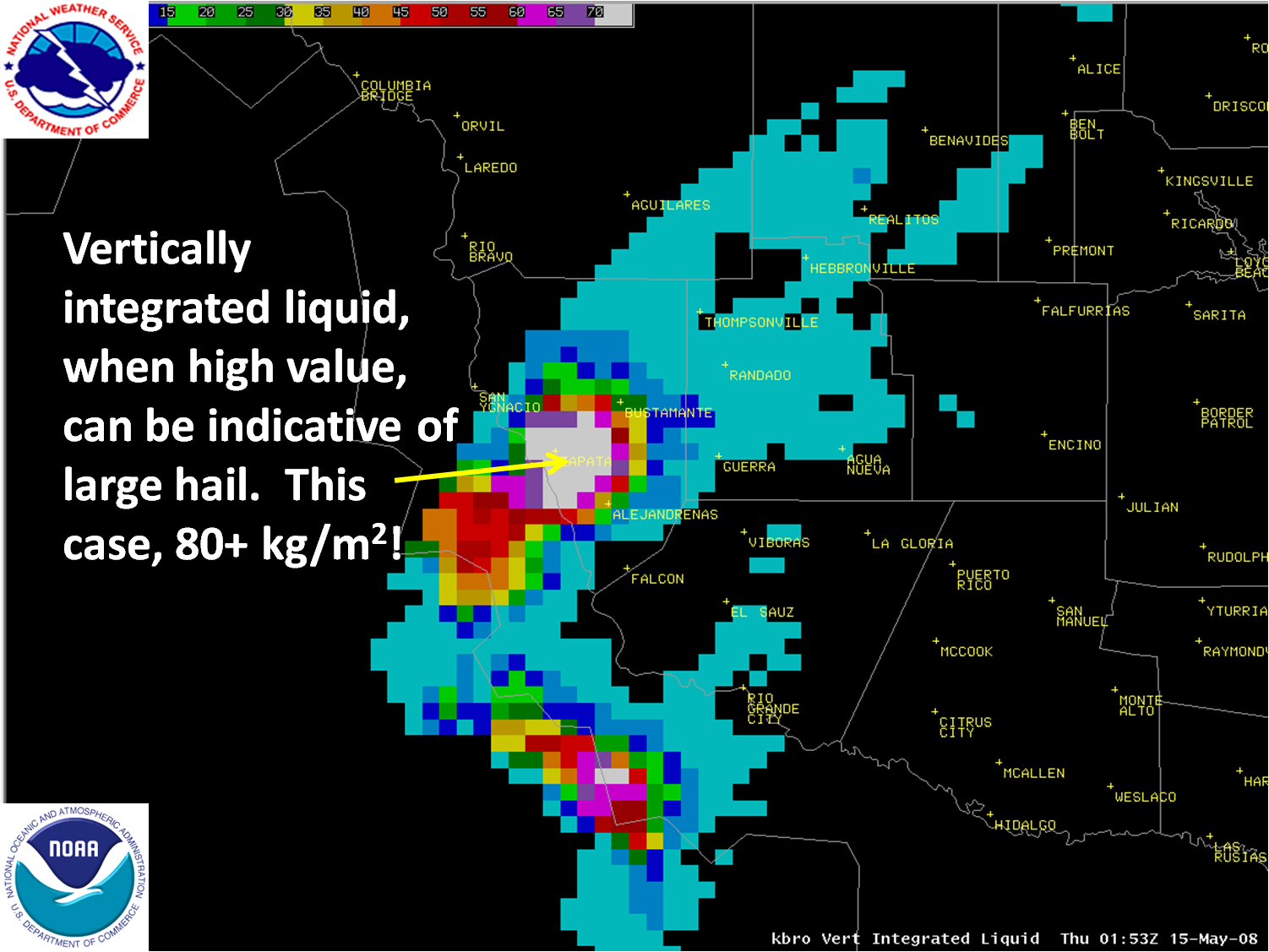
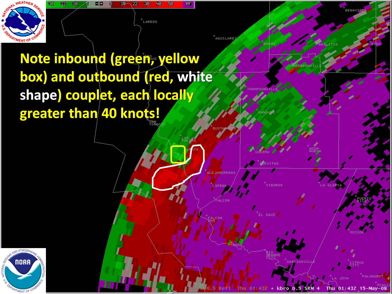
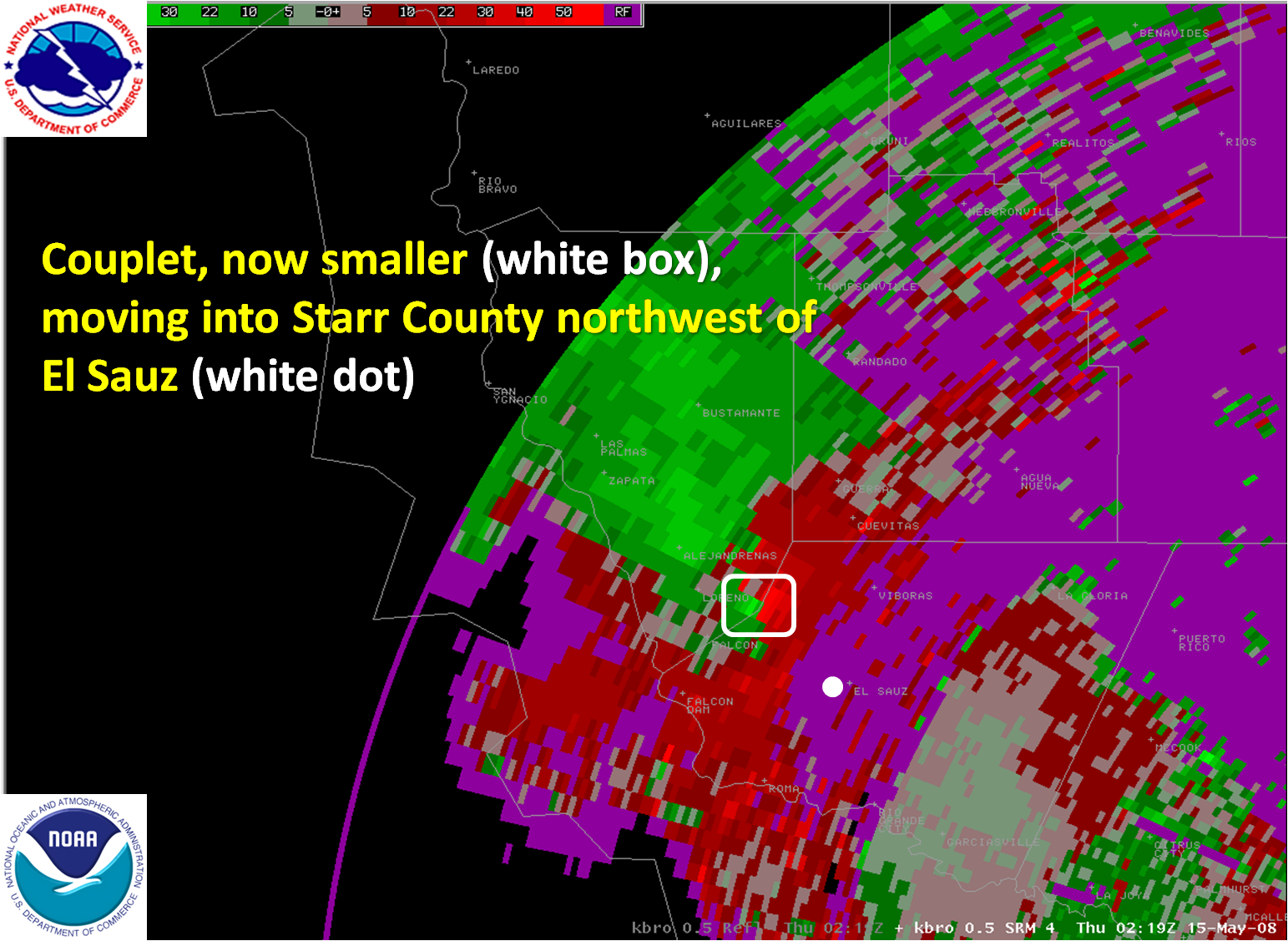
|||||||||
|
|||||||||

