| First Widespread Rainfall Since January 2008 Dumps Over 3 Inches in Some Areas 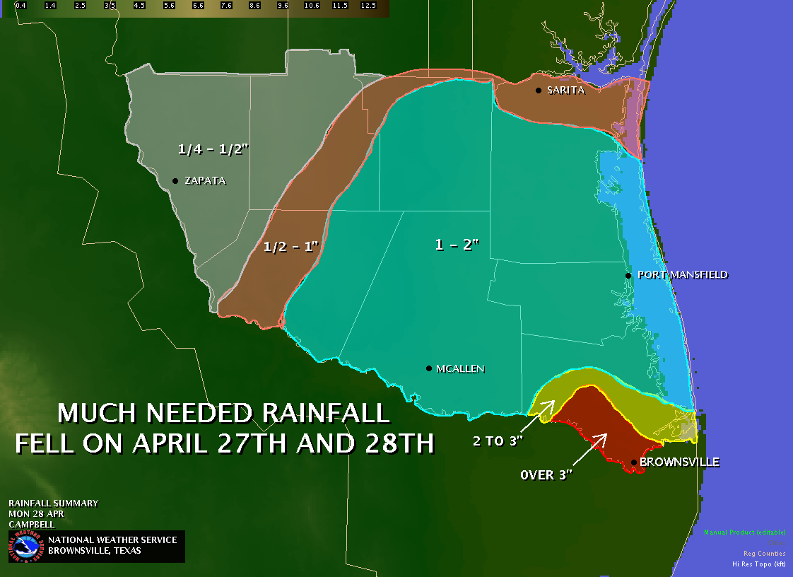 Cameron County Gets Lion's Share; 5 Inches near Border |
|||||||||||||||||||||||||||||||||||||||||||||||||||||||||||||||||||||||||||||||||||||||||||||||||||||||
|
A late season cold front, plowing into a warm and humid air mass residing across Deep South Texas and the Lower Rio Grande Valley, produced numerous late afternoon and evening thunderstorms across many locations. The heaviest rains, which fell during the late afternoon and early evening of April 27th 2008, were concentrated over the Southeast portion of the Lower Rio Grande Valley, particularly in Cameron County. Event totals ranged from less than a half inch in portions of the western Lower Rio Grande Valley, to nearly 4 inches in portions of Brownsville, and 5 inches at the Sabal Palm Audubon Center, just south of town. The NWS Dopper radar image from 542 PM CDT April 27th shows a snapshot of the heavy rains (in box) across Brownsville. 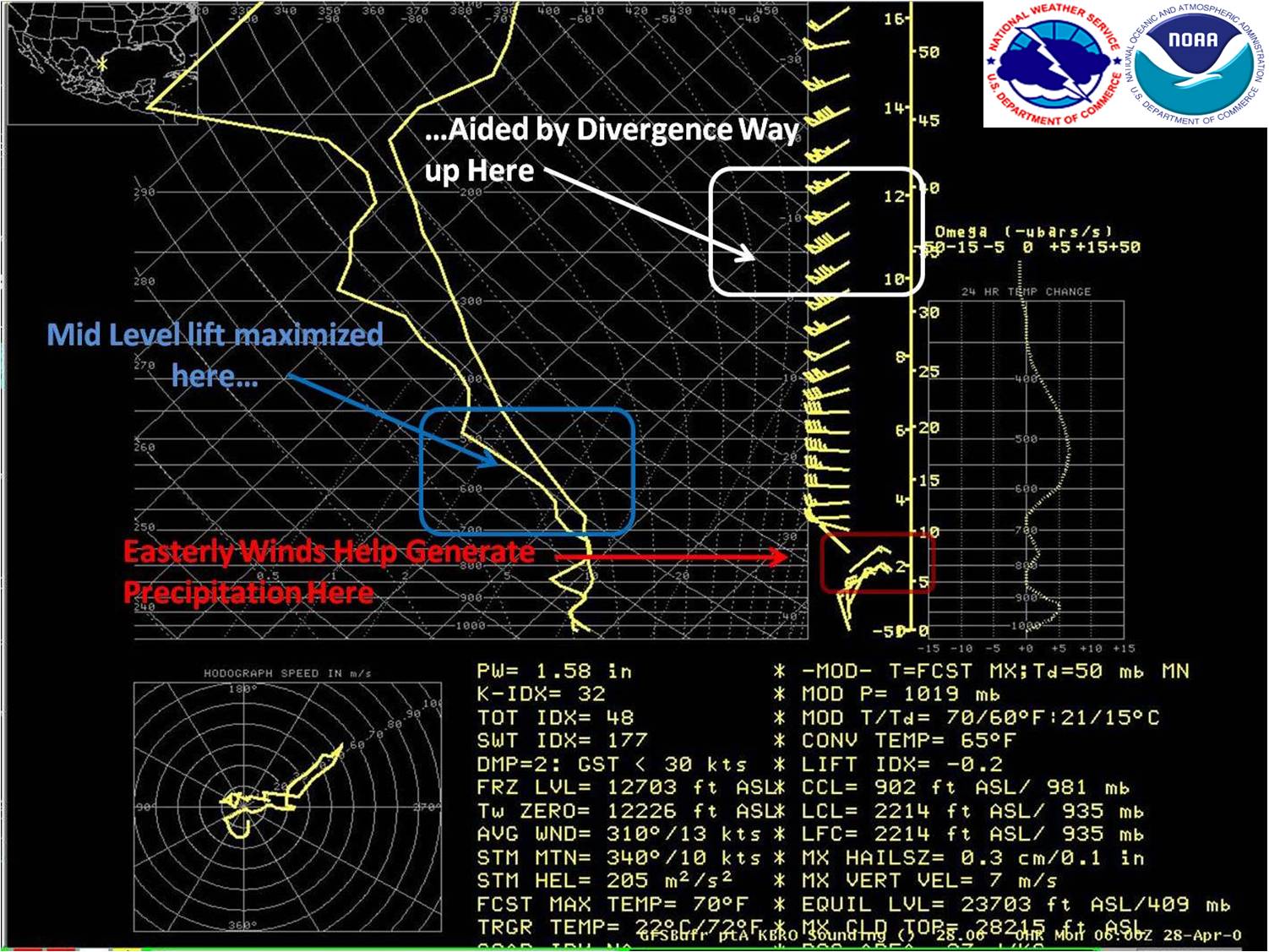
The Recipe for Rain |
was acted on by a rather vigorous upper level disturbance, or jet "streak", around 25 to 30 thousand feet above the surface. Often, active weather, including thunderstorms and rain bands, develop where the right rear quadrant of this high level jet streak (below, in box). This area, known as a divergence region, is normally countered by lower level (closer to the earth's surface) convergence, which leads to additional lifting of the warm and moist air. 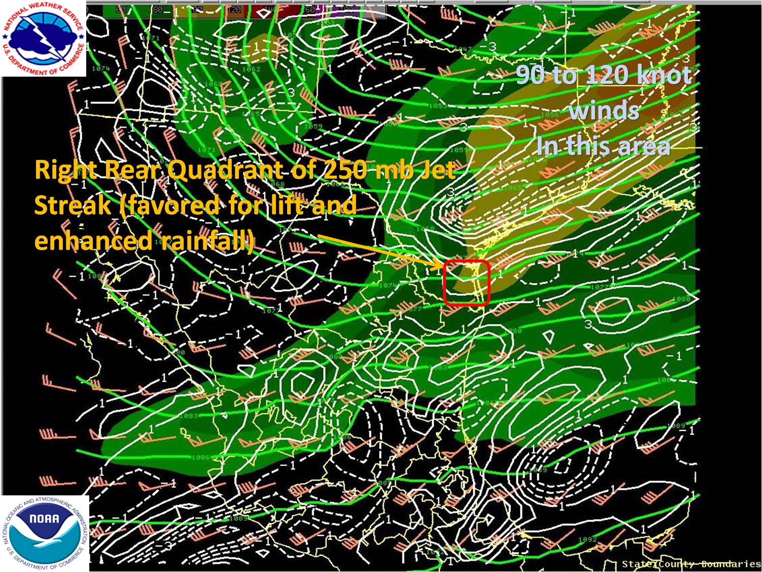
In this case, the atmosphere worked as a well-oiled machine. A closer look at the atmospheric profile at left shows the gears in motion: Upper level divergence (top right) aids convergence in the lower levels, which, in this case, was enhanced by easterly flow of additional moisture between roughly 5 and 8 thousand feet (lower box). This convergence allowed the saturated air (denoted by temperature and dew point lines running together in the lower box) to lift rapidly through the middle layers of the atmosphere (middle box), eventually producing additional clouds and precipitation, all of which fell as a period of light to moderate rains, with up to an additional one half to one inch of accumulation, during the night as cooler air surged into the area. Total rainfall from the afternoon of April 27th through daybreak on April 28th is shown in the table below. |
||||||||||||||||||||||||||||||||||||||||||||||||||||||||||||||||||||||||||||||||||||||||||||||||||||||
|
|||||||||||||||||||||||||||||||||||||||||||||||||||||||||||||||||||||||||||||||||||||||||||||||||||||||

