 Note: A map of the observed temperatures from climate cooperative sites, as well as local airports, can be found here. |
||||||||||||||||||||||||||||||||||||||||||||||||||||||||||||||||||||||||||||||||||||||||||||||||||||||||||||
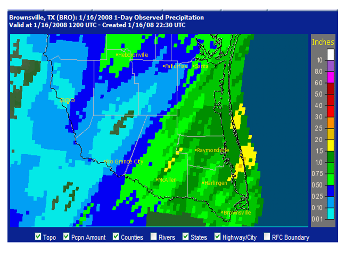
A Non-tropical area of low pressure along the lower texas coast, combined with a trough of low pressure in the upper levels of the atmosphere moving east through Texas, produced widespread showers with isolated thunderstorms over the Rio Grande Valley and adjacent coastal waters on Tuesday, January 15th, continuing into the late evening hours. Rainfall totals were as follows: |
||||||||||||||||||||||||||||||||||||||||||||||||||||||||||||||||||||||||||||||||||||||||||||||||||||||||||||
|
||||||||||||||||||||||||||||||||||||||||||||||||||||||||||||||||||||||||||||||||||||||||||||||||||||||||||||
|
These rains are the first somewhat measurable precipitation officially recorded since late November in McAllen (0.06 inches on the 25th), and mid December in Brownsville (0.09 inches on the 15th) and Harlingen (0.03 inches on the 18th). Area-wide, the rains were the first significant precipitation since around Thanksgiving weekend. Additional showers and perhaps some thunderstorms are expected later this week through the weekend, providing natural irrigation to farmland and residential areas, and reducing the threat, for the time being, for wildfire growth. |

