Overview
|
A significant ice storm started late on Christmas Day 2023, continuing into the early morning of the 27th, producing ice accumulations of up to 1 inch in the James River Valley.
A storm system well to our south created blizzard conditions across South Dakota and Nebraska. Warm air aloft got wrapped around the center of the storm system and spread across North Dakota. This layer of warm air helped snow higher up in the atmosphere melt into rain before it reaches the surface. However, since surface temperatures were below freezing, precipitation became freezing rain and led to significant ice accumulations across south central North Dakota and the James River Valley. Precipitation moved into the James River Valley the afternoon of Christmas Day, before expanding west through the night and through most of the day Tuesday, December 26th. Reports from Verona and Edgeley were the highest, with 1 inch of ice accumulation, while Jamestown, Ashley, and Marion all received 3/4 of an inch of ice accumulation. Additionally, there were strong winds across southern North Dakota, with the highest gust of 67 mph reported at Oakes late on Christmas Day. A portion of Interstate 94 between Jamestown and Dawson was closed on the 26th, and no travel was advised by the North Dakota Department of Transportation for the most of this event, as roads were ice-covered and made travel very hazardous. Widespread power outages were reported across the James River Valley, with utility companies reporting hundreds of broken power poles. Downed trees and tree branches were common as well from the combination of heavy ice accumulations and strong winds. Ice storms, especially of this magnitude, are a rare occurrence in North Dakota. The last time NWS Bismarck issued an Ice Storm Warning was back in 2016. |
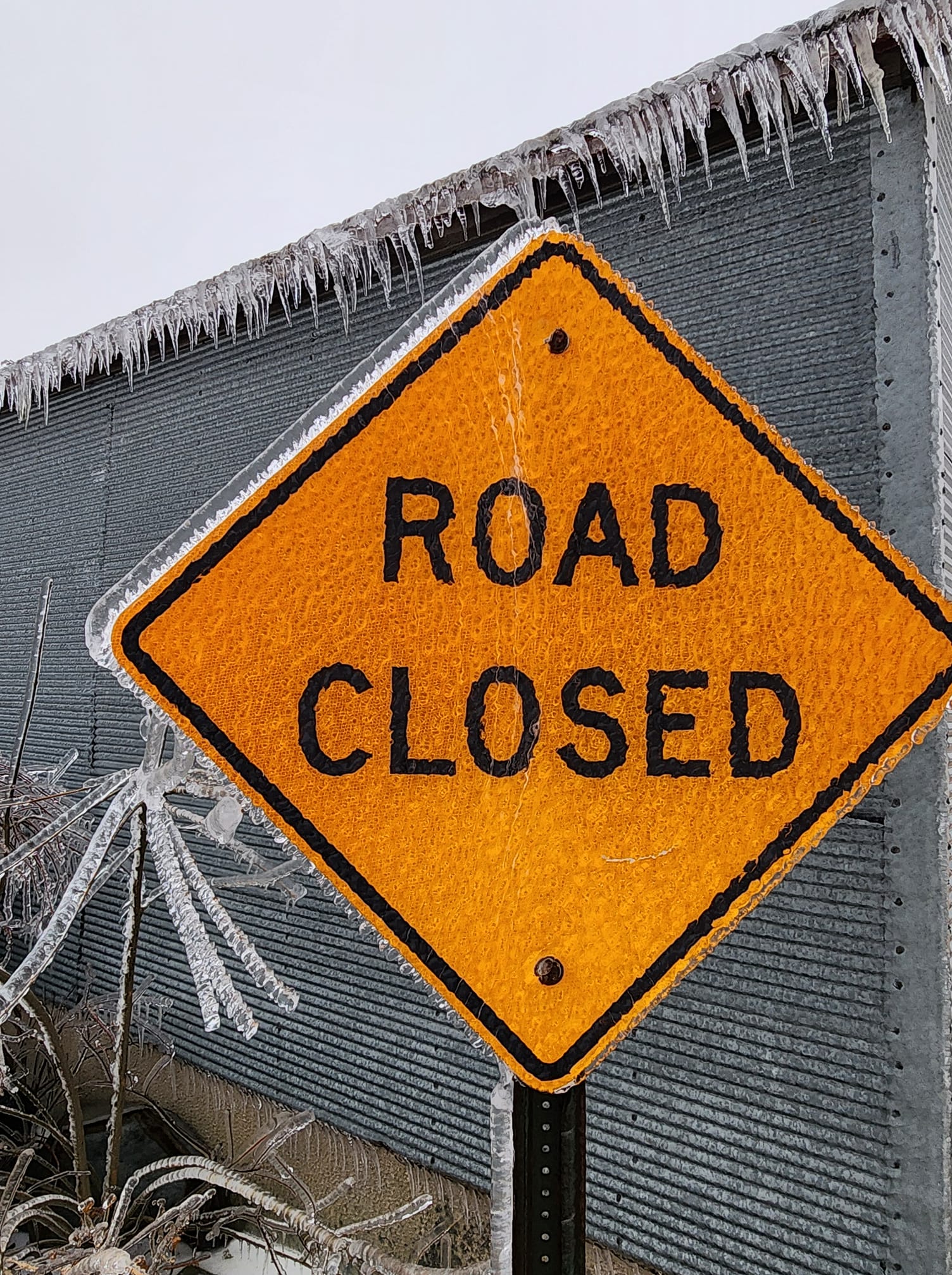 Ice accumulation on a road sign, 10 miles east of Ashley, ND. Photo from Steven Gussey via Facebook. |
Photos & Video
 |
 |
 |
 |
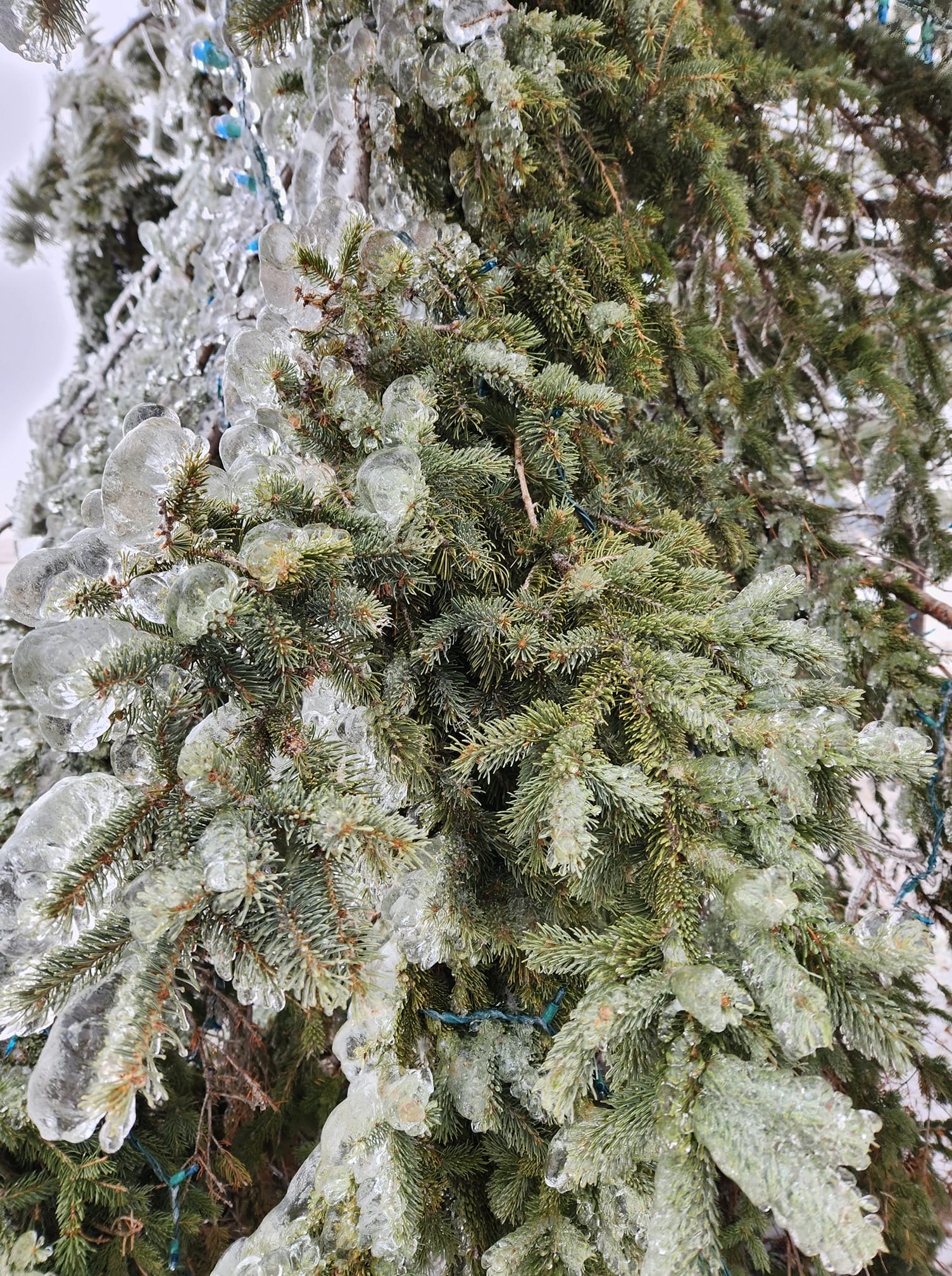
| Ice accumulation on a branch, 7 miles north of Verona, ND. (Matt Fitz via Facebook) |
A mailbox coated in ice, 2 miles southeast of Jamestown, ND. (Mike Harris via Facebook) |
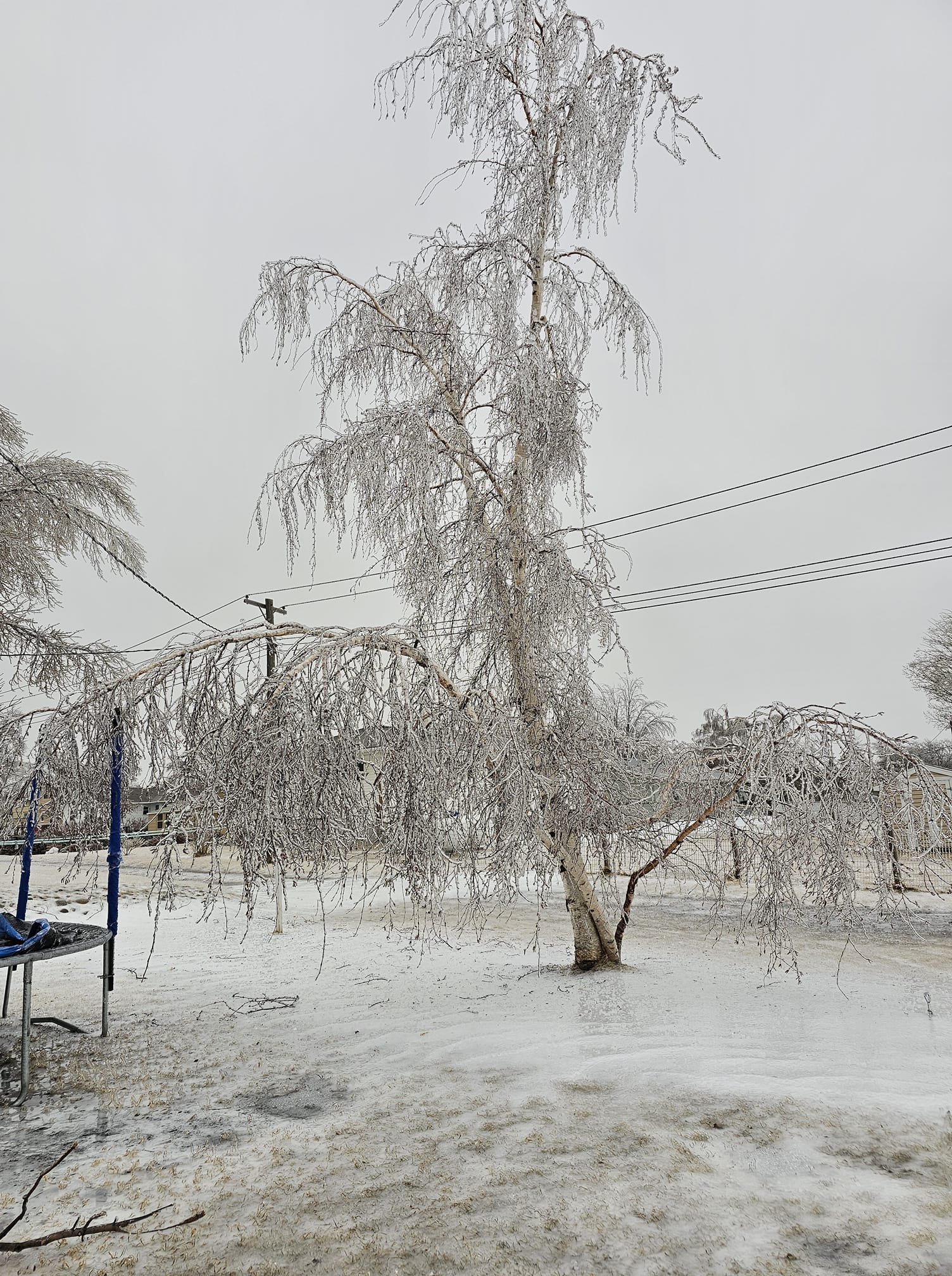
An ice-covered tree in Ashley, ND. (Bethany Schlenker via Facebook) |
A snapped power pole in Dickey County. (Dickey County Emergency Manager) |
 |
 |
 |
 |
| Ice accumulation one mile south of LaMoure, ND. (LaMoure County Emergency Manager) |
Ice accumulation on a tree, 10 miles east of Ashley, ND. (Steven Gussey via Facebook) |
Icicles on the Jamestown travel camera. (North Dakota Department of Transportation) |
The sun shining through ice-covered branches after the storm ended, in Bismarck, ND. (NWS Bismarck staff) |
Storm Reports

..TIME... ...EVENT... ...CITY LOCATION... ...LAT.LON...
..DATE... ....MAG.... ..COUNTY LOCATION..ST.. ...SOURCE....
..REMARKS..
0803 AM Snow/Ice Dmg Edgeley 46.36N 98.72W
12/26/2023 LaMoure ND Utility Company
Dickey County EM reported rural Dickey
County has been out of power since Christmas
Day evening due to major ice storm. Dakota
Valley Electric (based in Edgeley) shows
widespread outages across LaMoure and Dickey
Counties, as well as southern Stutsman
County, ongoing the morning of Tuesday
12/26.
0805 AM Snow/Ice Dmg Ellendale 46.00N 98.53W
12/26/2023 Dickey ND Emergency Mngr
Dickey County EM reported large trees and
tree limbs have been blown down due to the
heavy ice accumulations combined with strong
winds. Oakes observation nearby had a gust
to 67 mph during late evening Christmas Day.
Also a few isolated power outages in town
(Montana Dakota Utilities).
1016 AM Snow/Ice Dmg Jamestown 46.91N 98.71W
12/26/2023 Stutsman ND Utility Company
Otter Tail Power Company estimates 2900
without power across Stutsman County, with
the majority of those in the Jamestown area.
Reports from Jamestown are of one half to
one inch of ice accumulation from the ice
storm.
1200 PM Snow/Ice Dmg Fessenden 47.65N 99.63W
12/26/2023 Wells ND Emergency Mngr
Several vehicles in ditches across Wells
County.
0125 PM Snow/Ice Dmg Gackle 46.63N 99.14W
12/26/2023 Logan ND Utility Company
Otter Tail Power Company estimates 270
without power in the town of Gackle.
1019 AM Snow/Ice Dmg Carrington 47.45N 99.13W
12/27/2023 Foster ND Utility Company
Otter Tail Power Company reporting
approximately 1100 customers still without
power in Foster County, with the majority of
those in Carrington. Latest report from
Carrington is 3/4 of an inch of ice
accumulation.
0144 PM Snow/Ice Dmg 3 NE Grand Rapids 46.47N 98.33W
12/27/2023 LaMoure ND Emergency Mngr
LaMoure County EM sent photo of a tree on a
power line. About a mile away is a different
photo of wires across the road. Noted 16
broken poles in this area.
0811 AM Snow/Ice Dmg Edgeley 46.36N 98.72W
12/28/2023 LaMoure ND Utility Company
Dakota Valley Electric Cooperative (based in
Edgeley) is still reporting widespread power
outages across their coverage area in the
southern James River Valley from the
December 25 through 27 ice storm. Website
says there are 713 customers still without
power in LaMoure County, and 544 in Dickey
County. Per their Facebook page, the
cooperative is estimating 300 poles down and
widespread wire breaks. Noted that they were
still losing poles and wires, leading to new
outages, as of Wednesday afternoon (the
27th). Current estimate from the cooperative
is that power will not be fully restored
until next week.
Environment
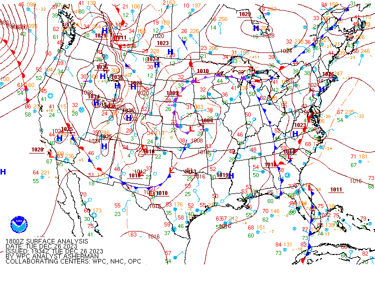
A deep surface low moved through the Central Plains, well south of North Dakota. However, warm air aloft got wrapped up around the north side of the storm, bringing not only widespread precipitation to central and eastern North Dakota, but causing the majority of precipitation to fall as freezing rain.
 |
 |
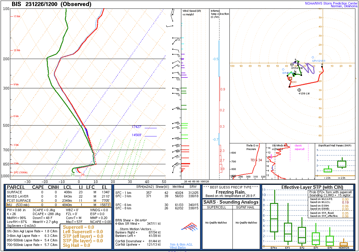 |
| Figure 1: 700mb height field analysis from the Weather Prediction Center for Tuesday morning, December 26th. A deep cyclone was centered over southeast Nebraska | Figure 2:Surface analysis from the Weather Prediction Center for 12 PM, Tuesday December 26th. The main surface low with our ice storm was analyzed in northeast Kansas, with an occluded front looping through the Central US, extending into southeast North Dakota. | Figure 3: Observed upper air sounding from NWS Bismarck the morning of Tuesday, December 26th. A warm layer is visible around 850 mb, while the surface is below freezing. This led to frozen hydrometeors melting into rain, and then freezing when it reached the ground. |
 |
Media use of NWS Web News Stories is encouraged! Please acknowledge the NWS as the source of any news information accessed from this site. |
 |