Life-threatening, potentially catastrophic flash flooding expected along the central Gulf Coast as the remnants of Arthur track across the area. Isolated brief tornadoes and damaging gusts remain possible overnight in the Southeast. Isolated to scattered dry thunderstorms may cause lightning-ignited fires and erratic behavior due to gusty winds across parts of the West Friday. Read More >
Overview
|
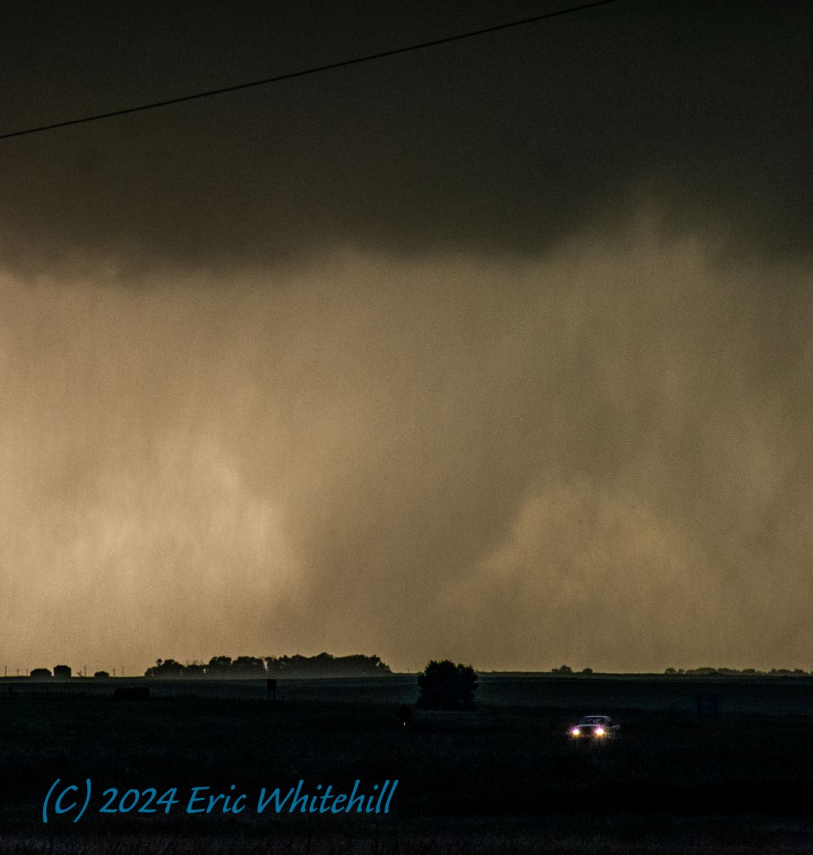
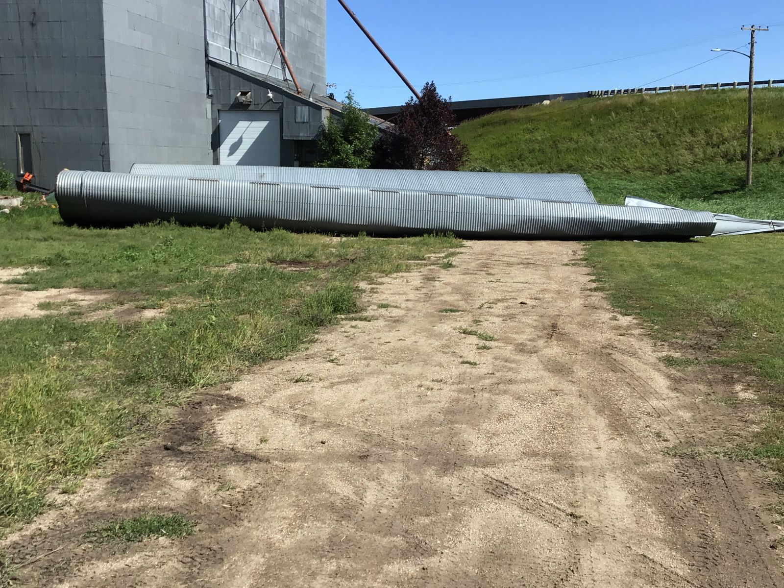
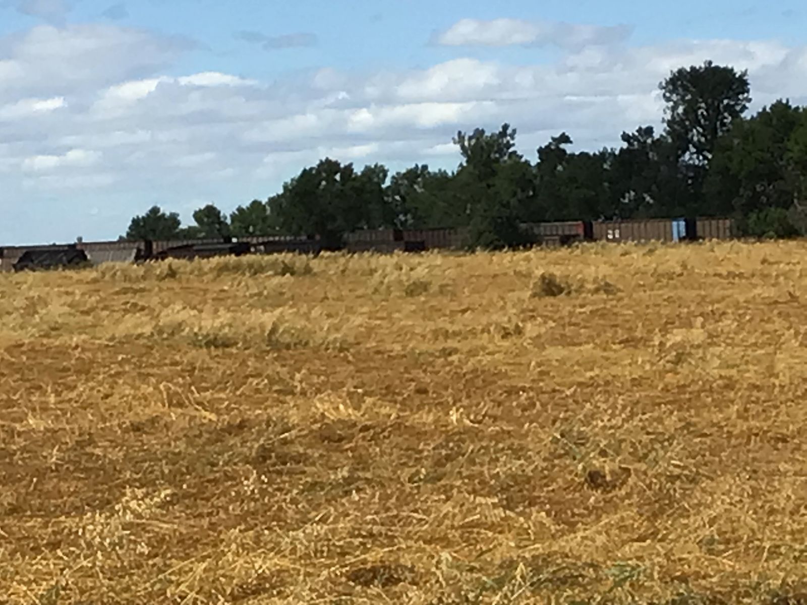
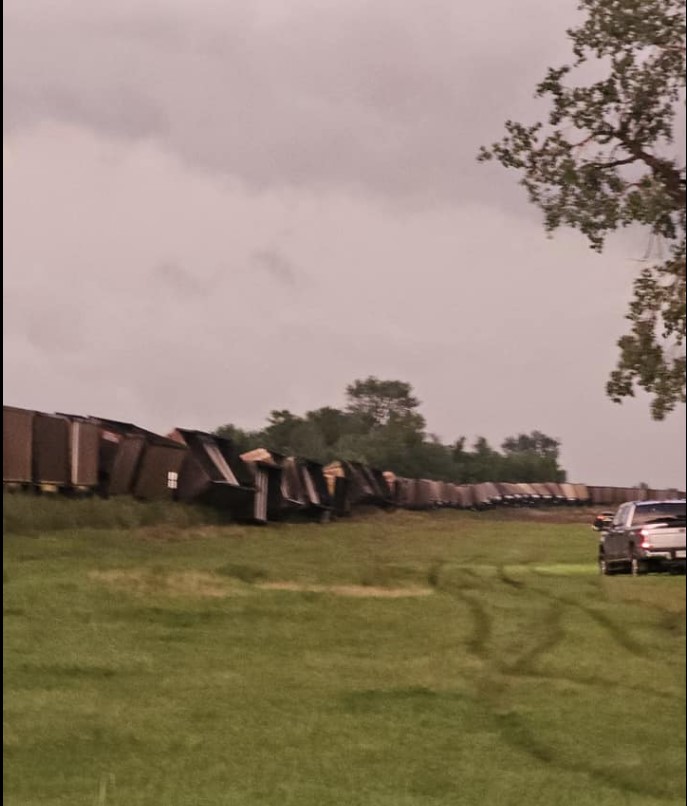
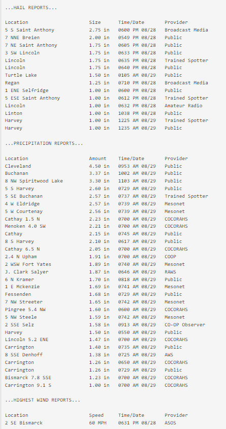
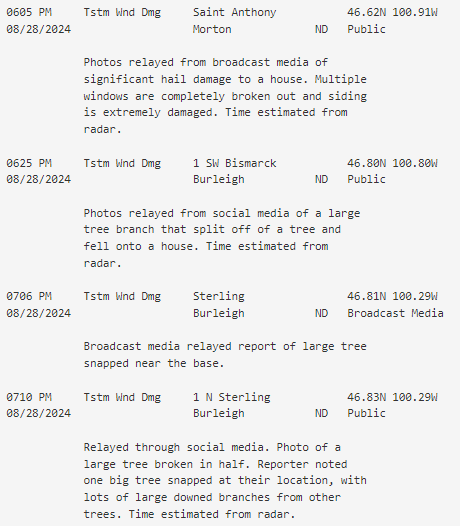
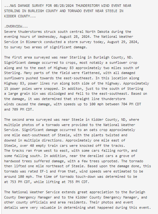
Numerous severe thunderstorms occurred across central North Dakota on Wednesday, August 28th and the early morning hours of Thursday the 29th, 2024, including two confirmed tornadoes. An EF-1 tornado touched down just east of Steele, turning over train cars and flattening fields. Another brief tornado was observed in Sioux County near Selfridge, which caused a small amount of power pole damage. The same storm that produced the EF-1 tornado near Steele also produced straight-line damaging winds up to 100 mph that knocked over an empty grain bin, snapped power poles, and destroyed a sunflower field near Sterling. Large hail was a more widespread impact from these storms. The largest hail, which occurred 5 miles south of St. Anthony in southeast Morton County, was estimated to be baseball size. There were also several reports of quarter to golf ball size hail along with snapped trees in the Bismarck area. Finally, multiple rounds of storms over Stutsman County produced localized flooding. The highest rain report was 5 inches at 1 mile south of Windsor. |
(Photo courtesy Eric Whitehill, Valley News Live) |
Tornadoes:
|
Tornado - 1 mile ESE Steele
Track Map 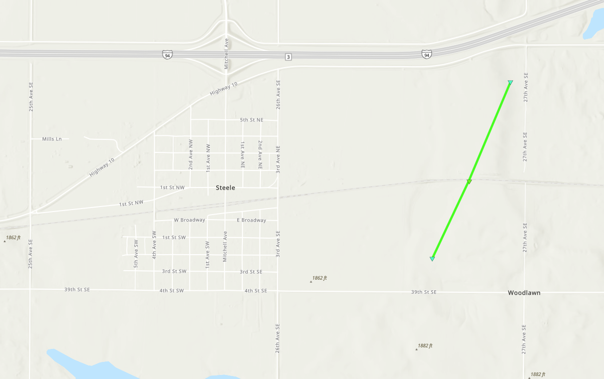 
Downloadable KMZ File |
||||||||||||||||
The Enhanced Fujita (EF) Scale classifies tornadoes into the following categories:
| EF0 Weak 65-85 mph |
EF1 Moderate 86-110 mph |
EF2 Significant 111-135 mph |
EF3 Severe 136-165 mph |
EF4 Extreme 166-200 mph |
EF5 Catastrophic 200+ mph |
 |
|||||
Photos & Video
 |
 |
 |
 |
| Damage to a grain bin just south of Sterling, North Dakota. (NWS Bismarck storm survey) |
Damage to crops near derailed train cars from the tornado near Steele, North Dakota. (NWS Bismarck storm survey) |
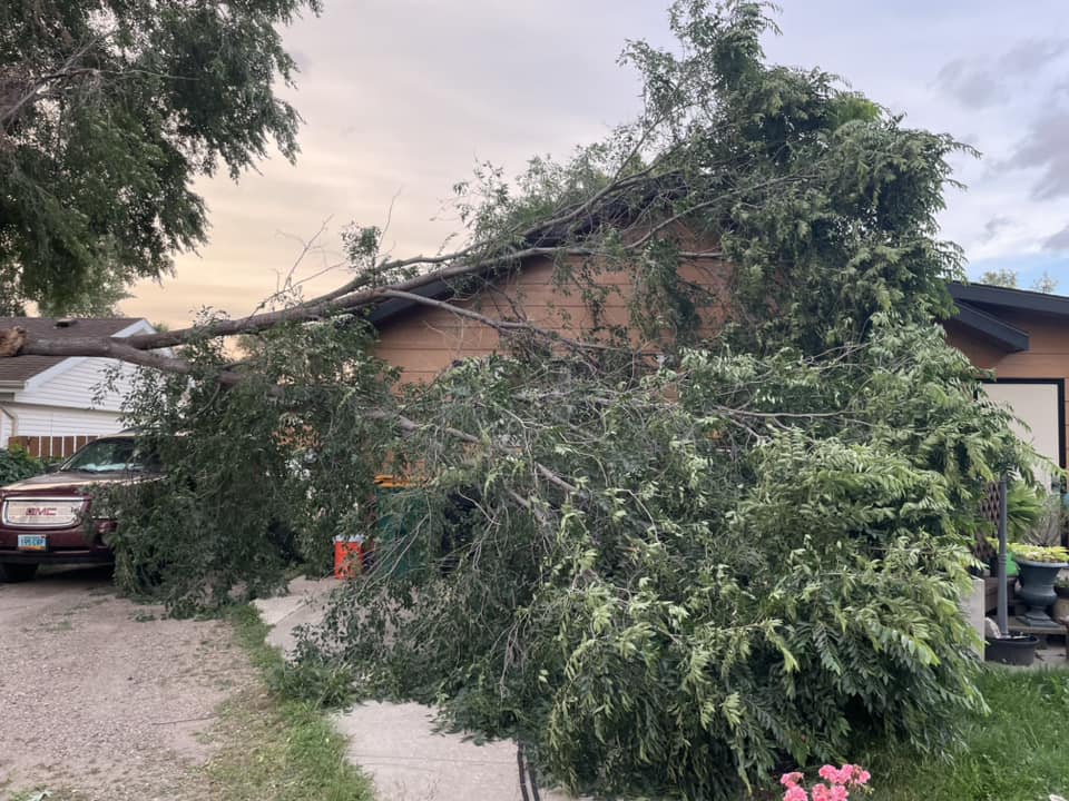
A large tree branch that fell on a house in south Bismarck, North Dakota. (Photo courtesy Desaray Schuh) |
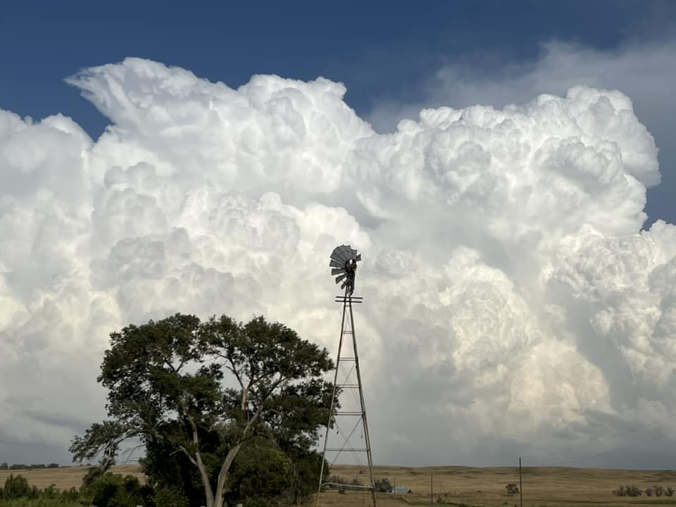
Back side of a thunderstorm, seen from Riverdale, North Dakota. (Photo courtesy Jeanette Reim) |
 |
 |
 |
.png) |
| Derailed train cars from the tornado near Steele, North Dakota. (Photo courtesy Kevin Reski) |
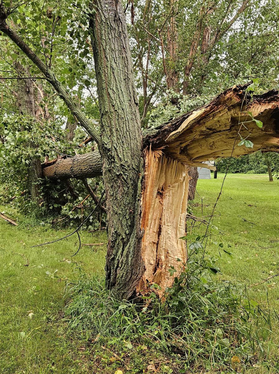
Tree damage one mile north of Sterling, North Dakota. (Photo courtesy Michelle Bohlander) |
Damage to a grain bin just south of Sterling, North Dakota. (NWS Bismarck storm survey) |
Snapped power poles along Highway 83 near Sterling, North Dakota. (NWS Bismarck storm survey) |
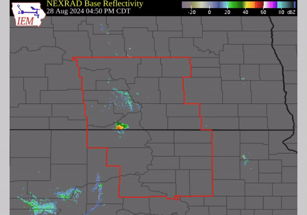
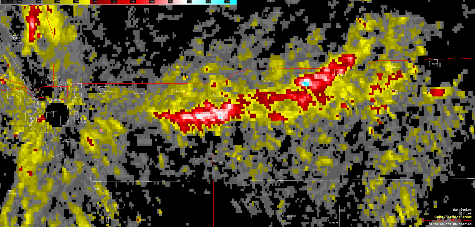
Radar
Radar loop from 4:50 PM to 2:40 AM CDT
Radar-derived rotation tracks from the storm that produced the tornado near Steele
Storm Reports
Environment
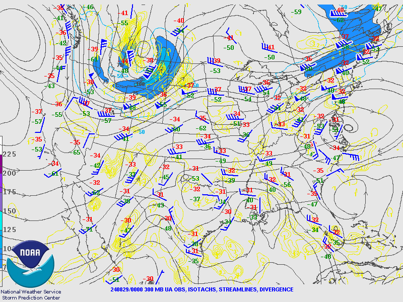
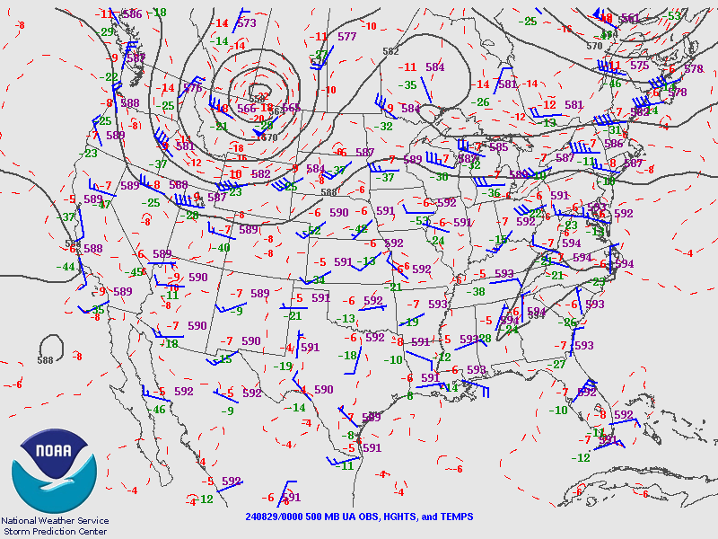
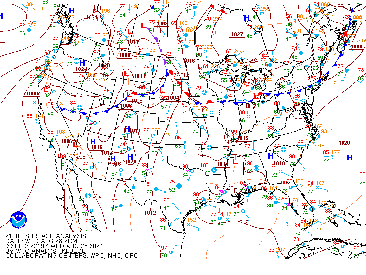
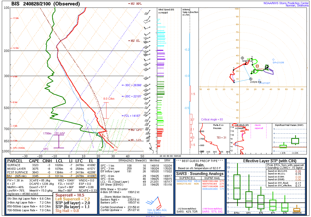
An upper-level low pressure with a strong jet streak wrapping around its base approached the Northern Plains on Wednesday afternoon (Fig. 1 and 2). Ahead of this feature, strong low-level southerly flow advected moisture-rich air from the Gulf of America into the central Dakotas (Fig. 3). At the surface, a cold front was overtaking a warm front across central North Dakota, becoming an occluded front, but a narrow "warm sector" was still present between the two fronts over far south central North Dakota. Despite a mid-level capping inversion sampled by a special balloon sounding at 4 PM CDT (Fig. 5), the surface fronts and associated low pressure system to the north and west provided ample forcing for thunderstorm development along and ahead of the occluded and cold fronts in south central North Dakota during the late afternoon. The atmosphere was highly unstable with over 3000 J/kg of Convective Available Potential Energy (CAPE), a key ingredient for severe storms. Southeast winds at the surface veering to the southwest and increasing with height produced strong vertical wind shear, another key ingredient for severe storms. Low-level wind shear was particularly strong in this setup, which can be seen in the curvature of the red-line portion of the hodograph (upper right of Fig. 5). This created an increased risk for tornadoes.
 |
 |
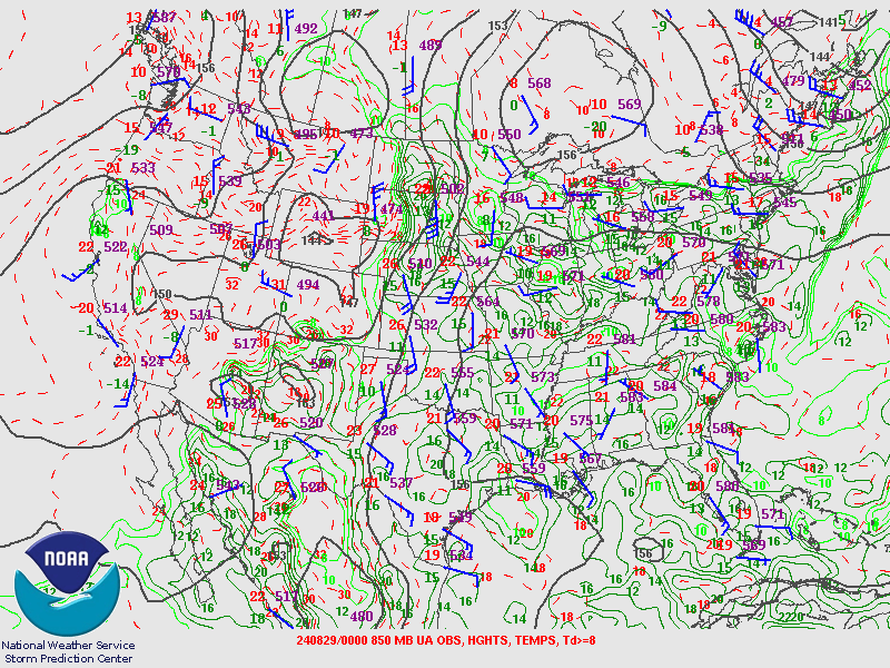 |
| Figure 1: 300 mb height and wind analysis from 7 PM Wednesday evening. Map from the Storm Prediction Center. | Figure 2: 500 mb height, wind, and temperature analysis from 7 PM Wednesday evening. Map from the Storm Prediction Center. | Figure 3: 850 mb height, wind, temperature , and moisture analysis from 7 PM Wednesday evening. Map from the Storm Prediction Center. |
 |
 |
|
| Figure 4: Analyzed surface map from 4 PM Wednesday afternoon. Map from the Weather Prediction Center. | Figure 5: Observed upper air sounding from NWS Bismarck taken at 4 PM Wednesday afternoon. |
 |
Media use of NWS Web News Stories is encouraged! Please acknowledge the NWS as the source of any news information accessed from this site. |
|