
Moisture across the northern Plains, upper Great Lakes into northern New England will likely bring a period of snow, sleet and freezing rain through this weekend. Meanwhile, heavy rainfall continues along the Gulf Coast with areas of flooding. Fire weather conditions continue for the areas of the Plains, southern Appalachians into portions of Florida. Severe thunderstorm potential increasing. Read More >
Overview
|
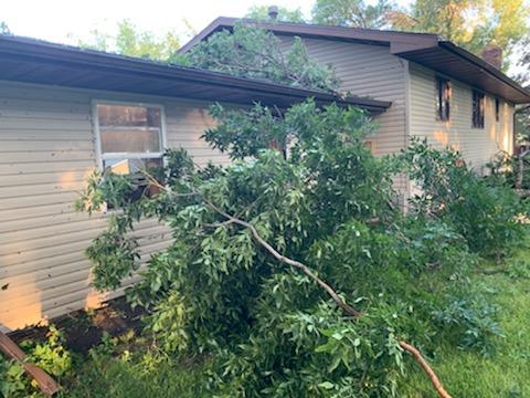
Heat and moisture began to increase quickly during the early afternoon hours of August 6, 2019 across western and central North Dakota. At around 2:00 pm CDT, a storm began to form just to the northwest of Halliday and rapidly intensified, taking on the characteristics of a rotating supercell thunderstorm. This storm produced periodic large hail as it slowly tracked southeast before dissipating south of Beulah. To the north, a new storm quickly formed over Hazen, and would go on to become a destructive long-lived supercell, making its way southeast all the way to near Linton before diminishing. This supercell was one of two severe storms that impacted the Bismarck/Mandan area during the afternoon. Golf ball size hail and significant tree damage was reported in Mandan, while ping pong ball size hail was reported in south Bismarck. Here at the National Weather Service office at the Bismarck Airport, we measured a 71 mph wind gust and quarter size hail as the strongest part of the storm moved over. Significant tree damage was also reported in Sterling, Medina, and Cleveland as another storm tracked through these areas. By late evening, storms had either moved south into South Dakota or east into the Red River Valley. |
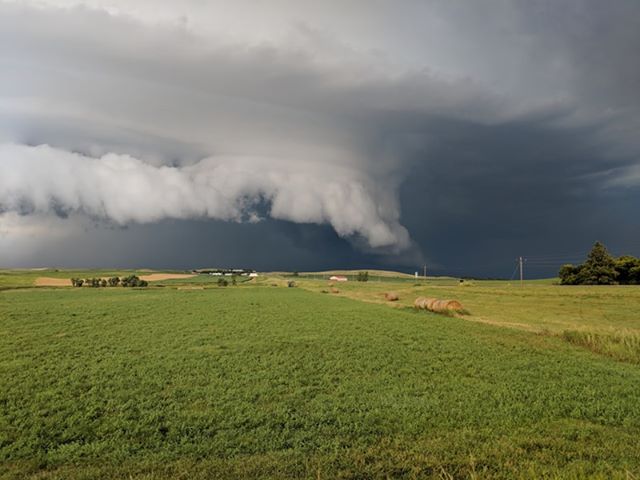 Looking North at an Approaching Supercell from the Mandan Airport. (Photo Courtesy of Cordell Booke)
|
Photos & Video
 |
 |
 |
 |
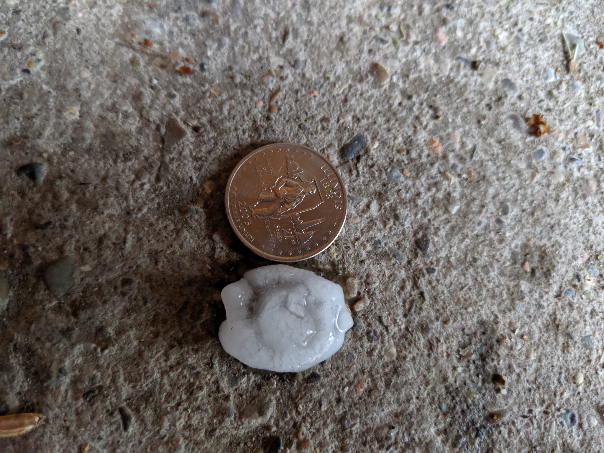
| Hail Just North of New Salem. (Photo Source Unknown) |
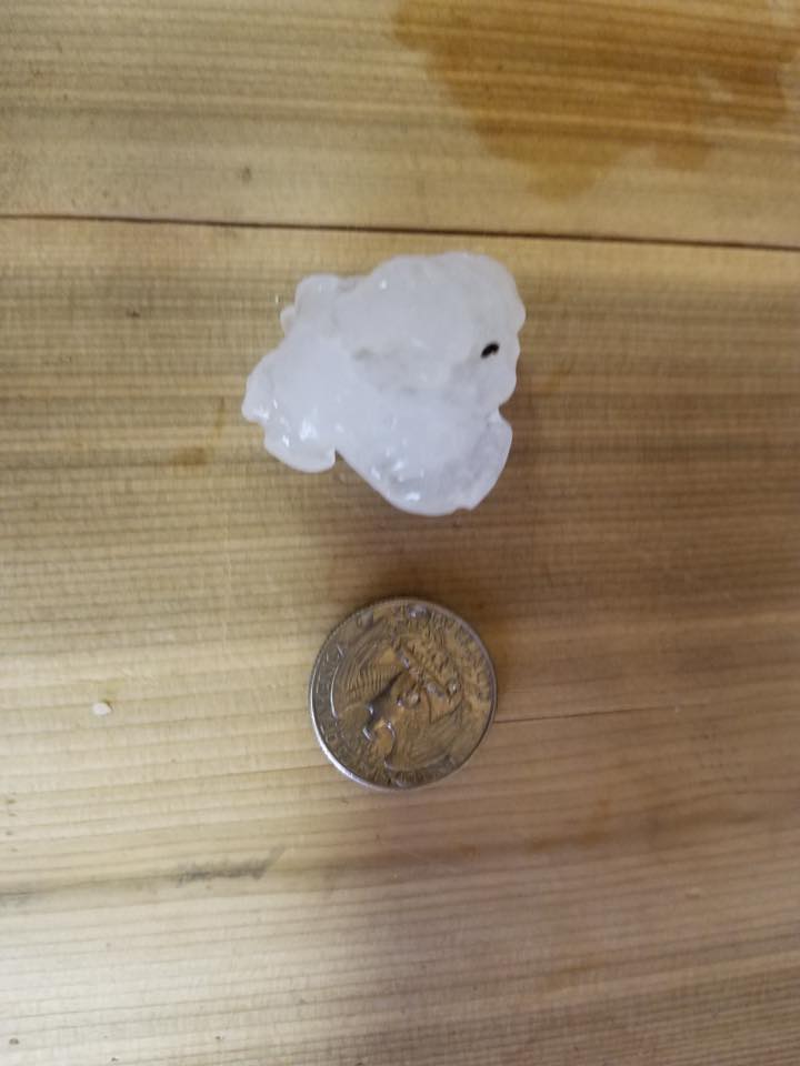
Hail in Mandan. (Photo Courtesy of Zach Niebuhr) |
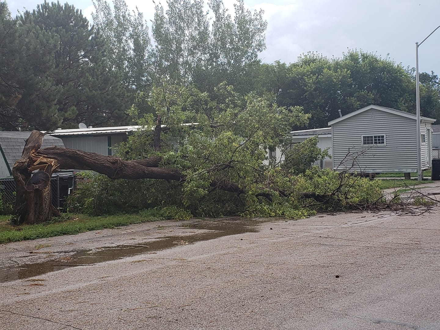
Cleveland Wind Damage. (Photo Courtesy of Connie Ova) |
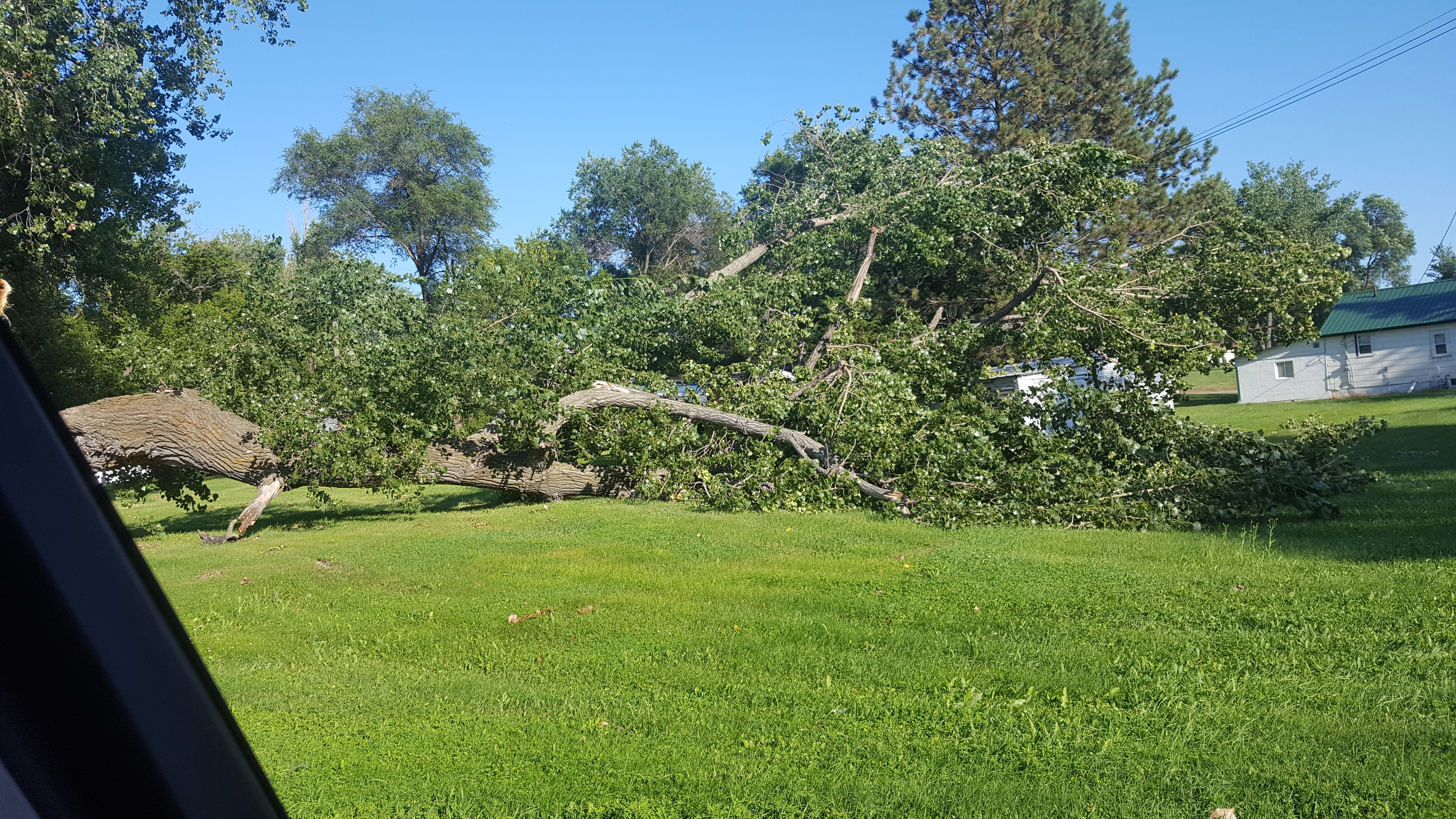
Mandan Wind Damage. (Photo Courtesy of Fred Palmer) |
 |
 |
 |
 |
|
Hail in Lincoln.
(Photo Courtesy of Bob N' Kristie)
|
Hail in Lincoln.
(Photo Courtesy of Sheryl Reeves)
|
Medina Wind Damage.
(Photo Courtesy of Jessica Hofmann)
|
Cleveland Wind Damage.
(Photo Courtesy of Connie Ova)
|
 |
 |
 |
 |
|
Hail in Strasburg.
(Photo Courtesy of Alex Scherr)
|
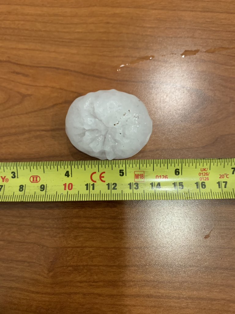
Hail in Downtown Bismarck.
(Photo Courtesy of Alex Edwards)
|
Hail One Mile North of Hazen.
(Photo Courtesy of Angie Faut)
|
Hail in South Bismarck.
(Photo Courtesy of Matt Sagaser)
|
 |
 |
 |
 |
|
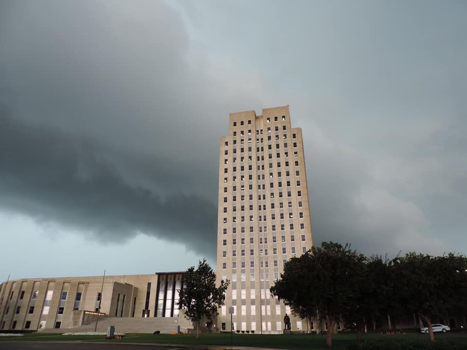
Shelf Cloud Approaching the Bismarck Capitol Building.
(Photo Courtesy of Justin Turcotte)
|
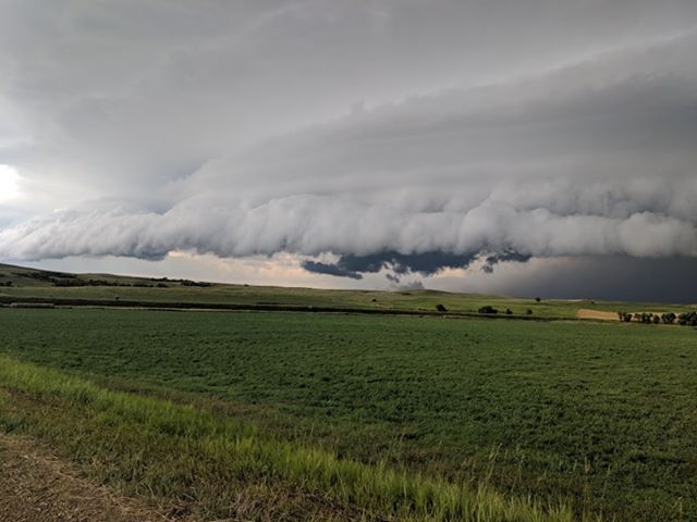
Looking North at an Approaching Supercell from the Mandan Airport.
(Photo Courtesy of Cordell Booke)
|
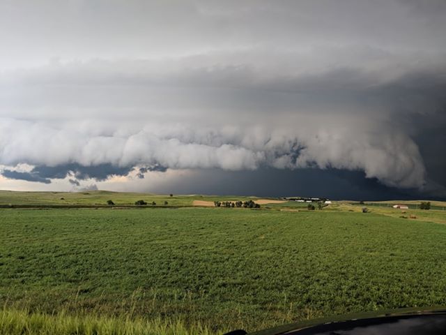
Looking North at an Approaching Supercell from the Mandan Airport.
(Photo Courtesy of Cordell Booke)
|
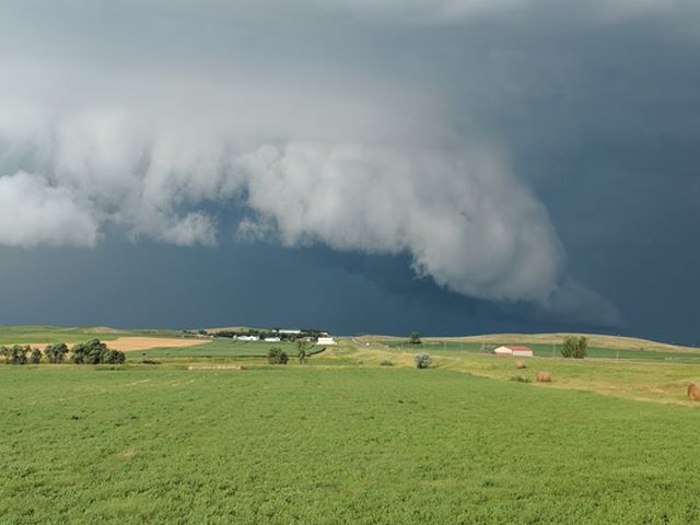
Looking North at an Approaching Supercell from the Mandan Airport.
(Photo Courtesy of Cordell Booke)
|
Radar
 |
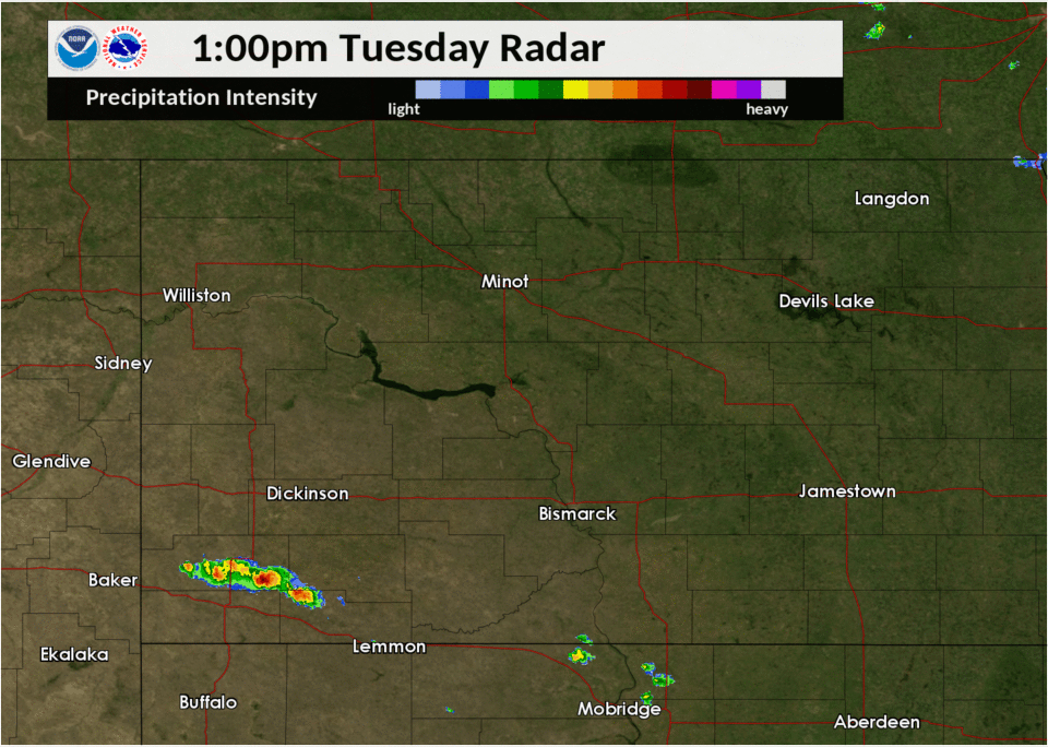 |
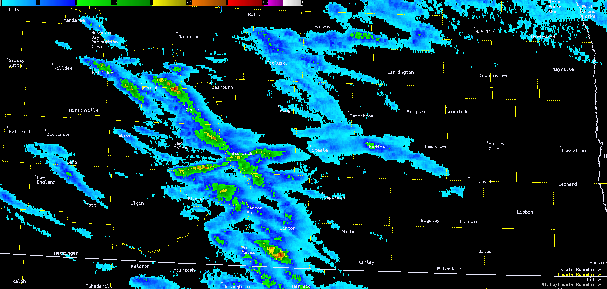
| Multi Radar Multi Sensor (MRMS) Maximum Hail Size Tracks (MESH) | Radar Loop |
Storm Reports
...A SUMMARY OF SEVERE WEATHER REPORTS IN WESTERN AND CENTRAL
NORTH DAKOTA FOR AUGUST 6 2019...

...HAIL REPORTS...

LOCATION                     SIZE      TIME/DATE       PROVIDER
6 SSE BEULAH                 2.00 IN   0317 PM 08/06   PUBLIC
4 W WESTFIELD                1.75 IN   0546 PM 08/06   TRAINED SPOTTER
STERLING                     1.75 IN   0430 PM 08/06   TRAINED SPOTTER
3 E CENTER                   1.50 IN   0347 PM 08/06   TRAINED SPOTTER
4 E CROWN BUTTE LAKE         1.50 IN   0425 PM 08/06   PUBLIC
5 NE DODGE                   1.50 IN   0240 PM 08/06   TRAINED SPOTTER
1 ENE LINCOLN                1.50 IN   0404 PM 08/06   TRAINED SPOTTER
4 N EMRICK                   1.00 IN   0653 PM 08/06   LAW ENFORCEMENT
FESSENDEN                    1.00 IN   0649 PM 08/06   PUBLIC
9 S BEULAH                   1.00 IN   0323 PM 08/06   PUBLIC
3 SSE CROWN BUTTE LAKE       1.00 IN   0420 PM 08/06   PUBLIC
3 NW MANDAN                  1.00 IN   0417 PM 08/06   PUBLIC
6 SW HUFF                    1.00 IN   0340 PM 08/06   PUBLIC
6 N SAINT ANTHONY            1.00 IN   0335 PM 08/06   PUBLIC
HAZEN                        1.00 IN   0240 PM 08/06   PUBLIC
3 SSE BISMARCK               1.00 IN   0441 PM 08/06   OFFICIAL NWS OBS
1 NE LINCOLN                 1.00 IN   0356 PM 08/06   NWS EMPLOYEE

...HIGHEST WIND REPORTS...

LOCATION                     SPEED     TIME/DATE       PROVIDER
3 SSE BISMARCK               71 MPH    0441 PM 08/06   OFFICIAL NWS OBS
6 SSE BEULAH                 70 MPH    0317 PM 08/06   PUBLIC
3 NE STERLING                68 MPH    0439 PM 08/06   MESONET
5 N CROWN BUTTE LAKE         65 MPH    0412 PM 08/06   PUBLIC
3 W ELDRIDGE                 63 MPH    0557 PM 08/06   MESONET
5 WNW MEDINA                 60 MPH    0534 PM 08/06   PUBLIC
5 W MENOKEN                  60 MPH    0405 PM 08/06   TRAINED SPOTTER

OBSERVATIONS ARE COLLECTED FROM A VARIETY OF SOURCES WITH VARYING
EQUIPMENT AND EXPOSURES. WE THANK ALL VOLUNTEER WEATHER OBSERVERS
FOR THEIR DEDICATION. NOT ALL DATA LISTED ARE CONSIDERED OFFICIAL.
 |
Media use of NWS Web News Stories is encouraged! Please acknowledge the NWS as the source of any news information accessed from this site. |
|

