Overview
|
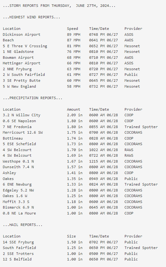
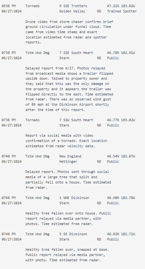
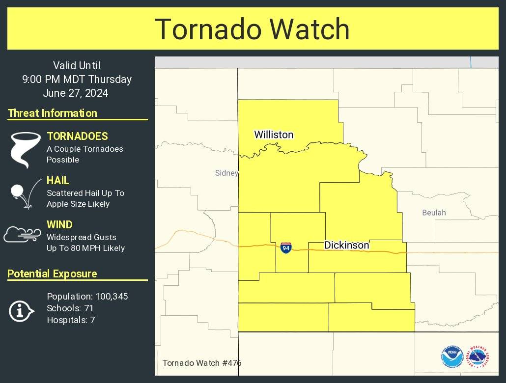
Numerous severe storms moved through parts of western and south central North Dakota on Thursday, June 27th, 2024. A strong upper-level shortwave moved from Montana into western North Dakota late in the afternoon on Thursday. In addition a warm front was found across southwestern North Dakota, while a cold front trailed in Montana. Discrete supercells formed along this warm front to start this event. A line of storms, that formed along the cold front in eastern Montana, eventually caught up to these supercells in western North Dakota and progressed eastward before diminishing in intensity across central North Dakota. A Tornado Watch was issued at 4:45 PM CDT until 9 PM CDT for most of western North Dakota, while a Severe Thunderstorm Watch was issued for most of central North Dakota at 7:00 PM CDT until 2 AM CDT. The highest measured wind gust was 89 mph at the Dickinson Airport. Numerous damage reports came from the city of Dickinson and the surrounding area, with damaged buildings and downed trees from the high-end wind gusts. The highest reported hail was 1.5 diameter hail 14 SSE of Fryburg. Weather spotters confirmed a brief tornado touchdown south of Trotters shortly after 5:30 PM CDT, with drone video showing a weak ground circulation underneath a funnel cloud. A second tornado was confirmed southwest of Dickinson around 7:30 PM CDT. |
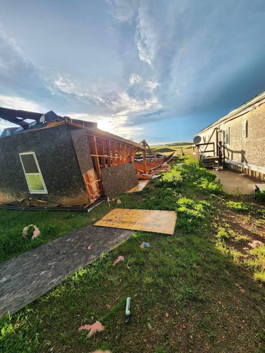 Damage to a trailer 9 miles southwest of Dickinson, North Dakota from a severe thunderstorm on Thursday, June 27th. Photo courtesy of Joshua Allocco. |
Photos & Video
Thank you to everyone who submitted photos!
 |
 |
 |
 |
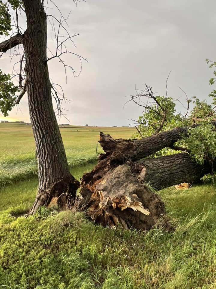
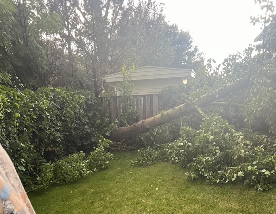
| Downed tree 5 miles south of Dickinson (Courtesy of Laura Troy Kraenzel) |
Damage to a trailer 9 miles southwest of Dickinson (Courtesy of Joshua Allocco) |
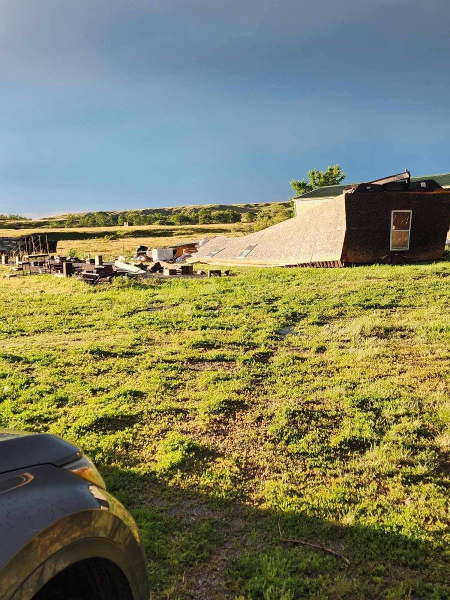
Damage to a shed in north Dickinson (Courtesy of Deputy Stephen Byrne) |
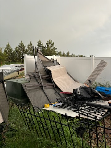
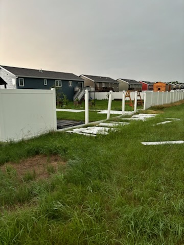
Fence damage in north Dickinson (Courtesy of Deputy Stephen Byrne) |
 |
 |
 |
 |
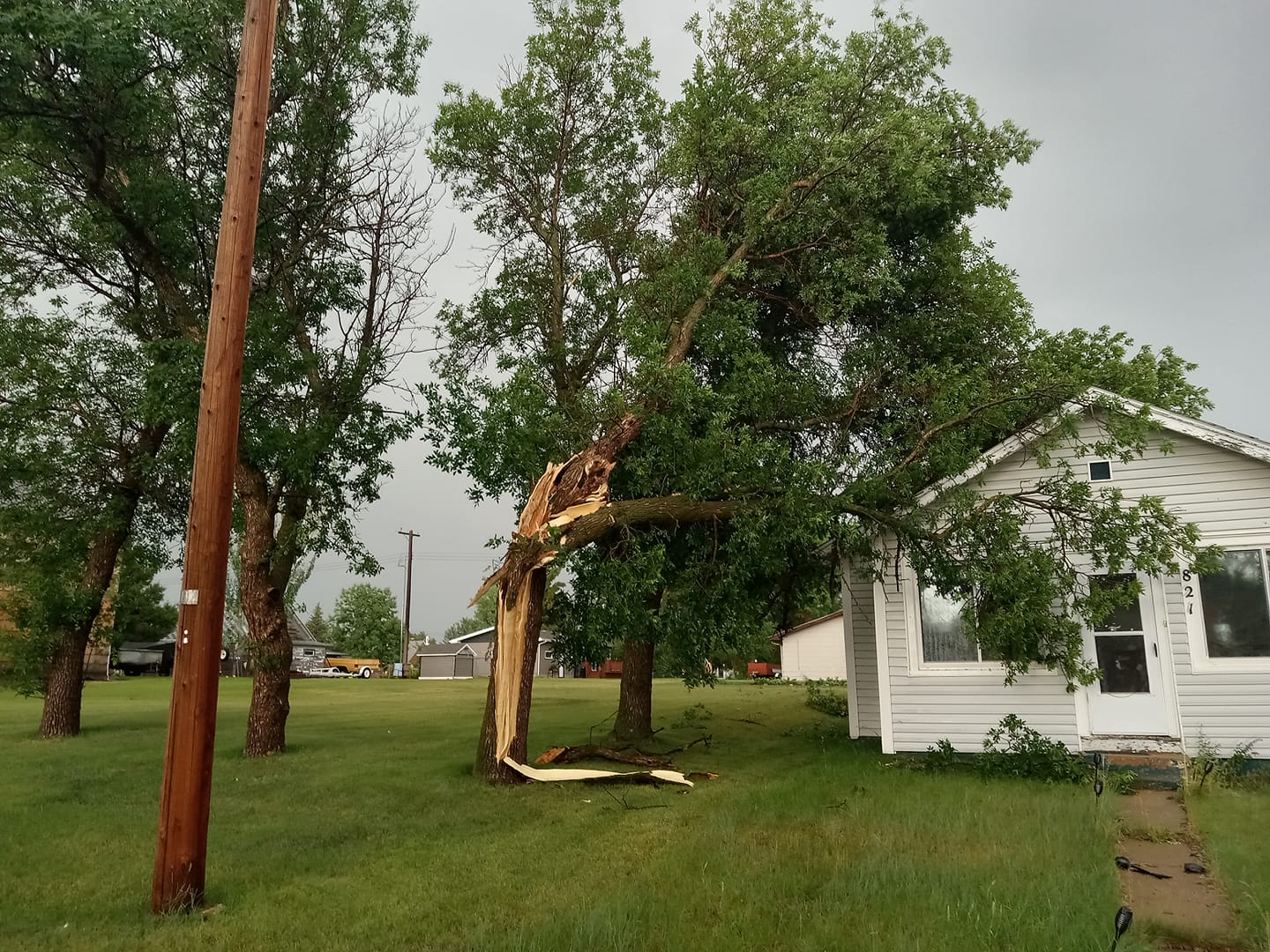
| Tree partially fallen onto a house in New England (Courtesy of Timothy Allen O'Rahilly) |
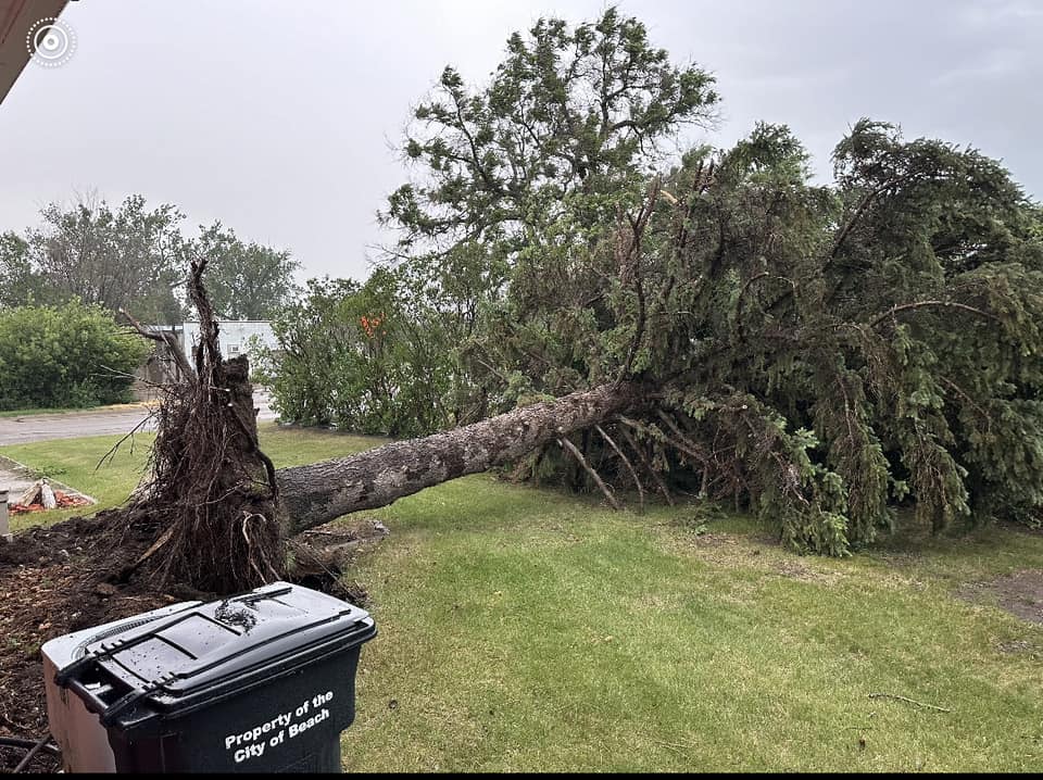
Downed tree in Beach (Courtesy of Theresa Howie) |
Downed tree in north Dickinson (Courtesy of Misty Freeburg) |
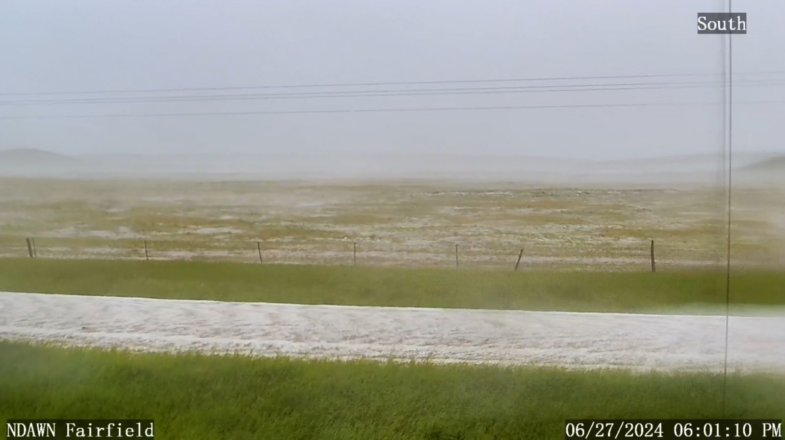
Hail covering the ground in Fairfield (Courtesy of NDAWN) |
 |
 |
 |
 |
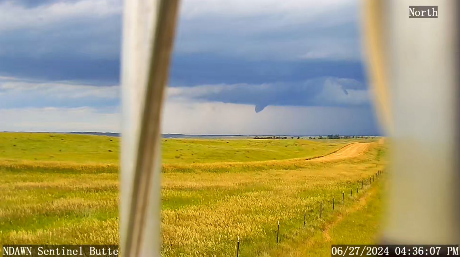
| Funnel cloud seen from the Sentinel Butte NDAWN camera. This was associated with a confirmed, brief tornado south of Trotters. (Courtesy of NDAWN) |
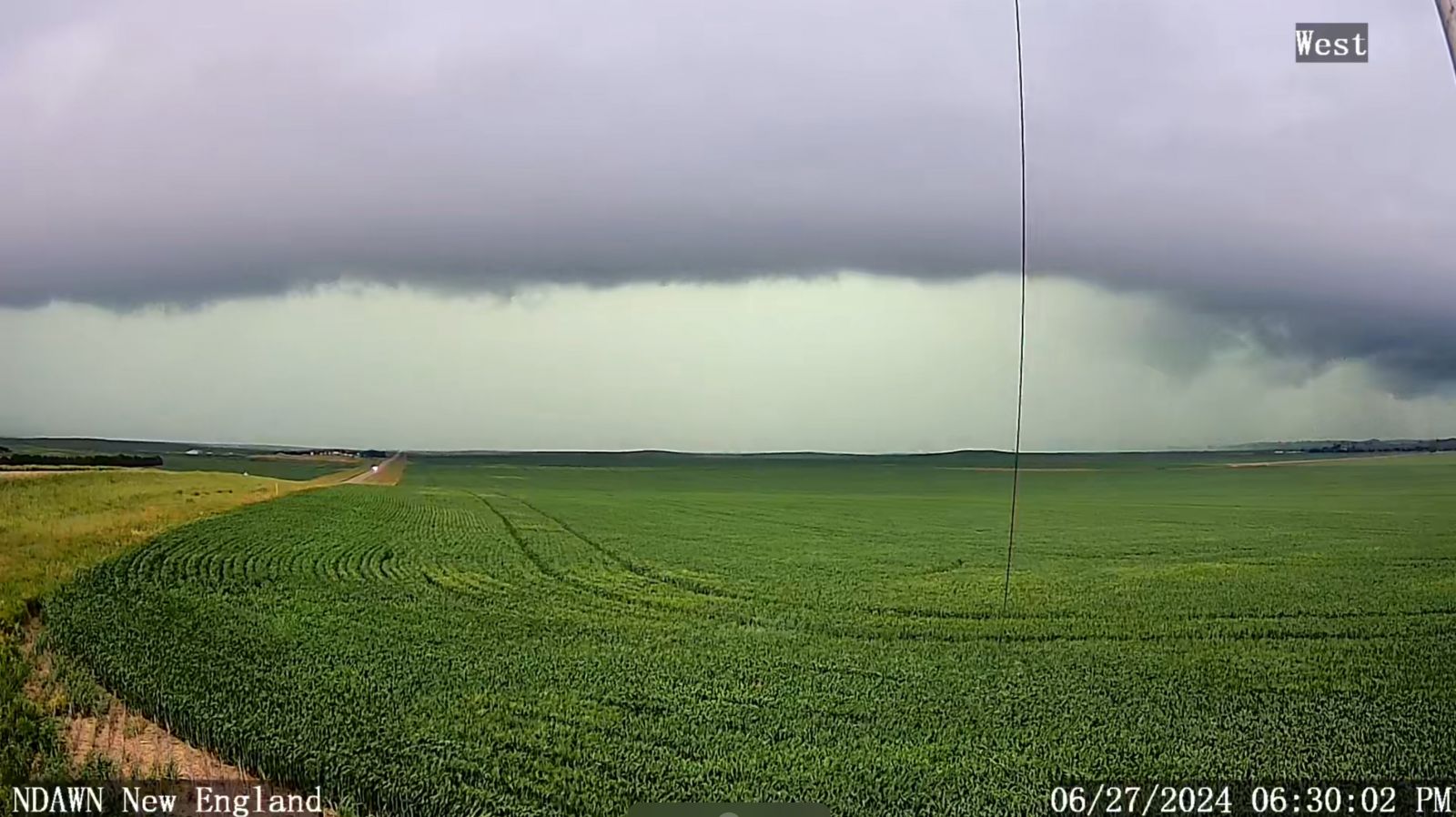
Shelf cloud on the leading edge of a severe thunderstorm moving into New England (Courtesy of NDAWN) |
Downed tree in Beach (Courtesy of Theresa Howie) |
Large hail 14 miles south of Belfield (Courtesy of Jessica Synnes) |
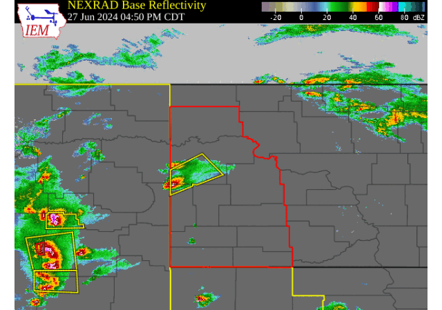
Radar
Regional radar imagery from early Thursday afternoon through Thursday evening, June 27th.
 |
| Note the Tornado Watch and Warnings along with the Severe Thunderstorm Watches and Warnings. |
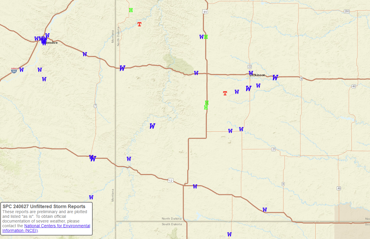
Storm Reports
Environment
 |
 |
.gif) |
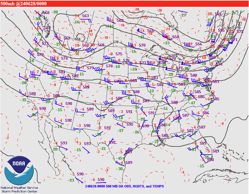
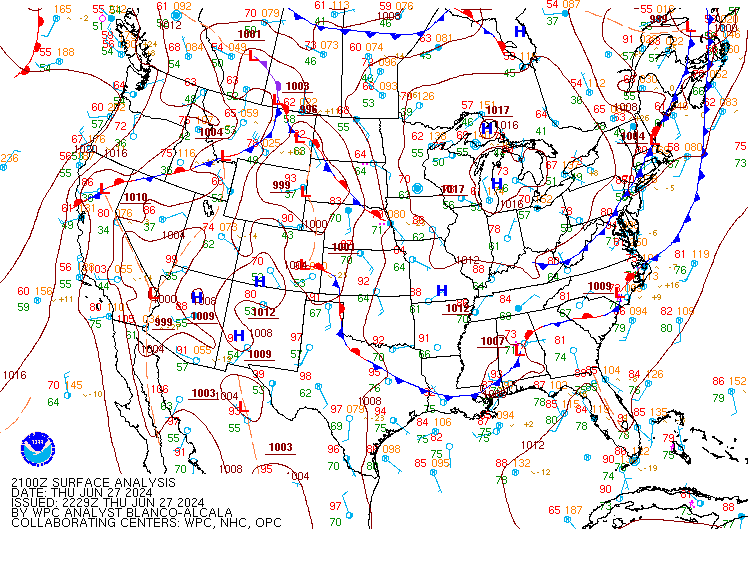
| Figure 1: SPC 500mb 00 UTC upper air map. Note the potent upper level wave. This also aided the increase in shear across the area. | Figure 2: WPC 21 UTC surface analysis shows a surface low centered over southeast Montana. A warm front is then draped across southwestern North Dakota, with a cold front in central Montana. During the event, discrete supercells developed along this warm front producing wind, large hail, and couple of tornadoes. The cold front quickly caught up to these storms and made a linear line of storms with strong winds. And embedded spin up was possible with this line, hence a few tornado warnings were issued along this line initially. | Figure 3: Observed upper air sounding from Rapid City, SD (closest sounding that represents the environment in western North Dakota) at 19 UTC. High amounts of CAPE and shear were present. Large DCAPE and 0 to 3 KM shear favors a strong wind threat. A nearly straight hodograph more favors large hail, than tornadoes. Interactions with local boundaries could have helped produce a couple isolated tornadoes on this day. |
 |
 |
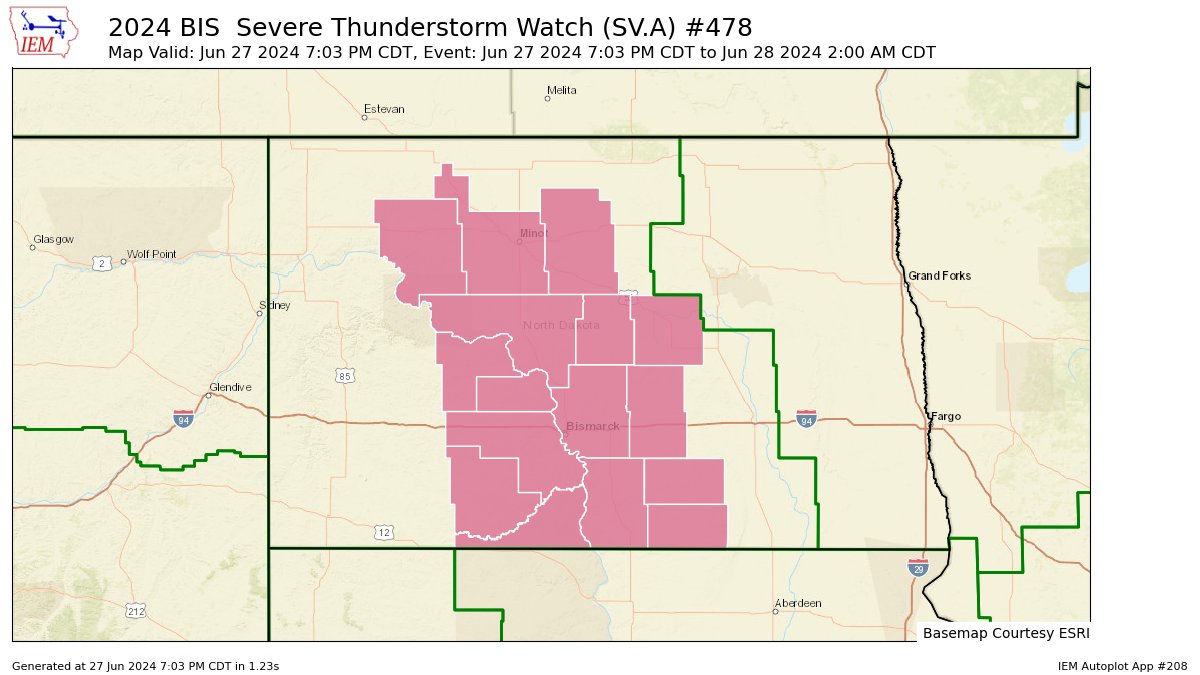 |
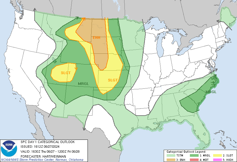
| Figure 4: SPC Day 1 Outlook issued at 1130 PM CDT. Note the Enhance Risk (level 3 out of 5). This is the first Enhanced Risk in western and central North Dakota since July 2022. | Figure 5: A Tornado Watch was issued until 10 CDT / 9 PM MDT for portions of western North Dakota. | Figure 6: A Severe Thunderstorm Watch was issued until 2 AM CDT. |
 |
Media use of NWS Web News Stories is encouraged! Please acknowledge the NWS as the source of any news information accessed from this site. |
|

