Overview
|
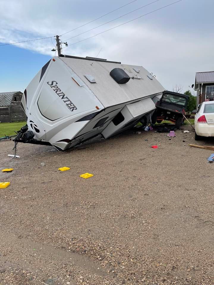
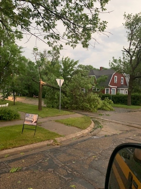
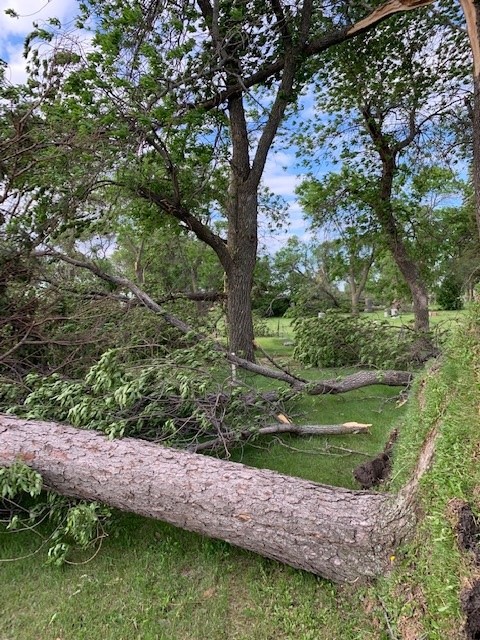
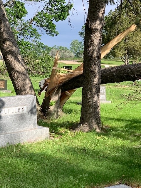
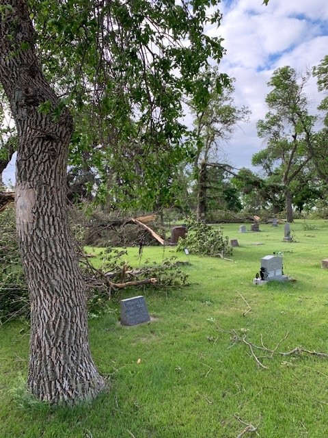
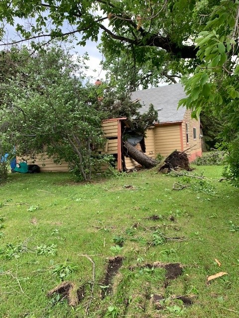
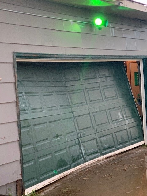
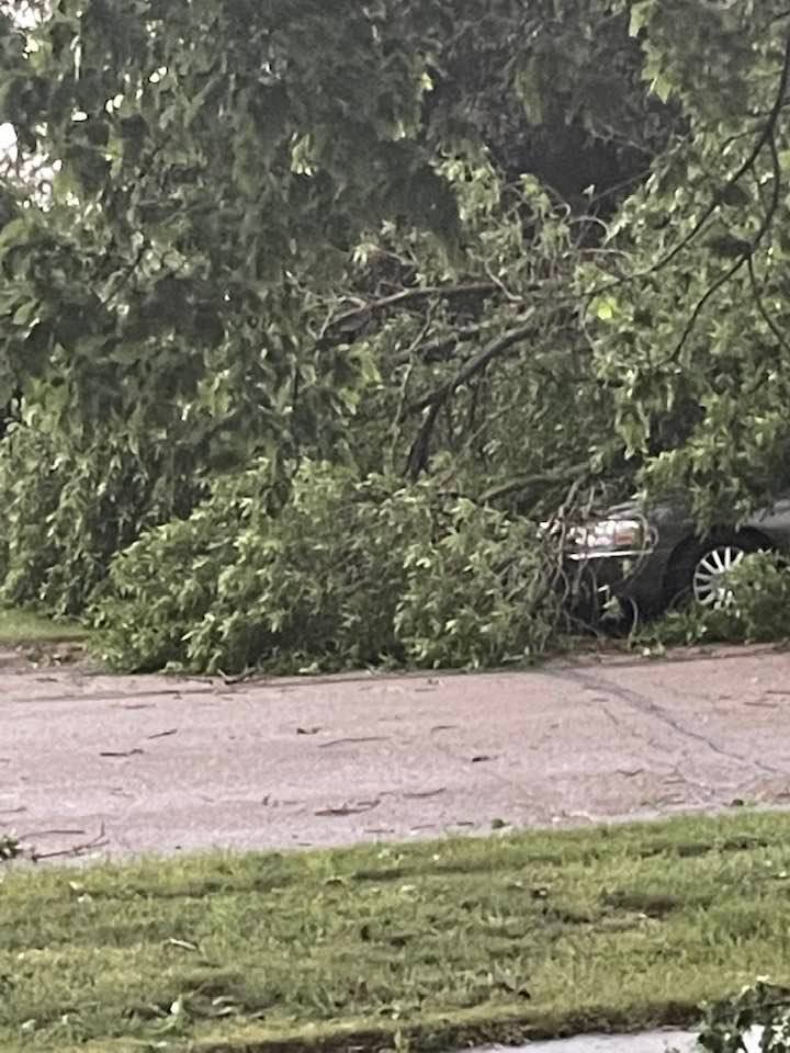
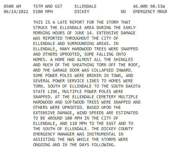
A swath of significant-severe convective winds occurred from southwest and central South Dakota into parts of the James River Valley early in the morning on Tuesday, June 16th, 2022. This included a high-end severe thunderstorm that moved through the Dickey County area around 5:00 AM CDT. Extensive damage was reported throughout the city of Ellendale and the surrounding areas. In Ellendale, many hardwood trees were snapped and others uprooted, with some falling onto homes. A home had almost all of the shingles and much of the sheathing torn off the roof, and the garage door was collapsed inward (see photos). Power poles were broken in the town of Ellendale and south of the town to the South Dakota state line. At the Ellendale Cemetery, multiple hardwood and softwood trees were snapped and others were uprooted. Based on the extensive damage, wind speeds are estimated to be around 100 mph in the city of Ellendale, and 110 mph to the east and south of Ellendale. There was a measured wind gust of 120 mph near Roscoe, SD, which is not far from the North Dakota / South Dakota state line in Edmunds County. Hail up to 3 inches in diameter was reported in Forbes, with quarter sized hail reported in Ellendale along with the damaging winds.
All photos are courtesy of Charlie Russell, Emergency Manager of Dickey County. |
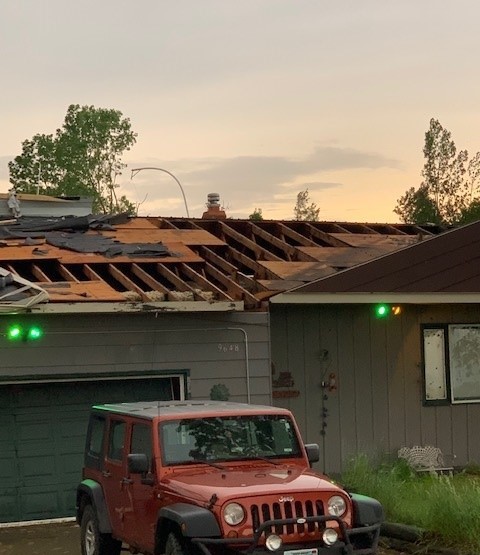 Damage in Ellendale, North Dakota |
Photos & Video
All photos are courtesy of Charlie Russell, Emergency Manager of Dickey County.
 |
 |
 |
 |
| Damage in Ellendale | Damage in Ellendale | Damage at the Ellendale Cemetery | Damage at the Ellendale Cemetery |
 |
 |
 |
 |
| Damage at the Ellendale Cemetery | Damage in Ellendale | Damage in Ellendale | Damage in Ellendale |
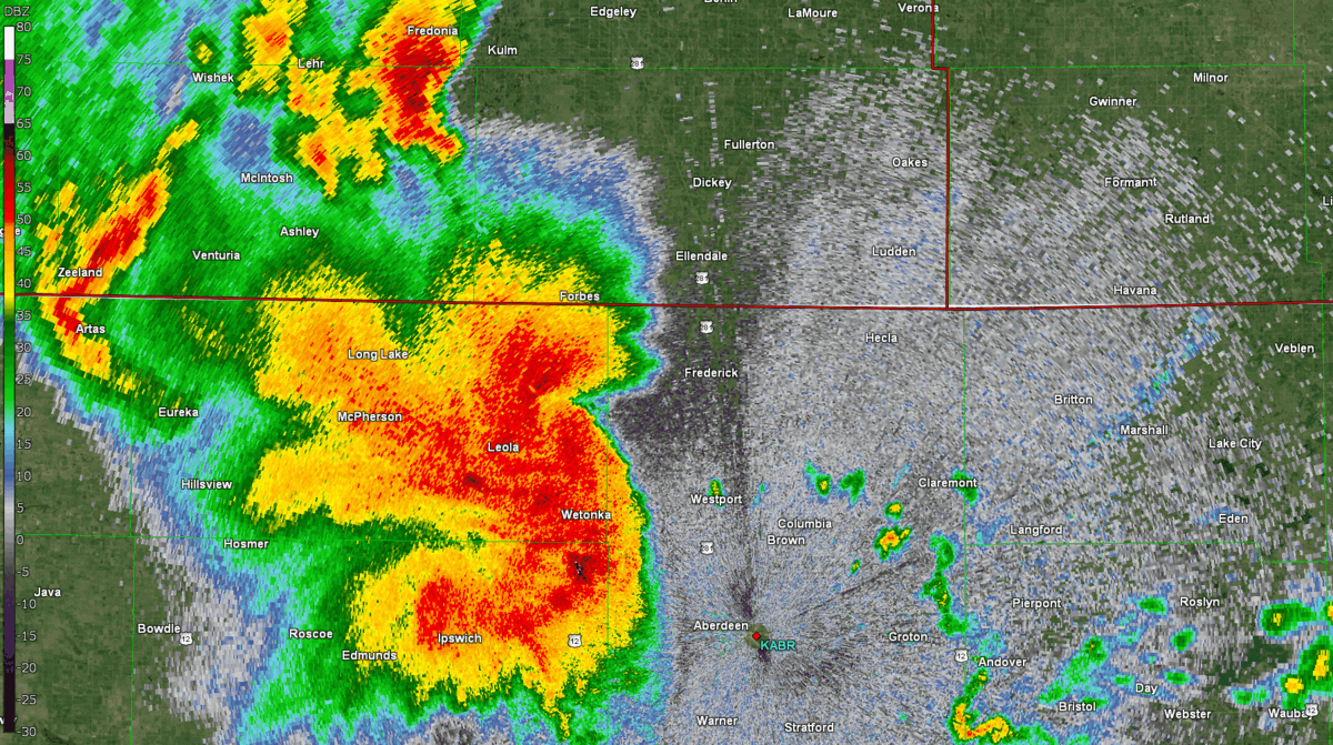
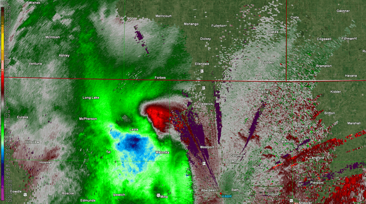
Radar Reflectivity and Velocity
Loop of base radar reflectivity from the Aberdeen radar KABR from 4:38 AM to 5:15 AM CDT on Tuesday, June 14th, 2022.
Loop of base velocity from the Aberdeen radar KABR from 4:38 AM to 5:15 AM CDT on Tuesday, June 14th, 2022. Green/blue shading represents inbound velocities and red/orange shading represents outbound velocities.
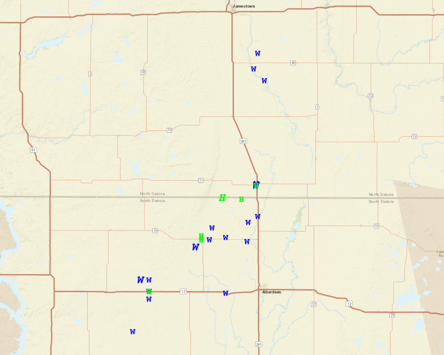
Storm Reports
The map of storm reports from the Storm Prediction Center (left) shows hail reports (green H) and wind reports (blue W) from the early morning of June 14th, 2022. The Local Storm Report (LSR, right) has a detailed description of damage that occurred in Ellendale.
 |
Media use of NWS Web News Stories is encouraged! Please acknowledge the NWS as the source of any news information accessed from this site. |
|

